How Far Can You Fly a Drone: Real Limits & Pro Tips
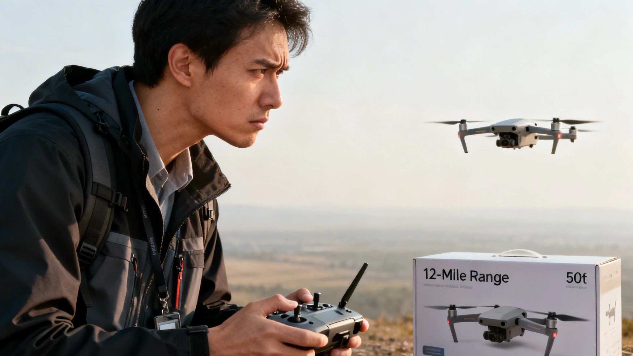
The most popular answer to how far can you fly a drone is usually the number printed on the box. For professional pilots, that number is almost the least useful one.
A drone may advertise long transmission distance, but that does not mean you can safely complete a mission at that distance, and it definitely does not mean you can do it legally. Range on paper is a lab number. Range on a job is a planning problem.
The gap between those two is where new commercial pilots get caught. They buy a capable aircraft, trust the spec sheet, then discover that signal quality, battery reserve, terrain, local rules, and return margin matter far more than the marketing headline.
The 12-Mile Myth What Drone Range Really Means
Consumer pilots often point to the latest aircraft and say, “this drone flies 12 miles.” That statement mixes up transmission capability, battery endurance, and operational legality as if they were the same thing. They are not.
The upper edge of what is technically possible is far beyond normal field operations. The Guinness World Record for the farthest distance to control a commercially available UAV is 18,411 kilometers (11,440 miles), achieved on February 9, 2023, when a drone was piloted via the internet from California to Réunion Island, showing what internet-based BVLOS control can do in the right setup (UCI Engineering world record report).
That record is impressive, but it is also the perfect example of why box specs confuse people. A world-record internet-controlled flight says something about networked control architecture. It says almost nothing about how far you can send your aircraft on a survey, roof inspection, media shoot, or utility corridor job next week.
What pilots need to ask
The practical question is not “what is the max range?” It is this:
- Can I maintain control quality the whole way
- Can I get home with reserve
- Can I remain compliant for the entire route
- Can I document the decision making behind the mission
Those questions matter more than brochure language.
If you already think about distance and endurance as the same problem, it helps to separate them. Flight distance is tied to power management as much as signal link, which is why understanding drone flight time is part of sound range planning.
Key takeaway: The advertised range is not a mission range. It is a best-case technical number, not a field-ready operating distance.
The Two Ceilings on Your Drone's Flight Distance
A simple way to judge any mission is to think in terms of two ceilings. One is set by the machine. The other is set by the rules.
The technical ceiling
The technical ceiling is the farthest your aircraft could go if hardware, environment, and power all cooperate. This ceiling depends on the radio link, battery state, wind, payload, and route profile.
A drone can have a very capable transmission system and still fail the mission because the aircraft burns too much battery fighting wind on the outbound leg. It can also have enough battery on paper and still lose practical range because trees, structures, hills, or local RF noise degrade the link.
This is why experienced pilots rarely ask one range question. They ask several smaller ones. How clean is the RF environment? What does the return leg look like? Is there terrain between controller and aircraft? What is the payload doing to endurance?
The legal ceiling
The legal ceiling is often lower than the technical one. In the United States, FAA rules keep most standard operations within visual line of sight and cap altitude to a specific height under the conditions described in the relevant data. In Europe, EASA rules cited in the relevant data set specific horizontal and vertical limits, depending on the operational framework described there. For many pilots, that means your legal distance is not “what the drone can do.” It is “what you can conduct compliantly from your operating position.”
Why these ceilings rarely match
Consider it similar to a vehicle with a high top speed on a road with a much lower speed limit. The machine may be capable of more. Your operation is not automatically allowed to use all of that capability.
For most professional pilots, the working limit is whichever ceiling is lower on that day:
- If the law is tighter than the hardware, compliance sets the range.
- If the environment is harsher than the brochure, the field conditions set the range.
- If your return margin is thin, battery discipline sets the range.
The practical habit that changes decisions
Pilots who stay out of trouble plan the mission around the limiting factor, not the best-case factor. That sounds obvious, but it changes real decisions in the field. It pushes you to shorten the route, move the takeoff point, split the task into multiple flights, or use a different aircraft class.
Good range planning starts with the lower ceiling, not the higher one.
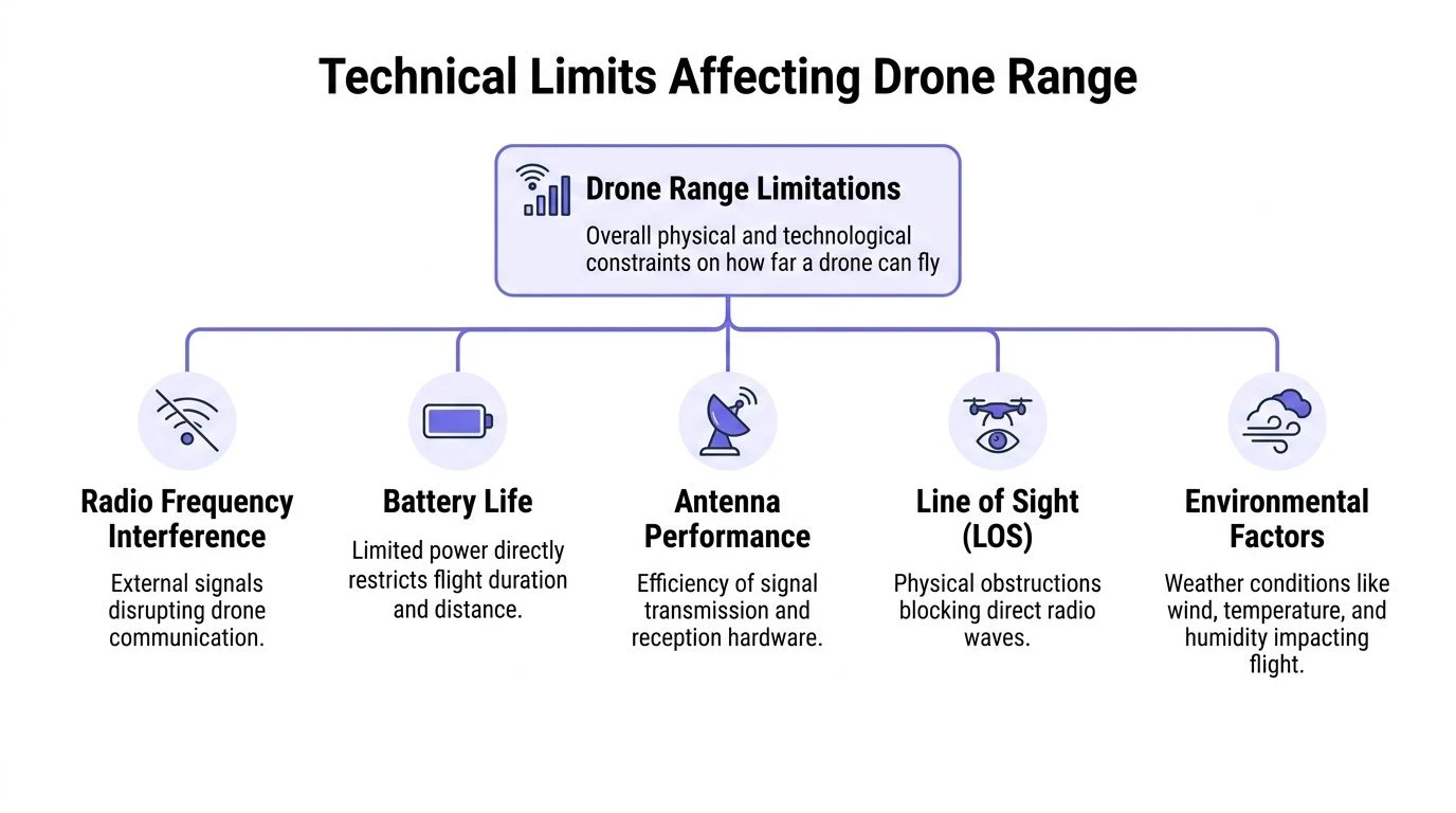
Decoding the Technical Limits That Affect Drone Range
The technical side of range is where many pilots overestimate their aircraft. They see a strong control link in open countryside once, then assume the same result will hold near buildings, tree lines, industrial sites, or coastal wind.
It will not.
Signal strength is not a fixed number
Modern DJI aircraft with O4 transmission can reach 20 km in ideal conditions, but real-world range is often reduced by 25 to 50% because of RF clutter and obstructions. Headwinds can also raise power draw by 20 to 30%, which cuts the safe round-trip distance and makes battery planning more important than the transmission claim suggests (Drone Bundle analysis of O4 range limits).
That one sentence explains most range disappointments in the field. Pilots expect a clean radio path. Real jobs rarely give them one.
What usually degrades the link first
A strong transmission system still loses effectiveness when the environment fights it.
- Urban RF clutter: Dense wireless activity makes the control link work harder and reduces the clean, predictable range you might get in open land.
- Obstructions: Buildings, trees, ridgelines, and even subtle terrain changes interrupt the path between controller and aircraft.
- Antenna orientation: Good hardware can still perform badly if the pilot points the controller poorly or allows body position and vehicles to block the path.
In practice, range drops do not always arrive gradually. The link can look stable, then become unreliable once the aircraft moves behind a stand of trees or passes low along a roofline.
Battery is the harder limit
Radio link gets the attention. Battery reserve decides whether the flight was smart.
Even when the aircraft can still hear the controller, the mission may already be too long to complete safely. Long outbound legs create a false sense of security because the aircraft keeps going while the return requirement keeps growing.
This matters even more when pilots rely on hover or calm-air endurance figures. Real jobs include climbs, repositioning, pauses for framing or inspection, and route corrections. Those all consume margin.
A useful discipline is to treat outbound distance as a budget, not an achievement. If the route, wind, and task force you to spend that budget too early, the mission should stop early.
Wind changes the whole calculation
Headwind is one of the fastest ways to turn a comfortable mission into a tight one. A drone that looked efficient on the way out with a tailwind may need far more power to come home. That is why experienced pilots plan range around the worst leg, not the easiest leg.
This becomes critical on corridor work, coastal operations, and elevated terrain where conditions can shift between launch point and work area.
Tip: Plan the return before the outbound leg. If the home leg looks expensive in battery terms, shorten the route before takeoff.
Payload shortens your useful distance
Payload weight is not just an enterprise-drone issue. Any added load changes the power picture. Professional pilots feel this when carrying different sensors, lighting kits, or job-specific accessories.
More weight means more energy demand. It also changes handling, climb performance, and how much battery margin you need for a stable landing. Even if the aircraft technically remains within its operating envelope, useful range shrinks.
Temperature and air density matter
Pilots often discuss wind and ignore temperature until batteries sag in the field. Cold weather can reduce battery efficiency. Hot weather can affect performance and operating decisions in a different way. Air density also changes how efficiently the aircraft generates lift and how hard the propulsion system must work.
You do not need to overcomplicate this. You do need to stop treating one battery percentage as equal to the same percentage on every day and every mission.
A practical way to think about technical range
Instead of asking for one number, judge range through four checks:
| Technical factor | What to look for in the field | What usually goes wrong |
|---|---|---|
| Signal path | Clear route between pilot and aircraft | Trees, rooftops, terrain masking |
| Battery margin | Conservative return reserve | Long outbound leg eats return safety |
| Wind profile | Strongest part of the route, especially return | Tailwind out, heavy headwind back |
| Aircraft load | Payload and mission behavior | Added equipment reduces useful distance |
For some pilots, even small hardware choices shape endurance and efficiency. If you want to understand how prop setup influences performance, this prop pitch calculator is a useful reference point.
Navigating the Legal Boundaries From VLOS to BVLOS
A drone can be technically capable of traveling well beyond your normal operating area and still be limited by law to a much shorter mission. That is the everyday reality for professional pilots.
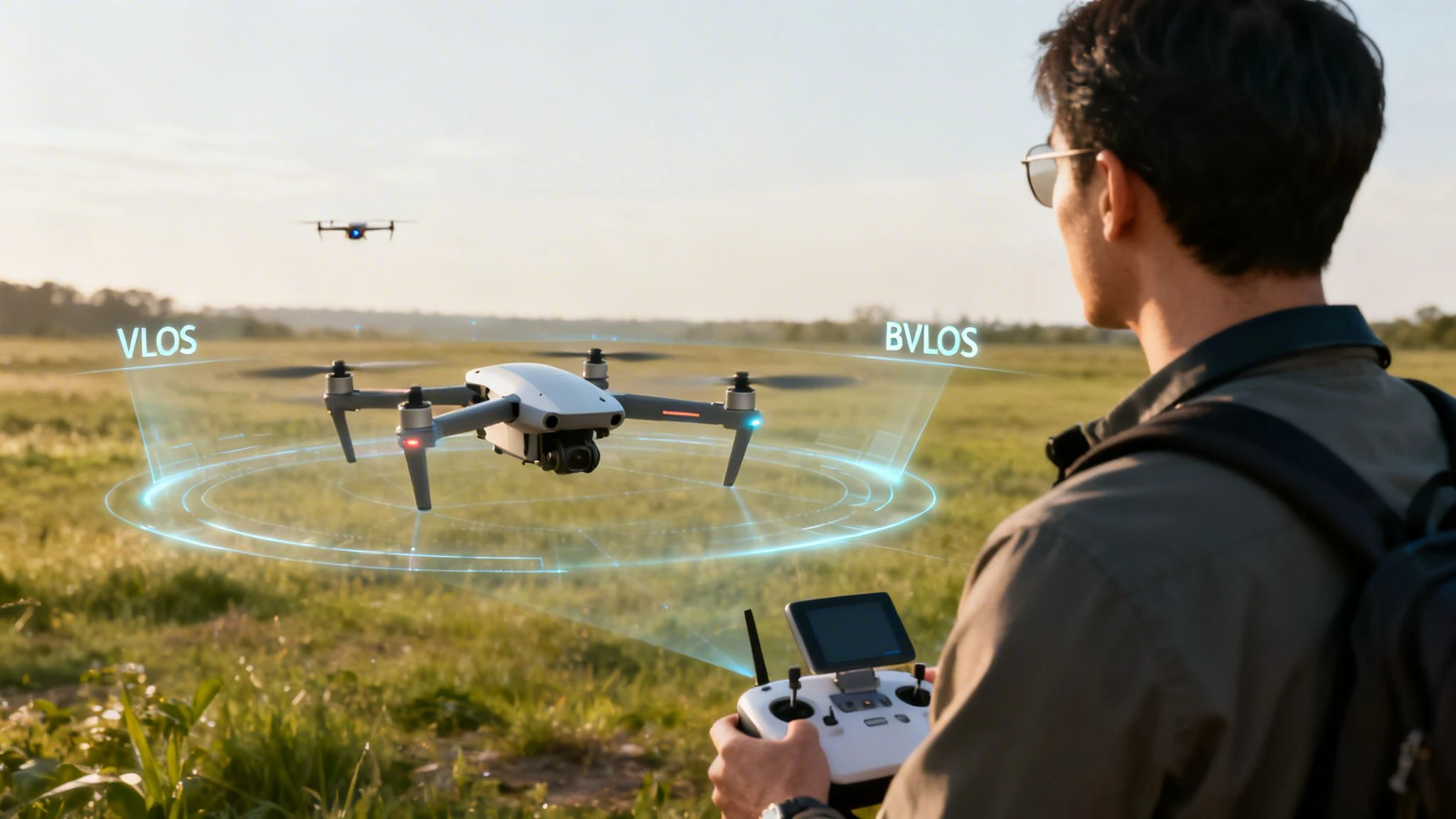
VLOS is the normal operating box
For most pilots, the default framework is visual line of sight, or VLOS. That means you must keep the aircraft within your unaided visual sight while operating. In practical terms, that usually brings the legal range down to something far shorter than any advertised transmission number.
Relevant data states that VLOS rules cap legal range to a relatively short distance, which lines up with what many operators already know from field work. Even when the aircraft and controller can communicate at much longer distances, the law can still stop the mission there.
That distinction matters most to new commercial operators. A strong link does not create a legal right to use it.
What BVLOS changes
Beyond visual line of sight, or BVLOS, is the route to longer commercial missions. It is also where many simplified articles become unhelpful. BVLOS is not just “fly farther.” It is an operational approval problem.
Relevant data notes that the FAA saw a significant surge in Part 107 BVLOS waivers, and that success often depends on thorough flight logging and compliance documentation. It also notes that solo operators without strong proof sets face higher rejection rates (JOUAV overview of BVLOS waiver trends).
That tells you something important. Regulators do not just care that the aircraft can cover the distance. They care that the operator can show how risk is being managed.
What regulators want to see in practice
A workable BVLOS case usually depends on the operator being able to demonstrate a controlled operation, not a wish to extend range. The exact requirements vary by authority and operation type, but the structure is familiar.
- Defined mission area: Regulators want clear boundaries, not vague intentions.
- Reliable procedures: Teams need repeatable methods for planning, launch, contingencies, and recovery.
- Risk controls: Detect-and-avoid capability, observer roles where relevant, route logic, and emergency actions all matter.
- Operational records: Logs, maintenance records, pilot competency evidence, and documented workflows strengthen the case.
Why many pilots misjudge the barrier
Some pilots assume BVLOS approval is mainly about buying more advanced hardware. Hardware matters, but documentation often decides whether an operation looks mature enough to trust.
A pilot with a capable aircraft and weak records may struggle more than a team with a structured operating system, disciplined logs, and a tightly defined use case.
Key takeaway: Long-range legal flying is usually earned through evidence, not unlocked by the aircraft alone.
The missions where BVLOS makes business sense
Not every operator needs BVLOS. Some do.
It becomes far more useful for corridor inspections, wide-area mapping, rural asset checks, and other missions where repositioning crews repeatedly wastes time and reduces productivity. In those operations, range is not just a technical feature. It is part of the business model.
Pilots considering that path should spend time learning the approval framework, not just the aircraft menu system. A practical starting point is this guide to BVLOS operations.
Typical Flight Ranges for Common Drone Classes
Professionals usually need a benchmark, not a promise. The table below gives a practical way to think about common drone classes without pretending every mission will produce the same result.
It separates typical VLOS range from potential BVLOS range because those are different planning worlds. The first is what many operators can realistically conduct under standard compliant operations. The second is what becomes possible with the right approval, aircraft, route, and conditions.
Realistic Drone Flight Ranges by Class 2026
| Drone Class | Typical VLOS Range (Legal & Practical) | Potential BVLOS Range (With Waiver & Ideal Conditions) | Example Models |
|---|---|---|---|
| Consumer drones | Usually constrained to visual line of sight and conservative return margins. In practice, pilots should expect a short working distance tied to what they can clearly and compliantly observe. | Limited by aircraft design, mission risk, and authorization. Some consumer platforms have strong transmission systems, but they are not automatically suitable for extended commercial BVLOS work. | DJI Mini 4 Pro, DJI Air 3 |
| Prosumer drones | Often used for inspection, photo, and light mapping jobs where the legal and practical distance remains within clear visual control. | Can support longer operations in the right framework, but route design, battery margin, and documentation become the deciding factors. | DJI Mavic 3, Autel EVO II Pro |
| Enterprise multirotors | Better suited to repeatable commercial workflows, though normal VLOS constraints still apply for many missions. | More realistic candidates for approved extended operations when paired with strong procedures and the right equipment stack. | DJI Matrice 300 RTK, SiFly Q12 |
| Fixed-wing and specialist long-endurance platforms | Used where area coverage matters more than stationary work, while launch site placement still shapes practical VLOS use. | The strongest fit for wide-area, corridor, or endurance-focused operations when the operator has the approval structure to support them. | JOUAV CW-30E, JOUAV CW-25H |
How to use the table
Do not read this as a shopping list. Read it as a mission fit check.
A Mini-class aircraft may be excellent for short, controlled visual operations. A heavier enterprise system may be the better tool when consistency, logging discipline, payload options, and route repeatability matter more than portability. A fixed-wing platform may be the right answer when the work is about coverage.
The buying mistake to avoid
Many range decisions go wrong before the first flight. Pilots buy for headline distance instead of operational profile.
A better approach is to match the aircraft to the job:
- Close visual inspection: Prioritize handling, image quality, and obstacle awareness.
- Large property mapping: Prioritize endurance and efficient area coverage.
- Programmatic industrial work: Prioritize repeatability, documentation, and system-level reliability.
- Future long-route operations: Prioritize the approval path and total operating workflow, not just the controller link.
The best aircraft for your business is the one that fits your most common mission while leaving enough margin for safe execution.
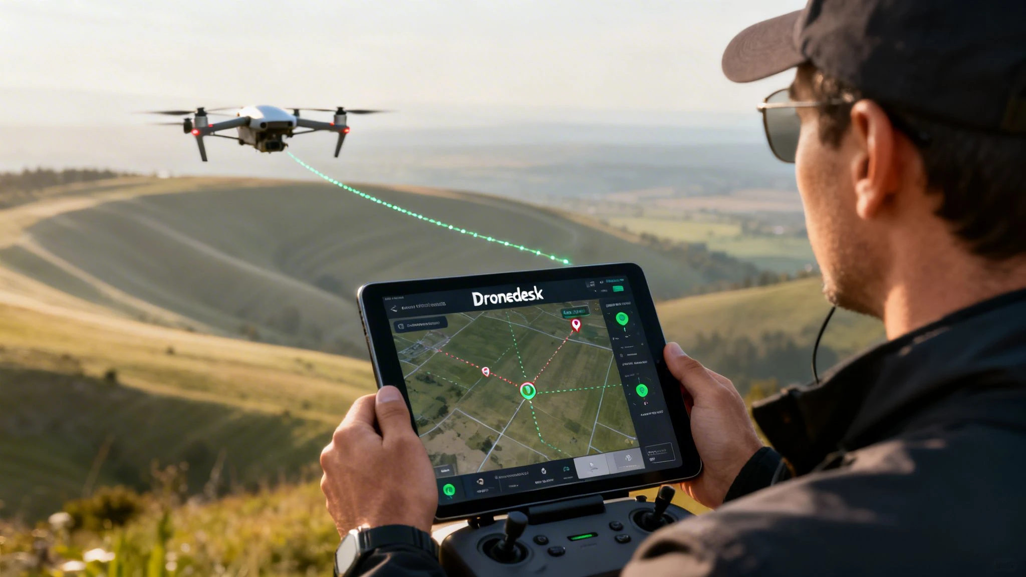
Planning for Maximum Safe Range with Dronedesk
Long-range performance is built on planning discipline. Pilots who consistently get useful distance out of their aircraft do the routine work before launch. They do not “see how far it goes.” They decide how far the mission should go, then they verify the aircraft can do it with margin.
The verified data makes the core point clearly. Endurance is as critical as transmission range for long-distance missions. While consumer drones offer 30 to 45 minutes of flight, professional multirotors are now achieving over 3 hours, enabling large-scale mapping in a single flight. This leap in productivity relies on meticulous planning and logging to manage battery life and ensure mission success, especially in challenging wind conditions (Guinness World Records on UAV endurance).
That principle applies even when you are not flying a record-setting aircraft. Better planning creates more usable range.
Start with the mission shape
Before checking the aircraft, define the route.
Ask where the aircraft must do real work, not just where it could physically travel. The shape of the job determines where distance matters and where it does not. A compact roof survey is different from a linear utility inspection. A mapping run is different from cinematic repositioning over varied terrain.
Pilots who map the mission shape early make better range decisions because they identify where the aircraft will slow down, hover, climb, or repeat passes.
Build the pre-flight range check
A disciplined long-range workflow should include these checks:
- Airspace review: Confirm the operating environment, nearby constraints, and whether the route remains appropriate from launch to recovery.
- Ground position choice: Move the pilot position if needed. Sometimes the easiest way to gain useful range is not a better aircraft. It is a better launch point.
- Weather review: Focus on the route, not just the takeoff spot. Wind along the return path matters most.
- Battery logic: Base the mission on conservative return reserve, not optimistic endurance.
- Signal path review: Look for tree belts, buildings, ridges, industrial clutter, and other likely interruptions.
- Contingency planning: Decide early abort points, alternate landing logic, and lost-link behavior before launch.
Use software to reduce guesswork
Planning tools matter most when the mission gets repetitive, regulated, or geographically spread out. Good software helps pilots stop treating every job like a fresh mental exercise.
A strong operations platform supports:
- Airspace intelligence so you can assess where distance is operationally possible and where it is not.
- Flight planning that lets you define routes, not just react in the field.
- Risk assessments that turn vague concerns into documented controls.
- Flight logging that preserves what happened and why.
- Fleet records so the aircraft, batteries, and maintenance state stay tied to the mission history. These capabilities enable many professional teams to gain real performance. Not because software makes the drone fly farther by itself, but because it helps the operator avoid poor decisions that shorten useful range.
Logging is part of range management
Some pilots see logs as admin work. In serious operations, logs are part of flight safety and future capability.
Accurate records help teams understand which batteries age well, which aircraft underperform in wind, which sites cause link degradation, and where route planning needs adjustment. Over time, those records turn “I think this should be fine” into “we know how this site behaves.”
Tip: If you want more reliable range, log the flights that underperformed. Those teach more than the easy days.
What works and what does not
A few field-tested habits consistently improve safe operating distance.
What works
- Relocating the pilot station to preserve a cleaner line of sight
- Shortening the outbound leg when return wind looks unfriendly
- Splitting one ambitious mission into several controlled flights
- Using repeatable planning workflows instead of improvised decisions in the field
- Reviewing battery history before assigning packs to longer jobs
What does not
- Basing the route on the advertised range
- Assuming calm conditions at launch mean calm conditions across the route
- Treating RTH as the plan instead of the backup
- Flying deep into the battery because the signal still looks good
- Relying on memory instead of documented procedures
Software becomes most valuable when teams need consistency across pilots, aircraft, and clients. A platform like Dronedesk fits that need by combining planning, records, airspace context, and operational documentation into one workflow instead of scattering them across separate apps and notebooks.
Conclusion The Smart Pilot Flies the Plan Not Just the Drone
The honest answer to how far can you fly a drone is not a single distance. It is the result of a calculation.
The aircraft sets one limit. The rules set another. Your planning discipline decides how much of that capability you can use on a real job.
That is why the advertised number matters less than commonly believed. In day-to-day commercial work, range is shaped by signal quality, battery reserve, wind, payload, launch position, airspace, and the legal framework around the mission. Ignore any one of those and the flight distance on paper becomes meaningless.
The pilots who handle range well do not chase maximum distance for its own sake. They protect control quality, preserve return margin, document their decisions, and stop the mission before conditions force a bad choice. That is what professional operating discipline looks like.
BVLOS operations will keep expanding where regulators are satisfied that operators can show real control over risk. When that opportunity opens up, the winners will not just be the pilots with capable aircraft. They will be the teams with strong procedures, clear records, and a repeatable planning system.
Smart range management is not about proving what the drone can do. It is about proving what the operation can support.
Dronedesk helps professional drone operators turn that planning discipline into a repeatable workflow. If you want one place to manage flight planning, airspace intelligence, risk assessments, fleet records, and flight logs, take a look at Dronedesk.
 Current Drone Laws: What Changed in 2026? →
 JARUS SORA Explained in Plain English →
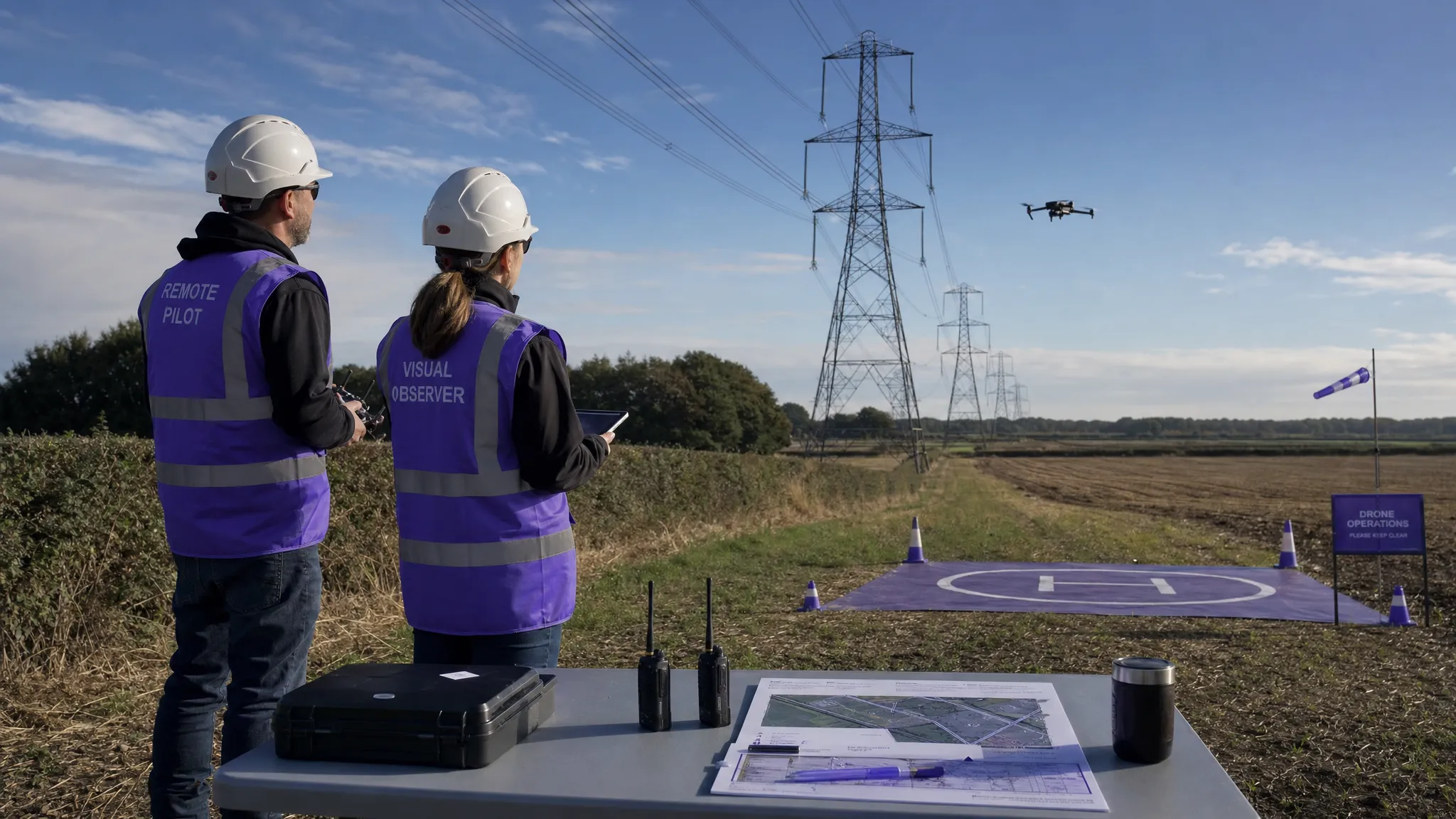 Drone Visual Line of Sight Rules Explained →
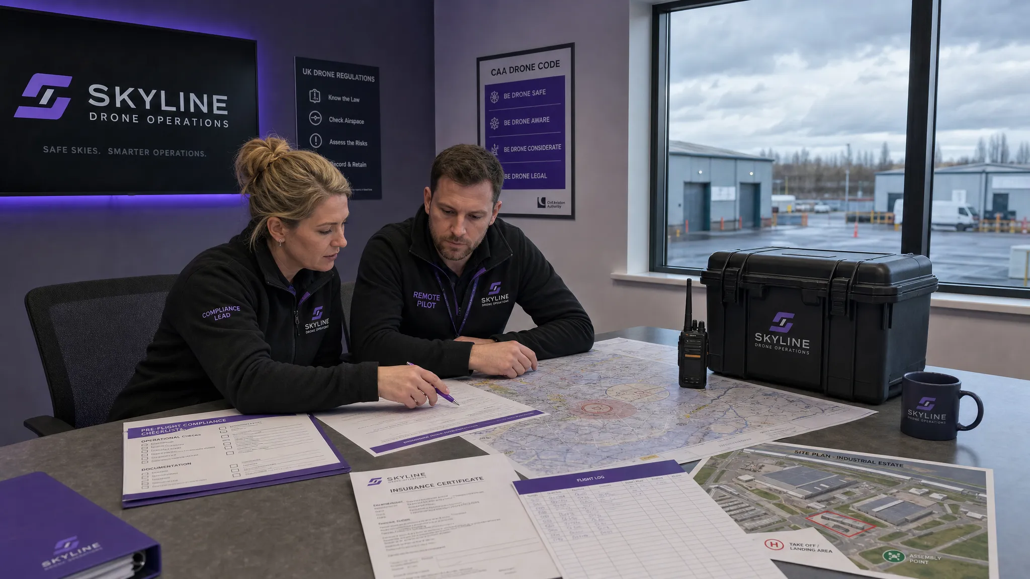 Drone Regulations Checklist for Commercial Flights →
 Drone Flying Laws: A Practical Guide for Operators →
 CAA UAV Regulations Explained for UK Operators →
 UK SORA Explained for Drone Operators →
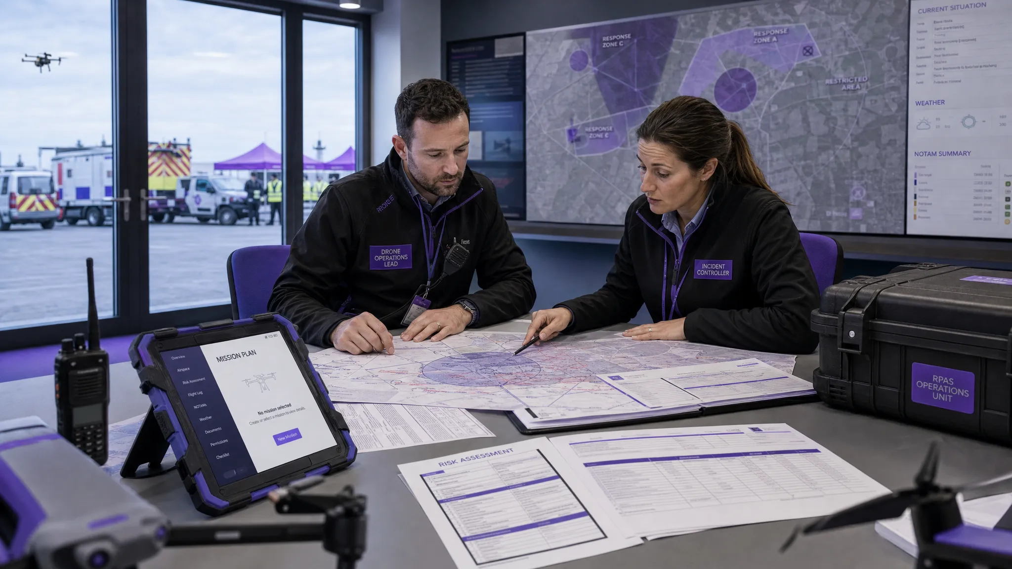 AUS Drone Laws Explained for Commercial Operators →
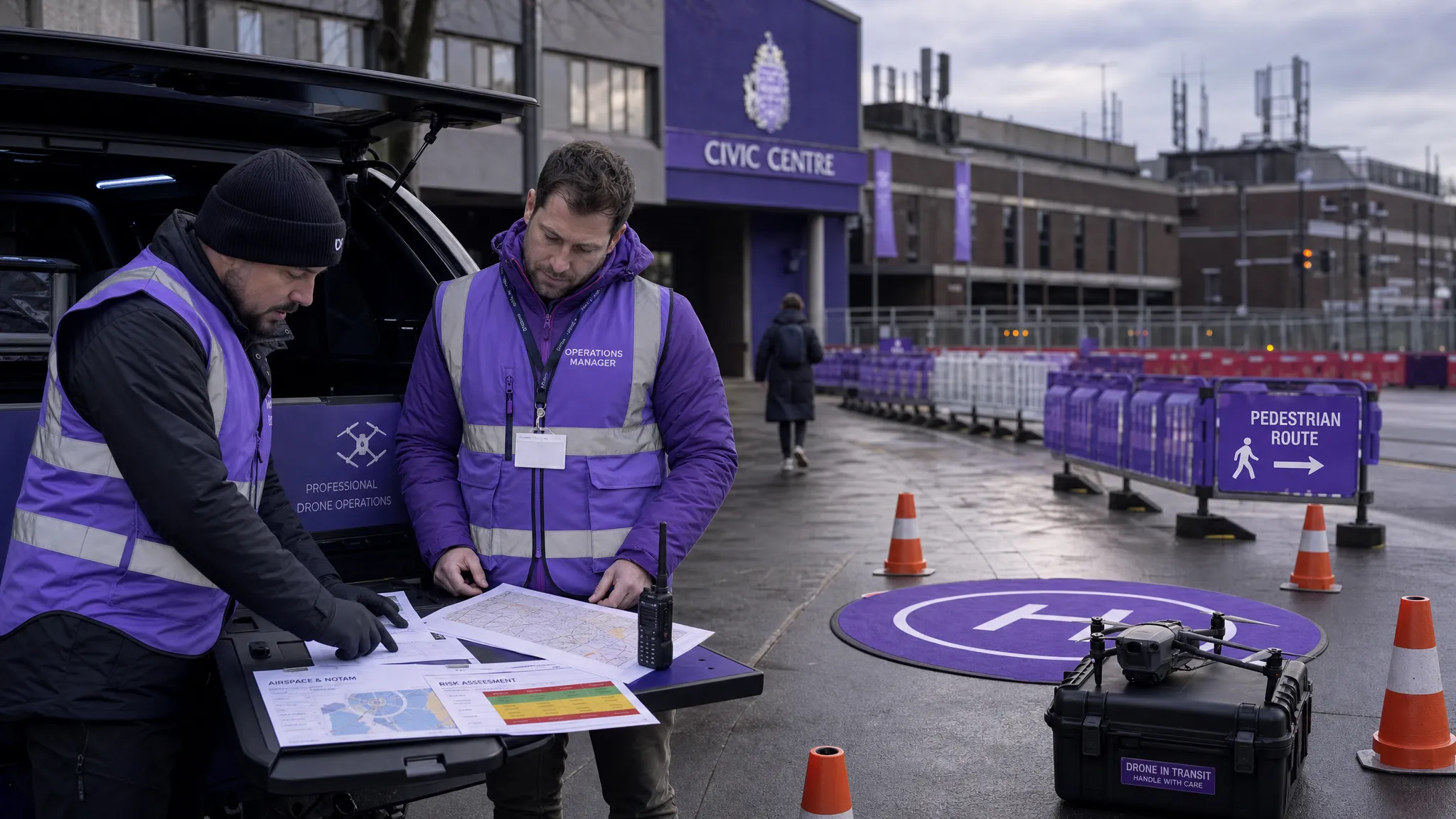 Drone Flying Rules Explained for Business Use →
 How to Choose an Aerial Survey Drone for Accurate Data →