Drones and Airports: drones and airports Safety and Compliance Guide
Flying a drone near an airport is a bit like merging a scooter onto a motorway packed with articulated lorries—it takes serious precision, constant awareness, and sticking to the rules like glue. The fundamental issue with drones and airports is that they share the same sky but play by completely different rules. A drone is small and nimble, but an airliner is a massive, fast-moving machine with hundreds of lives on board.
The High-Stakes World of Professional Drone Operations
This guide is for professional pilots. We know the sky isn’t just empty space; it's a complex, managed system where safety is everything. The relationship between drones and airports is wrapped in layers of regulations, all designed to keep manned and unmanned aircraft from getting into trouble. For a commercial pilot, working in this environment isn't about avoiding airports altogether—it's about knowing how to operate near them safely and legally.
Think of the airspace around an airport as a highly structured city with invisible lanes, altitudes, and traffic laws. Breaking those rules, even by accident, can cause chaos. The consequences range from grounding flights and triggering huge economic losses to posing a direct physical threat to an aircraft.
Why Professionalism Matters Here
Let’s be honest, the public's view of drones is often tainted by headlines about unauthorised flights causing havoc at major airports. As a professional, your work has to be the antidote to that narrative. Every single flight you plan and fly in controlled airspace helps build a case for the value and responsibility of our industry.
This is where a methodical, by-the-book approach is non-negotiable. It boils down to a few key disciplines:
- Knowing Your Airspace: Understanding the critical differences between Class B, C, and D airspace and instantly recognising a Flight Restriction Zone (FRZ).
- Getting the Green Light: Using systems like LAANC correctly or filing for manual authorisations when needed.
- Assessing Every Risk: Proactively identifying potential hazards and having solid plans to mitigate them before you even think about taking off.
- Keeping Your Paperwork Straight: Maintaining meticulous records of every flight plan, approval, and post-mission log.
For a skilled operator, the challenge of working near an airport isn't a barrier. It’s a mark of professionalism. It’s what separates a hobbyist from a credentialed pilot who can be trusted in the most demanding environments.
Modern flight management platforms are built to turn this high-risk operational puzzle into a compliant, repeatable process. For instance, a system like Dronedesk bakes airspace intelligence right into your planning workflow, showing you exactly where the lines are drawn. It helps you generate the risk assessments and flight plans you need to get that all-important legal authorisation.
In this guide, we'll pull back the curtain on the invisible boundaries, the critical risks, and the essential tech that allows professional pilots to work safely near airports. By the end, you'll have a clear roadmap for navigating the rules that govern drones and airports, making sure every flight is professional, compliant, and safe.
Decoding Airspace Rules Around Airports
To fly a drone safely near an airport, you first have to get your head around the invisible infrastructure that keeps all aircraft—big and small—safely apart. The best way to picture it is as a series of invisible, stacked layers, almost like an upside-down wedding cake. Each of these layers has its own set of rules dictating who can fly there, when, and how.
Getting this right isn't just a "nice-to-have"; it's the absolute foundation of professional drone operations. It’s what separates a trusted, professional pilot from someone who is a genuine risk to public safety. The entire system is built to protect manned aircraft when they are most vulnerable: during takeoff and landing.
This diagram helps to visualize how the different users of the sky fit together.

As you can see, there's a clear chain of command. General airspace rules govern airports, which then impose specific, strict restrictions on any low-altitude drone flights to keep everyone safe.
Understanding Controlled Airspace
The sky immediately around most airports is what we call controlled airspace. This is where Air Traffic Control (ATC) is actively managing and directing aircraft to prevent collisions. As a drone pilot, the most common types you'll come across are Class B, C, and D.
Let's break them down simply. Think of these classes as different security levels. Class D is like a restricted area needing a keycard, while Class B is a high-security facility that requires a personal escort.
For a more detailed look at what these zones mean for professional drone pilots, check out this table:
Common Airport Airspace Zones Explained
| Airspace / Zone Type | Typical Location | What It Means for Drones | Is Authorization Required? |
|---|---|---|---|
| Class B | The nation's busiest airports (e.g., London Heathrow, JFK) | The most restrictive. A complex, multi-layered zone. Flying a drone here is extremely rare and requires extensive coordination. | Yes, explicit ATC clearance is mandatory. |
| Class C | Moderately busy airports with a control tower | A two-tiered zone. Operations are possible but require careful planning and communication. | Yes, authorization is always required. |
| Class D | Airports with a control tower but less traffic | A simple cylindrical shape. This is the most common controlled airspace you'll encounter for jobs like site surveys. | Yes, authorization is always required. |
| FRZ (Flight Restriction Zone) | UK/EU airports | A permanent digital 'no-fly zone' protecting runways and their approach/departure paths. | Yes, explicit permission from ATC is mandatory. |
As you can see, getting the right permissions is non-negotiable in these areas. For a deeper dive into all the classifications, have a read of our guide on the different classes of airspace.
Special Zones and Permanent Restrictions
On top of the standard airspace classes, you'll also run into special zones with even tougher rules. These are usually found near airports or other sensitive locations.
A great example, especially in the UK and Europe, is the Flight Restriction Zone (FRZ). An FRZ is basically a permanent digital 'do not enter' sign around an airfield, designed to protect the runway and the paths aircraft use to approach and depart. Flying a drone inside an FRZ without getting permission from ATC first is illegal and incredibly dangerous.
The core principle is simple: the closer you get to an airport's runway and flight paths, the more restrictive the rules become. These zones aren't arbitrary; they are meticulously designed buffers to protect aircraft and the people in them.
And this protective buffer is critical. Statistics show a drone strike is most likely to happen below 500 feet and within two miles of an airport—exactly where aircraft are flying slower and have less room to react. Understanding these invisible boundaries is the very first step in planning a safe, compliant flight. If you fail to respect them, you're not just breaking the law, you're putting lives at risk. That's the key consideration for any operation involving drones and airports.
Of course. Here is the rewritten section, crafted to sound completely human-written and natural, following all your specific instructions.
The Real-World Impact of Unauthorized Drone Flights
It's one thing to read about airspace rules in a manual, but it’s another thing entirely to see the chaos a single rogue drone can cause near an airport. These aren't just hypotheticals we're talking about; they're real, increasingly frequent events, and the ripple effects are massive. The rules are there for a reason, and the consequences of ignoring them are far more severe than just a slap-on-the-wrist fine.
The physics of a drone hitting a manned aircraft are genuinely terrifying. It’s not about the drone's weight alone; it’s the kinetic energy. Picture a dense, solid object slamming into a jet engine's turbine blades, which are spinning thousands of times a minute. Even a small consumer drone can cause catastrophic engine failure.
And it’s not just the engines. A drone hitting a cockpit windshield, a wing's control surface, or the tail rotor of a helicopter could easily cause the pilot to lose control. This is especially true during takeoff or landing—the most critical phases of flight, where there's zero room for error. This is the "why" behind every single regulation we have to follow.
The Domino Effect of a Drone Sighting
The danger isn’t just about direct hits, either. The mere sighting of a drone in restricted airspace is enough to bring a major international airport to its knees. When a pilot or air traffic controller spots one, they have to assume the worst and hit the emergency brakes on the whole operation.
This triggers a massive chain reaction. We're not talking minor delays here. An airport shutdown immediately leads to:
- Grounded Flights: Every plane scheduled to depart is stuck on the tarmac until the all-clear is given.
- Diverted Aircraft: Inbound planes are forced to reroute to other airports, sometimes hundreds of miles away.
- Massive Delays: A single drone can create hours of backlog, throwing travel plans into chaos for thousands of passengers.
The economic fallout from this is staggering. Think about the cost of fuel for diverted aircraft, compensation for stranded passengers, rescheduling crews, and the airport's own operational losses. It can all add up to millions from just one person's reckless flight.
From Hypothesis to Harsh Reality
These scenarios aren’t just fear-mongering; they're happening all the time. In the US alone, unauthorized drone sightings near airports caused 749 flight delays in just the first nine months of a recent year. Boston's Logan International Airport was hit the hardest, with 141 incidents causing major disruptions. New York wasn't far behind; one drone at Stewart International Airport shut down a runway for a full hour. You can get more of the story on these delays in this detailed report.
This is a global problem, not just an American one. And here’s the thing—every professional pilot has a duty to protect not only the public but also the reputation of our own industry. When an airport gets shut down, the public doesn't see the difference between a clueless hobbyist and a certified professional. Every negative headline erodes the trust we work so hard to build.
Following the rules isn’t just about compliance; it's about professional self-preservation. When you meticulously plan every flight, get the right authorizations, and use tools to log every step, you're putting clear blue water between yourself and the cowboys who give us all a bad name. It's that commitment to safety that protects your business, your reputation, and the public's trust in what we do. When it comes to flying near airports, there is simply no margin for error.
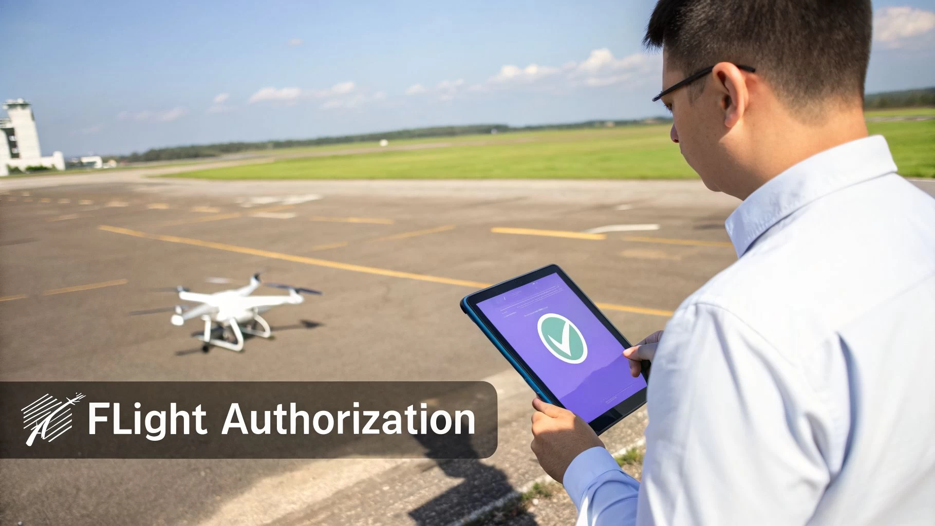
How to Legally Fly a Drone Near an Airport
Knowing the rules of the sky is one thing, but getting the official green light to fly in controlled airspace is where the pros really stand apart. This isn't about looking for loopholes; it's about following a clear, established process to operate safely and legally.
With the right approach and a little know-how, you can turn a potential no-fly zone into a 'fly-with-permission' zone.
The key is figuring out which type of authorization you need and how to get it. For many routine commercial jobs, technology has made this simpler than ever. For more complex missions, though, the traditional, more detailed methods still apply.
The Automated Green Light: LAANC
For pilots operating in the United States, the Low Altitude Authorization and Notification Capability (LAANC) system is your go-to for accessing controlled airspace around hundreds of airports. Think of it as an automated, digital air traffic controller built just for drones.
Instead of a long-winded manual application, LAANC gives near-instant approval for flights under pre-determined safe altitudes. It works by connecting drone pilots directly to Air Traffic Control through approved third-party apps.
The process is surprisingly simple:
- Check Your Maps: Use a LAANC-enabled app to look at the FAA's UAS Facility Maps (UASFM). These maps show controlled airspace broken down into a grid, with each square showing the maximum altitude you can request for automated approval (like 100 ft or 200 ft).
- Submit Your Details: In the app, you'll define your flight area, pick your altitude (up to the grid limit), and set the time for your operation.
- Get Instant Authorization: Once you hit submit, the system checks your request against safety rules. If it all checks out, you can get your approval in seconds.
This system is perfect for everyday jobs like rooftop inspections or real estate shoots that fit neatly within those pre-approved altitude limits. It’s fast, efficient, and slots right into a professional workflow.
The Manual Path for Complex Missions
But what if your job needs you to fly higher than the LAANC grid allows? Or maybe you need to operate at night or in an area LAANC doesn't cover. This is where you'll need to apply for a manual airspace authorization or waiver directly from the aviation authority, like the FAA in the US or the CAA in the UK.
This process is a whole different ballgame and requires a rock-solid safety case. You can't just ask for permission; you have to prove your operation will be safe.
A manual authorization is a conversation with the regulator. You are presenting a detailed plan that demonstrates your understanding of the risks and the specific measures you will take to mitigate them. It’s a testament to your professionalism as an operator.
Your application will need to be packed with details about your mission, your aircraft, and your safety protocols. This is not a quick job—it can often take weeks or even months to get an answer, so planning way ahead is a must. If you need a hand with this, our deep-dive article on how to file drone flight plans is a great resource.
Your Final Pre-Flight Check: Reading NOTAMs
Whether you get your go-ahead through LAANC or a manual process, there's one final, absolutely critical step before you take off: checking for NOTAMs (Notice to Airmen). A NOTAM is a real-time alert about temporary hazards or changes in the airspace.
Think of NOTAMs as the daily traffic report for the sky. They can warn you about things like:
- Temporary flight restrictions (TFRs) for a VIP visit or a big sporting event.
- Crane operations or other tall obstacles that have popped up near your flight path.
- GPS outages or runway closures that could impact local air traffic.
Ignoring a NOTAM is like driving the wrong way down a one-way street because the road was clear yesterday. It's a non-negotiable part of your pre-flight checklist. Reading them ensures you have the absolute latest information, protecting your mission, your gear, and everyone else in the sky.
Essential Tech for Safe Airport Operations
Knowing the rules is one thing, but having the right tech to actually follow them is a whole different ball game. For professional drone pilots working anywhere near an airport, modern tools aren't just nice to have; they're an essential safety layer that makes compliant flights even possible. Think of these technologies as your digital co-pilot, helping you see and avoid hazards that are completely invisible to the naked eye.
The most basic feature you'll run into is geofencing, which is built right into most modern drones. It's like an invisible electric fence for your aircraft. The drone's software uses GPS to create virtual no-fly zones around sensitive spots like airports, stopping it from accidentally straying into restricted airspace. While that's a decent safety net, professional operators need something far more sophisticated for planning and getting the right authorisations.
This is where dedicated drone operations platforms step up, moving you from simple prevention to smart, proactive flight management.
Unifying Airspace Intelligence
A professional platform like Dronedesk brings everything you need to know into a single, clear picture. Instead of juggling a half-dozen different apps for weather forecasts, airspace maps, and ground hazard data, it layers all that critical information onto one interactive map. This unified view is an absolute game-changer when you're planning a mission in the complex environment of an airport.
You can see below how Dronedesk pulls everything together for a planned flight.

The map instantly visualises controlled airspace, potential ground risks, and your planned flight path, giving you total situational awareness. That kind of clarity is what lets you make safe, informed decisions before you even step foot on site.
From Planning to Proof
Good platforms don't just show you the airspace; they're built to manage the entire mission from start to finish with compliance baked in. This structured workflow makes sure nothing gets missed and embeds safety into every single step you take.
Some of the key features that make this happen include:
- Automated Flight Planning: You plot your mission, and the system automatically checks it against airspace restrictions, NOTAMs, and local advisories.
- Integrated Risk Assessments: These tools help you generate detailed, site-specific risk assessments that flag potential hazards, from nearby schools to overhead power lines.
- Compliance Documentation: All your essential paperwork—flight authorisations, risk assessments, and post-flight logs—is created and stored in one secure, easily accessible place.
- Automatic Flight Logging: Many platforms sync directly with your drone to log flight data automatically. This creates an accurate, un-editable record of every single operation.
This level of documentation is your professional shield. If there's ever an incident or an audit, a complete and accurate logbook proves you followed every procedure and took every precaution. It’s your evidence of due diligence.
This all-in-one approach is especially vital when you consider the stakes of flying near airports. It’s a sobering fact that over 60% of all drone-aircraft close encounters happen within just 200 feet of airports, making these hubs high-risk zones. For pilots using tools like Dronedesk, solid airspace intelligence is the number one defence against becoming part of that statistic. You can dig deeper into these numbers in this detailed analysis.
On top of that, technology like Remote ID acts as a digital license plate, broadcasting your drone’s location and identification info. Our guide on what Remote ID for drones means for you breaks down how this adds another layer of transparency and accountability to your flights.
Ultimately, whether you're a solo operator or running a large team, a comprehensive platform transforms the tangled web of rules around drones and airports into a structured, repeatable, and safe process.
What We Can Learn from Global Airport Drone Incidents
The abstract rules of airspace become painfully real when you look at the chaos caused by rogue drones at major international airports. These aren't just isolated incidents; they're cautionary tales that highlight a massive and growing challenge for the entire aviation industry. For us professional pilots, these stories are a stark reminder of why meticulous, by-the-book planning isn't just best practice—it's non-negotiable.
The headlines are often dramatic for a good reason. When an unauthorized drone shows up, it's not just a potential collision risk. Its mere presence is enough to trigger a complete operational shutdown. This isn't an overreaction. It's a mandatory safety protocol. Air traffic control has no way of knowing who's flying it or what their intent is, so they have no choice but to ground everything. This creates a massive domino effect of delays, diversions, and cancellations that can affect thousands of passengers and cost airlines millions.
The European Drone Crisis
Europe has recently seen a dramatic spike in airport drone incursions, which really paints a clear picture of the problem's scale. One report showed incidents shot up, with a 4x increase over the previous year, hitting 24 airports across 12 countries by September. Denmark alone recorded 107 illegal flights, while Germany was dealing with 192.
Munich Airport, right in the middle of the busy Oktoberfest period, had to suspend runways twice. The first shutdown resulted in 17 cancellations and 15 diversions. The chaos spilled into the next day with another 170 flights cancelled as sightings continued. Brussels Airport had a similar nightmare, shutting down twice in one month, with one incident causing 54 cancellations. It's not just airports; even nuclear power stations aren't safe, with drones spotted flying over these highly sensitive sites. You can dig into more of the data on these widespread disruptions in this comprehensive incident report.
These events hammer home a critical point for any professional operator. When an airport gets shut down, the public and the regulators don't see the difference between a reckless hobbyist and a certified commercial pilot. Every negative headline tars the entire drone industry with the same brush, eroding the trust we all work so hard to build.
Maintaining a sterling professional reputation means actively separating your operations from this chaos. It's about demonstrating through action—meticulous planning, documented compliance, and the use of reliable management systems—that you are part of the solution, not the problem.
This is exactly where a professional mindset, backed by solid tools like Dronedesk, becomes a form of industry advocacy. By making sure every single flight is planned, authorized, and logged with precision, you create an undeniable record of professionalism. This doesn't just protect your business; it reinforces the value and safety of commercial drone operations in a world that's becoming more and more wary of the risks.
Common Questions About Drones and Airports
Working out the rules for flying drones near airports throws up a lot of questions, especially when you're planning a real-world commercial job. Let's tackle some of the most common ones to clear things up.
Can I Fly in an Airport No-Fly Zone for a Commercial Job?
This is a great question because the term "no-fly zone" can be a bit misleading. While you can never fly in a true, restricted no-fly zone without very specific, high-level permission, many of the areas around airports are actually just "controlled airspace." And yes, you can legally fly there for work with the right authorization.
For most professional jobs, you'll be using a system like LAANC in the U.S. This gives you automated, near-instant approval to fly at specific, pre-cleared altitudes that are well clear of manned aircraft.
What’s the Difference Between LAANC and Manual Authorization?
Think of LAANC as the express lane at the supermarket. It's an automated system designed for routine drone flights, giving you almost instant green lights for operations in controlled airspace as long as you stay below the altitudes shown on UAS Facility Maps. It's perfect for most standard, low-risk jobs.
A manual authorization is the full, detailed application you submit directly to the aviation authority (like the FAA's DroneZone). You'll need to go this route for anything outside of LAANC's limits—like flying at night or needing to go higher than the pre-approved grid altitudes. It's a much slower process, often taking weeks, and requires you to build a solid safety case for your proposed flight.
How Close to an Airport Can I Legally Fly My Drone?
There’s no magic number here. The answer depends entirely on the specific airspace classification around that airport. A massive international airport in Class B airspace has much stricter and larger boundaries than a small regional field in Class D. Instead of guessing distances, a professional pilot always uses a reliable airspace intelligence tool to see the exact boundaries and altitude limits for their location.
With the right LAANC authorization, you might be approved to fly surprisingly close to an airport's operational area. The key is that you'll be restricted to a very specific, low altitude that keeps you safely separated from air traffic. It's all about getting the right permission for the right altitude in exactly the right spot.
Planning flights in complex airspace demands precision. Dronedesk pulls all the airspace intelligence and compliance tools you need into one place, turning what could be a high-stakes job into a routine, safe operation. Explore how Dronedesk can simplify your workflow.
 FAA Remote ID Rule Explained for Commercial Pilots →
 Drone Legal Requirements for Commercial Operations →
 Drone Near Airport Rules Explained for Safer Planning →
 International Drone Regulations Every Global Team Should Know →
 Drone Flight Risk Assessment Example for Safer Missions →
 Beyond Visual Line of Sight Explained for Operators →
 How BVLOS Drone Operations Change Commercial Workflows →
 FAA Drone Rules Every Commercial Pilot Should Know →
 FAA 107 Explained for Commercial Drone Operators →
 Canadian Drone Regulations Explained for Business Use →