A Guide to Professional Drone Aerial Services
Let's be clear: drone aerial services are a whole lot more than just snapping pretty pictures from the sky. Think of a drone service provider less like a photographer and more like a specialist consultant who uses a flying, high-tech platform to solve very real, often very expensive, business problems.
What Are Drone Aerial Services
At its heart, a professional drone service uses a UAV kitted out with specialized gear—like high-resolution cameras, thermal imagers, or LiDAR scanners—to collect information that would otherwise be dangerous, costly, or just plain impossible to get. This isn't just data for data's sake; it's about turning that information into actionable insights for businesses in nearly every industry you can think of.
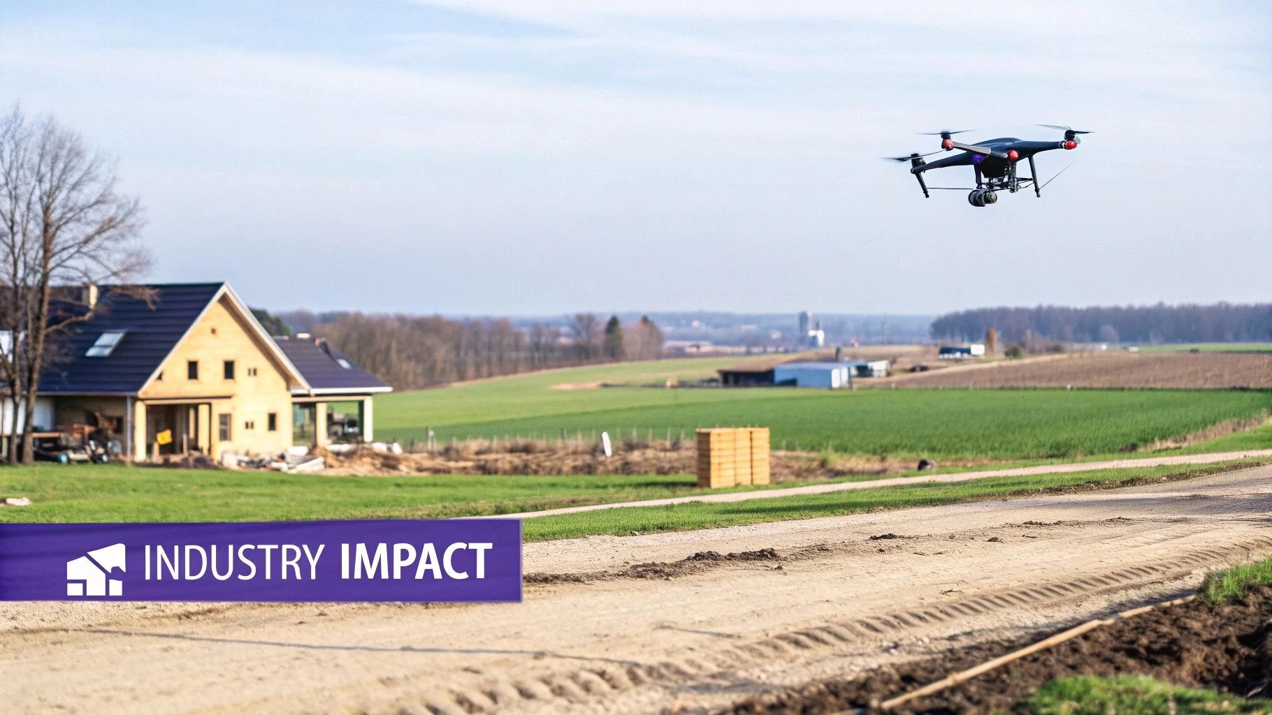
Picture a construction manager trying to keep tabs on a massive development. Instead of spending days walking the site, a drone can fly the entire area and capture a complete overview in less than an hour. And we're not talking about a simple photo. This is a rich dataset that can be turned into 3D models, used to measure stockpiles of materials with incredible accuracy, and even perform safety compliance checks. The drone effectively becomes an extension of the project manager's own eyes, offering a perspective that's completely out of reach from the ground.
A Toolkit for Modern Problems
The real magic of drone aerial services is their incredible versatility and efficiency. Every flight is designed to tackle a specific business challenge, transforming raw data from the air into tangible results on the ground. The benefits are hard to ignore:
- Enhanced Safety: Drones can inspect dangerous spots like cell towers, fragile rooftops, and live power lines, keeping human workers safely on the ground.
- Cost Reduction: An aerial survey is dramatically faster and needs fewer people than traditional methods, which translates to serious savings on labor and equipment.
- Improved Data Accuracy: Technologies like photogrammetry and LiDAR create precise, measurable 3D models and maps that leave manual estimates in the dust.
- Faster Decision-Making: With data collected and processed in hours instead of weeks, stakeholders get the intel they need to make smart, informed decisions, fast.
The true power of a drone service isn't in the flying; it's in converting an aerial viewpoint into a measurable business advantage. It’s about delivering intelligence that drives efficiency, safety, and profitability.
The explosive growth of this sector tells its own story. The global drone market is booming, encompassing everything from agriculture and construction to complex inspections. After being valued at a massive $63.6 billion in 2025, the market is projected to more than double, hitting an incredible $127 billion by 2032. This incredible pace highlights the huge opportunities waiting for skilled professionals.
Ultimately, drone aerial services act as the bridge between complex physical assets and the digital tools we use to manage them. Whether it’s creating a jaw-dropping cinematic video to sell a luxury property or spotting a single faulty panel on a massive solar farm, drones offer a powerful and flexible solution.
For a deeper look into all the different ways drones are being put to work, check out our comprehensive guide on the diverse applications for drones.
Core Categories of Drone Aerial Services at a Glance
To give you a clearer picture, here’s a quick breakdown of the main service types you'll encounter in the industry. This table sums up the most common categories, what they're used for, and the value they bring to clients.
| Service Category | Primary Application | Key Client Benefit |
|---|---|---|
| Photography & Videography | Real estate marketing, event coverage, promotional content. | High-impact visuals that grab attention and showcase properties or events from a unique perspective. |
| Inspection Services | Inspecting roofs, power lines, bridges, cell towers, and wind turbines. | Major improvements in safety by keeping humans out of harm's way, plus faster and more thorough assessments. |
| Surveying & Mapping | Land surveying, construction site progress, stockpile volume measurement. | Highly accurate topographic maps and 3D models, leading to better planning and cost control. |
| LiDAR Services | Creating detailed 3D maps of terrain, often through vegetation. | Unmatched precision for engineering, forestry, and infrastructure projects where accuracy is critical. |
| Thermal Imaging | Solar farm inspections, building heat loss analysis, search and rescue. | The ability to "see" heat, identifying problems like faulty panels or insulation leaks that are invisible to the naked eye. |
| Drone Delivery | Transporting medical supplies, packages, and food. | Fast, efficient, and direct delivery, especially valuable for urgent items or reaching remote areas. |
Each of these categories represents a specialized field requiring unique skills and equipment, but they all share a common thread: using aerial data to solve problems more effectively than ever before.
The Spectrum Of Professional Drone Services
Understanding how drone services tackle real business challenges is the crucial first step. These offerings don’t just capture pretty pictures—they turn raw aerial data into decisions that drive real impact. In this section, we’ll unpack each service category and show how operators transform a flying machine into a problem-solving powerhouse.
Think of it like a contractor’s toolbox: you wouldn’t swing a sledgehammer when a finishing nail needs a gentle tap. Equally, the drone and sensor setup for a cinematic real estate shoot are worlds apart from those used to map a 500-acre farm. Spotting the right combination of aircraft, payload, and technique ensures operators hone their craft and helps clients zero in on the exact solution they need.

As the concept map shows, operations begin with aerial data capture and finish by delivering concrete improvements—whether that’s cutting inspection time, reducing costs, or enhancing safety.
Aerial Photography And Videography
Most professionals start here. The mission: create high-impact visuals that were once only achievable via helicopters or cranes.
- Real Estate: Elevated perspectives reveal entire properties and their surroundings, driving higher buyer interest and faster sales.
- Marketing And Events: From music festivals to corporate gatherings, dynamic aerial footage injects energy into promotional content.
But achieving those silky-smooth shots takes more than a drone in the sky. It demands mastery of framing, natural light, and advanced flight maneuvers to produce truly cinematic results.
Infrastructure And Energy Inspections
In this arena, drones shift from promotional props to vital inspection tools. The main advantage: collect high-resolution imagery on hard-to-reach assets without ever putting a technician at risk.
Consider the routine check of a wind turbine. Traditionally, crews rappel down blades—slow, costly, and dangerous. A drone equipped with a high-resolution zoom camera can scan every inch in minutes, detecting cracks or corrosion before they escalate. This same approach extends to:
- Cell towers
- Bridges and overpasses
- High-voltage power lines
By replacing scaffolding and harnesses with automated flight patterns, operators slash both time and safety risks.
Surveying And Mapping Solutions
When precision matters, this category shines. Using photogrammetry—stitching hundreds of overlapping photos into a 3D model—or LiDAR, which sends laser pulses to record exact distances, drones forge high-precision digital replicas of real-world sites.
A drone survey is not just a picture; it’s a dataset. It transforms physical environments into models you can measure, analyze, and monitor over time with centimeter-level accuracy.
This rich dataset empowers industries like:
- Construction: Track site progress, verify work against plans, and calculate material volumes (sand, gravel, etc.).
- Agriculture: Generate elevation maps to fine-tune irrigation and drainage—boosting yields and conserving water.
- Land Development: Produce topographic surveys faster and more cost-effectively than traditional ground crews.
Thermal Imaging Diagnostics
Thermal sensors give drones a superpower: the ability to see heat. Infrared cameras translate temperature differences into visual maps, revealing issues invisible to the naked eye.
Imagine flying over a solar farm with thousands of panels. Manually inspecting each one could take weeks. A thermal drone scans the entire site in hours, flagging underperforming modules as distinct “hot spots.” That insight slashes energy losses and directs maintenance crews right to the trouble spots.
Thermal imaging also proves invaluable for:
- Detecting heat loss in building envelopes
- Locating moisture intrusion under roofing materials
- Supporting search and rescue missions by pinpointing body heat
Across all these applications, drones leverage their unique vantage point to deliver targeted, measurable value that drives operational efficiency.
How Drones Are Remaking Key Industries
Knowing the types of drone services is one thing, but seeing them solve real-world problems is where their value truly clicks. Drones aren't just a novelty; they are powerful tools delivering measurable results and a clear return on investment across a ton of different sectors.
From massive construction sites to sprawling farm fields, UAVs are tackling old challenges in ways we could only dream of a decade ago. Let's dig into how a bird's-eye view is turning operational headaches into opportunities for growth and, crucially, making work safer for everyone involved.
The market numbers tell the story. The commercial drone services sector was valued at $12.81 billion in 2025 and is on track to more than double to a staggering $27.68 billion by 2032. This explosion is being driven by industries that see the direct cost savings and efficiency gains—think delivery services sidestepping road traffic or farmers slashing their spending on fertilisers.
To illustrate how this plays out on the ground, let's look at a few examples.
Drone Service Impact Across Key Industries
The table below breaks down how specific drone services address common pain points in different industries, highlighting the direct drivers of ROI.
| Industry | Common Problem | Drone Service Solution | Typical ROI Driver |
|---|---|---|---|
| Construction | Inaccurate progress tracking and site safety risks. | Regular aerial mapping & 3D modelling. | Reduced rework, faster stockpile calculations, fewer safety incidents. |
| Real Estate | Standard photos fail to show a property's full scope. | Cinematic aerial photography & videography. | Higher buyer interest, quicker sales, premium listing prices. |
| Agriculture | Inefficient resource use and slow crop scouting. | Multispectral mapping for plant health analysis. | Reduced input costs (fertiliser, water), increased crop yield. |
| Energy | Dangerous and slow inspections of power lines or turbines. | Thermal and high-resolution visual inspections. | Drastically reduced inspection time and elimination of human risk. |
| Insurance | Slow and unsafe property damage assessments. | Rapid aerial imagery capture post-incident. | Faster claims processing and safer adjuster deployment. |
This is just a snapshot, of course. The applications are spreading fast as more businesses realise the benefits of getting data from the air.
Construction: Building Smarter and Safer
The construction industry is a textbook case for drone adoption. A project manager's biggest headaches are often tracking what's actually been built versus the plans and keeping the site safe. Both are traditionally slow, manual, and expensive jobs.
Drones change the entire workflow. A single automated flight can hoover up comprehensive site data, which is then stitched into high-resolution orthomosaic maps and 3D models. This gives managers the power to:
- Verify work completed against blueprints with centimetre-level accuracy.
- Calculate stockpile volumes of sand or gravel in minutes, not hours.
- Spot safety hazards from a distance without sending anyone into a potentially dangerous area.
A drone on a construction site isn't just a camera—it's a project management powerhouse. It becomes the single source of truth, cutting down on disputes, preventing expensive rework, and keeping the project on schedule and under budget.
By replacing manual surveys, firms save thousands in labour costs and gain a vital layer of risk management. For a much deeper look, check out our guide on drone use in construction.
Real Estate: Selling the Big Picture
In the cut-throat world of real estate, first impressions are everything. Ground-level photos just don't do justice to large homes or commercial properties, failing to capture their true scale and appeal.
Aerial drone services are a complete game-changer here. Showing a property from the air allows agents to highlight the features that sell:
- The sheer size of the land and its proximity to parks, schools, or the waterfront.
- The full property layout, including the garden, pool, and any outbuildings.
- The incredible views and the feel of the surrounding neighbourhood.
This elevated view creates an immediate emotional connection. A cinematic aerial tour makes a listing pop, driving far more interest and often leading to faster sales at better prices. It's a small investment for a massive marketing punch.
Agriculture: Farming with Precision
Farming is a constant battle to boost crop yield while cutting back on resources. The old way of walking the fields is slow and often misses the early signs of trouble like pests, dry patches, or nutrient-starved plants.
Drones equipped with multispectral sensors give farmers superpowers. These sensors see light beyond what our eyes can, revealing subtle stress in plants across hundreds of acres. This enables precision agriculture, where farmers can:
- Spot stressed crops long before the damage becomes visible.
- Create "prescriptions" to apply fertiliser or water only where it's truly needed.
- Generate accurate yield forecasts well before the harvest.
This data-first approach helps farmers slash input costs on things like fertiliser and pesticides by 15-20%, save water, and ultimately grow more profitable, sustainable crops.
Getting to Grips with the Rules and Flying Safe
Running a professional drone business is about so much more than owning a decent bit of kit and knowing how to get a good shot. At the heart of any trustworthy, long-lasting operation are two non-negotiables: rock-solid compliance with aviation rules and a real commitment to safety. These aren't just boxes to tick; they’re what build a client’s trust and separate the pros from the hobbyists.
Think of it like a pilot's pre-flight checklist. An airline captain wouldn’t dream of taking off without running through strict protocols, and a drone operator is no different. You have to navigate a whole landscape of regulations designed to keep the skies safe for everyone. This rigorous, professional approach is what will make you stand out. It shows clients you're a low-risk, high-value partner, helping you build a reputation for reliability one safe flight at a time.
The Must-Haves for Drone Compliance
Before you even think about spinning up the props for a paid job, you need the right paperwork and permissions. The exact details change from country to country, but the core ideas are the same. In the United States, for instance, the Federal Aviation Administration (FAA) is the one setting the rules.
For any US-based operator, here are the key checkpoints:
- Part 107 Certification: This is your main ticket to fly commercially. To get it, you have to pass a pretty tough aeronautical knowledge test that covers everything from airspace classifications to weather patterns and flight rules.
- Drone Registration: Any drone weighing over 0.55 lbs (250 grams) that's used for work needs to be registered with the FAA. You also have to make sure the registration number is clearly marked on the aircraft itself.
- Airspace Authorizations: You can't just fly wherever you fancy. A lot of the sky is controlled airspace, especially around airports. To fly in these areas, you need specific permission, which you can often get pretty quickly through the LAANC (Low Altitude Authorization and Notification Capability) system.
Let's be clear: compliance is not optional. Flying a commercial job without the right ticket or clearance can land you with hefty fines, instantly wreck your professional credibility, and expose your clients to a world of liability they didn't sign up for.
Getting a handle on these rules is just the starting point. To really dive deep into what it takes to operate legally, check out our complete commercial drone compliance guide.
Building a True Culture of Safety
Compliance is about what you have to do. A real safety culture is about what you should do, every single time you fly. It's this proactive mindset that stops incidents from happening and makes sure every mission ends without a hitch. It means making methodical planning and risk management just part of your normal routine.
A professional's playbook is built on a few core safety habits:
- Solid Pre-Flight Checks: This is way more than just seeing if the batteries are charged. It’s a full physical inspection of the drone—the frame, the props, the camera. It’s also checking that the firmware is up to date and that you have a strong, stable GPS lock.
- Detailed Risk Assessments: Before you even get to a site, you should be analysing potential hazards. Are there airports nearby? Schools? Power lines? What's the terrain like, and what's the weather forecast saying about wind and rain? This assessment helps you build a solid plan to manage any risks you find.
- On-Site Surveys: Once you arrive, a final walk-through is crucial. This is your chance to spot any new or temporary obstacles that weren’t on a map, like construction gear, people walking by, or even wildlife.
- Emergency Protocols: What's the plan if the drone loses connection or a battery is about to die? A pro already knows. This means having a clear emergency landing spot picked out and knowing exactly how the drone's return-to-home (RTH) feature will behave in different situations.
Ultimately, this methodical, safety-first approach is what gives you the confidence to operate, deliver consistently great work, and build the kind of long-term client relationships that are the bedrock of a successful drone services business.
Building a Profitable Drone Service Business
So, you can fly a drone. That’s a fantastic start, but turning that skill into a real business that pays the bills? That’s a whole different ball game. A profitable drone service is built on more than just flight time; it’s a mix of technical skill, smart business strategy, clear pricing, and knowing how to land the jobs that matter.
It’s about making the leap from pilot to entrepreneur. This means getting your head around your real value, carving out a specific niche, and, yes, taming the beast that is business admin. Let’s walk through what it takes to stop flying as a hobby and start running a drone business that actually lasts.
Defining Your Pricing Strategy
One of the first hurdles every new operator faces is figuring out what to charge. It's a huge decision. Price too low, and you're working for peanuts; price too high, and you might scare everyone off. Your rates need to cover everything—your gear, software subscriptions, insurance, marketing, and the expertise you've spent countless hours building.
Most operators land on one of three pricing models, each with its own sweet spot:
- Per Hour: Simple and effective. This works great for jobs where the scope is a bit fuzzy, like covering a live event or being on-call for site monitoring. It guarantees you're paid for every minute you're on the job, including setup and those inevitable delays.
- Per Project: Perfect for well-defined gigs. Think of a standard real estate photo package or a straightforward roof inspection. You give the client a single, flat-rate fee, which they love for budgeting, and it allows you to price based on the value you deliver, not just the hours you clock.
- Per Acre/Asset: When you're dealing with big areas like agricultural mapping or inspecting multiple cell towers, this model just makes sense. It scales beautifully and is easy for clients in those industries to wrap their heads around.
Remember, you're not just selling time in the air. You’re selling critical data, insights that save money, and a professional service that reduces risk. Your pricing has to reflect that total value.
Whichever path you take, you have to know your numbers cold. Tally up all your annual business costs, figure out how many jobs you can realistically handle, and set a rate that actually leaves you with a profit.
Creating a Winning Business Plan
A solid business plan is your roadmap to success. It’s what forces you to think through every piece of the puzzle, from who you’re trying to sell to, to how you’re going to grow. And the first step is finding your niche. Don't be a jack-of-all-trades. Instead of flying for anyone who will pay, why not become the go-to expert for construction progress monitoring in your city? Or the top choice for cinematic videos of luxury properties?
A tight niche makes your marketing laser-focused and your value crystal clear. Once you know who you're targeting, your business plan should lay out:
- Services Offered: A detailed rundown of exactly what you do.
- Marketing and Sales Strategy: How you’ll get in front of your ideal clients.
- Financial Projections: A realistic look at your expected income, costs, and profit.
- Operational Workflow: Your step-by-step process, from the first client call to the final file delivery.
This plan is the backbone of your proposals. A great proposal doesn't just list a price; it shows you understand the client's problem and positions your drone service as the perfect solution, spelling out the deliverables, timeline, and exactly what they can expect.
From First Contract to Sustainable Growth
Landing that first big contract feels amazing. But it also throws a whole new set of challenges your way. Suddenly, you're not just a pilot; you're also juggling client emails, scheduling, flight plans, compliance paperwork, and invoices. This is where a lot of new businesses get bogged down, spending more time on admin than flying.
Imagine you've just won a contract to monitor three construction sites every week. That’s three different locations, each with its own airspace rules and safety risks. Without a solid system, it’s easy to miss a pre-flight check, misplace a flight log, or deliver a report late. A few simple mistakes can put a valuable client relationship at risk.
The only way to grow without burning out is to build scalable systems from day one. That means finding tools to automate the boring stuff, streamline your flight planning, and keep your compliance on lock for every single mission. When you systematize your operations with a platform like Dronedesk, you free yourself up to focus on what really moves the needle: delivering incredible work for your clients and strategically building your business.
How Dronedesk Helps You Scale Your Operations
Let's be honest, flying the drone is the fun part. The real grind of running a professional drone service comes from the mountain of admin that piles up behind every single job. You're constantly juggling client details, planning complex flights, logging every minute in the air, and trying to stay on top of a dizzying amount of compliance paperwork. This is the stuff that grinds businesses to a halt and stops talented pilots from scaling up.
This is exactly why dedicated drone operations management platforms exist. Instead of wrestling with a chaotic mix of spreadsheets, Word documents, and forgotten notebooks, a platform like Dronedesk gives you a single, sane system to manage everything. It’s built to take the tedious, time-sucking admin off your plate so you can focus on what actually makes you money: flying missions and winning new clients. For many operators, making this switch cuts their job planning time by over 50%.
Centralize and Simplify Your Workflow
Imagine having one place—a single dashboard—that ties every part of your business together. From the first email with a new client to delivering the final data, Dronedesk connects all the dots so nothing ever gets missed. It's a simple idea, but it changes everything.
Here's what that looks like in practice. This is the Dronedesk dashboard, which brings your job pipeline, team schedule, and fleet status into one clean view.
This central hub means no more hunting for information. You get an instant snapshot of your entire operation, allowing you to make quick, smart decisions.
A single, streamlined system means you can take on more projects without dropping the ball. Whether you’re a one-person crew or running a growing team, this approach is the key to handling a bigger workload without compromising on quality or safety. It turns administrative chaos into a smooth, predictable, and scalable process.
Automated Compliance and Risk Management
For professional drone aerial services, compliance isn't optional—it's the foundation of your business. Dronedesk bakes safety and compliance right into your workflow, automating a ton of the checks that are all too easy to forget when you're under pressure.
By building risk assessments and pre-flight checklists directly into every job plan, Dronedesk ensures every flight is not only efficient but also fully compliant and safe. It’s about protecting your business, your reputation, and your clients.
Some of the key automated features include:
- Airspace Intelligence: Instantly pull up data on airspace restrictions, ground hazards, and NOTAMs for any flight location. No more manual searching.
- Risk Assessments: Use pre-built, industry-standard templates to quickly flag and mitigate potential risks before you even step on-site.
- Automated Logging: Sync flight logs straight from your drone. This creates a perfect, indisputable record for any regulatory questions that might come up.
This solid framework drastically reduces the chance of human error and gives you a clear audit trail for every single mission. It’s the kind of peace of mind that allows you to confidently bid on bigger, more ambitious projects and grow your business the right way.
Burning Questions Answered
How Much Does It Really Cost to Start a Drone Business?
You can get off the ground for anywhere between $2,000 to over $15,000, and it really boils down to what services you plan to offer. The essentials include a solid professional drone (something like a DJI Mavic series), your pilot certification fees (like the FAA Part 107 in the US), liability insurance, and the right software to manage it all.
But if you're eyeing the more advanced drone aerial services like LiDAR or thermal imaging, you’re looking at a much bigger initial investment. Those high-end sensors and the specialized training required can push your startup costs way, way higher.
What's the Most Profitable Drone Service I Can Offer?
While you can make money in any region, the big profits are consistently in specialized industrial work. Think infrastructure inspection, thermal imaging, and LiDAR surveying—these services command top dollar because they save clients a fortune and drastically reduce safety risks compared to old-school methods.
That said, don't overlook real estate photography and videography. The barrier to entry is much lower, and while you might earn less per job, you can build a very profitable business by handling a high volume of clients and nailing your workflow.
The secret to profitability isn’t just the service you sell; it’s about the specific, high-value problem you solve. Focus on a niche that eases a major safety headache or efficiency bottleneck for your client, and you'll find the best returns.
Do I Actually Need a License to Fly Drones for Money?
Yes. 100%. No exceptions. To legally charge for drone services, virtually every country on the planet requires you to have a commercial drone pilot license or certification. In the United States, that means getting your Remote Pilot Certificate under the FAA's Part 107 rules.
This involves passing a pretty comprehensive aeronautical knowledge test and registering your drone with the FAA. Flying commercially without the right credentials can land you in hot water with massive fines and serious legal trouble. It's the absolute, non-negotiable first step for any pro operator.
Juggling all these operational details—from client projects to flight logs and compliance checks—is what separates the pros from the amateurs. Dronedesk is a complete drone operations management platform built to keep your business organised, compliant, and ready to grow. See how it works at https://dronedesk.io.
 What a BVLOS Flight Means for Risk and Compliance →
 Drone VLOS Rules Explained for Commercial Teams →
 FAA Remote ID Rule Explained for Commercial Pilots →
 Drone Legal Requirements for Commercial Operations →
 Drone Near Airport Rules Explained for Safer Planning →
 International Drone Regulations Every Global Team Should Know →
 Drone Flight Risk Assessment Example for Safer Missions →
 Beyond Visual Line of Sight Explained for Operators →
 How BVLOS Drone Operations Change Commercial Workflows →
 FAA Drone Rules Every Commercial Pilot Should Know →