Drone Use in Construction A Modern Builder's Guide
Using a drone on a construction site isn't some futuristic fantasy anymore. It's become standard practice for anyone serious about boosting efficiency, keeping people safe, and getting things right the first time. That bird's-eye view gives teams the critical data they need to track progress, manage resources, and spot risks before they blow up into costly delays.
Why Drones Are Changing the Game on Construction Sites
A modern construction site is a complex dance of timelines, materials, and people. For decades, project managers have wrestled with the same old headaches: budget overruns, surprise delays, and safety hazards. The traditional ways of keeping tabs on things, like manual surveys and photos from the ground, often leave huge data gaps. You're left making big decisions with outdated or incomplete information.
It’s like trying to build a complex puzzle with half the pieces missing. That’s what managing a site without a clear, real-time picture feels like.
This is exactly where drones come in and completely change the dynamic. They aren't just flying cameras; they're powerful data-gathering tools that create a single source of truth for the entire project. In the time it takes you to grab a coffee, a single drone flight can capture a detailed, data-rich snapshot of the entire job site.
More Than Just a Flying Camera
Think of a drone not as a replacement for your crew, but as a superpower for them. It gives superintendents, project managers, and engineers the ability to see the "big picture" without ever leaving the site office. This aerial view is a game-changer for:
- Solving Problems Before They Happen: Spot potential clashes between trades, see materials staged in the wrong place, or identify safety issues from a safe distance.
- Keeping Everyone in the Loop: Sharing crystal-clear visual updates with clients and investors builds trust and makes sure everyone is on the same page.
- Making Data-Driven Decisions: Swap guesswork for pinpoint accuracy when measuring earthwork, checking stockpile volumes, or verifying as-builts.
The rapid uptake of this technology is plain to see in the market numbers. The global construction drone market was recently valued at USD 6.94 billion and is only expected to climb higher. This growth is being pushed by things like rapid urbanization—with the global urban population projected to hit 6 billion by 2045—and the constant demand for smarter, faster infrastructure development. You can dig into more data on this market expansion to get the full story.
Drones give you the ultimate high-ground advantage. They turn reactive, fire-fighting management into proactive leadership by delivering undeniable visual proof of what’s happening on-site right now. This directly tackles the biggest project killers: delays and budget creep.
At the end of the day, using drones in construction delivers a clear return on investment. By catching mistakes early, optimising how you use your resources, and preventing accidents, this technology doesn't just add a little value—it becomes a core part of running a profitable and successful project.
Creating Digital Blueprints with Drone Surveying
Before a single foundation gets poured, every successful construction project hinges on a precise understanding of the land. Traditional surveying methods, while reliable, are notoriously slow and labour-intensive. They often involve teams slogging it out on the ground with specialised equipment, a process that can chew up days, or even weeks, creating a bottleneck right at the very start of a project.
Now, imagine swapping that entire process for a single, automated flight. Using drones in construction for surveying has completely upended this critical first step. Instead of a hand-drawn sketch or a jumble of isolated data points, you get a high-definition digital twin of your job site. A single drone, armed with advanced sensors, can wrap up in a few hours what used to take a full crew a week to complete.
From Manual Labour to Digital Precision
This isn't just about doing things faster; it's about the sheer quality and depth of the data you get. Drones capture thousands of images and data points, which are then stitched together using photogrammetry software. The result? A stunningly accurate and interactive 3D model that you can poke, prod, and explore right from your desk.
This process gives you invaluable assets for planning:
- Orthomosaic Maps: Think of these as super-detailed, distortion-free aerial maps. They provide a perfectly flat, top-down view of the entire site, far richer than any standard satellite image.
- LiDAR Point Clouds: By using Light Detection and Ranging (LiDAR) sensors, drones create incredibly dense and precise 3D point clouds. This data is the gold standard for measuring topography, calculating volumes, and truly understanding the site's exact contours.
The table below really drives home the quantitative improvements drones bring to these fundamental pre-construction and monitoring activities. It's a clear look at how a small change in tooling can lead to massive gains in efficiency and accuracy.
| Activity | Traditional Method | Drone-Assisted Method | Key Improvement Metric |
|---|---|---|---|
| Topographic Survey | 2-person crew, 5 days | 1 drone operator, 1 day | 80% reduction in field time |
| Volumetric Calculation | Manual spot checks, estimates | Automated LiDAR/photogrammetry | Up to 99% volume accuracy |
| Progress Tracking | Weekly site walks, photos | Bi-weekly drone flights, overlays | 50% faster progress reporting |
| Safety Inspection | Manual visual inspections | High-res drone imagery/video | 75% faster inspection time |
By replacing slow, manual processes with rapid, automated data collection, drones not only speed up the timeline but also deliver a richer, more reliable dataset to work from.

As you can see, the impact is huge, with accuracy improvements climbing as high as 90% while slashing the time required on site.
Smarter Planning and Reduced Rework
This unprecedented level of detail fundamentally changes how projects get planned and executed. With a complete digital model in hand, you can precisely calculate cut-and-fill volumes, plan site logistics with real confidence, and design drainage systems based on actual topography, not just educated guesses. It’s a proactive approach that helps you sidestep costly rework and disputes down the line.
It's no surprise that drone adoption is surging. In fact, 45% of civil contractors and a staggering 67% of major organisations now use drones on all their projects. The data shows this tech has improved measurement accuracy by 61% and cut data collection time by 53%, accelerating project timelines and boosting productivity across the board.
Think of it like this: drone surveying gives you the project's "answer key" before the test even begins. It lets your team find and fix potential issues in the digital model, saving an immense amount of time and money compared to discovering them in the field.
Beyond the initial site map, this same technology is a powerhouse for ongoing assessments. For example, drones are instrumental in performing detailed building condition surveys, capturing vital data on existing structures with a speed and safety that traditional methods just can't match.
Ultimately, by creating these rich digital blueprints, drones set the stage for a more profitable and predictable project from day one. To really dig into the specific techniques and benefits, check out our detailed guide on https://blog.dronedesk.io/surveying-with-drones/. Getting this foundation right is the first and most critical step in unlocking the full power of aerial data.
Keeping Your Project on Track from the Sky
Once the initial surveys are done and the first shovel hits the dirt, a construction project becomes a living, breathing thing. Trying to manage its day-to-day evolution with old-school methods is like conducting an orchestra but only hearing the violins. A walk around the site gives you one perspective, sure, but you're completely missing the bigger picture of how every trade, every piece of equipment, and every material stockpile is interacting. This is where consistent drone use in construction becomes a project manager's best friend.
Regular drone flights give you a real-time, bird's-eye view that quickly becomes the ultimate source of truth for your job site. Picture your project manager starting their morning not with a stack of conflicting reports, but with a fresh, high-resolution aerial map of the entire project. This isn't just a pretty picture; it's a dense layer of objective data, ready to be analysed.

This daily stream of information fuels a much smarter, more proactive management style. It’s the difference between constantly putting out fires and actually preventing them in the first place.
From Blueprint to Reality with BIM Overlays
One of the most powerful things you can do with this data is compare your as-built progress against your Building Information Models (BIM). By overlaying the latest drone-captured map or 3D model directly onto the project’s digital blueprint, any differences between the plan and the reality jump right off the screen.
Let's walk through a typical scenario for a VDC manager. A drone flies the site on Monday. By Tuesday morning, the data is processed. The manager drags the new as-built model over the BIM design and spots it immediately: a subcontractor has laid utility conduits two feet to the right of where they should be.
Without a drone, this kind of mistake might go unnoticed for weeks, maybe even until after concrete is poured over it. The cost to dig that up and fix it would be enormous. With daily drone data, it's a minor correction handled in a few hours.
This constant back-and-forth between the digital plan and the physical site is what modern construction is all about. It lets teams:
- Spot Deviations Early: Catch when foundations, steel, or MEP systems are misaligned with the design before it creates a domino effect of problems.
- Validate Work Completed: Get visual proof that the work you're paying for has actually been done to spec. This makes progress payments far more accurate and less contentious.
- Improve Coordination: Share clear, visual evidence of issues with trade partners to get them resolved fast, without the usual finger-pointing.
Managing Materials and Measuring Progress
Beyond just checking for clashes, regular drone flights are a game-changer for logistics. Anyone who’s worked on a busy site knows how chaotic tracking materials and measuring progress can be.
Drones provide clear, quantifiable answers to critical questions. For example, a project manager can use the data to run quick and accurate volumetric calculations on earthwork stockpiles. This tells them precisely how much fill has been moved, making sure subcontractors are billed correctly and that there are enough materials for the next phase of work.
This data stream is also incredibly useful for general progress tracking and inventory.
- Material Inventory: A quick flight can confirm the delivery and location of key materials like rebar, steel beams, or precast panels. This helps prevent theft and ensures materials are staged correctly to avoid bottlenecks.
- Percent Complete Reporting: Instead of relying on gut feelings or rough estimates, you can use drone imagery to create objective, visual progress reports. This builds incredible transparency and trust with clients, who love seeing the project come to life week by week.
- Identifying Bottlenecks: From the air, you can spot logistical jams that are invisible from the ground, like inefficient haul routes or a piece of equipment blocking access for other trades.
By turning the entire job site into a measurable dataset, the drone use in construction creates a powerful feedback loop that drives efficiency. Platforms like Dronedesk are central to this, giving you the flight planning and data management tools to make these daily check-ins a seamless part of your operation. It’s this consistent flow of information that empowers data-driven decisions, keeping projects on schedule and, most importantly, on budget.
Building a Safer Job Site with Drones
It's no secret that construction is a high-risk game. Every day, workers face situations that can put them in serious danger. For decades, job site safety has hinged on manual inspections, physical barriers, and personal protective equipment. While these are all non-negotiable, they're often reactive measures. This is where drone use in construction changes the entire safety equation, shifting the focus from reaction to prevention.
Think of a drone as a powerful safety multiplier. It's your remote set of eyes, capable of going places that are dangerous, difficult, or downright impossible for a person to reach. Drones take on the high-risk jobs, gathering vital data without putting a single crew member in harm's way.

This proactive approach to finding hazards gives safety managers the power to spot and fix risks long before they can cause an incident. The result? A fundamentally safer work environment for everyone on site.
Proactive Hazard Identification from Above
A drone's bird's-eye view is incredibly effective for spotting potential hazards. Instead of sending an inspector to climb scaffolding or walk the precarious edge of a deep trench, a drone can capture high-resolution images and video from a safe distance.
It's like having an on-demand safety audit at your fingertips. In just a few minutes, a safety manager can review footage of the entire site, catching issues that would be easy to miss from the ground.
This is a game-changer for common but dangerous scenarios, such as:
- Inspecting Work at Height: You can evaluate scaffolding integrity, check elevated platforms, or assess roofing without anyone's boots leaving the ground.
- Examining Unstable Areas: Safely inspect deep trenches, excavation walls, or steep embankments for any signs of instability or a potential collapse.
- Monitoring Heavy Equipment Operation: Observe cranes, excavators, and other big machinery to ensure safe operating clearances and identify blind spots that could lead to an accident.
By taking people out of the most dangerous inspection tasks, you're not just making things more efficient; you're directly cutting the risk of falls, collapses, and other all-too-common construction accidents. This proactive stance is the heart of a drone's safety value.
Advanced Sensing for Invisible Dangers
Today's drones are more than just flying cameras. When you equip them with advanced sensors, like thermal cameras, you unlock another layer of safety intelligence. Thermal imaging detects heat signatures invisible to the naked eye, a game-changer for spotting hidden electrical faults and for predictive maintenance.
A quick thermal scan can pick up on:
- Overheating electrical panels or transformers, which are clear fire hazards.
- Failing mechanical equipment or engines that are running dangerously hot.
- Moisture trapped behind walls or under roofing, a precursor to structural decay.
Catching these problems before they escalate means you can schedule safe, planned repairs instead of facing emergency shutdowns or catastrophic failures. To see how this works in a specific trade, understanding drone roof inspection software gives a great picture of how this tech pinpoints specific issues from above.
Enhancing Site Security and Asset Protection
A truly safe construction site is also a secure one. The theft of expensive materials and equipment or acts of vandalism aren't just financial losses; they create unsafe conditions if damaged equipment is used without anyone knowing.
Drones offer a brilliantly simple solution for site security, especially after hours or on large, sprawling projects that are tough to patrol on foot.
- Deterring Trespassers: The sight and sound of regular, automated drone patrols are a powerful deterrent to would-be thieves.
- Incident Documentation: If a security breach happens, high-resolution aerial footage provides crystal-clear evidence for law enforcement and insurance claims.
- Asset Tracking: A quick daily flight can verify that high-value assets and materials are secure and accounted for, stopping loss before it happens.
When you add it all up, the benefits of drone use in construction go far beyond simple efficiency. By taking on dangerous tasks, providing proactive hazard intelligence, and securing the entire site, drones have become an essential tool for building a true culture of safety.
Turning Drone Data into Actionable Insights
Raw aerial images from a drone are just the start. By themselves, they offer a great view, but their real value in construction isn't unlocked until that data is processed, analyzed, and plugged right into your project management workflow. The genuine power behind drone use in construction is in turning those thousands of pictures into clear, actionable intelligence. This is where specialized software becomes your command center, translating what the drone sees into information you can actually use to make critical calls.
Think of it like this: your drone is a scout, sending back raw reports from the field. But without a general at headquarters to make sense of those reports, they’re just noise. In this scenario, the "general" is a data processing platform like Dronedesk. It gives you the tools to manage flights and, crucially, organize the mountain of data you collect. This software then channels the data into photogrammetry engines that stitch all those individual images into cohesive, measurable models.

This is the key relationship: the drone hardware paired with intelligent software. It’s what allows managers to stop just reacting to problems and start making proactive, strategic decisions that optimize resource use and boost project profitability.
Demystifying AI and Machine Learning in Construction
This is where things get really clever. Artificial intelligence (AI) and machine learning algorithms are the analytical brains of the operation. These systems are trained to automatically comb through the processed data—your 3D models and orthomosaic maps—to pinpoint what truly matters.
Instead of a project manager manually poring over maps to find discrepancies, the software does all the heavy lifting. For instance, AI can:
- Automatically Spot Deviations: By comparing the as-built 3D model against the original BIM design, the system can flag anything that’s out of place, from a misplaced foundation to incorrect pipework.
- Calculate Stockpile Volumes: Machine learning algorithms can identify and measure material stockpiles with up to 99% accuracy. This takes the guesswork out of inventory management and subcontractor payments.
- Generate Insightful Progress Reports: The software can automate the creation of weekly progress reports, complete with annotated images and key metrics, keeping every stakeholder in the loop.
This isn't about replacing human expertise; it's about amplifying it. AI handles the tedious, data-heavy tasks with incredible speed and accuracy. This frees up your team to focus on what they do best: solving complex problems and managing the project.
This kind of tech adoption is a big reason why North America has cornered over 42.7% of the construction drone market. Getting in early on advanced automation for tasks like precise data collection and real-time progress tracking has slashed labor costs and project timelines. Plus, new sustainability trends favor drones for making the most of every resource.
From Data Points to Dollars and Cents
Ultimately, every piece of data you collect should point back to a real business outcome. The insights generated from drone data platforms have a direct impact on your bottom line. When you can accurately track earthwork progress, you avoid overpaying for soil removal. When you spot a design deviation early, you prevent thousands of dollars in rework.
To help manage this process, construction firms can put a system in place using a Drone Footage Request Form Template. This simple step formalizes the data collection workflow, making sure every flight has a clear purpose and that the resulting data is handled properly from the get-go.
When data collection is this organized, you turn what could be random data points into predictable dollars and cents. It provides the financial and operational clarity you need to keep a project profitable. By integrating drone data into daily operations, construction firms aren't just building structures; they're building a more efficient, predictable, and profitable business.
Launching a Successful Drone Program
So, you're ready to bring drones to your construction sites. That's a great move, but let's be honest: buying the hardware is the easy part. A truly successful program isn't about having a few cool flying gadgets; it's about building a solid strategy that ties directly into your business goals. This is what separates a short-lived experiment from a scalable, data-driven operation that delivers real, measurable value.
The first step is to get past the "wow" factor and figure out exactly what you want to achieve. Think of it like laying the foundation for a building—without clear objectives, the whole thing is unstable. Are you trying to slash surveying time? Make safety inspections less risky? Give clients better progress reports? Pin these goals down and attach some real numbers to them, like "cut surveying fieldwork by 75%" or "completely eliminate manual roof inspections."
Navigating Regulations and Certifications
Once you know what you're aiming for, the next hurdle is making sure you're doing it all by the book. In the United States, commercial drone use in construction falls under the Federal Aviation Administration's (FAA) Part 107 rules. This isn't just bureaucratic red tape; it's a critical legal and safety requirement.
Adhering to these rules is non-negotiable. Trying to operate outside of them opens your company up to hefty fines and serious legal trouble, which can wipe out any potential ROI your drone program was supposed to generate.
This means that anyone on your team who will be flying a drone needs to get a Remote Pilot Certificate from the FAA. But certification is just the start. Investing in professional, hands-on flight training is just as vital. A certified pilot knows the rules, but a well-trained pilot knows how to fly safely and effectively on a busy, ever-changing construction site.
Creating Standardized Workflows
If you want reliable data, consistency is everything. If every pilot captures footage or survey data a little differently, your results will be all over the place and almost impossible to compare from one week to the next. That's why you need to establish standardized operational workflows for every single drone flight.
These standard operating procedures (SOPs) should cover the entire process:
- Pre-flight Checklists: A non-negotiable routine to make sure the drone, batteries, and sensors are ready to go before takeoff.
- Mission Planning: Using a platform like Dronedesk to create automated flight paths. This guarantees you get the same area coverage and image overlap every single time.
- Data Capture: Defining the exact altitude, camera angle, and sensor settings for different jobs (e.g., surveying requires a different setup than taking progress photos).
- Data Management: Having a clear, organized process for uploading, processing, sharing, and storing the huge amount of data you're about to collect.
Keeping track of your aircraft, maintenance logs, and pilot records is also crucial if you plan to scale up. For a closer look at this, our guide on effective drone fleet management has a ton of practical tips to keep your operation running smoothly.
Building the Business Case for ROI
Finally, to get the higher-ups on board and keep the funding coming, you have to prove your drone program is delivering a clear return on investment (ROI). Those KPIs you set at the very beginning? They're now the foundation of your business case. Track your progress and translate it into cold, hard numbers.
Show exactly where the value is coming from:
- Cost Savings: Tally up the reduced labor hours for surveying, the money saved by catching mistakes before they become expensive rework, and any drops in equipment rental fees.
- Enhanced Safety: Point to the reduction in high-risk tasks, like sending someone up on scaffolding. If your incident rates or insurance premiums drop, shout it from the rooftops.
- Improved Project Outcomes: Show how better data led to projects finishing on time, happier clients, and fewer disagreements or disputes.
When you focus on a smart strategy, strict compliance, and consistent execution, your drone program will evolve from a novel idea into an absolutely indispensable part of your construction operations.
Got Questions About Construction Drones?
Dipping your toes into drone technology can feel like a massive leap, so it’s only natural to have a few questions rattling around. Let's walk through some of the most common ones we hear from construction pros thinking about bringing drones into their workflow.
What Are the Main Legal Requirements?
In the United States, if you're flying a drone for work, you're playing in the FAA's ballpark, and their rulebook is called Part 107. This means your pilot needs a Remote Pilot Certificate, the drone itself has to be registered, and you must stick to key operational rules, like always keeping the drone in your line of sight.
Don't forget to check for any extra state or local regulations, as they can sometimes add another layer to the rules.
How Accurate Is Drone Data for Surveying?
This is a big one. Modern drones kitted out with RTK (Real-Time Kinematic) tech and used with Ground Control Points (GCPs) can deliver survey-grade accuracy, often getting you to within a few centimetres. That's more than sharp enough for critical construction tasks like calculating earthwork volumes or verifying as-built conditions.
The key takeaway here is that with the right gear and solid methods, drone data isn't just "good enough"—it's a highly reliable foundation for making major project decisions.
What Software Do I Need?
Okay, so you've got a memory card full of images. Now what? To stitch those raw pictures into a measurable 3D model or map, you’ll need a photogrammetry platform. Think of tools like DroneDeploy or Propeller Aero.
Then, to pull it all together, a solid management platform like Dronedesk is an absolute must. It’s the glue for your entire operation, helping you organize flights, track your drones and batteries, and stay on the right side of compliance. You can learn more over at https://dronedesk.io.
 What Is a BVLOS Drone and Why It Matters →
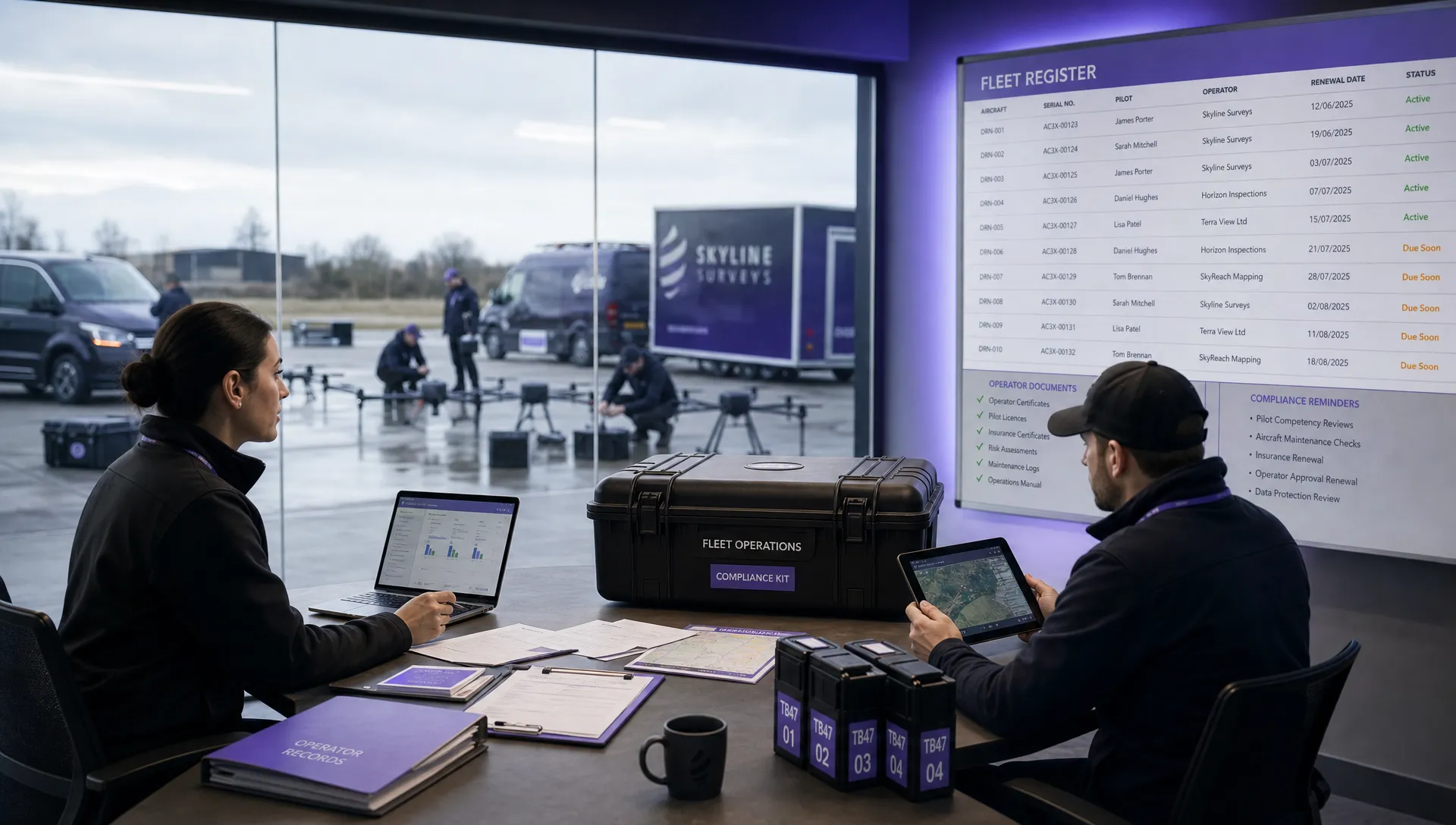 Drone Registration Regulations Businesses Must Follow →
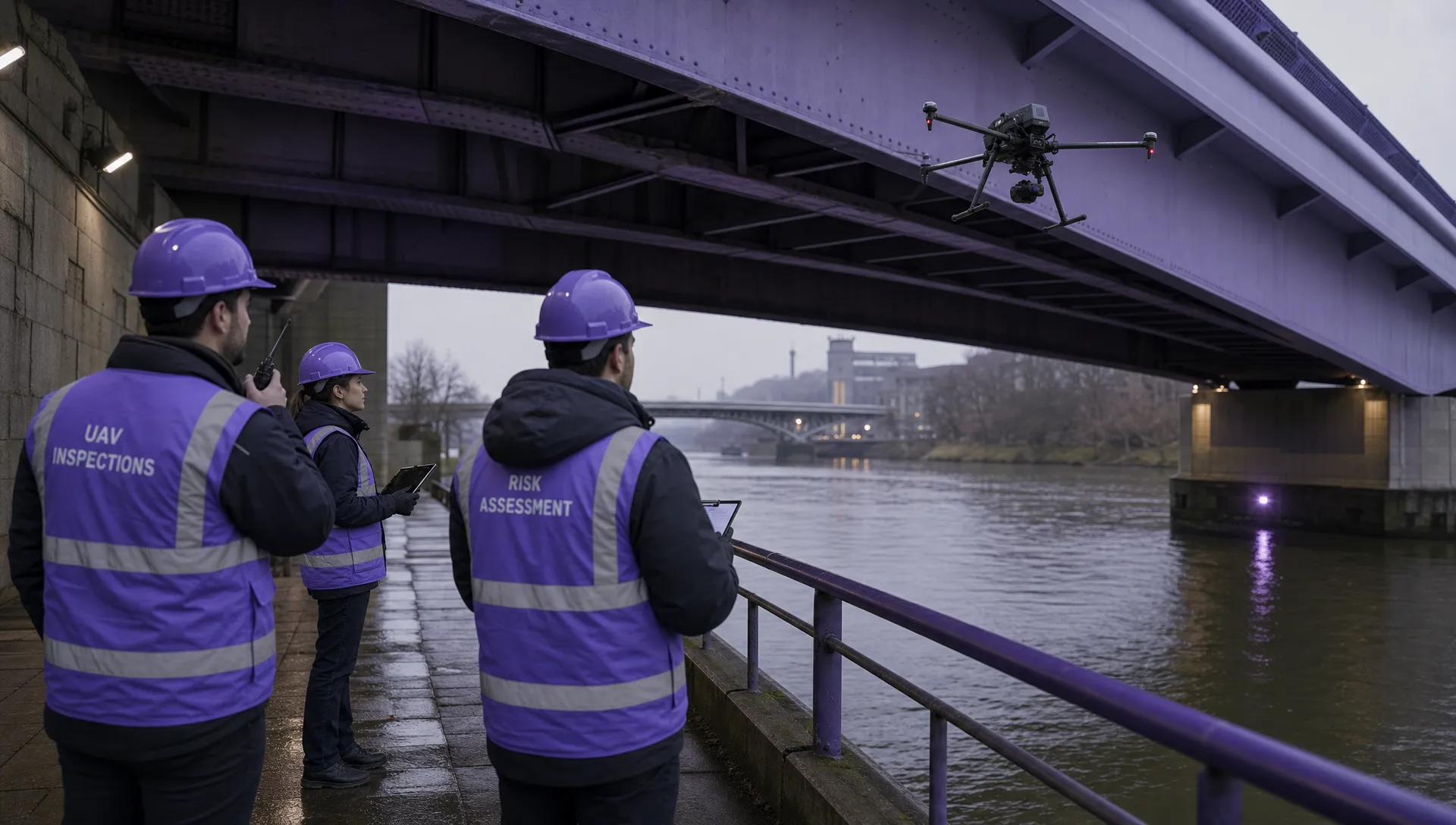 Atypical Airspace Explained for UK Drone Operators →
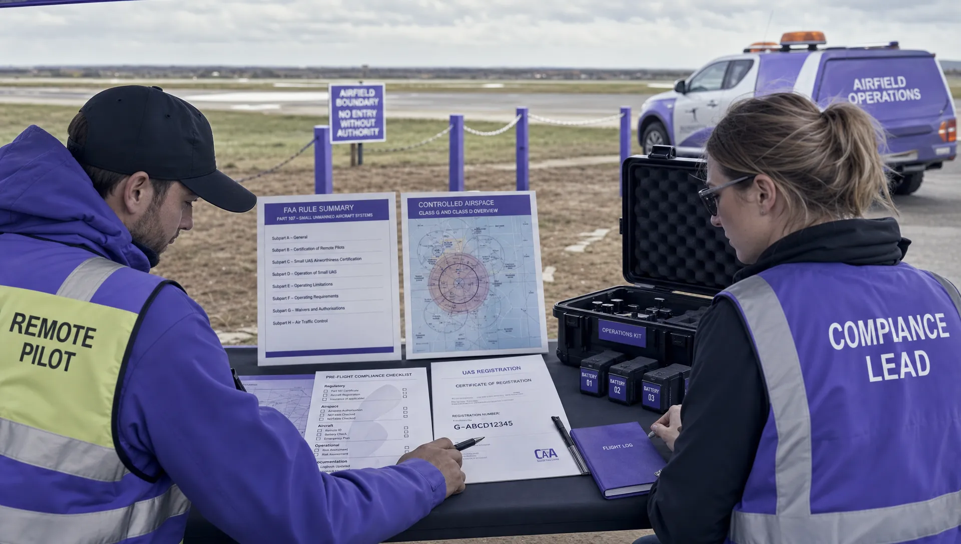 FAA Unmanned Aircraft Regulations Made Simple →
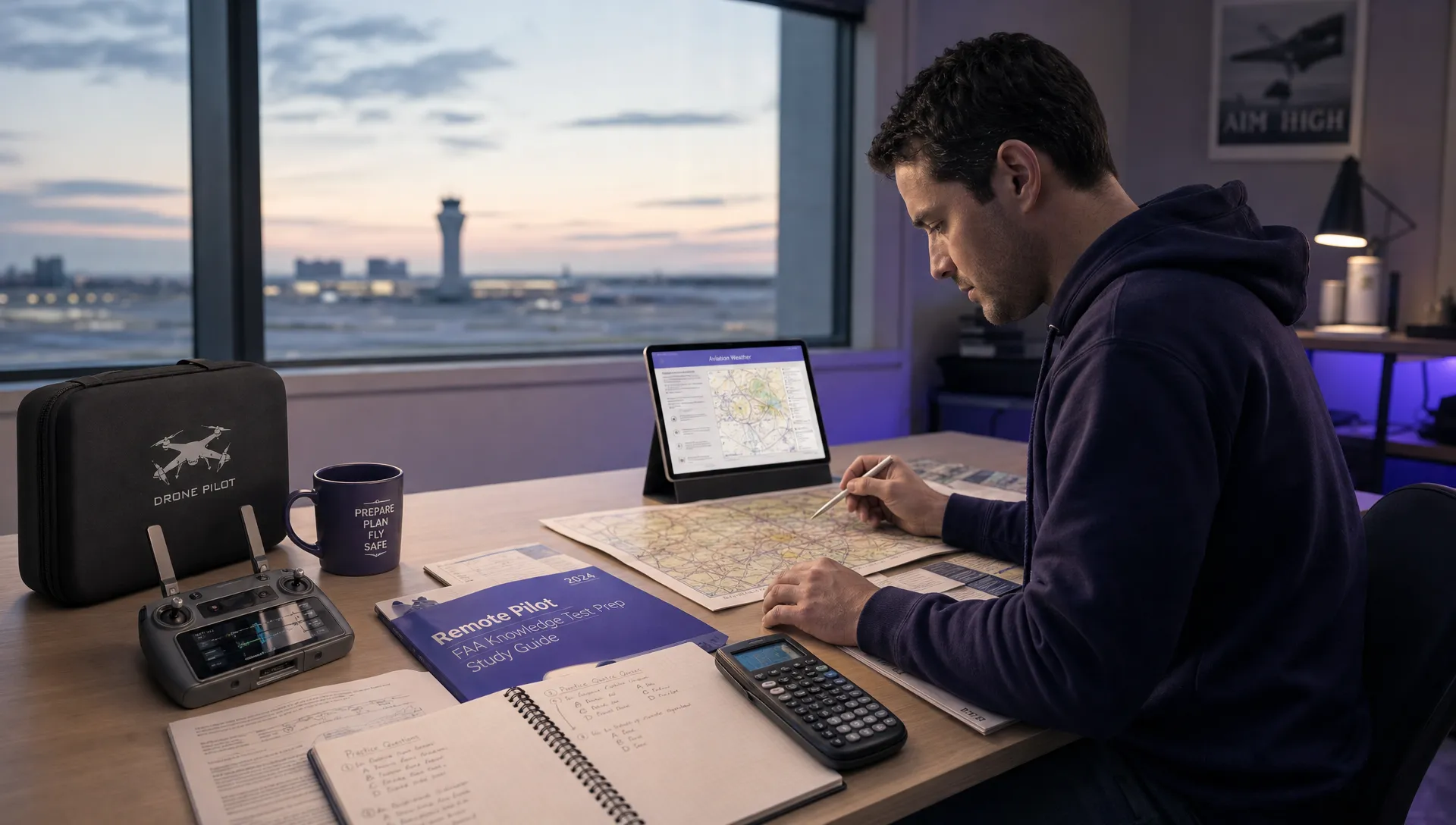 Part 107 Test Tips to Pass With Confidence →
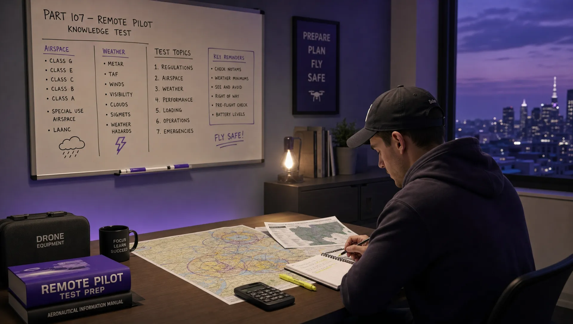 How to Pass the FAA Drone Written Test First Time →
 What a BVLOS Flight Means for Risk and Compliance →
 Drone VLOS Rules Explained for Commercial Teams →
 FAA Remote ID Rule Explained for Commercial Pilots →
 Drone Legal Requirements for Commercial Operations →