Top 10 Commercial Applications for Drones in 2026
The hum of rotors is no longer a novelty; it’s the sound of industries being fundamentally redefined. From the inspection of critical infrastructure to the management of sprawling farmlands, unmanned aerial vehicles (UAVs) are unlocking unprecedented levels of efficiency, safety, and data-driven insight. The question is no longer if drones are useful, but how they are being used most effectively. What are the truly impactful applications for drones driving business value today?
This guide moves beyond abstract potential to provide a detailed, industry-by-industry roundup of the top 10 commercial drone uses transforming the modern economy. We will dissect the practical realities of deploying UAVs in sectors ranging from construction and public safety to media and environmental conservation.
For each application, you will learn about:
- Practical Workflows: The specific, step-by-step processes involved.
- Tangible ROI: How these operations save money, time, and improve safety.
- Regulatory Hurdles: Key compliance considerations you need to navigate.
- Common Challenges: The real-world obstacles operators face.
More importantly, this article connects theory to practice by illustrating how a robust drone management platform like Dronedesk provides the essential framework for success. You'll see how integrated tools for fleet management, job planning, compliance, and reporting transform a single drone into a scalable, professional, and profitable business asset. Prepare to explore how these aerial platforms are not just capturing stunning images, but creating measurable value across the global economy.
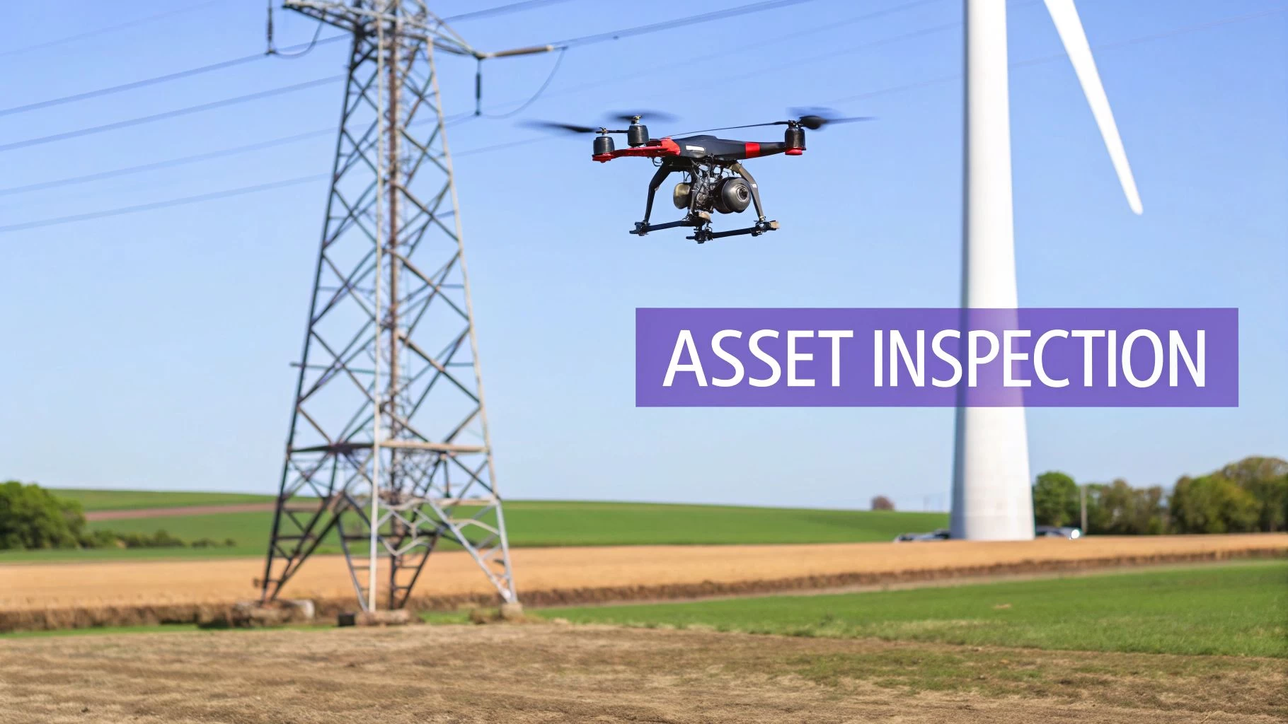
1. Infrastructure and Utility Inspection
One of the most impactful applications for drones is the inspection of critical infrastructure and utilities. This process involves using unmanned aerial vehicles (UAVs) equipped with high-resolution RGB, thermal, and multispectral sensors to assess the condition of assets like power lines, wind turbines, solar farms, bridges, and pipelines. Drones capture detailed imagery from angles that are dangerous, difficult, or impossible for human crews to reach, identifying issues like corrosion, structural damage, and thermal anomalies without requiring costly shutdowns or hazardous manual climbs.
How It Works and Why It’s Effective
Traditional inspection methods often involve sending personnel up towers, using helicopters, or conducting ground patrols, all of which are time-consuming, expensive, and carry significant safety risks. Drones transform this workflow by providing a safer, faster, and more data-rich alternative. For example, Duke Energy now uses drones to inspect its vast network of power lines, reducing inspection times from days to hours and significantly improving worker safety. Similarly, NextEra Energy leverages UAVs for solar farm maintenance, quickly identifying faulty panels with thermal imaging.
This approach is highly effective because it provides objective, repeatable data. Instead of relying on subjective visual checks, operators can analyze high-fidelity imagery and thermal data to pinpoint defects with precision, enabling predictive maintenance and extending asset lifecycles.
Getting Started with Drone Inspections
Implementing a drone inspection program requires careful planning and the right tools. Here are some actionable tips:
- Standardize Flight Plans: Create and save reusable flight plans within a platform like Dronedesk for recurring inspections of similar assets, like cell towers or wind turbines. This ensures data consistency and operational efficiency.
- Manage Your Fleet and Maintenance: Use Dronedesk's fleet management features to track aircraft, batteries, and sensor maintenance schedules. This is crucial for ensuring equipment reliability and compliance.
- Automate Reporting: Sync flight logs and inspection data directly from DJI or other drones to generate comprehensive reports. This minimizes manual data entry and helps track asset health trends over time.
By replacing hazardous manual tasks with automated aerial data capture, drone operations are transforming infrastructure inspections, making them safer and more efficient. For a deeper dive into this topic, you can learn more about how drone operations are revolutionizing the sector.
2. Aerial Photography and Videography
One of the most widespread and recognizable applications for drones is professional aerial photography and videography. This field leverages drones equipped with high-resolution, gimbal-stabilized cameras to capture stunning visual content for industries like real estate, media production, events, and tourism. These devices provide dynamic, cinematic perspectives from the air at a fraction of the cost and with far greater flexibility than traditional methods like helicopters, cranes, or jibs.
How It Works and Why It’s Effective
Before drones, capturing high-quality aerial shots was an expensive, logistically complex endeavor reserved for big-budget productions. Today, a single operator can deploy a drone with a 4K or 8K camera in minutes, capturing everything from sweeping establishing shots for films to detailed property overviews for real estate listings. This democratization of aerial imaging has unlocked immense creative and commercial potential. For instance, real estate marketers now use drone footage to showcase entire properties and their surroundings, leading to reported engagement increases of over 60%.
This approach is effective because it delivers a unique and compelling viewpoint that captures attention and provides valuable context. Wedding videographers integrate drone footage for breathtaking opening sequences, while tourism boards like Visit Costa Rica create immersive promotional videos that were once prohibitively expensive. The ability to fly low, high, and through tight spaces gives creators unparalleled control over their shots.
Getting Started with Aerial Photography
Building a successful aerial media business requires a blend of piloting skill, creative vision, and operational efficiency. Here are some actionable tips:
- Plan Every Shoot: Use Dronedesk’s job planning tools to create detailed shot lists, schedule flights around optimal lighting conditions (like the golden hour), and manage client deliverables all in one place.
- Organize Your Assets: Track your fleet of drones, cameras, and batteries within Dronedesk to ensure the right equipment is allocated for each project and that maintenance is up to date.
- Streamline Client Workflows: Create project templates for recurring job types, such as real estate packages or event coverage. This standardizes your process and saves administrative time.
- Manage Your Team: For larger projects, use team management features to assign pilots, coordinate schedules, and ensure everyone on the crew has access to the correct project information and flight plans.
3. Land Surveying and Mapping
Another transformative application for drones is in land surveying and mapping. This field leverages drones equipped with advanced sensors like LiDAR, photogrammetry cameras, and RTK/PPK GPS to produce highly accurate 3D maps, orthomosaics, and digital elevation models. These outputs are crucial for construction planning, environmental monitoring, and land development, dramatically reducing field time and costs while boosting spatial accuracy. Drones can capture vast amounts of topographical data in a single flight, a task that would take ground crews days or weeks to complete.
How It Works and Why It’s Effective
Traditional surveying methods rely on ground-based equipment like total stations and GPS rovers, which are precise but slow and labor-intensive, especially over large or difficult terrain. Drones automate this data collection process from the air. For instance, a construction firm can use a DJI Matrice 300 RTK to survey a large development site, saving up to 40% of the time compared to traditional methods. Similarly, environmental agencies monitor coastal erosion by using drone-based LiDAR to create precise elevation models, tracking changes with a level of detail previously unimaginable.
This method is effective because it delivers a comprehensive dataset quickly and safely. The high-resolution aerial data, processed with software like Pix4D, creates a detailed digital twin of the area. This allows for accurate volume calculations, site progress monitoring, and better-informed decision-making without putting surveyors in hazardous environments.
Getting Started with Drone Surveying
To launch a successful drone surveying operation, precision in planning and execution is key. Here are some actionable tips:
- Plan for Precision: Use Dronedesk's airspace intelligence and project planning tools to create standardized survey flight plans. This ensures repeatable, accurate data collection for every mission.
- Manage Survey Assets: Track your specialized drones (like the Matrice 300), sensors, and ground control points within Dronedesk’s fleet management system to monitor utilization and maintenance schedules.
- Demonstrate Compliance: Generate comprehensive flight logs and compliance reports directly from the platform. This provides clients with auditable proof of professional and safe operations.
- Correlate Data Quality: Use detailed job logging features to link flight conditions, like wind speed and lighting, to the quality of the collected data, enabling continuous improvement of your survey workflows.
By automating data capture, drone surveying delivers superior results with significant time and cost savings. To explore this topic further, you can learn more about aerial drone mapping and its workflows.
4. Construction Site Management and Progress Monitoring
One of the most transformative applications for drones is in construction site management and progress monitoring. UAVs equipped with high-resolution cameras and LiDAR sensors provide a bird's-eye view of job sites, capturing timestamped aerial data that is processed into orthomosaics, 3D models, and digital twins. This technology offers project managers and stakeholders unparalleled insight into progress, safety compliance, material stockpiles, and overall site activity, moving beyond traditional ground-level observations.
How It Works and Why It’s Effective
Traditional site monitoring relies on manual walk-throughs and static photography, which can be inefficient and often fails to capture the full scope of a project. Drones automate this entire process, conducting comprehensive surveys in a fraction of the time. For example, Balfour Beatty implements monthly drone surveys for highway construction projects to precisely track progress against plans, while Turner Construction uses drone data to reduce oversight costs on major infrastructure builds.
This method is incredibly effective because it provides an objective, verifiable record of site conditions. The data integrates directly with Building Information Modeling (BIM) and project management software, allowing for "as-built" vs. "as-designed" comparisons. This immediate feedback loop helps identify discrepancies early, optimize scheduling, and improve communication with stakeholders, with some contractors reporting project completion times reduced by up to 15%.
Getting Started with Construction Monitoring
Implementing a drone program on a construction site requires consistency and robust data management. Here are some actionable tips:
- Schedule Recurring Flights: Set up recurring job schedules in Dronedesk for weekly or bi-weekly flights. Consistent data capture is key to accurately tracking progress over time.
- Organize Project Data: Use client and project management features to organize photos, logs, and reports by job site. This ensures stakeholders can easily access the information relevant to them.
- Automate Flight Plans: Create standardized, automated flight plans that cover the entire site. This ensures each survey produces comparable data for accurate month-over-month analysis.
- Integrate with Project Software: Export geospatial data and orthomosaics from your drone platform for seamless integration with BIM, CAD, and other project management systems.
By providing accurate, repeatable, and easily shareable data, drones are becoming an indispensable tool for modern construction management.
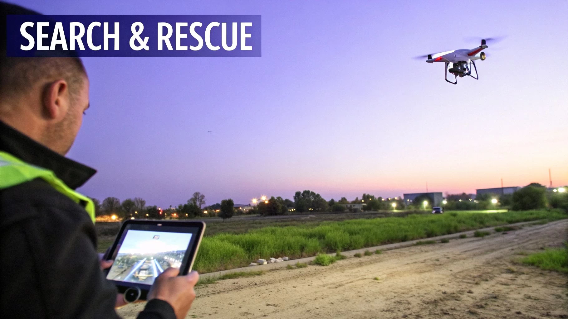
5. Emergency Response and Search & Rescue
Drones are fundamentally changing how first responders manage disasters, search for missing persons, and assess incident scenes. This critical application involves deploying UAVs, often equipped with thermal and zoom cameras, to provide immediate situational awareness in hazardous environments. They offer a bird’s-eye view for damage assessment after events like hurricanes or earthquakes and can locate individuals in vast wilderness areas or collapsed structures, all while keeping human responders out of harm's way.
How It Works and Why It’s Effective
Traditional search and rescue (SAR) operations rely on ground crews and expensive manned aircraft, which can be slow to deploy and limited by terrain or weather. Drones offer rapid deployment, providing real-time video streams to an incident command post. For instance, following major hurricanes like Harvey and Irma, FEMA used drones to quickly map flooded areas and identify cut-off communities. Fire departments in California use thermal drones to monitor wildfire perimeters and spot hidden hotspots, enabling safer and more strategic firefighting.
This rapid aerial intelligence is effective because it accelerates decision-making when every second counts. A drone can cover large areas far faster than a ground team, and its thermal sensor can detect a heat signature that would be invisible to the naked eye, drastically reducing search times and improving the odds of a successful rescue.
Getting Started with Emergency Drone Operations
Successfully integrating drones into emergency protocols requires robust planning and organization. Here are some actionable tips for public safety teams:
- Create Rapid-Response Checklists: Use Dronedesk to build and store pre-flight and operational checklists specifically for emergency scenarios. This ensures that even under pressure, all safety and procedural steps are followed correctly.
- Establish Pre-approved Flight Plans: Prepare and save emergency flight plans for known high-risk areas. This allows for near-instant deployment and authorization when an incident occurs, saving critical time.
- Maintain Detailed Team Records: Keep pilot certifications, training logs, and qualifications up-to-date in a centralized system like Dronedesk. This is essential for demonstrating compliance and ensuring only qualified responders are deployed.
- Document All Flights for Reporting: Automatically log flight data, including precise timestamps and geolocations. This information is vital for creating official incident reports, after-action reviews, and providing evidence for investigations.
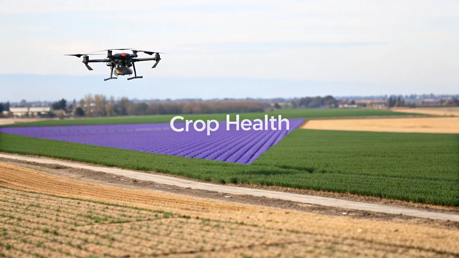
6. Agricultural Monitoring and Crop Management
Precision agriculture is one of the most transformative applications for drones, empowering farmers to increase yields, reduce costs, and improve sustainability. Agricultural drones, equipped with advanced multispectral, hyperspectral, and thermal sensors, collect critical data on crop health, soil conditions, and hydration levels. This allows for precise interventions, such as identifying plant stress, mapping crop vigor with NDVI (Normalized Difference Vegetation Index), and optimizing irrigation and nutrient application.
How It Works and Why It’s Effective
Traditionally, crop scouting relied on manual field walks or expensive satellite imagery, which often lacked the necessary resolution or timeliness. Drones provide on-demand, high-resolution aerial intelligence that pinpoints problems like pests, diseases, and nutrient deficiencies before they spread. AgTech leaders like Taranis use AI-powered imagery analysis to provide farmers with actionable alerts, while John Deere integrates drone data with its FarmLogs platform for automated field management.
This technology is effective because it enables a shift from uniform field treatment to variable-rate application. By understanding exactly which areas of a field need water, fertilizer, or pesticides, farmers can apply resources precisely where they are needed, drastically cutting waste and environmental impact while boosting yields, often by 15-20%.
Getting Started with Agricultural Drones
Deploying drones for crop management requires a systematic approach to data collection and analysis. Here are some actionable tips:
- Schedule Regular Flights: Use a platform like Dronedesk to schedule recurring jobs throughout the growing season. Consistent monitoring is key to detecting changes in crop health over time.
- Maintain Consistent Flight Paths: Create and reuse flight plans to ensure data from different flights can be accurately compared for multi-temporal analysis, which helps identify trends.
- Coordinate with Your Team: Use team management features to share flight plans and data with agronomists and ground staff, ensuring insights from the air are quickly translated into action on the ground.
- Log Detailed Flight Data: Tag flight logs with field identifiers, crop types, and growth stage information within Dronedesk. This creates a comprehensive seasonal record for analysis and future planning.
7. Environmental Monitoring and Conservation
Drones are providing scientists and conservationists with a revolutionary, non-invasive tool for environmental monitoring. This application involves deploying UAVs equipped with specialized sensors like multispectral, thermal, and LiDAR to collect critical data on ecosystems, wildlife populations, and environmental changes. Drones can access remote or delicate areas with minimal disturbance, capturing high-resolution imagery to assess deforestation, track coral bleaching, monitor wetland health, and conduct wildlife censuses, all while providing cost-effective, long-term data for evidence-based policy decisions.
How It Works and Why It’s Effective
Traditionally, environmental data collection relied on expensive satellite imagery, manned aircraft, or intensive on-the-ground fieldwork, which could be slow, dangerous, and disruptive to wildlife. Drones offer a far more agile and detailed alternative. For instance, the World Wildlife Fund (WWF) uses UAVs to monitor elephant and rhino populations in African reserves, deterring poachers and tracking herd movements. Similarly, organizations like the Coral Reef Conservation Foundation use drones to create detailed 3D maps of reefs, precisely tracking bleaching events and recovery over time.
This approach is highly effective because it delivers repeatable, high-resolution data that was previously unattainable. Multispectral sensors can assess plant health and deforestation rates, while LiDAR can map forest canopy structure and biomass. This data enables conservationists to react quickly to threats and measure the impact of their interventions with unparalleled accuracy, making it one of the most vital applications for drones in preserving our planet.
Getting Started with Environmental Monitoring
A successful drone conservation program is built on precision, consistency, and verifiable data. Here are some actionable tips:
- Establish Standardized Protocols: Use a platform like Dronedesk to create and save standardized survey protocols. This ensures data from different flights and seasons is comparable, which is essential for long-term trend analysis.
- Log Environmental Conditions: Create detailed flight logs that include environmental conditions like wind speed, cloud cover, and time of day. This helps correlate data quality with the collection context, adding credibility to your findings.
- Coordinate Field and Lab Teams: Utilize team management features to seamlessly coordinate between field operators collecting data and specialists analyzing it back in the lab, ensuring a smooth workflow from capture to insight.
- Archive Data for Long-Term Study: Properly archive all flight data, sensor readings, and metadata. This creates a valuable historical record that can be used for future trend analysis and research publications.
8. Real Estate and Property Marketing
One of the most visually compelling applications for drones is in real estate and property marketing. This practice involves using drones equipped with high-quality cameras, like the DJI Mavic and Air series, to capture stunning aerial photographs and cinematic videos of properties. These assets showcase a home's key features, its surrounding neighborhood, and its full context in a way that ground-level photography simply cannot, providing a powerful tool for agents marketing residential, commercial, or vacation rental listings.
How It Works and Why It’s Effective
Traditional real estate marketing relies on standard photos that often fail to capture the full scope and appeal of a property. Drones revolutionize this by offering breathtaking perspectives, from sweeping flyovers showing the entire lot to detailed shots of roofing and unique architectural features. Luxury firms like Sotheby’s International Realty and Christie's International Real Estate now consider drone photography a standard for high-end listings, recognizing its ability to create an emotional connection with potential buyers.
This method is highly effective because it drives engagement and accelerates sales cycles. Listings on platforms like Zillow and Realtor.com that feature drone imagery see significantly more views and interaction. Vacation rental sites like Airbnb and Vrbo report that properties with aerial footage can achieve booking rates over 30% higher than those without. Drones provide a virtual tour experience that allows remote buyers to confidently assess a property, making them an indispensable marketing asset.
Getting Started with Real Estate Drone Photography
Building a successful real estate drone service requires efficiency, consistency, and professional client management. Here are some actionable tips:
- Standardize Service Packages: Create reusable job templates in Dronedesk for different real estate packages (e.g., "Standard Photo Package," "Premium Video Tour"). This ensures you capture the same essential shots for every client, guaranteeing consistency.
- Manage Client Deliverables: Use Dronedesk's client management portal to organize property listings, associate job files, and seamlessly deliver final photos and videos to real estate agents.
- Optimize Pilot Scheduling: For teams handling multiple agent requests, use the team scheduling feature to assign pilots to jobs based on location and availability, maximizing efficiency and minimizing travel time.
By providing a unique and captivating view of properties, drones are transforming how real estate is marketed, helping agents close deals faster and command higher prices. To select the right equipment for the job, you can explore the best drones for real estate videos.
9. Mining and Quarrying Operations
Drones are fundamentally changing the mining and quarrying industry by providing safer, more efficient, and highly accurate methods for site management. Using UAVs equipped with high-resolution cameras and LiDAR sensors, operators perform volumetric calculations for stockpiles, monitor pit progress, and conduct comprehensive site surveys. This data improves material billing accuracy, optimizes inventory control, and enhances safety by eliminating the need for personnel to conduct hazardous manual surveys on unstable ground.
How It Works and Why It’s Effective
Traditionally, measuring stockpiles or surveying a mine required teams of surveyors on the ground, a process that was slow, dangerous, and often produced inconsistent results. Drones, such as the DJI Matrice 300 RTK, can now fly over a site and generate a detailed 3D orthomosaic or LiDAR point cloud in a fraction of the time. Mining software then processes this data to calculate precise volumes, track changes, and monitor operations. For instance, major companies like Rio Tinto and Martin Marietta use drones for aggregate stockpile measurements, integrating the data directly into production planning and inventory management systems.
This modern approach is highly effective because it delivers objective, repeatable data that is crucial for financial reporting and operational planning. The ability to quickly and frequently measure inventory prevents stockouts, improves billing accuracy, and allows for better resource allocation, directly impacting the bottom line.
Getting Started with Drone Mining Operations
To effectively integrate drones into mining and quarrying, a structured approach is essential. Here are some actionable tips:
- Schedule Recurring Surveys: Use Dronedesk to establish monthly or quarterly volumetric survey schedules for all stockpiles. This ensures consistent inventory tracking and creates a reliable historical record for analysis.
- Standardize Data Capture: Create and reuse standardized LiDAR or photogrammetry flight paths for key areas. This enables precise comparative analysis over time, making it easy to track extraction rates and stockpile changes.
- Ensure Data Quality Control: Leverage Dronedesk's team management features to assign different operators for blind verification of survey data. This cross-checking process enhances the accuracy and reliability of your volumetric calculations.
- Generate Impactful Reports: Automate the creation of detailed volumetric reports that include financial impact analysis. This helps communicate the value of the drone program to management and stakeholders by connecting survey data to business outcomes.
10. Insurance Claims Assessment and Damage Documentation
One of the most practical and cost-effective applications for drones is in the insurance industry, specifically for claims assessment and damage documentation. This involves deploying UAVs equipped with high-resolution RGB and thermal cameras to quickly and safely capture detailed imagery of damaged properties, whether from natural disasters like hurricanes and wildfires or individual incidents like house fires and auto collisions. Drones provide adjusters with a comprehensive, birds-eye view of a loss site, allowing them to assess damage to roofs, siding, and other hard-to-reach areas without climbing ladders or entering unstable structures.
How It Works and Why It’s Effective
Traditionally, insurance adjusters would spend hours on-site, manually measuring and photographing damage, often in hazardous conditions. This process was slow, subjective, and carried significant safety risks. Drones revolutionize this workflow by capturing precise, geolocated, and timestamped data in a fraction of the time. For instance, major insurers like State Farm and Allstate now routinely deploy drone teams after hailstorms or tornadoes, enabling them to process thousands of roofing claims with greater speed and accuracy.
This method is highly effective because it accelerates the entire claims cycle, from first notice of loss to final settlement. Policyholders receive faster payouts, and insurers reduce operational costs and improve fraud detection through objective, high-quality documentation. The detailed aerial data allows for more accurate damage estimates and lessens the chance of disputes, creating a more efficient process for everyone involved.
Getting Started with Drone-Based Assessments
Integrating drones into an insurance workflow requires consistency and robust data management. Here are some actionable tips:
- Standardize Assessment Flights: Create and save reusable flight plans in Dronedesk for common assessment types, such as roof inspections. This ensures every adjuster captures the same consistent data set for each claim.
- Organize Claims by Client: Use Dronedesk’s client and project management features to organize all flight data, imagery, and reports by policyholder and property, creating a clear audit trail for each claim.
- Generate Professional Reports: Integrate photos, orthomosaics, and annotations into comprehensive damage reports directly within the platform. This provides clear, professional documentation for internal review and policyholder communication.
By leveraging drones, insurance companies can dramatically improve the safety, speed, and accuracy of claims assessments, ultimately leading to better customer service and reduced operational overhead.
Top 10 Drone Applications Comparison
| Application | Implementation Complexity 🔄 | Resource Requirements ⚡ | Expected Outcomes ⭐📊 | Ideal Use Cases 💡 | Key Advantages ⭐ |
|---|---|---|---|---|---|
| Infrastructure and Utility Inspection | 🔄 Moderate–High: certified pilots, airspace coordination, thermal workflows | ⚡ Specialized drones, thermal/RGB sensors, long flight times, processing tools | ⭐ High accuracy; 📊 faster cycles, cost ↓ up to ~80% vs traditional | 💡 Power lines, turbines, pipelines, recurring asset inspections | ⭐ Reduces safety risk; scalable; comprehensive documentation |
| Aerial Photography and Videography | 🔄 Moderate: permits, cinematography skillset, editing workflows | ⚡ Gimbaled 4K/8K cameras, batteries, pilot + post-production suite | ⭐ Broadcast-quality assets; 📊 high engagement and marketing ROI | 💡 Real estate, events, film production, tourism promos | ⭐ Lower cost than helicopters; flexible cinematic shots |
| Land Surveying and Mapping | 🔄 High: RTK/LiDAR setup, photogrammetry processing, QA workflows | ⚡ RTK GPS/LiDAR multispectral payloads, processing software, analysts | ⭐ Centimeter-level accuracy; 📊 hours vs weeks data collection | 💡 Construction planning, topographic surveys, environmental monitoring | ⭐ High spatial accuracy; CAD/GIS integration; repeatable surveys |
| Construction Site Management & Progress Monitoring | 🔄 Moderate: recurring missions, BIM/PM integration, data ops | ⚡ Orthomosaic-capable drones, thermal sensors, integration with BIM/Procore | ⭐ Timestamped progress records; 📊 fewer site visits, better schedule control | 💡 Large builds, stakeholder reporting, safety inspections | ⭐ Objective documentation; improves scheduling & dispute evidence |
| Emergency Response & Search & Rescue | 🔄 High: rapid deployment, BVLOS/waivers, SAR training required | ⚡ Thermal-capable, weather-resistant drones, reliable comms/streaming | ⭐ Faster victim/location detection; 📊 reduces responder risk/time | 💡 Disasters, wildfires, missing-person searches, damage assessments | ⭐ Rapid situational awareness; lowers personnel exposure |
| Agricultural Monitoring & Crop Management | 🔄 Moderate: flight consistency, agronomic analytics expertise | ⚡ Multispectral/hyperspectral sensors, NDVI tools, analytics platforms | ⭐ Early stress detection; 📊 yield ↑10–20%, optimized input use | 💡 Large-acre farms, precision irrigation, pest/disease monitoring | ⭐ Optimizes inputs; scalable; environmental and cost benefits |
| Environmental Monitoring & Conservation | 🔄 High: protected-area permissions, specialist analysis, long-term protocols | ⚡ LiDAR/multispectral payloads, high-altitude endurance, heavy processing | ⭐ Non-invasive, quantitative monitoring; 📊 cost-effective long-term data | 💡 Forests, wetlands, coral reefs, wildlife population studies | ⭐ Minimal disturbance; policy-ready quantitative datasets |
| Real Estate & Property Marketing | 🔄 Low–Moderate: permits, privacy coordination, client scheduling | ⚡ 4K drones, virtual-tour/Matterport tools, pilot/operator | ⭐ Higher buyer engagement; 📊 fewer days on market, more inquiries | 💡 Residential/commercial listings, vacation rentals, portfolio marketing | ⭐ Differentiates listings; strong per-job ROI and repeat business |
| Mining & Quarrying Operations | 🔄 High: LiDAR/RTK missions in harsh terrain, strict safety procedures | ⚡ LiDAR/orthomosaic drones, rugged gear, volume-calculation software | ⭐ Accurate volumetrics; 📊 faster inventory, billing accuracy, safety gains | 💡 Stockpile measurement, site monitoring, reclamation tracking | ⭐ Measurement accuracy; operational efficiency; 6–12 month payback |
| Insurance Claims Assessment & Damage Documentation | 🔄 Moderate: rapid assessment protocols, consent/privacy, system integration | ⚡ RGB + thermal drones, claims management integration, trained adjusters | ⭐ Faster claims resolution; 📊 reduces fraud and adjuster travel costs | 💡 Roofing, large-loss incidents, post-disaster claims, remote assessments | ⭐ Objective, timestamped evidence; speeds processing and reduces cost |
Integrating Drone Operations for Maximum Impact
Throughout this comprehensive exploration, we have journeyed through a vast landscape of innovation, uncovering the myriad of powerful applications for drones that are reshaping industries from the ground up. From the precision-driven world of infrastructure inspection and land surveying to the dynamic, creative realms of aerial cinematography and real estate marketing, the message is clear: unmanned aerial systems are no longer a niche technology but a foundational tool for modern business. We've seen how they provide unprecedented access, deliver data with remarkable accuracy, and create efficiencies that were previously unimaginable.
The common thread weaving through all ten applications we've detailed, whether it's monitoring crop health in agriculture or coordinating search and rescue missions, is the critical need for a structured operational framework. The true potential of a drone program is unlocked not just by the pilot's skill or the quality of the sensor, but by the robustness of the management system that supports every flight. Without it, scaling operations becomes a logistical nightmare fraught with compliance risks, data silos, and operational inefficiencies.
From Individual Flights to a Cohesive Drone Program
The transition from executing individual drone missions to managing a full-fledged, professional drone program is the most significant hurdle for many organizations. A single pilot might be able to juggle flight logs, risk assessments, and client reports manually. However, as soon as you add more pilots, more aircraft, and a higher volume of projects, that manual system collapses. This is the pivotal moment where strategy must evolve beyond the hardware.
Consider the key takeaways from our deep dive into drone applications:
- Compliance is Non-Negotiable: Every industry, from construction to public safety, operates under a strict regulatory framework. Maintaining comprehensive records of pilot certifications, aircraft maintenance, and site-specific risk assessments is essential for legal and safe operations.
- Data is the Product: The drone is merely the vehicle. The real value lies in the data it captures and the actionable insights derived from it. Effective data management, from flight planning to final deliverable, is paramount to demonstrating ROI.
- Efficiency Drives Profitability: The competitive advantage of using drones often comes down to speed and cost-effectiveness. Streamlining workflows, from initial client request to final report generation, directly impacts your bottom line and client satisfaction.
Mastering these elements is what separates a hobbyist from a professional drone service provider and an ad-hoc drone user from a strategic enterprise program. The future of commercial drone applications will be defined by the organizations that can consistently and reliably deliver high-quality results at scale. This requires a centralized system, a single source of truth that connects every aspect of your operation.
The Strategic Value of Centralized Operations
Ultimately, the most successful drone programs are those that treat their operations with the same rigor and professionalism as any other business division. They recognize that a drone is a valuable asset, a pilot is a skilled professional, and a mission is a complex project with multiple stakeholders. By implementing a dedicated management platform, you're not just organizing paperwork; you're building a scalable, resilient, and profitable business engine. You are creating a system that empowers your team to focus on what they do best: capturing incredible data and delivering exceptional value to clients.
The diverse applications for drones we've covered are just the beginning. As technology advances and regulations evolve, new opportunities will continue to emerge. By establishing a strong operational foundation now, you are future-proofing your business, ensuring you are perfectly positioned to adapt, innovate, and lead in this exciting and rapidly expanding industry. The sky is no longer the limit; it's the new frontier for business intelligence.
Ready to transform your drone operations from a series of individual tasks into a streamlined, compliant, and profitable program? Dronedesk provides the all-in-one platform you need to manage your fleet, plan jobs, and ensure compliance across all applications for drones. Visit Dronedesk to start your free trial and build the operational foundation your business deserves.
 FAA Remote ID Rule Explained for Commercial Pilots →
 Drone Legal Requirements for Commercial Operations →
 Drone Near Airport Rules Explained for Safer Planning →
 International Drone Regulations Every Global Team Should Know →
 Drone Flight Risk Assessment Example for Safer Missions →
 Beyond Visual Line of Sight Explained for Operators →
 How BVLOS Drone Operations Change Commercial Workflows →
 FAA Drone Rules Every Commercial Pilot Should Know →
 FAA 107 Explained for Commercial Drone Operators →
 Canadian Drone Regulations Explained for Business Use →