Top Commercial Drones of 2025 - Find Your Perfect Model
Taking Flight: Choosing the Right Commercial Drone
Finding the perfect commercial drone can be challenging. This listicle simplifies the selection process, presenting eight top-tier commercial drone models for 2025. Whether you're a solo operator, part of a small team, or managing enterprise drone operations, this guide helps you choose the right tool for your needs. We cover models ranging from the DJI Matrice 300 RTK and Autel Robotics EVO II Enterprise to specialized platforms like the senseFly eBee X and Wingtra One. Discover which commercial drone best suits your aerial photography, videography, inspection, surveying, or other commercial drone applications.
1. DJI Matrice 300 RTK
The DJI Matrice 300 RTK stands out as a premier commercial drone, setting a high bar for industrial applications. Designed for demanding tasks like infrastructure inspection, public safety operations, surveying, and even professional filmmaking, the M300 RTK offers a powerful and versatile platform. Its robust build, coupled with advanced features and adaptable payload options, makes it a top choice for professionals seeking a reliable and high-performing commercial drone solution. This drone's capabilities go far beyond simple aerial photography, offering a comprehensive solution for complex tasks.

One of the most significant advantages of the M300 RTK is its exceptional flight time of up to 55 minutes. This extended flight duration allows operators to cover larger areas and complete missions more efficiently compared to commercial drones with shorter flight times. The 15 km transmission range further expands operational possibilities, enabling beyond-visual-line-of-sight (BVLOS) operations in approved jurisdictions. Furthermore, the triple payload capacity, with a maximum payload of 2.7 kg, provides unparalleled flexibility. Whether you need to equip the drone with a high-resolution camera, thermal imaging sensor, LiDAR scanner, or a combination thereof, the M300 RTK can handle the task. This adaptability makes it an invaluable asset across various industries. For instance, utility inspectors can use a combination of zoom and thermal cameras to identify potential defects in power lines, while surveyors can leverage LiDAR technology for detailed 3D mapping. Learn more about DJI Matrice 300 RTK discussing how drones, like the M300 RTK, are revolutionizing infrastructure inspections.
The M300 RTK prioritizes safety with features like the AirSense ADS-B receiver, which alerts operators to nearby manned aircraft, enhancing airspace awareness. Its IP45 rating provides weather resistance, allowing operations to continue in light rain and dusty environments. The six-directional sensing and positioning system ensures stable flight and obstacle avoidance, crucial for operating in complex environments. Dual operator control further enhances safety and operational flexibility, allowing one operator to pilot the drone while another manages the payload and its associated data.
While the DJI Matrice 300 RTK offers exceptional capabilities, it's essential to consider its high price point, starting around $13,200 (without payloads). The significant size and weight (approximately 6.3 kg) necessitate careful transport and handling. Furthermore, new operators will face a steep learning curve due to the drone's advanced features and complex control systems. Finally, maximizing the M300 RTK's potential requires investing in specialized payloads and accessories, adding to the overall cost.
Despite these considerations, the M300 RTK's advanced capabilities, robust construction, and versatile payload options solidify its position as a leading commercial drone. For professionals seeking a reliable and high-performing platform for demanding applications, the investment in the DJI Matrice 300 RTK can deliver significant returns in efficiency, data quality, and operational safety. Visit the DJI website for further details and specifications.
2. Autel Robotics EVO II Enterprise
The Autel Robotics EVO II Enterprise is a powerful and versatile commercial drone designed for a wide range of professional applications. From aerial inspections and surveying to public safety and emergency response, this drone offers a compelling blend of performance, features, and flexibility. Its modular design allows users to tailor the payload to specific needs, making it a valuable asset for solo drone operators, small to medium drone teams, and enterprise drone operations managers alike. This adaptability is a key reason why it holds a prominent place on this list of top commercial drones.

One of the EVO II Enterprise's standout features is its impressive 40-minute flight time, allowing for longer missions and greater efficiency. The omnidirectional obstacle avoidance, utilizing 19 sensor groups, provides enhanced safety and reduces the risk of collisions, especially crucial in complex operating environments. For professional photographers and videographers, the available 8K camera with a 1-inch sensor delivers stunning high-resolution imagery, while surveyors and utility inspectors will appreciate the optional RTK positioning modules enabling centimeter-level accuracy. Furthermore, the availability of dual camera thermal/visual configurations opens up a world of possibilities for applications like search and rescue, infrastructure inspection, and precision agriculture. The EVO II Enterprise also offers unique enterprise payload options such as a spotlight, speaker, and beacon, further expanding its utility in commercial drone operations.
The EVO II Enterprise’s foldable design makes it remarkably portable for an enterprise-grade drone, allowing professionals to easily transport it to various job sites. A key advantage for commercial operators is the absence of geofencing restrictions, providing greater flexibility compared to some competitors who lock down flight in certain areas. This commercial drone also represents a good value proposition when compared to similar enterprise systems, offering comparable performance and features at a potentially lower price point. While pricing can vary based on configuration and retailer, you can expect to invest between $2,000 and $5,000 USD.
While the Autel EVO II Enterprise presents a compelling package, it's important to consider its drawbacks. Its ecosystem of accessories is not as extensive as that of DJI, which is the current market leader. The software interface, while functional, is also considered by some to be less refined than competing platforms. Finally, at 1.2 kg, it's heavier than consumer-grade drones, a factor to consider for portability.
Implementation tips for the EVO II Enterprise include familiarizing yourself with the Autel Explorer app, practicing in a safe open area before undertaking complex missions, and regularly calibrating the sensors for optimal performance. Exploring the available payloads and choosing the configuration that best suits your specific needs is also crucial for maximizing the drone's effectiveness in your commercial operations.
For more information and to explore the various configurations available, visit the Autel Robotics website: https://www.autelrobotics.com/enterprise-drones/evo-ii-enterprise
3. Skydio X10
The Skydio X10 earns its spot on this list as a top-tier commercial drone specifically designed for demanding enterprise applications. Built in the USA, this drone prioritizes autonomous flight and robust data security, making it a compelling choice for professionals seeking reliable and automated aerial solutions. If your operations require navigating complex environments or conducting repetitive inspections, the X10's autonomous capabilities set it apart from the competition.
This commercial drone shines in sectors like infrastructure inspection, public safety, and defense, thanks to its advanced features and robust design. Imagine effortlessly inspecting bridges, power lines, or cell towers with the X10's autonomous flight and obstacle avoidance system. For public safety agencies, the X10 can provide rapid situational awareness in search and rescue operations or disaster assessments. Its military-grade security features, including AES-256 encryption, make it suitable for sensitive defense applications.
The X10's dual payload system is a significant advantage, offering both a high-resolution 4K/48MP RGB camera for detailed visual data and a 640×512 radiometric thermal camera for capturing heat signatures. This combination allows for comprehensive data collection in a single flight, increasing efficiency and providing valuable insights. For example, utility inspectors can identify failing components in power lines by combining visual and thermal data.
Skydio’s proprietary Autonomy Enterprise software powers the X10's autonomous flight, allowing for pre-planned flight paths, 3D scan capabilities, and sophisticated obstacle avoidance. This minimizes the need for extensive manual piloting skills and opens up opportunities for automated inspection workflows. While manual flight is possible, the X10’s core strength lies in its autonomous operation, making it ideal for repeatable missions and data acquisition.
Key Features & Benefits:
- Advanced Autonomous Flight: Skydio Autonomy Enterprise software allows for truly hands-free operation, enabling complex flight paths and automated inspections.
- Military-Grade Security: AES-256 encryption ensures data security for sensitive operations.
- Dual 4K RGB and Thermal Imaging: Capture comprehensive visual and thermal data simultaneously.
- Long Flight Time: Enjoy up to 47 minutes of flight time, maximizing operational efficiency.
- Enterprise-Focused Mission Planning: 3D scan capabilities and advanced flight planning tools streamline complex operations.
Pros:
- Industry-Leading Autonomous Flight Capabilities: Sets a high bar for autonomous navigation and obstacle avoidance.
- US-Based Manufacturing: Offers peace of mind for security-sensitive applications.
- Exceptional Obstacle Avoidance System: Navigates challenging environments with confidence.
- Highly Reliable Automated Inspection Workflows: Reduces manual effort and improves data consistency.
Cons:
- Higher Price Point: Starting around $14,000, it's a significant investment.
- More Limited Ecosystem than Some Competitors: Fewer third-party integrations compared to more established platforms like DJI.
- Heavier Focus on Autonomy than Manual Flight Controls: May not be ideal for pilots who prefer full manual control.
Implementation/Setup Tips:
- Familiarize yourself with Skydio Autonomy Enterprise software to maximize the drone's capabilities.
- Plan flight paths and missions in advance to leverage the autonomous features.
- Ensure proper calibration and pre-flight checks for optimal performance.
Comparison: While DJI offers a wider range of commercial drones and accessories, the Skydio X10 stands out with its superior autonomous capabilities and focus on data security. If autonomous flight and US-based manufacturing are paramount, the X10 offers a distinct advantage.
Website: https://www.skydio.com/skydio-x10
The Skydio X10 is a powerful commercial drone that represents the cutting edge of autonomous flight technology. While the investment is substantial, its capabilities make it a valuable asset for organizations seeking to enhance their operations with safe, reliable, and highly automated aerial solutions.
4. senseFly eBee X
The senseFly eBee X stands out as a premier commercial drone specifically designed for large-scale mapping and surveying operations. Unlike multi-rotor drones often used for smaller projects, the eBee X’s fixed-wing design unlocks significantly greater flight endurance and coverage. This makes it a powerful tool for professionals seeking efficiency and detailed data acquisition across expansive areas. This commercial drone's ability to cover up to 500 hectares in a single 90-minute flight truly sets it apart.

For solo drone operators, small to medium drone teams, and enterprise drone operations managers in industries like surveying, utility inspection, and agriculture, the eBee X offers a compelling value proposition. Its highly portable design with tool-free assembly makes it easy to deploy in remote locations. Furthermore, the availability of multiple specialized camera options, including the S.O.D.A. 3D mapping camera, RGB, multispectral, and thermal sensors, caters to diverse data acquisition needs. The built-in RTK/PPK capability ensures centimeter-level accuracy, crucial for precise mapping and measurement applications. This level of precision is highly valuable for surveyors creating topographic maps, utility inspectors assessing infrastructure, and agricultural professionals monitoring crop health. Considering the need for precise flight planning for such missions, you might find this article on drone flight planning software useful.
While the eBee X excels in mapping and surveying, its specialized design does come with certain limitations. Compared to multi-rotor drones, it offers less versatility for tasks like close-up inspections or dynamic filmmaking. Its fixed-wing design necessitates larger, open spaces for takeoff and landing, potentially restricting its use in confined environments. The specialized nature of the eBee X and its advanced features also contribute to a steeper learning curve for operation, requiring dedicated training and practice.
The senseFly eBee X truly shines when large-area coverage and high-accuracy mapping are paramount. Its endurance mode, extending flight time to an impressive 90 minutes, translates to significant time and cost savings for large-scale projects. While pricing isn't readily available publicly and likely varies based on configuration and payload, the investment is justified by the efficiency gains and data quality it delivers. If your commercial drone operations demand extensive coverage and accurate mapping, the senseFly eBee X deserves serious consideration. Learn more about senseFly eBee X.
5. Wingtra One
The Wingtra One stands out as a top-tier commercial drone, particularly for professionals requiring both extensive coverage and pinpoint accuracy. This hybrid VTOL (Vertical Take-Off and Landing) fixed-wing drone seamlessly blends the best of both worlds: the vertical takeoff and landing convenience of a multi-rotor with the efficient, long-range flight capabilities of a fixed-wing aircraft. This unique design eliminates the need for catapults or large, clear landing areas, making it exceptionally versatile for diverse operational environments. This makes it a highly effective tool for large-scale mapping, surveying, and inspection projects where detailed data acquisition across expansive areas is paramount.

The Wingtra One's impressive flight time of up to 59 minutes allows it to cover up to 400 hectares in a single flight, significantly reducing operational time and costs compared to traditional methods or multi-rotor alternatives. Its integrated high-resolution Sony RX1R II camera option, combined with multi-frequency PPK/RTK capabilities, delivers industry-leading data accuracy down to 1 cm, making it ideal for demanding applications like precision agriculture, infrastructure inspection, and topographic surveys. While similar commercial drones might offer VTOL capabilities, the Wingtra One distinguishes itself through this combination of extended range, endurance, and exceptional accuracy.
The dedicated WingtraPilot software streamlines the entire workflow, from flight planning and execution to data processing and analysis. This intuitive software makes the Wingtra One accessible to both seasoned professionals and those transitioning from other commercial drone platforms.
While the Wingtra One excels in performance, it's important to consider the financial investment. With a starting price around $20,000 (including RTK), it represents a significant investment. Furthermore, its more complex mechanical design compared to simpler fixed-wing or multi-rotor systems might require more specialized maintenance. Its larger transport size, compared to compact folding quadcopters, also necessitates more logistical planning for transportation. Lastly, payload options are somewhat limited compared to highly modular drone systems.
Key Features and Benefits:
- VTOL Capability with Fixed-Wing Efficiency: Combines vertical takeoff and landing convenience with long-range and efficient flight.
- Extended Flight Time: Up to 59 minutes, allowing for broad coverage areas.
- Large Coverage Area: Up to 400 hectares in a single flight, maximizing efficiency for large-scale projects.
- High Accuracy: Multi-frequency PPK/RTK provides centimeter-level accuracy.
- High-Resolution Imagery: Integrated Sony RX1R II camera option for detailed data capture.
- Streamlined Workflow: WingtraPilot software simplifies operation and data processing.
Pros:
- Hybrid design eliminates the need for launchers or extensive landing areas.
- Unmatched data accuracy for mapping and surveying applications.
- Efficient workflow with dedicated software.
Cons:
- High price point.
- More complex mechanical system compared to simpler drones.
- Larger transport size.
- Limited payload flexibility.
Website: https://wingtra.com/wingtraone/
The Wingtra One earns its place on this list as a powerful commercial drone solution for professionals who prioritize efficiency, range, and accuracy. Its unique hybrid design, combined with advanced features and dedicated software, makes it a compelling option for demanding mapping, surveying, and inspection projects, despite its higher price point and specific logistical considerations.
6. FreeFly Astro
The FreeFly Astro is a heavy-lift commercial drone designed to tackle demanding tasks in various professional fields. This high-end platform excels in high-end cinematography, intricate industrial inspections, and complex payload operations, making it a powerful tool for serious commercial drone applications. Its robust carbon fiber frame and powerful motors provide the stability and lift needed to carry payloads up to 15 pounds (6.8 kg). This impressive capacity opens doors for professionals to use high-quality cinema cameras, LiDAR scanners, and other specialized industrial equipment. Furthermore, the Astro's modular design allows for custom configurations, ensuring it can be tailored to the specific needs of each mission, whether it's capturing breathtaking aerial footage or conducting detailed infrastructure inspections.

For filmmakers, the Astro's payload capacity and compatibility with professional cinema cameras and gimbals make it a game-changer. Imagine capturing sweeping cinematic shots with heavy, high-end cameras that were previously impossible to fly on smaller drones. This commercial drone empowers cinematographers to push creative boundaries and achieve stunning results. In industrial settings, the Astro's heavy-lift capability allows for the deployment of advanced sensors and inspection tools, enabling thorough assessments of infrastructure like bridges, power lines, and cell towers. Surveyors can utilize its payload capacity for LiDAR mapping and photogrammetry, gathering highly accurate data with efficiency.
The Astro's advanced flight controller with redundant systems ensures reliability and safety during critical operations. This built-in redundancy minimizes the risk of failure, providing peace of mind for operators working in challenging environments or on high-stakes projects. The modularity of the Astro is a significant advantage, enabling users to swap components and adapt the system to evolving mission requirements. This flexibility allows operators to optimize the drone for different payloads and flight conditions, maximizing its versatility and return on investment.
While the FreeFly Astro offers exceptional capabilities, it's important to consider the investment involved. The premium pricing starts around $17,000 for the base system, placing it in the higher tier of commercial drones. The flight time, while respectable at 25 minutes with a cinema payload, can be shorter when carrying maximum payloads. Its larger size also presents logistical challenges for transportation compared to smaller, more portable drones. Finally, the Astro is a specialized system requiring technical expertise for optimal operation and maintenance.
Key Features and Benefits:
- Heavy-Lift Capacity: Carry payloads up to 15 pounds (6.8 kg), including professional cinema cameras and industrial equipment.
- Modular Design: Swappable components for customizable configurations based on mission needs.
- Redundant Systems: Enhanced safety and reliability during critical operations.
- Made in USA: High-quality components and manufacturing standards.
Pros and Cons:
- Pros: Exceptional payload capacity, built-in redundancy, highly customizable, made in USA.
- Cons: Premium pricing, shorter flight time with heavy payloads, larger size, requires technical expertise.
For those seeking a top-tier commercial drone capable of handling heavy payloads and complex missions, the FreeFly Astro represents a significant investment that can deliver outstanding results. Its robust design, advanced features, and made-in-USA quality make it a powerful tool for professionals in cinematography, industrial inspections, and other demanding fields. Learn more and explore the full specifications on the FreeFly Systems website: https://freeflysystems.com/astro
7. DJI Mavic 3 Enterprise
The DJI Mavic 3 Enterprise stands out as a compelling option for professionals seeking a powerful yet portable commercial drone. It bridges the gap between DJI's consumer-focused Mavic series and larger, more complex enterprise platforms. This makes it an ideal choice for a broad range of applications, from solo drone operators to larger enterprise teams. This versatile commercial drone excels in scenarios requiring both portability and advanced features.

Its compact, foldable design makes it incredibly easy to transport and deploy, a significant advantage for professionals working in the field. The Mavic 3 Enterprise boasts an impressive 46-minute maximum flight time, allowing for longer missions and greater efficiency. Its dual-camera system is a key selling point, combining a high-quality 4/3 CMOS Hasselblad camera for stunning visuals with a 12MP zoom camera capable of up to 56x zoom, perfect for detailed inspections and surveillance. Omnidirectional obstacle sensing ensures safe operation in complex environments, minimizing the risk of collisions. The DJI O3 Enterprise transmission system provides a robust connection with a range of up to 15km, further expanding the drone's operational capabilities.
For professionals in fields like surveying, utility inspection, and infrastructure monitoring, the Mavic 3 Enterprise offers significant advantages. The integrated RTK capability enables centimeter-level positioning accuracy, crucial for precise mapping and data collection. Its compatibility with a range of enterprise accessories, including a speaker, beacon, and RTK module, further enhances its versatility for specific commercial drone applications. For instance, the speaker can be used for public safety announcements, while the beacon enhances visibility during night operations.
Compared to larger enterprise drones, the Mavic 3 Enterprise comes at a more accessible price point, making it an attractive entry point into the commercial drone market. Its seamless integration with the DJI ecosystem of software and accessories further simplifies workflows and data management. However, it's important to note that its payload capacity is limited compared to larger platforms, and it offers less customization than modular systems. Also, like other DJI products, it is subject to geofencing restrictions in certain areas. Finally, the thermal version, while offering valuable thermal imaging capabilities, features a smaller sensor compared to dedicated thermal drones, which might be a consideration for users prioritizing thermal data quality above all else.
Key Features & Benefits:
- Portability and Power: Compact, foldable design combined with advanced features.
- Extended Flight Time: Up to 46 minutes in the air.
- Advanced Camera System: Dual-camera setup with Hasselblad and zoom capabilities.
- Safety and Reliability: Omnidirectional obstacle sensing and DJI O3 Enterprise transmission.
- Precision Positioning: RTK capability for centimeter-level accuracy.
- Ecosystem Compatibility: Seamless integration with DJI software and accessories.
Pros:
- Excellent balance of portability and professional capabilities.
- Impressive camera quality with Hasselblad color science.
- More affordable entry point to commercial drones.
- Compatible with DJI ecosystem of software and accessories.
Cons:
- Limited payload capacity compared to larger enterprise drones.
- Less customizable than modular systems.
- Subject to DJI geofencing restrictions in some areas.
- Smaller sensor in thermal version compared to dedicated thermal drones.
Website: https://enterprise.dji.com/mavic-3-enterprise
While pricing can vary depending on configuration and accessories, the Mavic 3 Enterprise typically starts around $3,000 USD. Setting up the drone is generally straightforward, involving registering the aircraft, calibrating the sensors, and familiarizing oneself with the flight controls and software interface. For optimal performance, ensure the firmware is up-to-date and consider investing in relevant training resources to maximize the drone's potential for your specific commercial drone operations.
8. Quantum Systems Trinity F90+
The Quantum Systems Trinity F90+ stands out as a premier commercial drone solution for professionals needing long-range mapping, surveying, and linear infrastructure inspection. This advanced VTOL (Vertical Takeoff and Landing) fixed-wing drone combines the best of both worlds: the vertical takeoff and landing convenience of a multi-rotor with the extended flight times and range of a fixed-wing aircraft. This makes it a powerful tool for covering vast areas quickly and efficiently.

With an impressive flight time of up to 90 minutes, the Trinity F90+ can cover up to 700 hectares in a single flight. This drastically reduces the number of takeoffs and landings required for large-scale projects, saving valuable time and resources. Its unique tri-copter design facilitates vertical takeoff and landing, minimizing the need for large, open spaces typically required for fixed-wing aircraft. This makes it ideal for operating in challenging terrains and confined areas. The Trinity F90+ excels in corridor mapping applications, making it particularly well-suited for inspecting pipelines, power lines, and railways. Its swappable payload options, including RGB, multispectral, and LiDAR sensors, provide flexibility for various data acquisition needs. Fully autonomous mission planning further streamlines workflows, allowing operators to pre-program flight paths and data collection parameters.
For solo drone operators and small to medium drone teams, the Trinity F90+ offers a significant advantage in terms of efficiency and data quality, albeit at a premium price point. Enterprise drone operations managers will appreciate the robust German engineering and high build quality, contributing to reliable performance and reduced downtime. Professional photographers and videographers focusing on large-area aerial surveys will benefit from the extended flight times and high-resolution imagery achievable with the interchangeable payloads. Surveyors and utility inspectors, especially those dealing with linear infrastructure, will find the Trinity F90+'s specialized corridor mapping capabilities invaluable. Drone service providers can leverage the platform's efficiency and data quality to offer premium mapping and inspection services to their clients.
While the starting price of around €30,000 positions the Trinity F90+ in the higher end of the commercial drone market, the return on investment comes from its exceptional efficiency and data acquisition capabilities. Compared to traditional fixed-wing drones, the VTOL capability simplifies operations and reduces logistical challenges. Compared to multi-rotor drones, the Trinity F90+ offers significantly longer flight times and broader coverage, minimizing the need for multiple flights and battery swaps. The larger transport case, compared to some folding drones, might be a consideration for operators with limited transport space. The system's specialized nature requires specific training, so operators should factor in the time and cost associated with mastering the platform. Finally, while excellent for large area mapping, its specialized design makes it less versatile for stationary, close-up inspection tasks compared to agile multi-rotor platforms.
Implementing the Trinity F90+ effectively involves careful mission planning and utilizing the autonomous flight features. Learn more about Quantum Systems Trinity F90+ for insights into drone fleet management, which can be particularly beneficial for organizations operating multiple Trinity F90+ units. The system’s ability to operate in winds up to 30 km/h expands operational windows, but proper pre-flight checks and adherence to safety protocols are always essential. For detailed specifications and to explore purchasing options, visit the Quantum Systems website. The Trinity F90+ represents a powerful tool for commercial drone operations, particularly those focused on large-scale mapping, surveying, and linear infrastructure inspection. Its blend of VTOL convenience, long endurance, and advanced features justifies its place among the leading commercial drone platforms available today.
Top 8 Commercial Drones Comparison
| Drone Model | Core Features & Capabilities | User Experience & Quality ★★★★☆ | Value Proposition & Price 💰 | Target Audience 👥 | Unique Selling Points ✨ |
|---|---|---|---|---|---|
| DJI Matrice 300 RTK | 55 min flight, IP45 weather resistant, triple payloads | Robust, advanced AI, dual operator control | High-end, starting ~$13,200 🏆 | Industrial, inspection, surveying | 15 km range, AirSense ADS-B, versatile payload |
| Autel Robotics EVO II Ent. | 40 min flight, omnidirectional avoidance, 8K camera | Portable, solid thermal, good value | Mid-high range, competitive pricing 💰 | Public safety, commercial | No geofencing, dual thermal/visual cameras ✨ |
| Skydio X10 | 47 min flight, autonomous flight, dual RGB/thermal | Industry-leading autonomy, secure AES-256 | Premium ~$14,000 | Defense, inspection, automation | AI-powered autonomous flight, US-made |
| senseFly eBee X | 90 min fixed-wing, large area coverage, RTK/PPK | Efficient for mapping, tool-free assembly | Specialized, premium mapping drone 💰 | Surveying, agriculture, mapping | Up to 500 ha coverage, fixed-wing endurance |
| Wingtra One | VTOL fixed-wing, 59 min flight, 400 ha coverage | Combines multi-rotor ease with fixed-wing eff. | High-end ~$20,000 | Large-scale mapping, surveying | VTOL + fixed-wing, 1 cm RTK accuracy |
| FreeFly Astro | Heavy-lift 6.8 kg payload, modular, 25 min flight | Designed for cinema & industrial pros | Premium ~$17,000 | Cinematography, inspections | Large payload, modular design, redundancy |
| DJI Mavic 3 Enterprise | 46 min flight, foldable, dual Hasselblad cameras | Portable, professional quality, DJI ecosystem | Mid-range commercial, affordable 💰 | Enterprise, inspection, portability | 56x zoom, RTK, 15 km transmission |
| Quantum Systems Trinity F90+ | VTOL fixed-wing, 90 min, 700 ha coverage, LiDAR option | High endurance, autonomous mission planning | Premium €30,000+, corridor mapping focused | Pipeline, power line inspection | Large coverage, VTOL & tri-copter hybrid |
Streamlining Your Drone Operations with Dronedesk
From the versatile DJI Matrice 300 RTK and Autel Robotics EVO II Enterprise to specialized platforms like the senseFly eBee X and Wingtra One, the range of commercial drone options available today is vast. We've explored eight leading platforms, each with its unique strengths for different applications. Choosing the right commercial drone for your specific needs, whether you're a solo operator, part of a small team, or managing a large enterprise operation, is paramount. Key takeaways include carefully considering flight time, payload capacity, sensor options, and software integrations before making a purchase decision. Remember to factor in not only the initial investment but also the ongoing costs of maintenance, software subscriptions, and potential upgrades.
Implementing the right tools alongside your chosen commercial drone is equally critical for success. Factors like ease of use, scalability, and integration with existing workflows should be top of mind. Whether you’re a professional photographer capturing stunning aerial footage with a DJI Mavic 3 Enterprise, a surveyor leveraging the precision of a Quantum Systems Trinity F90+, or a utility inspector deploying a Skydio X10 for autonomous inspections, efficient data management and operational oversight are key. This is where a platform like Dronedesk comes into play.
Dronedesk provides a comprehensive solution for managing all aspects of your commercial drone operations. From client management and flight planning to airspace intelligence and detailed reporting, Dronedesk helps you streamline workflows, improve safety, ensure compliance, and unlock the full potential of your drone program, regardless of the specific commercial drone you fly. Ready to elevate your drone operations? Explore how Dronedesk can empower your business and simplify your workflow by visiting Dronedesk today. Discover the power of a centralized platform built specifically for commercial drone professionals.
 BVLOS Drone Meaning and Why It Matters →
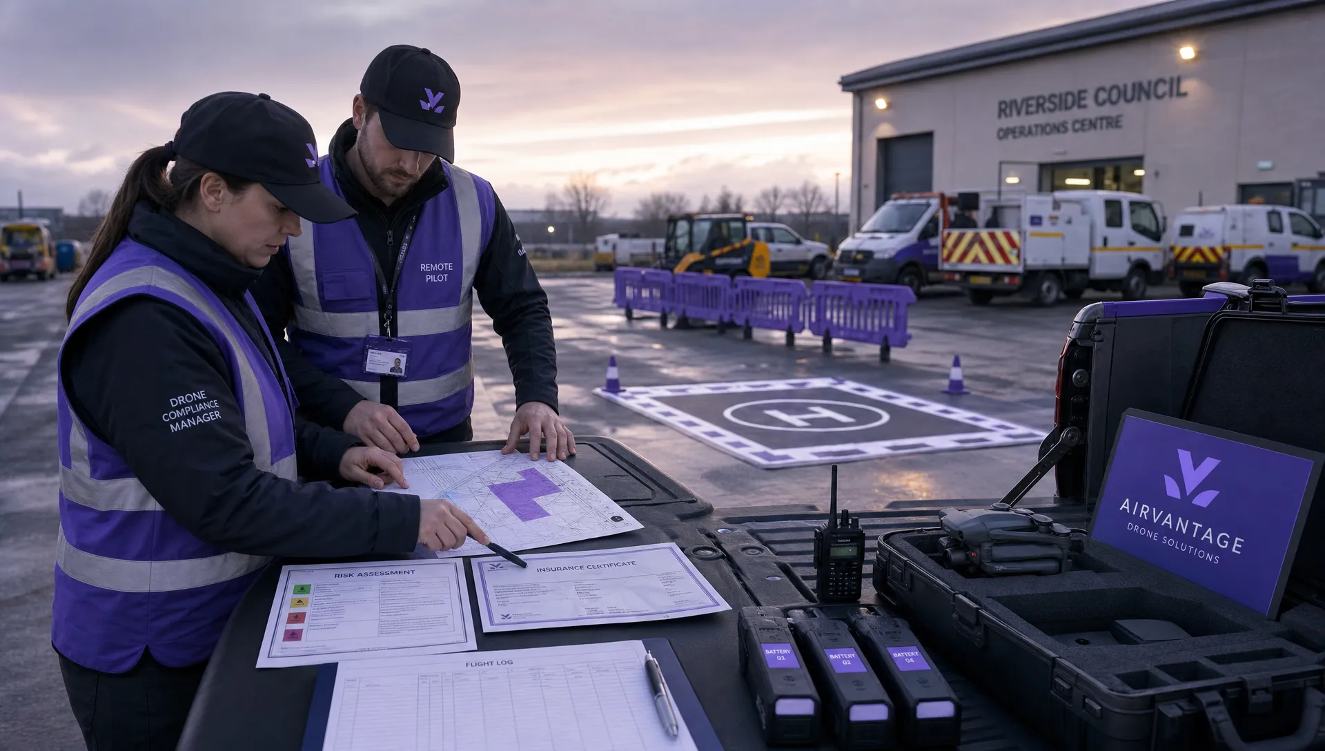 Drone Operation Regulations Explained for Businesses →
 How to Pass Your Drone Pilot License Test →
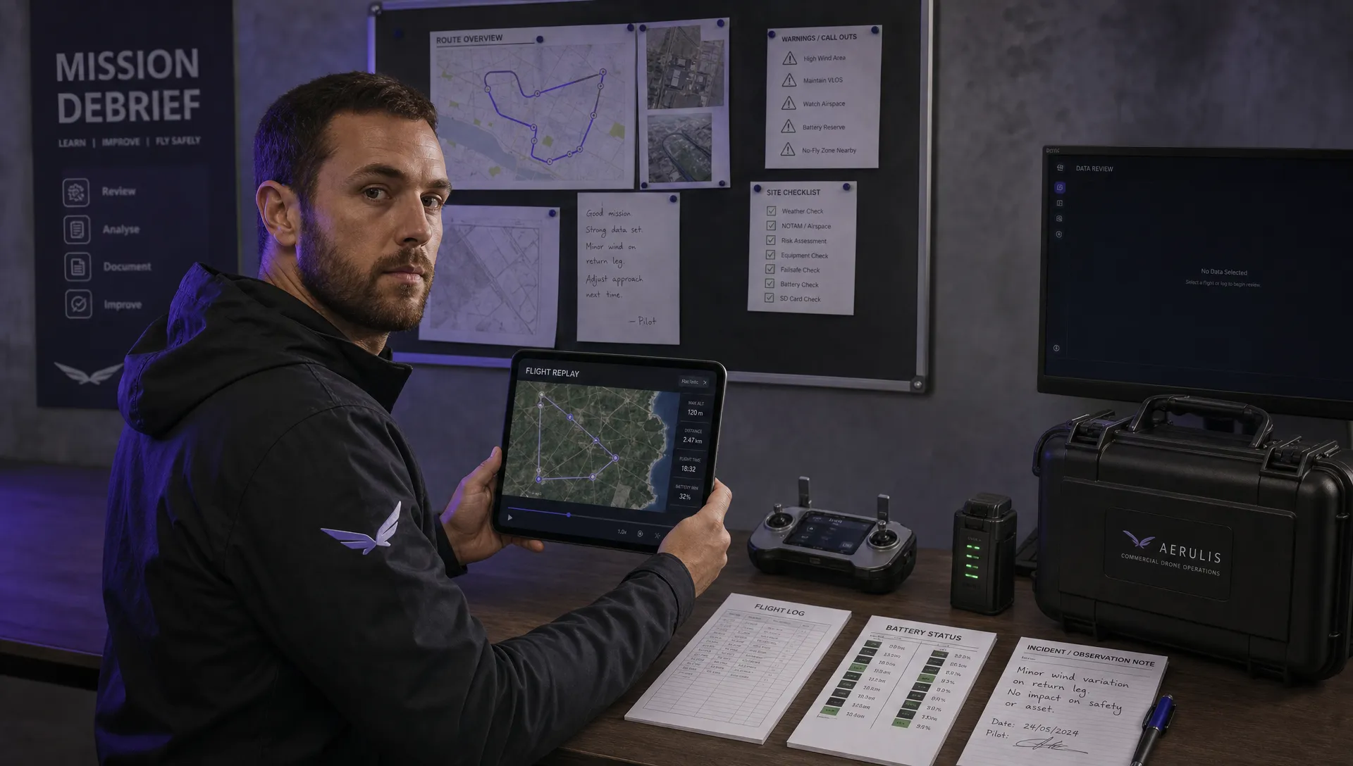 How to Review a DJI Flight Record After a Mission →
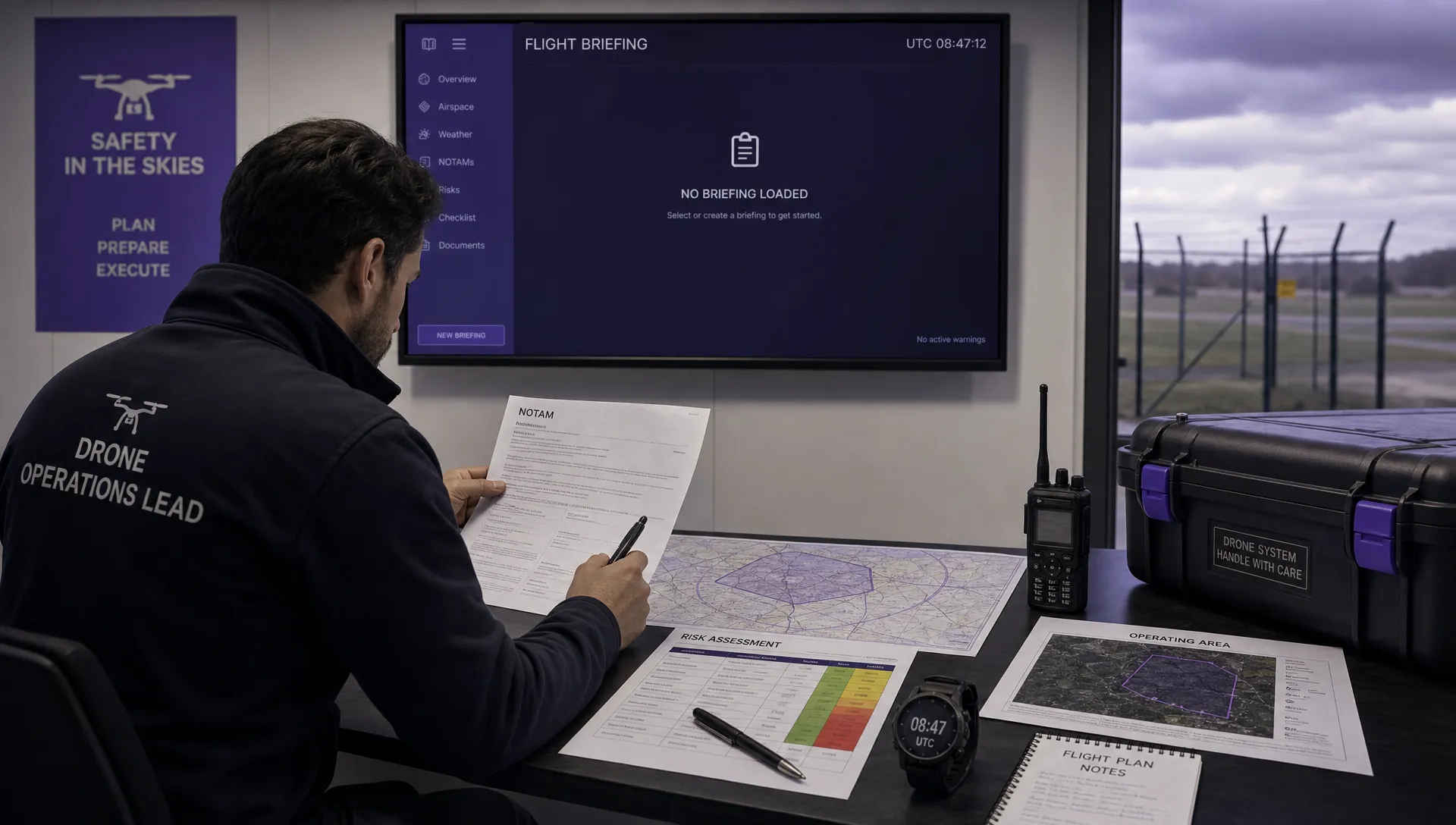 How to Check a Drone NOTAM Before You Fly →
 Part 108: What Drone Operators Should Expect →
 Beyond Visual Line of Sight BVLOS Explained →
 Drone Laws and Regulations Every Team Should Review →
 Current Drone Laws: What Changed in 2026? →
 JARUS SORA Explained in Plain English →