Drone Operations Transforming Infrastructure Inspections - 8 Key Innovations
Revolutionizing Inspections: The Drone Advantage
Drone operations are transforming infrastructure inspections, offering safer, faster, and more cost-effective solutions. This listicle details eight key drone operations enhancing how we assess and maintain critical infrastructure. Discover how these methodologies improve safety, reduce costs, and increase data accuracy. Learn about LiDAR, thermal imaging, photogrammetry, AI-powered defect detection, RTK GPS, BVLOS operations, digital twin integration, and multi-sensor fusion, and understand how these drone operations are revolutionizing infrastructure inspections.
1. LiDAR-Based Inspection Methodology
LiDAR (Light Detection and Ranging) technology is revolutionizing infrastructure inspections, offering a powerful and efficient method for assessing the condition of critical assets. Drone operations transforming infrastructure inspections are increasingly relying on LiDAR due to its ability to create highly accurate 3D models. This methodology involves emitting rapid pulses of laser light towards the target infrastructure and measuring the time it takes for the reflections to return to the sensor. This process generates a dense "point cloud" of data, representing the surface of the structure with millimeter-level precision. These point clouds can then be processed into detailed 3D models, providing a comprehensive view of the asset's geometry and condition. This allows for the detection of even subtle structural anomalies, such as cracks, corrosion, or deformations, that might be invisible to the naked eye or traditional camera systems.

LiDAR's unique capabilities make it particularly well-suited for inspecting complex or difficult-to-access infrastructure. Features such as high-precision distance measurements, the ability to penetrate vegetation, and operability in various lighting conditions, including nighttime, significantly enhance inspection capabilities. This translates to several key benefits, including exceptional accuracy for detecting structural deformations, the provision of comprehensive volumetric data, and effectiveness in areas with dense vegetation or complex structures. Furthermore, sequential LiDAR scans can be compared to detect subtle changes over time, enabling proactive maintenance and preventing catastrophic failures. This makes it an ideal tool for drone operations transforming infrastructure inspections.
Examples of successful LiDAR-based drone inspections abound. TransGrid has used LiDAR drones to inspect over 13,000 kilometers of high-voltage transmission lines in Australia, while SNCF has implemented the technology for railway infrastructure monitoring in France. Portland General Electric utilizes LiDAR for power line corridor mapping and vegetation management, and the Colorado Department of Transportation has incorporated it into their bridge inspection program. These real-world applications demonstrate the effectiveness and versatility of LiDAR in diverse infrastructure settings.
While LiDAR offers significant advantages, it's important to consider its limitations. Higher equipment costs compared to traditional camera systems, heavier payload requirements impacting flight time, and the need for specialized software and expertise for data processing can be barriers to entry. Furthermore, increased power consumption and potential permit requirements in certain jurisdictions should be factored into operational planning.
Pros:
- Exceptional accuracy for detecting structural deformations
- Provides comprehensive volumetric data
- Effective in areas with dense vegetation or complex structures
- Can detect subtle changes over time
- Weather-resistant compared to photogrammetry
Cons:
- Higher equipment costs
- Heavier payload requirements
- Complex data processing
- Greater power consumption
- May require special permits
Tips for Effective LiDAR Drone Operations:
- Calibrate: Calibrate LiDAR sensors before each mission for optimal accuracy.
- Ground Control: Use ground control points to improve geospatial accuracy.
- Weather: Consider weather conditions as heavy rain can interfere with laser pulses.
- Flight Patterns: Implement automated flight patterns to ensure consistent coverage.
- RGB Integration: Combine LiDAR data with RGB imagery for easier interpretation and context.
Companies like DJI (Zenmuse L1), Velodyne Lidar, Riegl (miniVUX series), and Terra Drone Corporation have been instrumental in popularizing and advancing LiDAR technology for drone applications. Their innovations have made LiDAR increasingly accessible and powerful, further driving the transformation of infrastructure inspections.
LiDAR-based inspection methodology deserves its place on this list because it offers a step-change in accuracy and efficiency for infrastructure inspections. Its ability to generate detailed 3D models, penetrate vegetation, and operate in challenging conditions makes it a valuable tool for drone operators, surveyors, and inspectors across various industries. By understanding the capabilities, limitations, and best practices of LiDAR, stakeholders can leverage this technology to enhance safety, improve maintenance strategies, and optimize infrastructure management.
2. Thermal Imaging Inspection Methodology
Thermal imaging inspection methodology is revolutionizing how we approach infrastructure inspections. This technique, a key component of drone operations transforming infrastructure inspections, leverages infrared cameras mounted on drones to detect subtle temperature variations across infrastructure surfaces. These variations can often indicate underlying structural issues, electrical problems, or energy inefficiencies that might be invisible to the naked eye. By analyzing these heat signatures, inspectors can pinpoint problems such as electrical hotspots, moisture intrusion, or insulation failures before they escalate into costly repairs or safety hazards.

Thermal cameras offer features like a temperature variation detection precision of ±2°C or better, the ability to operate day and night, and various temperature range options (typically -20°C to 1500°C). Real-time thermal data streaming enables immediate analysis, and compatibility with both radiometric and non-radiometric analysis provides flexibility depending on the inspection's requirements. This technology allows for a non-contact inspection method, ensuring the safety of inspectors, particularly in hazardous environments or at height. It quickly identifies energy losses in buildings and industrial facilities, detects electrical issues before they lead to failures, finds moisture intrusion and the resulting structural damage, and significantly reduces inspection time compared to traditional manual methods.
The benefits of this technology are evident in its widespread adoption. The Enel Group, for example, uses thermal drones to inspect over 40,000 km of power lines across Italy. The Tokyo Electric Power Company has implemented thermal imaging for nuclear facility inspections, while BP deploys it for pipeline leak detection in remote areas. Closer to home, the New York Power Authority has a thermal drone program for substation inspections, demonstrating the broad applicability of this technology across diverse infrastructure settings.
While powerful, thermal imaging does have limitations. Environmental conditions like sun, wind, and precipitation can influence readings. Accurate interpretation of thermal data requires specialized knowledge, and the technology cannot see through all materials, facing limitations with metal and glass. Thermal cameras are also more expensive than standard visual cameras, and reflective surfaces can create false readings.
To maximize the effectiveness of thermal drone inspections, consider these tips: conduct inspections during optimal temperature differential conditions (early morning or evening), maintain a consistent distance from the target for accurate temperature readings, use emissivity charts to account for different material properties, combine thermal imagery with visual imagery for easier problem identification, and implement standardized thermal palettes for consistent data interpretation.
Key players like FLIR Systems (with their Vue Pro and Duo Pro R thermal cameras), DJI (with their Zenmuse XT2 dual thermal/visual camera system), Workswell (with their WIRIS Pro thermal camera systems), and DroneBase (through their Thermal Live Maps solution) have been instrumental in popularizing and advancing thermal imaging technology for drone applications.
This methodology deserves its place in the list of drone operations transforming infrastructure inspections due to its ability to provide rapid, safe, and detailed insights into the condition of critical infrastructure. Its non-contact nature, speed, and ability to detect otherwise invisible problems offer significant advantages over traditional methods, paving the way for more efficient and proactive maintenance strategies. This, in turn, leads to cost savings, improved safety, and enhanced operational efficiency across various sectors.
3. Photogrammetry-Based Inspection Methodology
Photogrammetry is revolutionizing infrastructure inspections by offering a cost-effective and visually compelling way to assess asset conditions. Drone operations transforming infrastructure inspections often leverage this technique, which involves capturing hundreds or thousands of overlapping high-resolution images (typically 20MP+ cameras) with drones equipped with precise GPS positioning. These images are then processed with specialized software to create detailed 3D models of the infrastructure. This methodology enables comprehensive documentation of asset conditions with measurable data that can be analyzed and compared over time, making it an invaluable tool for preventative maintenance and informed decision-making.

High-resolution images and videos captured by drones during inspections can quickly create massive datasets. It's crucial to manage these efficiently. To learn more about optimizing file sizes without compromising quality, check out this guide on how to reduce file size. This approach generates a range of valuable outputs including orthomosaic maps (geometrically corrected aerial images), 3D meshes (digital representations of the surface), and digital elevation models (DEMs representing terrain elevation). With proper ground control points (GCPs), photogrammetry can achieve centimeter-level accuracy, enabling precise measurements of structural elements.
This methodology earns its place in the list of drone operations transforming infrastructure inspections due to its versatility and accessibility. Compared to LiDAR, photogrammetry generally requires lower equipment costs. The visually intuitive outputs—3D models and orthomosaics—are easy for stakeholders to understand, facilitating communication and collaboration. This visual documentation allows for comprehensive assessments of entire assets, enabling inspectors to identify potential issues that might be missed with traditional methods. Moreover, the ability to track changes over time through sequential modeling offers valuable insights into asset degradation and structural health.
Pros:
- Lower equipment costs compared to LiDAR
- Creates visually intuitive outputs
- Provides comprehensive visual documentation
- Enables precise measurements
- Tracks changes over time
Cons:
- Highly dependent on good lighting conditions
- Requires significant post-processing time and computing power
- Less effective for vegetation-covered or reflective surfaces
- May struggle with uniform or featureless surfaces
- Generally less accurate than LiDAR for absolute measurements
Examples of Successful Implementation:
- Network Rail (UK): Reduced track closures by 30% using drone photogrammetry for railway infrastructure inspections.
- Port of Rotterdam: Employs photogrammetry for ongoing documentation and maintenance of marine infrastructure.
- Norwegian Public Roads Administration: Utilizes drones and photogrammetry for bridge inspection programs.
- Enel Green Power: Applies this methodology for hydroelectric dam monitoring in Italy and South America.
Tips for Effective Photogrammetry:
- Use ground control points (GCPs) for georeferencing and improved accuracy.
- Maintain consistent lighting conditions throughout the mission.
- Ensure sufficient image overlap (70-80% is recommended).
- Implement grid or circular flight patterns for comprehensive coverage.
- Calibrate cameras before missions to ensure optimal image quality.
Popularized By:
- Pix4D
- DroneDeploy
- Bentley Systems (ContextCapture)
- Skycatch
Photogrammetry offers a powerful and accessible solution for drone operations transforming infrastructure inspections. By understanding its strengths and limitations, and by following best practices, operators can leverage this technology to improve inspection efficiency, reduce costs, and enhance safety.
4. Automated Defect Detection Using AI
Drone operations are transforming infrastructure inspections, and a key driver of this transformation is automated defect detection using AI. This methodology combines drone-captured imagery with artificial intelligence and machine learning algorithms to automatically identify and classify infrastructure defects, significantly enhancing the efficiency and effectiveness of inspections. This technology allows drone operators to move beyond simple visual data collection and enter the realm of sophisticated analysis, making it a crucial element in modern infrastructure inspection workflows.
Here's how it works: drones equipped with high-resolution cameras capture detailed images and videos of the infrastructure being inspected. This visual data is then fed into an AI-powered system trained on a vast dataset of images showcasing various types of defects, such as cracks, corrosion, vegetation encroachment, and other anomalies. Utilizing sophisticated computer vision algorithms optimized for specific defect types, the system analyzes the imagery, recognizing patterns associated with these defects and pinpointing their location. This analysis can be performed in real-time during the flight or post-flight, offering flexibility depending on the specific application and available connectivity.
The system not only detects but also classifies defects with a confidence score, providing inspectors with valuable insights into the severity and potential impact of each issue. This automated reporting and prioritization of findings streamlines the inspection process and facilitates faster decision-making regarding repairs and maintenance. Furthermore, the results can be integrated with asset management systems for a comprehensive overview of infrastructure health.
Features of AI-powered defect detection:
- Computer vision algorithms optimized for specific defect types
- Real-time or post-flight analysis capabilities
- Defect classification with confidence scoring
- Automatic reporting and prioritization of findings
- Integration with asset management systems
Benefits of using AI in drone infrastructure inspections:
- Drastically reduces human analysis time: Instead of manually reviewing hours of footage, inspectors can focus on verifying the AI's findings, increasing efficiency and freeing up time for other critical tasks.
- Improves consistency in defect identification: Unlike human inspectors who may be prone to fatigue and subjective interpretation, AI algorithms consistently apply the same criteria, leading to more reliable and repeatable results.
- Enables processing of massive datasets: AI systems can effortlessly analyze large volumes of data that would overwhelm manual methods, making them ideal for inspecting extensive infrastructure networks.
- Can detect subtle early-stage defects: AI algorithms can be trained to identify even minor anomalies that might be missed by the human eye, enabling proactive maintenance and preventing larger problems down the line.
- Automatically tracks defect progression over time: By comparing data from multiple inspections, AI can monitor the development of defects over time, providing valuable information for predictive maintenance strategies.
Challenges and Considerations:
- Requires extensive training data: The accuracy of the AI model depends heavily on the quality and quantity of the training data. Gathering and labeling this data can be time-consuming and resource-intensive.
- Potential for false positives/negatives: In unusual conditions or with poor image quality, the AI may generate incorrect results. This necessitates careful calibration and validation of the system.
- Initial investment: Implementing AI-powered defect detection requires a significant upfront investment in software, hardware, and potentially specialized expertise.
- Human verification still necessary: While AI can automate much of the analysis, human verification of critical findings is still essential to ensure accuracy and safety.
- Performance variations: Factors like image quality and lighting conditions can impact the system's performance.
Examples of Successful Implementations:
- SNCF (French National Railway Company) has implemented an AI-powered drone inspection system that has reduced railway inspection times by 30%.
- American Tower Corporation utilizes AI for cell tower inspection across its vast network of over 40,000 structures.
- Southern Company leverages AI defect detection for power infrastructure monitoring, enhancing grid reliability and safety.
- Chevron has deployed AI-driven drone inspections for automated oil and gas infrastructure inspection.
Tips for Implementation:
- Start with a focused use case: Rather than trying to detect every possible defect, begin with a specific area of concern and gradually expand the system's capabilities.
- Create a robust training dataset: Invest time and effort in building a high-quality, diverse dataset of labeled defect examples.
- Implement confidence thresholds: Define appropriate confidence levels for different types of defects, based on their criticality and the potential consequences of misclassification.
- Leverage transfer learning: Adapt existing AI models trained on similar infrastructure types to accelerate the development process.
- Develop a human-in-the-loop workflow: Ensure that human experts are involved in verifying critical findings and validating the AI's output.
Learn more about Automated Defect Detection Using AI
Platforms like IBM Maximo Visual Inspection, Microsoft Azure Custom Vision, Skyqraft, Percepto, and Neurala offer solutions for developing and deploying AI-powered drone inspection systems. By embracing this technology, drone operators, service providers, and infrastructure managers can unlock new levels of efficiency, accuracy, and safety in their inspection workflows. Automated defect detection using AI isn't just a technological advancement; it's a paradigm shift that is fundamentally reshaping the future of infrastructure management.
5. Real-Time Kinematic (RTK) GPS Precision Methodology
Real-Time Kinematic (RTK) GPS is revolutionizing drone operations transforming infrastructure inspections by offering centimeter-level accuracy, a game-changer for detailed assessments and precise measurements. This methodology enhances traditional GPS by utilizing a network of base stations or a single base station, providing real-time correction data to the drone during flight. This correction data eliminates common GPS inaccuracies, allowing for extremely precise geolocation of the drone and, consequently, the data it collects. This level of precision makes RTK an essential consideration for any professional seeking highly accurate data from their drone operations.
How RTK Works: RTK drones receive raw GPS data from satellites, just like standard GPS drones. However, they also receive correction data from a base station or network via radio link or cellular connection. The base station, with its known fixed location, compares its extremely precise position to the GPS data it receives and calculates the error. This correction data is then transmitted to the drone, allowing it to correct its position in real-time, achieving centimeter-level accuracy (typically 1-3cm). This eliminates the need for extensive ground control points (GCPs), significantly streamlining workflows and reducing time spent in the field.
Features and Benefits:
- Centimeter-Level Positioning Accuracy: RTK achieves accuracy within 1-3 centimeters, enabling highly precise measurements directly from the collected data.
- Real-time Correction: Real-time correction data ensures accuracy during the flight, eliminating the need for post-processing in many cases.
- Precise Geolocation Tagging: All captured imagery and data are tagged with highly accurate geolocation information.
- Reduced or Eliminated Ground Control Points: RTK minimizes or entirely removes the need for GCPs, streamlining workflows and saving time.
- Repeatability: The ability to return to exact locations for follow-up inspections and temporal analysis.
Pros:
- Significantly improves the spatial accuracy of inspection data.
- Enables precise measurements directly from the collected data.
- Streamlines workflow by reducing or eliminating ground control point requirements.
- Allows for accurate temporal comparison at precise locations.
- Provides reliable positioning even in challenging GPS environments.
Cons:
- Higher equipment costs compared to standard GPS drones.
- Requires access to an RTK correction network or a separate base station.
- More complex setup and operation compared to standard drones.
- May experience signal interruptions in certain environments (dense urban areas, canyons).
- The additional weight of the RTK system can slightly reduce flight time.
Examples of Successful Implementation:
- California Department of Transportation (Caltrans): Caltrans utilizes RTK drone technology for highway infrastructure mapping, enabling precise measurements of road conditions and assets.
- Network Rail (UK): Network Rail deploys RTK drones for accurate railway asset documentation, including track geometry and infrastructure condition assessments.
- Sydney Water (Australia): Sydney Water leverages RTK-equipped drones for water infrastructure mapping and inspection, facilitating precise assessments of pipes, dams, and reservoirs.
- Dominion Energy: Dominion Energy implements RTK drones for transmission tower inspections, allowing for accurate measurements of critical components and identifying potential defects.
Actionable Tips for Utilizing RTK:
- Establish or Verify RTK Correction Sources: Before dispatching teams, ensure access to a reliable RTK correction network or set up a base station.
- Maintain Clear Line of Sight to Satellites: Obstructions can interfere with GPS signals; ensure sufficient satellite visibility during operation.
- Consistent Initialization Procedure: Implement a standardized initialization procedure to ensure consistent accuracy.
- Consider Post-Processed Kinematics (PPK) as a Backup: PPK can provide high accuracy when RTK signals are unreliable, requiring post-flight processing.
- Periodic Accuracy Validation: Validate the accuracy of your RTK system periodically using known control points.
When and Why to Use RTK:
RTK is ideal for infrastructure inspections requiring high accuracy and precise measurements. Applications include:
- Detailed asset mapping and modeling: Create highly accurate 3D models of infrastructure.
- Precision measurement and analysis: Obtain precise measurements of structures and components.
- Change detection and monitoring: Accurately track changes over time.
- Volume calculations: Precisely calculate volumes of stockpiles or excavations.
- Structural deformation analysis: Monitor and analyze structural changes with millimeter precision.
Popularized By:
Leading drone manufacturers have championed the adoption of RTK technology:
- DJI: Phantom 4 RTK, Matrice 300 RTK
- Wingtra: WingtraOne mapping drone
- Microdrones: mdMapper series
- Emlid: Reach RS2, Reach M2
- senseFly (now AgEagle): eBee X RTK/PPK
RTK GPS precision methodology represents a significant advancement in drone-based infrastructure inspections. By providing centimeter-level accuracy, it enables more detailed assessments, precise measurements, and efficient workflows, transforming how we inspect and manage critical infrastructure. Its benefits in accuracy and efficiency justify the increased cost and complexity for applications where precision is paramount.
6. BVLOS (Beyond Visual Line of Sight) Inspection Methodology
BVLOS (Beyond Visual Line of Sight) inspection methodology is revolutionizing how drone operations transform infrastructure inspections. This innovative approach enables drones to inspect assets far beyond the operator's visual range, dramatically expanding the scope and efficiency of inspections. Instead of being limited to the operator's eyesight, which restricts inspections to relatively small areas, BVLOS operations can cover vast distances, often exceeding 50 kilometers from the base of operations. This makes it particularly well-suited for inspecting extensive linear infrastructure networks like pipelines, power transmission lines, and railways. This methodology deserves its place on this list due to its potential to drastically improve safety, efficiency, and cost-effectiveness of large-scale infrastructure inspections.
BVLOS operations are made possible by a combination of advanced technologies. These include robust communication systems (often utilizing a combination of cellular, satellite, and radio links) to maintain constant contact with the drone, sophisticated detect-and-avoid systems for obstacle management, and precise flight planning software. Automated emergency procedures are also essential in case of connection loss, ensuring the drone can safely return to base or land in a designated area. Corridor mapping and linear infrastructure specialization further enhance the effectiveness of BVLOS inspections, allowing for targeted data acquisition along predetermined routes. Learn more about BVLOS (Beyond Visual Line of Sight) Inspection Methodology to understand the intricacies of flight planning for these complex operations.
Several companies have successfully implemented BVLOS inspection programs, demonstrating the practical benefits of this technology. For example, TransAlta uses BVLOS operations for power line inspections across 400km in Canada, while Xcel Energy has received FAA approval for BVLOS power infrastructure inspections. Other notable examples include Shell's deployment for pipeline monitoring in remote parts of Australia and SNAM's natural gas pipeline inspection program covering over 500km in Italy.
Features and Benefits:
- Extended operational range: Covering 50+ kilometers from the base significantly expands the area that can be inspected in a single operation.
- Advanced detect-and-avoid systems: Ensures safe operation in complex environments by autonomously avoiding obstacles.
- Redundant communication systems: Maintains reliable communication with the drone even in challenging conditions.
- Automated emergency procedures: Provides fail-safe mechanisms in case of communication loss or other unforeseen events.
- Corridor mapping and linear infrastructure specialization: Optimizes data collection for targeted and efficient inspections.
Pros:
- Dramatically increases the efficiency of inspecting linear infrastructure.
- Reduces personnel requirements and field deployment costs.
- Enables inspection of remote or difficult-to-access assets.
- Improves safety by removing humans from dangerous inspection environments.
- Allows for regular, consistent monitoring of extensive networks.
Cons:
- Complex regulatory approval process in most countries.
- Higher equipment costs for long-range communications and safety systems.
- Greater risk management requirements and insurance considerations.
- Requires more sophisticated flight planning and monitoring.
- Limited by battery life and weather conditions.
Tips for Successful BVLOS Operations:
- Begin with regulatory engagement: Understand and comply with all applicable regulations early in the planning process.
- Implement a layered approach to detect-and-avoid systems: Combine various sensor technologies for robust obstacle detection and avoidance.
- Establish clear contingency procedures for various failure scenarios: Ensure safe operations even in unexpected situations.
- Use high-resolution corridor mapping techniques for efficient data collection: Optimize data acquisition for specific inspection needs.
- Consider solar or hybrid power systems for extended range operations: Overcome battery limitations for longer flights.
Companies like American Robotics with their Scout system, Skydio with their autonomous navigation, Percepto with their drone-in-a-box solutions, Zipline with their BVLOS delivery operations (which have advanced the regulatory framework), and SenseFly (now AgEagle) with their long-range fixed-wing systems have popularized and driven advancements in BVLOS technology. When considering BVLOS for your drone operations transforming infrastructure inspections, carefully weigh the pros and cons, engage with regulators, and invest in the appropriate technology and training to ensure safe and effective operations.
7. Digital Twin Integration Methodology
Digital Twin Integration Methodology represents a significant advancement in how drone operations are transforming infrastructure inspections. This methodology involves creating and maintaining accurate virtual replicas (digital twins) of physical infrastructure using data collected by drones. These digital twins aren't just static 3D models; they are dynamic, interactive representations that combine visual, thermal, and other sensor data with existing asset information. This comprehensive approach enables advanced simulation, predictive maintenance, and collaborative decision-making, fundamentally changing how we manage and inspect infrastructure.

The infographic above visualizes the key data and relationships within the Digital Twin Integration Methodology. The central concept, the "Digital Twin," is built upon and connected to several crucial components. Drone data (visual, thermal, LiDAR, and sensor data) feeds into the model, forming its foundation. This data is then integrated with existing asset information (BIM, GIS data, maintenance records) to create a holistic view of the infrastructure. This integration allows for advanced analytics (predictive maintenance, simulations, anomaly detection) and facilitates better decision-making and collaboration among stakeholders. The most important relationship highlighted is the continuous feedback loop between real-world infrastructure, drone data acquisition, and the digital twin, ensuring the virtual model remains accurate and up-to-date. As the infographic illustrates, the ultimate goal is improved infrastructure management, reduced operational costs, and enhanced safety.
This approach empowers stakeholders to virtually inspect assets, identify potential problems, and plan maintenance activities remotely, significantly reducing the need for costly and time-consuming on-site visits. The features that enable this transformation include seamless integration of multiple data types (imagery, LiDAR, thermal, and other sensor data), real-time or near-real-time updating capabilities, Building Information Modeling (BIM) compatibility, historical data layering for condition comparison over time, and API connectivity with asset management and maintenance systems.
Examples of Successful Implementation:
Several organizations have successfully implemented digital twin technology for infrastructure management, showcasing its real-world impact. The Port of Rotterdam utilizes a complete digital twin of its harbor infrastructure for optimized operations and logistics. National Grid in the UK has implemented a digital twin program for critical power infrastructure, enhancing their maintenance strategies. Singapore's nationwide digital twin initiative encompasses building and transportation infrastructure, aiming to improve urban planning and resource allocation. Similarly, SNCF leverages a railway digital twin project for the Paris-Lyon high-speed line for improved maintenance and operational efficiency.
Pros and Cons:
While the benefits are numerous, implementing digital twin technology comes with its own set of challenges.
Pros:
- Provides a single source of truth for infrastructure condition and information.
- Enables remote collaboration among distributed teams.
- Supports predictive maintenance through trending and anomaly detection.
- Reduces site visits through comprehensive virtual inspection capabilities.
- Improves decision-making with contextualized, visual data.
Cons:
- Complex implementation requiring significant data integration.
- High initial investment in software and systems architecture.
- Requires standardized data collection protocols.
- Data storage and management challenges for large infrastructure projects.
- May necessitate organizational change management.
Tips for Implementation:
To effectively leverage digital twin technology in your drone operations, consider these practical tips:
- Start with a defined scope and high-value assets rather than attempting to model everything at once.
- Establish clear data standards and collection protocols to ensure data consistency and quality.
- Focus on integration with existing enterprise systems to maximize the value of the digital twin.
- Build a scalable cloud infrastructure for data storage and processing to accommodate growing data volumes.
- Implement progressive levels of detail to manage complexity and optimize performance.
When and Why to Use This Approach:
Digital twin integration is particularly valuable for complex infrastructure inspections where remote monitoring, predictive maintenance, and collaborative decision-making are crucial. It's ideal for large-scale projects, hazardous environments, and situations requiring detailed, readily accessible information. This methodology significantly enhances the value of drone operations transforming infrastructure inspections by moving beyond simple visual inspections to proactive, data-driven asset management.
Popular platforms supporting this technology include Bentley Systems with their iTwin platform, Siemens with their Xcelerator digital twin solutions, Microsoft with their Azure Digital Twins platform, Autodesk through their Tandem digital twin offering, and NVIDIA with their Omniverse platform. Learn more about Digital Twin Integration Methodology to explore this transformative technology further.
8. Multi-Sensor Fusion Inspection Methodology
Drone operations are transforming infrastructure inspections, and the multi-sensor fusion inspection methodology represents a significant leap forward in this evolution. This powerful approach combines data from multiple sensor types – such as visual, thermal, LiDAR, multispectral, and even gas detection – into a comprehensive dataset, providing a level of insight impossible to achieve with a single sensor. This detailed view empowers inspectors to perform more thorough analyses, diagnose complex issues, and ultimately make more informed decisions regarding infrastructure maintenance and repair. This approach is crucial for anyone involved in drone operations transforming infrastructure inspections because it dramatically increases the value and effectiveness of each flight.
How it Works:
Multi-sensor fusion can be achieved by equipping a single drone with multiple sensors or through coordinated flights of multiple drones, each carrying a specialized sensor. The key is to synchronize data capture with precise timestamp correlation and integrated geo-referencing. This ensures that all data streams are accurately aligned, creating a holistic representation of the inspected asset. Advanced data fusion algorithms then combine these disparate data types into a unified model. For example, thermal imagery might highlight a hot spot on an electrical component, while visual imagery provides context and LiDAR data gives precise measurements of the component's dimensions, enabling accurate assessment of the problem.
Features:
- Simultaneous operation of multiple sensor types
- Synchronized data capture with precise timestamp correlation
- Integrated geo-referencing across all data streams
- Specialized sensor payloads for specific infrastructure types (e.g., gas detection for refineries, multispectral for vegetation management)
- Advanced data fusion algorithms for combining disparate data types
Pros:
- Complementary Data: Reveals issues invisible to any single sensor, like subsurface defects or gas leaks.
- Reduced False Positives: Cross-verification between sensor types reduces the likelihood of misinterpreting data.
- Maximized Flight Value: Collects multiple data types in a single flight or coordinated series of flights, saving time and resources.
- Comprehensive Root Cause Analysis: Facilitates a deeper understanding of complex problems by providing a more complete picture.
- Confident Decision-Making: Corroborated findings from multiple sensors support more confident maintenance and repair decisions.
Cons:
- Reduced Flight Time: Heavy multi-sensor payloads can significantly reduce a drone's flight time.
- Complex Integration: Requires sophisticated hardware and software integration for data acquisition and processing.
- Higher Equipment Costs: Specialized sensor arrays can be expensive.
- Expertise Required: Interpreting fused data requires specialized training and expertise.
- Complex Data Processing: Workflows for processing and analyzing large, multi-modal datasets can be complex.
Examples of Successful Implementation:
- Shell: Utilizes multi-sensor drones combining gas detection, thermal, and visual sensors for refinery inspections.
- Southern California Edison: Employs a multi-sensor approach for wildfire risk management in power line corridors.
- Network Rail: Implements a comprehensive bridge inspection program using visual, thermal, and LiDAR fusion.
- Petronas: Conducts offshore platform inspections using a combination of multiple sensor technologies.
Tips for Effective Implementation:
- Tailor Sensor Packages: Design sensor packages specific to the infrastructure type and anticipated failure modes.
- Calibrate Sensors: Implement rigorous pre-flight sensor calibration procedures to ensure data accuracy.
- Visualize Data Effectively: Develop standardized visualization tools that present fused data intuitively.
- Consider Specialized Flights: When dealing with heavy payloads, consider multiple specialized flights instead of one heavily-loaded drone.
- Establish Clear Data Workflows: Develop and adhere to clear data processing workflows that maintain data integrity across all sensor streams.
Popularized By:
- DJI Enterprise: Modular payload systems.
- FLIR: Multi-sensor gimbal systems.
- Workswell: Integrated thermal/visual solutions.
- Hovermap: Simultaneous LiDAR and visual mapping systems.
- Sterblue: Multi-sensor data processing platform.
By carefully considering these factors and implementing best practices, drone operators can leverage the power of multi-sensor fusion to significantly enhance the effectiveness and efficiency of their infrastructure inspections, ultimately contributing to safer and more reliable infrastructure.
8-Methodology Comparison Matrix
| Methodology | Implementation Complexity 🔄 | Resource Requirements ⚡ | Expected Outcomes 📊 | Ideal Use Cases 💡 | Key Advantages ⭐ |
|---|---|---|---|---|---|
| LiDAR-Based Inspection | High – requires specialized processing and expertise | High – costly equipment, heavy payload, high power | Very high accuracy 3D models and structural anomaly detection | Dense vegetation, complex structures, volumetric analysis | Exceptional millimeter accuracy, weather-resistant |
| Thermal Imaging Inspection | Moderate – specialized knowledge for data interpretation | Moderate – expensive thermal cameras | Identification of thermal anomalies and energy losses | Electrical hotspots, moisture intrusion, energy audits | Safe non-contact method, quick detection of heat issues |
| Photogrammetry-Based Inspection | Moderate to High – extensive image capture and processing | Moderate – standard drone cameras, high computing need | Detailed 3D reconstructions with visual documentation | General asset documentation, construction monitoring | Lower cost, easy visual interpretation, change tracking |
| Automated Defect Detection Using AI | High – AI training and data integration | High – requires quality data, AI development, computing | Fast, consistent, automated defect identification | Large dataset analysis, defect classification, prioritization | Reduces analysis time, detects subtle and early defects |
| RTK GPS Precision Methodology | Moderate – requires precise GPS setup | Moderate to High – specialized RTK drones and networks | Centimeter-level spatial accuracy and precise measurements | Pipeline, linear infrastructure, mining, bridge inspection | Eliminates ground control points, repeatable accuracy |
| BVLOS Inspection Methodology | Very High – advanced flight planning, approval needs | Very High – long-range comms, detect-and-avoid systems | Extended range inspections beyond visual line of sight | Large linear infrastructure, remote/difficult to access areas | Increased operational efficiency and safety |
| Digital Twin Integration | Very High – complex data integration and system design | Very High – software, data management, cloud infrastructure | Interactive virtual models enabling predictive maintenance | Broad assets, collaborative decision-making, simulation | Centralized data source, remote collaboration, predictive insights |
| Multi-Sensor Fusion Inspection | Very High – hardware/software integration complexity | Very High – multiple sensors, payload weight | Comprehensive, corroborated multi-sensor datasets | Complex or critical infrastructure needing multiple data types | Cross-verified findings reduce false positives, thorough analysis |
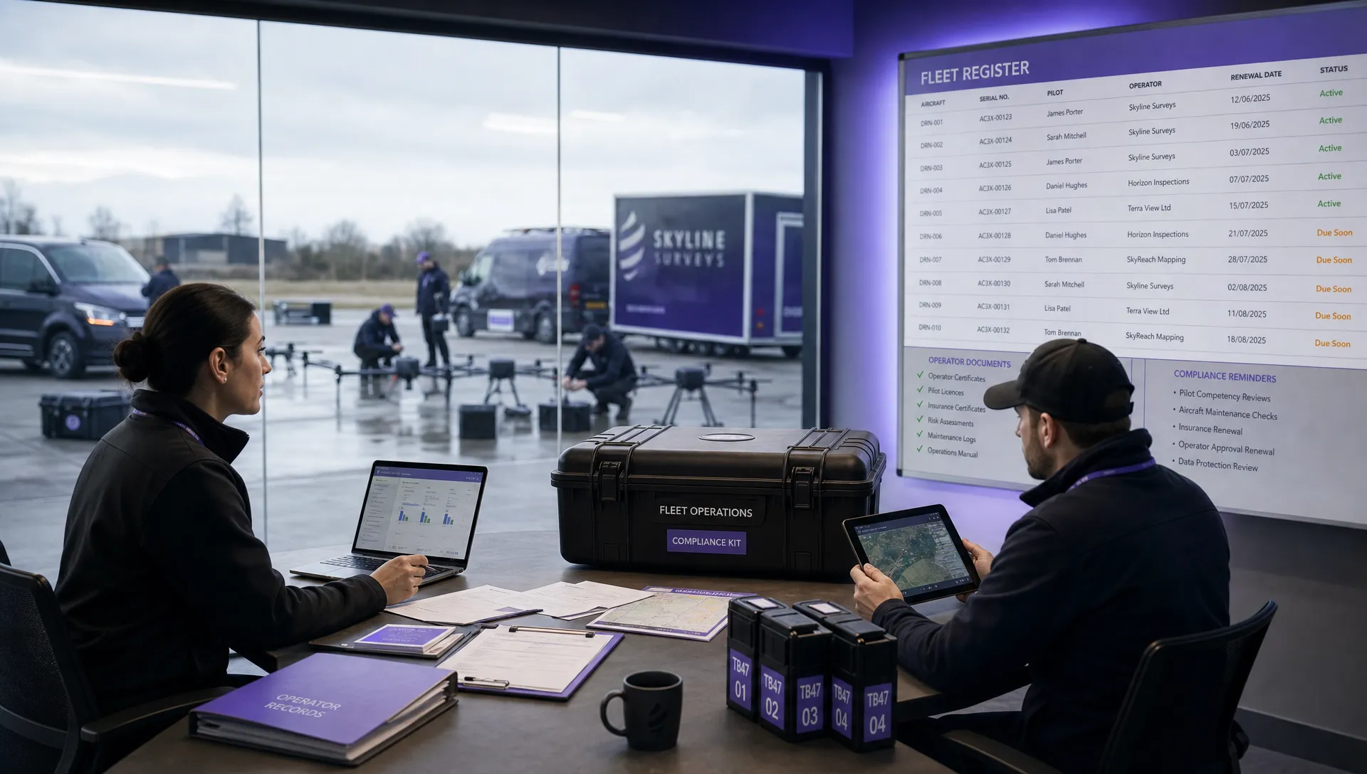
Streamlining Inspections with Dronedesk
Drone operations are transforming infrastructure inspections, offering unprecedented levels of safety, efficiency, and data-driven insights. From LiDAR and thermal imaging to photogrammetry and AI-powered defect detection, the methodologies covered in this article highlight the powerful potential of drones to revolutionize how we manage and maintain critical infrastructure. Mastering these techniques, including RTK GPS precision, BVLOS operations, digital twin integration, and multi-sensor fusion, is crucial for staying competitive and maximizing the return on investment in your drone program. These advancements empower inspection teams to collect higher quality data, reduce operational costs, and make more informed decisions about asset management, ultimately leading to safer and more resilient infrastructure.
The key takeaway is clear: drone technology is not just a futuristic concept; it's a practical and transformative tool available today. By embracing these innovative approaches, organizations can significantly improve the speed, accuracy, and comprehensiveness of their infrastructure inspections. This translates to reduced downtime, improved safety for inspection personnel, and more proactive maintenance strategies, all contributing to a more robust and sustainable future for our infrastructure.
Ready to optimize your drone operations transforming infrastructure inspections? Dronedesk provides a comprehensive platform to manage your entire drone program, seamlessly integrating the methodologies discussed and empowering you to unlock the full potential of your drone operations. Visit Dronedesk today to learn more and request a demo.
 Drone Registration Regulations Businesses Must Follow →
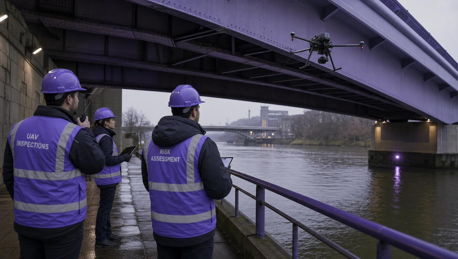 Atypical Airspace Explained for UK Drone Operators →
 FAA Unmanned Aircraft Regulations Made Simple →
 Part 107 Test Tips to Pass With Confidence →
 How to Pass the FAA Drone Written Test First Time →
 What a BVLOS Flight Means for Risk and Compliance →
 Drone VLOS Rules Explained for Commercial Teams →
 FAA Remote ID Rule Explained for Commercial Pilots →
 Drone Legal Requirements for Commercial Operations →
 Drone Near Airport Rules Explained for Safer Planning →