Class A Airports & Airspace: A Drone Pilot's Guide
You’re planning a paid mission in a city center. The site is only a few miles from a major airport. Your drone will stay low, your client wants rooftop imagery, and your mapping app is full of layered airspace rings, altitude caps, and warning boxes. Then someone on the team says, “Do we need to worry about Class A airports here?”
That phrase is where a lot of confusion starts.
There really isn’t a formal category called class a airports in the way many drone operators mean it. The correct term is Class A airspace. That distinction matters because airports are physical places on the ground, while airspace is the regulated structure above them. If you mix those up, it becomes much harder to make good decisions about where your drone can fly and why certain restrictions exist.
For most professional drone pilots, Class A can feel irrelevant at first glance. It starts high above normal drone operating altitudes, so it’s easy to treat it as somebody else’s problem. But that’s not how the National Airspace System works. Airspace is layered, connected, and built around the movement of manned aircraft from departure to arrival. If you fly beneath major airline corridors, around towered airports, or near dense urban airspace, your mission sits inside that larger system.
That’s why understanding Class A makes you a better low-altitude operator. It sharpens your judgment about airport environments, approach paths, waivers, and the difference between a legal mission and a reckless one.
The Professional Drone Pilot's Introduction to High-Altitude Airspace
Professional drone work often starts with a map and a question: what’s above and around this job site that could affect the mission? If you inspect roofs, capture media downtown, survey infrastructure, or manage repeat flights for enterprise clients, you’ve probably opened your planning tools and found airspace that looks more complicated than the job itself.
The phrase class a airports usually shows up when operators are trying to make sense of that complexity. The problem is that the term blends two different ideas. Airports have traffic patterns, control towers, and surrounding terminal airspace. Class A airspace is a national high-altitude layer. If you want a clean mental model, start there.
A useful way to think about it is this. The airport is the building and the ramps. The surrounding controlled airspace is the street network. Class A is the interstate system far above, where high-speed traffic moves under tighter rules.
For a broader refresher on how the full system fits together, Dronedesk’s guide to the class of airspace is a helpful companion.
Why drone pilots should care anyway
Your drone probably won’t operate anywhere near the floor of Class A. That doesn’t make the subject academic. It matters because major airports sit beneath the larger structure of controlled airspace, and the busiest parts of the system create pressure all the way down to the altitudes where drones work.
When manned aircraft descend out of higher airspace and funnel into terminal areas, the sky becomes more structured, not less. Arrival corridors, departure routes, altitude shelves, and ATC-managed flows all compress into the exact regions where commercial drone jobs often happen.
Practical rule: If your mission is near a major airport, don’t just ask, “Can I stay under my drone altitude limit?” Ask, “What manned traffic is being organized above and around me?”
The professional mindset
A recreational pilot can sometimes get away with a narrow view of the map. A professional operator can’t. Clients expect repeatable planning, documented decisions, and a clear safety rationale. That means understanding not only your own altitude, but also the aviation logic behind the airspace around you.
The strongest drone crews treat airspace awareness as part of operational discipline, not test prep trivia. That’s where Class A becomes useful. It teaches you how the upper system is organized, and once you understand that, the lower layers start making far more sense.
Demystifying Class A The Superhighway in the Sky
Think of Class A as the superhighway in the sky. It’s built for fast, high-altitude traffic that needs strict spacing, common rules, and constant coordination. That’s why drone pilots hear about it in training even though they’ll almost never operate inside it.
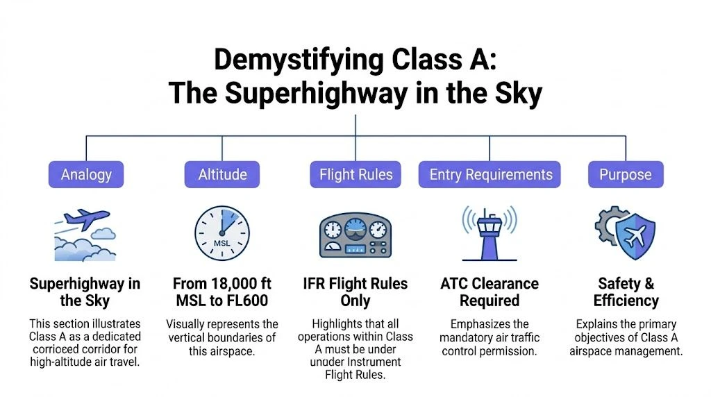
Under FAA rules, Class A airspace extends from 18,000 feet MSL to FL600, requires IFR operations only, and requires ATC clearance before entry. Aircraft operating there use a standard altimeter setting of 29.92 inches Hg, and required equipment includes a two-way radio, a Mode C transponder, and ADS-B Out. Pilots also need an instrument rating because this is a high-speed environment built around controlled, instrument-based operations, as explained in Pilot Institute’s breakdown of Class A airspace requirements.
What those rules really mean
Each of those requirements solves a specific problem.
IFR-only operations mean pilots aren’t improvising visually in a crowded high-altitude environment. ATC knows who they are, where they’re going, and how they’ll get there. Clearance before entry means no one wanders into the system. The standardized altimeter setting means every aircraft is reading altitude from the same baseline, which reduces the risk of altitude misunderstandings.
For drone operators, the lesson isn’t “memorize the regulation.” The lesson is that airspace design follows traffic complexity. The faster the aircraft and the denser the flow, the less tolerance there is for ambiguity.
Why it’s so tightly controlled
At lower altitudes, pilots can sometimes rely more on visual references and local procedures. In Class A, that would break down quickly. Aircraft are moving too fast, covering too much distance, and often operating in weather conditions that require instrument navigation. ATC doesn’t just help in that environment. It becomes the central organizer.
This is why Class A feels so different from the lower airspace classes drone pilots see on sectional charts and authorization apps. It isn’t just another box on the map. It’s a managed corridor for aircraft that need exact routing, exact altitude assignments, and exact communication.
You don’t need to fly in Class A to benefit from understanding it. You need to understand why aviation reserves some parts of the sky for tightly managed traffic and leaves far less room for guesswork.
The contrast with drone operations
A drone under Part 107 lives in a different operational world. The aircraft is slower, lower, and usually much closer to the pilot. It doesn’t carry the onboard systems or pilot qualifications required for high-altitude IFR flight. That gap is precisely why the system separates manned and unmanned activity by altitude, procedure, and approval pathway.
If you’re still building your regulatory foundation, a solid Part 107 study resource can help connect these ideas to the exam language. TruTec’s guide on how to pass your Part 107 exam is a practical place to reinforce the airspace concepts that matter in real operations.
The simple takeaway
Class A is not mysterious once you strip away the terminology. It is:
- High altitude only
- IFR only
- ATC controlled
- Equipment dependent
- Built for fast manned aircraft, not routine drone activity
Once you understand that, you stop treating airspace as a set of random restrictions and start seeing it as a traffic management system with a very clear logic.
How to Identify Class A Airspace on Your Maps
Most drone pilots expect Class A to appear on a chart the same way Class B, C, or D does. Then they open a sectional and can’t find a bold boundary line for it. That’s where the second big misunderstanding starts.
Class A usually isn’t something you “spot” as a local shape around one airport. You identify it by knowing its floor and by understanding that it forms a broad upper layer over the contiguous United States and Alaska.
Why it doesn’t look like Class B
Class B wraps around major airports in visible shelves. Pilots often describe it as an upside-down wedding cake because each layer steps outward as altitude increases. Drone pilots get used to reading those shelves because they directly affect authorization, altitude limits, and route selection.
Class A is different. It sits above that local architecture. Instead of being drawn as a custom shell around one airport, it’s better thought of as the ceiling layer that starts at 18,000 feet MSL across a huge area.
So when you review a mission map, the right question isn’t “Where’s the Class A boundary line?” It’s “What lower airspace am I operating under, and how does that fit beneath the national high-altitude structure?”
A better mental picture
Build the map in layers from the ground up:
- Surface operations happen around airports, towers, heliports, and local obstacles.
- Terminal airspace builds upward and outward around busier airports.
- En route structure connects traffic moving between metro areas.
- Class A sits above as the high-altitude IFR layer.
That mental stack makes the map much easier to read. It also helps you understand why a downtown drone mission can still be affected by airline traffic patterns even though your aircraft stays far below Class A itself.
For chart-reading practice, Dronedesk’s article on how to read sectional charts is worth keeping handy during planning.
What drone pilots should actually look for
When you evaluate a map near a major airport, focus on the lower structures that feed traffic into and out of the upper system.
Look for:
- Class B and Class C shelves that cap your altitude or require authorization.
- Approach and departure corridors where manned traffic may be descending or climbing.
- MSL versus AGL references so you don’t confuse local terrain height with airspace ceilings.
- Urban terrain traps, especially tall buildings that can make a legally low flight operationally closer to manned traffic than it appears.
A chart doesn’t need to draw Class A with a bright outline for it to matter. If you’re under a busy terminal area, you’re already working beneath a much larger traffic system.
A practical example
Take a skyscraper inspection near a major airport. Your drone might never leave low altitude relative to the building, but the airspace picture isn’t just about the drone’s height above takeoff point. You need to know the controlled airspace overhead, nearby approach routes, the local authorization grid, and how terrain or structures affect your true position in the system.
That’s the habit that separates a pilot who reads maps from one who interprets them.
Rules of the Road Manned vs Unmanned Operations
A jet crew entering Class A and a Part 107 drone pilot launching for a commercial job are operating in the same national system, but under completely different assumptions. Comparing the two side by side makes the safety logic much easier to grasp.
What the airline crew is doing
For a manned aircraft in Class A, ATC takes primary responsibility for separation. Pilots must maintain two-way radio contact and comply with ATC instructions under 14 CFR 91.135. This control regime is credited with keeping mid-air collision rates below 1 per 10 million flight hours, with standards such as RVSM above FL290 supporting tighter but controlled vertical separation, according to the St. Mary’s County airspace reference on Class A operating rules and separation.
That means the crew isn’t just “flying high.” They’re participating in a tightly managed flow. Their routing, altitude, and separation aren’t casual choices. ATC is sequencing those aircraft continuously.
If you want a pilot-focused explanation from the manned aviation side, DuBois Aviation’s A Pilot's Guide to Class A Airspace gives useful context.
What the drone pilot is doing
A professional drone pilot works from the opposite end of the system. You’re usually operating visually, locally, and at much lower altitude. Your aircraft doesn’t carry the equipment package, certification path, or ATC integration expected in high-altitude IFR operations.
That’s why Class A is effectively not part of normal drone access. It’s not because regulators dislike drones. It’s because the operating assumptions are incompatible. The system cannot safely mix high-speed IFR traffic and routine small UAS operations in the same layer without a very different level of integration.
Side-by-side comparison
| Operation type | Manned aircraft in Class A | Part 107 drone operation |
|---|---|---|
| Primary flight method | IFR | Visual, mission-specific operation |
| ATC relationship | Continuous communication and compliance | Usually indirect unless operating within controlled lower airspace processes |
| Equipment expectation | Certified onboard systems for high-altitude controlled flight | Mission equipment built for low-altitude UAS work |
| Traffic environment | High-speed, structured flows | Localized low-altitude activity |
| Access to Class A | Permitted with qualifications and clearance | Not routine, highly restricted |
Why the separation is necessary
Speed changes everything. So does distance. An airliner descending through a terminal area covers ground rapidly and may be managed as part of a long chain of arrivals. A drone pilot may be stationary over one site, but from the ATC and airspace design perspective, that local operation still sits beneath a dynamic traffic environment.
That’s the part many operators miss. Airspace rules aren’t just about what your drone can physically do. They’re about whether your operation can fit into a system designed around many other aircraft moving through the same region.
Operational insight: The more you understand how manned aircraft are organized above you, the better your decisions become below them.
Your Practical Guide to Class A Compliance
If you never plan to fly anywhere near 18,000 feet, Class A still matters because the busiest commercial airport environments sit beneath the broader high-altitude structure. Those airports don’t operate in isolation. They feed traffic up and down through layered airspace, and that shapes the risks around your mission area.
The FAA reports that the Core 30 airports handled 12.7 million operations in FY2024, up from 12.2 million in FY2023, and notes that all towered U.S. airports collectively processed 38.9 million operations in FY2024, a 4.5% increase from the prior year. The same FAA data identifies Atlanta, Chicago O’Hare, Dallas-Fort Worth, Memphis, and Denver among the highest-traffic airports by average daily operations, with each exceeding 2,900 arrivals and departures per day in FY2024. The agency also reports that delays at Core 30 airports rose 13% year over year, while go-arounds reached about 0.41% of arrivals, a 6.3% increase from the previous year, in its Air Traffic by the Numbers FY2024 report.
Those figures matter to drone operators because dense airline activity creates a busier, less forgiving environment in the terminal areas below.
What this means for a real mission
Consider a downtown inspection near a major hub. Your drone operation may be lawful at low altitude with the right approvals, but the surrounding environment may include departure corridors, helicopter traffic, tower instructions, and narrow operational margins caused by buildings or local terrain.
That means compliance isn’t just about getting airborne. It’s about proving that you assessed the whole risk picture.
Use this mindset for every airport-adjacent mission:
- Start with the site, not the aircraft. Ask what airspace overlays the property and what traffic patterns exist nearby.
- Check altitude in context. A legal mission altitude can still be a poor operational choice if structures, ridgelines, or approach paths compress separation.
- Review nearby aviation activity. Major hubs generate complex movement in the layers beneath Class A.
- Document your reasoning. If your client, regulator, or insurer asks why you judged the mission safe, “the app said okay” isn’t enough.
Drone Operations Compliance Checklist Near Major Airports
| Action Item | Do | Don't |
|---|---|---|
| Verify airspace class | Confirm whether the site is under Class B, C, D, E, or G and what authorization process applies | Assume all airport-adjacent sites are the same |
| Use the correct altitude reference | Check whether your operational limit is tied to AGL, MSL, structure height, or grid authorization | Treat every altitude number on the map as interchangeable |
| Assess manned traffic exposure | Look for likely arrival, departure, and helicopter activity near the mission area | Focus only on the drone’s takeoff point |
| Plan for lost link or drift | Build buffers for unexpected movement, especially near controlled airspace boundaries | Fly right up to a boundary with no margin |
| Coordinate internally | Brief crew members on no-go sectors, max altitude, emergency actions, and abort triggers | Let visual observers or subcontractors guess the plan |
| Keep records | Log approvals, planning notes, and on-site decisions | Rely on memory if questions come up later |
| Use waivers realistically | Treat high-altitude or unusual operations as exceptional and heavily scrutinized | Assume a waiver is a shortcut into sensitive airspace |
| Abort when conditions change | Stop if traffic, weather, or site conditions make the original plan unsafe | Continue because the client is on site and the schedule is tight |
What’s always a bad idea
Some errors show up again and again in airport-area drone work.
- Chasing the client’s preferred shot without rechecking the map. A rooftop angle can nudge the aircraft toward a shelf or boundary you didn’t originally plan to approach.
- Using one app view only. Cross-check your data. Airspace interpretation is too important for a single-screen habit.
- Treating authorization as a full risk assessment. Authorization is one piece. It doesn’t replace judgment, crew coordination, or contingency planning.
- Ignoring vertical creep. Tall structures, rising terrain, and repositioning maneuvers can eat into your safety margin faster than operators expect.
The safest commercial drone pilots don’t think in terms of “How close can I get?” They think in terms of “How much buffer do I need to stay predictable?”
Rare cases involving higher-altitude concepts
Some enterprise operators deal with specialized missions, such as long linear inspections, advanced waiver work, or experimental profiles that push beyond normal low-altitude assumptions. In those cases, the logic of Class A becomes more than background knowledge. It becomes part of the risk argument.
That doesn’t mean routine access. It means the burden of planning rises sharply as your mission starts to interact more directly with airspace used by manned traffic. If your concept of operation feels even remotely similar to “shared airspace with faster aircraft,” expect intense scrutiny and build your documentation accordingly.
Streamline Compliance and Mitigate Risk with Dronedesk
Manual airspace research works for simple jobs. It breaks down quickly when you manage recurring projects, multiple pilots, client deadlines, and sites near busy aviation infrastructure. The challenge isn’t only finding the rules. It’s applying them consistently across every mission.
Why software changes the workflow
Professional operators need one place to visualize airspace, assess risk, capture approvals, and keep a permanent record of who flew what, where, and under which conditions. Without that, planning gets fragmented across screenshots, text messages, spreadsheets, and pilot memory.
That fragmentation is exactly where preventable mistakes happen. One pilot checks the map. Another assumes the same site conditions still apply next week. A subcontractor gets the coordinates but not the restrictions. The organization has rules, but no durable workflow.
A dedicated operations platform solves that by turning planning into a repeatable system instead of a collection of individual habits.
The Class A connection for drone teams
For drone operators, BVLOS missions or high-altitude surveys near the floor of Class A require waivers, and non-compliance can trigger immediate ATC response. Pilot Institute notes that 95% of Class A violations stem from aircraft climbing without clearance and argues that integrating ADS-B tracking in fleet management software helps teams monitor traffic, reroute when needed, and maintain compliance logs in its discussion of airspace intelligence and Class A risk.
That matters even for lower-altitude work because the same planning discipline applies. If your software helps you understand nearby controlled airspace, traffic exposure, and mission-specific hazards, you reduce the chance of making decisions in isolation.
What a stronger workflow looks like
A mature workflow usually includes:
- Airspace visualization so pilots can see the mission inside its broader aviation context.
- Risk assessment forms that force the crew to evaluate hazards before launch.
- Flight logging that creates an auditable record after the mission.
- Team controls so every pilot follows the same planning standard.
- Direct sync with supported flight ecosystems to reduce admin gaps between what happened in the field and what was documented later.
Good compliance systems don’t just store information. They shape pilot behavior before the mission begins.
Why this matters for scaling
A solo pilot can sometimes hold the whole operation in their head. A team can’t. Once you have several pilots, several aircraft, and several clients, consistency becomes the primary safety challenge.
That’s where structured software earns its place. It helps teams move from “experienced individuals” to “managed operation.” In practical terms, that means fewer assumptions, cleaner records, and better decisions near complex airspace.
If you’re operating around major airports, that consistency is not optional. The sky may be layered and complicated, but your planning process shouldn’t be.
Flying Professionally in a Complex and Layered Sky
The phrase class a airports sounds simple, but it hides an important distinction. Airports and airspace are not the same thing. Once you separate those ideas, the whole system becomes easier to read.
Class A is the high-altitude IFR layer. Most drone pilots won’t operate in it, but every professional operator benefits from understanding why it exists. It explains how the system protects fast-moving manned aircraft, why major airport environments are so structured, and why low-altitude drone work near those airports demands more discipline than a basic app check.
That’s the bigger lesson. Professionalism in drone operations isn’t only about smooth stick control or sharp imagery. It’s about thinking like an aviator. You need to understand the traffic system above you, the airspace around you, and the operational consequences of every planning decision you make.
The safest operators build habits that scale. They verify the airspace, interpret the chart correctly, keep buffers, document decisions, and treat airport-area work with the respect it deserves.
That approach protects more than a single flight. It protects your certificate, your client relationships, and your reputation in an industry that’s becoming more accountable every year.
Dronedesk helps professional drone pilots turn that safety mindset into a repeatable workflow. If you want clearer airspace visibility, stronger pre-flight planning, better recordkeeping, and a more consistent compliance process across every mission, explore Dronedesk.
 Atypical Airspace Explained for UK Drone Operators →
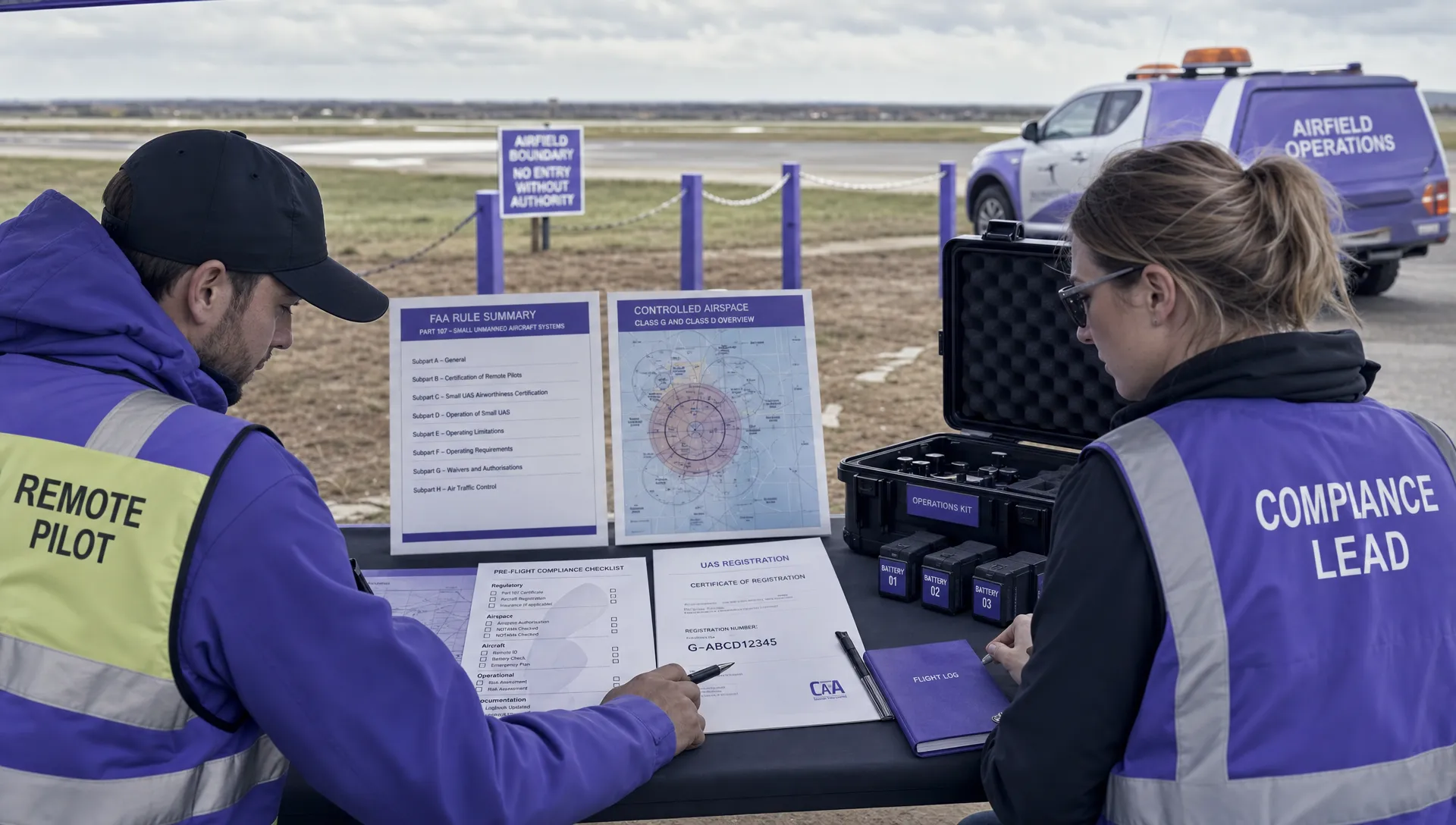 FAA Unmanned Aircraft Regulations Made Simple →
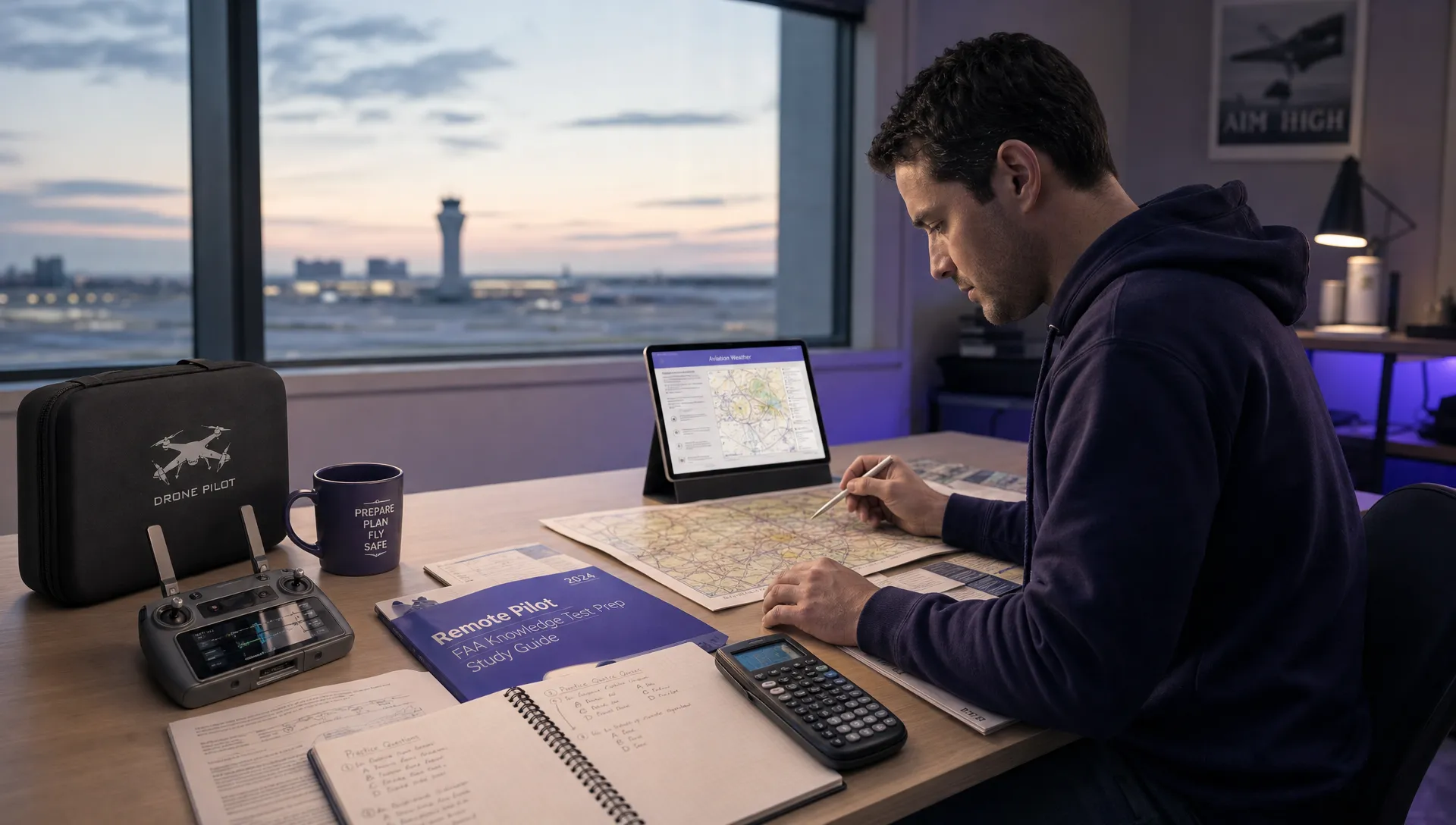 Part 107 Test Tips to Pass With Confidence →
 How to Pass the FAA Drone Written Test First Time →
 What a BVLOS Flight Means for Risk and Compliance →
 Drone VLOS Rules Explained for Commercial Teams →
 FAA Remote ID Rule Explained for Commercial Pilots →
 Drone Legal Requirements for Commercial Operations →
 Drone Near Airport Rules Explained for Safer Planning →
 International Drone Regulations Every Global Team Should Know →