Dronedesk Airspace Intelligence | Smarter Drone Flight Planning
Think of trying to navigate a bustling city with nothing but a year-old paper map. Now, picture having a live GPS that not only maps your route but also flags traffic jams, alerts you to road closures, and points out potential hazards before you even get there. That's the leap Dronedesk Airspace Intelligence provides for drone pilots.
What Exactly Is Dronedesk Airspace Intelligence?
This isn't just about looking at a map of the sky; it’s a living, breathing system designed to be your co-pilot on every mission.
It goes way beyond static charts to give you a complete, real-time picture of your entire operational environment. By pulling together ground hazards, airspace rules, and environmental conditions into one simple platform, it makes complex flight planning safer and more straightforward for any drone job. At its heart, Dronedesk relies on sophisticated real-time data analytics to crunch all that complex data and give you insights you can actually use.
Beyond The Map A Cohesive Operational Picture
Dronedesk delivers a clear, multi-layered view of your mission area, bringing all the data you need into one place. This cohesive approach is a game-changer, turning scattered bits of information into a real strategic advantage. It ensures every single flight is planned with total awareness.
The platform’s dashboard gives you that central hub for all your critical flight data.

This single screen gives pilots a complete operational picture—from spotting hazards to confirming compliance—long before the props start spinning. If you want to dive deeper into how this all comes together, check out our guide on the benefits of an airspace intelligence platform.
The demand for this kind of detailed aerial data is exploding across countless industries. Drone data services, which are the backbone of platforms like Dronedesk, are a booming market. In 2024, the industry hit a global value of around USD 2.64 billion. Projections show it rocketing to USD 39.29 billion by 2034, which just goes to show how critical these aerial insights have become.
To give you a clearer idea of what goes into this "cohesive picture," we've broken down the key information layers that Dronedesk integrates. Think of each layer as a different piece of the puzzle, all coming together to show you exactly what you're flying into.
Key Data Layers in Dronedesk Airspace Intelligence
| Intelligence Layer | What It Provides Pilots | Primary Benefit |
|---|---|---|
| Airspace Restrictions | Real-time alerts for controlled airspace, temporary flight restrictions (TFRs), and no-fly zones. | Compliance. Avoids accidental airspace violations and potential fines. |
| Ground Hazards | Identification of schools, hospitals, power lines, railway lines, and other sensitive ground locations. | Safety. Enables pilots to plan flight paths that minimize risk to people and property on the ground. |
| Environmental Data | Live and forecast weather conditions, including wind speed, gusts, precipitation, and solar flare activity (KP index). | Mission Viability. Helps pilots determine if conditions are safe for flight and prevents weather-related incidents. |
| Topographical Information | Elevation data and terrain mapping for the operational area. | Situational Awareness. Provides a better understanding of the physical landscape to avoid collisions and plan efficient flights. |
| Regulatory Boundaries | Clear mapping of local, national, and international aviation authority rules and boundaries. | Certainty. Ensures that every flight plan is fully compliant with the governing regulations for that specific location. |
By weaving all these data sources together, Dronedesk moves beyond just showing you where you can fly and tells you how to fly there safely and legally. It’s about making informed decisions, not just following a line on a map.
Understanding the Three Pillars of Airspace Awareness
To really get a feel for what Dronedesk’s airspace intelligence can do, it helps to stop thinking of it as a single feature. Instead, picture it as a complete system built on three distinct, interconnected pillars. Each pillar tackles a different kind of risk, and by weaving them together, Dronedesk creates a complete operational picture you just can’t get by patching together separate tools. This approach turns a complex puzzle of potential dangers into a clear, manageable flight plan.
Think of it like building a sturdy three-legged stool. If one leg is weak or missing, the whole thing becomes unstable. Dronedesk makes sure all three legs—Ground Hazards, Airspace Regulations, and Dynamic Environmental Factors—are rock solid, giving you a firm foundation for every single mission.
Pillar One: Ground Hazards
The first pillar of awareness starts right on the ground. Before a drone even comes out of its case, a pilot has to understand the landscape below. This is about more than just glancing at a satellite map; it’s about identifying specific, ground-based risks that could affect the flight or be endangered by it.
Dronedesk automatically flags critical infrastructure and sensitive locations, transforming a simple map into a detailed hazard overview. This includes pinning down features like:
- Schools and Hospitals: Areas with vulnerable populations that demand much wider safety buffers.
- Power Lines and Railways: Critical infrastructure that represents a direct collision risk.
- Prisons and Other Secure Facilities: Locations that often come with strict no-fly rules.
By seeing these ground hazards laid out directly within the flight planning interface, pilots can proactively map out safer flight paths. This pillar is all about preventing incidents by knowing the environment from the ground up, making sure the mission is safe for both the drone and the community below.
Pillar Two: Airspace Regulations
The second pillar lifts our focus from the ground into the sky, where a complicated web of invisible rules governs every flight. For a lot of pilots, navigating controlled airspace, no-fly zones, and temporary restrictions is the most intimidating part of staying compliant. Dronedesk’s airspace intelligence acts like a digital interpreter, translating this regulatory minefield into a simple, visual guide.
Instead of making you sift through dense aviation charts and text-heavy notices, the platform lays this information out as clear, color-coded layers on your map. This pillar handles the legal and regulatory side of a flight, making sure every mission is totally compliant.
By translating complicated aviation rules into an intuitive visual format, Dronedesk effectively removes the guesswork from compliance. It allows pilots to see exactly where they can and cannot fly, making it easier to plan legal missions with confidence.
This infographic shows how Dronedesk helps a professional manage the crucial pillar of compliance tracking right from their workstation.
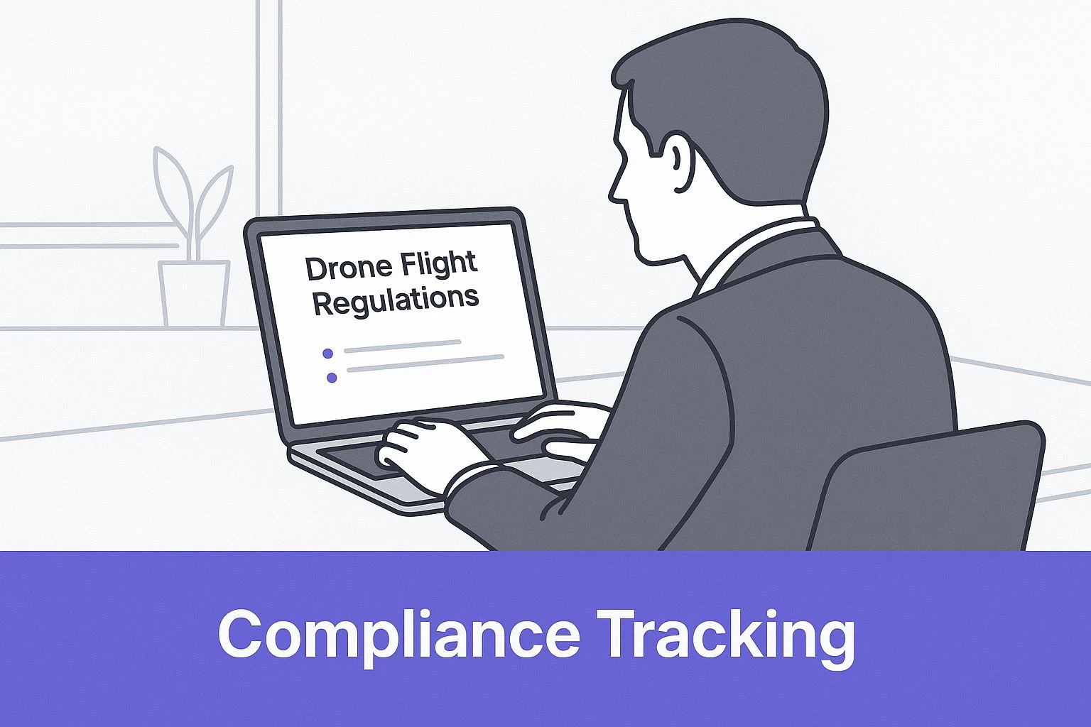
The visualization highlights that modern drone operations require integrated tools that make complex regulatory data accessible and actionable for every flight.
Pillar Three: Dynamic Environmental Factors
The final pillar is all about the unpredictable and ever-changing elements of nature. A flight plan that looks perfect on a clear, calm day can become incredibly dicey with a sudden turn in the weather. Dronedesk airspace intelligence pulls in real-time and forecast data to account for these dynamic factors, which can include:
- Weather Conditions: Wind speed, gusts, precipitation, and visibility.
- Solar Activity (KP Index): High solar activity can mess with GPS signals, putting flight stability at risk.
- Bird Migration Patterns: Seasonal data can warn pilots about the increased risk of bird strikes in certain areas.
This third pillar acknowledges that a safe flight plan is never set in stone. It has to be able to adapt to real-world conditions that can change from one minute to the next. By serving up this crucial environmental data, Dronedesk gives pilots the foresight they need to avoid being caught off guard by unpredictable weather or natural events, ensuring the mission is both viable and safe.
How AI Transforms Flight Planning and Reduces Risk
What really sets Dronedesk apart from your average mapping tool is its intelligent core. Behind the scenes, artificial intelligence and automation are constantly at work, crunching enormous amounts of data. It's like having an experienced mission planner looking over your shoulder for every single flight.
Think of it less like a simple database and more like a seasoned air traffic controller who sees potential conflicts long before they ever become a problem. This forward-thinking approach is built into the platform's DNA, turning raw data into insights you can actually use.
The platform’s sophisticated algorithms are always analysing weather forecasts, new flight restrictions, and complex ground-level data. The goal is to deliver predictive insights that truly empower pilots. This is where the power of Dronedesk airspace intelligence comes into its own, moving beyond just showing you information to providing genuine operational guidance.
From Data Overload to Actionable Intelligence
In the world of drone operations, pilots often feel like they're drowning in disconnected data streams. You've got your weather apps, separate airspace maps, and a bunch of PDF documents outlining site hazards. The real challenge isn't getting the data; it's making sense of it all quickly and without missing anything. This is where AI is a complete game-changer.
Dronedesk's system pulls all these different sources together into a single, coherent picture. It doesn't just show you a weather forecast; it interprets how that forecast, combined with local topography and airspace rules, will specifically affect your mission's risk profile.
This shift from data overload to actionable intelligence saves countless hours of manual work. More importantly, it drastically cuts down the potential for human error. The system does the heavy lifting, so you can focus on what you do best: flying safely. You can discover more about the applications of artificial intelligence in our detailed article on how AI is shaping drone operations.
Automated Compliance and Smart Risk Mitigation
One of the most powerful ways AI is used within Dronedesk is for compliance and risk management. The platform runs automated checks that cross-reference your flight plan against a constantly updated database of regulations and known hazards.
By automating routine compliance checks, Dronedesk frees up pilots to concentrate on the unique, mission-specific challenges that require human expertise. It acts as a safety net, ensuring no critical regulatory detail is overlooked during the planning phase.
Instead of you having to manually verify every single detail, the system flags potential issues for you. For instance, it can spot if your planned route crosses an unexpected temporary flight restriction (TFR) that was only issued a few hours before your flight. But it doesn't stop there; it also offers smart suggestions.
- Smart Hazard Alerts: If your flight plan is a bit too close to a school or a power line, the system won't just flag it. It might also suggest a safer alternative route.
- Predictive Weather Warnings: The AI analyses wind speed forecasts and will warn you if gusts are predicted to exceed your drone's operational limits during your planned flight window.
- Compliance Prompts: It ensures your pre-flight checklists and risk assessments are completed in line with specific regulatory standards, preventing any accidental slip-ups.
This proactive support turns flight planning from a reactive chore into a strategic, forward-looking activity.
The integration of artificial intelligence is profoundly reshaping the entire drone industry. The global market for AI in drones was valued at around USD 658.6 million in 2024 and is projected to jump to USD 2,751.9 million by 2030. This explosive growth, a compound annual growth rate of 27.4%, is fuelled by the enhanced decision-making and autonomy AI brings to platforms like Dronedesk. You can explore the full research on the expanding AI in drones market to understand its industry-wide impact.
Applying Dronedesk in Commercial Drone Operations
Theory is great, but seeing how a tool performs in the real world is where you really see its value. To show you the practical power of Dronedesk airspace intelligence, let's walk through how it turns complex jobs into straightforward, compliant missions across three very different commercial scenarios.
This isn’t just about looking at maps. It's about seeing the platform as a complete operational hub that solves specific industry challenges. From congested cities to sprawling farmland, Dronedesk brings the clarity and control you need for safe, repeatable success.
Construction Survey Near Controlled Airspace
Imagine a construction firm needs to survey a new development. The big problem? The site is just two miles from a regional airport, putting it squarely within controlled airspace. This kind of job is a compliance minefield where there’s absolutely no room for error.
The project manager starts by creating a new job in Dronedesk and linking it to the client. First up in the flight planning module, they draw a quick polygon around the survey area on the map. Instantly, the platform’s airspace intelligence layer sparks to life, highlighting the Class D airspace boundary and showing the FAA-approved altitude grid.
- Automated Hazard Identification: Dronedesk doesn’t just flag the controlled airspace. It also picks up nearby ground hazards, including a school and major power lines bordering the property.
- Integrated Risk Assessment: The system then prompts the pilot to complete a risk assessment based on these identified hazards. The pilot notes down mitigation strategies, like using a visual observer to keep an eye on the power line corridor and scheduling the flight outside school hours.
- Streamlined Authorization: Because Dronedesk pulls all this data together, generating the pre-flight reports needed for compliance is just a matter of a few clicks. The pilot ends up with a complete job pack containing maps, risk assessments, and flight parameters, all ready to go.
By weaving these elements together, Dronedesk transforms a high-risk mission into a structured, documented, and fully compliant operation. The team can get on with the job confidently, knowing every regulatory box has been ticked.
Agricultural Consulting in a Rural Area
Next up, let's picture an agricultural consultant monitoring crop health across a huge, 500-acre farm. Here, the challenge isn't so much controlled airspace but managing a large-scale operation efficiently while staying aware of less obvious environmental and ground-level risks.
The consultant uses Dronedesk to plan a series of automated flights to cover the whole property. A quick look at the airspace intelligence feature confirms the area is free from major flight restrictions. But its real value goes much deeper than that initial check.
Dronedesk’s strength in rural operations lies in its ability to consolidate environmental and ground hazard data, providing a complete safety overview even in areas that appear simple on the surface.
The platform automatically pulls in crucial data layers that are vital for this kind of mission:
- Weather Forecasting: The built-in forecast flags a period of high winds predicted for the afternoon, letting the pilot schedule the flight for the calmer morning window.
- Solar Activity (KP Index): Dronedesk displays the KP index, warning the pilot about potential GPS signal issues due to solar activity—a critical factor for flights that depend on precise automated navigation.
- Ground Hazard Details: Even out in the countryside, the system identifies a railway line that cuts through the property, making sure the flight plan maintains a safe buffer.
This complete intelligence picture allows the consultant to carry out the mission safely and efficiently, dodging weather-related problems and ensuring the flight data is solid. As operations grow, knowing how to manage multiple sites becomes crucial. You can learn more about how Dronedesk for scaling helps businesses manage expanding drone programs effectively.
Media Production in a Dense Urban Environment
Finally, let’s follow a media crew capturing aerial shots for a commercial in a bustling city center. This is the ultimate test of situational awareness, blending regulatory headaches with huge ground risk.
The Dronedesk workflow starts with outlining the desired flight paths over the city streets. The airspace intelligence engine immediately paints a complex picture of overlapping restrictions, temporary flight notices, and a ton of ground hazards. The system automatically spots schools, hospitals, and public transport routes within the operational area.
A key feature for this scenario is the ability to generate detailed site plans and safety reports that can be shared with local authorities and the production team. Dronedesk pulls all the critical information—airspace maps, identified risks, flight times, and pilot certifications—into a single, professional briefing document.
This turns the platform into a vital communication tool, proving due diligence and professionalism to clients and regulators. For the media crew, Dronedesk isn't just for planning; it's for securing the trust and permissions needed to fly in such a challenging environment. It transforms a logistical nightmare into a clear, methodical, and safe production workflow.
Integrating Dronedesk into Your Aviation Ecosystem
Effective drone operations are rarely a solo act. A professional flight isn't just about a pilot and their drone; it's one piece of a much larger puzzle involving data, regulations, and business goals. Viewing a platform like Dronedesk as just another app misses the point entirely. It’s designed to be the central nervous system of a modern aviation ecosystem, connecting your flights to the bigger picture.
Thinking this way is crucial. Adopting a platform with robust Dronedesk airspace intelligence isn't just about making today's mission easier—it's a strategic move to future-proof your entire drone program. You're laying the groundwork for participating in an increasingly integrated and automated sky.
Beyond a Tool A Central Operational Hub
Try to think of Dronedesk less like another piece of software and more like the command centre for your entire operation. The data and insights you gather during flight planning and execution don't just evaporate after a mission. They become valuable assets that feed back into every other part of your business.
This constant loop of information helps you refine and improve your entire workflow. It’s about building a smarter, more efficient operation from the ground up.
The intelligence gathered from each flight can directly inform:
- Fleet Management: Flight hours and component usage are logged automatically. This gives you a crystal-clear picture of your fleet's health, allowing for predictive maintenance that stops costly equipment failures before they happen.
- Pilot Training: By spotting recurring challenges or near-misses from flight data, you can pinpoint specific areas where pilots might need a bit more training, like operating in complex airspace.
- Broader Business Strategy: Analysing job profitability, time spent on compliance, and how your equipment is deployed helps you make smarter calls about which contracts to chase and how to scale your services effectively.
By connecting these dots, Dronedesk turns isolated flight data into a powerful business intelligence engine.
Preparing for the Future of Aviation
The aviation world is on the cusp of a huge shift, with Unmanned Traffic Management (UTM) systems moving from concept to reality. Think of UTM as air traffic control for drones, designed to manage the low-altitude sky safely and efficiently. Platforms like Dronedesk are the foundational building blocks for this future.
By getting comfortable with comprehensive airspace intelligence today, you're essentially learning the language of tomorrow's automated sky. Your operations will already be fluent in the kind of data-driven planning and compliance that will be mandatory in a UTM environment.
This proactive approach means your business won't get left in the dust as the industry evolves. You'll be ready for future innovations like automated drone deliveries and Urban Air Mobility (UAM), where seamless integration into a managed airspace system will be non-negotiable.
Laying the Groundwork for Innovation
The growth in this sector is impossible to ignore. The intelligent drone airport market, which is tightly linked to airspace intelligence systems like Dronedesk, is poised for massive expansion. Valued at roughly USD 500 million in 2025, the market is projected to grow at a compound annual growth rate of around 25% through 2033. This surge is being driven by the explosion of drones in delivery, surveillance, and inspection—all of which rely on sophisticated traffic management. You can read the full research about the intelligent drone airport market to see exactly where the industry is headed.
Ultimately, bringing a system like Dronedesk into your workflow is about more than just simplifying today’s flights. It's an investment in operational maturity and readiness. It positions your drone program not just to survive in the future aviation landscape, but to be a leader within it.
Got Questions About Dronedesk Intelligence?
Even with a solid grasp of what Dronedesk can do, it's totally normal to have a few specific questions pop up. It's one thing to read about features, but it's another to see exactly how Dronedesk airspace intelligence slots into your day-to-day work. Let's tackle some of the most common ones we hear to clear things up.
Think of this as moving from the 'what' to the 'how'. The goal is to make sure you're completely confident in what the platform brings to the table before you weave it into your operations.
How Does Dronedesk Data Differ From Free Apps?
This is a big one, and probably the most important question for any professional pilot. Free airspace apps are fine for a weekend hobbyist, but they just don't have the depth, detail, or integrated smarts you need when your business is on the line. Dronedesk is a whole different ecosystem.
It’s not just about slapping some restricted zones on a map. It’s about the quality and layers of data you’re getting. Most free apps give you the bare minimum—a basic look at controlled airspace and maybe some major advisories.
Dronedesk, on the other hand, pulls from multiple premium data streams to paint a complete picture of your operating environment:
- Real-world Ground Hazards: We go way beyond the basics to pinpoint risks like schools, hospitals, power lines, and railways—critical details often missing from free services.
- Layered Regulatory Info: The platform stacks national airspace rules with local advisories, giving you a much clearer path to compliance.
- Constant, Verified Updates: Our data is refreshed on a strict schedule. Critical stuff like TFRs and NOTAMs? That happens in near real-time, so you’re never caught out by old information.
For any commercial operator, flying with free, non-guaranteed data is a business risk you can't afford to take. Think of Dronedesk's professional-grade intelligence as an investment in safety, compliance, and your reputation.
At the end of the day, Dronedesk is built for professional accountability. The data isn't just for show; it’s a cornerstone of a system designed to create a solid, verifiable audit trail for every single flight. Free apps simply weren't built for that.
Is Dronedesk Better for Solo Pilots or Large Teams?
We designed Dronedesk to scale right from the get-go. It works just as well for a one-person operation as it does for a fast-growing enterprise. That flexibility is baked right in, so the tool grows alongside your business.
A solo pilot's workflow is worlds apart from a large team's, and Dronedesk handles both beautifully.
For the solo pilot, it's your all-in-one command center. It pulls flight planning, risk assessments, client management, and even invoicing into one smooth process. This slashes the time you spend on admin, freeing you up to do what you do best: fly and win more work.
For large teams, Dronedesk offers a powerful set of tools for collaboration and oversight:
- Fleet Management: Keep tabs on maintenance schedules, flight hours, and battery cycles for every drone you own.
- Team Collaboration: Assign pilots to jobs, share flight plans, and make sure everyone is working from the latest, most accurate information.
- Smart Permissions: An operations manager can keep a bird's-eye view of everything while giving individual pilots the exact access they need to plan and fly their missions safely.
This scalability means you never have to worry about outgrowing the platform. Whether you're a one-person crew or managing a team of fifty, the core Dronedesk airspace intelligence and management tools flex to fit your needs.
How Frequently Is the Airspace Data Updated?
In aviation, old data isn't just unhelpful—it's dangerous. You can't afford to fly with outdated information. That's why Dronedesk uses a multi-layered update schedule to make sure the intelligence you're seeing is as current as humanly possible.
Different data types get refreshed at different rates, depending on how quickly they change and how critical they are to your mission.
We pull from a mix of official and commercial sources, each with its own update cycle. This blended approach gives you the most comprehensive coverage.
| Data Type | Update Frequency | Why It Matters |
|---|---|---|
| TFRs & NOTAMs | Near Real-Time | These are dynamic, short-notice restrictions for things like events or emergencies. Instant updates are essential. |
| Controlled Airspace | Daily/Weekly | Airport and military zone boundaries are mostly stable, but we check them constantly for any official changes. |
| Ground Hazards | Monthly/Quarterly | Data on schools, hospitals, and infrastructure is updated periodically to reflect new construction or changes in land use. |
| Weather Data | Real-Time & Forecast | You get live wind and precipitation data plus multi-day forecasts to ensure your mission is a go from a safety standpoint. |
This tiered system means the most time-sensitive info, like a pop-up TFR for a wildfire, hits your dashboard almost immediately. You can plan and fly knowing you have the freshest operational picture available.
Can Dronedesk Be Used for International Flights?
Absolutely. While Dronedesk was born in the UK and has incredibly deep integrations with CAA and EASA regulations, its reach is global. We have thousands of pilots using the platform in countries all over the world.
That said, the depth of specific regulatory tools can vary by region. The core Dronedesk airspace intelligence—your airspace maps, ground hazards, and weather data—is available for most international locations. Pilots outside the UK and EU still get huge value from the planning and management features.
Just remember: when you're planning international flights, it's always your responsibility as the pilot to double-check and comply with the local aviation authority's rules. Dronedesk gives you a powerful planning framework, but nothing replaces verifying against the specific regulations of the country you're operating in.
Ready to transform your flight planning from a chore into a strategic advantage? Discover how Dronedesk can bring clarity, safety, and efficiency to your entire drone operation. Explore Dronedesk's features and start your free trial today.
 Drone Legal Requirements for Commercial Operations →
 Drone Near Airport Rules Explained for Safer Planning →
 International Drone Regulations Every Global Team Should Know →
 Drone Flight Risk Assessment Example for Safer Missions →
 Beyond Visual Line of Sight Explained for Operators →
 How BVLOS Drone Operations Change Commercial Workflows →
 FAA Drone Rules Every Commercial Pilot Should Know →
 FAA 107 Explained for Commercial Drone Operators →
 Canadian Drone Regulations Explained for Business Use →
 FAA Part 107 Drone License Explained for Beginners →