A Pilots Guide to Restricted Air Space Maps
Restricted air space maps are, quite simply, the official rulebooks for the sky. They show drone pilots exactly where they can and cannot fly. Think of them as the critical safety tool that prevents your drone from bumping into manned aircraft or straying over sensitive locations. In short, they keep every flight safe and on the right side of the law.
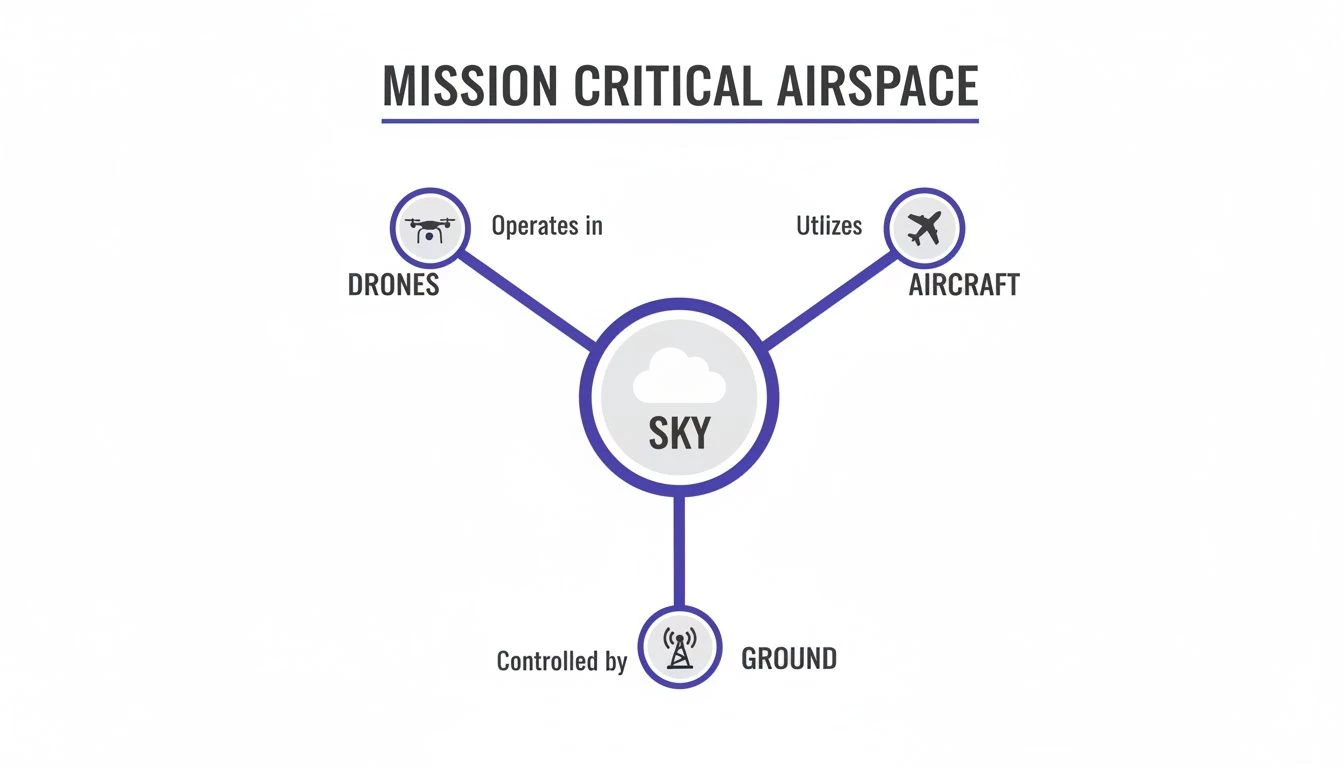
Why Restricted Air Space Maps Are Mission Critical
Imagine trying to drive through a major city with no road signs, no traffic lights, and no GPS. You’d have no idea which streets are one-way, where the school zones are, or if the motorway ahead is shut down. It would be chaos. That's exactly what flying a drone without checking restricted airspace maps is like—reckless, dangerous, and illegal. These maps are the definitive traffic system for the air.
For any professional drone pilot, these charts aren't just a friendly suggestion; they're a non-negotiable part of every single flight plan. They provide the intel you need to avoid catastrophic mistakes. Flying into the wrong airspace could disrupt commercial flights, interfere with military operations, or even pose a threat to national security. The penalties for getting it wrong are severe.
Understanding the Invisible Fences
At their core, restricted air space maps show you the invisible boundaries in the sky. These aren't just random lines drawn on a chart; each one is there for a very specific, and usually very important, reason. They act as digital fences, protecting everything from national landmarks to active military training grounds.
Two fundamental types of restrictions you'll see time and again are:
- Prohibited Areas (P-Areas): These are absolute no-fly zones. They’re typically established over sites critical to national security, like the White House or Camp David. Entry is forbidden, period.
- Restricted Areas (R-Areas): These zones often contain unusual and invisible hazards, like live artillery fire or aerial gunnery practice. They aren't always active, but you must get permission from the controlling agency to enter when they are.
Ignoring these is not an option. To give you some scale, the United States alone has over 370 restricted areas, and every country has its own complex web of airspace rules.
The Challenge of a Sky That Changes
One of the biggest traps a drone pilot can fall into is assuming the sky is static. It’s not. Airspace is a dynamic environment that can change with little or no warning. A political rally, a wildfire, or a major sporting event can trigger a Temporary Flight Restriction (TFR), instantly creating a new no-fly zone that simply wasn't there yesterday.
A TFR can pop up on the maps with very short notice, which makes real-time data absolutely essential. Relying on a printed chart or an old screenshot is one of the fastest ways to commit an airspace violation without even realizing it.
This constant potential for change is precisely why professional operators lean on platforms that deliver live, updated airspace intelligence. A map from last week is already out of date. Constant vigilance and access to real-time data are the bedrock of compliant and safe drone operations, turning potential disasters into routine, successful flights.
How to Read Aeronautical Charts and Symbols
Let's be honest, opening an aeronautical chart for the first time feels like you're trying to decode an ancient language. It's a jumble of lines, colours, and cryptic labels that looks more like abstract art than a practical tool. But for a drone pilot, those symbols are pure gold. They're the key to turning that confusing map into a clear, actionable source of intelligence for every flight.
This isn't about memorizing every single symbol like you're cramming for a test. It's about learning to spot the visual patterns that scream danger, caution, or "you need special permission to fly here." With a bit of practice, you’ll be able to glance at a chart and instantly understand the story it’s telling about the sky above your job site.
Decoding the Language of the Sky
Think of an aeronautical chart as a visual language. Different shapes and colours communicate specific rules and warnings. For us drone operators, the most critical symbols are those that mark out Special Use Airspace (SUA). These are chunks of the sky set aside for reasons of national security or public safety.
On a typical VFR (Visual Flight Rules) sectional chart, these areas are hard to miss once you know what to look for. They’re usually outlined with thick, hashed borders and labelled with a letter and number. This is all about ensuring everyone—manned aircraft, drones, and ground control—can operate safely in a shared environment.
This diagram gives a great sense of just how busy the sky can be. It’s not just empty space; it’s a managed system, and we all have a part to play in keeping it safe.
Key Symbols You Absolutely Must Know
While the charts are packed with information, a handful of symbols are absolutely vital for avoiding a very bad day. Getting these wrong can lead to serious violations, so let’s nail down the most common ones you'll see.
- Prohibited Areas (P-###): Marked with a 'P' followed by a number (like P-56 over the White House). These are outlined with a blue hashed border and are permanent, no-fly zones. No ifs, ands, or buts. Entry is forbidden.
- Restricted Areas (R-###): Labeled with an 'R' and a number (e.g., R-2501). These areas hide invisible hazards like artillery firing, missile testing, or other military activities. You cannot fly here when the area is “active” or “hot.”
- Military Operations Areas (MOAs): These are outlined with a magenta hashed border. While you’re not technically forbidden from flying here, MOAs are where military aircraft practice high-speed, acrobatic manoeuvres. Flying a drone here without extreme caution is asking for trouble.
To help you get your eye in, here’s a quick-reference table that breaks down the most common airspace types you'll need to identify.
Understanding Special Use Airspace Designations
| Airspace Type | Purpose and Typical Location | Drone Access Rules | Chart Symbol Example |
|---|---|---|---|
| Prohibited (P) | Areas critical to national security, like the White House or Camp David. | Entry is strictly forbidden at all times. No exceptions. | Bold blue hashed line with "P-" and a number (e.g., P-40). |
| Restricted (R) | Contains invisible hazards like artillery firing or guided missiles. Often over military bases. | Entry is forbidden when the area is "active." Check chart notes for active times. | Bold blue hashed line with "R-" and a number (e.g., R-2505). |
| Warning (W) | Similar to Restricted Areas but located over domestic or international waters. | Same rules as Restricted Areas. Avoid when active. | Bold blue hashed line with "W-" and a number. |
| Military Operations Area (MOA) | Designated for military training activities like aerobatics and abrupt flight manoeuvres. | VFR flight is permitted, but exercise extreme caution. Drones should avoid if possible. | Bold magenta hashed line. |
| Alert (A) | Areas with high volumes of pilot training or unusual aerial activity. | No specific restrictions, but be extra vigilant for other air traffic. | Bold magenta hashed line with "A-" and a number. |
Memorising these key differences will give you the foundational knowledge to quickly assess a potential flight area and spot immediate red flags.
Putting It All Together with Chart Legends
Every piece of special use airspace on a chart comes with a backstory. You’ll find all the crucial details in the chart's legend or side panel. This isn't optional reading; it's mission-critical information.
That alphanumeric code, like R-4808N, is your key. It lets you look up the fine print: the specific operational hours, the altitude limits in Mean Sea Level (MSL), and which agency you need to contact for more information.
For example, a restricted area might only be active from 0800 to 1700 on weekdays. Flying there on a Sunday could be perfectly fine, but launching at noon on a Tuesday might put you in direct conflict with military aircraft. The details are everything, and they’re always on the chart if you know where to find them.
If you want to go even deeper, our detailed guide on how to read aeronautical charts is a great next step. Mastering these symbols is what turns confusion into confidence, ensuring every flight is built on a foundation of solid, reliable airspace intelligence.
Understanding Global Airspace Regulations
Flying a drone isn't like driving a car, where the rules are pretty much the same from one county to the next. The moment you cross an international border, the entire rulebook for the sky can flip on its head. What's standard procedure in North America could be a serious breach in Europe, making a global perspective on restricted air space maps an absolute must for any operator with international clients.
Airspace regulations aren't cooked up in a vacuum; they're a direct reflection of a country's national security concerns, geography, and its unique aviation culture. A drone pilot can't just assume the symbols and rules they know from home will apply everywhere. The sheer complexity of these differences highlights the massive challenge of staying compliant on a global scale.
FAA vs. EASA: A Tale of Two Systems
To get a real sense of this global patchwork, let's look at the two titans of aviation regulation: the U.S. Federal Aviation Administration (FAA) and the European Union Aviation Safety Agency (EASA). While both are obsessed with safety, their philosophies on managing the sky have key differences that directly affect drone pilots.
- The FAA Approach (North America): The FAA uses a more segmented system with clearly defined airspace classes (Class B, C, D, E, G) and Special Use Airspace, like Restricted and Prohibited Areas. Getting into controlled airspace often happens through automated systems like LAANC (Low Altitude Authorization and Notification Capability). It’s a very structured, clearly defined environment.
- The EASA Approach (Europe): EASA created a harmonized framework for its member states that's more flexible, categorizing drone operations by their risk level (Open, Specific, and Certified). Here, you'll hear a lot about "U-space" zones, which are specifically designed to manage drone traffic safely and efficiently.
What this means in practice is that a flight plan that's perfectly legal in Ohio might need a completely different set of approvals and risk assessments in Germany. How restricted areas are marked, activated, and communicated can vary wildly, driving home the need for localized, authoritative data.
Geopolitics and the Ever-Changing Map
Beyond the standard rules set by bodies like the FAA and EASA, restricted airspace maps are constantly being redrawn by something far less predictable: geopolitics. National security issues, military tensions, and active conflicts can create dynamic, high-risk zones that simply won't appear on standard charts. These aren't your typical, pre-planned training areas; they are emergency responses to real-world threats.
A drone operator working near a volatile border or in a politically unstable region is playing a different game entirely. An international incident can trigger a new no-fly zone overnight.
Relying on static data in a dynamic world is a recipe for disaster. Real-time intelligence isn't just a convenience; it's a critical safety layer that protects your mission, your equipment, and your reputation from unforeseen global events.
These sudden shifts show just how dangerous it is to use anything but the most current information. In recent years, geopolitical tensions have dramatically reshaped global flight paths, forcing airlines to reroute thousands of flights. A prime example was when Israel and Iran exchanged missile strikes, leading to widespread airspace avoidance across the Middle East. Similarly, the FAA issued an airspace warning for Venezuela's SVZM/Maiquetia FIR due to GPS interference and military activity, with jamming effects reaching up to 250 nautical miles and causing multiple airlines to suspend flights. You can dig deeper into these trends in the 2025 FAA Aerospace Forecasts.
The Critical Need for Centralized Intelligence
For any operator juggling projects across different countries, this global complexity is a huge operational headache. Trying to manually track the regulatory nuances of each country, monitor NOTAMs (Notices to Air Missions) for multiple regions, and stay ahead of geopolitical flare-ups is practically impossible for a small team, let alone a solo pilot.
This is where a centralized, real-time intelligence source becomes non-negotiable. Platforms like Dronedesk solve this by pulling data from multiple official sources around the world into a single, easy-to-read interface. Instead of hopping between dozens of different maps and government websites, you get one unified view of the sky. This ensures your flight plan is compliant no matter where your mission takes you, turning a daunting research task into a simple, automated step in your workflow.
Finding Authoritative Sources for Airspace Data
Let's be blunt: trustworthy, up-to-date data is the absolute bedrock of a safe and compliant flight plan. Using an old or unverified restricted airspace map is like trying to navigate a new city with a ten-year-old road map—you’re not just risking a wrong turn, you’re inviting a serious incident. Locating and verifying official sources for this information isn't just a best practice; it's a foundational skill for every professional pilot.
The sky is a managed environment. Just like road networks have transportation authorities, the airspace has its own governing bodies. These organizations are the primary, authoritative sources for all airspace data. They don't just create the rules; they publish the official charts and updates that pilots are legally required to follow.
Primary Governmental Authorities
For any flight, your first stop should always be the national aviation authority. These agencies are the definitive source of truth for everything related to airspace within their borders.
Here are the key players you need to know:
- Federal Aviation Administration (FAA) in the United States: The FAA is the gold standard for all things aviation in the U.S. Their official digital tools, like the B4UFLY app and the FAA DroneZone, give you direct access to the latest airspace restrictions, airport information, and TFRs.
- Eurocontrol and EASA in Europe: While individual countries in Europe manage their own airspace, Eurocontrol coordinates air traffic management across the continent, and EASA provides the regulatory framework. Pilots should consult their specific national authority (like the UK’s CAA or Germany’s LBA) for detailed local maps.
These primary sources are where all data originates. Any third-party app, no matter how slick, is ultimately pulling its information from these official feeds.
Official Sources vs. Third-Party Apps
Once you know the official sources, you'll find a whole ecosystem of third-party apps designed to make this data easier to digest. It's crucial to understand the difference.
Official data from sources like the FAA is the raw, uninterpreted truth. Third-party apps are interpreters—they take that complex data and present it in a user-friendly format, often adding extra features like flight logging and risk assessment tools.
Let’s break down the two approaches:
| Feature | Primary Official Sources (e.g., FAA Website) | Third-Party Platforms (e.g., Dronedesk) |
|---|---|---|
| Data Reliability | Highest possible; this is the direct source. | Generally high, but depends on the app's update frequency. |
| User Interface | Often functional but can be clunky and a pain to navigate. | Typically modern, intuitive, and designed for an efficient workflow. |
| Additional Features | Limited to raw data and basic map views. | Integrates data with flight planning, logging, and compliance tools. |
| Update Cycle | Data is updated as it's issued, but you may need to check manually. | Often aggregates multiple sources and provides real-time alerts. |
Relying solely on primary sources can be a real time-sink and is prone to human error, especially when you have to manually cross-reference multiple sites and documents. Third-party apps solve this by giving you a unified, easy-to-read view.
However, the golden rule is to always verify the app's data source. A reputable platform will be transparent about where it gets its information and how often it's updated. This is where professional drone management software shines, acting as a reliable bridge between complex official data and practical, mission-ready intelligence. For an in-depth look at how the FAA structures its airspace information, you can learn more about understanding FAA facility maps and their importance in your planning process.
Weaving Airspace Intelligence Into Your Workflow
Knowing how to read restricted airspace maps is one thing. Actually weaving that knowledge into a repeatable, mistake-proof pre-flight routine is what separates the pros from the amateurs. This is where theory hits the tarmac. It’s not just a box-ticking exercise; it’s about turning potential risks into documented facts so that every single launch is built on a solid foundation of safety.
The whole process starts with one simple question: "What does the sky look like over my job site today?" Answering that takes more than a quick glance at a map. You need a system that covers the permanent, long-term restrictions as well as the dynamic, short-notice changes that can pop up at any time. The goal is to build a complete picture of the operational environment long before your props even start to spin.

This shift from manual spot-checks to an integrated system is the very core of modern drone operations. It’s all about creating a single source of truth for every mission.
From Manual Checks to Automated Assurance
Not so long ago, pre-flight airspace checks were a real pain. A pilot would have to pull up an official sectional chart, hunt down the job site's coordinates, and then manually scan for any of those blue or magenta hashed lines. Then, they’d have to cross-reference everything with the latest NOTAMs to see if any TFRs had popped up. It was slow, tedious, and dangerously prone to human error. One missed detail could lead to a serious airspace violation.
Thankfully, technology has turned this chore into a reliable, automated process. Modern drone management platforms have made this manual grind a thing of the past.
The real value of an integrated system is its ability to turn hours of high-stakes manual research into a few seconds of automated analysis. It doesn't just show you the map; it interprets it for you in the context of your specific mission.
By simply plugging in your job details—location, date, time, and maximum altitude—the system does all the heavy lifting. It instantly sifts through layers of data from official sources, giving you a complete, easy-to-read intelligence report.
A Step-by-Step Digital Workflow
Let's walk through how this works in a professional platform like Dronedesk. The entire workflow is designed for efficiency and absolute clarity, completely removing the guesswork.
- Enter Job Details: First, you create a new job and plot your flight area on an interactive map. This defines the lateral and vertical boundaries of your operation.
- Instant Airspace Analysis: The second you define that area, the system cross-references it against a massive database of global airspace data. It checks for airports, controlled airspace, restricted zones, and ground-based hazards.
- Real-Time TFR and NOTAM Alerts: Crucially, the platform also scans for all active and upcoming Temporary Flight Restrictions and NOTAMs that might affect your mission. This live check is what saves you from last-minute surprises.
- Clear Visual Feedback: The results are then laid out visually. Instead of getting a wall of raw data, you see color-coded zones overlaid right on your map, with clear explanations of what each restriction means for your flight.
The Power of an Integrated System
This automated approach does way more than just save time. It builds a documented, auditable trail of due diligence for every single flight. If an incident ever occurs or a client questions your safety procedures, you have an unchangeable record showing that you identified all the risks and planned accordingly.
This integrated workflow creates a powerful feedback loop. By making airspace checks an effortless part of every plan, it fosters a culture where safety and compliance are second nature. The system ensures nothing gets missed, drastically cutting down the risk of human error that plagues manual processes.
To dig deeper into this, you can learn more about how Dronedesk’s airspace intelligence provides this critical operational advantage. Ultimately, it’s about making the safest choice the easiest choice.
Future Trends in Airspace Management
Let's be honest: the sky is getting busier. It’s becoming a more complex environment every single day. For those of us flying drones professionally, wrapping our heads around the future of airspace management isn't just some academic thought experiment—it's a straight-up business necessity.
The trends shaping the skies tomorrow will directly impact the rules, risks, and opportunities for every single flight you plan. By taking a peek at what's over the horizon, you can start preparing your operations for what’s coming next.
A huge part of this change is the massive rebound in global air travel. Passenger planes are back in force, which means the major flight corridors are getting seriously congested. This has a direct knock-on effect for drone operations, as regulators will almost certainly bring in tougher rules to keep everyone safe in these high-traffic areas.

The Squeeze of Congested Skies
Data from the FAA's latest Aerospace Forecast shows just how much restricted air space maps are factoring into long-term travel projections. International passenger capacity has seen solid growth, with traveller numbers across the Atlantic, Latin, Canada Transborder, and Pacific regions jumping by 5.2%.
The Pacific region has really led the charge, bouncing back with 9.3% year-over-year growth. Projections suggest that Pacific passenger numbers could hit 72.4 million by 2045. That gives you a real sense of the increasing density we'll all have to navigate. You can dig into more details about these long-term FAA projections to see the full picture.
What this growing congestion really means is that our margin for error is shrinking. Fast. Regulators will have less patience for airspace infringements, and the pressure for pinpoint-accurate flight planning is only going to intensify.
The future of professional drone operations is all about predictive, real-time intelligence. As the skies get more crowded, the ability to anticipate and deconflict with manned air traffic isn't just about compliance—it’s going to be a key competitive advantage.
Getting Ready for a More Regulated Future
So, what does this mean for your day-to-day workflow? The answer is simple: you have to adopt tools built for this more complicated future. Relying on manual checks of static maps is quickly becoming a thing of the past; they just can't keep up with the dynamic reality of a crowded sky.
Intelligent drone management software like Dronedesk is no longer just a nice-to-have. It’s a foundational piece of the puzzle for future-proofing your business. Here’s why this matters:
- Automated Deconfliction: The next generation of systems will automatically flag potential conflicts with both manned aircraft routes and other drone traffic.
- Predictive Analysis: More advanced platforms will use historical data and live traffic to predict high-risk times and locations, often suggesting safer flight alternatives.
- Dynamic Geofencing: We're going to see more temporary and fluid restrictions that adapt to real-time conditions. You'll need a system that can process these changes instantly.
By taking a forward-looking approach to airspace management, you're setting up your drone operations to be more resilient, competitive, and—most importantly—safe in the increasingly busy skies of tomorrow.
Frequently Asked Questions About Restricted Airspace
Even with the best planning tools at your fingertips, questions inevitably pop up when you're out in the field. Here are a few of the most common ones we hear from professional pilots, with clear answers to help you navigate those real-world situations.
What Is the Difference Between a Prohibited Area and a Restricted Area?
Think of it like this: a Prohibited Area (marked with a 'P' on charts) is a permanent, non-negotiable "No Entry" zone. These are typically established over highly sensitive locations like the White House for national security reasons. Flying here isn't just a bad idea; it's always forbidden. No exceptions.
A Restricted Area ('R'), however, is more like a road that closes for certain events. It’s airspace blocked off for things like military exercises or live-fire training. You can't fly there when it's "hot" or active, but it might be perfectly fine to enter when it's "cold." The key is you must check the active times with the controlling agency before even thinking about flying nearby.
How Do Temporary Flight Restrictions Appear on Maps?
Temporary Flight Restrictions (TFRs) are one of the biggest curveballs for pilots because they can pop up with very little warning. They're often put in place for things like presidential visits, major sporting events, or wildfire suppression efforts.
On any good digital restricted air space map, a TFR will show up as a clearly marked zone, often a circle, highlighted to grab your attention. It will include critical details like when it's active and the specific altitude limits. This is precisely why relying on old-school printed charts is such a massive risk—they won't show you a TFR that was just issued yesterday.
Relying on anything but live, updated airspace data is a significant gamble. A TFR can invalidate your flight plan instantly, turning a routine job into a serious airspace violation if you're not using a system that provides real-time alerts.
Can I Get Permission to Fly in Restricted Airspace?
When it comes to Prohibited Areas, the answer is almost always a hard no. For Restricted Areas, getting permission is technically possible but usually involves a complex and lengthy authorization process directly with the controlling agency. Honestly, it's pretty rare for most commercial drone operations.
It's a different story for controlled airspace around airports (like Class B, C, or D). In the US, you can often get instant, automated authorization through systems like LAANC. A professional flight management platform helps you immediately see what kind of airspace you're dealing with and what practical options you have for getting legal access.
Regulators are only getting stricter. To cut down on collision risks in busy hubs like Washington and Las Vegas, the FAA has been tightening the rules. Meanwhile, drone sightings have shut down major airports in Europe. You can explore more about these global air travel statistics to get a feel for the changing landscape.
Ready to make your flight planning safer, faster, and fully compliant? Dronedesk integrates real-time airspace intelligence directly into your workflow, eliminating guesswork and reducing risk. See how thousands of pilots are saving hours on every job at https://dronedesk.io.
 What a BVLOS Flight Means for Risk and Compliance →
 Drone VLOS Rules Explained for Commercial Teams →
 FAA Remote ID Rule Explained for Commercial Pilots →
 Drone Legal Requirements for Commercial Operations →
 Drone Near Airport Rules Explained for Safer Planning →
 International Drone Regulations Every Global Team Should Know →
 Drone Flight Risk Assessment Example for Safer Missions →
 Beyond Visual Line of Sight Explained for Operators →
 How BVLOS Drone Operations Change Commercial Workflows →
 FAA Drone Rules Every Commercial Pilot Should Know →