How High Can You Fly a Drone A Guide to FAA Rules and Limits
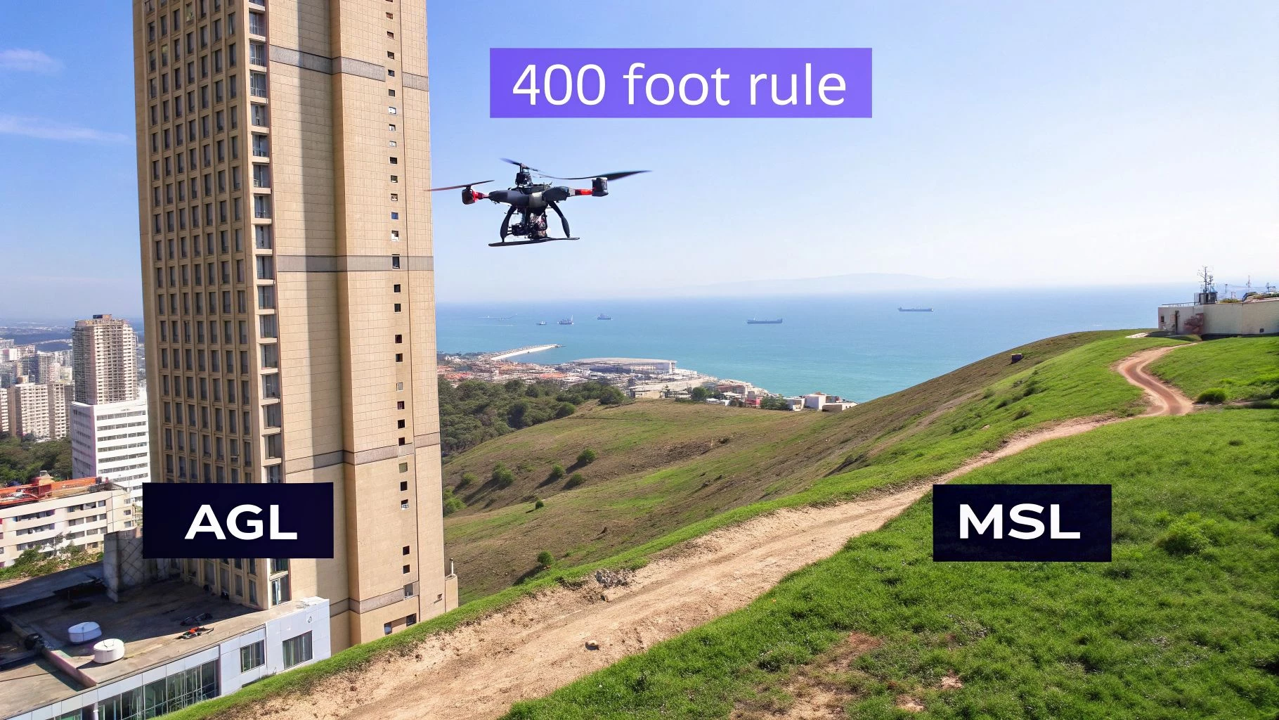
Ask a drone pilot "how high can you fly?" and most will tell you the answer is a firm 400 feet Above Ground Level (AGL). This isn't just an arbitrary number; it's a critical safety buffer established by aviation authorities like the FAA in the US. Think of it as a dedicated, low-altitude lane in the sky, created specifically to keep your drone safely separated from crewed aircraft.
The 400 Foot Rule Explained
While the 400-foot limit seems straightforward, it's more nuanced than it first appears. It’s not just about what your controller's screen says; it’s about constantly maintaining a safe altitude relative to the ground directly beneath your drone.
This is where understanding the difference between AGL and MSL becomes absolutely essential for any pilot.
AGL vs MSL: What Pilots Must Know
To fly safely and stay on the right side of the law, you need to get your head around two key altitude measurements:
- Above Ground Level (AGL): This is your drone's height measured from the ground directly below it. The 400-foot rule is almost always based on AGL, ensuring your drone hugs the terrain at a consistent, safe distance.
- Mean Sea Level (MSL): This measures altitude from the average sea level. It's the standard for crewed aviation but isn't practical for most drone operations because it doesn't account for hills, valleys, or buildings.
Let's make it practical. Say you're standing on top of a 500-foot hill and launch your drone 100 feet straight up. Your AGL is 100 feet, but your MSL is 600 feet. The FAA cares about that 100-foot AGL measurement. This distinction is vital because your legal flight ceiling changes constantly as you fly over rolling terrain.
For more on how geography impacts where you can fly, check out our guide on where you can fly your drone.
The Tall Structure Exception
So what happens when your job is to inspect a 600-foot cell tower or the side of a skyscraper? This is where a crucial exception to the 400-foot rule comes into play for licensed commercial pilots.
The rule allows you to fly up to 400 feet above the uppermost part of a structure, as long as you remain within a 400-foot horizontal radius of it.
This means for that 600-foot tower, you could legally fly at an altitude of 1,000 feet AGL (600 ft tower + 400 ft buffer), but only within that tight cylinder of airspace around the tower itself.
This provision is a perfect example of how regulations adapt to real-world needs. It's specifically designed for professionals doing inspection and survey work, giving them the access they need without putting other air traffic at risk. After all, crewed aircraft are already expected to steer clear of such tall obstacles.
Flying Higher With FAA Waivers and Authorizations
The 400-foot rule is the bedrock of drone safety, but for licensed commercial pilots, it's often just the starting line. Think about it: a professional job inspecting a wind turbine or mapping a skyscraper demands flying much, much higher. To pull this off legally, you've got to understand the sky's invisible zoning laws, known as airspace classes.
Imagine the sky is a city. Class G airspace is like an open field out in the country, where you can fly up to 400 feet with very few restrictions. But the airspace around airports—Class B, C, and D—is more like a bustling downtown district. It's heavily controlled to keep crewed aircraft safe. Flying here, even below 400 feet, requires getting specific permission. This is where authorizations and waivers become essential tools in a professional pilot’s kit.
The Power of LAANC
The fastest way to get a green light for flights in controlled airspace is through the Low Altitude Authorization and Notification Capability (LAANC) system. This automated FAA platform gives pilots near-instant approval to fly in designated areas, typically up to a pre-approved altitude shown on FAA facility maps.
Instead of filling out a mountain of paperwork and waiting, you can request authorization right through an FAA-approved LAANC provider. Many pilots do this directly from within their flight planning software, like Dronedesk. The system checks your request against safety rules and can grant approval in seconds.
- Speed: Get authorization in real-time for those jobs that just can’t wait.
- Access: Unlocks valuable operational areas near airports that would otherwise be completely off-limits.
- Integration: Modern flight management platforms build LAANC right into the pre-flight workflow, making it a seamless step.
This system is a true game-changer. It turns what used to be a complex, bureaucratic process into a simple digital handshake between you and air traffic control.
Beyond the 400-Foot Structure Rule
As we've touched on, the FAA gives you a bit of wiggle room to fly 400 feet above a structure, as long as you stay within a 400-foot radius of it. But what happens when a job requires you to go higher for other reasons? Maybe you're doing an aerial survey that needs to clear tall obstacles scattered across a wide area.
This is where a Part 107 waiver comes into play. A waiver is essentially a formal, long-term permission slip from the FAA that grants you an exception to specific Part 107 rules, including the § 107.51(b) altitude restrictions. Unsurprisingly, getting one is a much bigger lift than a simple LAANC authorization.
A waiver requires you to build a detailed safety case that proves your operation can be conducted just as safely as if you were following the standard rule. You have to demonstrate that your equipment, your procedures, and your pilot training all work together to create a level of safety equivalent to the rule you’re asking to bend.
For example, you might need to use a drone with specialized tracking technology or have multiple visual observers on site to get the nod. The application process is rigorous, no doubt, but a successful waiver can unlock huge commercial opportunities that are simply out of reach for other operators. If you're ready to dive deeper, you can learn more about the Part 107 waiver process in our detailed guide.
Why Planning Is Your Most Critical Tool
Whether you’re pinging LAANC for a quick flight near an airport or methodically building a safety case for a complex altitude waiver, meticulous planning is absolutely non-negotiable. This is where a dedicated drone operations platform becomes indispensable.
Tools like Dronedesk bring all your mission planning into one place. They give you a crystal-clear view of airspace classifications, TFRs (Temporary Flight Restrictions), and LAANC grid altitudes before you even think about stepping into the field. It helps you document your safety protocols, log flight data to prove you were compliant, and manage all the paperwork that comes with authorizations and waivers. For high-altitude flights, this level of documentation isn't just good practice—it's your professional shield, ensuring every single flight is safe, legal, and completely defensible.
Understanding Your Drone's Physical Limitations
Getting legal clearance to fly high is really only half the job. Your drone's own hardware, software, and the surrounding environment create a very real, practical ceiling that has nothing to do with FAA rules. Pushing past these physical limits isn't just a bit risky—it's a surefire way to lose your aircraft for good.
Think of your drone as a mountain climber. The higher it goes, the tougher the conditions get. The air thins out, the temperature plummets, and its radio link back to you on the ground gets weaker and weaker. A successful high-altitude flight means respecting these physical boundaries just as much as the legal ones.
The Challenge of Thin Air
The biggest physical roadblock to a drone's altitude is air density. As you climb, the air gets thinner, which is a massive problem for a multirotor drone that relies on its propellers pushing down on air molecules to generate lift.
With fewer air molecules to "grab," the motors have to spin significantly faster just to stay level. This puts an incredible strain on the whole system.
The point where a drone's motors are screaming at maximum power just to hover is known as its absolute ceiling. It’s a point of no return; climbing any higher is physically impossible. Manufacturers rarely, if ever, publish this number because it’s far too dangerous to test.
This is why most drone makers instead provide a maximum service ceiling. This is the highest altitude above sea level where the drone is guaranteed to still be able to climb at a minimum rate (usually about 100 feet per minute). That’s the number you should be using when planning jobs in mountainous areas.
Environmental Factors That Limit Altitude
Beyond just air density, a handful of other environmental conditions can seriously hamstring your drone's performance up high. These factors can slash your practical flight ceiling on any given day.
- Temperature: It gets a lot colder the higher you go. The lithium-polymer (LiPo) batteries that power most drones hate the cold, and their performance drops off a cliff. A battery that gives you 25 minutes of flight time at sea level might only last 15 minutes at 10,000 feet, which dramatically cuts down your time to get the job done.
- Wind: Wind speeds almost always pick up with altitude. A drone trying to battle strong headwinds at high altitude will chew through its battery at a terrifying rate, turning a standard flight into a frantic dash back to base.
- Signal Strength: Your controller's signal and the drone's GPS link aren't limitless. As the drone climbs higher and gets farther away, both signals get weaker. Losing your connection at high altitude is one of the scariest situations a pilot can find themselves in.
Getting a handle on these variables is absolutely critical. A drone that flies perfectly in warm, calm air at sea level might struggle to even lift off at a high-elevation launch site that’s cold and windy. This has a direct impact on how much work you can actually accomplish, a topic we dive into in our guide to understanding and maximizing drone flight time.
Pushing the Limits Safely
Despite all these challenges, some highly specialized drones are engineered to thrive in these extreme high-altitude environments. These aren't your typical off-the-shelf models; they're kitted out with beefier motors, purpose-built propellers, and rock-solid communication systems designed for thin air and brutal conditions.
A pretty incredible example of this happened in August 2023, when BonV Aero’s heavy-lift UAV smashed a world record by hovering at an unbelievable 19,024 feet above mean sea level in India. This flight, which took place on the world's highest motorable road, proved that with the right engineering, drones can operate where even traditional helicopters can't. You can read about this incredible high-altitude drone flight to see what's truly possible.
For commercial operators, the takeaway is simple: always match your drone to the mission environment. Before you say yes to a high-altitude project, you have to confirm that your equipment's service ceiling and performance specs are well within the safe limits for that specific location and its likely weather. This is where a platform like Dronedesk becomes indispensable—it lets you log and plan for these specific factors, making sure every high-altitude mission is built on a solid understanding of what your drone can actually handle.
Pushing the Boundaries of Drone Altitude
While your day-to-day commercial flights will almost certainly stay well within the legal limits, it’s fascinating to look at the extreme edge of what’s technically possible. These record-breaking, high-altitude flights offer incredible lessons in engineering, aerodynamics, and the kind of meticulous mission planning that professionals can learn from.
These missions aren't just about posting impressive numbers; they are the ultimate testbeds for technology that eventually makes the drones we use every day better, safer, and more capable.
Learning from the High-Fliers
Think of these record attempts as the Formula 1 of the drone world. You don’t drive an F1 car on your daily commute, but the breakthroughs in engine efficiency, safety, and materials developed on the racetrack eventually make their way into the family car. It's the same story here. The lessons learned from sending drones to the edge of space directly impact the battery life and signal stability of your commercial quadcopter.
These boundary-pushing flights drive innovation in a few key areas that directly benefit us as professional operators:
- Aerodynamic Efficiency: Designing a drone to fly in thin air forces engineers to get creative, leading to more efficient propeller and airframe designs that translate into longer flight times for all of us.
- Power Management: Extreme altitude and endurance missions rely heavily on things like solar power and advanced battery chemistry. This research paves the way for better, longer-lasting batteries in the drones we buy off the shelf.
- Signal Integrity: Keeping a solid connection to a drone tens of thousands of feet away requires incredibly robust command-and-control systems. This work helps improve the reliability of the radio links you depend on every day at the job site.
Ultimately, this constant push for performance is what makes our everyday drone operations safer, more reliable, and more powerful.
Reaching the Edge of Space
When we talk about pushing boundaries, some aircraft are in a league of their own. One of the most remarkable examples is a special class of fixed-wing drones known as High Altitude Pseudo-Satellites (HAPS). These are designed to fly for weeks, or even months, in the upper atmosphere.
A stunning example is Airbus's Zephyr S. This solar-powered marvel holds the Guinness World Record for the highest altitude ever reached by a civil drone, soaring to an incredible 22,589.9 meters (74,114 feet) on July 13, 2018. As if that wasn't enough, during the same mission it also set an endurance record by staying airborne for over 25 days, cruising serenely above all weather and conventional air traffic. You can learn more about this historic drone flight and its amazing accomplishments directly from the record keepers.
A record like this isn’t just a technical achievement; it opens up a new frontier for things like persistent surveillance, environmental monitoring, and communications. The engineering challenges of operating at over 70,000 feet are immense, from dealing with extreme cold to flying in incredibly low air density.
To put these incredible feats into perspective, let's compare some of the different high-altitude records. While HAPS like the Zephyr S operate in the stratosphere, other records have been set by more conventional multi-rotor drones, showcasing what's possible with different kinds of technology.
Comparing High-Altitude Drone Flight Records
A look at different types of high-altitude drone flights, their records, and the technology that enabled them, providing context for what is technically possible versus what is legally permissible.
| Record Type | Altitude Achieved (Feet) | Drone / Aircraft Type | Key Takeaway for Professionals |
|---|---|---|---|
| Highest Civil Drone Flight (Absolute) | 74,114 ft | Airbus Zephyr S (HAPS) | Demonstrates the peak of current endurance and solar power tech, far beyond commercial use cases. |
| Highest Quadcopter Flight | 33,000 ft | Custom-built quadcopter | Highlights the incredible potential of multi-rotor platforms, but requires extreme customization. |
| Highest Commercial Drone Launch | 22,000 ft | DJI Mavic Pro (launched from a balloon) | Shows the hardware's resilience but isn't a true flight record. Highlights environmental factors. |
| Typical Legal Ceiling (FAA/CAA) | 400 ft AGL | All standard commercial drones | This is the operational reality for 99% of professional pilots, emphasizing the importance of compliance. |
These records are inspiring, but they also serve as a stark reminder of the massive gap between the technical ceiling and the legal ceiling we operate under every day.
What It Means for Your Drone Business
So, while you won’t be taking your DJI Mavic into the stratosphere anytime soon, these technological leaps have very real, practical benefits. The improvements in battery efficiency, GPS stability, and material science that make these record flights possible are the same innovations that allow your drone to fly longer, capture smoother video, and operate more reliably in tricky conditions.
Understanding these extremes gives you context. It helps you appreciate the incredible engineering packed into your own equipment and informs the way you plan your missions. Knowing the absolute limits of the technology allows you to operate confidently well within the safe, practical, and legal boundaries of your own work.
When it comes down to it, the answer to "how high can you fly a drone" is a story of two ceilings. The first is the legal ceiling, set by regulators to keep everyone safe. The second is the technical ceiling, which innovators are constantly pushing higher.
For the professional pilot, success lies in mastering the rules of the first ceiling while benefiting from the advancements of the second. This is where a comprehensive planning tool like Dronedesk becomes so important, helping you manage every aspect of compliance while letting you leverage the full capabilities of your aircraft.
Planning Your High Altitude Drone Mission
Knowing the rules and the physical limits of your drone is one thing, but pulling off a successful high-altitude mission comes down to meticulous, repeatable planning. It’s all about bridging that gap between theory and what you actually do on site. This means building a workflow that covers every single variable, from checking the airspace to filing your post-flight reports.
This isn't just about knowing how high you can fly; it’s about proving you can do it safely and legally, every single time.
Let’s walk through a real-world scenario. Say you’ve been hired to inspect a 750-foot communications tower. Right away, you know you’re operating beyond the standard 400-foot AGL ceiling. This is a professional, high-stakes job. Your first move isn’t to power up the drone. It’s to open your flight management software.
The chart below gives you a good sense of how drone altitude capabilities progress, from your everyday commercial flights right up to record-breaking attempts.
You can see the clear technological and regulatory steps involved. Moving past the usual commercial ceilings requires some seriously specialised gear.
Pre-Flight Intelligence Gathering
Before you even think about quoting the job, you need to run your initial checks. This is the critical go/no-go stage where you figure out if the mission is even possible. It's a multi-layered assessment that a platform like Dronedesk can automate, saving you what would otherwise be hours of painful, manual cross-referencing.
- Airspace Check: First thing's first: what's the airspace class around that tower? If it's controlled airspace (like Class B, C, or D), you'll need LAANC authorization, even for lower-altitude flights. You also need to scan for any active TFRs that could ground you immediately.
- Structure Rule Check: For our 750-foot tower, the "tall structure exception" is your ticket to fly legally. The rule lets you operate up to 400 feet above the tower's highest point—that's 1,150 feet AGL in this case. But, and this is a big but, you must stay within a 400-foot horizontal bubble around it. Your flight plan has to be locked into that invisible cylinder.
- Weather and Drone Suitability: Next up is the environment. Check the weather forecast, but not for the ground—check it for your planned altitude. A gentle breeze at your feet could be a raging gale at 1,000 feet. You also have to confirm your drone's maximum service ceiling is well above the mission altitude. This ensures it has enough power to perform reliably in thinner air without struggling.
Building Your Safety Case and Documentation
Once the initial checks are green-lit, it's time to build the mission plan itself. This is where solid documentation becomes your best friend, proving your professionalism and covering your back.
A well-documented mission isn't just for compliance; it's your operational blueprint. It ensures every team member is on the same page and provides a clear record that protects you and your client if anything is ever questioned.
This is exactly where a dedicated platform is worth its weight in gold. Instead of messing around with spreadsheets and paper checklists, you can generate a complete mission plan that bundles your risk assessments, pilot certifications, and detailed flight paths all in one place. Software like Dronedesk makes this a breeze by keeping all your client, site, and risk data organised and accessible.
Executing and Logging the Flight
On the day of the job, all that prep work pays off. You show up on-site with a crystal-clear plan, all the right authorisations in hand, and a full grasp of both the environmental conditions and your equipment's limits.
During the flight itself, accurate logging is non-negotiable. Modern flight management systems automatically sync your flight data, capturing vital details like max AGL and MSL altitudes, flight duration, and telemetry.
This automated log is your irrefutable proof that you operated within the plan, keeping regulators happy and giving your client peace of mind. That detailed data trail is crucial for showing you're a safe, compliant operator, which cuts down on admin headaches and builds your professional reputation.
Your Flight Compliance Checklist
Knowing the theory is one thing, but being a true professional comes down to consistent, safe execution on every single flight. Think of this checklist as the bridge between knowing the rules and actually following them, especially when you're pushing altitude limits.
This isn't just a list of boxes to tick; it's a pre-launch ritual. It’s about building a solid, repeatable workflow that accounts for every variable, minimizes your risk, and maximizes safety. This is the final sanity check that confirms your flight is not only possible but also completely legal and technically sound.
Your Essential Pre-Flight Steps
Before your props even think about spinning up, run through these five critical checks. This process will turn those abstract rules you've learned into concrete, real-world actions.
-
Verify Airspace Class and Restrictions: Jump into your flight planning software and confirm the exact airspace classification for your mission area. Don't forget to check for any active TFRs or local advisories that could ground you before you even leave the house.
-
Confirm the Tall Structure Rule: If you’re flying a tall structure, get its exact height nailed down. Double-check that your entire flight plan stays within that 400-foot horizontal bubble around the asset. No exceptions.
-
Assess Environmental and Hardware Limits: Check the weather forecast specifically for your target altitude—wind speed and temperature can be wildly different up there. Then, confirm your drone's maximum service ceiling is well above the height you're planning to fly.
-
Secure and Document Authorizations: Flying in controlled airspace? Make sure your LAANC authorization is approved and accessible. If your mission needs special permission, have that FAA waiver downloaded and ready to show anyone who asks.
-
Plan for Comprehensive Logging: Is your flight logging system ready to go? Make sure it’s active and set to record all your telemetry, especially the maximum AGL and MSL altitudes. This data is your proof of compliance if you ever need it.
Mastering your pre-flight checks is what separates the amateurs from the pros. It's a commitment to a process that protects your gear, your clients, and your reputation. It ensures every flight is as safe and compliant as the last.
Got Questions About Drone Altitude? We've Got Answers.
Even when you know the rules inside and out, things get tricky in the field. How high you can actually fly a drone isn’t just one simple number; it almost always depends on the specific job you're tackling. Here are some straight-talking answers to the altitude questions that professional pilots ask the most.
Can I Fly Higher Than 400 Feet Over Hills or Mountains?
This is a classic point of confusion, and for good reason. The 400-foot rule is all about Above Ground Level (AGL), which means your drone’s altitude is measured from whatever is directly beneath it at that very moment. So, if you're flying over a hill that's rising, your drone has to rise with it to maintain that distance.
Think of it this way: if you lift off from a valley floor and fly towards a 300-foot ridge, you can legally be at 700 feet Mean Sea Level (MSL) as you cross the peak, because you're still only 400 feet above the ground you're passing over. What you can't do is fly 400 feet above the highest point in the entire area for your whole mission. Your legal ceiling is more like a constantly shifting bubble that hugs the contours of the earth below.
What Does a Drone Actually See from 400 Feet?
From 400 feet, the view is pretty spectacular. It’s high enough to pull back the curtain and capture sweeping landscapes, entire construction sites, or massive properties in a single shot. People on the ground are small but you can still make them out, while things like cars and buildings are perfectly clear.
It's the sweet spot, really. You get the perfect blend of broad context and meaningful detail. This is the go-to altitude for slick real estate videos, initial site surveys, and event coverage where you need to show the big picture without losing the key players.
How Do Drones Figure Out Their Altitude Anyway?
It's not magic, but it is clever. Drones typically rely on a couple of key sensors working together to calculate their height. The main tool is a barometric pressure sensor, which is just a fancy name for an altimeter. It measures tiny changes in air pressure to figure out its altitude relative to where it took off. As the drone goes up, the air pressure drops, and the sensor translates that drop into a height reading.
To keep things extra accurate, that data is usually mixed with GPS data, which provides altitude based on its position from satellites (that's your MSL). For really precise, low-altitude work, some drones even use downward-facing vision or sonar sensors to measure the exact distance to the ground.
Do the Altitude Rules Change at Night?
Nope, the altitude limits are exactly the same when you're flying at night. Whether it's high noon or the middle of the night, you're still capped at 400 feet AGL unless you've got a specific waiver or you're using the tall structure exception.
The big difference for night flights is the need for anti-collision lights. Your drone has to be decked out with lights that are visible for at least three statute miles, making sure other aircraft can spot you in the dark.
While the regulations give us a firm ceiling, it's pretty amazing to see what's technically possible in the world of model aircraft. Back in 2019, a team of students absolutely smashed the Guinness World Record by flying an RC model aircraft to an eye-watering 10,607 meters (that's 34,800 feet). Feats like that really put the FAA's 400-foot limit into perspective and show why waivers are so crucial for pros who have a legitimate need to fly higher. You can read more about this record-breaking flight to see just how high this tech can really go.
Ready to take the guesswork out of your high-altitude missions? Dronedesk is the all-in-one platform that makes complex flight planning simple, automates your compliance checks, and keeps your entire workflow in one place. Stop fighting with spreadsheets and start planning smarter, safer, and more profitable flights today. Plan your first mission with us at dronedesk.io.
 BVLOS Drone Meaning and Why It Matters →
 Drone Operation Regulations Explained for Businesses →
 How to Pass Your Drone Pilot License Test →
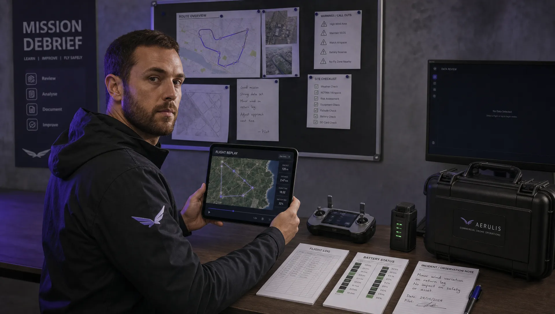 How to Review a DJI Flight Record After a Mission →
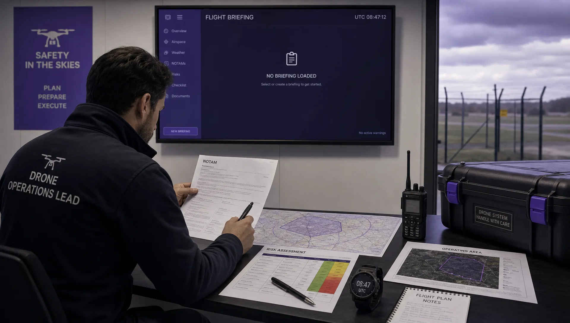 How to Check a Drone NOTAM Before You Fly →
 Part 108: What Drone Operators Should Expect →
 Beyond Visual Line of Sight BVLOS Explained →
 Drone Laws and Regulations Every Team Should Review →
 Current Drone Laws: What Changed in 2026? →
 JARUS SORA Explained in Plain English →