
A Pro's Guide to Flying a Drone Near an Airport
Flying a drone near an airport is absolutely possible for certified pilots, but let’s be clear: this is a high-stakes game. It’s not your average weekend flight. You’re stepping into complex, controlled airspace where the margin for error is zero, and you need explicit permission before your props ever start spinning.
The High Stakes of Flying Drones Near Airports
Operating a drone around an airport is one of the most demanding scenarios any professional pilot will face. A mistake here doesn’t just mean a hefty fine or a lost drone. It could endanger hundreds of lives, bring national air travel to a grinding halt, and torpedo your career for good.
This guide is for pilots who need to move beyond the basic rulebook. We'll dig into the practical, real-world knowledge you need to manage these high-consequence jobs safely, legally, and professionally.
The Threat Is Real and Growing
The need for meticulous planning isn't just theoretical. The data paints a pretty scary picture of just how often drones and manned aircraft are getting too close for comfort.
Recent analysis of aviation safety data revealed that drones were involved in 51% of reported near misses over the last decade. At the 30 busiest airports in the U.S., drones now account for nearly two-thirds of all reported near midair collisions. Think about that.
We’re not just talking about minor incursions. In January 2024, a British Airways flight carrying 180 people had a terrifyingly close call with an illegal drone over Kent, UK, at an altitude of 9,600 feet. You can dig into the full analysis of these drone risks to airliners to see just how serious this has become.
For a professional pilot, these stats aren't just numbers—they're a wake-up call. Every unauthorized flight chips away at public trust and invites tighter regulations for all of us. Mastering the rules isn't just about avoiding fines; it's about protecting the future of our entire industry.
Why Compliance Is Your Greatest Asset
It's easy to see the regulations as a roadblock, but that’s the wrong way to look at it. Smart pilots see them as a framework for success. When you have a deep, practical understanding of airspace, authorization procedures, and on-site safety protocols, you transform massive risk into a manageable, professional service.
Clients needing work done near an airport aren't just hiring a pilot with a drone. They're investing in an expert who can guarantee safety and compliance.
This guide will show you how to:
- Navigate Complex Airspace: We’ll break down the rules for Class B, C, D, and E airspace without the confusing jargon.
- Secure Legal Authorization: Learn the practical steps for getting clearance through LAANC and filing for FAA waivers.
- Implement Professional Safety Protocols: Build the checklists and communication plans that ensure every flight is buttoned up and safe.
Treating every airport-adjacent flight with the seriousness it deserves is what separates the amateurs from the pros. Let's start by looking at the invisible structures that govern the sky.
How to Navigate Controlled Airspace Like a Pro
Controlled airspace is the sky's invisible highway system. For drone pilots, understanding its structure isn't just a good idea—it's a non-negotiable part of the job. Flying near an airport means you’ll be operating right in the middle of this complex environment, where the rules change with every few feet of altitude and location.
Think of it like driving. A quiet back road has a very different set of rules than a six-lane highway ringing a major city. In the same way, the airspace around a small regional airport (Class D) is a world away from the complex, layered airspace protecting an international hub like LAX or Heathrow (Class B).
Cracking the Airspace Code
As a professional drone pilot, you’ll mainly be dealing with four types of controlled airspace when you're working near airports. Each has its own shape, size, and set of rules that dictate if, when, and how you can fly. Getting this wrong is a fast track to a serious safety incident or an unwelcome call from the aviation authorities.
Here’s a practical breakdown of what you'll encounter:
- Class B (Big & Busy): This is the most restrictive airspace out there, protecting the nation's busiest airports. Picture it as an upside-down wedding cake, with layers that get wider as they go higher. Flying here requires explicit, specific authorization and is always under the tightest scrutiny.
- Class C (Crowded): You'll find this around airports with a control tower and steady commercial traffic. It's smaller than Class B but still highly regulated. You will always need authorization to fly within these boundaries.
- Class D (Dime-sized): This typically surrounds airports with a control tower but less traffic than a Class B or C. It's often shown on charts as a simple cylinder stretching from the ground up to a specific altitude, usually around 2,500 feet.
- Class E (Everywhere Else): This is the catch-all for controlled airspace that isn't B, C, or D. It can start right at the surface around some smaller airfields, or at 700 or 1,200 feet above the ground in other areas. The key for us is knowing when Class E extends all the way down to the surface, because that also requires flight authorization.
If you want to really get your head around these invisible boundaries, check out our in-depth guide to the different classes of airspace and what they really mean for drone pilots.
Watching for Wild Cards: TFRs and NOTAMs
Beyond the fixed airspace classes, you have to be on the lookout for temporary changes. Before every single flight, you must check two critical alerts: Temporary Flight Restrictions (TFRs) and Notices to Air Missions (NOTAMs).
A Temporary Flight Restriction (TFR) is exactly what it sounds like—a pop-up no-fly zone. These are often put in place for major sporting events (like a Premier League match), VIP movements, wildfires, or other high-security situations. Busting a TFR is a huge deal and will land you in serious trouble.
A Notice to Air Missions (NOTAM) gives you real-time intel on potential hazards along your flight path. This could be anything from a closed runway or new crane operations near an airport to military exercises happening in the area.
A classic rookie mistake is thinking a LAANC authorization is a golden ticket. It's not. You have to check for TFRs and NOTAMs as a separate, mandatory pre-flight step. An approved flight altitude from LAANC means absolutely nothing if the entire area is covered by a last-minute TFR.
Real-World Planning Example
Let's walk through a scenario. You've landed a gig for a roof inspection in a busy city. The site is three miles from a major Class B airport, one mile from a smaller Class D airport, and two miles from a large stadium.
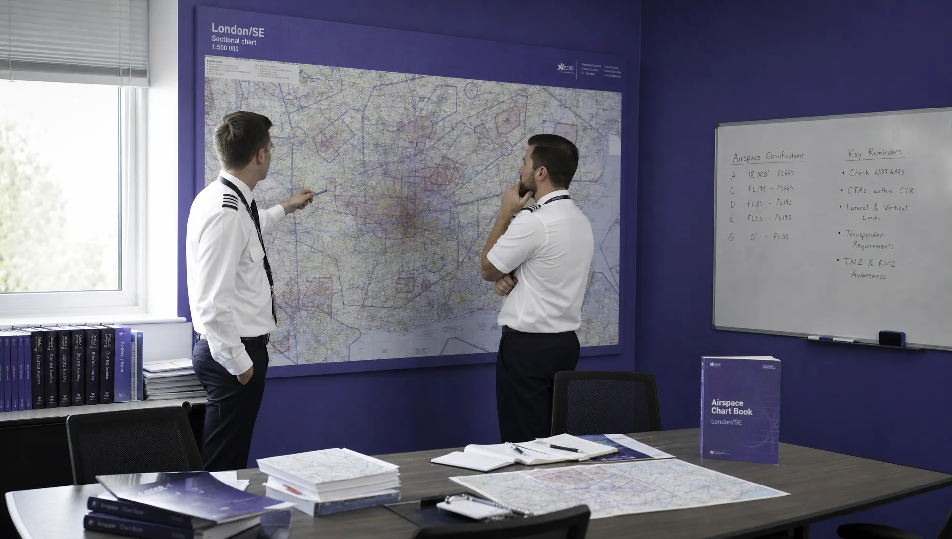
Your first move is to pull up a sectional chart. You immediately see you’re underneath a shelf of the Class B airspace but also squarely inside the Class D cylinder. That tells you right away you need authorization, most likely through LAANC.
Next, you check for TFRs. Turns out, the stadium has a big game tonight, so a TFR will be active starting one hour before kickoff. Your planned evening flight is now a no-go.
Finally, you scan the NOTAMs. You spot a notice about extensive crane activity just half a mile from your location, which you now have to factor into your on-site risk assessment. This kind of layered, multi-source check is the only way to operate safely and legally when flying a drone near an airport.
Gaining Flight Authorization with LAANC and Waivers
Now that you've got a handle on the invisible lines that govern the sky, the next move is getting explicit permission to fly within them. This isn't a suggestion; it's a mandatory step for any professional drone operation near an airport. Luckily, technology has made this process a whole lot faster than it used to be.
The go-to tool for most pilots is the Low Altitude Authorization and Notification Capability, better known as LAANC. Think of it as an automated air traffic controller just for drones. It connects you directly to the FAA's systems through third-party apps, giving you near-instant approval for flights within pre-approved altitude ceilings in controlled airspace.
How LAANC Works in Practice
LAANC has turned a once-painful process into a few taps on a screen. The FAA works with airports to create UAS Facility Maps (UASFM), which are basically grids laid over the controlled airspace. Every square on that grid has a pre-approved, safe altitude limit—say, 100 feet in one area, 200 feet in the one next to it, and so on.
When you fire up a LAANC-enabled app, you'll plug in your flight details: where you'll be, how high you need to go, and for how long. The system instantly checks your request against the UASFM grid. If your proposed flight is at or below the ceiling for that specific spot, you’ll often get an automatic, real-time approval sent straight to your device.
This diagram shows a simplified pre-flight workflow. Notice that identifying your airspace is the critical first step before you even think about seeking authorization.
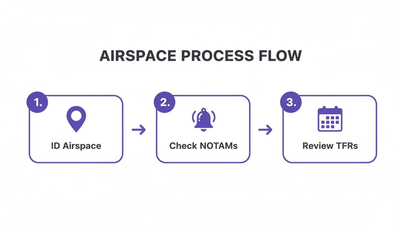
As you can see, checking the airspace class and looking for active restrictions like NOTAMs and TFRs has to happen before you can even consider submitting that LAANC request.
The ease of LAANC also brings a serious point into focus. Drone incidents are on a worrying upward trend. Since 2021, the FAA has logged over 2,000 drone incursions, with more than 100 sightings reported every single month. A staggering 60% of close calls between drones and manned aircraft happen within just 200 feet of airports. This makes sticking to systems like LAANC not just a legal requirement, but a profound ethical one.
When LAANC Isn't an Option
So, what happens when the job requires you to fly higher than the grid allows? Or you're tasked with a project in a "zero-grid" area right next to a runway where LAANC offers no altitude at all? This is where the old-school manual authorization and waiver process comes into play.
Be warned: this path is slower and demands a lot more from you, but it’s the only way forward for more complex jobs. You’ll need to submit a formal request through the FAA's DroneZone portal.
"A common mistake is treating a manual authorization like a LAANC request. You can't just ask for a higher altitude; you must build a robust safety case that proves you can mitigate the increased risk. This is your opportunity to demonstrate your professionalism."
To have any chance of success, your application needs to be absolutely rock-solid. You’ll need to provide:
- Detailed Flight Plans: We're talking exact coordinates, flight paths, and your standard operating procedures.
- A Robust Safety Case: How are you going to manage the risks? This should cover your plans for visual observers, communication protocols with ATC, and detailed emergency procedures.
- Specific Justification: Why is this specific altitude or this exact location essential to get the job done?
Crafting a Successful Manual Request
Think of your manual authorization request as a formal proposal to the FAA. It has to be clear, professional, and convincing. You need to steer clear of these common pitfalls that get applications denied all the time:
- Vague Information: A request for "flying near the airport" will get you nowhere. Be precise. Give them everything.
- Inadequate Risk Mitigation: Simply saying you'll "be careful" is an instant red flag. Detail your specific strategies for avoiding any conflict with manned aircraft.
- Unrealistic Timelines: Manual authorizations don't happen overnight. The FAA's official target for review is 90 days, though it can sometimes be faster. Plan your projects with that buffer in mind.
Getting through this process takes a deep understanding of the regulations and a sharp eye for risk management. If you're looking to tackle operations that bend the standard rules, it’s worth diving into a detailed breakdown of the Part 107 waiver and authorization process to make sure your application is as strong as it can be.
This is also where a platform like Dronedesk can be a massive help, allowing you to organize flight plans, document risk assessments, and keep the detailed records you’ll need for these more demanding requests.
Your Essential Pre-Flight and On-Site Safety Checklist
Getting that legal authorization is a huge step, but honestly, it’s just the start. When you're operating a drone near an airport, a successful flight is won or lost long before the props even spin. A quick battery check just isn't going to cut it here. Your pre-flight and on-site procedures are your first and best defense against disaster.
This is about more than just ticking boxes on a form. It's about building a systematic, repeatable process that embeds safety into every single action you take. Let's break down what separates a risky flight from a controlled, professional operation.
The Pre-Flight Briefing Your Mission Depends On
Before you even think about leaving for the site, you need to nail your preparation. This is your chance to sniff out potential hazards and lock in every logistical detail. If you rush this part, you're just setting yourself up for a panic-fueled scramble on-site.
Your pre-flight checks should be rigorous and, just as importantly, documented. Think of it as building a case file for a safe flight.
- Authorization Verification: Don't just assume your LAANC approval went through. Open the app and physically confirm the authorization is active for the correct time and date. I always take a screenshot for my records.
- Airspace Sanity Check: Check NOTAMs and TFRs one last time before you head out. Things can change in an instant. A presidential visit or a local airshow can ground your mission with absolutely no notice.
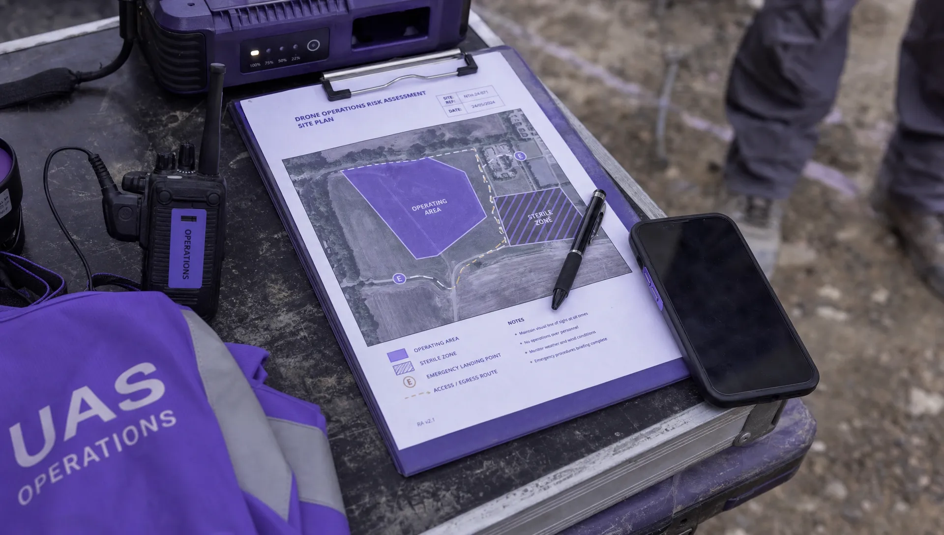
- Site and Hazard Mapping: Get on Google Earth or your mapping tool of choice and really scout your location. Identify your primary Launch and Recovery Zone (LRZ), making sure it’s clear of obstructions and as far from potential manned aircraft flight paths as possible. Crucially, you must also pick at least one alternate LRZ in case your main spot becomes unusable.
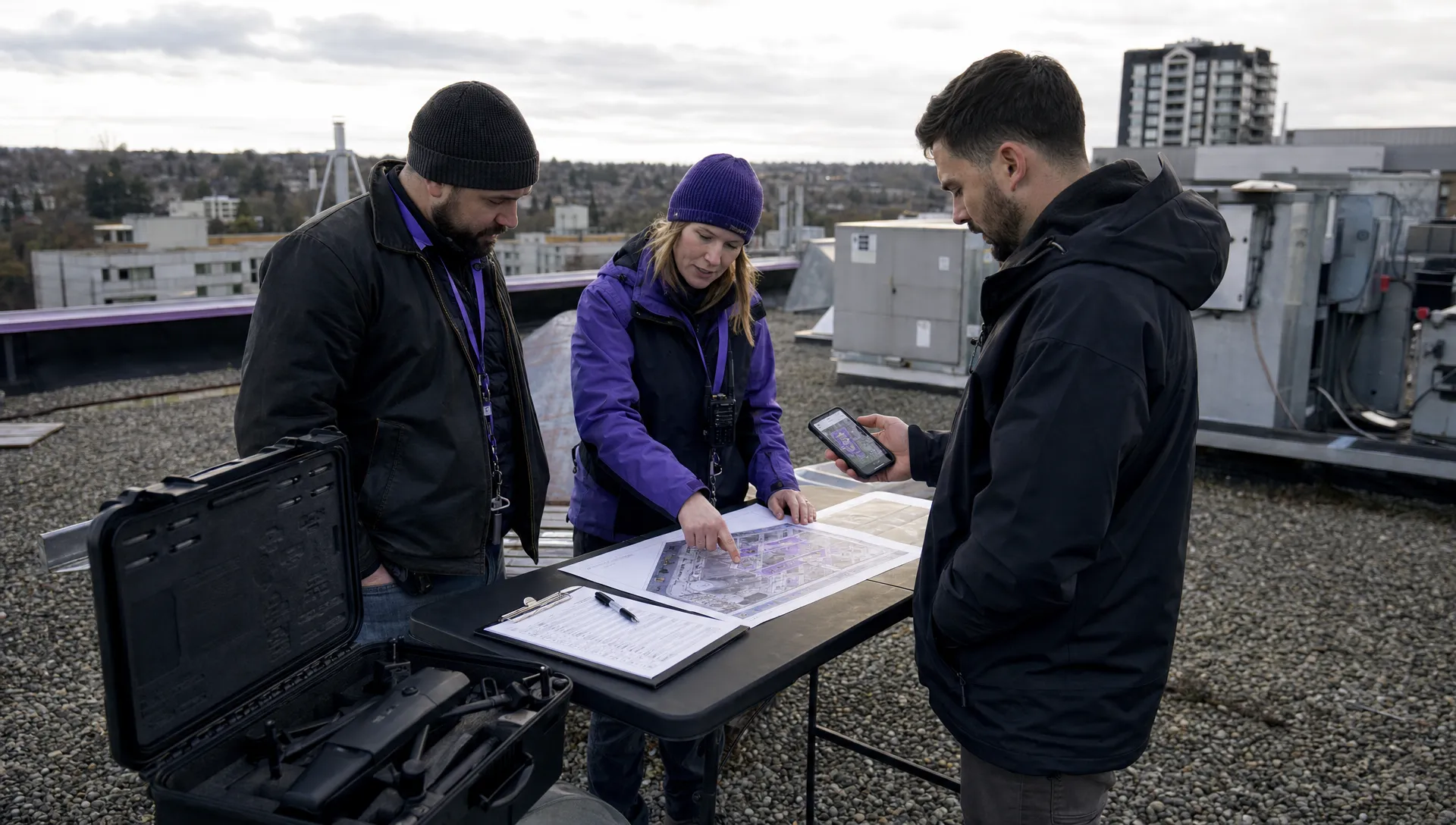
- Team Role Assignment: Get specific about who's doing what. Who is the Remote Pilot in Command (RPIC)? Who is the Visual Observer (VO)? Who’s handling communications with people on the ground? Everyone on the team needs to know exactly what they're responsible for.
A professional pilot always plans for failure. Your emergency plan can't be a vague idea; it has to be a concrete set of actions. What's your exact procedure for a lost link? Where's the rally point if an unexpected helicopter shows up? Talk through these scenarios before you fly.
Mastering On-Site Situational Awareness
Once you arrive, the game changes. The focus shifts from planning to execution and constant, real-time awareness. The environment near an airport is incredibly dynamic, and your ability to see, hear, and react is everything.
Your visual observer isn't just an extra set of eyes; they are a critical safety component. As the RPIC, you’re often head-down, focused on the controller screen to get the shot. The VO’s sole job is to scan the sky and the surrounding area, acting as your dedicated threat-detection system.
To make this partnership actually work, you need clear protocols.
- Establish a Communication System: Use clear, concise language. "Aircraft, nine o'clock, high" is a world away from "Hey look, there's a plane over there!" Practice this until it becomes second nature.
- Define Scanning Sectors: Don't just vaguely look around. Divide the sky into sectors for the RPIC and VO to ensure 360-degree coverage. Maybe the RPIC covers the forward view while the VO scans the sides and rear.
- Emergency Phraseology: Agree on commands that demand immediate action. "LAND NOW!" should mean an immediate, controlled descent to the nearest safe spot—no questions asked.
Building a solid checklist is fundamental to any safe drone operation. For a much more detailed list of checks you can adapt for your own missions, check out our complete preflight checklist for drones that covers everything from paperwork to propellers.
A Real-World Commercial Property Scenario
Let’s put this into practice. Imagine you're hired to survey a commercial property right on the edge of Class D airspace. During your pre-flight planning, you identify the main parking lot as the primary LRZ. On-site, your briefing confirms it's clear, and you establish a clock-based communication system with your VO.
Ten minutes into the flight, your VO calls out, "Helicopter, three o'clock, low, heading this way."
Because you briefed this exact scenario, you immediately halt the drone's forward movement and bring it to a lower altitude, well clear of the helicopter's path. The helicopter passes. Only after the VO confirms the sky is clear do you resume the mission. That seamless, professional response is a direct result of having a solid plan and rehearsing it.
Talking the Talk: Advanced Comms and Reporting
For a pro pilot, just following the rules is the bare minimum. True mastery comes from being ready for the unexpected. When you're flying a drone near an airport, your ability to handle things like talking to Air Traffic Control (ATC) or reporting an incident is what really sets you apart. These advanced skills are all about accountability and doing your part to keep the skies safe for everyone.
Directly chatting with ATC is pretty rare for most drone ops, but it can be a critical part of a complex mission under a specific waiver or, heaven forbid, in an emergency. This isn't a casual phone call; it's a formal process that needs precision and absolute clarity.
You’d typically only get on the radio if it’s a pre-arranged condition of your FAA authorization. If that's the case, you'll have been given the right frequency and call sign to use.
Making Contact with ATC
If you do have to get on the radio, professionalism is everything. Always use standard aviation phraseology. Get straight to it: state who you are, where you are, and what you’re doing.
Example Radio Call
"Hayward Tower, this is UAS operator N123XYZ, operating under authorization number 7890. I am located two miles east of the field at the old mill site, operating at 150 feet and below. Request to begin operations."
Keep your transmissions short and sweet. ATC is juggling multiple manned aircraft, so you need to be efficient. Listen carefully for their instructions and acknowledge them clearly, usually by repeating back the key parts of their direction.
Keeping Eyes on the Whole Sky
It's not just about your drone. You need a complete picture of the airspace around you. A visual observer is a must, but technology can add a powerful extra layer of safety.
A fantastic tool for this is an Automatic Dependent Surveillance-Broadcast (ADS-B) receiver. This handy device picks up the signals that nearby manned aircraft are broadcasting, showing you their position, altitude, and heading right on a screen or tablet. Think of it as a live feed of air traffic, which is absolutely invaluable when you're operating anywhere near the busy flight paths of an airport.
It's all about creating a "virtual bubble" of awareness around your operation.
The Pro's Duty: Incident Reporting
Sometimes, even with the best planning in the world, things go wrong. A flyaway, a loss of control, or a near-miss with another aircraft are all serious business. As a professional, your job doesn't end when the drone is back on the ground; you have a duty to report these things.
The FAA requires pilots to report any drone accident that results in serious injury or property damage over $500 (not including the drone itself). You have to get that report filed with the FAA within 10 days.
But the bigger picture here is about contributing to a safer system for everyone. The global trend of drone incidents is pretty alarming. Recent data showed a massive 60% jump in drone incidents in 2022 compared to 2021, with incidents near critical infrastructure actually doubling. Despite this, enforcement is still lagging, with only 5% of incidents leading to the operator being caught. You can read more about the concerning rise in global drone incidents and see why professional reporting is so important.
A solid incident report is factual, objective, and clear. It should cover:
- Your Details: Name and certificate number.
- Flight Information: Date, time, and location of the incident.
- Factual Description: A step-by-step account of what happened, without guessing or pointing fingers.
- Outcome: Specifics on any injuries or property damage.
Using a platform like Dronedesk helps massively here. All your flight logs, risk assessments, and location data are already documented, making it a whole lot easier to pull together an accurate, thorough report. This level of accountability isn’t just about ticking a regulatory box; it's the hallmark of a true aviation professional.
Got Questions About Flying Drones Near Airports? You're Not Alone.
Even when you know the rulebook inside and out, flying a drone near an airport throws some real curveballs. This is where the theory smacks into reality. Let's dig into some of the most common questions and tricky situations pilots face out in the field.
What Happens If My LAANC Request Gets Denied?
Seeing that LAANC denial pop up can feel like a brick wall, but it's usually just a sign you need to take a different path. Most of the time, a denial simply means you've asked for an altitude higher than the pre-approved ceiling for that grid, or you’re trying to fly in a "zero-grid" right next to the runway.
Don't just give up. Your next move is to file for a manual airspace authorization directly through the FAA's DroneZone portal. Be warned, this is a much more involved process than LAANC and it is not instant.
You'll need to hand over a detailed flight plan and a solid safety case that clearly explains how you'll manage the risks of your flight. The key here is patience and planning. Get your request in weeks, or even up to 90 days, before your planned flight to give the FAA enough time for a proper review.
The rookie mistake is resubmitting the same LAANC request at a slightly lower altitude. If the job requires you to be above that grid ceiling, a manual authorization is the only professional and legal way forward.
Can I Fly Near a Small, Non-towered Airport?
You absolutely can, but don't for a second think the risk is any lower. Lots of smaller airports don't have a control tower and sit in what's usually Class G airspace, which means LAANC authorization isn't required. But this is not a free-for-all.
The FAA's rules are crystal clear: you are forbidden from interfering with manned aircraft. Period. The area around a non-towered airport is a hive of activity, with planes taking off, landing, and pilots practicing circuits in the traffic pattern. You must always give way.
Here’s a pro tip: stay well clear of the runway approaches and get yourself a handheld aviation radio to monitor the airport's Common Traffic Advisory Frequency (CTAF). Listening in lets you hear pilots announcing their positions and intentions, giving you the vital situational awareness to stay out of their path.
My Job Site Is Just Outside the Controlled Airspace Line. Am I in the Clear?
Technically, if your feet are planted in Class G airspace, you might not need LAANC. But thinking of that line on the map as a solid wall is a huge, and potentially dangerous, mistake. Manned aircraft, especially on approach or departure, don't follow these lines with pixel-perfect precision.
Your head needs to be on a swivel in these edge zones.
- Create a Buffer: Fly as if the controlled airspace actually extends a bit further out than the chart indicates. Give yourself some breathing room.
- Fly Low: Stay well below the 400ft AGL limit to maximize your vertical separation from any potential traffic.
- Be Vigilant: Keep scanning the sky, especially looking towards the nearby airport. Don't get tunnel vision on your screen.
Treat that boundary line as a yellow warning light, not a green one. Always operate with the assumption that a manned aircraft could pop into your airspace at any moment.
What's the Difference Between a COA and a Part 107 Waiver?
This is a really common point of confusion, so let's break it down simply.
| Authorization Type | Who Needs It | What It Does |
|---|---|---|
| Airspace Authorization | Commercial (Part 107) & Recreational pilots | Grants permission to fly in a specific spot within controlled airspace for a set time (this is what you get from LAANC or DroneZone). |
| Part 107 Waiver | Commercial (Part 107) pilots only | Lets you bend a specific operational rule, like flying beyond visual line of sight (BVLOS) or operating at night. |
| Certificate of Authorization (COA) | Public agencies (like police or fire departments) | A broader type of permission for specific public aircraft operations, which can include airspace access. |
For most commercial pilots looking to fly near an airport, you're chasing an airspace authorization. A waiver is what you'd need if, for example, you wanted to perform that same flight at night. They're two separate permissions for two very different things.
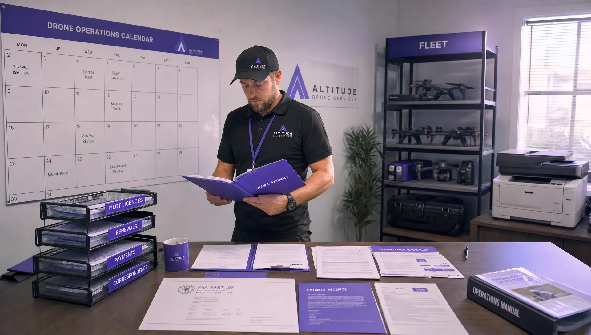
Juggling flight plans, risk assessments, and all the compliance paperwork for jobs near airports is a massive headache. Dronedesk is an all-in-one platform designed to make your operations safer and way more efficient. From pre-flight checklists to automatic logging, Dronedesk gives you the tools you need to operate like a pro. See how Dronedesk can manage your entire drone operation workflow.
 How to Evaluate a Free Drone Logbook Before Using It →
 FAA Part 107 Test: How to Master Airspace Questions →
 Drone Risk Assessment Controls That Work in the Field →
 FAA Drone License Costs Beyond the Knowledge Test →
 Drone Part 107 Operations: When a Waiver May Be Needed →
 Drone Operating Rules for Managing Contractors and Employees →
 BVLOS Drone Requirements for Building a Safety Case →
 Drone Pilot Test Mistakes That Cost Candidates Marks →
 FAA 107 License vs Part 107 Certificate: What’s the Difference? →
 Drone Airport Rules: A Field Checklist for Site Assessments →