A Drone Pilot's Guide to the Classes of Airspace
Think of the sky as a massive, invisible network of multi-layered highways. This is the simplest way to picture airspace, and getting your head around its different classes of airspace is the single most important skill for any drone pilot. It's not just a good idea—it's completely non-negotiable for running professional, compliant, and safe drone operations.
Decoding the Invisible Highways in the Sky
To fly a drone commercially, you have to understand the structure of the sky. The Federal Aviation Administration (FAA) categorizes airspace to manage air traffic, much like roads are divided into motorways, city streets, and quiet country lanes. This system is what keeps a passenger jet cruising at 30,000 feet from conflicting with a drone inspecting a roof at 200 feet.
These classes—primarily A, B, C, D, E, and G—dictate everything. They tell you where you can fly, when you can fly, and whether you need to get permission from Air Traffic Control (ATC) first. For drone pilots, this isn't just regulatory trivia to memorize for an exam; it's the very foundation of every single mission plan. It turns a complex jumble of rules into a practical roadmap for every flight.
Controlled Versus Uncontrolled Airspace
At the most basic level, all airspace is split into two main categories: controlled and uncontrolled. This is the first and most critical piece of the puzzle for any remote pilot.
- Controlled Airspace: This is where you'll find Classes A, B, C, D, and E. It’s airspace where ATC services are actively provided to manage the flow of traffic. Flying here demands strict adherence to the rules and, more often than not, direct authorization before your props even start spinning.
- Uncontrolled Airspace: This is simply Class G airspace. In these areas, ATC doesn't have the authority or responsibility to control air traffic. This gives drone pilots a lot more operational freedom, but all the usual safety responsibilities still rest squarely on your shoulders.
This diagram shows this fundamental hierarchy perfectly.
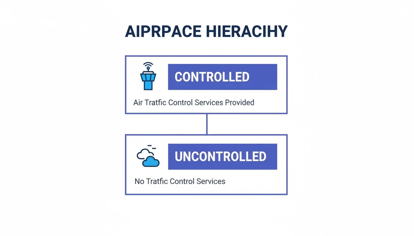
This simple division helps you quickly size up the baseline requirements for any potential flight area. Knowing whether you're in controlled or uncontrolled airspace immediately tells you what your next steps in mission planning should be, as we cover in our comprehensive map of airspace guide. Getting this basic structure down is the key to navigating the specific rules of each individual class.
For a quick overview, here's a handy table summarizing the key details of each airspace class.
Airspace Classes Quick Reference Guide
| Airspace Class | Typical Altitude (MSL) | Control Status | Drone Access | ATC Communication |
|---|---|---|---|---|
| Class A | 18,000 ft to 60,000 ft | Controlled | Prohibited | N/A for drones |
| Class B | Surface to 10,000 ft | Controlled | Requires ATC authorization | Required |
| Class C | Surface to 4,000 ft | Controlled | Requires ATC authorization | Required |
| Class D | Surface to 2,500 ft | Controlled | Requires ATC authorization | Required |
| Class E | Varies; often above Class G | Controlled | Authorization may be needed | Sometimes required |
| Class G | Surface to 700/1,200 ft AGL | Uncontrolled | Generally permitted | Not required |
This table is a great starting point, but remember that the specific boundaries and requirements can vary. Always check your sectional charts and flight planning tools before every operation.
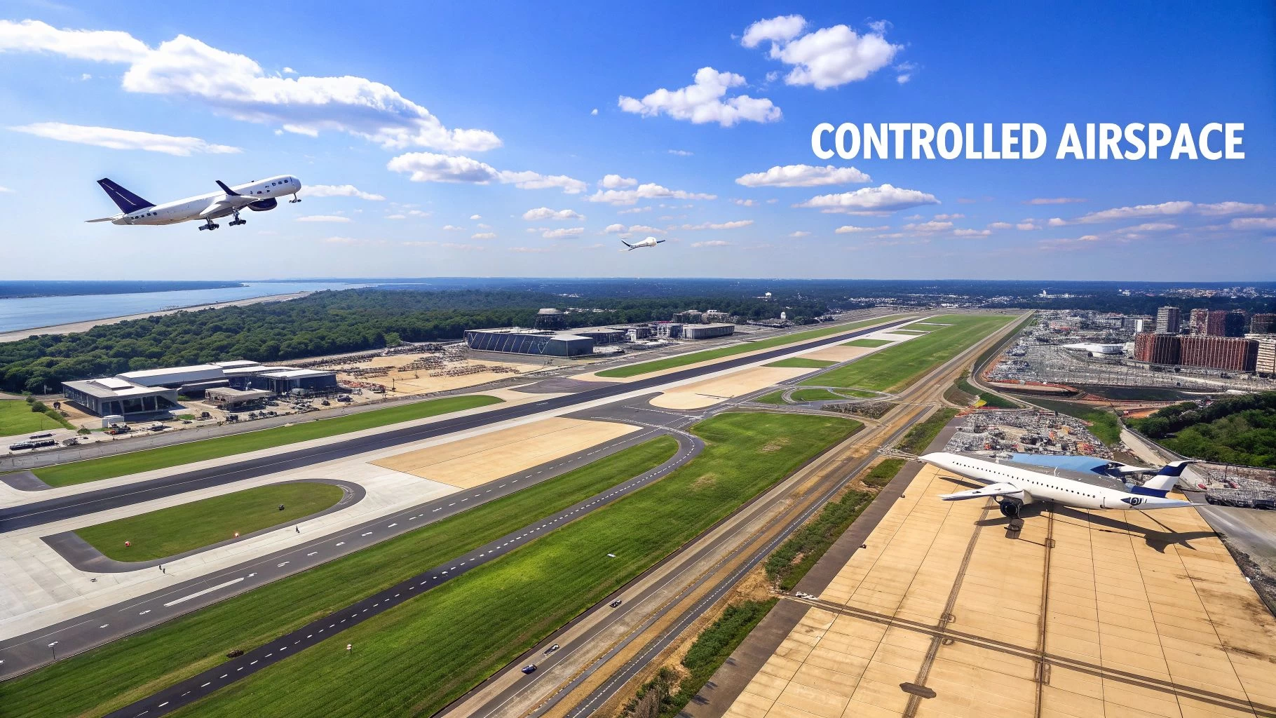
Flying in Controlled Airspace: Classes B, C, and D
When your drone missions take you near cities and airports, you’re stepping into controlled airspace. These zones—specifically Classes B, C, and D—are the most meticulously managed areas you’ll ever fly in. Picture them as the sky's busiest motorways and complex interchanges, all designed to keep a massive volume of air traffic flowing safely.
Success in these zones boils down to one simple, non-negotiable principle: authorization. Unlike the wide-open skies of uncontrolled airspace, you can't just show up and fly. Every single operation needs a green light from Air Traffic Control (ATC), which makes solid prep and clear communication your most important tools.
Understanding Class D Airspace
Let's start with the most common type of controlled airspace you're likely to bump into: Class D. This airspace typically surrounds smaller regional airports that have an active control tower but aren't quite busy enough to warrant the more complex setups of Class C or B.
Class D is usually shaped like a simple cylinder. It starts at the ground and extends up to 2,500 feet above the airport, with a radius of about 4 nautical miles. As long as the control tower is open, the airspace is active, and you absolutely must get ATC authorization to fly. But here's the catch: when the tower closes for the night or over a weekend, that Class D airspace often changes to Class E or G, which means the rules of the game change completely.
Key Takeaway: The tower's operating hours are everything. Always double-check them in your pre-flight planning, because they directly dictate the airspace class and what you need to do to fly legally.
This is a classic scenario for many drone pilots. A client might want aerial shots of a property just a few miles from a local airport. By using a system like the FAA's Low Altitude Authorization and Notification Capability (LAANC), you can often get near-instant, automated approval to fly at certain altitudes within that Class D zone. For a deeper dive into flying near airports, check out our guide on the relationship between airports and drones.
Visualizing Class C Airspace
Taking a step up in complexity, we get to Class C airspace. This class is designed to protect airports that see more action than Class D fields, including regular commercial airline flights. To handle the extra traffic, Class C has a more defined shape, best imagined as an inverted, two-tiered wedding cake.
It's typically built in two layers:
- Inner Core: A ring with a 5-nautical-mile radius that goes from the surface up to 4,000 feet.
- Outer Shelf: A wider, 10-nautical-mile radius ring that sits on top of the inner core, starting at 1,200 feet and extending up to 4,000 feet.
This tiered structure is all about sequencing aircraft as they approach and depart. For us drone pilots, the rule is the same as in Class D: you need ATC authorization to fly anywhere inside it. LAANC is again your go-to tool for getting that permission, but you can expect flight requests closer to the airport to face tougher scrutiny and lower altitude caps.
Navigating the Complexities of Class B Airspace
At the very top of the hierarchy sits Class B airspace. This is the most complex and restrictive environment, reserved for the nation's absolute busiest airports—think places like Hartsfield-Jackson Atlanta (ATL) or Los Angeles International (LAX). Its design is like a much larger, more elaborate inverted wedding cake, with multiple shelves reaching from the surface up to 10,000 feet or even higher.
The entire point of Class B is to give ATC positive control over every aircraft in the vicinity, from jumbo jets to tiny propeller planes. Its intricate shelves are custom-built to channel the flow of arrivals and departures, which is why no two Class B areas ever look the same on a chart.
These zones surround the world's major aviation hubs, managing immense volumes of traffic. Just recently, worldwide scheduled flights approached 38 million, with North America accounting for 23.3% of Available Seat Kilometers (ASK). For drone pilots, this intense activity presents big challenges, making systems like LAANC essential for even having a chance at authorization. You can get more insights on the global state of aviation on Spire.com.
Because of this complexity, getting a drone in the air inside Class B is the toughest challenge of all. LAANC is available for many Class B locations, but the approved altitude grids are often incredibly restrictive, sometimes dropping to a zero-foot ceiling right around the airport. If you need to fly higher or outside the LAANC grids, you'll have to file a manual airspace authorization request through the FAA DroneZone portal. Be warned: this is a long game that requires meticulous planning and can take weeks, if not months, to get approved.
Practical Steps for Getting Authorization
Whether you’re eyeing a flight in Class B, C, or D, the process for getting permission follows a pretty clear path. Your first port of call should always be LAANC.
Here’s the basic workflow:
- Identify the Airspace: Use a flight planning tool like Dronedesk to see exactly what airspace you're dealing with. The software will map out the boundaries and show you the LAANC grid altitudes right on the map.
- Submit a LAANC Request: Through a LAANC-approved provider, you’ll submit your flight details—the precise location, max altitude, time, and duration.
- Receive Authorization: For most requests that fall within the pre-approved altitude ceilings, you should get an automated authorization back via text or email in just a few seconds.
- Fly Compliantly: Once you have that authorization, you must stick to it religiously. Don’t fly higher or longer than what you were approved for.
If your mission requires you to fly above the LAANC grid altitude or in a location where LAANC isn’t available, you'll have to submit a manual authorization request through the FAA DroneZone. This is a much more involved process and demands a solid safety case to justify why your operation is necessary.
Mastering Your Operations in Classes E and G
Welcome to the airspace where most of your work as a professional drone pilot will actually take place. While it's crucial to get your head around the complexities of Classes B, C, and D, your day-to-day missions will almost certainly unfold in Class E and, even more often, Class G airspace. Think of these as the workhorse environments for drone pilots—they offer a lot more operational freedom but demand just as much care and attention.
This is where all that theoretical knowledge about airspace gets put into practice. Getting these two environments right is fundamental to running a safe and efficient drone business, whether you're surveying a remote field or shooting property photos in a quiet suburb.
Understanding the Ubiquitous Class E Airspace
Class E, or Echo airspace, is often called the "catch-all" of controlled airspace. It's basically the filler that exists wherever other controlled airspace (A, B, C, or D) doesn't. Its main job is to provide a controlled environment for aircraft flying under Instrument Flight Rules (IFR), especially as they're approaching or departing an airport.
Now, for a drone pilot, that might sound a little intimidating, but the reality is usually much simpler. A lot of Class E airspace starts at either 700 or 1,200 feet Above Ground Level (AGL), sitting right on top of Class G. This means for a typical Part 107 flight capped at 400 feet AGL, you can fly directly underneath Class E without ever needing to worry about it.
But here’s the critical part: in some areas, Class E extends all the way down to the surface. This is common around airports that don't have an operating control tower. In these "surface-level Class E" zones, you absolutely must have ATC authorization to fly. You'll typically get this through LAANC, just like you would in Class D.
Pro Tip: Never assume you know where the floor of Class E airspace is. Always use a reliable airspace tool like Dronedesk to check. Guessing it starts at 700 or 1,200 feet AGL is a classic rookie mistake that can land you in serious trouble.
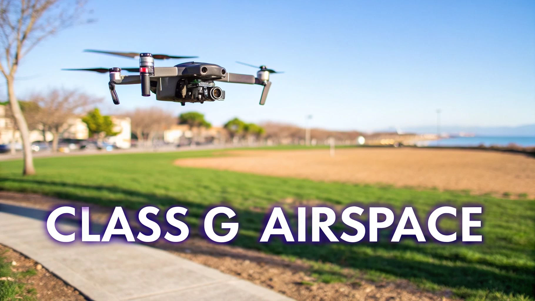
Embracing the Freedom of Class G Airspace
And that brings us to Class G, or Golf airspace. This is the one and only category of uncontrolled airspace in the National Airspace System. The easiest way to think of it is as the default sky—if it isn't specifically marked as A, B, C, D, or E, then it's Class G. For countless drone pilots doing everything from agricultural surveys to real estate photography, Class G is home base.
Its biggest selling point is simple: no ATC authorization is required.
This freedom is precisely what makes so many commercial drone operations viable and profitable. You don't need to file for LAANC or hang around waiting for permission. You just plan your mission, check that the conditions are safe, and fly. This open-access airspace usually extends from the ground up to the floor of whatever controlled airspace is above it, which is often 700 or 1,200 feet AGL.
The importance of this airspace to the drone industry can't be overstated. While global aviation is massive, with total departures recently hitting 35.3 million, it's in the low-altitude freedom of Class G that the drone sector really gets to shine. You can find more stats on global air transport performance on IATA.org. This is where inspectors, mappers, and photographers do their best work, well clear of the IFR traffic that owns the higher altitudes.
Responsibilities in Uncontrolled Skies
Just because there's no air traffic control in Class G doesn't mean there are no rules. In fact, it puts even more responsibility squarely on your shoulders as the remote pilot in command. Without ATC managing traffic, the guiding principle is simple: "see and avoid."
Here are your main duties when operating in Class G:
- Self-Separation: You are 100% responsible for scanning the sky and giving way to all manned aircraft. They aren't required to talk to anyone or announce their position, so you have to be constantly vigilant.
- Weather Minimums: Under Part 107, you need at least 3 statute miles of visibility. You also have to keep your drone 500 feet below clouds and 2,000 feet away from them horizontally. These VFR weather minimums are not optional.
- Visual Line of Sight (VLOS): This is a big one. You must be able to see your drone with your own eyes at all times. It's the cornerstone of safe separation and situational awareness in uncontrolled airspace.
At the end of the day, flying in Class G is an exercise in professional discipline. The freedom is great, but it's balanced by the expectation that you will act as your own air traffic controller, making sure your flight is no danger to anyone else, whether they're in the air or on the ground.
A Heads-Up on Special Use Airspace and TFRs
Just when you think you’ve got the hang of the A-to-G airspace classes, you run into the real gotchas of flight planning. I'm talking about Special Use Airspace (SUA) and Temporary Flight Restrictions (TFRs). These aren’t just footnotes on a chart; they're dynamic, critical zones that can ground your mission in an instant if you’re not paying attention.
Think of SUAs as long-term zones set aside for activities that don’t play well with others—things you definitely don't want to fly your drone through. TFRs, on the other hand, are like pop-up roadblocks in the sky, created for specific, short-term events. Both demand a whole other level of situational awareness.
Blundering into one of these zones isn't a slap on the wrist. You could be facing hefty fines, losing your certificate, or even getting a visit from law enforcement. The U.S. alone has over 370 charted restricted areas, and that number doesn't even touch all the other SUAs or the ever-changing TFRs.
Getting to Grips with Special Use Airspace Types
Special Use Airspace comes in a few different flavours, and as a drone pilot, you absolutely need to know the difference. Understanding what each one means is the key to telling a hard "no-fly" zone from an area you can enter with extreme caution.
-
Prohibited Areas (P-Areas): The name gives it away. Flying here is completely forbidden, usually for national security reasons. Picture the airspace over the White House or Camp David. There are zero exceptions for drones. Don't even think about it.
-
Restricted Areas (R-Areas): These zones are hotbeds of invisible hazards to aircraft—think artillery practice, aerial gunnery, or guided missiles. While not technically prohibited forever, you need explicit permission from the controlling agency to enter. Getting that green light for a drone mission is rare and difficult.
-
Military Operations Areas (MOAs): MOAs are where military aircraft practice training manoeuvres, including high-speed, aerobatic, and abrupt flight changes. Legally, you can fly your drone in an active MOA under VFR, but it is incredibly risky. You need to exercise an extreme level of caution and be constantly scanning the sky.
Key Insight: The difference between these SUAs is crucial. A Prohibited Area is an absolute no-go, while a Restricted Area might be accessible with prior coordination. An active MOA is technically open to VFR traffic like drones, but it demands a very high level of risk assessment before you even consider launching.
If you want to dive deeper, our complete guide to special use airspace breaks down these zones with more detail and planning tips.
The Moving Target of Temporary Flight Restrictions
If SUAs are the permanent hazards on the map, TFRs are the surprise roadblocks that pop up out of nowhere. They can be established with very little warning, which makes a last-minute check before every single flight an non-negotiable part of your workflow. TFRs are issued through a Notice to Air Missions (NOTAM) for all sorts of reasons.
Here are some of the most common triggers for TFRs:
- VIP Movements: Anytime the President or another top official is on the move, a strict "VIP TFR" will follow.
- Major Sporting Events: Think Super Bowls, big league baseball games, or huge outdoor concerts. They are almost always protected by TFRs.
- Emergency Situations: These pop up around wildfires, hurricane recovery zones, or major accidents to give first responders clear, safe airspace.
- Space Launches: Areas like Cape Canaveral will have massive TFRs in place to protect launch and recovery operations.
TFRs are probably one of the easiest ways for even a seasoned pilot to get into serious trouble. Because they are temporary, they won't be on your printed charts. You have to use a digital flight planning tool like Dronedesk that pulls in live NOTAM and TFR data. Flying into a TFR without authorisation is a major violation and will get you noticed by the authorities, and not in a good way.
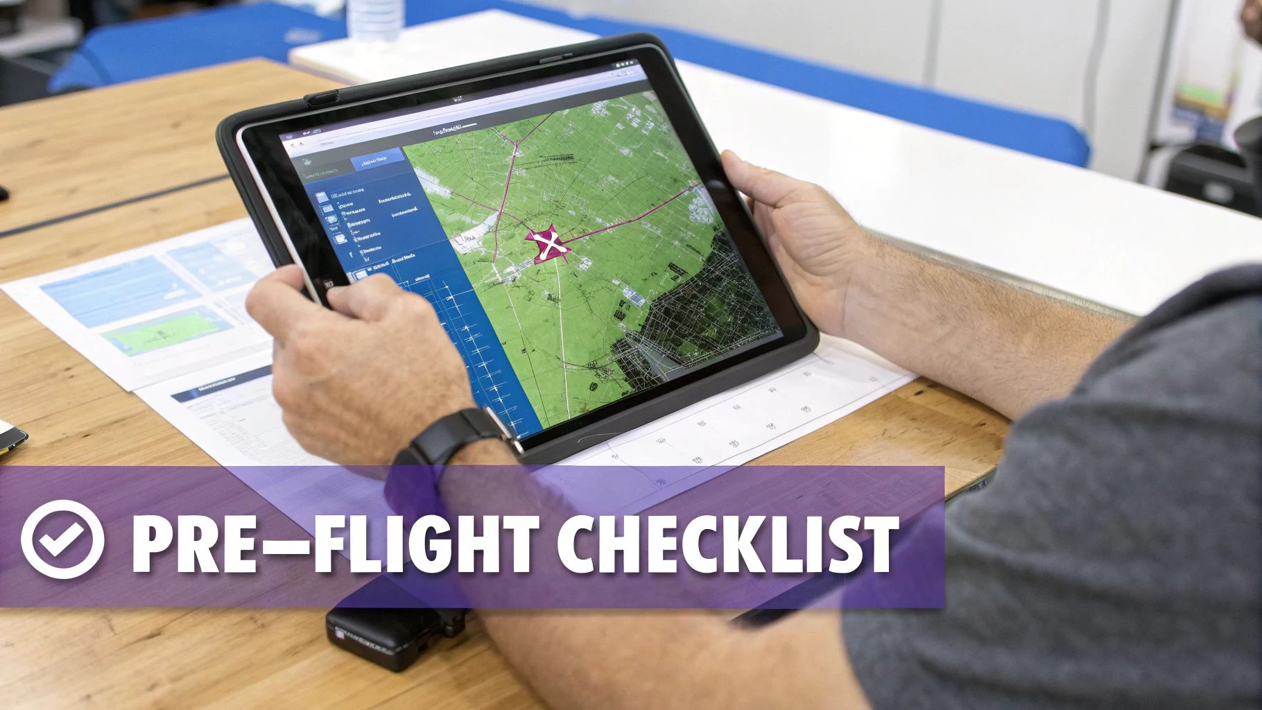
Building Your Pre-Flight Airspace Checklist
Knowing the theory behind airspace is one thing. Actually putting it into practice before every flight? That’s something else entirely. A solid, repeatable pre-flight assessment is what separates the pros from the hobbyists. It's the critical process that turns a potential job into a safe, compliant, and successful operation.
This isn't just about a quick glance at a map. We're talking about a deliberate workflow to sniff out every potential airspace conflict before your props even spin up. By building and sticking to a consistent checklist, you create a powerful safety net that protects you, your clients, and your hard-earned certificate.
Step 1: Identify Your Core Airspace Class
First things first: what's the primary airspace classification right where you plan to fly? This is your starting point. Are you out in the wide-open expanse of Class G, or are you tucked under the shelf of a Class C or sitting squarely inside a Class D cylinder? This one piece of information dictates everything that comes next.
Modern drone management software is your best friend here. Platforms like Dronedesk consolidate complex official data into a single, easy-to-read map, instantly showing you the foundational rules for your mission area. This completely removes the guesswork and the risk of misreading a complicated sectional chart.
Here’s a look at how Dronedesk visualizes airspace, giving you a clear, immediate picture of your operational environment.
The color-coded overlays and clean boundaries provide instant situational awareness, which is the baseline for the rest of your checklist.
Step 2: Scan for Overlapping Special Use Airspace
Once you've nailed down the primary class, you have to hunt for overlaps. It's common for Special Use Airspace (SUA) to be embedded within other airspace classes. For example, a Military Operations Area (MOA) could be active right in the middle of Class G airspace, which dramatically changes the risk profile of your flight.
Your pre-flight check needs to specifically look for:
- Prohibited and Restricted Areas: These are non-negotiable. Find them and make absolutely sure your flight plan stays well clear.
- Military Operations Areas (MOAs): You need to check if they are active ("hot"). If they are, you have to seriously weigh the extreme risk of fast-moving military aircraft against the importance of your mission.
- Alert Areas: Take note of these zones, which are known for high volumes of pilot training or other unusual aerial activity, and ramp up your vigilance.
Step 3: Check for Temporary Flight Restrictions
This is the most time-sensitive step and, honestly, one of the easiest to miss. TFRs and NOTAMs (Notice to Air Missions) are dynamic; they can appear with very little warning. A check you did last night is already out of date—you must do a final check right before you take off.
Critical Reminder: TFRs are not printed on charts. Your only reliable source is a live data feed from a tool that pulls real-time FAA information. Flying into a TFR for a major sporting event or VIP movement is a surefire way to get some unwanted attention from federal authorities.
Step 4: Determine Your Authorization Needs
Okay, you've gathered all the data. Now you can make a final call on authorization. Think of it as a simple decision tree based on what you just found.
- Is your flight in controlled airspace (B, C, D, or surface-level E)? If yes, you need ATC authorization. Your first and best tool for this is LAANC.
- Is your request above the LAANC grid ceiling or in a zero-grid area? If yes, you'll need to submit a manual authorization request through the FAA DroneZone. Be warned: this requires significant lead time.
- Are you in Class G airspace with no overlapping SUAs or TFRs? If yes, then no airspace authorization is needed. You're clear to proceed, but your responsibility to see and avoid other aircraft is still paramount.
Beyond just the rules of the sky, a truly professional operator also plans for the business side of things. Understanding financial factors, like the cost for drone photography, is another key part of thorough pre-flight planning. This comprehensive approach, covering both safety and business logistics, is how you set every mission up for success from all angles.
Frequently Asked Questions About Airspace
Even once you've got a good handle on the different classes of airspace, you’ll find that real-world situations always throw up new questions. Let's tackle some of the most common points of confusion that every drone pilot runs into out in the field.
How Do I Get Authorization for Controlled Airspace?
For most drone flights under 400 feet in controlled airspace (like Class B, C, D, and some surface E areas), the fastest way is through the FAA's Low Altitude Authorization and Notification Capability (LAANC) system. Many drone management platforms have this built right in, giving you near-instant approval for your flight.
But what if you need to fly higher than the approved LAANC grid altitudes, or operate where LAANC isn't available? In that case, you have to submit a request for a waiver or special authorization through the FAA DroneZone portal. This is a much deeper process that can take up to 90 days, so planning well ahead is absolutely critical.
What Happens If I Fly Into Restricted Airspace?
Flying into restricted airspace without the right permissions is a huge mistake with serious fallout. At a minimum, you could get a formal warning. Worst-case scenario? The FAA could suspend or even revoke your Part 107 certificate and hit you with some pretty hefty fines.
If you wander into a highly sensitive area, like one covered by a TFR or near critical infrastructure, you could also find yourself dealing with law enforcement or the military. This is exactly why thorough pre-flight planning with reliable, current tools isn't just a good idea—it's non-negotiable for protecting your career and keeping everyone safe.
The United States alone has over 370 charted restricted areas, and that's not even counting temporary flight restrictions. It just goes to show how vital it is to check your airspace status before every single flight.
Can I Fly My Drone in a National Park?
In a word, no. The National Park Service (NPS) prohibits flying a drone within the boundaries of any U.S. National Park. This is a key distinction: the rule comes from land management policy, not the FAA's airspace classification.
So, even if the airspace over a park is wide-open Class G, the NPS still has the authority to ban you from taking off, landing, or operating from its land. Always double-check the local land-use rules for your flight area. Many federal, state, and even local agencies have their own drone restrictions that are completely separate from FAA airspace rules.
How Does Weather Affect Airspace Rules for My Drone?
Weather doesn't actually change the airspace boundaries or what class it is, but it has a massive impact on whether you can legally fly. Under Part 107, you're required to operate under Visual Flight Rules (VFR), and that comes with some strict weather minimums.
You need at least three statute miles of visibility. You also have to keep your drone 500 feet below the clouds and 2,000 feet away from them horizontally. If you don't have those conditions, you're grounded—it doesn't matter if you're in Class G airspace with no ATC in sight. Bad weather can also change how manned aircraft fly, so being aware of your surroundings becomes even more important.
Simplify your entire workflow and ensure every flight is compliant with Dronedesk. Our platform gives you instant airspace intelligence, automated LAANC access, and streamlined planning tools all in one place. Try it today at https://dronedesk.io.
 Drone Legal Requirements for Commercial Operations →
 Drone Near Airport Rules Explained for Safer Planning →
 International Drone Regulations Every Global Team Should Know →
 Drone Flight Risk Assessment Example for Safer Missions →
 Beyond Visual Line of Sight Explained for Operators →
 How BVLOS Drone Operations Change Commercial Workflows →
 FAA Drone Rules Every Commercial Pilot Should Know →
 FAA 107 Explained for Commercial Drone Operators →
 Canadian Drone Regulations Explained for Business Use →
 FAA Part 107 Drone License Explained for Beginners →