
Drone Restrictions You Need to Check Before Flying
Before a drone leaves the case, one question matters more than almost anything else: are you allowed to fly that aircraft, at that height, from that launch point, at that time, for that purpose?
For professional operators, drone restrictions are not just a compliance box. A missed restriction can lead to an aborted job, an unsafe flight, a complaint from the public, enforcement action, invalid insurance, or a damaged client relationship. This is especially true for survey companies, utilities, emergency services and inspection teams working near airports, cities, critical infrastructure, railways, roads, crowds or sensitive land.
The safest way to think about restrictions is in layers. A location can look clear on one map and still be restricted because of a temporary airspace notice, landowner rule, environmental constraint, privacy issue, operational authorisation condition, or last-minute emergency activity.
This guide takes a UK-focused view, but the same principle applies anywhere: verify the official aviation rules first, then check site-specific, operational and environmental constraints before every flight.
Why a simple no-fly zone check is not enough
The phrase no-fly zone is useful shorthand, but it can be misleading. In practice, drone restrictions come from several different sources, and not all of them appear in the same app or map.
A professional pre-flight restriction check should cover four broad questions:
- Can this operator and pilot conduct this type of flight? This depends on the aircraft, operating category, training, authorisations, insurance and procedures.
- Is the airspace available? This includes Flight Restriction Zones, controlled airspace, prohibited or restricted areas, danger areas, UAS geographical zones and temporary notices.
- Can you safely use the site? This includes take-off and landing permission, local byelaws, security rules, ground hazards and separation from uninvolved people.
- Are there non-aviation restrictions? Privacy, wildlife, environmental rules, client policies and emergency activity can all affect whether a flight should proceed.
No single source answers every one of these questions. A drone app is useful, but it should not replace official sources, client engagement, site checks and documented decision-making.
1. Confirm the operation is legal for your pilot, aircraft and purpose
Before checking the location, confirm that the proposed flight fits the legal basis you intend to use. In the UK, the CAA's Drone and Model Aircraft Code sets out core rules for drone and model aircraft users, including height, visibility, registration and safety responsibilities.
Commercial and organisational drone flights typically fall into one of three broad categories:
- Open category: Lower-risk flights that do not need prior CAA authorisation, provided the aircraft, location and operating conditions fit the rules.
- Specific category: Higher-risk operations that require an Operational Authorisation from the CAA, with procedures and mitigations defined in the operator's documentation.
- Certified category: The highest-risk operations, generally involving risk levels closer to manned aviation.
Even if the airspace is clear, the operation may still be restricted by the limits of your category or authorisation. Check whether the planned flight involves flying beyond visual line of sight, close to uninvolved people, over assemblies of people, at night, above the usual height limits, near congested areas, from a moving vehicle, or with a heavier or unusual payload.
For professional teams, the key question is not simply whether drones are allowed in the area. It is whether your specific pilot, aircraft, procedures and permissions match the exact task you are about to conduct.
2. Check aerodrome Flight Restriction Zones and controlled airspace
Airport and aerodrome restrictions are among the most important checks before flying. In the UK, many protected aerodromes have Flight Restriction Zones (FRZs). You must obtain appropriate permission before flying within an FRZ, usually from air traffic control or the aerodrome operator, depending on the site.
This matters for more than major international airports. Smaller airfields, heliports, hospital helipads and specialist aviation sites can also affect drone operations. Utility inspections, roof surveys, construction progress flights and emergency response missions often take place in built-up areas where helicopters or light aircraft may be operating nearby.
Controlled airspace is not automatically a complete ban on drone activity, but it does mean you need to understand the classification, local procedures and any required coordination. If your planned flight is near an airport, under a busy approach path, close to a heli-route, or in an area with regular low-level aviation, treat it as a higher scrutiny operation.
Use official aviation information alongside your planning tools. The CAA guidance on drone rules and categories is the starting point for understanding regulatory expectations, while official aeronautical information and local air traffic contacts should be used where permission or clarification is needed.
3. Check prohibited, restricted, danger and UAS geographical zones
Some drone restrictions are linked to national security, safety, defence activity or sensitive infrastructure. These may appear as prohibited, restricted or danger areas, often referred to in aviation as P, R and D areas.
Examples can include military ranges, weapons testing areas, prisons, nuclear sites, royal or government locations, and other sensitive assets. Some areas are active only at certain times, while others apply continuously. Danger areas may also have activity windows, crossing services or published contact procedures, but you should never assume they are inactive without checking current information.
The UK also uses UAS geographical zones to define places where drone operations are restricted, prohibited or subject to conditions. These zones can be used to protect aerodromes, prisons, sensitive infrastructure and other locations.
For inspection and utility operators, this is especially important. A site can be commercially attractive precisely because it is critical infrastructure, but that also means it may sit inside additional security or access rules. Always check whether your client has authority to approve the flight, whether a separate site owner or security team needs to be involved, and whether aviation restrictions apply independently of site permission.
4. Check NOTAMs and temporary restrictions
A location that is legal today may be restricted tomorrow. Temporary drone restrictions can arise from major public events, air displays, emergency incidents, police activity, VIP movements, military exercises, large sporting events or temporary controlled airspace.
NOTAMs, which stands for Notices to Airmen or Notices to Air Missions, are used to publish time-sensitive aeronautical information. Professional operators should make NOTAM review part of their planning process, not a last-minute afterthought. The NATS Aeronautical Information Service provides access to official UK aeronautical information, including NOTAM-related services.
Temporary restrictions are particularly relevant for emergency services and media-adjacent operations. If there is a major incident, unauthorised drones can obstruct police, fire, ambulance, coastguard or air ambulance activity. Even well-intentioned flights can create risk if they are not coordinated through incident command or the relevant aviation authority.
| Restriction layer | What to verify | Common evidence to record |
|---|---|---|
| Operating category | Whether the flight fits Open, Specific or Certified rules | Pilot qualification, operator ID, authorisation reference, aircraft details |
| Aerodrome restrictions | Whether the site is inside or near an FRZ or protected airspace | FRZ map check, ATC or aerodrome permission, contact name and time |
| Restricted airspace | Whether prohibited, restricted, danger or UAS geographical zones apply | Airspace chart extract, official source reference, activation status |
| Temporary restrictions | Whether NOTAMs or temporary airspace measures affect the job | NOTAM search, briefing note, time window checked |
| Ground permissions | Whether take-off, landing and site access are permitted | Landowner or client approval, permit, site induction record |
| Operational constraints | Whether people, privacy, weather or environment limit the flight | Risk assessment, method statement, crew briefing and decision log |
5. Check people, crowds, buildings and third-party property
Many drone restrictions are really restrictions on how close you can fly to people, property or congested areas. The exact limits depend on the aircraft, category, subcategory and authorisation you are operating under, so avoid treating all drones the same.
Assemblies of people deserve particular caution. A crowd is not just a group of individuals. It is a gathering where people may not be able to move away easily if the drone fails. Concerts, sporting events, protests, markets, festivals and busy transport hubs should be treated as high-risk environments, even if the airspace map does not show an obvious restriction.
For survey companies, the practical challenge is often dynamic movement. A quiet industrial estate at 07:00 can become a busy delivery area by 09:00. A roof inspection can start with good separation, then become compromised when contractors, residents or members of the public enter the area. Your restriction check should therefore include site control measures, communication plans and abort criteria.
The restrictions you identify should feed directly into a practical drone flight risk assessment that works, rather than sitting in a separate planning note that the crew never uses on site.
6. Check take-off, landing and ground access restrictions
Aviation rules decide whether the flight can happen in the air, but they do not automatically give you permission to stand on someone else's land, block a path, launch from a park, or operate inside a managed site.
You may need permission from a landowner, local authority, site manager, principal contractor, port operator, rail authority, highway authority, utility company, facilities manager or event organiser. Local byelaws may also restrict launching or landing drones from parks, beaches, commons, heritage sites or nature reserves.
This distinction matters. A landowner does not automatically control all airspace above their land in the same way the aviation system does, but they can control access to their property and impose site rules. From a commercial perspective, it is usually better to secure clear site permission than to argue about boundaries after a complaint.
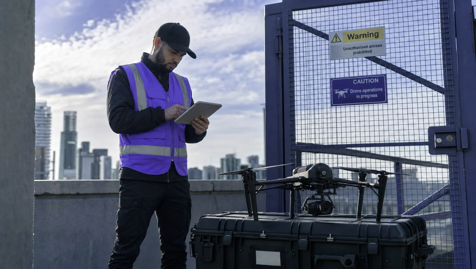
Ground restrictions also affect safety. Check for overhead cables, masts, cranes, loose materials, public footpaths, livestock, traffic, radio interference sources, emergency access routes and safe landing alternatives. A technically legal flight can still be a poor operational decision if the launch area is insecure or uncontrolled.
7. Check privacy, surveillance and data protection restrictions
If your drone carries a camera, thermal sensor, LiDAR unit or other data capture payload, you are not just flying an aircraft. You may also be collecting information about people, vehicles, homes, workplaces or sensitive sites.
For organisations, privacy checks should be built into the planning stage. Consider what data you need, whether people can be identified, how you will minimise unnecessary capture, how long data will be retained, who can access it, and whether signage or notification is appropriate. The ICO's guidance on drones is a useful starting point for understanding privacy expectations.
Drone restrictions linked to privacy are often client and context specific. A roof survey over a school, hospital, residential block or care facility may require a different approach from a flight over an empty field. Thermal inspections can be particularly sensitive because they may reveal occupancy patterns, equipment use or other operational details.
For utility companies and survey firms, good privacy planning also protects client trust. Limit the sensor view to what is necessary, brief the crew on camera angles, avoid unnecessary hovering near windows or private spaces, and document how captured data will be handled.
8. Check environmental, wildlife and livestock restrictions
Drone operations can disturb wildlife, livestock and protected habitats. This is not only an ethical issue. In some locations, it can become a legal or contractual restriction.
Bird nesting sites, coastal cliffs, seal colonies, nature reserves, Sites of Special Scientific Interest, national parks and conservation areas may require additional checks before flying. Land managers may impose seasonal restrictions, minimum separation distances, or complete bans during sensitive periods.
Rural infrastructure surveys, power line inspections and emergency response flights often cross farmland or habitat-rich areas. Check for livestock in adjacent fields, particularly horses, sheep and cattle that may react unpredictably to drone noise. If the flight involves repeated passes, low altitude work or thermal surveys at dawn or dusk, increase the scrutiny.
Environmental restrictions are easy to miss because they may not appear on a standard aviation map. Build them into the client questionnaire and site reconnaissance process, especially when operating near water, woodland, cliffs, agricultural land or protected landscapes.
9. Check weather, visibility and day or night constraints
Weather is not always described as a restriction in the same way as an FRZ or NOTAM, but it can restrict the flight just as effectively. If the pilot cannot maintain visual line of sight, control the aircraft, preserve separation from obstacles, or comply with the conditions in the operating manual, the flight should not continue.
Check wind at operating height, not just at ground level. Urban canyons, coastlines, valleys, tall structures and industrial sites can produce gusts, turbulence or compass interference that are not obvious from a general forecast. Rain, fog, low cloud, glare and low sun can also affect visibility, image quality and emergency landing options.
If flying at night or in low light, check that your procedures, lighting, pilot competence and authorisation conditions support the operation. Night flights can be safe and productive when planned well, but they reduce visual cues and can increase public concern if the flight has not been communicated properly.
A practical restriction-check workflow for professional operators
A reliable process is more valuable than a heroic last-minute map check. The best operators treat restriction checking as a workflow that starts before the quote is accepted and continues until the flight is logged.
| When to check | What to do |
|---|---|
| At enquiry stage | Confirm the task, location, aircraft type, operating category, likely permissions and any obvious airspace or site constraints. |
| During planning | Check FRZs, controlled airspace, restricted areas, UAS geographical zones, landowner rules, privacy issues, environmental constraints and client site requirements. |
| 24 to 48 hours before flight | Re-check NOTAMs, weather, crew availability, aircraft status, batteries, access arrangements and any permission conditions. |
| On arrival | Conduct a dynamic site survey, verify launch and landing areas, check people movement, confirm communications and brief the crew. |
| During the operation | Monitor airspace, people, weather and site activity, then pause or abort if conditions change. |
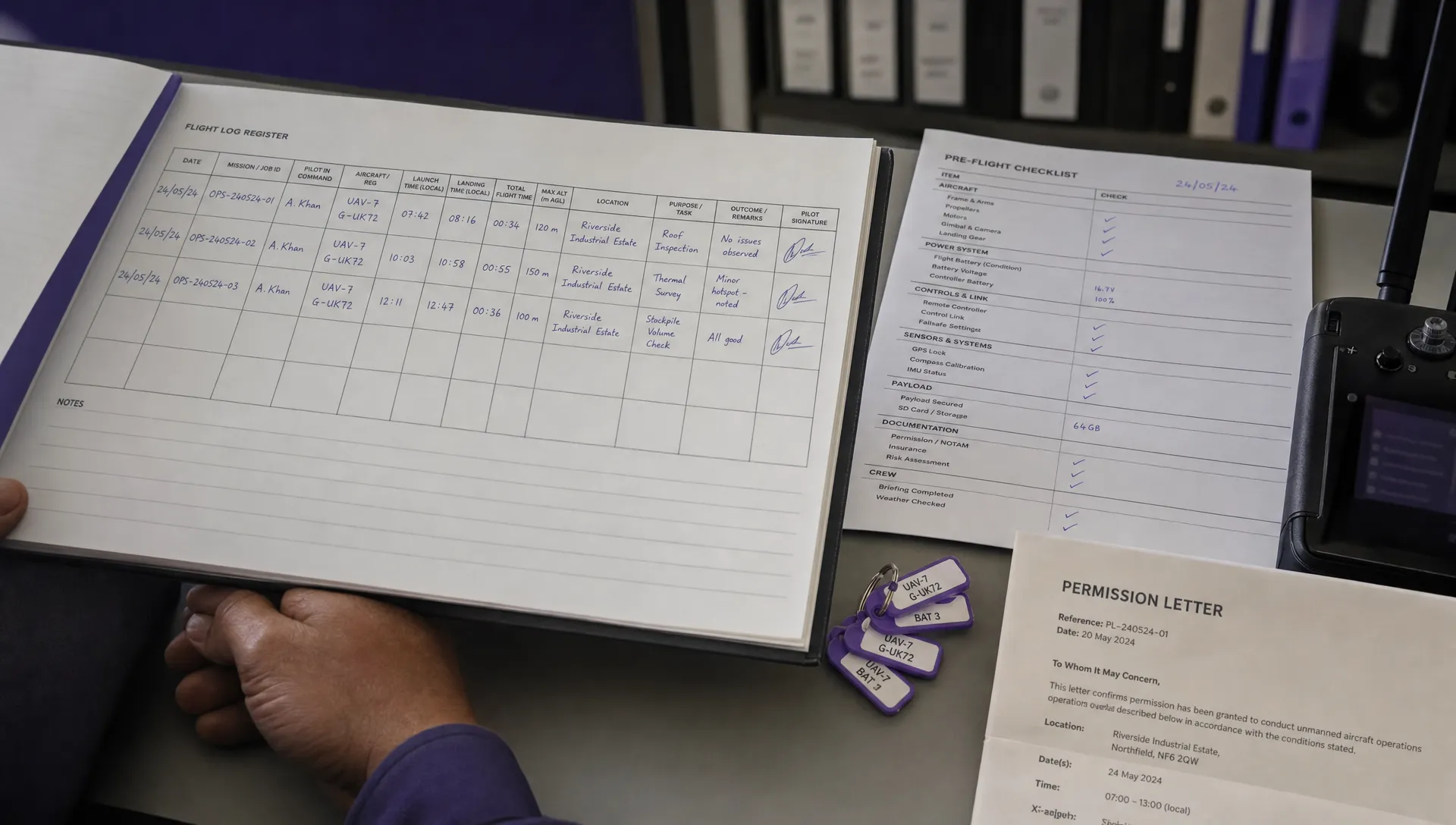
| After the flight | Log what was checked, what changed, any incidents or near misses, and what should be improved next time. |
For organisations running several aircraft, pilots or client sites, this process quickly becomes a fleet management challenge. The Dronedesk drone fleet management guide explores how growing teams can move beyond spreadsheets and disconnected records.
Common drone restriction mistakes to avoid
Even experienced operators can miss restrictions when a job feels routine. Watch for these recurring mistakes:
- Relying on one app only: Planning apps are useful, but official sources, site permissions and local procedures still matter.
- Checking airspace but not ground rules: You may be clear to fly in the air but not permitted to launch from the land you intend to use.
- Assuming sub-250 g means unrestricted: Lighter drones may have more flexibility, but height, visibility, privacy, FRZ, crowd and local restrictions can still apply.
- Copying an old risk assessment: Airspace, NOTAMs, site access, people movement and environmental factors can change between visits.
- Treating client approval as aviation approval: A client can approve access to a site, but they may not have authority to approve restricted airspace or third-party land use.
The aim is not to make every job feel complicated. It is to avoid false confidence. If you can show what you checked, when you checked it, what source you used and how you adapted the plan, your operation becomes safer and easier to defend.
Frequently Asked Questions
Can I fly a drone in controlled airspace? Sometimes, but it depends on the location, airspace classification, type of operation and required permissions. Check official airspace information and follow any CAA, ATC or aerodrome procedures before flying.
Do I need permission to fly near an airport? If the flight is inside a Flight Restriction Zone, you need appropriate permission before flying. Do not rely on distance alone, as FRZ boundaries and local procedures must be checked for the specific aerodrome.
Do sub-250 g drones avoid drone restrictions? No. Sub-250 g drones may have fewer restrictions in some scenarios, but they are not unrestricted. Height limits, visual line of sight, privacy rules, FRZs, temporary restrictions, crowds and local site rules can still apply.
How often should I check NOTAMs? Check during planning and again close to the flight, especially within 24 to 48 hours and on the day of operation for higher-risk jobs. Temporary restrictions can appear after the initial survey or quote stage.
Is landowner permission the same as airspace permission? No. Landowner or site permission allows you to access and operate from a location, but it does not override aviation restrictions. Equally, clear airspace does not automatically give you permission to launch or land from private or managed land.
What should I do if my drone app says the flight is allowed but another source suggests a restriction? Treat the conflict as a stop-and-verify moment. Check official sources, contact the relevant authority if needed, document the decision and do not fly until the restriction is understood.
Make restriction checks repeatable
Drone restrictions are manageable when they are checked early, documented clearly and connected to the rest of your operating process. The problem usually starts when airspace, permissions, risk assessments, checklists, crew notes and flight logs live in separate places.
Dronedesk's operations management platform includes client, fleet and team management, airspace and proximity intelligence, flight planning, configurable checklists, risk assessments, flight logging and data reporting, as outlined on the Dronedesk features page. For commercial operators, that means restriction checks can become part of a consistent workflow instead of a last-minute scramble before take-off.
 FAA 107 License vs Part 107 Certificate: What’s the Difference? →
 FAA Part 107 Record-Keeping Rules for Commercial Teams →
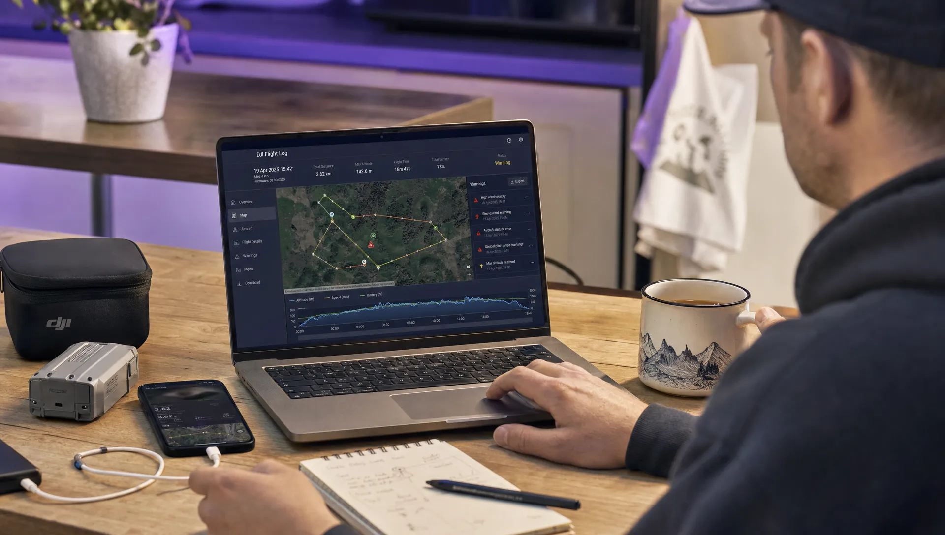 How to Review a DJI Flight Log After an Unexpected Event →
 Drone Laws Around the World: A Pre-Flight Research Framework →
 How to Compare Drone Survey Services for Complex Sites →
 How to Start a Drone Mapping Business With a Clear Workflow →
 Class C Airspace Drone Rules for Commercial Flights →
 How to Create a Drone Job Pack for Every Mission →
 FAA Small UAS Rule: Key Requirements for Operators →
 How to Build a Drone Pilot Flight Log That Is Audit Ready →