Flying a Drone Near Airport A Pilot's Legal Guide
Flying a drone near an airport isn't your average Tuesday flight. It's a high-stakes operation where even the smallest mistake can have massive, life-altering consequences. This isn't just about getting the shot; it's about operating with the level of professionalism and precision that this sensitive environment demands.
Why Airport Drone Operations Demand Extreme Caution

There's a world of difference between flying in an open field and operating in controlled airspace. The air around an airport is a complex, fast-moving puzzle, and the potential for a catastrophic run-in with a manned aircraft is frighteningly real. A small drone can inflict catastrophic damage on a passenger jet, and I don't need to spell out what that could mean.
This is precisely why regulatory bodies like the FAA have such strict rules. The entire goal is to keep traditional aircraft and unmanned systems safely separated, protecting everyone in the air and on the ground. Recent data really drives home just how serious this is.
Over the last ten years, drones have been involved in 51% of reported near misses with commercial passenger planes at major airports. The danger is most intense right at the airport's edge, where over 60% of these close calls happen within just 200 feet.
Beyond the Risk of Collision
The fallout from a reckless or unauthorized flight goes way beyond the immediate physical danger. A single drone in the wrong place at the wrong time can set off a chain reaction of disruptions:
- Flight Delays and Cancellations: An airport might have to ground every single flight, stranding thousands of passengers and hitting airlines with millions in costs.
- Severe Legal Penalties: Pilots can face crippling fines, the suspension of their license, and even criminal prosecution for breaking airspace rules.
- Erosion of Public Trust: Every time a drone makes headlines for the wrong reasons, it damages the reputation of our entire industry, making it tougher for all of us who follow the rules.
The responsibility resting on your shoulders in these situations cannot be overstated. A safety-first mindset isn't just a good idea—it's the absolute, non-negotiable foundation of being a professional pilot.
Getting your head around these risks is the first step. To really build on that, it’s worth digging into the broader principles of aviation safety that govern all types of flight. It's also critical to know the right way to document incidents. You can learn more about that in our guide to the Aviation Safety Reporting System: https://blog.dronedesk.io/aviation-safety-reporting-system/
Decoding Airspace Before You Ever Take Off
Before you even think about asking for permission to fly near an airport, you have to be fluent in the language of the sky. This means building solid airspace intelligence—the ability to glance at a map and instantly understand the invisible rules and boundaries that dictate your flight.
For any responsible pilot, this is a non-negotiable skill.
Your go-to tool for this is an FAA-approved app like B4UFLY. These apps do the heavy lifting, translating complex aeronautical data into a simple, visual format. They’ll show you exactly what kind of controlled airspace—be it Class B, C, D, or E—you’re dealing with.
From Theory to Practical Interpretation
Forget about memorizing textbook definitions for a second. What really matters is what you see on your screen and how you interpret it.
Planning a flight two miles from a small regional airport? You're likely looking at Class D airspace, which usually looks like a simple cylinder on the map. The rules are strict, but they're typically straightforward.
Now, contrast that with a job four miles from a major hub like LAX or ATL. You’ll almost certainly be under the complex, layered shelves of Class B airspace. The restrictions here are far tighter, and the altitude ceilings can change dramatically as you move away from the airport's core.
The need for this knowledge isn't just theoretical. Since 2021, there have been over 2,000 drone sightings reported near U.S. airports. Some of these, like a near-miss with a United Airlines flight near San Francisco, highlight just how dangerous a lack of awareness can be.
This simple workflow is a great way to approach airspace analysis for any mission.

Breaking down the task into these three manageable actions ensures you’ve gathered all the critical data you need before you even think about requesting flight authorization.
Moving Beyond Basic Apps
While apps like B4UFLY are fantastic for a quick look, true professionals often need to dig deeper. This is where learning to read VFR sectional charts comes into play. These charts are the definitive source for airspace information, showing nuances that apps sometimes oversimplify.
Key Takeaway: Your goal is to look at any map—whether it’s on an app or a traditional chart—and immediately recognize your operational limits. This includes maximum altitudes, airspace boundaries, and any active Temporary Flight Restrictions (TFRs).
For a more detailed look at the airspace classes you’ll encounter near airports, this table breaks it down.
Controlled Airspace Classes at a Glance
| Airspace Class | Typically Surrounds | Drone Authorization Required? | Key Characteristic |
|---|---|---|---|
| Class B | The busiest major airports (e.g., ORD, ATL). | Yes, always. | Complex, multi-layered "upside-down wedding cake" shape. Strictest rules. |
| Class C | Busy airports with a control tower and radar approach. | Yes, always. | Two-tiered structure. Less complex than Class B but still requires ATC comms. |
| Class D | Airports with a control tower but no radar approach services. | Yes, always. | A simple cylinder shape, usually extending up to 2,500 feet. |
| Class E | Can exist in various forms, often starting at 700 or 1,200 feet AGL. | Sometimes, especially when it extends down to the surface near an airport. | The "catch-all" controlled airspace. Check your app for specific altitude floors. |
This simplified chart gives you a quick reference, but nothing beats getting comfortable with the raw data. Understanding these visual languages is fundamental.
To really elevate your planning from basic to expert, check out our guide on how to read sectional charts. Ultimately, mastering airspace intelligence is what separates a hobbyist from a professional UAS operator—especially when you’re flying a drone near an airport.
Mastering LAANC for Instant Flight Authorizations
This is it. This is the fastest, most efficient way to get legal approval for flying your drone near an airport. The Low Altitude Authorization and Notification Capability (LAANC) system is a true game-changer for professional pilots. It has completely transformed what used to be a weeks-long waiting game into a process that now, more often than not, takes just a few seconds. Think of it as your direct line to Air Traffic Control for automated, real-time authorizations in controlled airspace.

The entire system works through a network of FAA-approved third-party apps, which act as the bridge between your flight plan and the ATC system. For most of us flying regular jobs in controlled airspace, these apps are the go-to tool for daily operations.
How LAANC Works in the Real World
Picture this: you get a last-minute call for a job to inspect a rooftop HVAC unit. The catch? It’s just three miles from a Class D airport. In the old days, this would have been a non-starter, requiring a manual waiver request submitted weeks in advance. With LAANC, it’s a whole different story.
You’ll start by firing up a LAANC-enabled app on your phone or tablet. Right away, you’ll see the airport's airspace laid out with a grid system. This is the UAS Facility Map (UASFM). Each square on this grid has a number—100, 200, 400, etc.—which represents the maximum altitude (in feet AGL) that the FAA has already pre-approved for drone flights in that specific little box.
If your mission altitude is at or below that grid ceiling, you’re on the fast track. You just need to punch in your flight details:
- The exact time and duration of your flight.
- The precise area you’ll be operating within.
- The maximum altitude you plan to fly, making sure it doesn’t go over the grid number.
Once you hit submit, the system cross-references your request with those pre-approved ceilings. In almost every case, you'll get an authorization pinged back to you via text or in-app notification nearly instantly. It's a beautifully simple process that gets you in the air quickly and, most importantly, legally. If you're wondering which app to use, take a look at our list of the best drone airspace apps available.
When Your Flight Needs a Closer Look
So, what happens if the job requires you to fly higher than the pre-approved grid altitude? Let's say you need to inspect a 250-foot cell tower, but it's sitting in a grid marked with a 200-foot ceiling. This is where the process needs an extra step.
When you submit a request that goes above the UASFM ceiling, it automatically triggers what's called a “Further Coordination” request. This means your plan is no longer eligible for that instant, automated approval. Instead, it gets routed directly to the Air Traffic Manager at that specific airport for a manual review.
This manual review is not instantaneous. While it's still lightyears faster than the old waiver system, it can take anywhere from a few hours to several days to hear back. The decision rests entirely on the controller’s assessment of your flight and its potential impact on manned air traffic.
To give yourself the best shot at approval, your request needs to be absolutely rock-solid. You’ll have to provide a compelling safety justification explaining exactly why you need that extra altitude and prove you have strong mitigation strategies in place. This is where a professional flight operations platform like Dronedesk really proves its worth, helping you build and document the comprehensive safety cases required for these more complex requests.
How and When to Talk to Air Traffic Control
While technology like LAANC is a massive help for routine flight authorizations, it's not a silver bullet. There will absolutely be times when an app just won't cut it, and you'll need to pick up the phone and talk directly with an Air Traffic Control (ATC) tower. This is one of those skills that really separates seasoned professionals from the rest of the pack.
Knowing when to make that call is the first hurdle. You’ll need to initiate direct contact if you’re planning an operation under a waiver that explicitly requires it, or if you’re trying to fly in controlled airspace that isn’t LAANC-enabled yet. Sometimes, even with a LAANC approval, unique operational needs—like a non-standard altitude or specific timing—might mean a conversation is necessary.
I get it, this can feel intimidating. But it doesn't have to be. Controllers are professionals laser-focused on safety; they aren't looking to trip you up. Your only job is to be clear, concise, and have all your ducks in a row before you even think about dialing their number.
Preparing for the Call to ATC
Confidence on the phone is a direct result of solid preparation. There's nothing worse than scrambling for information while a controller is waiting on the line. It’s unprofessional and wastes everyone's time. Before you make that call, have this information ready to go:
- Your Full Name and Part 107 Certificate Number: This identifies you as a certified remote pilot right away.
- Your Call Sign (if you have one): This is usually your company name or another designated identifier.
- The Phrase "UAS Operator": State this early. It immediately clarifies the type of operation you're conducting.
- Precise Flight Location: Be ready with both latitude/longitude coordinates and a simple, plain-language description. For example, "the northeast corner of the Main Street and 5th Avenue intersection."
- Proposed Flight Details: Get specific. They need to know your maximum altitude (in feet AGL), the exact start and end times, and the total duration of your flight.
- Nature of the Operation: Keep it brief but clear. Explain the purpose, whether it’s a roof inspection, real estate photography, or a survey flight.
Having these details neatly organized shows you respect their incredibly busy schedule and that you understand the professional standards for flying a drone near an airport. It builds immediate credibility.
Just remember, the person on the other end of that line is juggling the safety of numerous manned aircraft. Your professionalism and preparedness directly contribute to their ability to keep the skies safe for everyone.
What to Expect During the Conversation
Once you're connected, get straight to the point. A good, professional opening sounds something like this: "Good morning, this is [Your Name], a UAS operator with [Your Company]. I'm calling to coordinate a drone operation near your airport."
From there, the controller will likely ask for the specific details you've already prepared. They need to build a clear mental picture of your flight to make sure it won’t conflict with any arriving or departing aircraft.
They might approve your request as is, suggest a modification (like a slightly lower altitude or a different time window), or deny it if it poses an unacceptable risk. Whatever the outcome, stay courteous and professional. Your reputation with that control tower is something you build over time, and it matters.
Your Pre-Flight Checklist for Airport Operations

A safe flight near an airport is won or lost long before your props even start spinning. Preparation is everything. This goes way beyond your standard checks like battery levels or propeller integrity; those should be second nature by now.
When you're operating in these high-risk environments, your pre-flight checklist needs to be far more rigorous. Think of it as your professional standard operating procedure, built to guarantee every single flight is airtight. This is your final defense against complacency—each item is a critical link in the chain of safety.
Verify Your Authorizations and Tech
First things first: confirm your digital paperwork is in order. Never assume your LAANC authorization from yesterday is still valid for today’s flight. You need to physically check.
- Confirm LAANC Approval: Open your authorization app and look at the approval confirmation. Double-check the start and end times to ensure your planned flight window is completely covered.
- Check Remote ID Broadcast: Power on your drone and use a dedicated app to verify that your Remote ID is broadcasting correctly before you take off. This is a non-negotiable FAA requirement.
- Review Active NOTAMs/TFRs: Do one last sweep for any new NOTAMs (Notice to Air Missions) or TFRs (Temporary Flight Restrictions). Presidential movements or local events can change the airspace with very little warning.
Skipping these checks can invalidate your entire operation and put you in direct violation of FAA regulations, even if you have a prior authorization in hand.
Remember, an authorization is a permission slip, not a pass to skip final due diligence. The ultimate responsibility for a safe, compliant flight always rests with the Remote Pilot in Command.
Setting Up a Digital Safety Net
Beyond the regulatory must-dos, you need to leverage your drone’s own technology to create a backup safety net. This is where you proactively build a buffer against potential mistakes or technical glitches.
One of the most powerful tools for this is the geofence. Before you launch, take a minute to set a maximum altitude and a horizontal radius in your flight software that lines up perfectly with your authorized flight area. This creates a virtual boundary your drone simply cannot cross, acting as a fantastic safeguard against accidentally drifting into a more restrictive zone.
The table below breaks down how a standard pre-flight routine stacks up against the elevated checks you need when flying near an airport.
Essential Pre-Flight Safety Checks Near Airports
| Check Item | Standard Flight | Airport Vicinity Flight |
|---|---|---|
| Airspace Authorization | Check for local rules. | Must have active and verified LAANC or DroneZone authorization. |
| Remote ID | Required for most drones. | Must confirm broadcast is active and functional before takeoff. |
| Geofencing | Good practice for safety. | Crucial for setting hard limits that match your authorization. |
| NOTAM/TFR Check | Recommended. | Mandatory final check for last-minute airspace changes. |
This heightened level of scrutiny isn't about bureaucracy; it’s about professionalism. When you build these steps into your workflow—perhaps using a platform like Dronedesk to standardize the process—you're proving you understand the immense responsibility that comes with operating in shared skies.
Common Questions on Flying Drones Near Airports
Even when you think you've got the rules down, certain situations can still make you second-guess yourself. Let's tackle some of the most common and tricky questions pilots face when planning flights in controlled airspace. I'll give you clear, straight-to-the-point answers you can actually use.
What Happens if I Fly Without Authorization?
Let's be blunt: flying a drone near an airport without the proper authorization is a huge deal for the FAA. The consequences are far from a simple slap on the wrist. We're talking about anything from official warnings to eye-watering fines that can easily run into thousands of dollars for a single mistake.
It gets worse than just a financial hit. The FAA has the power to suspend or even permanently revoke your Part 107 certificate, which could spell the end of your professional flying career. In the most extreme cases, especially if you actually endanger a manned aircraft, you could be facing federal criminal charges. Trust me, the FAA has sophisticated detection systems and they don't take these incursions lightly.
Can I Fly in a Zero Altitude Grid on an Airport Map?
For all intents and purposes, the answer is no—at least not through any automated system. When you see a "0" on a UAS Facility Map (UASFM) inside LAANC, it's a clear signal that the area is a no-go for automated approvals.
These zero-altitude grids are typically placed directly in the flight paths of runways or on the airport property itself. If you absolutely must fly there, your only route is a manual airspace authorization request through the FAA DroneZone portal. This isn't a simple form-fill; you'll need an incredibly robust safety case, exhaustive risk mitigation plans, and frankly, it's almost never approved for regular commercial jobs. It's best to treat these zones as strict no-fly areas unless you have a critical, safety-related reason and have gone through the rigorous manual approval process.
Does LAANC Work for Recreational Pilots?
Yes, it absolutely does. Both Part 107 commercial pilots and recreational flyers can—and must—use LAANC to get the green light for flying in controlled airspace. The request process itself is practically the same for everyone.
The only real prerequisite for a recreational pilot is that they must have passed The Recreational UAS Safety Test (TRUST) before they can request LAANC authorization. Once they get that approval, they're bound by all the standard recreational flying rules, including staying below the maximum altitude that LAANC approved for that specific grid.
Crucial Reminder: It's not about being a fixed distance from an airport—it's about the specific class of airspace you're in. A major airport's controlled airspace can extend for many miles, while a small, private airstrip might be in uncontrolled airspace right up to its edge.
Always, always check a reliable airspace app like B4UFLY before every single flight. Never guess based on how far away you think you are. The map is your only source of truth.
Ready to manage your entire flight planning process, from airspace checks to compliance paperwork, all in one place? Dronedesk gives you the professional tools to handle every part of your drone operations, ensuring you're always safe, compliant, and efficient. Discover how Dronedesk can transform your workflow.
 Drone Testing Checklist Before Commercial Deployment →
 How to Plan a UAV Survey for Safer Field Operations →
 Drone Laws Explained for Commercial Pilots in 2026 →
 GCV Explained in UK SORA and BVLOS Planning →
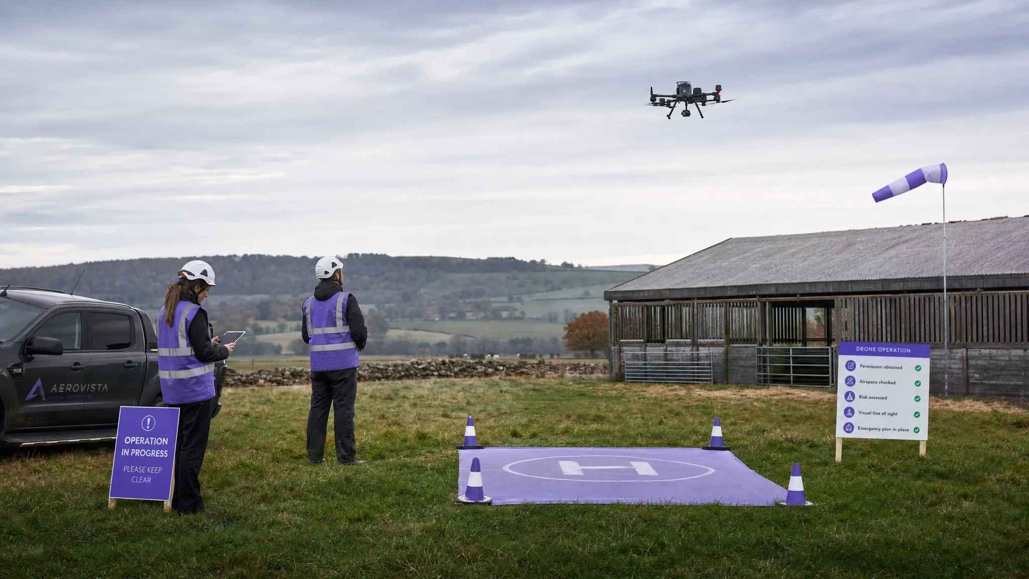 British Drone Laws Explained for Commercial Operators →
 Commercial Drone Services: How to Scale Without Chaos →
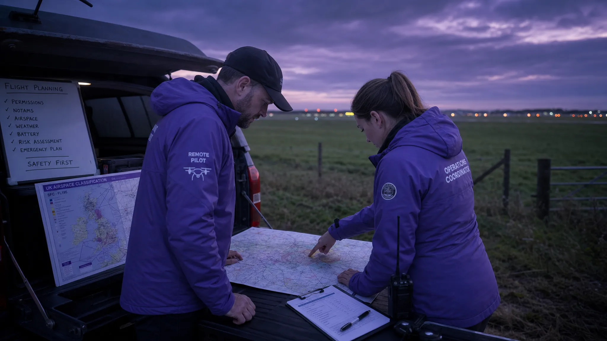 Drone Airspace Map Guide for Safer UK Flight Planning →
 How to Build a Drone Flight Risk Assessment That Works →
 BVLOS Meaning Explained for Commercial Drone Teams →
 Drone Mapping Companies: How to Choose the Right Partner →