How to Plan a UAV Survey for Safer Field Operations
A well-planned UAV survey is not just about capturing sharp imagery or achieving the right ground sampling distance. It is about getting the right data while protecting people, property, your crew, the aircraft and the reputation of your operation.
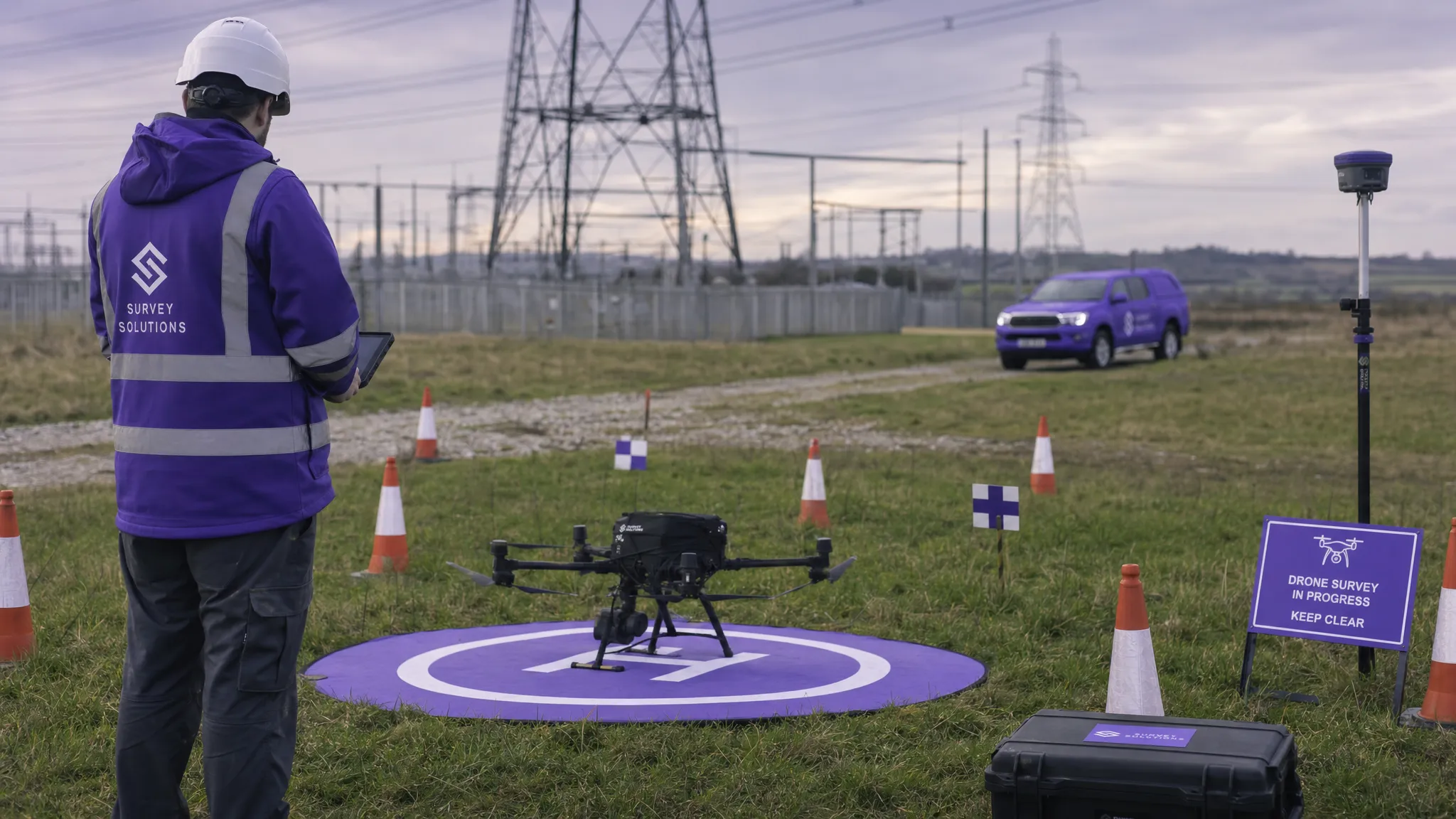
For drone operators, survey companies, utilities and emergency services, the safest field operations are usually the ones where the field team has fewer surprises. That means the planning process needs to cover the survey objective, regulatory position, site hazards, access, weather, crew roles, communications, permissions, emergency procedures and post-flight records.
This guide walks through a practical approach to planning a UAV survey that supports both safety and data quality, from the first client brief to the final flight log.
Start with the survey objective, not the flight path
Before you draw a grid in mapping software, clarify what the UAV survey must achieve. A topographic survey, roof inspection, utility corridor assessment, emergency scene overview and stockpile measurement all create different operational risks.
A useful planning brief should answer these questions:
- What decision will the survey data support?
- What area, structure or asset must be captured?
- What level of detail or accuracy is required?
- What sensors are needed, such as RGB, thermal, LiDAR or multispectral?
- Are there time constraints, access restrictions or public safety concerns?
- Who owns the site, and who can authorise access?
- What deliverables are expected, such as orthomosaics, inspection images, point clouds or condition reports?
This matters because the safety plan follows the mission. A roof condition survey in a busy urban street may need more attention to cordons, pedestrians and take-off positioning. A utility corridor survey may involve longer distances, difficult terrain, livestock, power infrastructure and multiple landowners. A search and rescue mapping flight may need rapid deployment, but still requires clear roles, risk controls and communication discipline.
Data requirements also influence operational exposure. Higher resolution may require lower altitude, more flight lines and longer time on site. Thermal work may need specific times of day. Photogrammetry may require more overlap and consistent lighting. Good survey planning balances data quality with the lowest reasonable operational risk.
Confirm the regulatory position early
Every UAV survey should be planned within the rules that apply to the aircraft, location, pilot competence, operation type and airspace. In the UK, operators should check current guidance from the Civil Aviation Authority and the Drone and Model Aircraft Code before flying.
For commercial and public sector teams, this usually means confirming:
- Whether the operation sits in the Open or Specific category.
- Whether the pilot and operator registration details are current.
- Whether the aircraft class, weight and operating conditions are appropriate.
- Whether an Operational Authorisation or other permission is required.
- Whether the site is in controlled airspace, a flight restriction zone or a temporary restricted area.
- Whether local permissions are needed from landowners, asset owners, site managers or event organisers.
Do not leave this until the morning of the survey. If permissions are required, lead times can affect the entire project. For utilities, infrastructure and emergency services, the airspace picture can also change quickly due to incidents, temporary restrictions or other aircraft activity.
A safe planning process should include a final airspace and NOTAM check before deployment, plus a dynamic review on arrival. Even if the survey has been flown before, treat each job as a new operation.
Build a site picture before the crew arrives
Desk-based reconnaissance is one of the highest-value parts of UAV survey planning. It helps you identify hazards before the team is under time pressure in the field.
Use reliable mapping, satellite imagery, site plans, client information and local knowledge to understand the operating environment. Look beyond the survey boundary. The main risk may not be inside the survey area. It may be a nearby road, school, railway, overhead line, heliport, public footpath, livestock field or sensitive facility.
Key items to identify include take-off and landing points, emergency landing areas, safe access routes, parking, terrain changes, obstacles, water hazards and possible public interaction points. In rural settings, check for livestock, shooting activity, farm machinery and uneven ground. In urban or industrial settings, check for cranes, masts, reflective glass, moving vehicles, security restrictions and electromagnetic interference.
For utility surveys, proximity to power lines and substations should be treated as a major planning factor. For emergency services, the site picture should integrate with the incident command structure, ground team movements and any manned aviation activity.
Turn hazards into practical controls
A risk assessment should not be a paperwork exercise completed after the real decisions have already been made. It should actively shape how the UAV survey is flown.
The Health and Safety Executive describes risk assessment as identifying hazards, deciding who might be harmed and evaluating precautions. For drone operations, that approach should be specific to the site and mission, not copied from a generic template.
| Hazard | Why it matters in a UAV survey | Example control |
|---|---|---|
| People near the operating area | Increased risk if control is lost or landing is required | Use cordons, observers, signage and a take-off point away from public routes |
| Roads and moving vehicles | Distraction, collision consequences and public exposure | Avoid overflight where possible and position crew clear of traffic |
| Overhead lines and masts | Collision risk and possible signal interference | Mark obstacles in the briefing and maintain defined separation distances |
| Poor weather or gusting wind | Reduced aircraft performance and unstable imagery | Set go/no-go thresholds and monitor conditions during the job |
| Difficult terrain | Trips, falls and delayed emergency response | Plan safe access, footwear, communications and recovery routes |
| Nearby airspace activity | Conflict risk with manned aircraft or other drones | Check airspace, NOTAMs and local procedures before and during the operation |
| Battery or equipment failure | Loss of mission continuity or forced landing | Carry serviceable spares and define emergency landing areas |
| Public interaction | Distraction during critical flight phases | Assign a crew member to handle questions away from the remote pilot |
The best controls are simple, visible and briefed. If a control relies on everyone remembering a complicated instruction under pressure, it may not be robust enough.
Plan crew roles and communications
Even small UAV survey jobs benefit from clear role allocation. The remote pilot should not be expected to fly, monitor mapping progress, speak to the public, manage traffic, update the client and watch for aircraft at the same time.
For low-risk sites, a remote pilot and one trained observer may be enough. For higher-risk or larger survey areas, consider adding a survey lead, visual observers, a client liaison, a safety marshal or a data technician. Emergency service operations may also require integration with incident command, blue light partners and ground search teams.
The pre-flight briefing should cover the mission objective, planned flight area, aircraft, battery sequence, take-off and landing points, emergency actions, weather limits, communication method and stop-work triggers. Keep the briefing short enough to be usable, but specific enough that everyone understands the plan.
Agree communication words in advance. Phrases such as “hold”, “land now”, “aircraft approaching” and “public entering area” should have clear meanings. If radios are used, confirm channels and call signs. If mobile signal is unreliable, plan accordingly rather than discovering the problem after deployment.
Design the flight plan for safety and data quality
The flight plan is where survey requirements and operational controls come together. The safest route is not always the shortest route, and the best mapping grid is not always the safest field operation.
Consider flight altitude, overlap, camera angle, flight speed, lighting, battery endurance, return-to-home settings, terrain variation, wind direction and emergency landing options. If using automated flight, confirm the route does not create avoidable overflight of people, roads or sensitive areas. Automated does not mean unattended.
For photogrammetry, overlap and consistent imagery are important. For inspection work, oblique images and stand-off distance may be more relevant. For corridor surveys, segmenting the route can improve control, battery management and crew positioning. For thermal surveys, timing and environmental conditions can be as important as the flight line itself.
Ground control points, checkpoints and survey markers should be planned with crew safety in mind. Do not place a marker where someone must cross unsafe ground, stand near traffic or enter a restricted area. If the survey needs high accuracy, discuss control strategy with the survey professional responsible for the deliverable.
If you are comparing data capture and processing tools, Dronedesk’s drone mapping software guide explains how mapping platforms differ from operations management software. In practice, many teams use both: one tool to capture and process survey data, and another to manage the operational planning, compliance and records around the flight.
Set realistic weather limits
Weather is one of the most common reasons for unsafe or poor-quality UAV survey work. It affects aircraft stability, battery performance, image sharpness, crew safety and the quality of the final deliverable.
Plan go/no-go thresholds before the field team arrives. These should reflect the aircraft manufacturer’s limits, pilot competence, site risk and survey requirements. A wind speed that is acceptable in a flat open field may be unsuitable around buildings, cliffs, trees or industrial structures where turbulence is likely.
Check wind speed and gusts, precipitation, visibility, temperature, cloud base, sun angle and the likelihood of sudden changes. For coastal, upland or remote sites, local conditions can differ significantly from the nearest forecast. For emergency services, pressure to deploy quickly should not override basic weather judgement.
Weather planning should also include human factors. Cold, wet or hot conditions can reduce crew concentration, shorten safe working time and make batteries harder to manage. A tired, uncomfortable field team is more likely to miss a hazard.
Prepare field checklists that match the mission
Checklists reduce reliance on memory, especially when the team is dealing with client pressure, changing weather or a complex site. The key is to make them relevant. A checklist that is too generic or too long may be ignored.
| Checklist stage | What it should confirm |
|---|---|
| Pre-deployment | Permissions, airspace checks, crew availability, aircraft status, batteries, payloads, insurance and site access |
| Arrival on site | Dynamic risk assessment, take-off area, landing area, public presence, obstacles, weather and communications |
| Pre-flight | Aircraft condition, propellers, battery status, controller settings, GNSS status, failsafe settings and flight plan loaded |
| During flight | Aircraft position, battery level, airspace awareness, public movement, weather change and data capture progress |
| Post-flight | Aircraft condition, battery records, captured data, flight log, incidents, maintenance needs and client handover notes |
For repeat survey operations, such as monthly construction progress mapping or routine utility inspections, standardised checklists help improve consistency. However, repeat work can create complacency. The site may have changed since the last visit, with new scaffolding, temporary roads, cranes, livestock, site compounds or public access points.
Manage permissions, privacy and stakeholders
A UAV survey often affects more people than the client. Neighbours, tenants, site workers, security teams, landowners, local authorities and the public may all need to be considered.
Permissions should be documented before arrival where possible. If the survey area includes multiple land parcels, confirm who has authority for each one. For utilities and linear infrastructure, access can be one of the most complex parts of the job.
Privacy should also be planned, not treated as an afterthought. If imagery may capture people, homes, vehicles or sensitive sites, consider how you will minimise unnecessary data capture and manage the resulting data. The UK Information Commissioner’s Office provides guidance on data protection and drones, which is especially relevant for operators working in public or residential environments.
Stakeholder communication does not need to be complicated. Clear signage, a short site briefing and a named contact can prevent confusion. For emergency services, communication should fit the incident structure and avoid distracting operational teams.
Use stop-work triggers during the survey
Planning does not end at take-off. Field conditions can change quickly, and a safe UAV survey plan should include clear triggers for pausing or stopping the operation.
Common stop-work triggers include unexpected people entering the operating area, a manned aircraft nearby, loss of visual line of sight, deteriorating weather, abnormal aircraft behaviour, battery warnings, loss of communications, crew fatigue, public confrontation or uncertainty about the aircraft’s position.
The remote pilot should feel empowered to stop the flight without debate. A useful safety culture is one where stopping is treated as professional judgement, not failure. It is usually easier to relaunch later than to explain why the team continued after a known risk became unacceptable.
Record the operation while details are fresh
Post-flight documentation is part of safe operations. Flight logs, maintenance notes, battery records, incident reports and lessons learned all help the next survey run more smoothly.
Record what was planned, what changed and why. If a take-off point was unsuitable, note it. If public access was higher than expected, note it. If wind around a structure caused instability, note it. This information is valuable for repeat clients, utility corridors, emergency response plans and future risk assessments.
Good records also support accountability. If a client later asks why a section was not captured, your notes can show that the decision was made for safety, access or weather reasons. If the aircraft needs maintenance, the flight record provides context.
Where Dronedesk fits into UAV survey planning
UAV survey teams often use specialist tools for mapping, modelling and inspection analysis. The operational challenge is making sure the job itself is planned, risk assessed, flown, logged and documented in a consistent way.
Dronedesk is an all-in-one web platform for drone operations management. According to the Dronedesk features page, it includes client management, fleet management, team management, airspace intelligence, proximity intelligence, flight planning, flight logging, data reporting, configurable checklists and risk assessments.
For survey companies, utility teams and emergency services, that means the operational admin around a UAV survey can be kept in one place rather than spread across emails, spreadsheets, paper forms and disconnected documents. Used well, this supports a more consistent planning workflow from client brief to post-flight record.
If risk assessment is a particular focus for your team, Dronedesk also has a dedicated guide on building a drone flight risk assessment that works.
A practical UAV survey planning workflow
If you want a simple structure, think of the planning process as a sequence of decisions rather than a stack of forms.
First, define the data requirement and confirm the survey method. Next, check the regulatory position, airspace and permissions. Then build the site picture, identify hazards and choose controls. After that, assign the crew, prepare the flight plan and brief the operation. On site, complete the dynamic risk assessment, fly within the agreed limits and stop if conditions change. Finally, log the flight, secure the data and record lessons learned.
This approach keeps safety connected to the actual work. It also helps teams avoid two common mistakes: planning only for the image capture, or creating paperwork that does not influence field behaviour.
Frequently Asked Questions
What is the most important part of planning a UAV survey? The most important part is understanding the mission objective and site risk before deciding how to fly. The flight path, crew setup, permissions, checklists and emergency procedures should all follow from the survey purpose and operating environment.
How far in advance should a UAV survey be planned? Simple low-risk surveys may be planned quickly, but work involving controlled airspace, multiple landowners, utilities, public areas or emergency response constraints should be planned as early as possible. Permission lead times can affect the whole project.
Do I need a risk assessment for every UAV survey? Yes, a risk assessment should be completed for each operation and reviewed dynamically on site. Repeat surveys can use a consistent structure, but the actual hazards and controls should be checked every time.
How can UAV survey teams improve safety without slowing down delivery? Standardised workflows, clear crew roles, relevant checklists, pre-planned permissions and accurate records all help reduce uncertainty in the field. The goal is not more paperwork, but better decisions before and during the flight.
Can mapping software replace operations management software? Usually, no. Mapping software focuses on capture, processing and outputs such as orthomosaics, 3D models or point clouds. Operations management software supports planning, risk assessments, checklists, flight logging and operational records around the survey.
Plan safer surveys with a clearer operational workflow
A safer UAV survey starts with preparation: a clear objective, a realistic site assessment, documented permissions, practical risk controls, trained crew members and reliable records.
If your team is managing survey jobs across spreadsheets, paper checklists and separate documents, it may be time to simplify the operational side of drone work. Explore Dronedesk’s drone operations management features to see how flight planning, risk assessments, checklists, fleet records, team management and flight logging can support more consistent field operations.
 FAA Remote ID Rule Explained for Commercial Pilots →
 Drone Legal Requirements for Commercial Operations →
 Drone Near Airport Rules Explained for Safer Planning →
 International Drone Regulations Every Global Team Should Know →
 Drone Flight Risk Assessment Example for Safer Missions →
 Beyond Visual Line of Sight Explained for Operators →
 How BVLOS Drone Operations Change Commercial Workflows →
 FAA Drone Rules Every Commercial Pilot Should Know →
 FAA 107 Explained for Commercial Drone Operators →
 Canadian Drone Regulations Explained for Business Use →