Flying by the Rules A Drone Pilot's Guide to FAA Airspace Classifications
To fly a drone safely and legally, you first have to understand the invisible structure of the sky. FAA airspace classifications are essentially the invisible highways that organize all air traffic, from tiny drones like yours to massive commercial airliners.
Think of it as a set of rules for the road, just in three dimensions. This system dictates who can fly, where they can fly, and what procedures they need to follow to make sure everyone stays safely separated. Getting a handle on these rules is the absolute first step to becoming a responsible, professional drone pilot.
Why Do We Even Have Airspace Rules?

Before we get into the nitty-gritty of each class, it’s important to understand why this system exists in the first place. These aren't just random regulations designed to make your life harder; they're life-saving structures built from the hard lessons of aviation history. The whole point is to prevent mid-air collisions and make the sky a predictable, safe place for everyone.
This organized system became a national emergency after a few tragic events showed just how dangerous unregulated skies could be. The big one was a horrific collision over the Grand Canyon on June 30, 1956, which claimed 128 lives. That disaster was a major wake-up call and a direct catalyst for creating the Federal Aviation Agency (what we now call the FAA) and the airspace system we use today. You can read more about this pivotal moment in the FAA's historical records.
For drone pilots, this history isn't just a trivia fact—it's a reminder of why our compliance is so critical.
An Analogy from the Ground
Sometimes the easiest way to understand the sky is to think about the ground. Imagine our national road system. You have different kinds of roads for different jobs:
- Rural country roads: These are a lot like Class G airspace. They're wide open, traffic is light, and you don’t need special permission to drive on them. You still have to follow the basic rules of the road, of course.
- Small town streets: Think of these as Class D and C airspace. They typically surround local and regional airports. Traffic is heavier, so you need to be much more aware of your surroundings and follow specific local rules.
- Multi-lane interstates around major cities: This is the perfect parallel for Class B airspace. It’s the busiest, most complex environment, designed for high-speed traffic heading to major hubs. You absolutely need explicit permission and a high level of skill to navigate here.
This analogy helps put the whole system into perspective. Every class of airspace has its own purpose, traffic density, and set of rules designed to keep everyone safe, whether you're flying a Mavic over a field or landing a 747 at LAX.
Your Quick Reference Guide
To get you started, let's break down the different airspace classifications and what they mean for you as a drone pilot. We'll dive much deeper into each one, but this table gives you a fantastic high-level overview to build on. Think of it as your first look at the map before you start your journey.
FAA Airspace Quick Reference for Drone Pilots
Here's a simplified look at each airspace class from a drone pilot's perspective.
| Airspace Class | Primary Use / Location | Drone Operation Requirement |
|---|---|---|
| Class B | Surrounds the nation's busiest airports (e.g., LAX, JFK) | Authorization required. Must be specifically approved by the FAA. |
| Class C | Surrounds busy airports with control towers | Authorization required. Typically available via LAANC. |
| Class D | Surrounds smaller airports with control towers | Authorization required. Typically available via LAANC. |
| Class E | Most controlled airspace, often starting at 700' or 1,200' AGL | Authorization required only when it extends to the ground. |
| Class G | Uncontrolled airspace, typically in rural areas | No authorization required. Fly up to 400' AGL. |
This cheat sheet is a great starting point, but remember that the real world has plenty of nuances. Now, let's explore what each of these classifications really means for your day-to-day drone operations.
Learning the Language of Aeronautical Charts
Moving from abstract rules to real-world flying means you’ve got to learn the visual language of aviation. Aeronautical charts, which you’ll often hear called sectional charts, are the official maps of the sky. They translate all those complex FAA airspace classifications into a clear, visual format that you can actually use.
For any drone pilot, getting comfortable with these charts is a non-negotiable skill. It’s about building genuine situational awareness and having a way to double-check what your flight apps are telling you. Think of it as the ultimate ground truth.
Decoding the Core Symbols
The first thing you need to get a handle on are the lines that define the boundaries of controlled airspace. Each class has its own distinct signature on the chart, and you need to be able to spot them in a heartbeat.
- Class B Airspace: These are marked by solid, bold blue lines. They usually form a series of concentric circles around the nation's busiest airports, looking like a big bullseye on the map.
- Class C Airspace: Look for solid magenta (purplish-pink) lines. Just like Class B, these are typically circular and mark the airspace around airports with a pretty high volume of traffic.
- Class D Airspace: This one is represented by dashed blue lines. This marking almost always forms a single circle around smaller airports that have an operating control tower.
Recognizing these three patterns is your starting point. When you see that solid blue line, your brain should immediately think "most restrictive airspace." Solid magenta means a busy area that needs authorization, and dashed blue points to a smaller, towered airport zone.
Understanding Altitude Markings
Spotting the lines is only half the battle; you also need to know the floor and ceiling of that airspace. This information is shown on the chart in a simple fraction format that’s easy to read once you know the trick.
For instance, you might see a set of numbers that looks like this: 45/SFC.
This little fraction tells you the vertical limits for that piece of sky. The top number is the ceiling, and the bottom number is the floor, both measured in hundreds of feet Above Mean Sea Level (MSL).
So, 45/SFC means that particular chunk of airspace goes from the Surface all the way up to 4,500 feet MSL. A marking of 120/40 would mean that section starts at 4,000 feet MSL and stops at 12,000 feet MSL.
This is absolutely crucial for drone pilots. If you're planning a flight near an airport and see the Class D airspace is marked 29/SFC, you know that controlled airspace begins right at ground level. That means you can’t even think about taking off without getting authorization first. These details make all the difference, and for a much deeper dive, you can learn more about how to read sectional charts and really master this stuff.
Class E and G: The Subtle Differences
Not all airspace is marked with big, bold circles. Class E, which is the most common type of controlled airspace, and the uncontrolled Class G have much more subtle visual cues. You have to train your eye to spot them.
- Class E starting at the Surface: This is shown with dashed magenta lines, which look a lot like Class D but are a different color. It’s critical to spot this because it means controlled airspace starts at ground level, even if there isn't an obvious airport tower nearby.
- Class E starting at 700 ft AGL: You'll see this as a thick, fuzzy magenta border. Inside this shaded area, the airspace is Class G (uncontrolled) up to 700 feet above the ground, and then it becomes Class E.
- Class E starting at 1,200 ft AGL: In the wide-open areas on a chart with no other markings, Class E generally begins at 1,200 feet AGL. Below that, you’re in Class G airspace.
Learning to read these charts really is like learning a new language. It takes some practice, but once you're fluent, you’ll have an unmatched understanding of the sky you're flying in. That confidence doesn't just make you a more compliant pilot—it makes you a much safer one.
Alright, let's leave the theory of chart-reading on the ground for a minute and talk about what happens when you’re actually flying near airports. This is where we get into the heart of the matter: the busiest, most regulated sections of the sky, known as Classes B, C, D, and E controlled airspace.
These classifications are the FAA's way of keeping everyone safe, especially manned aircraft during takeoff and landing—their most vulnerable moments. For drone pilots, knowing the rules for each class isn't just about passing a test. It's about being a predictable, safe operator in a sky we all share. It means knowing where these zones are and, just as importantly, how to get permission to fly in them.
The chart symbols we've been looking at aren't just random lines; they represent a clear hierarchy of control.

This pyramid structure directly mirrors the volume and complexity of air traffic. Those solid blue lines of Class B airspace? They signify the highest level of control, reserved for the nation's most congested airports.
Class B Airspace: The Major Leagues
Think of Class B airspace as the VIP lounge of the sky. It's the high-security zone protecting the country's absolute busiest airports—places like Hartsfield-Jackson Atlanta (ATL) or Chicago O’Hare (ORD). On a sectional chart, you'll spot it immediately by its bold, solid blue lines.
The structure is often called an inverted wedding cake. It’s built in layers that get wider the higher you go. A small ring surrounds the airport itself, starting right at the surface. Each layer above it expands outwards, creating a protected funnel for aircraft climbing out or descending in.
For drone pilots, the takeaway is simple: Class B is the most restrictive airspace you will encounter. Flying here requires explicit, specific authorization from the FAA, and your standard automated LAANC approval won't cut it.
To fly a drone here, you have to submit a detailed request through the FAA's DroneZone portal. It's a manual process that can take a long time, and honestly, approvals are few and far between. They're typically reserved for missions with a very compelling public interest or a commercial need that just can't be met any other way.
Class C Airspace: The Regional Hubs
Take one step down the ladder and you’ll find Class C airspace. This surrounds airports that are definitely busy but not quite on the scale of the major international hubs. Think airports like Raleigh-Durham (RDU) or Sacramento International (SMF). They have an operating control tower and are serviced by radar, which is key.
On a chart, you'll see Class C marked with solid magenta lines. It often has a tiered "wedding cake" shape too, but it's smaller and simpler than Class B. It’s usually just two layers:
- An inner core extending from the surface up to about 4,000 feet above the airport.
- An outer shelf that starts higher up, around 1,200 feet, and extends further out.
For us drone pilots, Class C is way more accessible than Class B. You absolutely need authorization, but you can almost always get it through the LAANC (Low Altitude Authorization and Notification Capability) system. This automated system provides near-instant approval for flights under the altitude ceilings shown on the FAA's UAS Facility Maps. If you want to dive deeper into this, our guide on what is controlled airspace covers the process in more detail.
Class D Airspace: The Local Airports
Next up is Class D airspace. You'll find this around smaller local airports that have an operational control tower but don't handle the heavy traffic of Class B or C airports. A typical municipal or regional airport is a perfect example. On a sectional chart, you can spot Class D by its dashed blue lines, which usually form a single circle around the airfield.
This airspace generally goes from the surface up to 2,500 feet above the airport. The big thing to remember about Class D is the control tower. If that tower closes for the night, the airspace classification can actually change, often reverting to Class E or even Class G. This is a critical detail to double-check during your pre-flight planning.
Just like Class C, drone ops in Class D airspace require authorization. And the good news is that these airports are also widely covered by LAANC, making the approval process quick and painless for most flights.
Class E Airspace: The Great Everywhere
Finally, we get to Class E airspace, which I like to call "Class Everywhere" because it covers so much of the country. It’s the FAA's catch-all controlled airspace. Its main job is to provide a controlled environment for aircraft flying under Instrument Flight Rules (IFR) once they are outside of Classes A, B, C, or D.
The trickiest part of Class E for drone pilots is figuring out where it starts. Its "floor," or the altitude where it begins, isn't consistent. It can start at a few different altitudes:
- At the surface: Around some airports that don't have an operating control tower, Class E extends right down to the ground. This is shown on charts with dashed magenta lines. In these zones, you must get LAANC authorization to fly.
- At 700 feet AGL: In many areas transitioning toward an airport, Class E begins at 700 feet above the ground. You’ll see this marked by a thick, shaded magenta border. Below 700 feet, you're in uncontrolled Class G airspace.
- At 1,200 feet AGL: This is the default. In most other open areas without specific markings, the floor of Class E is 1,200 feet AGL.
Since Part 107 rules keep us at or below 400 feet AGL, you'll usually be flying well below the Class E floor in the last two scenarios. This means that in most places where Class E starts at 700 or 1,200 feet, you do not need authorization. The only time you need to worry about LAANC for Class E is when it extends all the way to the surface.
To help put it all together, here's a quick reference table for operating your drone in these key airspace classes.
Controlled Airspace Drone Operations At-A-Glance
| Airspace Class | Typical Shape & Size | Drone Authorization Method | Key Takeaway for Pilots |
|---|---|---|---|
| Class B | Inverted wedding cake, up to 10,000 ft MSL, solid blue lines | Manual request via FAA DroneZone; LAANC is not available | Most restrictive. Plan way ahead; approvals are rare. |
| Class C | Smaller 2-tiered cake, up to 4,000 ft AGL, solid magenta lines | LAANC is the primary method for fast, automated approval | Accessible with LAANC. Check UAS Facility Maps for altitude limits. |
| Class D | Single cylinder, up to 2,500 ft AGL, dashed blue lines | LAANC is the standard method for automated authorization | Easy to access via LAANC, but always check tower operating hours. |
| Class E | Varies; can start at surface, 700 ft, or 1,200 ft AGL | LAANC required ONLY when it starts at the surface (dashed magenta) | If it doesn't start at the surface, you likely don't need authorization. |
This table should give you a solid baseline for your pre-flight planning. Always remember that the chart is your ultimate guide, and using a tool that integrates LAANC checks and airspace data is one of the smartest things a professional pilot can do.
Operating in Class G: The "Uncontrolled" Airspace
After wading through the rules for controlled airspace, we finally get to Class G—the airspace where most of us will spend the vast majority of our flying time. It’s often called "uncontrolled" airspace, but don't let the name fool you. While it’s true you don't need a direct thumbs-up from Air Traffic Control to fly here, it is absolutely not a regulatory free-for-all.
Think of Class G as the local country roads of the sky. They’re open, easy to get onto, and you don’t need to coordinate with a central tower just to get from A to B. But all the standard rules of the road still apply.
For drone pilots, this means every single one of the Part 107 regulations is in full effect. The foundational principles of flying safely are non-negotiable, no matter what patch of sky you're in.
Core Rules for Class G Operations
Even without a controller on the other end of the radio, your responsibilities as Pilot in Command are exactly the same. The fundamental safety rules you must always follow are baked into your license:
- Maximum Altitude: You’ve got to stay at or below 400 feet Above Ground Level (AGL), unless you're flying within a 400-foot radius of a structure.
- Visual Line of Sight (VLOS): Your drone has to be visible with your own eyes at all times. No binoculars, no FPV goggles (unless you have a visual observer), just your naked eye.
- Daylight Operations: As a rule, you fly during daylight hours. You can fly at night, but only if your drone has the right anti-collision lights and you’ve completed the required night operations training.
- See and Avoid: This one's huge. It is always your job to spot and steer clear of manned aircraft. They have the right of way, every single time. No exceptions.
These rules are the bedrock of safe flying anywhere, but in Class G, they are your primary guideposts.
Key Takeaway: "Uncontrolled" does not mean "unregulated." Class G simply means you're not under the direct supervision of an ATC facility. You are, however, still under the full authority of the FAA's Part 107 rules.
Real-World Class G Scenarios
So what does a typical Class G flight actually look like? For many commercial drone pilots, it’s their bread and butter.
Example 1: Agricultural Surveying Picture this: you're hired to survey a massive farm way out in a rural area, miles from any city. The sky above those fields is almost certainly Class G. You can get straight to work, flying your grid patterns over the crops at 300 feet AGL to capture data, all while keeping the drone in sight and following your Part 107 checklist.
Example 2: Real Estate Photography A realtor needs aerial shots of a suburban house that's nowhere near a towered airport. That whole neighborhood is likely sitting in Class G airspace. You're clear to launch and capture those stunning aerial views of the property, as long as you stay below 400 feet and make sure not to fly directly over people.
Knowing Where Class G Ends
The single most critical skill when you’re operating in Class G is knowing its boundaries. This airspace typically starts at the surface and goes up until it hits the floor of the controlled airspace above it, which is usually Class E. On an aeronautical chart, this transition can be surprisingly subtle.
If you see a thick, shaded magenta border, that’s your cue that the floor of Class E airspace starts at 700 feet AGL. Everything below that line is Class G. In wide-open areas with no special markings, the default floor for Class E is 1,200 feet AGL, with Class G underneath it. By sticking to your standard 400-foot altitude limit, you’ll be comfortably inside Class G in these very common scenarios.
Watching Out for Special Use Airspace and TFRs

Just when you think you’ve got the standard FAA airspace classifications dialled in, the sky throws you a curveball. Beyond the predictable boundaries of Classes B through G, there’s a whole other layer of airspace that can pop up anywhere, at any time.
These are known as Special Use Airspace and Temporary Flight Restrictions (TFRs). Let me be blunt: ignoring them is one of the fastest ways to land yourself in a world of hurt.
If the regular airspace system is the permanent road network, think of these special zones as temporary roadblocks or detours for military exercises or major events. Flying into one without permission is like blowing past a police barricade and driving onto a closed-off movie set. It won’t end well.
Understanding Special Use Airspace
Special Use Airspace (SUA) carves out sections of the sky for activities that could be hazardous to anyone not involved. For drone pilots, spotting and understanding these areas during pre-flight planning is non-negotiable. Our complete guide to Special Use Airspace goes into more depth, but here are the main types you'll run into.
- Prohibited Areas (P-###): These are exactly what they sound like—absolute no-fly zones set up for national security. Think of places like the White House or Camp David. Entry is completely forbidden.
- Restricted Areas (R-###): Flying here isn't totally banned, but it is heavily restricted. These areas often contain some serious, invisible hazards like artillery firing or guided missile tests. You absolutely need permission from the controlling agency to even think about entering.
- Military Operations Areas (MOAs): MOAs are designated for military training, which can include anything from high-speed aerobatic maneuvers to formation flying. While you can technically fly in an active MOA, it’s incredibly dangerous and something I strongly advise against. Just steer clear.
You’ll see these areas clearly marked on sectional charts with hashed borders and labels (like P-40 or R-2501). More importantly, your flight planning software should highlight them, making it a simple checklist item to avoid them.
The Ever-Changing Threat of TFRs
Now for what might be the biggest moving target for drone pilots: the Temporary Flight Restriction, or TFR. These are short-term, pop-up no-fly zones that the FAA can put in place with very little warning. Violating a TFR isn't a slap on the wrist; we're talking certificate suspension, massive fines, and even criminal charges.
A TFR is not a suggestion. It's a legally binding rule that grounds all drone operations in a specific area for a set time. The penalties for breaking it are severe.
TFRs can appear for all sorts of reasons, creating no-fly zones that can be miles wide.
- VIP Movement: For when the President or Vice President is in town.
- Major Sporting Events: Over stadiums hosting NFL, MLB, and major college football games.
- Emergency Situations: Around wildfires, hurricanes, or accident scenes to keep the skies clear for first responders.
- Security Reasons: Near major public gatherings, national landmarks, or critical infrastructure.
Back in the day, managing this kind of dynamic airspace was a huge deal. For example, Space Shuttle reentries required clearing massive hazard areas. While our drone ops are on a smaller scale, the principle is the same. The sky is a busy place, and we have to stay out of the way when required.
The bottom line is simple: you must check for TFRs before every single flight. No exceptions. The FAA's official TFR website and integrated flight planning apps are your best friends here. Make this check a non-negotiable part of your pre-flight routine. It protects your license, your business, and the safety of everyone in the air.
Your Airspace Questions Answered
We’ve covered a lot of ground, from the busy corridors of Class B to the wide-open fields of Class G. It's a lot to take in. Now, let's nail down some of the most common questions that pop up for drone pilots, new and experienced alike.
Think of this as your go-to cheat sheet. These are the practical, on-the-ground questions that can mean the difference between a smooth flight and a massive headache. Let's clear up any lingering confusion.
What Is LAANC and When Do I Need It?
LAANC, which stands for Low Altitude Authorization and Notification Capability, is a system that gets you near-instant FAA permission to fly in controlled airspace. It’s an absolute game-changer, replacing a painfully slow manual waiver process that used to take weeks or even months.
You need to use LAANC any time you plan to fly within the controlled airspace of a LAANC-enabled airport. That typically includes:
- Class C airspace
- Class D airspace
- Class E airspace that starts at the surface
The system is smart. It instantly checks your flight request against the pre-approved altitude ceilings laid out on the FAA’s UAS Facility Maps. If your mission is below that ceiling, approval often comes through in seconds. Most modern drone planning apps have LAANC built right in, making the whole process incredibly straightforward.
How Do I Know What Airspace I’m In Without a Chart?
Learning to read a VFR sectional chart is a fantastic skill, but let's be honest, it's not always practical when you're standing in a field. The easiest and most reliable way to check airspace is with a modern drone flight app on your phone.
The FAA’s own B4UFLY app is a great place to start, but many all-in-one drone operations platforms pack in even more detail. These tools use your phone's GPS to pinpoint your exact location on a map that's overlaid with clear, color-coded airspace boundaries. They do the hard work for you, translating complex chart data into a simple display showing altitude limits, active TFRs, and other critical advisories.
What Happens If I Fly in Controlled Airspace Without Permission?
Flying in controlled airspace without the proper authorization is a serious violation of FAA regulations, and the consequences are just as serious. This isn't a minor slip-up; the FAA sees it as a significant safety risk to manned aviation.
The penalties can be severe and depend on the specific situation, but they can include:
- A formal warning from the FAA.
- Required remedial training to get you up to speed.
- Suspension or even permanent revocation of your Part 107 remote pilot certificate.
- Substantial civil penalties—fines that can easily run into the thousands of dollars.
To put it bluntly, the risk is never, ever worth it. Proper pre-flight planning using reliable airspace tools is your best defense against making a costly and dangerous mistake.
Why Is Class A Airspace Not a Concern for Drone Pilots?
You probably noticed we skipped right over Class A in this guide. There's a simple reason for that: as a drone pilot, you’ll never fly there.
Class A airspace is essentially the high-altitude highway system for commercial jets and other fast-moving aircraft. It exists everywhere over the United States, starting at 18,000 feet Mean Sea Level (MSL) and extending all the way up to 60,000 feet.
Since Part 107 rules limit standard drone operations to a maximum of 400 feet Above Ground Level (AGL), your drone will always be flying thousands of feet below the floor of Class A. It’s an airspace class reserved for aircraft operating under Instrument Flight Rules (IFR), so it's one part of the sky you never need to worry about.
Planning compliant flights shouldn't be a chore. Dronedesk integrates all the essential airspace intelligence, flight logging, and mission planning tools you need into one seamless platform. Stop juggling multiple apps and start managing your drone operations the smart way.
Discover how Dronedesk can simplify your workflow at https://dronedesk.io
 Part 108: What Drone Operators Should Expect →
 Beyond Visual Line of Sight BVLOS Explained →
 Drone Laws and Regulations Every Team Should Review →
 Current Drone Laws: What Changed in 2026? →
 JARUS SORA Explained in Plain English →
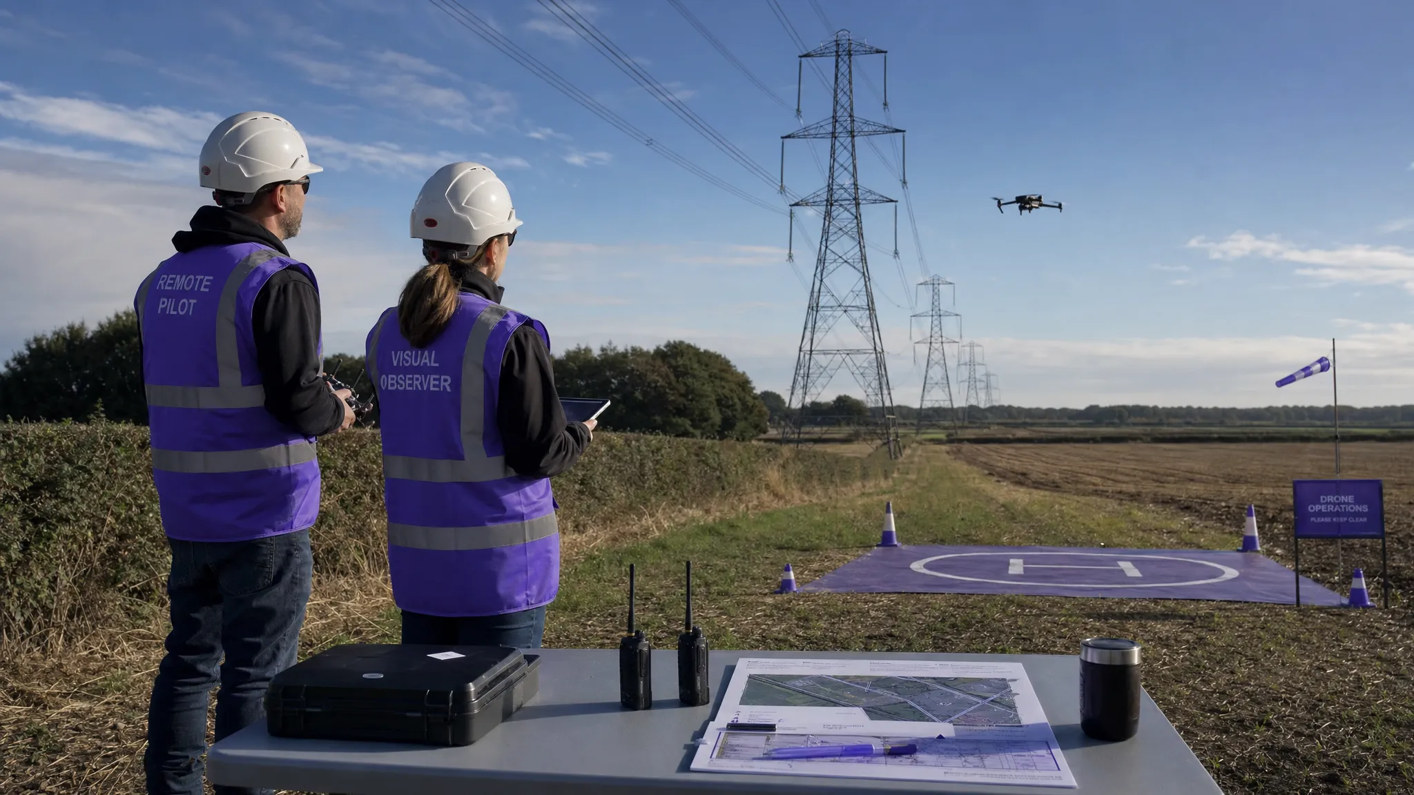 Drone Visual Line of Sight Rules Explained →
 Drone Regulations Checklist for Commercial Flights →
 Drone Flying Laws: A Practical Guide for Operators →
 CAA UAV Regulations Explained for UK Operators →
 UK SORA Explained for Drone Operators →