Drone Permit California Your Guide to Flying Legally
Flying a drone in California can feel like untangling a legal puzzle, but it all boils down to one simple fact: there is no single statewide "drone permit." Instead, you're dealing with a two-tiered system. You've got the federal FAA rules for pilots and their drones, and then you have a patchwork of local city and county rules that tell you where you can actually take off and land.
Understanding California's Drone Permit Puzzle
The biggest mental hurdle for drone pilots in California isn't some complicated state application. It's getting your head around this critical federal vs. local distinction.
The Federal Aviation Administration (FAA) owns the skies. They set the rules for how you fly, who's qualified to be a pilot, and what kind of gear your drone needs. But the local cities and counties? They control the ground—the parks, beaches, and public spaces where you need to launch and land. This is precisely why a flight can be perfectly legal by FAA standards but still get you in trouble with a local park ranger.
To fly legally, you have to play by both sets of rules. Think of it like driving a car. The DMV (the FAA in this analogy) gives you your license and registers your vehicle. But it's the local police department that hands out tickets for speeding or parking in the wrong spot on their streets.
Here’s a practical breakdown of what this means for you:
- Federal Compliance: This is about getting your drone registered with the FAA and having the right pilot certification. For hobbyists, that means passing The Recreational UAS Safety Test (TRUST). If you're flying for work, you need your Part 107 certificate.
- Local Compliance: This is all about doing your homework. Before you fly, you have to research and follow the specific rules for the city, county, or park district you're in. These can range from a total ban on drones in all city parks to needing a specific film permit if you're doing commercial work.
The real takeaway here is that getting compliant isn't a one-and-done deal. Every single time you fly in a new spot in California, you've got to do a quick check of the local rules before your drone's props even start spinning.
To help clear things up, let's look at a quick comparison.
Federal vs Local Drone Requirements at a Glance
This table gives you a quick summary of the different layers of drone regulation you'll encounter when flying in California.
| Regulatory Body | What It Governs | Who It Applies To | Key Requirement Example |
|---|---|---|---|
| Federal Aviation Admin (FAA) | Airspace, pilot certification, drone registration, and operational flight rules. | All drone operators nationwide | Obtaining a Part 107 certificate for commercial use. |
| Local Municipalities (Cities, Counties, Parks) | Ground-based activities, including where you can launch, land, and operate. | Operators within their specific jurisdiction | A city ordinance prohibiting drone takeoffs in public parks. |
As you can see, the FAA sets the foundation for safe flying everywhere, but local authorities have the final say on what happens on the ground within their boundaries.
The Federal Foundation of Drone Flight
In California, the rules for drone permits and registration have tightened up over the years. Right now, any drone weighing 0.55 pounds (250 grams) or more has to be registered with the FAA. This applies to everyone, whether you're flying for fun or for a client.
California is a huge hub for drone activity. According to FAA data, out of the 1.2 million+ drones registered across the country, California pilots account for roughly 12% of them—that's about 144,000 drones.
When dealing with the broader legal landscape, especially if your operations involve contracts or data privacy, you might find resources like California-specific legal templates for various agreements useful for related paperwork. This dual system—federal rules for the air, local rules for the ground—is the bedrock of every legal drone flight in the state.
Building Your Foundation with FAA Requirements
Before you even think about local drone permits in California, every flight has to clear the federal bar first. The Federal Aviation Administration (FAA) lays down the law for the entire country, and these rules aren't optional—they're the bedrock of any legal drone operation. This isn't just about ticking boxes; it's about ensuring safety and accountability across the national airspace.
The very first stop for most pilots is registration. If your drone weighs 0.55 pounds (250 grams) or more, it needs an FAA registration number. This is something you should only do through the official FAA DroneZone portal. You'll see plenty of third-party sites offering to do it for you at a markup, but the official process is simple and costs next to nothing.
Recreational vs. Commercial Flights
The "why" behind your flight is what determines the rulebook you need to follow. Are you just flying for the fun of it, or is there any kind of business purpose involved? This is a critical distinction that dictates the type of certification you’ll need.
This flowchart breaks down the two main paths for drone pilots.

As you can see, the moment your flight shifts from pure recreation to anything that benefits a business, the requirements get a lot more serious.
Understanding Your Pilot Certification Path
For recreational flyers, things are pretty straightforward. You'll need to pass The Recreational UAS Safety Test (TRUST). It’s a free, online test covering basic safety and knowledge. Once you pass, you get a certificate you need to have on you whenever you fly, just in case law enforcement or the FAA asks to see it.
Commercial operations, on the other hand, demand a Remote Pilot Certificate, which most of us just call a Part 107 certificate. Getting one involves passing a much tougher aeronautical knowledge exam at an FAA-approved testing center. This proves you have a solid grasp of airspace rules, weather patterns, operational limits, and what to do in an emergency.
Key Takeaway: There’s no grey area here. If your flight supports a business in any way—even grabbing a few quick photos for your company's social media—you're flying commercially and absolutely must have a Part 107 certificate.
The Critical Role of Remote ID
One of the biggest recent changes to federal drone rules is Remote ID. Think of it as a digital license plate for your drone. It broadcasts identification and location data, allowing the FAA and law enforcement to see who is flying in their airspace.
Most new drones you buy today come with Standard Remote ID already built in. If you’re flying an older model that doesn't have it, you have a couple of options:
- Attach a Broadcast Module: You can buy a separate, FAA-approved module that clips onto your drone and broadcasts the necessary info.
- Fly in an FRIA: You can fly without Remote ID, but only within an FAA-Recognized Identification Area (FRIA). These are typically established model aircraft fields for hobbyists.
To dig deeper into the specifics and make sure your gear is compliant, it's worth taking the time to learn more about https://blog.dronedesk.io/remote-id-drone/ and how it works. This isn't an optional rule—it's mandatory for virtually all flights in California.
The meticulous standards the FAA sets are all about safely weaving drones into the wider aviation world. To appreciate the level of detail involved, just look at the kind of work that goes into areas like aircraft structural integrity research. It's a good reminder of how seriously airspace safety is taken. Mastering these federal requirements isn't just a preliminary step—it's the most important one you'll take.
Navigating California's Maze of Local Drone Rules
So, you've got your FAA certifications handled. You’re good to go, right? Not so fast. In California, federal rules are only half the battle.
While the FAA owns the airspace, it's the cities, counties, and park districts that control the ground. This is the tripwire for so many pilots, even experienced ones. A flight that's perfectly legal by federal standards can land you a serious fine if it runs afoul of a local ordinance you never knew existed.
Think of it this way: the FAA gives you a driver's license, but it's the local town council that puts up the "No Parking" signs. Your Part 107 certificate is essential, but it doesn't give you a free pass to launch from a beach in Orange County where drones are flat-out banned. This patchwork of rules is the single biggest challenge of flying in the Golden State, demanding a level of pre-flight diligence that goes way beyond checking an airspace map.
The Ground Game: Why Local Rules Matter So Much
Local governments have a lot of say over what happens on public property within their borders. They use this authority to manage things like noise, wildlife protection, and public safety, especially in shared spaces like parks, beaches, and hiking trails.
Their go-to tool is the municipal code. Tucked away in these local laws, you'll find regulations that dictate everything from business operating hours to—you guessed it—where you can fly a drone. This creates a headache for pilots, as the rules can change the second you cross from one city into another.
For instance, you might be flying completely by the book in an unincorporated part of Los Angeles County. But drift a few hundred feet into the city limits of Calabasas, and suddenly you're playing by a whole different rulebook.
Here's the key takeaway every pilot needs to burn into their memory: local authorities can't tell you how to fly, but they absolutely can tell you where you can launch, land, and operate from. Understanding this distinction is crucial.
This isn't a uniquely Californian problem, but the state’s dense population and varied landscapes make it especially tricky. For a wider view, checking out guides on state drone laws across the country can show you how these regulatory patterns pop up elsewhere: https://blog.dronedesk.io/state-drone-laws/
A Tale of Three Cities: How Rules Differ Across California
To really see this patchwork in action, let's look at how three major California areas handle drones. The differences are stark and drive home the point that you can never, ever assume the rules are the same twice.
Los Angeles: A City of Ordinances
The City of Los Angeles has a specific ordinance (Municipal Code §56.31) that gives the LAPD the power to enforce drone rules on a local level. It mirrors a lot of FAA guidance but puts local law enforcement in the driver's seat.
- Key LA City Rules:
- No flying within 25 feet of any person (except during takeoff/landing).
- Flights are restricted to daylight hours, from sunrise to sunset.
- Flying within 5 miles of an airport requires prior authorization.
But here’s the classic jurisdictional trap: Los Angeles County, a completely separate government entity, bans drones in all county-run parks. A park might feel like it's "in LA," but whether it's managed by the city or the county changes everything.
San Francisco: Park Bans and Federal Overlays
San Francisco takes a different tack. The city's Park Code outright prohibits launching, landing, or operating a drone in any city park without a permit—and those permits are notoriously hard to get.
This makes iconic spots like Golden Gate Park and Dolores Park no-fly zones for most pilots. To complicate things even more, a lot of the best scenery, like the Presidio and Ocean Beach, is actually part of the Golden Gate National Recreation Area (GGNRA). That’s federal land, where drones are banned entirely.
Orange County: A Blanket Ban on Public Lands
Down in Orange County, many cities and the county itself have some of the most restrictive policies in the state. OC Parks and many local beaches have a blanket ban on all "motorized model craft," a category that includes drones.
- Yorba Linda: Prohibits flying within 500 feet of a special event.
- Laguna Beach: Has specific rules against flying over crowds on its famous beaches.
These examples aren't meant to scare you off, but to show that there's no "one-size-fits-all" rule for California. The only way to fly legally and confidently is to do your homework for each specific location, every single time.
Your Pre-Flight Research Framework
Making local research a non-negotiable part of your pre-flight routine is the best way to steer clear of trouble. Here’s a simple, repeatable framework to use before you fly anywhere new.
-
Identify the Jurisdiction. First things first: figure out the exact city and county you're in. A quick search on Google Maps usually clears this up. Don't forget that some areas are "unincorporated" and fall under county rules, not city rules.
-
Check the City's Municipal Code. Head to the city’s official government website and search their municipal code library. Use terms like "drones," "unmanned aircraft," or "model aircraft." This is the definitive source for local laws.
-
Review Parks and Recreation Rules. If you're flying near a park, go straight to the city or county's Parks and Recreation department website. They often have a specific page or FAQ section detailing their drone policies.
-
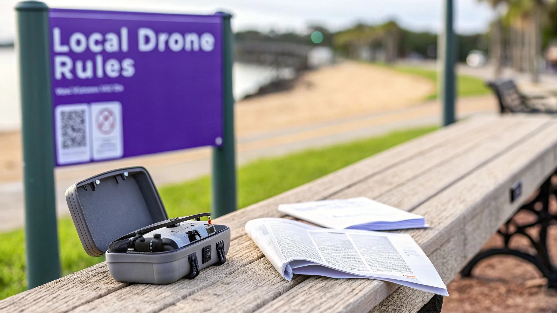
Look for Posted Signage. When you get to your location, do a quick visual sweep. Many parks and beaches post their drone rules on signs at entrances or along pathways. This is your final confirmation on the ground.
Following these steps builds a complete picture of the rules you’re operating under. It’s this diligence that separates a professional pilot from one who’s just asking for trouble.
How to Secure Permits for Special Drone Operations

Sometimes, your Part 107 certificate is just the baseline. For the kind of high-value work that really moves the needle—cinematic filming, detailed surveying, or public safety missions—you'll often find yourself needing an extra layer of specialized permits and waivers.
These aren't your run-of-the-mill flights. They require specific approvals from state or local agencies, and frankly, this is where the pros separate themselves from the amateurs. It means more paperwork, longer lead times, and a deep-dive into an agency's specific rulebook. But get it right, and you unlock some of the most rewarding and lucrative projects in the Golden State.
Commercial Filming in California State Parks
California’s state parks are magnets for filmmakers, but you can’t just show up with your drone and start rolling. Any commercial drone flight inside a California State Park demands a specific permit, a process that has become much more buttoned-up as drone use has exploded.
The oversight for these permits has definitely tightened up recently. To operate legally, you have to submit a solid application to the right State Park District, and they'll want to see all your ducks in a row. In fact, the California Department of Parks and Recreation now processes over 1,200 commercial drone permit applications annually for things like filming and surveying, with a solid 85% approval rate for those who do their homework.
To give yourself the best shot, your application package needs to be perfect.
- Proof of Part 107 Certification: This is table stakes. No certificate, no permit.
- Liability Insurance: Most districts won't even look at your application without a certificate of insurance (COI). Expect to need coverage between $1 million to $2 million, and they'll almost always require you to name the State of California as an additional insured party.
- Detailed Flight Plan: Get specific. I'm talking maps of your flight zones, designated takeoff and landing spots, and a clear outline of your safety protocols. How will you handle public interaction? How will you protect sensitive wildlife or natural features? Spell it all out.
Pro Tip: Don't drag your feet on this. The approval process for a California State Park permit can take anywhere from a few weeks to over a month. It all depends on how complex your flight is and how swamped that particular district office is. Plan ahead.
Public Safety and Drone as First Responder (DFR) Programs
Public safety agencies are all-in on drones, using them for everything from accident reconstruction to search and rescue. One of the most game-changing applications is the Drone as First Responder (DFR) program, where drones are sent ahead to emergencies to give ground units a live look at the scene before they even arrive.
These advanced missions, especially when they involve flying beyond the pilot's visual line of sight (BVLOS), require a whole different level of FAA approval. Public safety teams don't typically operate under Part 107 rules. Instead, they fly under a Certificate of Authorization or Waiver (COA). Think of a COA as a special grant from the FAA for specific types of public aircraft operations.
Getting a COA is a serious, formal process. It involves a comprehensive application to the FAA that details the agency’s mission, aircraft, pilot training programs, and safety protocols. We've got a full guide on the FAA Certificate of Authorization that breaks down everything involved. This is the key that unlocks critical, life-saving missions that would be impossible under standard commercial rules.
Specialized Drone Permit and Waiver Overview
To put it all in perspective, here’s a quick comparison of the permitting requirements for these two common special operations in California.
| Operation Type | Governing Body | Typical Requirement | Estimated Timeline |
|---|---|---|---|
| Commercial Park Filming | CA State Parks, Local Film Office | Specific Use Permit, Part 107, Liability Insurance | 2-6 weeks |
| Public Safety DFR | Federal Aviation Administration (FAA) | Certificate of Authorization (COA) or Waiver | 3-12 months or more |
As you can see, the timelines and requirements vary wildly. Whether you're chasing that perfect cinematic shot over Big Sur or helping launch a DFR program in a major city, mastering California's specialized drone permits is non-negotiable. It requires professionalism, painstaking planning, and a genuine respect for the rules governing our skies.
Staying Compliant on Every California Flight
Getting your certifications and permits is really just the starting line. The mark of a true professional is staying compliant on every single flight. This comes down to developing a rock-solid pre-flight routine and never underestimating the dynamic nature of California's airspace.
Complacency is the fastest way to get yourself into hot water. Before your props even think about spinning up, your first move must be a thorough check of the immediate airspace. This isn't just a friendly suggestion; it’s a core responsibility of any remote pilot in command.
Your Pre-Flight Airspace Checklist
The days of just glancing up at the sky are long gone. We've got amazing tools now that make airspace intelligence immediate and accessible. Your pre-flight workflow should always, always include firing up an FAA-approved app that provides LAANC (Low Altitude Authorization and Notification Capability).
- Check for TFRs: Temporary Flight Restrictions pop up all the time in California, especially during wildfire season or for big events like concerts and sporting events. An active TFR turns that area into a strict no-fly zone, period.
- Use B4UFLY: This is the FAA's official app, and it should be your first stop. It pulls real-time data on airspace restrictions and other crucial advisories straight from the source. No guesswork involved.
- Verify Controlled Airspace: You might be miles from LAX, but you could still be in controlled airspace from a small municipal field, a hospital heliport, or a private airstrip. Your app will show you the exact altitude ceilings and, in many cases, LAANC can get you instant authorization to fly.
A classic rookie mistake is assuming a clear sky means clear airspace. In California, an invisible restriction like a wildfire TFR can appear with very little notice, making a previously safe spot illegal to fly in. Checking your app right before you take off isn't optional—it's non-negotiable.
Navigating California’s Diverse Environments
Flying in California means you have to be a bit of a chameleon. A flight over a farm in the Central Valley is a completely different ballgame than a mission in downtown Los Angeles, and each environment has its own set of unwritten rules.
Take coastal flights, for instance. You absolutely have to be aware of Marine Protection Areas. Flying low over sensitive marine wildlife can cause serious distress and could land you in trouble with federal laws like the Marine Mammal Protection Act. Keep a respectful altitude and give them space.
Then you have urban centers like San Francisco or San Diego, where the challenges multiply. You're dealing with a soup of radio frequency interference, bizarre wind patterns whipping around tall buildings, and a much higher chance of interacting with the public. Your situational awareness has to be cranked to eleven.
This is truer now than ever, with the explosion of drones used by first responders. The adoption of Drone as First Responder (DFR) programs by public safety agencies here has surged. More than 40 agencies have submitted DFR waiver applications, with over 30 approved and response times now averaging under five minutes.
What does that mean for you? It means you have to be ready to yield to and avoid interfering with emergency aircraft at all times—they are becoming a common sight in our urban skies. You can learn more about the mainstream growth of DFR programs and their impact.
Always Carry Your Documentation
Finally, a simple but critical rule: never leave home without your credentials. Whether you're flying for fun or on a paid gig, you must be able to produce your documentation if asked by law enforcement or an FAA official.
Make sure your flight kit always includes:
- Proof of FAA Drone Registration: A digital copy on your phone or a physical printout works.
- Pilot Certification: Your TRUST certificate for recreational flying or your Part 107 Remote Pilot Certificate for any commercial work.
Treating every single flight with this level of diligence does more than just keep you out of trouble. It builds the habits of a safe, responsible, and professional pilot, ensuring you’re always prepared for whatever California's skies throw at you.
California Drone Law FAQs
Let's cut through the noise. Flying drones in California means juggling rules from the FAA, the state, and sometimes even the specific park you're standing in. Here are some straight answers to the questions I hear most often from pilots.
Do I Need a Permit to Fly for Fun in a Local Park?
This is the classic "it depends" scenario, and the answer almost always comes down to the local city or county that runs the park. The FAA doesn't demand a special permit for recreational flights—you just need your drone registered (if it’s over 250 grams) and proof you’ve passed The Recreational UAS Safety Test (TRUST).
But that's where federal oversight ends. The local municipality has total say over what happens on its own turf. Many cities, especially in Orange County and the Bay Area, have blanket ordinances banning drone takeoffs and landings in their parks without a specific activity permit.
Before you even think about launching, check the city’s parks and recreation website. Look for signs at the park entrance. Never, ever assume it’s okay to fly.
Can I Fly My Drone Over Private Property?
Flying over private property is a legal gray area every pilot needs to handle with care. Technically, the FAA controls the airspace, so you aren't trespassing just by flying over a house at a reasonable altitude.
However, California has incredibly strong privacy laws. If you're flying low, hovering, or recording someone in a way that violates their reasonable expectation of privacy, you're asking for legal trouble. The state's "Paparazzi Law" (Civil Code 1708.8) was even updated specifically to target intrusive drones.
The best practice is simple: just don't do it. Avoid flying directly over private homes and backyards, especially at low altitudes. It’s about showing basic respect and stopping a potential conflict before it starts.
What Happens If I Get Caught Flying Illegally?
The penalties really depend on what rule you broke. If you're caught flying an unregistered drone, the FAA can hit you with civil penalties up to $27,500. For commercial pilots operating without a Part 107 certificate, those fines can easily top $1,000 for each violation.
On a local level, breaking a city ordinance—like flying in a no-drone zone at a park—will likely earn you a citation and a fine, similar to a traffic ticket. It is absolutely essential to have all your documents ready to go, because both federal and local law enforcement are actively enforcing these rules across California.
Are There Statewide Drone Laws to Know About?
Yes. While most of the specific "where you can fly" rules are local, California has a couple of major statewide laws that apply everywhere you go.
- Paparazzi Law (Civil Code 1708.8): This law makes it illegal to use your drone to invade someone's privacy in any place they have a reasonable expectation of it (think backyards, windows, etc.).
- Interference with Emergency Responders (Penal Code §402): This one is serious. It's a crime to interfere with emergency personnel. Flying a drone near a wildfire and getting in the way of firefighting aircraft can lead to massive fines and even jail time.
These state laws are always in effect, sitting on top of whatever local ordinances you also need to follow.
Ready to stop juggling spreadsheets and paperwork for every flight? Dronedesk is the all-in-one platform that manages your clients, team, fleet, and compliance, cutting your flight planning time by up to 90%. See how thousands of pilots are flying safer and more efficiently at https://dronedesk.io.
 Part 108: What Drone Operators Should Expect →
 Beyond Visual Line of Sight BVLOS Explained →
 Drone Laws and Regulations Every Team Should Review →
 Current Drone Laws: What Changed in 2026? →
 JARUS SORA Explained in Plain English →
 Drone Visual Line of Sight Rules Explained →
 Drone Regulations Checklist for Commercial Flights →
 Drone Flying Laws: A Practical Guide for Operators →
 CAA UAV Regulations Explained for UK Operators →
 UK SORA Explained for Drone Operators →