Drone Operations Transforming Emergency Services - 8 Key Innovations
A New Era for Emergency Response
Drone operations are transforming emergency services, offering increased speed and safety during critical situations. This listicle details eight key ways drones are revolutionizing emergency response, providing valuable insights for drone operators, service providers, and emergency management teams. Discover how drone technology improves disaster response, search and rescue, medical supply delivery, and more. Understanding these applications is crucial for staying at the forefront of this rapidly developing field and contributing to more effective emergency services.
1. Rapid Aerial Assessment for Disaster Response
Rapid Aerial Assessment for Disaster Response is revolutionizing how emergency services respond to crises. This strategy leverages drones equipped with advanced imaging technology to quickly assess damage, locate survivors, and map affected areas following a disaster. Instead of relying on ground teams that may be hampered by debris, flooding, or other hazards, drones provide a bird's-eye view within minutes, enabling faster and more effective response efforts. Using high-resolution cameras, thermal imaging, and even multi-spectral sensors, these airborne platforms gather critical data that informs decision-making in the crucial early stages of a disaster. This real-time aerial reconnaissance capability significantly speeds up the initial assessment phase, moving it from hours or even days to just mere minutes. This allows for the prioritization of resources, targeted rescue operations, and ultimately, the saving of lives.

This approach is particularly powerful due to its ability to access otherwise inaccessible areas. Features such as thermal imaging allow for the detection of survivors trapped under rubble or obscured by smoke and low visibility, while multi-spectral imaging provides a comprehensive view of damage extent across a wide area. Automated flight patterns ensure systematic coverage, and live video streaming to command centers offers real-time situational awareness. Drone operations are transforming emergency services, and rapid aerial assessment is a prime example of this transformation. Learn more about Rapid Aerial Assessment for Disaster Response.
This method is invaluable in a variety of disaster scenarios, from earthquakes and wildfires to floods and structural collapses. The California Fire Department's use of drones during the 2018 Camp Fire to pinpoint hotspots and locate trapped survivors demonstrated the life-saving potential of this technology. Similarly, following the Surfside condo collapse in 2021, Miami-Dade Fire Rescue deployed drones to navigate the unstable debris field, aiding in search and rescue efforts. The 2015 Nepal earthquake response and Hurricane Harvey in 2017 showcased the effectiveness of drones in mapping inaccessible mountain villages and assessing flood damage, respectively. These examples highlight the versatility and crucial role of drones in diverse disaster situations.
Pros:
- Significantly reduces initial assessment time.
- Provides access to inaccessible areas.
- Improves resource allocation efficiency.
- Reduces risk to emergency personnel.
- Enables data-driven decision-making early on.
Cons:
- Weather limitations (high winds, heavy rain).
- Limited flight time necessitates multiple batteries/drones.
- Initial investment costs for equipment and training.
- Potential for data overload at command centers.
- Requires specialized pilots in high-stress situations.
Tips for Effective Implementation:
- Establish pre-programmed flight patterns for common disaster scenarios in your area.
- Train multiple team members as drone pilots to ensure 24/7 availability.
- Develop clear protocols for data processing and dissemination to avoid overwhelming command centers.
- Regularly practice rapid deployment drills to minimize setup time in real emergencies.
- Invest in weatherproofing technology to extend operational conditions and maximize usability.
Organizations like DJI Enterprise with their Disaster Relief Program, Global Medic, the International Association of Fire Chiefs, and FEMA have been instrumental in popularizing and developing best practices for drone use in disaster response. Rapid Aerial Assessment deserves its place on this list because it represents a paradigm shift in how we respond to emergencies, offering a faster, safer, and more efficient way to assess damage, locate survivors, and ultimately, mitigate the impact of disasters.
2. Drone-Based Search and Rescue Operations
Drone-based search and rescue (SAR) is revolutionizing how we locate missing persons, offering a significantly faster, safer, and more effective approach than traditional methods. This strategy utilizes drones equipped with specialized sensors and cameras to scan vast areas, pinpoint human signatures, and ultimately save lives in time-critical situations. These drones act as an aerial extension of search teams, allowing them to quickly cover challenging terrain and identify individuals who may be obscured from view or otherwise difficult to locate. This technology is rapidly becoming a cornerstone of modern emergency services, transforming how we respond to missing person reports and offering a vital lifeline in diverse scenarios, from wilderness searches to disaster zones.

Drones deployed for SAR operations are typically outfitted with advanced technology, including high-resolution thermal imaging cameras capable of detecting body heat signatures even in darkness or through dense foliage. AI-powered human detection algorithms further enhance accuracy by automatically identifying potential human forms within the captured imagery. Coupled with long-range zoom cameras with stabilization and specialized audio equipment for detecting calls for help, these platforms offer an unparalleled advantage in search efforts. The integration with GIS mapping systems allows for precise documentation of searched areas, ensuring efficient coverage and minimizing redundancy.
The benefits of integrating drones into SAR operations are substantial. They can search expansive areas much faster than ground teams, operate effectively in low visibility conditions, and significantly reduce the exposure of search personnel to hazardous environments. Furthermore, their ability to detect subtle signs of life often invisible to the naked eye, such as faint heat signatures or slight movements, has proven invaluable in numerous successful rescues.
Examples of Successful Implementation:
- Yosemite National Park (2019): Lost hikers were successfully located using thermal drones.
- Devon and Cornwall Police (UK): DJI Matrice drones have aided in finding missing elderly patients.
- Swiss Alps: Drones are regularly employed to locate avalanche victims.
- Royal Canadian Mounted Police (RCMP): Drones are critical tools for finding missing persons in remote wilderness areas.
Tips for Effective Drone SAR Operations:
- Develop Search Patterns: Create a library of search patterns optimized for various terrains and scenarios.
- Day/Night Transition Protocols: Establish clear procedures for transitioning between day and night operations.
- Thermal Signature Training: Train drone operators to recognize subtle thermal signatures that could indicate a person.
- Multi-Drone Coordination: Utilize multiple drones in coordinated search patterns for maximized coverage.
- Integrated Approach: Combine drone operations with traditional search methods for optimal results.
Pros and Cons of Drone-Based SAR:
Pros:
- Rapid and efficient search capabilities
- Effective in challenging conditions (darkness, low visibility)
- Enhanced safety for search teams
- Detection of otherwise invisible signs of life
- Detailed search area documentation
Cons:
- Limited battery life restricts continuous operation
- Dense canopies can obstruct thermal detection
- Requires specialized operator training
- High equipment costs (thermal cameras, zoom lenses)
- Airspace restrictions may apply in certain areas
Key Players in Drone SAR:
- DJI (Specialized public safety drones)
- FLIR Systems (Thermal imaging technology)
- National Association for Search and Rescue (NASAR)
- Project Lifesaver International
Drone-based SAR deserves its place within the transformative landscape of emergency services due to its proven ability to expedite searches, enhance safety, and ultimately increase the likelihood of successful outcomes. This technology is not just a supplementary tool; it is rapidly becoming a primary resource in the ongoing effort to protect and preserve life in emergencies. For solo drone operators, small to medium drone teams, enterprise drone operations managers, and other stakeholders, understanding and implementing drone-based SAR protocols is crucial for maximizing the potential of this life-saving technology.
3. Drone-Delivered Emergency Medical Supplies
Drone-delivered emergency medical supplies represent a revolutionary advancement in emergency services, significantly impacting how critical care is delivered. This strategy employs drones to swiftly transport vital medical resources, such as blood products, medications, defibrillators, and specialized equipment, directly to emergency scenes or remote locations. By circumventing ground traffic and geographical obstacles like mountains or bodies of water, medical drones can deliver life-saving supplies much faster than traditional methods, significantly improving outcomes in time-critical situations. This speed is crucial for conditions like strokes, heart attacks, and severe bleeding, where rapid intervention can mean the difference between life and death. This approach is a cornerstone of drone operations transforming emergency services.

These drones are specifically designed for medical transport. Features often include temperature-controlled payload compartments to maintain the integrity of sensitive supplies, automated flight paths with obstacle avoidance technology for safe and efficient navigation, GPS precision delivery capabilities for pinpoint accuracy, specialized landing mechanisms adaptable to various terrains, and two-way communication systems between drone operators and on-site medical personnel. Payload capacity is also optimized to accommodate the size and weight of necessary medical items.
This approach is particularly valuable in scenarios where traditional emergency response is delayed or impractical. Examples of successful implementation include Zipline's nationwide blood and vaccine delivery network in Rwanda, Matternet's medical delivery systems integrated into Switzerland's hospital networks, and Swedish programs utilizing AED (defibrillator) delivery drones, achieving response times of 4 minutes compared to 20+ minutes for ambulances. In the United States, UPS and WakeMed have an FAA-approved program for medical sample transport in North Carolina. These examples showcase the real-world impact of drone technology on emergency response.
Pros:
- Dramatically reduces delivery time: This is the primary advantage, crucial for time-sensitive medical emergencies.
- Provides access to remote or disaster-affected areas: Drones can reach locations inaccessible by road, especially after natural disasters or in remote, underserved areas.
- Enables just-in-time delivery of temperature-sensitive products: Temperature control ensures the viability of blood products, vaccines, and other sensitive materials.
- Reduces need for widespread stockpiling: Hospitals and clinics can reduce on-site inventory of expensive and rarely used supplies, relying on rapid drone delivery when needed.
- Can operate 24/7 with minimal staffing requirements: Automated systems minimize personnel needs, ensuring availability around the clock.
Cons:
- Limited payload capacity compared to ground vehicles: Drones can carry smaller loads than ambulances or trucks, potentially limiting the quantity of supplies per delivery.
- Range restrictions based on battery life and regulations: Current technology limits flight range, and regulations restrict beyond-visual-line-of-sight (BVLOS) operations in many areas.
- Weather dependencies affecting reliability: Strong winds, rain, or snow can ground drone operations.
- Requires specialized landing zones or receiver training: Safe landing and retrieval require designated areas or trained personnel on-site.
- Regulatory hurdles in many jurisdictions for BVLOS operations: Expanding the potential of medical drone delivery hinges on evolving regulations.
Tips for Implementation:
- Begin with high-impact, lightweight medical supplies: Start with items like blood, antivenom, or critical medications to demonstrate the value and feasibility of drone delivery.
- Develop relationships with aviation authorities early: Secure necessary approvals and permits for drone operations, especially for BVLOS flights.
- Create redundant communication systems to ensure reliability: Backup communication systems minimize the risk of communication failures during critical deliveries.
- Establish clear handoff protocols for medical personnel receiving supplies: Develop standardized procedures for safe and efficient transfer of medical supplies from drone to medical staff.
- Implement tracking and chain-of-custody systems for controlled substances: Ensure secure tracking and documentation for controlled medications to maintain accountability.
Drone-delivered medical supplies deserve a prominent place in the list of drone operations transforming emergency services because they offer a tangible, life-saving solution to existing limitations in emergency response. By addressing the challenges of time, distance, and accessibility, this technology has the potential to revolutionize how we deliver critical care and improve patient outcomes worldwide. Pioneers like Zipline International, Matternet, Wingcopter, Everdrone (AED delivery specialists), and Dr. Timothy Amukele (Johns Hopkins pathologist pioneering drone transport of lab specimens) are paving the way for broader adoption and demonstrate the transformative power of this technology.
4. Fire Detection and Monitoring Systems
Drone operations are transforming emergency services, and fire detection and monitoring is a prime example. This strategy utilizes drones equipped with cutting-edge technology to provide real-time intelligence to firefighting teams, drastically improving their ability to combat wildfires and structural fires. This approach deserves its place on this list because it offers a significant leap forward in fire management, offering improved safety for firefighters and more effective resource deployment.
This method works by deploying drones fitted with high-definition thermal cameras, multi-spectral cameras, and gas sensors. These tools allow firefighters to "see" through smoke, identify hotspots invisible to the naked eye, and analyze the chemical composition of the smoke plume. Automated hotspot detection algorithms further enhance this capability, flagging critical areas requiring immediate attention. 3D mapping capabilities even allow for modeling fire behavior, providing valuable predictive insights. This real-time data is then transmitted to incident command posts, enabling informed, data-driven decision-making.
Features and Benefits:
- High-definition thermal imaging: Penetrates smoke to reveal hidden hotspots and fire perimeters.
- Multi-spectral cameras: Assess burn severity, vegetation health, and identify potential fuel sources.
- Automated hotspot detection algorithms: Quickly pinpoint critical areas requiring immediate attention.
- Gas sensors: Measure air quality and combustion products, providing insights into fire intensity and potential hazards.
- 3D mapping capabilities: Model fire behavior and predict fire spread.
- Live data transmission: Delivers critical information to incident command posts in real-time.
Pros:
- Provides real-time fire perimeter mapping impossible with ground observations, offering a comprehensive overview of the fire's extent.
- Identifies spot fires and flare-ups before they expand, preventing the fire from spreading uncontrollably.
- Monitors the effectiveness of fire suppression tactics, allowing for adjustments in strategy as needed.
- Reduces firefighter exposure to dangerous conditions, enhancing personnel safety.
- Enables data-driven decisions about evacuation zones and resource deployment, optimizing resource allocation.
Cons:
- Smoke density can impair visibility, even for thermal cameras, limiting effectiveness in extremely dense smoke.
- High winds associated with fires can ground drone operations, restricting usage in certain weather conditions.
- Heat damage poses a risk to equipment flying near intense fires, requiring careful operation and monitoring.
- Battery limitations constrain continuous monitoring time, necessitating battery swaps and potentially impacting real-time coverage.
- Coordination challenges with aerial firefighting assets require careful planning and communication to ensure safe airspace management.
Examples of Successful Implementation:
- The California Department of Forestry and Fire Protection (CAL FIRE) regularly uses drone teams during major wildfires.
- Australia deployed drones extensively during the devastating 2019-2020 bushfire crisis.
- Spain's firefighting services utilize drones to monitor forest fires in real-time.
- Colorado's Center of Excellence for Advanced Technology Aerial Firefighting has a dedicated drone program.
Actionable Tips for Drone Operators in Emergency Services:
- Establish minimum safe distances from fire fronts for different drone models to prevent equipment damage.
- Develop standard operating procedures for integrating drone operations with traditional aerial firefighting efforts.
- Create predetermined flight patterns for systematic fire perimeter mapping, ensuring comprehensive coverage.
- Train operators specifically in fire behavior interpretation to maximize the value of the data collected.
- Implement automated change detection software to identify rapidly evolving fire conditions and alert command personnel.
Popularized By:
- DJI Enterprise with its specialized thermal solutions.
- FLIR Systems thermal imaging technology.
- Parrot's professional-grade thermal drones.
- The Los Angeles Fire Department's drone program, led by Battalion Chief Richard Fields.
- The International Association of Fire Chiefs' UAS program.
By leveraging drone technology, fire departments and emergency services organizations can significantly enhance their fire detection and monitoring capabilities. This, in turn, leads to safer operations for firefighters, more effective resource allocation, and better outcomes in containing and suppressing fires. This application of drone technology is a critical component of the ongoing transformation of emergency services, offering a powerful tool in protecting lives and property.
5. Hazardous Material (HazMat) Incident Response
Hazardous material (HazMat) incidents pose significant risks to first responders. The inherent danger of exposure to unknown and potentially lethal substances necessitates a cautious and informed approach. This is where drone operations are transforming emergency services, offering a safer and more efficient way to manage these complex situations. HazMat incident response using drones allows for the assessment, monitoring, and data gathering in hazardous environments without immediately exposing emergency personnel to dangerous substances, making it a critical component of modern emergency response strategies. This approach is rapidly gaining traction as a key element of drone operations transforming emergency services.
These specialized drones act as the "eyes in the sky," equipped with an array of sophisticated tools to navigate and analyze dangerous scenarios. Chemical sensor arrays detect industrial chemicals, gases, and CBRN (Chemical, Biological, Radiological, Nuclear) agents. Radiation detectors assess radiation levels, while specialized cameras, often with high-resolution zoom capabilities and specialized lighting for nighttime operations, provide clear visuals of the scene. Some advanced models even possess sample collection mechanisms and explosion-proof designs for use in flammable environments. This detailed information allows incident commanders to make informed decisions, minimizing risk and maximizing effectiveness.
Examples of Successful Implementation:
Several real-world examples highlight the effectiveness of drones in HazMat incidents:
- Houston Fire Department: Deployed drones after the Arkema chemical plant explosion to monitor the situation and assess the extent of the damage.
- Merseyside Fire & Rescue Service (UK): Utilizes drones during industrial chemical spills to gather critical data and monitor the spread of hazardous materials.
- New York Fire Department: Employs drones during gas leak investigations, identifying the source and assessing the risk to surrounding areas.
- Japanese Authorities: Deployed drones to assess radiation levels and monitor the situation after the Fukushima disaster.
Pros and Cons:
| Pros | Cons |
|---|---|
| Eliminates initial human exposure to unknown hazards | Specialized sensors add significant weight, affecting flight time |
| Provides rapid assessment of incident scope and severity | Sampling capabilities are limited compared to human technicians |
| Enables continuous monitoring of changing conditions | Wind can affect gas concentration readings |
| Reduces need for Level A suit entries by human responders | High cost for specialized HazMat drone packages |
| Creates detailed documentation for later analysis | Specialized training is required for effective interpretation of sensor data |
Actionable Tips for Effective HazMat Drone Operations:
- Pre-programmed Flight Patterns: Create flight patterns specific to various HazMat scenarios to ensure consistent and efficient data collection.
- Decontamination Protocols: Establish clear decontamination procedures for drones after deployment in hazardous environments to prevent cross-contamination.
- Standard Operating Procedures: Develop standardized response procedures that integrate drone data into HazMat decision-making processes.
- Operator Training: Train operators thoroughly in interpreting chemical sensor data, plume modeling, and other relevant skills.
- Rapid Deployment Practice: Conduct regular drills to practice rapid deployment and minimize response time in critical situations.
When and Why to Use This Approach:
This approach is invaluable whenever there's a suspected release or presence of hazardous materials. It's particularly beneficial in situations with:
- Unknown Substances: Drones can identify the substance without risking human exposure.
- Confined Spaces: Drones can access areas too dangerous or difficult for humans to enter.
- Large-Scale Incidents: Drones can provide a comprehensive overview of the incident area.
- Ongoing Monitoring: Drones can track changes in the situation over time.
Key Players in the Industry:
Companies like FLIR Systems (with their specialized detection equipment), DroneSense (HazMat response systems), and Industrial Scientific (gas detection technology) are at the forefront of this technology. Organizations like the EPA's Environmental Response Team and the National Fire Protection Association (NFPA) also play a crucial role in developing best practices and standards.
By reducing risk to personnel, improving situational awareness, and enabling more effective decision-making, HazMat drones are truly transforming emergency services and are essential tools for any organization dealing with hazardous materials.
6. Crowd Management and Public Safety Monitoring
Drone operations are transforming emergency services, and crowd management and public safety monitoring represent a significant advancement in this field. This strategy employs drones equipped with high-resolution cameras, thermal imaging, and advanced software to monitor large public gatherings, events, and emergency evacuations, offering real-time situational awareness to law enforcement and emergency service personnel. This aerial perspective provides a comprehensive overview impossible to achieve from ground level, making it an invaluable tool for maintaining public safety.
How it Works: Drones capture high-resolution video streams, which are transmitted to command centers. AI-powered crowd density analysis software and anomaly detection algorithms process this data, identifying potential safety issues like overcrowding, bottlenecks, or suspicious activities. The drone's loudspeaker system can then be used to make public announcements, directing people away from congested areas or providing critical instructions during emergencies. Thermal imaging allows for effective monitoring even in low-light or nighttime conditions. Automated crowd counting and flow analysis provide valuable data for resource allocation and post-event analysis. These systems can also integrate with existing security camera networks, creating a comprehensive surveillance and response system.
Features and Benefits: This technology offers numerous advantages:
- Enhanced Situational Awareness: Provides a complete aerial view, enabling early identification of developing problems or bottlenecks.
- Improved Resource Allocation: Helps direct personnel and resources where they are most needed during large events or evacuations.
- Proactive Safety Measures: Allows for preventative measures to be taken before situations escalate into critical incidents.
- Efficient Emergency Response: Facilitates faster response times and better coordination between different agencies and response teams.
- Valuable Data Collection: Creates comprehensive documentation for post-event analysis and future planning.
Real-world Examples: The efficacy of drone-based crowd management has been demonstrated globally:
- London Metropolitan Police: Utilize drones during major public events for enhanced security and surveillance.
- Rio de Janeiro Olympics (2016): Drones played a vital role in security operations during the games.
- Singapore Police Force: Employ drones for crowd monitoring during National Day celebrations.
- Boston Marathon (post-2013): Drones have been incorporated into security operations to enhance safety and prevent future incidents.
Pros and Cons: While the benefits are significant, it’s important to consider both sides:
Pros:
- Comprehensive aerial view
- Early identification of potential issues
- Improved resource allocation
- Valuable post-event analysis
- Enhanced inter-agency coordination
Cons:
- Privacy concerns regarding surveillance
- Noise pollution at lower altitudes
- Regulatory restrictions
- Potential for public apprehension
- Weather limitations
Real-time data analysis from drones can significantly enhance crowd management strategies. Leveraging platforms like analytics for chatbots can offer similar advantages for managing large volumes of communication data, improving response times and efficiency.
Actionable Tips for Effective Drone Operations:
- Transparency and Privacy: Establish clear privacy policies and make them publicly available to address concerns about surveillance.
- Noise Mitigation: Utilize higher altitudes to reduce noise disruption while maintaining effective monitoring.
- Strategic Flight Planning: Develop specific flight patterns for different types of events and venues to maximize coverage and efficiency.
- Emergency Response Protocols: Create clear protocols based on potential situations identified by the drones.
- Specialized Training: Train drone operators in identifying crowd dynamics and potential safety or security issues.
Key Players and Influencers:
- Axon (formerly Taser): Provides public safety drone systems.
- DJI Government Edition drones: Specialized drones for governmental applications.
- Major metropolitan police departments: Increasingly adopting drone technology for crowd management.
- International Association of Chiefs of Police: Advocates for the use of drones in law enforcement.
- Dr. Keith Still, professor of crowd science: Promotes the use of aerial monitoring for crowd safety.
Drone operations are undoubtedly transforming emergency services, and the use of drones for crowd management and public safety monitoring is a prime example. This technology offers an unprecedented level of situational awareness and control, enabling proactive safety measures, more efficient resource allocation, and faster response times. By carefully considering the ethical and practical implications and implementing appropriate safeguards, this technology can significantly improve public safety during large gatherings and emergencies.
7. Post-Disaster Infrastructure Assessment
Post-disaster infrastructure assessment is rapidly transforming how emergency services respond to and recover from catastrophic events. This innovative approach leverages drone technology to quickly and safely evaluate the condition of critical infrastructure following disasters like earthquakes, hurricanes, floods, and wildfires. As part of the wider trend of drone operations transforming emergency services, it offers a powerful tool for informed decision-making and efficient resource allocation.
This method involves deploying drones equipped with advanced imaging and mapping technologies to capture detailed data about damaged structures. These drones, acting as aerial eyes, can access dangerous or inaccessible areas, providing crucial information without putting human inspectors at risk. They gather data through a variety of sensors, including:
- LiDAR sensors: Create highly accurate 3D models of structures, revealing even subtle deformations.
- Photogrammetry software: Processes multiple images to generate detailed structural models and measurements.
- Crack detection algorithms: Automatically identify and highlight structural weaknesses like cracks and fissures.
- Millimeter-wave radar: Enables "seeing through" certain materials like debris or smoke, uncovering hidden damage.
- Machine learning systems: Automate the classification of damage types and severity levels.
- GPS-tagged imagery: Provides precise location data for every image and measurement, essential for documentation and repair planning.
The benefits of using drones for post-disaster infrastructure assessment are substantial:
Pros:
- Enhanced Safety: Provides a comprehensive assessment without putting human inspectors in harm's way.
- Speed and Efficiency: Dramatically reduces the time required for infrastructure surveys compared to traditional methods.
- Precise Documentation: Creates detailed records of damage for insurance claims and disaster aid applications.
- Accessibility: Enables inspection of otherwise inaccessible structures like damaged bridges or unstable buildings.
- Data-Driven Decisions: Facilitates informed prioritization of limited repair resources based on objective data.
Cons:
- Cost: High-end sensors and software required for detailed structural assessments can be expensive.
- Expertise: Complex data processing and interpretation require specialized expertise.
- Limitations: Some structural issues may still require physical inspection for confirmation.
- Battery Life: Drone battery limitations can affect the scope of a single survey.
- Data Management: Large datasets generated by these surveys require robust data storage and management solutions.
Real-world examples demonstrate the effectiveness of this strategy:
- Puerto Rico: Following Hurricane Maria, drones were used to assess damage to bridges, enabling rapid repairs and restoring vital transportation routes.
- Italy: Drones have been instrumental in assessing historical buildings after earthquakes, aiding in preservation efforts.
- Florida: The Florida Department of Transportation utilizes drones for bridge inspections following hurricanes, ensuring the safety and integrity of critical infrastructure.
- Japan: After the Fukushima disaster, drones were used to assess the nuclear facilities, providing valuable information in a hazardous environment.
Learn more about Post-Disaster Infrastructure Assessment
To effectively integrate drone-based post-disaster infrastructure assessments into your operations, consider these tips:
- Baseline Imagery: Establish a library of pre-disaster imagery of critical infrastructure to serve as a comparison point.
- Standardized Protocols: Develop standardized assessment protocols for different types of infrastructure (bridges, roads, buildings, etc.).
- Training: Train drone operators to recognize and document critical structural damage patterns.
- Data Management: Implement robust data management systems specifically designed for infrastructure assessment data.
- Collaboration: Partner with structural engineering experts to interpret complex data and provide actionable recommendations.
This method deserves its place on this list of "Drone Operations Transforming Emergency Services" because it directly addresses the crucial need for rapid and accurate damage assessment following disasters. It empowers emergency managers, engineers, and government agencies to make informed decisions, allocate resources effectively, and expedite the recovery process, ultimately contributing to the safety and well-being of affected communities. By embracing this technology, we can move towards more resilient and responsive disaster management strategies.
8. Autonomous Emergency Response Networks
Autonomous Emergency Response Networks represent a paradigm shift in how we handle emergencies. This advanced strategy establishes interconnected systems of autonomous drones, strategically positioned in docking stations throughout a coverage area, ready to be deployed instantly. These networks leverage AI decision-making to dispatch the most appropriate drone, equipped with the necessary payload, in response to emergency calls with minimal human intervention. This dramatically reduces response times, especially crucial for time-sensitive situations like cardiac arrests, drownings, or accidents in remote locations, firmly placing this approach among the top drone operations transforming emergency services.

The infographic above visualizes the process flow of an autonomous drone responding to a cardiac arrest. It highlights the key steps starting from the emergency call triggering the dispatch system, the drone's autonomous flight to the scene, delivery of the AED, and finally, the arrival of first responders. The rapid, automated nature of this process is key to its effectiveness in time-critical situations. The visualization clearly demonstrates the significant time savings achieved through this autonomous approach.
This approach works by integrating AI-powered dispatch systems directly with emergency call centers. When a call comes in, the system analyzes the situation, selects the nearest available drone with the appropriate payload (e.g., AED, life raft, medical supplies), and dispatches it autonomously. The drone navigates to the scene using obstacle avoidance technology, maintaining real-time communication with both dispatchers and on-scene responders. Upon arrival, the drone delivers the payload and can relay vital information back to emergency services, enhancing situational awareness. You can learn more about Autonomous Emergency Response Networks.
Examples of successful implementations are already emerging globally. Sweden's Everdrone network is delivering AEDs with average response times under four minutes. Other examples include Dongguan, China's integrated drone emergency response system, an autonomous search and rescue network in the Swiss Alps, and South Korea's smart city drone response network in Busan.
Features and Benefits:
- Self-charging docking stations: Ensures 24/7 operational readiness.
- AI-powered dispatch: Optimizes resource allocation and minimizes response times.
- Autonomous flight and obstacle avoidance: Enables safe and efficient navigation.
- Specialized payloads: Allows for a tailored response to diverse emergency types.
- Real-time communication: Keeps all stakeholders informed and connected.
- All-weather operation capabilities: Maximizes system availability.
Pros:
- Drastically reduces initial response time for life-threatening emergencies.
- Provides 24/7 coverage with minimal staffing requirements.
- Scales more efficiently than traditional emergency services.
- Cost-effectively serves remote or underserved areas.
- Collects valuable response data for continuous improvement.
Cons:
- High initial infrastructure investment.
- Complex regulatory approval process in most jurisdictions.
- Public acceptance challenges for fully autonomous systems.
- Cybersecurity concerns with networked emergency systems.
- Technical limitations in severe weather conditions.
Tips for Implementation:
- Begin with single-purpose, high-impact use cases like AED delivery.
- Develop public education campaigns before implementation.
- Create collaborative frameworks with traditional emergency services.
- Establish clear protocols for handoff between drone and human responders.
- Implement progressive levels of autonomy rather than immediate full automation.
Autonomous Emergency Response Networks are most effective when addressing time-critical emergencies in areas with limited access or where rapid response is paramount. While challenges remain, the potential benefits of these systems are immense, paving the way for a future where drone operations play an integral role in saving lives and enhancing the effectiveness of emergency services.
8-Methodology Impact Comparison
| Methodology | Implementation Complexity 🔄 | Resource Requirements ⚡ | Expected Outcomes 📊 | Ideal Use Cases 💡 | Key Advantages ⭐ |
|---|---|---|---|---|---|
| Rapid Aerial Assessment for Disaster Response | Moderate: specialized pilots, training, equipment | High: drones, thermal & multi-spectral cameras, batteries | Fast situational awareness, resource prioritization | Immediate post-disaster damage & survivor assessment | Rapid data collection, improves safety, data-driven decisions |
| Drone-Based Search and Rescue Operations | High: AI systems, operator training, sensor integration | High: thermal and zoom cameras, AI detection tools | Faster large-area search, detection in darkness or low visibility | Wilderness or disaster zone search for missing persons | Enhanced detection, reduces team risk, detailed area documentation |
| Drone-Delivered Emergency Medical Supplies | Moderate: flight path planning, regulatory approval | Moderate: temperature-controlled payload, communication systems | Rapid delivery of critical medical supplies, 24/7 operation | Time-sensitive medical delivery to remote or blocked areas | Drastically reduced delivery time, access to remote locations |
| Fire Detection and Monitoring Systems | High: sensor integration, coordination with firefighting | High: thermal cameras, gas sensors, data transmission | Real-time fire behavior mapping, early hotspot detection | Wildfire monitoring and tactical firefighting support | Real-time data, reduces firefighter risk, enhances resource use |
| Hazardous Material (HazMat) Incident Response | High: specialized sensors, complex data interpretation | High: chemical, radiation sensors, explosion-proof drones | Safe rapid assessment, continuous monitoring of HazMat incidents | Industrial spills, chemical/radiation incident response | Eliminates human exposure, detailed incident documentation |
| Crowd Management and Public Safety Monitoring | Moderate: AI integration, privacy compliance | Moderate: high-res cameras, AI crowd analysis, loudspeakers | Real-time crowd monitoring, issue identification, coordination | Large events, emergency evacuations, public safety surveillance | Comprehensive views, early problem detection, multi-agency coordination |
| Post-Disaster Infrastructure Assessment | High: advanced sensors, complex data processing | High: LiDAR, photogrammetry software, machine learning | Detailed 3D structural models, damage classification | Post-disaster structural safety and repair prioritization | Precise assessments without risk, speeds inspections, data for aid claims |
| Autonomous Emergency Response Networks | Very High: AI dispatch, autonomous flight, docking stations | Very High: networked drones, docking infrastructure, AI systems | Drastically reduced emergency response times, continuous coverage | Life-threatening emergencies needing rapid intervention (e.g. AED delivery) | 24/7 autonomous response, scalable, remote area coverage |
The Future of Emergency Services, Up in the Air
Drone operations are transforming emergency services in profound ways, offering unprecedented speed, efficiency, and safety advantages. From rapid aerial assessments for disaster response and drone-based search and rescue operations, to delivering emergency medical supplies and monitoring hazardous material incidents, the applications we've covered demonstrate the vast potential of this technology. The ability of drones to provide real-time data for fire detection, crowd management, and post-disaster infrastructure assessment is revolutionizing how emergency teams respond to and manage crises. Furthermore, the emergence of autonomous emergency response networks promises to further enhance these capabilities, pushing the boundaries of what's possible in critical situations.
Mastering these drone-based approaches is not just about adopting new technology; it's about saving lives and improving the effectiveness of emergency response across the board. By embracing these advancements, emergency service providers can significantly reduce response times, improve situational awareness, minimize risks to personnel, and ultimately, provide better outcomes for those in need. The future of emergency services is undeniably linked to the continued development and integration of drone technology. As regulations adapt and technology advances, the potential for innovation within this space is truly limitless, promising a safer and more resilient future for all.
Ready to elevate your drone operations for emergency services and unlock their full potential? Explore Dronedesk, the comprehensive platform designed to manage and scale complex drone operations, at Dronedesk. Dronedesk empowers emergency service providers with the tools they need to effectively leverage drone technology and maximize their life-saving impact.
 What Is a BVLOS Drone and Why It Matters →
 Drone Registration Regulations Businesses Must Follow →
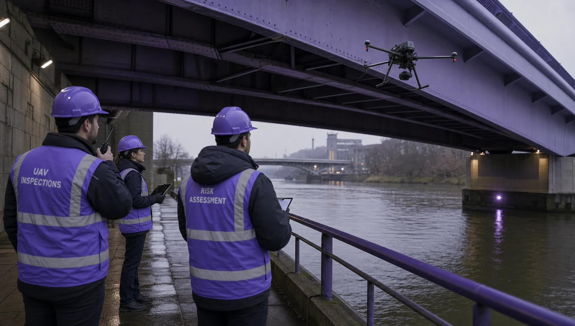 Atypical Airspace Explained for UK Drone Operators →
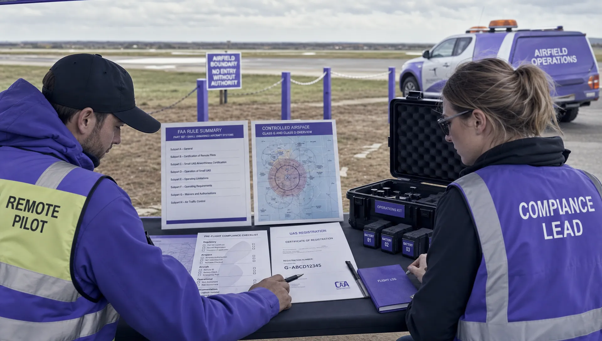 FAA Unmanned Aircraft Regulations Made Simple →
 Part 107 Test Tips to Pass With Confidence →
 How to Pass the FAA Drone Written Test First Time →
 What a BVLOS Flight Means for Risk and Compliance →
 Drone VLOS Rules Explained for Commercial Teams →
 FAA Remote ID Rule Explained for Commercial Pilots →
 Drone Legal Requirements for Commercial Operations →