Master UAV Flight Planning for Safer, Efficient Drones
The Evolution of UAV Flight Planning: From Basic to Brilliant

Early UAV flight planning was a rudimentary affair. Pilots meticulously charted flight paths on paper maps, relying heavily on estimations and favorable weather. Accuracy was a significant challenge, and mission complexity was severely limited. These early missions were often restricted to simple tasks within the pilot's visual line of sight.
These initial methods, while basic, were the precursors to the digital transformation of UAV flight planning. The limitations of manual planning were obvious, highlighting the need for more sophisticated tools.
The introduction of basic digital tools marked a significant improvement. These early software solutions allowed operators to plot waypoints digitally, offering a step up from paper maps. However, they frequently lacked key features such as real-time airspace monitoring and automated obstacle avoidance. Dealing with terrain changes, for instance, still relied heavily on the pilot's experience and judgment.
The Rise of Advanced Flight Planning Software
Advancements in computing power, GPS technology, and AI algorithms have dramatically reshaped UAV flight planning. Today's software provides a suite of advanced features previously unimaginable. These tools automate complex tasks, leading to improved precision, efficiency, and safety. Consequently, UAVs can now handle complex missions beyond visual line of sight, gathering high-quality data for a range of applications.
This has unlocked new possibilities for various industries, from agriculture and construction to infrastructure inspection and emergency response. Historically, the development of UAV flight planning has been shaped by technological advancements and regulatory changes. For example, the Department of Defense's roadmap for unmanned aerial vehicles projected significant technological growth, instrumental in developing today's advanced flight planning systems. As of 2025, there's an increasing industry emphasis on smarter planning, underscoring the value of advanced flight planning tools. Learn more about this in the Department of Defense's roadmap.
Key Features of Modern UAV Flight Planning Software
Modern UAV flight planning software incorporates vital features to improve and enhance operations:
-
Automated Flight Pathing: Simply input waypoints, and the software generates optimized flight paths, accounting for terrain, obstacles, and airspace restrictions.
-
Real-Time Airspace Monitoring: Dynamically updated airspace information helps ensure compliance and avoids potential hazards.
-
Integrated Weather Forecasting: Access to up-to-date weather forecasts allows for informed decisions, promoting safe and efficient operations.
-
3D Terrain Modeling: Precise terrain data enables accurate altitude control and consistent data acquisition.
-
Mission Simulation and Pre-Flight Checklists: Virtual testing and automated checklists help identify and mitigate potential problems before takeoff, maximizing mission success.
These features free up operators to focus on the strategic aspects of their missions, ensuring their UAVs operate safely and effectively. This move towards smarter planning is essential for navigating the increasing complexity of modern UAV operations and managing diverse fleets.
Building Your UAV Flight Planning Foundation That Actually Works

Modern UAV flight planning involves much more than just picking points on a map. It’s a complex process requiring careful consideration of several critical elements that directly influence mission success. Ignoring these fundamentals can jeopardize data quality or even lead to equipment failure. This section details the core components of effective UAV flight planning employed by experienced professionals.
Essential Pre-Flight Considerations
Before any UAV takes off, a few key factors demand thorough evaluation. Terrain analysis is crucial. Understanding the landscape, including elevation changes, slopes, and potential obstacles like trees or buildings, is vital for creating a safe and effective flight path. This is especially important for tasks like surveying construction sites or inspecting linear infrastructure.
Weather conditions are another critical factor. Weather assessment, including evaluating wind speed, visibility, and precipitation, is essential. These factors can drastically affect flight stability and data accuracy. Overlooking these elements can result in aborted missions or damage to the UAV. Strong winds, for example, can quickly deplete battery power, requiring an early return and potentially compromising data acquisition.
Building a Comprehensive Flight Plan
A robust UAV flight plan incorporates several key elements working in concert to optimize operational efficiency and safety. Battery management is a primary concern. Accurately calculating battery usage based on the planned flight path, the weight of any onboard equipment, and predicted weather conditions is crucial to prevent mid-air power loss. Carrying heavier payloads, such as LiDAR scanners, consumes significantly more power compared to basic visual inspections, necessitating careful adjustments to the flight plan. This might involve incorporating battery reserves or designated charging stops.
Contingency planning is also essential. Preparing for unexpected events, such as sudden weather shifts or equipment malfunctions, is a defining characteristic of professional UAV operations. Any comprehensive plan should include designated emergency landing zones, alternate flight paths, and clear communication procedures.
To help illustrate the importance of these and other components, let's look at a table summarizing the essentials of UAV flight planning:
UAV Flight Planning Essential Components
Key elements that must be incorporated into any comprehensive drone mission plan
| Component | Purpose | Implementation Tools | Risk if Omitted |
|---|---|---|---|
| Terrain Analysis | Understanding the landscape for safe flight pathing | Mapping software (DroneDeploy), GIS tools (ArcGIS), terrain following systems | Collisions, inefficient flight paths, compromised data |
| Weather Assessment | Evaluating conditions for flight stability and data accuracy | Weather apps, forecasting services (AccuWeather), on-board sensors | Aborted missions, equipment damage, inaccurate data |
| Battery Management | Ensuring sufficient power for mission completion | Flight planning software (AirData), battery monitoring systems | Mid-flight power failure, mission interruption |
| Contingency Planning | Preparing for unexpected events | Pre-defined emergency procedures, communication protocols, backup equipment | Inability to respond effectively to emergencies, mission failure |
| Pre-flight Checklists | Verifying all systems are operational | Standardized checklists, software-based checks | Equipment malfunctions, compromised data, safety risks |
| Risk Assessment | Identifying and mitigating potential hazards | Risk assessment matrices, hazard analysis tools | Increased likelihood of accidents, mission failure |
This table emphasizes the crucial role each component plays in successful UAV operations. By addressing these elements, pilots can significantly enhance safety and data quality.
Pre-Flight Checklists and Risk Mitigation
Finally, pre-flight checklists are indispensable. These documented procedures help identify and resolve potential issues before takeoff, minimizing in-flight problems. Checklists cover everything from battery status and sensor calibration to firmware updates and control surface checks. See our guide on How to master your pre-flight checklist. Risk assessment is equally important. This involves identifying potential hazards, such as nearby buildings or power lines, and implementing mitigation strategies. Check out How to improve operational efficiency. This proactive approach substantially improves safety and helps ensure successful mission completion. Implementing these strategies enhances both operational safety and data quality, contributing to a more robust and effective UAV program.
Choosing Flight Planning Software That Delivers Results
Choosing the right UAV flight planning software can be a daunting task with the multitude of options on the market. But by looking past the marketing jargon and focusing on your specific operational needs, you can make a clearer, more informed decision. This involves identifying the features that genuinely improve your workflow, and those that are simply unnecessary extras.
Matching Software to Operational Requirements
Whether you're conducting single-drone inspections or managing complex multi-aircraft operations, your software must align with the scale of your work. A solo operator might prioritize ease of use and affordability, while larger enterprises require more robust features, such as team management and detailed reporting. For example, a small business inspecting roofs might find a simple mobile app like DroneDeploy sufficient. However, a large construction company overseeing multiple projects would likely need a comprehensive platform with collaboration features like UgCS.
Your mission types also dictate the required software capabilities. Mapping missions require precise control over flight paths and camera settings, while inspection tasks benefit from real-time video streaming and annotation tools. Choosing software tailored to your specific tasks, whether corridor mapping or structural inspections, drastically improves efficiency and data quality. You can explore more options in our ultimate guide to drone flight planning software.
Manufacturer-Specific vs. Universal Planning Tools
Platform compatibility is another vital factor. Manufacturer-specific applications, such as DJI Pilot, offer seamless integration with their drones but limit flexibility. Universal planning tools, like AirMap, support a wider range of drones but may lack certain manufacturer-specific features. Your choice depends on whether you operate a uniform fleet or need the versatility to manage various aircraft. Current regulatory shifts, like the potential 2025 DJI ban in the United States, influence these decisions. Learn more about this shift in the UAV landscape.
Critical Features for Success
Certain software features are essential for safe and effective UAV operations. Offline functionality, for example, is invaluable in areas with unreliable internet access. Terrain modeling allows pilots to plan flights that maintain safe altitudes, preventing potential accidents. Obstacle avoidance automatically adjusts flight paths to prevent collisions, protecting your equipment. These features are not just extras, but essential tools for successful flight planning.

This infographic illustrates the importance of risk assessment in UAV flight planning by highlighting weather factors considered before a flight. It shows how integrating weather data into the planning process allows pilots to make better decisions regarding flight feasibility and safety. This proactive approach to using environmental data in flight plans is crucial for safe and successful drone operations.
To help you compare various flight planning software, we've created a comparison table below:
To assist in evaluating various flight planning software options, the following table summarizes key features of several leading solutions:
UAV Flight Planning Software Comparison Feature comparison of leading flight planning software solutions for different operational needs
| Software | Platform Compatibility | Offline Capability | Advanced Features | Industry Focus | Price Range |
|---|---|---|---|---|---|
| DroneDeploy | Multi-platform | Yes | Mapping, 3D Modeling, Analytics | Construction, Agriculture, Surveying | $0-$1,499/month |
| UgCS | Multi-platform | Yes | Terrain Following, Corridor Mapping, Photogrammetry | Surveying, Inspection, Search & Rescue | $49-$499/month |
| DJI Pilot | DJI Drones | Limited | Waypoint Missions, Obstacle Avoidance, Live Streaming | DJI Drone Users | Free |
| AirMap | Multi-platform | Yes | Airspace Intelligence, Flight Authorization, UTM Integration | Commercial Drone Operators | Varies |
| Pix4Dcapture | Multi-platform | Yes | Grid Mapping, Double Grid, Circular Missions | Mapping, Surveying, Inspection | Free |
This table provides a quick overview of some popular software choices. Remember to consider your unique needs and budget when making your final decision. Choosing the correct software can significantly improve your operational efficiency and overall success in the UAV industry.
Mastering Complex UAV Flight Planning Scenarios
Moving beyond simple grid patterns unlocks a world of possibilities for UAV flight planning. This section explores the advanced techniques used by professionals for challenging operations, including corridor mapping, structural modeling, and Beyond Visual Line of Sight (BVLOS) flights.
Corridor Mapping: Linear Infrastructure Inspections
Corridor mapping is crucial for inspecting linear infrastructure such as pipelines, power lines, and railways. Effective UAV flight planning in these situations demands specialized approaches. Defining the corridor's centerline and establishing suitable flight altitudes and overlaps are crucial for gathering complete data. Imagine mowing a lawn – you wouldn't want to miss any sections. In the same way, proper overlap guarantees complete coverage of the asset, eliminating gaps in the collected data. Adjusting the camera angle to focus on the asset, rather than the surrounding area, maximizes the quality of the inspection data.
Structural Modeling: Capturing Complex 3D Data
Structural modeling involves capturing detailed 3D representations of structures like bridges, buildings, and cell towers. Orbital flight patterns, where the UAV circles the structure, are especially effective. Picture a spiral staircase ascending a tower. The UAV follows a similar route, capturing images from various angles as it climbs, creating a rich dataset for building precise 3D models. Accurate altitude control and image overlap are essential for this process, providing enough data points for accurate reconstruction.
BVLOS Operations: Expanding the Operational Horizon
BVLOS flights, where the UAV operates outside the pilot's visual range, introduce unique planning considerations. Reliable communication systems, backup safety measures, and thorough contingency plans are vital. This often involves using technologies like satellite communication for control and incorporating fail-safes like automatic return-to-home features. The UAV industry is experiencing significant global growth, fueled by the expanding use of BVLOS operations. In 2025, industry projections point towards scaling drone operations and integrating drones into existing workflows for increased efficiency. Learn more at AirHub. These operations frequently require advanced software and regulatory approvals, showcasing a rise in the complexity of UAV flight planning.
Step-by-Step Planning for Complex Missions
Successfully managing complex UAV flight planning scenarios necessitates a methodical process:
-
Define Objectives: Clearly define mission goals, including data resolution or specific areas of interest.
-
Conduct Site Surveys: Evaluate the site for potential hazards, such as terrain changes, obstacles, and airspace limitations.
-
Select Appropriate Software: Use software with advanced features like terrain following, corridor mapping, and BVLOS support.
-
Design Flight Paths: Create efficient flight paths based on mission goals and site conditions, considering factors like altitude, speed, and overlap.
-
Simulate Missions: Utilize software to simulate the mission, identifying any issues and improving the plan before execution.
-
Implement Contingency Plans: Develop procedures for handling unforeseen events like equipment problems or weather changes.
By mastering these techniques and implementing a careful planning process, UAV operators can execute complex missions with confidence while prioritizing safety and maximizing data quality. This thorough preparation is essential for handling the increasing demands of modern UAV operations.
UAV Flight Planning That Keeps You Compliant and Flying
Successfully navigating the world of drone regulations can feel like a challenge, but a proactive approach to flight planning makes all the difference. By integrating airspace restrictions, permission requirements, and operational limitations into your workflow from the start, you can stay compliant without sacrificing efficiency.
Integrating Compliance Into Your Workflow
Experienced UAV operators know that compliance isn’t a separate task—it’s woven into the fabric of flight planning. They build airspace checks and permit applications directly into their existing processes. For instance, before finalizing a flight path, they consult interactive airspace maps like those available from B4UFLY or DroneScene to identify restricted zones. Adding buffer zones around sensitive areas further minimizes the risk of accidental incursions. This forward-thinking approach prevents costly delays and headaches down the line.
They also automate where possible. Using automated authorization systems for permit applications significantly cuts down on paperwork and ensures compliance with ever-changing regulations. Much like pre-filling online forms, this simplifies administrative tasks and frees up valuable time.
Tools and Resources for Simplified Compliance
Several resources can simplify compliance checks and make your life easier. Interactive airspace maps, providing real-time information on flight restrictions, make it simple to plan routes that are compliant. These maps visually represent no-fly zones, restricted areas, and other key airspace details, enabling quick, informed decision-making.
Automated authorization systems are another invaluable tool. They streamline the permit application process, saving operators hours of paperwork and minimizing the risk of errors. These systems frequently interface directly with regulatory bodies, guaranteeing accurate and timely submissions.
Finally, documentation templates offer a standardized structure for compliance paperwork. These templates ensure consistency and reduce the chances of missing critical information. Think of them as a comprehensive checklist, guiding you through the documentation process with ease. For a refresher on pre-flight procedures, check out our guide on How to Master Your Pre-Flight Checklist.
Staying Ahead of the Curve: Evolving Regulations
Drone regulations are dynamic and continuously evolving. Staying informed about these changes is crucial for maintaining compliance. Successful operators subscribe to industry newsletters, follow regulatory websites, and participate in online forums. Platforms like Dronedesk offer up-to-date regulatory information. This vigilance enables quick adaptation to changes and avoids potential compliance issues.
Real-World Compliance Successes
Real-world scenarios underscore the importance of meticulous compliance planning. In one case, a drone operator experienced a near-miss with a manned aircraft. Their detailed documentation, including a thorough flight plan and pre-flight checklist, proved invaluable. This preparation protected the operator from potential penalties and legal ramifications.
Another operator faced a sudden change in airspace restrictions during a critical infrastructure inspection. Their proactive monitoring of regulatory updates enabled them to adjust their flight plan mid-mission, avoiding a violation and ensuring project completion. These examples show how solid compliance planning protects operators in unforeseen circumstances. This commitment to safety and professionalism builds credibility and trust with clients and regulatory bodies. By seamlessly integrating compliance into every aspect of UAV flight planning, operators can confidently navigate the regulatory landscape and maximize their operational efficiency.
UAV Flight Planning for Data That Actually Matters
Great drone flights aren't about capturing breathtaking footage alone; they're about gathering actionable data to inform decisions. This requires careful UAV flight planning tailored to each mission's unique data needs. Let's explore how skilled operators maximize data quality across diverse applications.
Impact of Flight Parameters on Data Quality
Even small tweaks to flight parameters significantly affect collected data. Altitude, for instance, directly impacts Ground Sampling Distance (GSD), controlling image detail. Higher altitudes cover more ground faster but compromise resolution. Lower altitudes yield higher resolution but necessitate more flight time and battery consumption, driving up operational expenses.
Camera angle is also critical. For photogrammetry, a consistent nadir view (straight down) is vital for accurate 3D model creation. However, inspections often require oblique angles to capture specific structural details. Similarly, overlap settings determine the redundancy in adjacent images. Higher overlap benefits photogrammetry and 3D modeling, but extends processing time. When dealing with UAV flight planning, particularly in commercial settings, regulatory considerations are paramount. Reviewing resources like the legal guidelines for employee background checks in India can be helpful in understanding compliance requirements.
Balancing Coverage and Resolution
Operators must constantly balance coverage efficiency with resolution needs. In precision agriculture, covering large fields quickly is often paramount, necessitating higher altitudes and lower resolution. This broad overview can quickly pinpoint problem areas. Conversely, construction monitoring may prioritize high-resolution imagery for precise progress tracking and issue identification, demanding lower altitudes and multiple passes.
Overcoming Data Collection Challenges
Effective UAV flight planning proactively addresses potential issues. Variable lighting can degrade image quality, so planning flights for optimal light or using image processing techniques is essential. Wind compensation is also key, as strong winds affect stability and image sharpness. Utilizing drones with advanced stabilization and adjusting flight parameters to counteract wind drift helps ensure consistent coverage. Finally, terrain adaptation is crucial for maintaining uniform image quality over uneven landscapes. Terrain-following features in flight planning software maintain a consistent altitude relative to the ground, particularly important for surveying or mapping mountainous regions. These techniques generate high-quality data that strengthens decision-making across various industries.
The Future of UAV Flight Planning: What You Need to Know Now
The UAV industry is dynamic and constantly evolving. Staying competitive means understanding emerging trends in UAV flight planning. It's important to keep an eye on the technologies and methods shaping the future of drone operations.
AI-Powered Optimization
AI-assisted route optimization is changing how we plan flights. These systems analyze massive amounts of data, like terrain, weather, and airspace restrictions, to create efficient flight paths. This results in significant efficiency gains of 30% or more, cutting down flight times, extending battery life, and lowering operational costs. Think of it as a highly advanced GPS for your drone, able to adjust the route in real-time based on current conditions and drone-specific factors.
Enhanced Safety Through Automation
Automated obstacle avoidance systems are getting smarter. Using advanced sensors and AI, these systems can detect and avoid obstacles in real-time, even in difficult environments. This prevents costly crashes and allows UAVs to operate safely closer to structures, leading to better data quality for inspections and other uses. This increased safety is key for expanding UAV use in urban areas and other complex locations.
Collaborative Planning and Enterprise Integration
Collaborative planning tools are transforming teamwork. These tools allow multiple users to access and edit flight plans at the same time, promoting real-time communication and coordination. Integration with other systems – like air traffic management databases and internal asset management software – is creating new possibilities. Imagine a UAV automatically updating its flight plan based on live airspace data from air traffic control, or triggering a maintenance alert based on its own internal diagnostics. This integration streamlines workflows and improves decision-making across organizations. Managing large files is often a concern. For expert advice on file compression, check out this resource.
Staying Ahead of the Curve
Not every new technology is ready for immediate use. Some are ready for implementation, while others are still experimental. AI-powered route optimization and automated obstacle avoidance, for example, are quickly becoming standard, providing clear benefits today. Other advances, like fully autonomous flight, are still developing. By evaluating which technologies are worth immediate attention and taking steps to prepare, organizations can be ready to use these advances as they mature. Ready to improve your drone operations? Dronedesk offers a platform to manage your entire drone program, from flight planning and compliance to team management and data analysis. Visit their site to learn more and request a demo.
 Part 108: What Drone Operators Should Expect →
 Beyond Visual Line of Sight BVLOS Explained →
 Drone Laws and Regulations Every Team Should Review →
 Current Drone Laws: What Changed in 2026? →
 JARUS SORA Explained in Plain English →
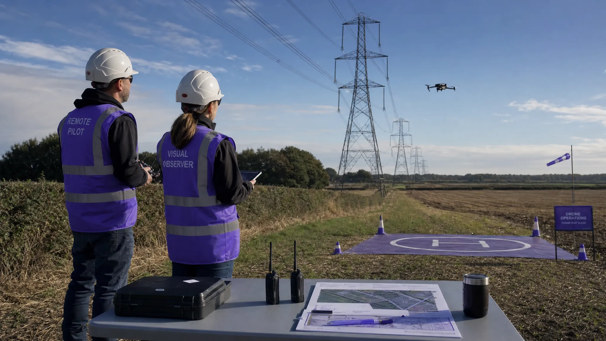 Drone Visual Line of Sight Rules Explained →
 Drone Regulations Checklist for Commercial Flights →
 Drone Flying Laws: A Practical Guide for Operators →
 CAA UAV Regulations Explained for UK Operators →
 UK SORA Explained for Drone Operators →