UAV Mapping Explained for Commercial Drone Operators
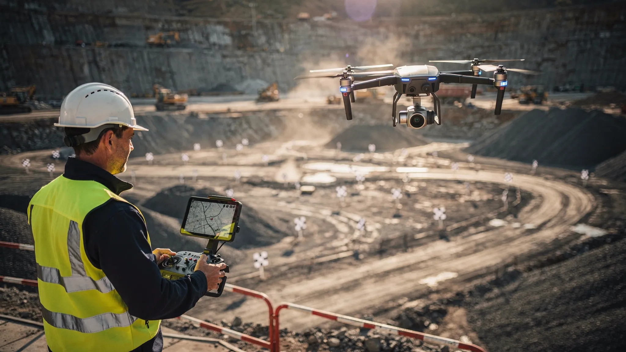
For commercial drone operators, UAV mapping is one of the clearest ways to move from “nice aerial images” to measurable client value. It turns a planned drone flight into usable geospatial data: maps, models, measurements, contours, stockpile volumes, progress records and asset intelligence.
But successful UAV mapping is not just a matter of launching a drone and flying a grid. Clients expect accurate outputs, repeatable results, clear documentation and safe, compliant operations. That means operators need to understand the full workflow, from scoping and flight planning through to quality control, delivery and record keeping.
This guide explains UAV mapping from an operator’s perspective, with a practical focus on commercial jobs, UK compliance considerations and the operational systems needed to run mapping work professionally.
What is UAV mapping?
UAV mapping is the process of using an unmanned aerial vehicle, more commonly called a drone, to capture overlapping aerial data and convert it into a georeferenced map or model.
Most commercial UAV mapping uses photogrammetry. The drone captures many overlapping images of the same area from different positions. Specialist software then identifies matching points between images and reconstructs the site in 2D or 3D. Depending on the job, the final deliverable might be an orthomosaic, point cloud, digital surface model, 3D mesh, contour drawing or measurement report.
UAV mapping can also involve other sensors, such as LiDAR, thermal cameras or multispectral cameras. The core idea is the same: collect structured aerial data that can be measured, analysed and repeated over time.
The important distinction is that mapping is not the same as general aerial photography. Aerial photography is usually judged on visual quality. UAV mapping is judged on whether the data is complete, correctly referenced and fit for the client’s intended use.
Common UAV mapping outputs and what they are used for
Commercial clients may ask for “a drone survey” without knowing exactly what output they need. A key part of the operator’s role is translating that request into a clear deliverable.
| Mapping output | What it is | Common commercial uses | Key operator consideration |
|---|---|---|---|
| Orthomosaic | A corrected, measurable 2D image map made from many overlapping photos | Site plans, progress monitoring, roof plans, land records | Needs sufficient overlap, consistent exposure and accurate georeferencing |
| Point cloud | A 3D set of measured points representing surfaces and objects | Asset inspection, volume calculations, terrain modelling | Requires careful quality checks for noise, gaps and alignment errors |
| Digital Surface Model (DSM) | A height model including buildings, trees, stockpiles and other surface features | Construction, quarrying, flood modelling inputs, vegetation assessment | Surface features remain included, which may or may not suit the client’s use case |
| Digital Terrain Model (DTM) | A model of bare earth terrain, with surface objects removed where possible | Civil engineering, drainage, earthworks, contours | Usually needs additional processing and validation |
| 3D mesh | A textured 3D representation of a site, structure or asset | Visualisation, heritage, property, inspection reporting | Excellent visually, but not always the best format for precise measurement |
| Volume report | Calculated quantities for stockpiles, cut and fill or material movement | Quarries, aggregates, construction, waste management | Needs repeatable capture methods and clearly defined measurement boundaries |
The deliverable should always be agreed before the flight. A client who needs a visual progress map has different requirements from a client who needs survey-grade measurements for engineering decisions.
Why UAV mapping matters for commercial operators
UAV mapping is attractive because it solves real operational problems for clients. It can reduce time on site, improve safety, create repeatable records and help teams make decisions from current data rather than outdated drawings.
In construction, mapping can document progress, support site meetings and identify changes between visits. In quarrying and aggregates, it can measure stockpiles more safely than manual methods. For utilities and infrastructure, UAV mapping can support inspection planning, route analysis and asset condition records. In agriculture and environmental work, it can reveal crop variation, drainage issues, habitat change or storm damage.
The strongest commercial opportunities usually come from repeatable mapping programmes rather than one-off flights. A monthly construction progress map, a weekly earthworks volume report or a quarterly estate survey creates recurring revenue and gives the client a consistent dataset over time.
That repeatability places more pressure on the operator. If flight heights, camera settings, ground control methods, naming conventions or processing settings change every time, the client may struggle to compare outputs. Professional mapping is therefore as much about process discipline as it is about drone capability.
The UAV mapping workflow
A good UAV mapping workflow is structured, documented and repeatable. The exact process varies by aircraft, sensor and sector, but most commercial jobs follow the same broad stages.
| Stage | Operator objective | Typical questions to answer |
|---|---|---|
| Scope the job | Define what the client actually needs | What decision will this data support? What accuracy is required? What file formats are expected? |
| Assess the site | Identify safety, airspace, access and privacy constraints | Is the site near controlled airspace, roads, rail, people, livestock, buildings or sensitive infrastructure? |
| Plan the capture | Build a flight plan that supports the required output | What altitude, overlap, speed, sensor angle and ground control method are appropriate? |
| Prepare the operation | Confirm aircraft, batteries, crew, permissions and checklists | Are pilot competency, insurance, maintenance, weather and emergency procedures all current? |
| Fly the mission | Capture complete, consistent data safely | Are images sharp, exposure consistent and coverage complete before leaving site? |
| Process and quality check | Convert raw data into reliable deliverables | Are there gaps, distortions, georeferencing issues or obvious measurement anomalies? |
| Deliver and archive | Provide outputs, records and supporting documentation | Has the client received the agreed files, limitations, reports and audit trail? |
The most expensive mapping mistakes often happen before take-off. If the deliverable is unclear, or the site risks are underestimated, the flight may produce data that looks impressive but cannot be used.
Accuracy in UAV mapping: what operators need to understand
Accuracy is one of the most misunderstood parts of UAV mapping. Clients often ask for “high accuracy” without defining what that means. Operators should avoid vague promises and instead discuss accuracy in relation to the intended use.
A map used for marketing, site familiarisation or basic progress tracking may not need the same control as a survey used for design, setting out or contractual quantities. If the output will support engineering, legal boundaries or critical measurements, the work should be designed and reviewed by suitably competent professionals.
Several factors influence mapping accuracy.
Ground sample distance, or GSD, describes how much ground each image pixel represents. Lower flight altitudes generally produce a smaller GSD and more visible detail, but they also increase flight time, image count and processing load. Higher flights cover more ground quickly, but may not capture enough detail for the job.
Image overlap matters because photogrammetry relies on common points between images. Too little forward or side overlap can create holes, warping or weak 3D reconstruction. Complex sites with vegetation, reflective surfaces, uniform roofs, water or steep faces may need more conservative capture settings.
Ground control points, RTK and PPK can improve georeferencing, but they are not magic fixes. Ground control must be placed, measured and identified correctly. RTK or PPK can reduce the need for extensive control in some workflows, but independent checkpoints are still valuable when accuracy claims matter.
Camera and flight behaviour also affect results. Rolling shutter distortion, motion blur, poor focus, harsh shadows, low light, high wind and inconsistent exposure can all degrade the output. A technically compliant flight can still produce poor mapping data if capture quality is not checked on site.
A practical approach is to define accuracy in the quote, capture data in a repeatable way, use checkpoints where appropriate and include limitations in the final report. This protects both the client and the operator.
Compliance and risk management for UAV mapping in the UK
Commercial UAV mapping in the UK must be planned within the applicable aviation rules and operating category. Operators should stay aligned with the UK Civil Aviation Authority’s guidance, including CAP 722 and the Drone and Model Aircraft Code.
Mapping jobs can look routine on a map but become complex in practice. A flight over an empty field may still involve nearby roads, public footpaths, overhead cables, livestock, protected sites, people entering the operating area, nearby aerodromes or local restrictions. Urban mapping can introduce additional challenges such as congested areas, privacy concerns, high structures, GNSS interference and take-off access.
Privacy and data protection also matter. UAV mapping can capture people, vehicles, gardens, commercial premises and other identifiable information. The UK Information Commissioner’s Office provides public guidance on drones and privacy, and commercial operators should apply sensible data minimisation, communication and retention practices.
For each job, a robust operational record should show that the operator considered the site, airspace, weather, people, aircraft, pilot competency, emergency procedures and client requirements. This is not just paperwork. It is evidence that the flight was planned professionally and that mapping data was collected under controlled conditions.
Equipment choices for UAV mapping
You can carry out basic UAV mapping with many modern camera drones, but equipment should be matched to the output, environment and client expectations.
For general orthomosaics and visual site models, a high-quality RGB camera drone may be sufficient. For precise topographic work, an RTK or PPK-enabled platform may be more appropriate. For vegetation analysis, a multispectral camera may be needed. For powerlines, forestry, complex structures or ground modelling beneath vegetation, LiDAR may be the better tool.
Battery endurance, wind resistance, sensor size, mechanical shutter availability, camera calibration, payload options and compatibility with flight planning software should all influence equipment choice. So should supportability. A drone that produces excellent data but is difficult to maintain, insure or operate consistently may be a poor commercial choice.
Fleet management becomes more important as mapping work grows. Operators need to know which aircraft and batteries were used, when maintenance is due, whether firmware changes affected performance and whether each pilot is current for the task. These details can become critical if a client questions a dataset months later.
Turning UAV mapping into a profitable service
Many drone businesses underprice mapping because they charge only for time in the air. In reality, the flight is just one part of the job.
A commercial quote should account for scoping, client communication, desktop planning, airspace checks, travel, site induction, setup, flying, contingency time, processing, quality control, reporting, data storage, revisions, insurance, software subscriptions and administrative records. Large datasets can also create storage and transfer costs that are easy to overlook.
Clear scoping helps protect margin. Before accepting a job, confirm the area size, deliverables, required accuracy, coordinate system, file formats, deadline, site access, repeat visit schedule and any third-party requirements. If the client asks for additional outputs after the flight, you can then price the change fairly.
It is also worth productising common mapping services. For example, a construction progress package could include a monthly orthomosaic, selected site measurements and a short change summary. A quarry package might include stockpile volume calculations and a repeatable capture plan. A property or estate package might include a high-resolution map, 3D model and asset imagery.
Productised services are easier for clients to understand and easier for operators to deliver consistently.
Common UAV mapping mistakes to avoid
Even experienced pilots can run into problems when moving into mapping. The most common issues are rarely dramatic. They are usually small planning or process gaps that reduce data quality, create rework or weaken the commercial value of the job.
- Quoting before the deliverable and accuracy requirement are properly defined.
- Assuming RTK removes the need for quality checks or independent validation.
- Flying at the wrong altitude for the required level of detail.
- Using insufficient overlap on complex or low-texture surfaces.
- Leaving site before checking for missing images, blur or coverage gaps.
- Forgetting landowner access, privacy considerations or local site rules.
- Delivering files without explaining limitations, assumptions or coordinate references.
- Storing flight records, risk assessments and client correspondence in separate places.
The last point is operational rather than technical, but it matters. UAV mapping clients often come back weeks or months later with questions. If your records are scattered across emails, spreadsheets, memory cards and notebooks, answering those questions takes longer than it should.
Where Dronedesk fits into UAV mapping operations
Photogrammetry and mapping software handle the processing. Dronedesk supports the operational layer around the job: the planning, compliance, team coordination, fleet records, checklists, risk assessments, flight logging and client administration that make a mapping business scalable.
For a commercial mapping operator, that operational layer can be the difference between doing occasional drone jobs and running a professional, repeatable service. Dronedesk helps operators bring key workflow elements into one web platform, including client management, fleet management, team management, airspace intelligence, proximity intelligence, flight planning, flight logging, configurable checklists, risk assessments and data reporting.
That matters because mapping work is documentation-heavy. You need to show what was planned, who flew, what aircraft was used, what risks were assessed, what checks were completed and what happened on site. When that information is centralised, it is easier to stay compliant, prepare for audits and deliver consistently to clients.
Dronedesk is not a replacement for specialist mapping processing tools such as photogrammetry, LiDAR or GIS platforms. It complements them by managing the operational workflow before and after data capture. If you are comparing processing options, Dronedesk’s drone mapping software guide explains the main categories and tools in more detail.
The operational benefit is especially clear as job volume increases. In a Dronedesk survey company case study, Drone Evolution scaled to 100+ flights per month by replacing spreadsheets with a more centralised planning and field operations workflow. For mapping providers, that kind of structure helps protect margins while maintaining professional standards.
A practical pre-flight mindset for mapping jobs
Before any UAV mapping job, ask one simple question: “Will the data we capture today be good enough for the decision the client needs to make?”
That question keeps the focus on the outcome rather than the flight itself. It pushes you to confirm the deliverable, plan the capture properly, consider ground control, check site constraints, manage safety and record the operation clearly.
A beautiful orthomosaic that cannot be measured reliably may not be useful. A highly accurate dataset with poor documentation may be difficult to defend. A well-planned mapping operation should produce both good data and a clear operational record.
For commercial drone operators, that combination is where UAV mapping becomes a serious service rather than a technical experiment.
Frequently Asked Questions
What is UAV mapping used for? UAV mapping is used to create measurable maps and models for construction, surveying, quarrying, agriculture, utilities, environmental monitoring, property management and infrastructure inspection. Common outputs include orthomosaics, point clouds, 3D models, terrain models and volume reports.
Is UAV mapping the same as drone surveying? The terms overlap, but they are not always identical. UAV mapping describes the data capture and map-making process. Drone surveying usually implies measurement-focused outputs that may need specific accuracy controls, professional oversight and defined survey methodology.
How accurate is UAV mapping? Accuracy depends on the drone, camera, flight height, image overlap, ground control, RTK or PPK workflow, site conditions and processing method. Operators should define accuracy requirements before the flight and use checkpoints or suitable validation where measurement quality matters.
Do I need ground control points for UAV mapping? Not always, but ground control points are still useful for many commercial mapping jobs, especially where accuracy claims are important. RTK and PPK can improve georeferencing, but independent checkpoints can help prove the quality of the output.
What software do I need for UAV mapping? Most operators use flight planning software for capture, photogrammetry or LiDAR software for processing, and sometimes GIS or CAD tools for analysis. An operations platform such as Dronedesk supports the surrounding workflow, including planning, risk assessments, checklists, fleet records and flight logs.
Can UAV mapping be profitable for small drone operators? Yes, especially when services are clearly scoped and repeatable. Profitability depends on pricing the full workflow, not just flight time. Operators should include planning, travel, processing, quality control, reporting, software, insurance and administration in their pricing.
Run UAV mapping jobs with less admin and more control
UAV mapping rewards operators who can combine safe flight operations, reliable data capture and professional documentation. If your mapping workflow still depends on spreadsheets, disconnected checklists and repeated manual admin, it becomes harder to scale without losing control.
Dronedesk gives commercial drone operators one place to manage clients, plan flights, assess risk, check airspace, manage fleets and teams, log flights and keep auditable operational records.
If you want to spend less time chasing paperwork and more time delivering valuable mapping data, explore how Dronedesk can support your next stage of growth.
 BVLOS Drone Meaning and Why It Matters →
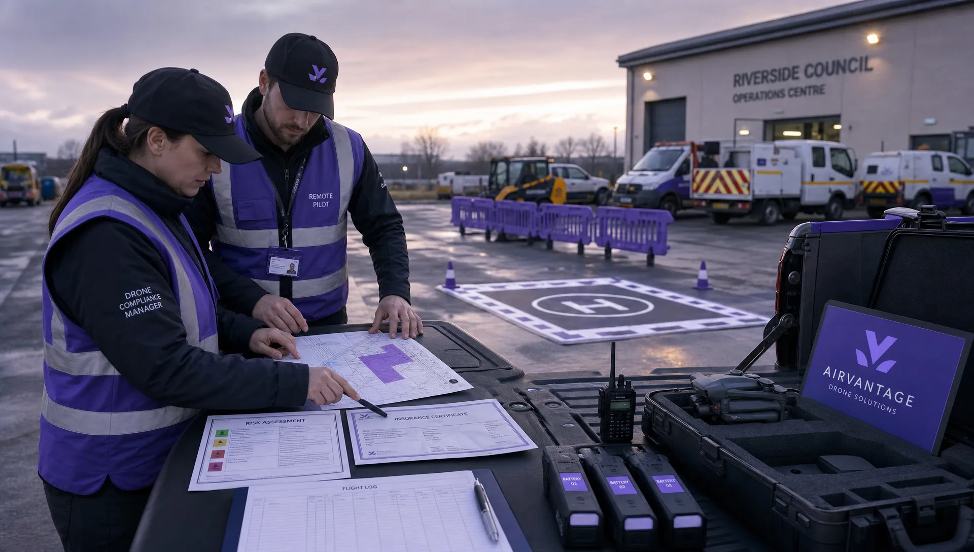 Drone Operation Regulations Explained for Businesses →
 How to Pass Your Drone Pilot License Test →
 How to Review a DJI Flight Record After a Mission →
 How to Check a Drone NOTAM Before You Fly →
 Part 108: What Drone Operators Should Expect →
 Beyond Visual Line of Sight BVLOS Explained →
 Drone Laws and Regulations Every Team Should Review →
 Current Drone Laws: What Changed in 2026? →
 JARUS SORA Explained in Plain English →