drone flying in national parks - rules, safety, and alternatives
Let's cut right to the chase: if you're a recreational pilot, drone flying in national parks is a non-starter across the entire United States. This isn't some arbitrary rule; it's a hard-and-fast ban put in place to protect wildlife, preserve the natural quiet that makes these places special, and keep visitors safe.
While the answer for hobbyists is a firm "no," this guide is for those who need to understand the why behind the ban and for the professionals—scientists, researchers, and official agencies—who might have a narrow path to fly legally through a strict permit process.
The Reality of Drone Flying in National Parks

We've all seen the incredible aerial footage and imagined capturing that epic shot over Yosemite Valley or the Grand Canyon. It's a powerful idea, but for the vast majority of drone pilots, it has to stay a dream. Back in 2014, the National Park Service (NPS) rolled out a system-wide ban on the recreational use of unmanned aircraft, and it wasn't a snap decision. It was a direct response to a growing wave of incidents that were threatening the very soul of these protected lands.
This blanket ban means no launching, landing, or operating a drone from anywhere within the boundaries of all 63 designated national parks, plus hundreds of other sites managed by the NPS. For the average visitor, the rule is simple and absolute. The goal here is to be crystal clear from the outset, so you can understand the reasoning, navigate the permit maze if you have a legitimate need, and find other ways to get stunning shots without breaking federal law.
Why the Strict Stance?
The mission of the NPS is crystal clear: "to preserve unimpaired the natural and cultural resources and values of the National Park System for the enjoyment, education, and inspiration of this and future generations." Drones, with their buzzing props and intrusive presence, just don't mesh with that mission.
The ban isn't about stifling creativity; it’s about protecting the core experience of a national park. The reasons are pretty straightforward:
- Wildlife Protection: Drones can be terrifying for animals. They can trigger stampedes, cause birds to abandon their nests, and disrupt natural feeding and mating habits.
- Visitor Experience: People visit national parks to escape the noise of daily life. The high-pitched whine of a drone completely shatters the peace and tranquility that millions come to find.
- Public Safety: A drone malfunction is bad anywhere, but it's a disaster in a national park. We've seen drones crash into sensitive thermal pools in Yellowstone and even interfere with critical emergency operations like wildfire fighting and search and rescue missions.
To give you a quick overview, here's how the rules generally break down for different types of drone flights in protected areas.
Drone Rules in National Parks At a Glance
This table offers a quick snapshot of the general drone policies in place across most national park systems.
| Flight Type | General Status | Primary Reason | Potential Exception |
|---|---|---|---|
| Recreational/Hobby | Banned | Wildlife disturbance, visitor experience, safety. | None. This is a hard-and-fast rule. |
| Commercial | Banned | Same reasons as recreational flights. | Extremely rare; requires a special permit for specific NPS-contracted work. |
| Scientific/Research | Permit Required | To minimize impact while allowing for critical research. | A Special Use Permit (SUP) may be granted for approved projects. |
| Official/Gov't Use | Permit Required | For essential missions like search & rescue, wildfire monitoring. | Authorization is handled internally or through specific agreements. |
Remember, even when exceptions are made, they come with a mountain of paperwork and strict operational limits.
The story of how we got here shows just how quickly consumer drone technology outpaced regulation. A few high-profile incidents of people flying recklessly in parks created a domino effect. Yosemite National Park was one of the first to act, banning drones in May 2014, with Zion and Great Smoky Mountains quickly following suit. By June 2014, the problem was so widespread that the NPS had no choice but to issue its blanket, nationwide ban. You can read more about the history of this drone policy.
This history really sets the stage for everything that follows—it explains why the rules are so rigid and why, for professionals, navigating the legal channels is both so challenging and so important.
Why Drones and National Parks Don't Mix
The almost total ban on flying drones in national parks isn't some arbitrary rule meant to kill your fun. It's a critical shield forged from decades of conservation policy. To really get why the rules are so strict, you have to look past the simple "no" and dig into the real-world impacts that forced the park service's hand.
At its heart, the ban stands on three main pillars: protecting fragile wildlife, preserving the visitor experience, and ensuring public safety.
Protecting Sensitive Wildlife
The number one reason for the drone ban is to shield park animals from a type of stress they've never evolved to handle. Think about it: a car on a park road makes a predictable, low-frequency rumble. A drone, on the other hand, sounds alien and invasive—often like a swarm of insects, which for many species is a natural alarm bell.
This isn't just a minor annoyance; it can have devastating results. For nesting birds like the majestic bald eagle or the endangered California condor, a drone buzzing too close can cause parent birds to bolt, leaving their eggs or chicks exposed to predators and the elements. A single careless flight could destroy an entire generation in that nest.
The problem has grown right alongside the popularity of recreational drones. We've seen documented cases of drones scattering bird populations in Alaska’s Denali National Park and separating young bighorn sheep from their herds in Zion National Park. These aren't just sad stories; they're violations of wildlife protection laws that can come with hefty penalties, including fines up to $5,000 and even jail time. You can get more insights on the global impact of drones on wildlife from D-Fend Solutions.
Preserving the Natural Soundscape
Beyond the direct harm to animals, drones completely shatter the very thing that makes a national park so special: its natural quiet. People travel thousands of miles to escape the city's constant hum and plug into what experts call the natural soundscape—the symphony of wind, water, and wildlife that defines a place.
A single drone can pollute this soundscape for miles, swapping the peaceful sounds of nature for a persistent, high-pitched whine. It fundamentally ruins the visitor experience, turning a tranquil hike into a source of irritation. The National Park Service isn't just tasked with protecting the views; they're mandated to preserve the sounds of these places for all of us.
The natural soundscape is as much a resource as the geysers of Yellowstone or the granite cliffs of Yosemite. Its preservation is essential for both wildlife that relies on sound for communication and survival, and for the human visitors seeking tranquility and a connection to the natural world.
Ensuring Public and Environmental Safety
Finally, you've got the straightforward safety risks. Drones are complex pieces of tech, and sometimes they fail. A malfunction that’s a small problem in an empty field can turn into a catastrophe inside a national park.
Here are just a few of the very real concerns that back up the ban:
- Environmental Damage: Imagine a drone crashing into a delicate thermal feature in Yellowstone, like the Grand Prismatic Spring. It could cause permanent damage to unique geological formations that took thousands of years to create.
- Interference with Emergency Operations: This is a big one. Drones flying where they shouldn't can force the grounding of firefighting aircraft and search and rescue helicopters. When emergency crews can't fly, people's lives are on the line.
- Visitor Safety: A drone falling from the sky could easily injure people on a crowded trail or at a popular viewpoint. And let's not forget the risk of a battery fire after a crash, which could spark a major wildfire in dry park environments.
When you see how all these issues connect, it's easy to understand why managing drone flying in national parks demands such a firm hand. For a deeper look into controlled and restricted flight zones, our ultimate map of no-fly zones is a great place to start.
How to Navigate the Special Use Permit Process
While flying your drone for fun in a national park is a definite no-go, there's a slim—and I mean slim—possibility for professional operators. The National Park Service (NPS) can issue something called a Special Use Permit (SUP), but only for very specific, high-value activities that directly support the park's mission. Don't think of this as a loophole; it’s a formal tool for essential work.
Let's be clear: these permits are incredibly rare. They're almost never given out for your average commercial real estate shoot or a wedding video. Instead, they're reserved for unique situations where a drone can do something that's otherwise impossible or far too dangerous.
Who Can Qualify for a Permit
Getting your hands on a permit is a tough, competitive process. The NPS scrutinizes every single application to see if it directly benefits park management, public safety, or scientific discovery. The bar is set incredibly high, and honestly, only a handful of project types even get a second look.
Here are the main categories that might stand a chance:
- Scientific Research: Think of biologists needing to monitor bird nests on a sheer cliff face, geologists mapping erosion in an inaccessible canyon, or ecologists assessing vegetation regrowth after a wildfire. These are prime examples.
- Official Government Use: This is for critical missions, like search and rescue operations, monitoring wildfires, or inspecting park infrastructure. These flights are typically conducted by or for the NPS itself.
- Commercial Filmmaking: This is the rarest of them all. A permit might be considered for a massive production, like a major nature documentary, but only if the drone footage is absolutely essential to telling a story that helps the park’s educational mission.
This infographic really gets to the heart of why these rules are so strict in the first place—it all comes down to protecting wildlife, the visitor experience, and general safety.

As you can see, the potential for negative impacts is very real, which is why the permit process is designed to be so rigorous.
The Application Workflow Step by Step
Applying for a SUP isn't just filling out a form; it's a formal, detailed, and often lengthy process. You have to build an airtight case that proves not just why your mission is necessary, but also that you're a professional who can operate with minimal impact and maximum safety.
- Initial Contact: Your first step should always be to get in touch with the specific park's permit coordinator. Every park handles its own process, so this early communication is absolutely vital.
- Submit Application: Next, you'll fill out the official application form. Be prepared for a non-refundable processing fee right off the bat.
- Provide Supporting Documents: This is where the real work begins. You'll need to submit a comprehensive package of information that proves your project's legitimacy and your professionalism as an operator.
A successful permit application is more than just paperwork; it’s a professional proposal. It must convince park managers that your project's value outweighs the inherent risks and disturbances of a drone flight.
Your documentation packet has to be flawless. It should include detailed flight plans with exact GPS coordinates, proof of at least $1 million in aviation liability insurance, copies of your FAA Part 107 Remote Pilot Certificate, and a meticulously detailed safety and risk mitigation plan. To get a better handle on the airspace you're dealing with, it's a good idea to dig into the various FAA UAS data sources for comprehensive mapping.
You can find some initial information directly on the official NPS page for Special Park Uses.
Common Reasons for Permit Denial
Knowing why applications get rejected is just as important as knowing what to include. The single most powerful part of your application is the justification—you need a rock-solid argument explaining why a drone is the only tool for the job. If the same task can be done from the ground, with a helicopter, or even with satellite imagery, your request will almost certainly be denied.
Other common deal-breakers include:
- Incomplete or vague flight plans.
- A weak justification for why the flight is absolutely necessary.
- Not having the right insurance or FAA certification.
- The potential for significant disruption to wildlife or the experience of other park visitors.
The Real Consequences of Illegal Drone Flights
Thinking about ignoring the drone rules in a national park? Be warned: this isn't like getting a simple parking ticket. The National Park Service (NPS) takes these violations incredibly seriously, and the consequences pack a much bigger punch than just a slap on the wrist. We're not just talking about breaking a park rule here; we're talking about violating federal regulations that have real teeth.
This authority isn't arbitrary. It comes directly from NPS Policy Memorandum 14-05, the very document that put the nationwide ban in place back in 2014. This policy gives park rangers the full legal backing to act when they spot an unauthorized drone. Flying a drone in a national park is a high-stakes gamble, and the penalties are designed to be a powerful deterrent.
The Financial and Legal Penalties
That perfect Instagram shot you're chasing could end up being the most expensive photo you ever take. The penalties for flying a drone illegally are severe and can stack up fast, depending on exactly what you did wrong.
Here’s a quick rundown of what you could be up against:
- Hefty Fines: Fines can soar up to $5,000 per offense. This isn't just a theoretical number; it's a reality for plenty of pilots who have been caught.
- Equipment Confiscation: Park rangers have the power to confiscate your drone and all your gear right on the spot. And there’s no guarantee you’ll ever see it again.
- Potential Jail Time: For more serious offenses, like harassing wildlife or interfering with firefighting operations, you could face up to six months in jail.
- Additional FAA Charges: Don't forget, the NPS isn't the only authority you have to worry about. The FAA can levy separate, significant fines for unlicensed drone operations.
These aren't empty threats. The NPS actively prosecutes illegal drone flights to protect the parks' natural resources and keep visitors safe.
A Cautionary Tale from Yellowstone
If you want to see how this plays out in the real world, just look at the infamous incident at Yellowstone National Park. A tourist crashed his drone directly into the Grand Prismatic Spring—one of the park's most iconic and fragile thermal features.
The fallout was a perfect storm of bad outcomes. Not only did the drone cause potential, irreparable damage to the spring's delicate ecosystem, but the operator landed in serious legal hot water. He was hit with over $3,000 in fines, banned from the park for a year, and put on probation. The story went viral, becoming a powerful lesson for anyone else thinking of breaking the rules.
This one incident perfectly illustrates the triple threat of illegal drone flights: environmental damage, stiff financial penalties, and a permanent mark on your record. It’s a textbook example of why the NPS enforces its drone policy so aggressively.
Despite the clear rules and harsh penalties, illegal drone activity is still a stubborn problem. In Yosemite National Park, a protected area roughly the size of Rhode Island, volunteer guides still report seeing multiple unauthorized drones every day at popular spots like El Capitan and Tunnel View. This leads to a constant stream of visitor complaints. You can learn more about the ongoing challenges in Yosemite and see how it spoils the experience for everyone.
The message couldn't be clearer. The risk of flying a drone illegally in a national park far outweighs any reward. With thousands of dollars in fines, the loss of your expensive gear, and even potential jail time on the table, it's a gamble you’re almost certain to lose.
How the World Protects Its Natural Spaces From Drones
If you’ve ever felt the sting of the strict drone ban in U.S. national parks, it’s easy to think the rules are uniquely restrictive. But if you take a step back and look at the bigger picture, you’ll see the U.S. is far from alone.
It turns out that nations all over the world have independently come to the same conclusion: drones and protected natural spaces just don't mix well. This global consensus isn't a coincidence; it's a shared understanding that these incredible landscapes need a different kind of protection. For any pilot with a passport, this is critical information. What’s illegal in Yellowstone is almost certainly illegal in Banff or Fiordland, and showing up unprepared can lead to the same grim outcome—hefty fines, confiscated gear, and a trip ruined before it even starts.
A Look at Drone Rules in Canada
Just across the northern border, Parks Canada doesn't mince words. Flying a drone in any of Canada's jaw-dropping national parks, like the iconic Banff or Jasper, is strictly forbidden without securing a special permit first. The rules are crystal clear: launching, landing, or operating a drone inside park boundaries violates the Canada National Parks Act.
Their reasoning mirrors what we see in the States. Parks Canada is upfront that the ban is there to protect wildlife from stress and disturbance. An elk or a grizzly bear doesn't care about borders; the whine of a drone overhead is the same perceived threat whether it's in Wyoming or Alberta. And they back it up with serious penalties. Fines for illegal flights in Canadian parks can soar as high as $25,000 CAD.
Regulations Down Under in Australia and New Zealand
Head to the Southern Hemisphere, and you'll find that same protective instinct. In Australia, the Civil Aviation Safety Authority (CASA) sets the nationwide drone rules, but local park authorities add their own, stricter layers on top. Most national parks, from the ancient Daintree Rainforest to the majestic Blue Mountains, either ban drones outright or require permits that are next to impossible for a recreational pilot to get.
New Zealand is even more direct. The Department of Conservation (DOC) is the guardian of the country's breathtaking national parks, including Fiordland and Tongariro. Their policy is simple: you need a specific concession or permit to fly over public conservation land. For a casual holiday flyer, the chances of getting one are practically zero.
The consistency we see across the globe isn't an accident. It’s a powerful statement from conservation authorities everywhere. They all recognize that unregulated drone use poses a universal threat to ecological balance and visitor peace, not just a localized problem.
Drone Policies Across the United Kingdom
Over in the United Kingdom, the legal landscape is a bit more pieced together, but the end result is the same. The Civil Aviation Authority (CAA) sets the high-level drone code, but it’s the landowner who calls the shots on the ground. The National Trust, a charity that manages huge swathes of historic and scenic land, has a blanket "no drones" policy.
Most UK National Parks, like the stunning Lake District or Peak District, have their own bylaws that heavily restrict or flat-out forbid drone use. It’s all about preventing disturbance to wildlife and ensuring other visitors can enjoy the tranquility. While it's not one single federal law like in the U.S., the practical effect is identical: these protected landscapes are off-limits for the average pilot.
This worldwide unity sends a powerful message. It underscores just how valuable—and fragile—the peace and quiet of our natural world really is.
The rules can vary in the details, but the core principle of protecting wildlife and visitor experience remains consistent. Here's a quick look at how different countries handle drones in their most precious natural areas.
International Drone Regulations in National Parks (Examples)
| Country | Governing Body | General Policy | Permit Availability |
|---|---|---|---|
| United States | National Park Service (NPS) | Strict ban on launching, landing, or operating drones within park boundaries. | Extremely rare; typically only for scientific research or official park business. |
| Canada | Parks Canada | Strictly prohibited without a special permit. | Very limited; mainly for commercial, scientific, or public safety purposes. |
| Australia | Varies by state/territory park authority | Generally banned or heavily restricted. Requires specific park approval. | Difficult to obtain for recreational use; commercial permits are possible but stringent. |
| New Zealand | Department of Conservation (DOC) | Requires a permit (concession) to fly over any public conservation land. | Virtually impossible for casual recreational flyers; complex process for professionals. |
| United Kingdom | Varies by landowner (e.g., National Trust, Park Authorities) | Widely banned by bylaws and landowner policies in most national parks. | Generally not available for recreational use; some commercial exceptions possible. |
As the table shows, while the specific agency in charge changes, the outcome for the recreational drone pilot is almost always the same: keep the drone grounded. It's always best to assume a ban is in place and then do your homework to confirm, rather than the other way around.
Smart Alternatives for Capturing Aerial Views Legally
Finding out your drone is grounded inside a national park can feel like a huge creative dead end. But the ban on drone flying in national parks doesn't mean those incredible, sweeping vistas are out of reach.
With a little strategic thinking and a few clever tricks, you can still walk away with stunning aerial-style shots—all while staying legal, ethical, and respectful of the park rules.

The secret is to shift your focus just outside the park's boundaries. National parks are often neighbors with vast stretches of National Forest or Bureau of Land Management (BLM) land, where drone rules are a whole lot more relaxed.
Fly From Adjacent Public Lands
This is your best bet, and it starts with some digital location scouting before you even pack your bags. The goal is to pinpoint the exact park boundaries. You'll often find that public lands, where recreational drone flights are perfectly fine under FAA guidelines, run right up against the park. You can legally take off from these adjacent areas and grab breathtaking shots of the park’s scenery from just outside its airspace.
This method does require some careful prep work:
- Verify Boundaries: Use official maps to know exactly where the park ends and National Forest or BLM land begins. Don't guess.
- Check Local Rules: While they’re generally more drone-friendly, some National Forests have their own specific restrictions. This is especially true in designated Wilderness Areas or during high fire-risk seasons. A quick call to the local ranger district is always a smart move.
- Maintain Line of Sight: This is critical. Even though you're launching from outside, you can never fly your drone over the national park itself. Your drone must stay within your visual line of sight and remain completely outside of park airspace.
For a deeper dive into finding legitimate spots to fly, our guide on https://blog.dronedesk.io/where-can-i-fly-my-drone/ is packed with useful tools and tips.
Think of the park boundary as an invisible wall that stretches straight up into the sky. Your job is to fly parallel to that wall, never crossing over it. You'll capture the same majestic peaks and valleys, just from a legal and respectful distance.
Master Ground-Based "Aerial" Techniques
Who says you need a drone to get an aerial shot? Sometimes, all you need is a higher perspective. High vantage points are your best friend here.
Many parks have hiking trails that lead to spectacular overlooks, giving you a natural "drone's-eye view" that can be just as powerful. A wide-angle lens from a high peak can create a sense of scale and grandeur that easily rivals what you’d get from a drone.
If you want to get a bit more creative, think about using a lightweight, telescoping camera pole. These tools can extend 15-20 feet (or even more) into the air, lifting your camera high above the ground. It’s a simple, effective, and completely legal way to capture unique perspectives of landscapes, rock formations, or forest canopies.
For serious digital planning, you can explore advanced tools like Geographic Information Systems (GIS). These systems compile and analyze layers of geographic data, including satellite imagery, helping you map out the perfect ground-based shot before you even arrive.
Got Questions About Flying Drones in Parks? We've Got Answers.
Flying a drone in a national park seems like a dream, but the rules can feel like a tangled mess. It’s a topic surrounded by myths and confusion, and a lot of pilots ask the same questions. Let’s cut through the noise and get you some straight answers.
This isn't about finding loopholes. It's about understanding the regulations so you can plan your flights legally, safely, and with respect for these incredible natural spaces.
Are There Any Drone-Friendly US National Parks?
This is the big one, and the answer is a hard no. Since 2014, the National Park Service (NPS) has a blanket ban that covers every single one of the 63 designated national parks. There are no exceptions for recreational pilots.
This means you cannot launch, land, or operate a drone from anywhere on land managed by the NPS. Sure, you might hear about rare permits, but those are reserved for very specific scientific research, official park business, or massive commercial projects that directly benefit the park—not for your average photo or video shoot.
What if I Fly Over a Park From Outside the Boundary?
Here’s another common myth that needs busting. Many pilots think that if they take off from private land outside the park, they're free to fly over it. That’s also strictly illegal. The NPS doesn’t just manage the ground; they control the airspace directly above it too.
The second your drone crosses that invisible property line in the sky, you're violating federal regulations (36 CFR 1.5). Park rangers can and will issue fines and penalties, no matter where your feet are planted.
Picture the park boundary as a wall that stretches straight up into the sky. Flying over it is trespassing, plain and simple.
How Can I Check the Rules for a Specific Park?
Even with a universal ban, it never hurts to check the official source for local advisories or specific details. Your best bet is always the official NPS website for the park you’re interested in (for example, nps.gov/yose for Yosemite).
Once you're on the park's site, here’s what to look for:
- Plan Your Visit: This area usually has the most current alerts and basic rules.
- Rules & Regulations: Here you'll find a deeper dive into park-specific policies.
- Superintendent's Compendium: This is the official document listing all local regulations, and it will spell out the drone ban explicitly.
For checking airspace just outside a national park, the FAA's B4UFLY app is an absolute must-have. It gives you live airspace data so you can find safe, legal spots to fly right up to the park's edge without crossing the line.
Flying near sensitive locations demands a professional approach. Dronedesk takes the guesswork out of compliance with advanced airspace intelligence, automated risk assessments, and clean flight logging. Make sure every mission is buttoned up and professional with a platform designed to keep you safe. See how Dronedesk protects your operations.
 Drone Testing Checklist Before Commercial Deployment →
 How to Plan a UAV Survey for Safer Field Operations →
 Drone Laws Explained for Commercial Pilots in 2026 →
 GCV Explained in UK SORA and BVLOS Planning →
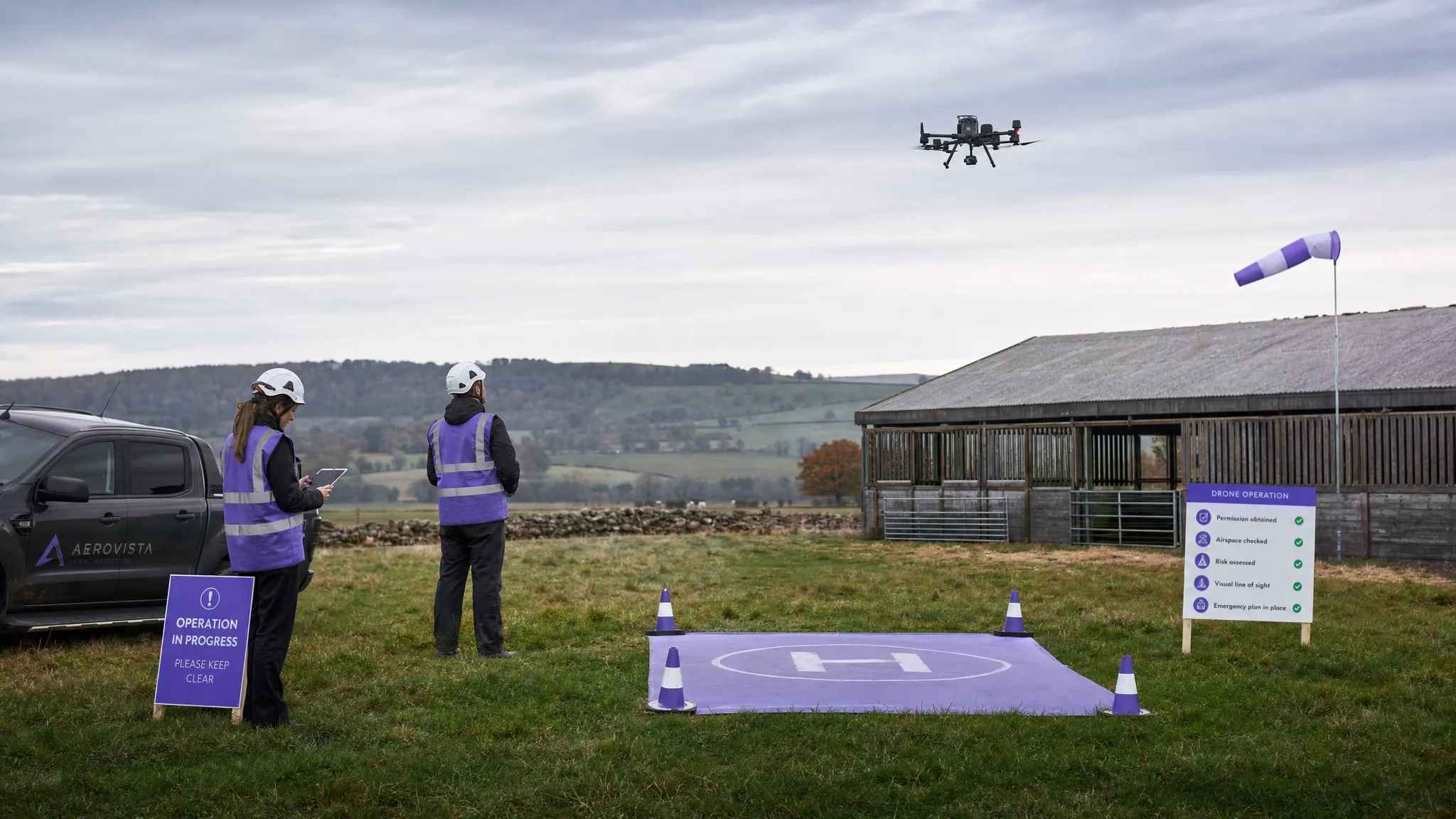 British Drone Laws Explained for Commercial Operators →
 Commercial Drone Services: How to Scale Without Chaos →
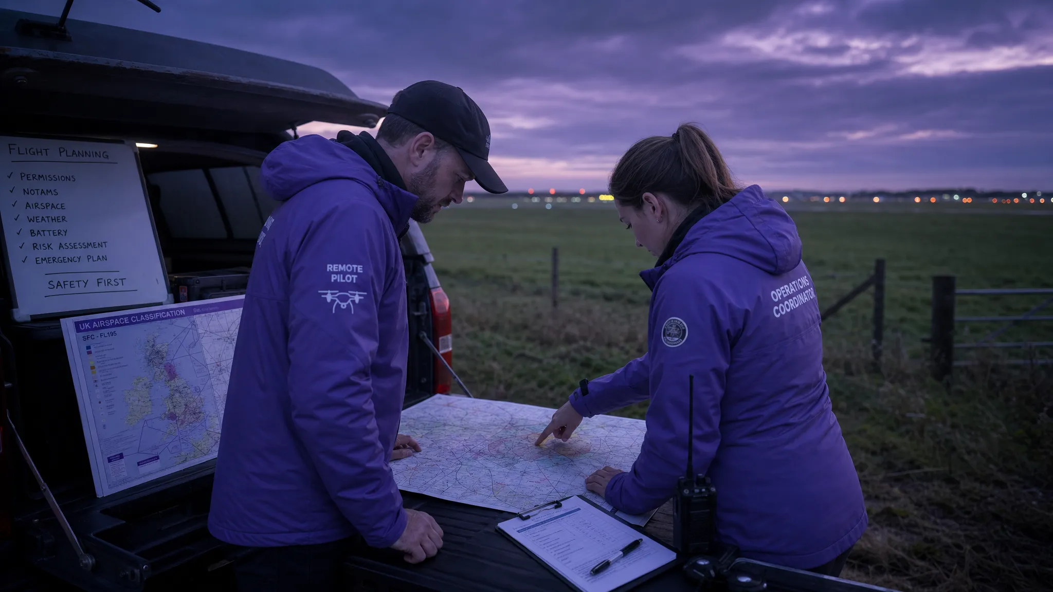 Drone Airspace Map Guide for Safer UK Flight Planning →
 How to Build a Drone Flight Risk Assessment That Works →
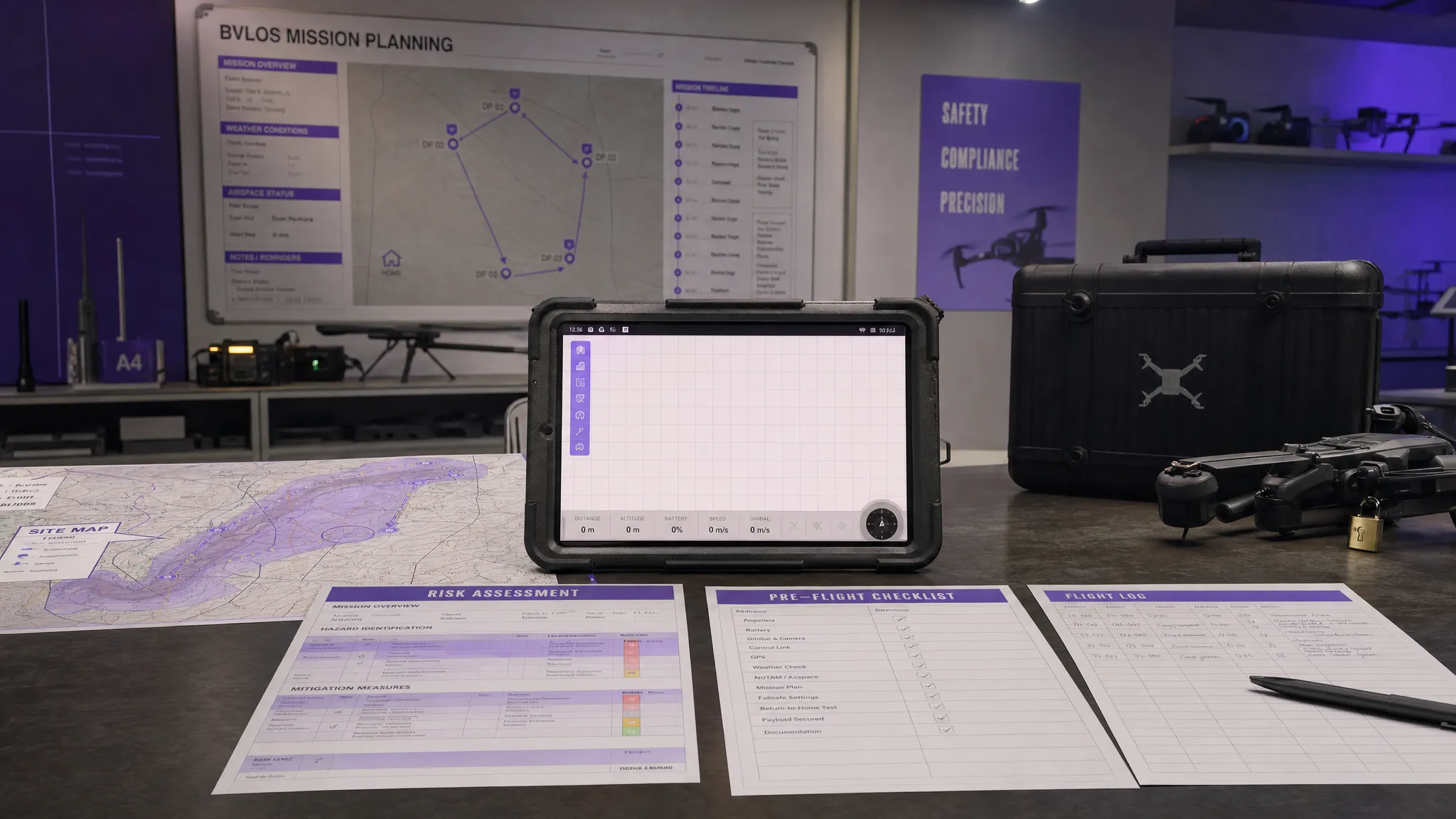 BVLOS Meaning Explained for Commercial Drone Teams →
 Drone Mapping Companies: How to Choose the Right Partner →