Class A Airspace: Understanding class a airspace Rules for Drones
Put simply, Class A airspace is the exclusive, high-altitude highway system of the sky, reserved for the fastest and most advanced aircraft. Think of it as the express lane for commercial jets and private planes flying long distances under the watchful eye of air traffic control.
Demystifying the High-Altitude Highway
Imagine the sky is a massive, invisible skyscraper. It has different floors, and each floor has its own set of rules. Class A airspace occupies the uppermost levels of this structure—a vast and highly controlled environment where precision and safety are everything.
It's a realm most of us only ever experience as passengers on a cross-country flight, totally separate from the lower altitudes where smaller planes and drones fly.
This specific classification exists to safely manage the densest and fastest air traffic. Commercial airliners, cargo planes, and high-performance business jets all travel within this zone. Because these aircraft cover huge distances at speeds often exceeding 500 miles per hour, they have to follow a rigid set of procedures to avoid any conflicts.
Every single movement is choreographed by Air Traffic Control (ATC), making it one of the safest transportation systems on the planet.
Defining the Boundaries of Class A
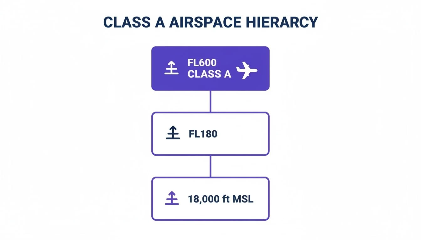
In the United States, the boundaries for Class A airspace are clear and consistent nationwide. It starts at 18,000 feet Mean Sea Level (MSL) and extends all the way up to 60,000 feet, an altitude also known as Flight Level 600 (FL600).
That 18,000 feet figure isn't just a random number. It’s the altitude where all pilots must set their altimeters to a standard pressure setting. This ensures every aircraft in this "express lane" is using the exact same frame of reference for their altitude.
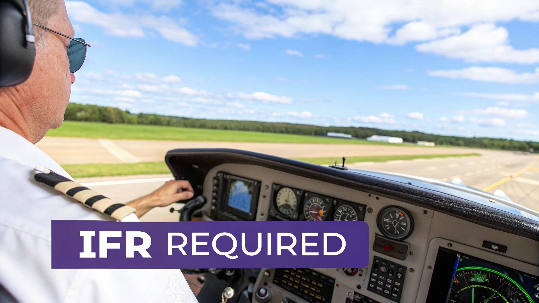
At these heights, pilots operate exclusively under Instrument Flight Rules (IFR). This means they navigate using their onboard instruments and direct instructions from ATC, rather than by looking out the window. This is non-negotiable and a core principle of flying in Class A.
This diagram gives you a simple visual of where Class A fits into the bigger picture of the national airspace system.
As you can see, Class A sits firmly above all other airspace types, creating a protected ceiling for high-speed transit.
Why Drones Are Strictly Prohibited
For drone operators, the most critical takeaway is simple: unmanned aircraft are not permitted in Class A airspace. The reasons are straightforward and all come down to safety and operational capability.
Drones simply aren't equipped with the sophisticated transponders, two-way radios, or anti-collision systems required to fly safely in this environment.
Plus, drone operations are typically limited to 400 feet Above Ground Level (AGL) to stay well clear of manned aircraft. The immense vertical separation between a drone’s legal ceiling and the floor of Class A is a fundamental safety buffer.
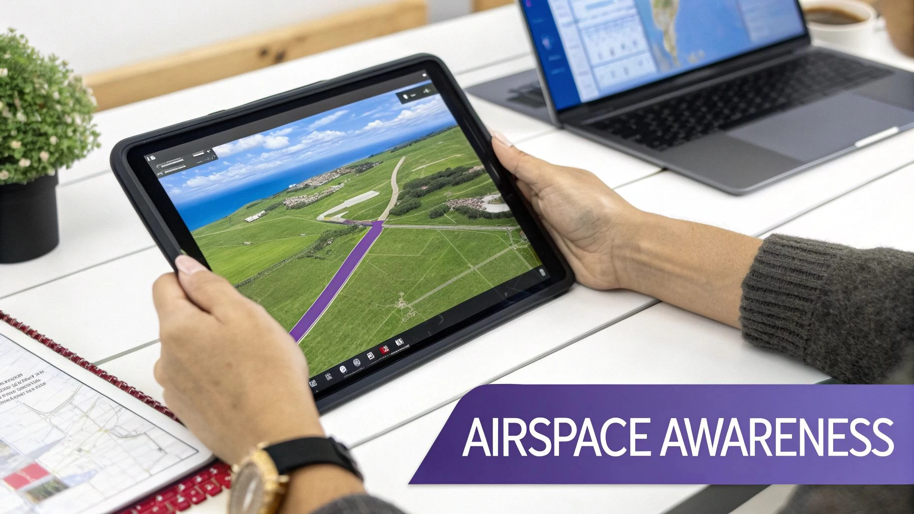
Understanding this separation is the first step toward building comprehensive airspace awareness. To better grasp the full picture, you can learn more about the different classes of airspace in our detailed guide.
Understanding the Rules of High-Altitude Flight
Think of flying in Class A airspace like driving on a German Autobahn, but with far more stringent rules and a traffic controller watching every single move. It's a precisely managed environment, purely designed for the safety of aircraft zipping along at incredible speeds. Up here, the regulations are absolute and non-negotiable—it has to be a zero-error system.
Unlike lower altitudes where pilots might navigate using landmarks on the ground, Class A airspace is an instruments-only world. When jets are closing the distance between them at hundreds of miles per hour, there's simply no room for guesswork or visual estimation. This is why a very specific set of requirements dictates everything that happens at these altitudes.
Mandatory Instrument Flight Rules
The golden rule of Class A is that all flights must operate under Instrument Flight Rules (IFR). An IFR flight plan is basically a detailed contract between a pilot and Air Traffic Control (ATC). It spells out the aircraft's exact route, altitude, and speed, and it has to be filed and approved before the plane even thinks about entering Class A.
This rule completely does away with the "see and avoid" principle common in lower airspace. Instead, ATC provides what's known as positive control, acting like the sky's central nervous system to guarantee safe separation between all aircraft. Visual Flight Rules (VFR), which depend on the pilot looking out the window, are strictly forbidden.
In the United States, Class A airspace is the pinnacle of controlled airspace, spanning from 18,000 feet mean sea level (MSL) all the way up to flight level 600 (roughly 60,000 feet). This huge slice of the sky is exclusively for IFR traffic, a setup solidified by the FAA back in 1993 to make high-altitude flight safer. You can dig into more data on the U.S. airspace structure in this aeronautical resource.
This IFR-only system is the absolute bedrock of high-altitude safety, making every flight predictable, tracked, and separated.
Essential Pilot and Aircraft Requirements
Of course, you can't just file an IFR plan in any old plane and head for 30,000 feet. Both the person in the cockpit and the machine they're flying have to meet some pretty demanding certification standards. It's all about ensuring they can handle the unique challenges of high-altitude, instrument-based flight.
Here are the must-haves:
- Instrument-Rated Pilot: The pilot in command needs an instrument rating. This is an advanced qualification proving they can fly the aircraft by relying solely on the instruments, without needing to see the horizon or anything else outside.
- IFR-Equipped Aircraft: The plane itself must be kitted out with the necessary navigation and communication gear for IFR flight. We're talking specialized GPS units, navigation radios, and backup systems to ensure nothing goes wrong.
These prerequisites guarantee that both pilot and plane are fully up to the task of operating safely in the highly procedural environment of Class A airspace.
Critical Communication and Surveillance Technology
The final pieces of the safety puzzle are constant communication and surveillance. Pilots in Class A must maintain two-way radio contact with ATC at all times. This is the lifeline that allows controllers to give instructions, warn about other traffic, and keep the whole system flowing smoothly.
On top of that, specific technology is required so ATC can "see" the aircraft on their screens. Every aircraft must have:
- A Mode C or Mode S Transponder: This little box broadcasts the aircraft’s position and, most importantly, its pressure altitude back to ATC's radar.
- ADS-B Out: A more modern system, Automatic Dependent Surveillance-Broadcast (ADS-B) continuously transmits precise position, altitude, and velocity information to both ATC and other aircraft with ADS-B receivers. This creates a much richer, real-time traffic map for everyone.
This constant stream of electronic data is what allows for precise tracking and keeps aircraft from getting too close. For drone pilots, it’s a perfect illustration of why our legal ceiling is so much lower; our drones just don't have the gear to play in this high-stakes, high-tech world. If you're curious, we take a closer look at the rules that keep UAVs at safe altitudes in our article on how high you can fly a drone.
So, Why Does Class A Airspace Matter to a Drone Pilot?
As a professional drone pilot, you might look at Class A airspace and think, "What's that got to do with me?" Fair question. Your operations are capped at 400 feet AGL, a world away from the 18,000-foot floor of that high-altitude jet stream. But here's the thing: no part of the sky exists in a vacuum.
The aircraft that own those Class A corridors don't just magically appear up there. They take off and land just like every other plane, which means they have to climb through and descend into your low-altitude operating environment to get where they're going. Understanding this vertical flow of traffic is the difference between simply following the rules and developing true professional situational awareness.
This isn't just a box-ticking exercise; it's a fundamental part of managing risk for every single flight you conduct, especially anywhere near airports or busy urban centers.
The Inverted Wedding Cake and Your Flight Zone
Imagine the airspace around a major airport is like an upside-down wedding cake. The busiest airports are surrounded by Class B airspace, which is built in layers that get wider the higher you go. A commercial jet descending for landing will transition from Class A, then step down methodically through the "layers" of Class B, C, or D airspace before it finally touches down.
That means a Boeing 777 that was cruising peacefully at 35,000 feet just a few minutes ago could soon be passing directly over your operational area at a much, much lower altitude. Of course, it's under strict Air Traffic Control, but its flight path slices right through the airspace where you work.
This is precisely why you need a big-picture understanding of the entire airspace ecosystem. Your focus can't be limited to the 400-foot bubble you're in; it has to include a solid awareness of the traffic moving above, below, and all around you.
Real-World Scenarios and Situational Awareness
Let's bring this down to earth with a practical example. Say you're conducting a critical rooftop inspection on a five-story building, about eight miles from a major international airport. You're flying at 300 feet AGL, perfectly within your legal limits and seemingly miles from any trouble.
What you might not realize is that your flight path is directly under a standard arrival route for that airport. At that very moment, a fully loaded passenger jet is on its final approach, descending through 2,000 feet. It’s exactly where it’s supposed to be, but it’s now a massive factor in your immediate environment. Without proper airspace intelligence, you’d be completely oblivious to its presence until it roared overhead.
This scenario really drives home a few key professional responsibilities:
- Anticipating Traffic: Knowing the structure of nearby airspace helps you anticipate where manned aircraft are most likely to appear.
- Proactive Deconfliction: Instead of just reacting to a nearby aircraft, you can plan your flights to avoid high-traffic corridors from the get-go.
- Demonstrating Professionalism: True experts understand the whole system, not just their little piece of it. This builds client trust and keeps everyone safe.
And that system is getting busier. As global aviation continues to recover, the density of operations in Class A airspace has soared. Projections for 2025 show a record global airline seat capacity, hitting a peak of 19,833,642 seats on August 1st alone. All that heavy traffic up high translates directly to more aircraft transitioning through lower airspace. You can dig into more insights on global air traffic trends from IATA to see just how complex the skies are becoming.
From Airspace User to Airspace Expert
Making the leap from being a simple user of the airspace to becoming an expert is all about changing your perspective. It’s about seeing the sky in three dimensions and recognizing that the jet flying at FL390 is part of the same interconnected system as your drone flying at 390 feet.
True airspace intelligence isn't just about avoiding red zones on a map. It's about understanding the "why" behind the structure—recognizing flight corridors, approach paths, and transition routes to build a complete mental model of aerial activity.
This deeper level of awareness completely changes how you plan and fly your missions. You start thinking less about just your drone and more about how your operation fits into the larger, dynamic picture of air traffic. That, right there, is the hallmark of a top-tier professional operator.
To help put this all into context, here’s a quick-reference table comparing the different airspace classes and what they mean for drone pilots on a day-to-day basis.
Airspace Classes and Key Drone Pilot Considerations
This table breaks down the basics of each US airspace class, giving you a snapshot of who uses it and what you need to know as a drone operator.
| Airspace Class | Altitude (Typical) | Primary User | Drone Pilot Requirement |
|---|---|---|---|
| Class A | 18,000 ft to FL600 | Commercial & IFR Jets | Prohibited. Awareness of transitioning traffic is key. |
| Class B | Surface to 10,000 ft | Major Airliners | ATC Authorization Required. High traffic environment. |
| Class C | Surface to 4,000 ft | Regional Jets/Turboprops | ATC Authorization Required. Moderate traffic environment. |
| Class D | Surface to 2,500 ft | General Aviation/Local | ATC Authorization Required. Operations near smaller airports. |
| Class E | Varies (often above G) | En-route & transition | Authorization may be needed depending on altitude and location. |
| Class G | Surface to 700/1200 ft | Uncontrolled traffic | No authorization needed, but situational awareness is critical. |
Ultimately, understanding Class A airspace is really about respecting the entire system. When you appreciate the sheer volume and nature of high-altitude traffic, you gain the context you need to operate more safely, professionally, and effectively at lower levels.
High-Altitude Airspace Rules Around the World
While the core idea of Class A airspace is pretty much a global standard—think of it as a protected superhighway for the fastest aircraft—the specific rules of the road are anything but universal. It’s a lot like driving; the goal is always to avoid a crash, but speed limits and road signs change the minute you cross a national border. For drone operators, especially those taking on international projects, getting these local differences right is non-negotiable.
The International Civil Aviation Organization (ICAO) lays down the basic blueprint for airspace that most countries follow, but local aviation authorities always add their own tweaks. This means that while the safety principles are shared, the actual altitudes, names, and entry requirements can be surprisingly different. Assuming US rules apply everywhere is a classic rookie mistake, and it can be a costly one.
A Look at European Airspace Standards
Take Europe, for instance. It generally sticks to the ICAO model but has its own flavor. In the U.S., the floor for Class A is set in stone at 18,000 feet (FL180). In Europe, things are a bit more fluid.
European countries often mark the beginning of their upper airspace from Flight Level 195 (FL195, or 19,500 feet) all the way up to FL660. The name of this airspace can also change. While it serves the same purpose as America's Class A—keeping IFR-only traffic separated—it might be called Class C in certain regions. In European Class C, both IFR and VFR flights are technically allowed (though you'd be hard-pressed to find a VFR pilot up there), and air traffic control provides separation for everyone.
This brings a critical difference into sharp focus:
- United States Class A: Strictly for IFR traffic. No VFR flights allowed, period.
- European Upper Airspace (often Class C): Mostly IFR, but VFR is technically possible with ATC separation.
This little detail shows just how important localized airspace knowledge is. Running on general assumptions could lead you to fundamentally misread the entire operational environment.
Global Variations and Local Nuances
The differences don't stop at Europe. Countries all over the world have their own approach to managing high-altitude airspace, shaped by their unique geography, air traffic density, and military needs. Some nations might not even use the "Class A" label, choosing different letters or names altogether, even if the function is identical.
The ultimate goal is the same everywhere: provide positive control and guaranteed separation for aircraft cruising at high altitudes. But the exact rules and boundaries used to achieve that goal are always local.
For example, the starting altitude for high-level controlled airspace might be higher over mountainous terrain or adjusted to fit the local airway structure. In Canada, Class A airspace kicks in at FL180, just like in the U.S., but they have their own specific equipment requirements, like antenna diversity for ADS-B. Head over to Australia, and you'll find their high-altitude rules are tailored specifically for their vast continental and oceanic regions.
These might seem like tiny details, but for an enterprise drone team planning a project abroad, they’re everything. A flight plan that’s perfectly compliant in one country could put you in serious violation in the next.
Why This Matters for Your Drone Operations
As a professional drone pilot, you’re responsible for understanding the whole airspace picture—not just what’s around you, but what’s happening miles above. The airliners transitioning out of those high-altitude corridors are following procedures specific to that country's rulebook.
This is where using a flight management platform with accurate, localized data becomes essential for any international work. A system like Dronedesk makes sure the airspace maps, rules, and advisories you’re looking at are correct for your precise location, whether you're in Dallas, Dubai, or Dublin. It cuts out the guesswork and helps you avoid dangerous mistakes by turning complex international regulations into clear, actionable intelligence for every single flight. That kind of localized awareness is the foundation of safe, compliant, and professional drone operations anywhere in the world.
Using Flight Planning Tools to Navigate Complex Airspace
Knowing the theory behind Class A airspace is one thing, but actually applying that knowledge when you're planning a real-world flight is a whole different ball game. The sky, after all, doesn't come with neat little road signs. This is exactly where modern flight planning and drone management platforms become a professional operator's best friend.
Instead of wrestling with multiple, often baffling, aeronautical charts, these systems pull all the crucial airspace data together into a single, clean interface. They translate the complex web of regulations and boundaries into a visual map that makes sense, turning abstract rules into practical, on-the-ground intelligence for your mission.
This move from clunky manual research to automated awareness is a massive step up. It lets you see not just your immediate flight area but the entire airspace structure around you, including those all-important controlled zones that act as funnels for aircraft descending from high altitudes.
Turning Data Into Actionable Intelligence
A professional drone management platform like Dronedesk does a lot more than just show you red and green zones on a map. It gives you the complete operational picture, building airspace intelligence right into your workflow from the moment you start planning.
This isn't just about overlaying a map; it's a much deeper level of analysis that helps you spot potential hazards long before they become genuine risks. These tools automatically flag nearby airports, controlled traffic regions (CTRs), and any temporary flight restrictions (TFRs), serving up a comprehensive pre-flight briefing without you having to spend hours doing it yourself.
Let's say you're planning a job near the approach path of a major airport. The system can actually visualize the corridors where commercial jets are likely to be descending from Class A airspace. This gives you the power to tweak your flight plan, reschedule for a quieter time, or decide to bring in extra observers to keep a sharp eye on the sky.
The real magic of these tools is their ability to pull together huge amounts of data—airspace classes, terrain, weather, known obstacles—and present it as a single source of truth for your mission. This integrated view is the bedrock of any solid safety management system.
By letting the software handle these complex checks, you free up your own mental bandwidth to concentrate on the mission itself, confident that the foundational airspace compliance is already sorted. To dig deeper, check out our guide on choosing the right drone flight planning tools for your specific needs.
Visualizing the Complete Airspace Picture
One of the biggest wins of using a dedicated platform is how clearly it visualizes the airspace in layered, easy-to-digest formats. It's a world away from trying to decipher a cluttered, old-school VFR sectional chart.
The map below, from the Dronedesk platform, is a great example of how airspace data can be presented cleanly.
This visual clarity means a pilot can instantly spot different airspace classes and get a real feel for how their vertical and horizontal boundaries relate to the planned flight area.
This kind of visualization is absolutely vital for understanding that classic "inverted wedding cake" airspace structure you find around airports. You can see precisely where the different layers of Class B or Class C airspace begin and end, which gives you a much better sense of where transitioning aircraft are going to be. That's a critical piece of your risk assessment that's incredibly difficult to nail down with static maps alone.
Streamlining Compliance and Risk Management
Beyond just pretty pictures, a proper operations platform weaves compliance into every single step. It's not just about planning the flight; it’s about managing the entire job from start to finish, safely and efficiently.
This integrated approach links every part of the operation, from the first call with the client to the final entry in the flight log. Here's how that works in the real world:
- Automated Pre-Flight Checks: As soon as you start planning a job, the system is already checking the airspace for you, flagging restrictions and requirements so nothing gets missed.
- Integrated Risk Assessments: The platform can walk you through creating a detailed risk assessment, prompting you to think about things like air traffic density—which is directly impacted by aircraft coming down from Class A airspace.
- Digital Documentation: Every flight plan, risk assessment, and compliance checklist is stored digitally and tied to that specific job. This creates a full, auditable trail of your due diligence, which is gold when it comes to showing clients and regulators you're a true professional.
By building these safety procedures right into the platform, you establish a standard, repeatable process that massively cuts down on the risk of human error. It ensures every pilot on your team is held to the same high standard of safety and compliance, no matter how complex the mission. It transforms airspace awareness from a chore into an automated, reliable part of your daily workflow.
Your Top Questions About Class A Airspace Answered
Even when you've got a good handle on the high-altitude world, a few "what if" questions always pop up. When it comes to Class A airspace, we hear a lot of the same queries from professional drone pilots dealing with specific edge cases and real-world scenarios.
Think of this section as your quick-reference guide. We’re moving beyond the textbook definitions to tackle the practical questions you might face in the field. The goal is to give you confident, actionable answers that boost your operational safety and professionalism.
Can a Drone Ever Fly in Class A Airspace?
This is probably the number one question we get, and the answer is refreshingly simple: for any standard commercial drone operation, getting permission to fly in Class A airspace is virtually impossible. The hurdles, both regulatory and technological, are massive and designed to be that way.
This airspace is the exclusive domain of aircraft that meet an incredibly high standard for equipment and pilot certification. These aren't just suggestions; they are hard requirements.
- IFR Certification: The aircraft must be fully equipped and certified for Instrument Flight Rules.
- Mandatory Equipment: It needs a Mode C or S transponder and, crucially, ADS-B Out technology.
- Pilot Rating: The person at the controls must hold an instrument rating.
- ATC Communication: The crew must maintain constant, two-way radio contact with Air Traffic Control.
Your typical commercial drone doesn't meet a single one of these criteria. As a result, the FAA and other aviation authorities around the world simply don't have a process for allowing standard drones into these altitudes.
Now, you might see highly specialized, experimental, or military unmanned aircraft operating in or even above Class A. But they're playing by a completely different set of rules, operating under unique waivers or military procedures that have nothing to do with civilian commercial drone regulations. For the working drone pro, Class A remains strictly off-limits.
What Happens When Manned Aircraft Enter My Drone Zone?
The sky is a dynamic, three-dimensional space. When an airliner or a business jet starts its descent from Class A airspace, it's under the constant, positive control of Air Traffic Control. These pilots aren't just winging it; they're following strictly defined arrival routes and procedures that guide them safely through the lower altitudes to their destination.
As a drone pilot, your job in this situation is crystal clear and absolute: you must always see, avoid, and yield the right of way to all manned aircraft. This is one of the foundational rules of aviation, and it applies everywhere, no exceptions.
Your best strategy isn't reacting in the moment—it's proactive planning. Before you even get to the site, use your airspace intelligence tools to spot nearby airports, see the common flight paths, and get a feel for where transitioning traffic is most likely to be. This lets you plan your mission to stay well clear of these high-traffic corridors from the start.
How Can I See Aircraft Descending from Class A in Real Time?
Situational awareness is your best friend, and modern tech gives you some incredible tools to sharpen it. Many drone flight planning apps and Electronic Flight Bags (EFBs) now pull in live air traffic data, essentially giving you a real-time radar view of the sky around your operating area.
This magic is usually powered by Automatic Dependent Surveillance-Broadcast (ADS-B) feeds. ADS-B is a system where aircraft constantly broadcast their identity, position, altitude, and velocity to both ATC and other aircraft with the right gear. Your drone planning app can listen in on this data, plotting nearby manned aircraft as icons right on your map.
Making this a standard part of your workflow is a hallmark of a professional operation, especially when you're working anywhere near the complex airspace around airports. It helps you:
- Visually Track Traffic: See the precise position and altitude of aircraft in your vicinity.
- Monitor Speed and Direction: Understand where a plane is headed and how fast it's moving.
- Make Informed Decisions: Proactively pause your flight, bring your drone down, or land long before a potential conflict even begins to develop.
This real-time data turns situational awareness from a guessing game into a data-driven process. It lets you see far beyond your own line of sight and operate with a much higher degree of confidence and safety, fully aware of the jets transitioning to and from the high-altitude highways of Class A airspace.
Ready to elevate your operational awareness and streamline every flight? Dronedesk integrates advanced airspace intelligence, automated compliance checks, and comprehensive risk management into a single, powerful platform. Plan safer, fly smarter, and reduce your administrative burden by visiting https://dronedesk.io to see how thousands of professional pilots manage their operations.
 How to Pass the FAA Drone Written Test First Time →
 What a BVLOS Flight Means for Risk and Compliance →
 Drone VLOS Rules Explained for Commercial Teams →
 FAA Remote ID Rule Explained for Commercial Pilots →
 Drone Legal Requirements for Commercial Operations →
 Drone Near Airport Rules Explained for Safer Planning →
 International Drone Regulations Every Global Team Should Know →
 Drone Flight Risk Assessment Example for Safer Missions →
 Beyond Visual Line of Sight Explained for Operators →
 How BVLOS Drone Operations Change Commercial Workflows →