Best Drones for Land Surveys - Top Models for 2025
Taking Land Surveys to New Heights
Need to collect accurate land survey data quickly and efficiently? Drones offer a powerful solution. This listicle presents eight top-performing drones ideal for land surveying, comparing their features, capabilities, and pricing. Whether you're a solo operator or manage an enterprise team, this guide will help you select the right UAV for your surveying projects. From the compact DJI Mavic 3 Enterprise to the specialized Wingtra One, we'll cover the tools to elevate your surveying workflow.
1. DJI Phantom 4 RTK
The DJI Phantom 4 RTK stands out as a game-changer for land surveying applications, offering an impressive blend of accuracy, efficiency, and ease of use. This drone distinguishes itself through its integrated Real-Time Kinematic (RTK) module, enabling centimeter-level positioning accuracy without the traditionally time-consuming and labor-intensive setup of Ground Control Points (GCPs). This feature makes it particularly appealing for professionals seeking to optimize workflows and reduce operational costs. Imagine surveying a large area with minimal ground preparation – the Phantom 4 RTK makes this a reality. From generating precise orthomosaic maps to creating detailed 3D models, this drone empowers surveyors with high-quality data acquisition capabilities.
This ability to achieve survey-grade accuracy without extensive GCP setups significantly reduces time spent in the field, boosting overall project efficiency. Learn more about DJI Phantom 4 RTK to understand the practical implications of this technology for various surveying projects. Furthermore, the integration of a 1-inch, 20MP CMOS sensor ensures high-resolution imagery, capturing the fine details critical for accurate measurements and analysis.

The DJI Phantom 4 RTK is designed with the user in mind. Its intuitive interface caters to both seasoned surveying professionals and those transitioning to drone-based mapping. The TimeSync system ensures precise data alignment between the flight controller, camera, and RTK module, contributing to the overall accuracy and reliability of the data collected. For even greater precision, the drone is compatible with the D-RTK 2 Mobile Station, further enhancing its capabilities in demanding surveying environments. With a flight time of around 30 minutes per battery, the Phantom 4 RTK allows for substantial coverage in a single flight.
While the Phantom 4 RTK offers compelling advantages, it's essential to consider its limitations. The system's price point, typically ranging from $5,000 to $7,000, represents a significant investment. Its payload capacity is also more limited compared to larger industrial drones, making it less suitable for applications requiring specialized sensors or heavier equipment. Additionally, DJI's proprietary ecosystem can restrict integration with certain third-party software or hardware.
Pros:
- Achieves survey-grade accuracy without extensive GCP setups
- Intuitive and user-friendly interface
- Stable flight performance in various weather conditions
- Excellent image quality for detailed mapping
Cons:
- High price point ($5,000-$7,000)
- Limited payload capacity compared to larger industrial drones
- Proprietary ecosystem limits third-party integrations
Website: https://www.dji.com/phantom-4-rtk
In conclusion, the DJI Phantom 4 RTK earns its place on this list for its revolutionary approach to land surveying. By eliminating the need for extensive GCPs, it streamlines workflows and significantly reduces time on site. While the investment cost is considerable, the increased efficiency and high-quality data output can make it a worthwhile investment for professionals prioritizing accuracy and speed in their surveying operations.
2. DJI Matrice 300 RTK
The DJI Matrice 300 RTK is a powerful workhorse designed for demanding aerial surveying and inspection tasks. Its robust build, advanced features, and impressive flight time make it a top choice for professionals seeking high-quality data acquisition. This drone is particularly well-suited for large-scale land surveys, infrastructure inspections, and complex mapping projects where reliability and endurance are paramount.
This drone isn't just about capturing pretty pictures; it's a data-gathering machine. Its compatibility with a range of payloads, including LiDAR scanners, high-resolution cameras, and multispectral sensors, allows for diverse data collection in a single flight. This versatility significantly reduces operational time and cost compared to using multiple drones or traditional surveying methods.

For land surveyors, the M300 RTK’s real-time kinematic (RTK) capabilities are a game-changer. RTK provides centimeter-level accuracy, eliminating the need for ground control points (GCPs) in many scenarios. This drastically reduces pre-survey preparation time and allows for highly precise georeferencing of collected data, crucial for creating accurate maps and 3D models. The hot-swappable battery system allows for near-continuous operation, maximizing efficiency on large projects. With a maximum flight time of 55 minutes, surveyors can cover extensive areas without frequent battery changes, further streamlining the workflow.
The M300 RTK boasts advanced safety features, including a six-directional sensing and positioning system and an ADS-B receiver for enhanced airspace awareness. These features contribute to safer operations, especially in challenging environments. The IP45 weather resistance rating also allows for operation in light rain and dusty conditions, expanding the operational window for time-sensitive projects.
While the M300 RTK offers exceptional capabilities, it's essential to consider the significant investment involved. The drone itself costs approximately $13,000+, and this doesn't include the necessary payloads, which can add substantial cost depending on your specific needs. Additionally, the advanced features require a steeper learning curve compared to simpler drones, necessitating proper training for optimal utilization. Its larger size also adds complexity to transportation and deployment.
Key Specifications and Features:
- Maximum Flight Time: 55 minutes
- Transmission Range: 15 km
- Weather Resistance: IP45
- Positioning System: Six-directional sensing and positioning, RTK
- Payload Capacity: Up to 2.7 kg
- Safety Features: ADS-B receiver, Obstacle avoidance
- Battery System: Hot-swappable
Pros:
- Exceptional flight time for large area coverage
- High payload capacity for multiple sensors
- Advanced safety features for reliable operation
- Robust build and weather resistance
- RTK capability for centimeter-level accuracy
Cons:
- Very high cost (drone and payloads)
- Steep learning curve for new operators
- Large size and weight can complicate transport
Website: https://www.dji.com/matrice-300
The DJI Matrice 300 RTK earns its place on this list due to its unparalleled combination of performance, reliability, and advanced features. While the cost may be prohibitive for some, its capabilities make it a valuable asset for professional land surveyors and other industries requiring high-precision aerial data acquisition. For those who can justify the investment, the M300 RTK offers a significant return in terms of efficiency, data quality, and operational safety.
3. Wingtra One
The Wingtra One stands out as a top-tier choice for large-scale land surveys, offering a powerful combination of efficiency, accuracy, and sophisticated technology. Its hybrid VTOL (Vertical Take-Off and Landing) fixed-wing design bridges the gap between the ease of multirotor takeoff and the extended range and endurance of fixed-wing aircraft. This makes it uniquely suited for professionals who need to cover extensive areas quickly and precisely, without the logistical challenges of traditional fixed-wing launch and recovery methods. Imagine surveying hundreds of acres without needing runways, launchers, or parachutes – the Wingtra One makes this a reality.
This hybrid design translates to substantial time savings in the field. Capable of covering up to 400 hectares (988 acres) in a single flight with a flight time of up to 59 minutes, the Wingtra One significantly outperforms conventional multirotor drones in terms of area coverage. This efficiency is a game-changer for large projects, reducing operational time and costs. Furthermore, its PPK (Post-Processed Kinematics) system ensures centimeter-level accuracy, crucial for generating reliable survey data. This high-accuracy positioning, combined with compatibility with the high-resolution Sony RX1R II 42MP camera, enables the creation of detailed orthomosaics and 3D models.

While the Wingtra One represents a significant investment, with a price point around $20,000+, its capabilities justify the cost for serious surveying operations. The increased efficiency and data quality can lead to faster project completion and potentially higher revenue in the long run. Compared to traditional fixed-wing drones, the Wingtra One simplifies logistics by eliminating the need for runways and complex launch procedures. Compared to multirotor drones, it dramatically expands the surveyable area per flight, making it a highly effective solution for large-scale projects. For flight planning and maximizing the Wingtra One's capabilities, resources like those available at Learn more about Wingtra One can be invaluable.
Setting up the Wingtra One is relatively straightforward, further contributing to its field efficiency. The VTOL functionality simplifies launch and landing, requiring minimal space compared to fixed-wing aircraft. However, it's important to operate the drone in relatively open areas to ensure safe transitions between vertical and horizontal flight.
Pros:
- Extremely efficient for surveying large areas
- No need for launchers or parachutes due to VTOL design
- High-quality PPK positioning system
- Easy to transport and set up in the field
Cons:
- Premium price point (approximately $20,000+)
- More susceptible to high winds than some multirotor drones
- Requires more open space for safe operation
Website: https://wingtra.com/wingtraone/
4. senseFly eBee X
The senseFly eBee X is a fixed-wing drone specifically designed for large-scale mapping and survey operations, making it a powerful tool for professionals in various industries. Its efficiency in covering vast areas makes it a standout choice for land surveyors, agricultural professionals, and anyone involved in projects requiring extensive aerial data acquisition. This drone excels where multirotor drones fall short, offering a compelling solution for projects demanding both broad coverage and high-accuracy data.

Unlike multirotor drones, the eBee X's fixed-wing design allows for incredibly efficient coverage of large areas. With the Endurance Extension, a single flight can map up to 500 hectares (1,235 acres) with a flight time of up to 90 minutes. This significantly reduces the number of flights required to survey a large area, saving valuable time and resources. The platform's compatibility with various payloads, including RGB, multispectral, and thermal cameras, broadens its applicability across diverse sectors. For instance, surveyors can utilize high-resolution RGB imagery for creating accurate orthomosaics and digital elevation models (DEMs), while agricultural professionals can leverage multispectral imagery for crop health analysis and targeted fertilizer application.
The eBee X's RTK/PPK capabilities are crucial for achieving centimeter-level accuracy, a critical requirement for many land surveying and mapping applications. This eliminates the need for ground control points (GCPs) in many cases, further streamlining the workflow and reducing operational costs. The intuitive eMotion flight planning software simplifies mission planning and execution, making it accessible to users of varying experience levels. While fixed-wing drones might have a steeper initial learning curve compared to multirotors, the eMotion software helps mitigate this, offering automated flight plans and easy-to-understand controls.
While the eBee X offers significant advantages, it's essential to consider its limitations. Its fixed-wing design requires more space for takeoff and landing compared to multirotor drones. Furthermore, mastering fixed-wing flight characteristics can initially be more challenging than learning to fly a multirotor. Lastly, the eBee X comes at a premium price point, ranging from approximately $15,000 to $25,000 depending on the configuration and chosen payloads. This cost reflects its advanced capabilities and robust design, making it a considerable investment best suited for professionals who require its unique features and performance.
Pros:
- Extremely efficient for large survey areas
- Lightweight and easily transportable (less than 2 kg)
- Simple workflow from planning to data processing
- Resilient design capable of withstanding minor crashes
- RTK/PPK for high accuracy
Cons:
- Steeper learning curve for fixed-wing operation
- Requires more extensive takeoff and landing areas
- Premium price point
Website: https://www.sensefly.com/drone/ebee-x/
For professionals undertaking large-scale mapping and surveying projects, the senseFly eBee X is a highly capable tool. Its efficiency, accuracy, and diverse payload options justify the investment for those needing extensive coverage and precise data. While the cost and fixed-wing operation may pose initial challenges, the long-term benefits in terms of time savings and data quality make it a compelling choice.
5. Autel Robotics EVO II Pro RTK
The Autel Robotics EVO II Pro RTK strikes an impressive balance between portability and professional-grade surveying capabilities, making it a compelling option for solo drone operators, small to medium-sized teams, and even enterprise operations managers looking for a robust yet manageable solution. This drone excels in scenarios where high-accuracy data is crucial but the site's accessibility or the project's budget might limit the use of larger, more complex systems. Think smaller construction sites, detailed inspections of infrastructure, or precision agriculture mapping for individual farms.
Its integrated RTK module is the star of the show, delivering centimeter-level positioning accuracy without the need for ground control points (GCPs). This drastically reduces setup time and effort in the field, a significant advantage for time-sensitive projects and solo operators. The 1-inch 20MP CMOS sensor captures high-resolution imagery suitable for generating accurate orthomosaics and 3D models. Furthermore, a 40-minute maximum flight time allows for covering a respectable area per flight, optimizing fieldwork efficiency.
Compared to industry giants like DJI, the Autel EVO II Pro RTK offers a compelling alternative, especially for those wary of geofencing restrictions. While DJI's ecosystem of accessories and software support is more extensive, Autel's offering provides a more accessible entry point into professional drone surveying, often at a more competitive price point. Learn more about Autel Robotics EVO II Pro RTK to explore its applications in greater detail.
Features:
- Built-in RTK module for centimeter-level positioning accuracy
- 1-inch CMOS sensor with 20MP resolution
- 40-minute maximum flight time
- 6-direction obstacle avoidance system
- 8.8 km transmission range
Pros:
- Excellent balance of portability and professional capabilities
- No geofencing restrictions, unlike some competitors
- More affordable than many professional surveying drones
- User-friendly interface requiring less training
Cons:
- Smaller ecosystem of accessories and support compared to DJI
- Software updates less frequent than industry leaders
- Battery life slightly shorter than top-tier alternatives
Implementation Tips:
- Pre-flight planning is key: Utilize mission planning software to optimize flight paths for survey accuracy and efficiency.
- RTK setup: Ensure proper calibration and connection to a base station or network RTK service for optimal accuracy.
- Image overlap: Maintain sufficient image overlap (70-80% front and side overlap is recommended) for successful photogrammetric processing.
- Post-processing: Utilize dedicated photogrammetry software to generate accurate orthomosaics, 3D models, and other deliverables from the captured data.
Website: https://www.autelrobotics.com/productdetail/23.html
While pricing can vary depending on the retailer and specific configuration (e.g., including extra batteries or the RTK base station), the Autel EVO II Pro RTK generally falls within a more accessible price bracket than comparable high-accuracy surveying drones, making it an attractive proposition for budget-conscious professionals. It deserves its place on this list for its ability to deliver professional-grade results in a portable and relatively affordable package, appealing to a broad spectrum of users, from independent surveyors to larger teams.
6. Microdrones MD4-1000
The Microdrones MD4-1000 is a heavy-duty quadcopter built for demanding surveying tasks. This professional-grade drone excels where reliability and precision are paramount, particularly in challenging environments that might ground lesser aircraft. Think large-scale construction sites, complex infrastructure inspections, or surveying projects in remote, windy locations. Its robust design and high payload capacity make it suitable for carrying advanced sensors, including LiDAR, for highly accurate data acquisition.
This isn't a drone for hobbyists. The MD4-1000 is purpose-built for professional users who prioritize data quality and operational efficiency. While other drones on this list might offer more accessible price points, the MD4-1000 justifies its premium cost (approximately $20,000-$50,000 depending on configuration) with its ruggedness, reliability, and integration with advanced mapping solutions.

One of the key strengths of the MD4-1000 lies in its integrated mdMapper packages. These packages combine the drone hardware with dedicated software and sensors, streamlining the entire surveying workflow. LiDAR integration is a standout feature, enabling the creation of highly detailed 3D point clouds for applications like volumetric calculations, terrain modeling, and infrastructure inspection. The 45-minute flight time with a standard payload and a payload capacity of up to 1.2kg allow for extensive coverage and efficient data acquisition. Furthermore, its resistance to winds up to 12 m/s (IP43 rating) ensures operation in less-than-ideal weather conditions.
Compared to smaller, more agile drones, the MD4-1000 trades maneuverability for stability and payload capacity. While drones like the DJI Matrice 300 RTK might offer greater flexibility for certain applications, the MD4-1000 shines in situations requiring extended flight times, heavy payloads, and robust performance in challenging weather.
Implementation Tips:
- Training is crucial: Due to the complexity and professional nature of this system, Microdrones offers comprehensive training programs. Investing in proper training is essential for maximizing the drone's potential and ensuring safe and efficient operations.
- Plan your missions meticulously: The MD4-1000's long flight time allows for extensive coverage, but careful flight planning is still vital for optimal data acquisition. Utilize flight planning software to design efficient flight paths and ensure adequate overlap for accurate mapping.
- Consider the full system: The true value of the MD4-1000 comes from its integrated systems. Evaluate your specific needs and choose the mdMapper package that best suits your project requirements, whether it's photogrammetry or LiDAR-based mapping.
Pros:
- Exceptional build quality and durability for harsh conditions
- High precision results with integrated mapping packages
- Strong wind resistance for reliable operation
- Comprehensive professional support and training
Cons:
- Very high cost (approximately $20,000-$50,000 depending on configuration)
- Larger and heavier than many competitors
- Less user-friendly for those new to professional drone surveying
Website: https://www.microdrones.com/en/integrated-systems/md4-1000/
The Microdrones MD4-1000 earns its place on this list by offering an unparalleled combination of robustness, precision, and integrated solutions for demanding land surveying applications. While its high cost makes it a significant investment, its capabilities are a compelling proposition for professionals who prioritize reliability, data quality, and operational efficiency in challenging environments.
7. DJI Mavic 3 Enterprise
The DJI Mavic 3 Enterprise shines as a compelling option for land surveying, striking a balance between portability and professional-grade features. This makes it particularly well-suited for smaller surveying projects or situations requiring quick deployment. Its dual-camera system, featuring a high-quality Hasselblad camera and a telephoto lens with impressive zoom capabilities, offers versatility for various surveying needs. While it may not boast the same sensor size as dedicated, high-end survey drones, its compact design and integrated features make it an attractive choice for many professionals.
This drone's strength lies in its ability to deliver accurate data without the bulk and complexity of larger systems. For instance, imagine needing to survey a small construction site or a section of agricultural land. The Mavic 3 Enterprise can be quickly deployed, capturing detailed images and generating accurate measurements thanks to its RTK compatibility. This efficiency saves valuable time and resources, especially for solo operators or smaller teams.

The 4/3 CMOS Hasselblad camera with 20MP resolution ensures crisp, clear images ideal for photogrammetry and other surveying applications. The 56x hybrid zoom on the tele camera allows for detailed inspections of specific areas from a safe distance, a significant advantage when surveying challenging or hazardous terrains. Moreover, the 46-minute maximum flight time allows for comprehensive coverage of the survey area without frequent battery changes, maximizing efficiency on-site. Omnidirectional obstacle sensing contributes significantly to flight safety, minimizing the risk of collisions in complex environments.
One crucial aspect for accurate surveying is the drone's positioning system. The Mavic 3 Enterprise supports RTK (Real-Time Kinematic) functionality through the DJI D-RTK 2 Mobile Station (sold separately). Connecting to this base station provides centimeter-level positioning accuracy, essential for generating precise survey data. While the RTK module being a separate purchase adds to the overall cost, it allows users to choose whether this level of precision is required for their specific project, offering flexibility in budget management. The current price for the Mavic 3 Multispectral (including the RTK module) hovers around $6000-$7000, while the standard Mavic 3 Enterprise sits closer to $3000-$4000.
Implementation Tips:
- Pre-flight planning: Utilize flight planning software to define survey waypoints and ensure optimal image overlap for accurate 3D model generation.
- Ground control points (GCPs): Even with RTK, using GCPs can further enhance the accuracy of your survey data, especially in larger areas.
- Calibration: Regularly calibrate the camera and IMU (Inertial Measurement Unit) to maintain optimal sensor performance.
- Post-processing: Use dedicated photogrammetry software to process the captured images and generate accurate orthomosaics, digital elevation models (DEMs), and other survey outputs.
Pros:
- Excellent portability and ease of transport
- Long flight time compared to other portable drones
- High-quality camera system for detailed imagery
- More affordable entry point for professional surveying with RTK capabilities
Cons:
- Smaller sensor than dedicated survey drones like the Phantom 4 RTK
- RTK module sold separately, adding to the total cost
- Limited payload options compared to larger systems
Website: https://enterprise.dji.com/mavic-3-enterprise
The DJI Mavic 3 Enterprise deserves its place on this list because it provides a compelling blend of portability, professional features, and affordability. It’s an ideal solution for professionals requiring accurate surveying capabilities without the investment and logistical overhead associated with larger, more complex drone systems.
8. Quantum Systems Trinity F90+
The Quantum Systems Trinity F90+ represents a significant step up in professional drone surveying, targeting large-scale projects where efficiency and accuracy are paramount. This VTOL (Vertical Take-Off and Landing) fixed-wing drone seamlessly blends the best of both worlds: the vertical takeoff convenience of a multirotor with the extended range and endurance of a fixed-wing aircraft. This makes it a compelling choice for professionals tackling extensive land surveys, corridor mapping, and other large-area aerial data acquisition tasks.
This hybrid design eliminates the need for launching equipment like catapults or runways, significantly streamlining the deployment process. The Trinity F90+ boasts an impressive 90-minute flight time, allowing it to cover up to 700 hectares (approximately 1730 acres) in a single flight. This extensive coverage translates to fewer flights needed to complete a project, saving valuable time and resources.

Furthermore, the Trinity F90+ utilizes Post-Processed Kinematic (PPK) technology, enabling centimeter-level accuracy in geospatial data acquisition. This high precision is crucial for accurate surveying, minimizing the need for ground control points (GCPs) and further enhancing operational efficiency. The system's modular design also allows for various payload options, catering to diverse data acquisition needs beyond just RGB imagery. This might include multispectral sensors for agricultural analysis or LiDAR for creating highly detailed 3D point clouds.
The robust German engineering ensures reliability and durability, even in challenging wind conditions up to 8 m/s (15.5 knots). Quantum Systems also provides comprehensive support, a vital aspect when investing in such a sophisticated system. Compared to traditional fixed-wing drones, the Trinity F90+ simplifies logistics by eliminating the need for specialized launch and recovery equipment. Compared to multirotor platforms, its significantly greater range and endurance make it far more suitable for large-area surveys.
However, this advanced technology comes at a premium. The Trinity F90+ carries a high price tag, approximately $30,000+, placing it firmly in the professional-grade category. Its complex system also requires specialized training to operate effectively, and its larger size necessitates more space for transport and storage.
Pros:
- Exceptional coverage area per flight (up to 700 hectares)
- VTOL capability simplifies launch and landing
- High-accuracy surveying with PPK
- High-quality German engineering and support
- Modular design with multiple payload options
- Wind resistance up to 8 m/s (15.5 knots)
Cons:
- Very high price point ($30,000+)
- Complex system requiring specialized training
- Larger size requires more transport space
Website: https://quantum-systems.com/trinity-f90/
Implementation Tips:
- Invest in comprehensive training from Quantum Systems to maximize the platform's potential.
- Carefully plan flight paths to leverage the extended flight time and coverage area.
- Utilize PPK processing workflows to achieve centimeter-level accuracy.
- Consider the increased logistical requirements for transport and storage due to the system's larger size.
The Quantum Systems Trinity F90+ justifies its place on this list by offering a unique blend of efficiency, accuracy, and convenience for large-scale land surveying operations. While the high price point and training requirements might make it less accessible to smaller operations, its capabilities are undeniable for those undertaking extensive surveying projects.
8-Drone Land Survey Comparison
| Drone Model | Core Features ★ | Performance & Ease 🏆 | Value Proposition 💰 | Unique Selling Points ✨ | Target Audience 👥 |
|---|---|---|---|---|---|
| DJI Phantom 4 RTK | RTK module, 20MP sensor, 30-min flight | Survey-grade accuracy, intuitive interface | Costly ($5K-$7K) but removes need for GCPs | TimeSync for real-time data | Surveyors & mapping pros |
| DJI Matrice 300 RTK | 55-min flight, 15km range, IP45 rating | Robust multi-sensor support, advanced safety | Premium ($13K+) for extensive operations | Hot-swappable batteries | Large-scale commercial surveyors |
| Wingtra One | VTOL, 59-min flight, PPK accuracy | Efficient for vast areas, easy field setup | High-end ($20K+) with expansive coverage | Combines VTOL & fixed-wing benefits | Large-area mappers & survey teams |
| senseFly eBee X | Fixed-wing, 90-min flight, multi-camera options | Lightweight with efficient mission planning | Premium range ($15K-$25K) for large area coverage | Covers up to 500 ha efficiently | Industrial mappers & survey experts |
| Autel Robotics EVO II Pro RTK | 40-min flight, 20MP CMOS, integrated RTK | Portable, user-friendly with obstacle avoidance | More affordable option for professional surveying | Unrestricted geofencing | Medium survey operations & professionals |
| Microdrones MD4-1000 | 45-min flight, high payload capacity, robust design | Reliable in harsh environments, high precision | High cost ($20K-$50K) for industrial-grade performance | German engineering with LiDAR options | Industrial survey teams |
| DJI Mavic 3 Enterprise | 4/3 Hasselblad camera, 46-min flight, foldable design | Compact with extended flight time | Entry-level for enterprise surveying (RTK optional extra) | Integrated RTK support option | Small-scale surveyors & enterprises |
| Quantum Systems Trinity F90+ | VTOL, 90-min flight, covers up to 700 ha | Efficient, modular system for vast areas | High price ($30K+) for expansive operational needs | Seamless VTOL & fixed-wing hybrid | Large-scale mappers & corridor surveys |
Choosing the Right Drone for Your Surveying Needs
Selecting the right drone for land surveying requires careful consideration of several key factors. From the compact efficiency of the DJI Mavic 3 Enterprise to the specialized capabilities of the Wingtra One and the heavy-lift capacity of the DJI Matrice 300 RTK, the ideal drone depends on the specific demands of your project. Accuracy requirements, budget constraints, the operational environment, and the overall project size will all play a role in determining the most suitable tool. Remember that factors like flight time, payload capacity, and data processing capabilities are crucial for efficient and accurate surveying. We’ve highlighted top contenders like the DJI Phantom 4 RTK and Autel Robotics EVO II Pro RTK for their RTK precision, the senseFly eBee X for its mapping prowess, and the Microdrones MD4-1000 and Quantum Systems Trinity F90+ for their specialized applications.
Collaboration and clear communication are essential for successful land surveying projects. To streamline feedback and revisions among team members, consider using real-time annotation tools for efficient project management. By thoroughly evaluating these factors against the capabilities of each drone discussed in this article, you can confidently choose the perfect tool for your next survey.
Streamline your drone operations and maximize the value of your aerial data with Dronedesk. Dronedesk provides a comprehensive platform for managing your drone fleet, planning missions, processing data, and collaborating with your team, making it the ideal companion for any land surveying operation. Empower your team and unlock new possibilities in land surveying with the right drone and the power of efficient data management.
 BVLOS Drone Meaning and Why It Matters →
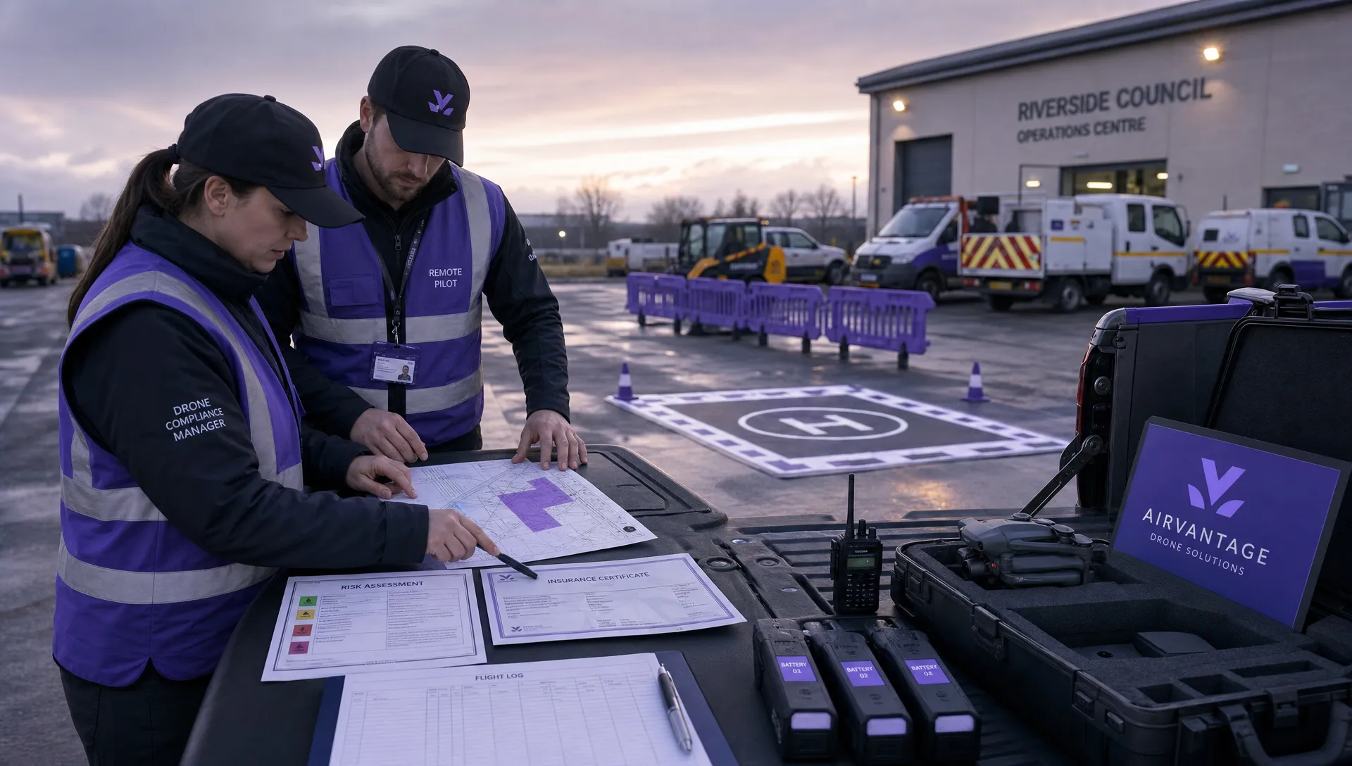 Drone Operation Regulations Explained for Businesses →
 How to Pass Your Drone Pilot License Test →
 How to Review a DJI Flight Record After a Mission →
 How to Check a Drone NOTAM Before You Fly →
 Part 108: What Drone Operators Should Expect →
 Beyond Visual Line of Sight BVLOS Explained →
 Drone Laws and Regulations Every Team Should Review →
 Current Drone Laws: What Changed in 2026? →
 JARUS SORA Explained in Plain English →