Surveying with Drones - Fast & Accurate Results
The Evolution of Surveying With Drones

Surveying used to be a long and arduous process. Surveyors would often find themselves spending weeks on site, manually gathering data across difficult terrain. This traditional method was not only slow and inefficient, but it also posed considerable safety risks, especially when accessing remote or hazardous locations. Projects frequently ran over schedule and budget, with a significant chance of human error affecting the results.
Imagine the logistical complexities of surveying a large construction site or an expansive agricultural field. Previously, this would have necessitated a large team and extensive time on the ground. Now, a single drone operator can efficiently collect all the required data in a fraction of the time. This has led to a remarkable increase in efficiency, improved accuracy, and reduced overall project costs.
This increased efficiency translates directly into significant financial savings. Drones have effectively reshaped the surveying industry by providing a cost-effective and efficient alternative to traditional methods. For instance, surveying long stretches of highway or inspecting potentially dangerous dams is now significantly easier and less expensive using drones. Consequently, there's a growing reliance on drones for tasks that were once prohibitively complex or costly.
The global drone services market, encompassing surveying and other applications, is projected to reach $65.1 billion by 2030. This highlights the increasing adoption of drones across diverse sectors, including environmental monitoring and Internet of Things (IoT) applications. Learn more about the expanding drone market and its legal implications in this insightful resource: Drone Law and Policy. Furthermore, ongoing advancements in drone hardware and software are driving this evolution forward.
Advancements in Drone Technology for Surveying
Modern drones boast improved flight capabilities, and combined with advancements in sensor technology, they enable extremely accurate data collection. High-resolution cameras, LiDAR systems, and multispectral sensors allow drones to capture highly detailed information about the surveyed area.
This data is then processed using specialized photogrammetry software, generating accurate 3D models, detailed maps, and other valuable deliverables. Interested in learning more about the process? Check out this helpful guide: How to Master Drone Surveys. This means that drone surveying isn't just a faster method; it delivers superior data quality, directly addressing long-standing challenges related to accessibility, safety, and accuracy. These ongoing improvements make drone surveying an essential tool for modern surveying professionals.
Game-Changing Technologies in Drone Survey Operations

Modern surveying with drones relies on a powerful combination of cutting-edge hardware and software. This synergy allows for data collection and analysis with remarkable speed and accuracy. This section explores the key technologies driving this progress, empowering surveyors to create highly detailed and accurate representations of the physical world.
Drone Platforms for Specific Surveying Needs
The choice of drone platform is paramount in drone surveying. It directly impacts the quality and efficiency of data acquisition. Selecting the right tool for the job is essential, and several drone types are commonly employed.
-
Multirotor Drones: Renowned for their Vertical Takeoff and Landing (VTOL) capabilities, multirotor drones are ideal for smaller areas or locations demanding precise maneuvering. They thrive in complex environments with obstacles, making them perfect for close-up inspections and detailed data capture.
-
Fixed-Wing Drones: Designed for endurance and covering extensive areas quickly, fixed-wing drones are the preferred choice for large-scale mapping projects. They are particularly well-suited for surveying vast expanses like agricultural fields or large construction sites. Their takeoff and landing requirements, however, can limit their use in confined spaces.
-
Hybrid VTOL Drones: Combining the strengths of both multirotor and fixed-wing designs, hybrid VTOL drones offer remarkable versatility. They can take off and land vertically like multirotor drones but transition to efficient fixed-wing flight for longer distances, adapting to diverse environments and project needs.
Advanced Sensors for Enhanced Data Collection
Advancements in sensor technology have significantly enhanced the power of drone surveying. These sensors enable drones to capture a wide spectrum of data, far exceeding simple visual information.
-
LiDAR Systems: LiDAR (Light Detection and Ranging) employs laser pulses to create incredibly accurate 3D point clouds of the surveyed area. LiDAR is invaluable for generating detailed terrain models and measuring volumes, even in challenging terrain or heavily vegetated areas.
-
High-Resolution Photogrammetry: High-resolution cameras capture intricate images processed using photogrammetry software to create accurate 2D maps (orthomosaics) and 3D models. This provides rich visual representations for analysis and planning.
-
Thermal Imaging: Thermal cameras detect temperature variations, delivering crucial data for infrastructure inspections and identifying potential problems like heat loss or leaks. This capability is especially beneficial in sectors like construction and utility management.
-
Multispectral Sensors: Capturing data across various wavelengths of light, including those beyond the visible spectrum, multispectral imagery is particularly useful in agriculture. It allows for assessing crop health, pinpointing stress areas, and optimizing irrigation practices.
Software Solutions for Data Processing and Analysis
Raw data from drones requires processing and analysis to unlock its true value. Specialized software plays a critical role in transforming this data into usable outputs.
-
Point Cloud Processing Software: Designed to handle LiDAR data, this software filters noise and generates precise 3D models for diverse applications, from creating digital twins of environments to precise measurements and volumetric calculations.
-
Photogrammetry Software: This software processes images to create orthomosaics, 3D models, and other visual outputs crucial for visualizing, measuring, and analyzing the surveyed area.
-
GIS Integration: Seamless integration with Geographic Information Systems (GIS) allows for easy incorporation of drone data into existing workflows. This allows surveyors to combine drone-collected data with other spatial data layers for a comprehensive understanding of the surveyed area.
To better understand the various drone surveying technologies, their applications, and their limitations, the following table provides a comparative overview.
Drone Surveying Technologies Comparison | Technology | Best Applications | Accuracy Range | Cost Level | Limitations | |---|---|---|---|---| | LiDAR | Terrain modeling, forestry, infrastructure | Very High (cm-level) | High | Cost, data processing complexity | | Photogrammetry | Mapping, 3D modeling, inspections | High (cm to m-level) | Medium | Requires clear visibility, image processing time | | Thermal Imaging | Infrastructure inspection, leak detection | Medium (dependent on camera resolution) | Medium to High | Affected by environmental conditions | | Multispectral Imaging | Agriculture, environmental monitoring | Medium (dependent on sensor) | Medium to High | Data interpretation can be complex |
This table summarizes the key differences between the primary drone surveying technologies, highlighting their strengths and weaknesses. Choosing the right technology depends on the specific application and project requirements.
By strategically integrating these technologies, modern surveyors gain access to valuable data and create accurate deliverables, simplifying complex surveying challenges and boosting efficiency across various industries. Using Dronedesk can further streamline drone surveying operations, simplifying flight planning and data management.
Why Surveying With Drones Is Transforming the Industry

Drone surveying isn't just a new technology; it's changing how the entire surveying industry works. It's impacting project timelines, costs, safety, and data quality. This shift is driven by the clear Return on Investment (ROI) drones offer. Projects that once took weeks with large teams are now completed in hours by a single drone operator.
This efficiency boost leads to significant cost reductions, making drone surveying a financially smart choice. Businesses can take on more projects and increase revenue as a result.
Enhanced Efficiency and Cost Savings
The financial advantages of drone surveying are considerable. By using drones, businesses eliminate the need for large on-site crews. This significantly cuts down on labor costs and reduces the time needed for data collection.
Drones work quickly, shortening project timelines and lessening overall project expenses. This allows businesses to use resources more effectively. The increased efficiency also allows for more projects, maximizing revenue potential for surveying professionals. These savings can then be reinvested into other business areas for even greater profitability.
Revolutionizing Safety in High-Risk Environments
Drone surveying isn't just efficient; it's significantly safer than traditional surveying. In high-risk areas like mines, steep terrain, or industrial sites, drones remove the need for personnel in hazardous locations. This drastically reduces workplace accidents and injuries.
Drones can also access hard-to-reach areas, expanding data collection without compromising safety. This improved access leads to more comprehensive surveys and richer data sets.
Delivering Superior Data Quality and Visualization
One of the most significant advantages of drone surveying is improved data quality. Drones use advanced sensors to capture high-resolution data, providing more detailed information than traditional methods. This results in greater accuracy and more comprehensive coverage.
The data collected can easily be converted into various formats like 3D models, orthomosaics, and point clouds, giving clients powerful visualization tools. This allows for better analysis and informed decision-making.
The global drone surveying market is booming. In 2023, it was valued at roughly $1,380.4 million. Projections estimate it will reach $8,061.5 million by 2033, growing at a CAGR of 19.3%. The U.S. market alone is forecast to reach $2,540 million by 2033. For more in-depth information, see this report: Drone Surveying Market Report. This growth reflects the wide adoption of drone technology in construction, mining, and agriculture, demonstrating its transformative effect on the surveying industry.
How Leading Industries Are Leveraging Drone Surveys

Drone surveys are changing the way industries operate, providing solutions to complex challenges. This section explores real-world applications across various sectors, highlighting how organizations use this technology to enhance efficiency, safety, and decision-making. From construction and mining to agriculture and infrastructure, drone surveys offer invaluable data and insights.
This shift towards drone technology is driven by the need for faster, safer, and more cost-effective data acquisition. The global demand for drone data services reached $1.05 billion in 2022. It's projected to grow at a CAGR of 39.0% from 2023 to 2030, according to Grand View Research. This growth is primarily fueled by the increasing need for automated mapping and volumetric calculations.
The following table summarizes key applications and benefits of drone surveying across different industries.
Drone Surveying Applications by Industry | Industry | Primary Applications | Key Benefits | ROI Metrics | |---|---|---|---| | Construction | Project progress monitoring, Earthwork calculations | Real-time insights, Early issue detection, Optimized schedules | Reduced rework, Cost savings, Faster project completion | | Mining | Hazardous area inspections, Stockpile analysis, Blast planning | Improved safety, Efficient resource allocation, Better mine management | Reduced risk to personnel, Optimized resource utilization, Improved productivity | | Agriculture | Crop health assessments, Irrigation optimization, Disease detection | Precision resource allocation, Maximized yields, Sustainable practices | Reduced water and fertilizer usage, Minimized crop loss, Increased profitability | | Infrastructure | Bridge and power line inspections, Network monitoring | Efficient inspections, Early defect detection, Preventative maintenance | Reduced downtime, Lower maintenance costs, Enhanced infrastructure integrity |
This table illustrates how drone surveys offer tailored advantages across diverse sectors, ultimately contributing to improved operational efficiency and cost savings.
Construction: Streamlined Project Management
In the construction industry, drone surveys provide real-time visibility into project progress. Daily updates on site conditions equip project managers to make informed decisions quickly. This proactive approach helps identify potential problems early, minimizing costly delays and rework.
Drones also accurately calculate earthwork volumes, ensuring precise material management and optimizing construction schedules. This level of accuracy helps prevent material shortages and overages, leading to cost savings and improved project efficiency.
Mining: Enhanced Safety and Inventory Management
Mining operations benefit significantly from the enhanced safety protocols enabled by drone surveys. Inspections of hazardous areas can be conducted remotely, reducing risks to personnel. This improves worker safety and minimizes the potential for accidents.
Furthermore, stockpile analysis and blast planning are now more efficient and safer with drone-collected data. This information allows for better resource allocation and improved overall mine management, contributing to increased productivity and profitability.
Agriculture: Precision Crop Management and Resource Optimization
Drone surveys support precision resource allocation in agriculture. Detailed assessments of crop health help identify areas of stress and optimize irrigation strategies. This approach maximizes yields while minimizing water and fertilizer usage, promoting more sustainable farming practices.
Early disease detection is another critical advantage. Drones can identify signs of disease before they become widespread, allowing farmers to implement timely interventions and mitigate potential crop losses, protecting their investment and ensuring a healthy harvest.
Infrastructure: Improved Inspection and Maintenance
Infrastructure management is also realizing significant benefits from drone surveys. Inspections of bridges, transmission lines, and transportation networks are more efficient and safer. Drones can quickly inspect large stretches of power lines or hard-to-reach bridge components, detecting structural defects early and preventing catastrophic failures.
This proactive approach to infrastructure maintenance reduces downtime and costs, ensuring the long-term integrity of critical assets. It also contributes to public safety by minimizing the risk of infrastructure-related incidents.
Navigating Drone Survey Regulations With Confidence
Regulations surrounding drone usage can seem daunting for surveyors considering this technology. This section clarifies essential guidelines for safe and legal drone surveying. We’ll cover key requirements, address common concerns, and ensure compliance doesn't hinder productivity.
Understanding FAA Part 107 and International Equivalents
In the United States, commercial drone surveying falls under FAA Part 107. This regulation outlines requirements for becoming a certified remote pilot, including a knowledge test and obtaining a remote pilot certificate. It also specifies operational limitations, like maximum altitude and speed. Part 107, for example, mandates maintaining visual line of sight with the drone.
Internationally, similar regulations exist. Specifics vary, but core principles often include pilot certification, operational restrictions, and airspace management. Understanding local regulations is crucial for legal and safe drone surveys globally. Consider reading more about this: How to master drone regulations.
Addressing Airspace Restrictions and Authorizations
Airspace regulations are critical for drone surveying. Certain areas, like those near airports or restricted airspace, require special authorizations. Obtaining these, often through online systems like LAANC (Low Altitude Authorization and Notification Capability) in the US, is vital for legal operation.
Successful surveying firms integrate airspace awareness into their processes. They use tools with real-time airspace data to avoid restricted areas and plan flights efficiently, streamlining operations and ensuring regulatory compliance.
Privacy, Property Access, and Liability Insurance
Beyond flight regulations, drone surveyors must consider privacy. Respecting individual privacy and obtaining permissions before flying over private property are essential.
Open communication with property owners is key for access and trust. Explaining the survey’s purpose and addressing privacy concerns fosters positive relationships. For instance, detailing data collection and storage practices can alleviate concerns.
Liability insurance is vital. Accidents can occur, and proper insurance protects against potential damages or injuries. It provides peace of mind and demonstrates professionalism.
Maintaining Compliance and Maximizing Operational Capabilities
Staying current with drone regulations is crucial. As drone technology advances, regulations adapt. Regularly reviewing FAA updates, or international equivalents, ensures ongoing compliance.
Integrating compliance procedures into standard operations streamlines workflows and reduces violation risks. Tools like Dronedesk can help manage flight logs, pre-flight checklists, and other vital documentation.
By proactively addressing regulations, drone surveyors operate confidently, knowing their work is safe and legal. This responsible approach strengthens industry professionalism and encourages the continued growth and acceptance of drone technology in surveying.
Mastering the Drone Surveying Workflow
Surveying with drones involves much more than simply buying equipment. A well-defined workflow is what sets apart successful drone surveying operations from mediocre ones. This section provides a blueprint for planning and executing efficient surveys, from the initial client discussions all the way to delivering the final product.
Initial Planning and Client Consultation
The first step in any drone surveying project is thorough planning, which begins with a detailed client consultation. Understanding their specific needs, project goals, and desired deliverables is crucial. This initial phase lays the groundwork for a successful survey.
For example, a construction company might need a highly accurate 3D model of a site for planning purposes, while an agricultural client might require multispectral imagery for crop health analysis. Clearly defined objectives guide the entire survey process and ensure the final data meets the client's expectations.
Defining Flight Parameters and Ground Control
Once project goals are established, the next step is defining the optimal flight parameters. These include flight altitude, overlap, and flight path, all of which affect the quality and resolution of the collected data. Selecting the appropriate Ground Control Points (GCPs) is also essential.
These precisely measured points on the ground serve as reference points for accurate georeferencing of the drone imagery. Accurate GCP placement ensures that the final deliverables are geographically accurate.
Pre-Flight Checks and Equipment Preparation
Before launching the drone, comprehensive pre-flight checks are vital. This includes verifying battery health, calibrating sensors, and ensuring all systems are functioning correctly. A thorough equipment checklist ensures the drone is ready for operation and minimizes potential in-flight issues.
Additionally, checking weather conditions is paramount. Wind speed, temperature, and visibility can significantly impact data quality and, importantly, flight safety. Choosing the right weather window is crucial for a successful and safe drone surveying operation.
Data Acquisition and Flight Execution
During the flight, the drone collects data according to the pre-determined flight plan. Real-time monitoring of the drone's performance and data acquisition progress is important to keep the survey on track.
For example, keeping an eye on battery levels and data storage capacity allows for timely adjustments, if needed. This proactive approach helps prevent data loss and ensures the survey is completed efficiently. Learn more in our article about How to master drone mapping software.
Data Processing and Quality Control
After the flight is complete, the collected data requires processing. This involves using specialized photogrammetry software to create deliverables such as orthomosaics, 3D models, and point clouds. Implementing quality control measures throughout this stage is crucial to ensure accuracy and reliability.
For instance, verifying data accuracy against the established GCPs allows for corrections and adjustments, guaranteeing the deliverables meet the required specifications.
Data Delivery and Reporting
The final step is delivering the processed data to the client in the agreed-upon format. This could be a digital file, an online platform, or a printed report. Providing a clear and concise report that summarizes the survey findings and highlights key insights provides added value for the client.
This report should include information on data accuracy, limitations, and any relevant observations made during the survey. This comprehensive approach ensures the client has a complete understanding of the data collected and its potential applications.
For organizations considering implementing drone surveying, choosing between building in-house capabilities or outsourcing is a key decision. Factors such as project frequency, budget constraints, and required expertise will influence this decision. Calculating ROI, including equipment costs, training, and productivity gains, helps determine the most cost-effective strategy.
Streamline your drone operations with Dronedesk, a comprehensive platform designed for drone professionals. From flight planning and data management to team coordination and regulatory compliance, Dronedesk simplifies complex workflows and boosts efficiency. Explore the power of Dronedesk and elevate your drone surveying operations: https://dronedesk.io
 Beyond Visual Line of Sight Explained for Operators →
 How BVLOS Drone Operations Change Commercial Workflows →
 FAA Drone Rules Every Commercial Pilot Should Know →
 FAA 107 Explained for Commercial Drone Operators →
 Canadian Drone Regulations Explained for Business Use →
 FAA Part 107 Drone License Explained for Beginners →
 How to Review a DJI Drone Flight Log Step by Step →
 Drone Registration Law Explained for Commercial Pilots →
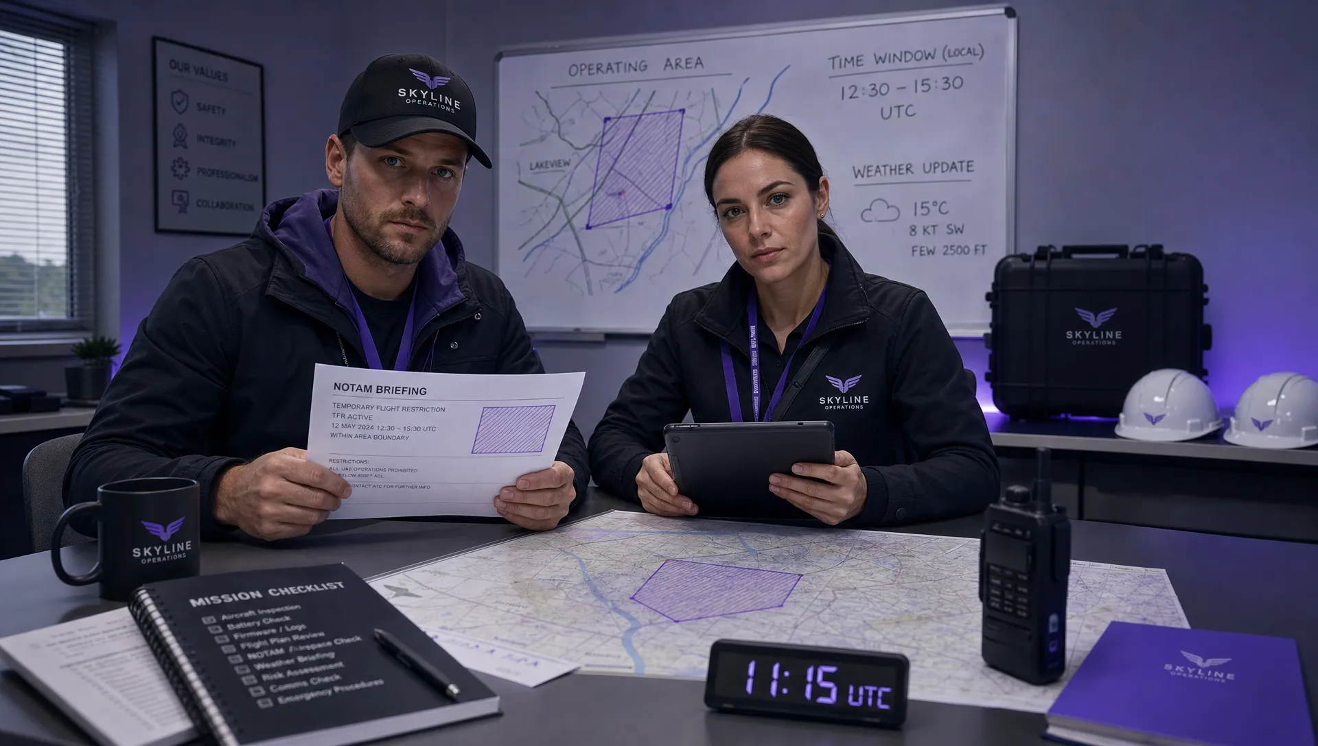 How to Check a Drone NOTAM Before Every Mission →
 BVLOS Drone Meaning and Why It Matters →