A Practical Guide to Aerial Survey UAV Operations
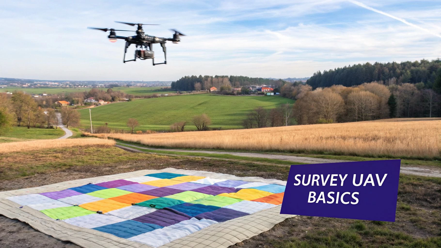
Think of an aerial survey UAV as a surveyor's best friend. It's a specialized drone loaded with high-precision sensors, designed to capture geospatial data from the sky. In simple terms, it's like giving surveyors a highly accurate, flying measuring tape that can glide over vast and tricky terrain in a tiny fraction of the time it would take on foot.
So, How Does It Actually Work?
At its core, an aerial survey UAV takes what looks like a standard drone and turns it into a serious data collection machine. It essentially creates a detailed digital quilt of the landscape below. Imagine each photo it snaps as a small fabric patch; these patches are then stitched together with incredible geospatial accuracy to form one seamless, complete picture.
This whole process is a massive leap forward from traditional ground-based methods. You know the ones—teams of people spending days, or even weeks, walking a site with GPS rovers. With a drone, a single flight can map hundreds of acres in less than an hour, collecting millions of data points with far greater efficiency and, crucially, much more safely.
The Two Ways a Drone "Sees"
Two primary technologies are at the heart of how a survey drone "sees" the world: Photogrammetry and LiDAR. They aren't interchangeable; each offers a totally different way of perceiving and measuring the environment.
- Photogrammetry: This method uses a high-resolution camera to snap hundreds, sometimes thousands, of overlapping images. Back at the office, specialized software digs into these photos, finds common points between them, and uses the principles of light and shadow to build a detailed three-dimensional model. It’s a bit like how our own two eyes create depth perception, but on a massive, mathematically precise scale.
- LiDAR (Light Detection and Ranging): This one works more like a bat's echolocation. A sensor fires out rapid pulses of laser light and precisely measures how long it takes for those pulses to bounce off surfaces and return. This gives you direct distance measurements, creating a dense "point cloud" of the terrain with stunning accuracy. It can even punch through vegetation to map the true ground level beneath the canopy.
The fundamental difference is simple: Photogrammetry interprets 3D geometry from 2D images, while LiDAR directly measures it with lasers. This distinction is crucial when choosing the right tool for a project.
From Niche Tech to Industry Standard
Not long ago, aerial survey UAVs were a niche experiment. Today, they're a mainstream data-collection tool across a ton of key industries. This boom isn't just about the hardware; it's driving serious demand for operations platforms to manage the sheer volume of flights and stay on top of regulatory compliance.
The commercial drone market, which is dominated by tasks like aerial surveying, is set to grow at a blistering 25.4% CAGR between 2025 and 2030. The total market is expected to hit USD 40.56 billion by 2030. To get a better handle on how these complex systems operate and communicate, it’s helpful to understand the principles of the Internet of Things (IoT), which govern how all sorts of devices collect and share data. You can read the full research on this booming market over at MarketsandMarkets for a more detailed breakdown.
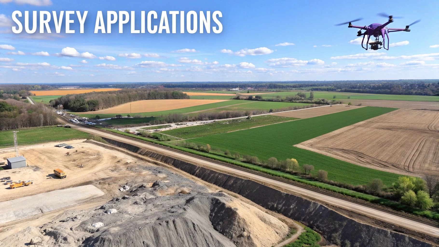
Key Applications for UAV Aerial Surveying
It's one thing to understand the tech behind an aerial survey UAV, but it’s a whole other ball game to see it in action. These aren’t just fancy flying cameras; they're workhorses solving real, tangible problems across massive industries. They turn messy, complex physical sites into clean, precise digital data—driving efficiency, boosting safety, and giving teams critical insights faster than ever before.
Picture a quarry manager staring down a quarterly inventory report. They need to know exactly how much gravel is in that massive stockpile. The old way? Shutting down operations for a day, sending a ground crew to clamber over hazardous piles—a slow, expensive, and frankly, dangerous ordeal. A UAV can nail that same job in under an hour during a lunch break, without a single boot touching the pile.
To really grasp the versatility of UAV surveying, it helps to see how different sectors are putting this technology to work. Each application has its own unique goals, outputs, and benefits.
Comparing Aerial Survey UAV Applications
| Application | Primary Objective | Common Deliverables | Key Industries |
|---|---|---|---|
| Topographic Mapping | Create detailed 3D models of terrain for planning and design. | Orthomosaic maps, digital elevation models (DEM), contour lines. | Construction, Land Development, Civil Engineering |
| Volumetric Surveys | Accurately measure the volume of stockpiles or earthworks. | 3D models, volume calculation reports, cut/fill analysis. | Mining, Aggregates, Construction |
| Asset Inspection | Safely assess the condition of critical infrastructure from a distance. | High-resolution images/video, thermal imagery, inspection reports. | Utilities, Energy, Telecommunications |
| Precision Agriculture | Monitor crop health and optimize resource application. | NDVI maps, plant health analysis, variable rate prescriptions. | Agriculture, Viticulture, Forestry |
This table gives a bird's-eye view, but the real magic is in the details of how each application fundamentally changes the way work gets done on the ground.
Construction and Topographic Mapping
On a large-scale construction project, an aerial survey UAV is the ultimate watchdog. Before a single shovel hits the dirt, a drone can fly a detailed topographic survey, creating a high-res map of the existing ground. This baseline data is absolutely critical for smart site planning and accurate cut-and-fill calculations.
As the project unfolds, weekly or bi-weekly flights provide an unarguable visual diary of progress. Project managers can overlay the latest orthomosaic map onto the original blueprints to:
- Track progress against the schedule and spot potential delays before they snowball.
- Verify work done by subcontractors before cutting a cheque.
- Ensure safety compliance by keeping an eye on site conditions from a safe vantage point.
This steady flow of data flips project management on its head—from reactive fire-fighting to proactive, data-driven decision-making.
Mining and Volumetric Surveys
That quarry example is a perfect slice of what volumetric surveying is all about. This is a cornerstone application for the mining and aggregates world, where knowing your inventory down to the last cubic metre is directly tied to your bottom line.
By capturing thousands of images of a stockpile, photogrammetry software calculates its volume with an accuracy often hitting 99%. This allows for pinpoint inventory tracking, financial forecasting, and smart resource allocation, all without causing any operational downtime.
The financial upside of this efficiency is huge, and it's a major reason for the tech's explosive growth. The global UAV market is on a trajectory to grow from USD 43.26 billion in 2025 to USD 157.21 billion by 2034, at a 15.5% CAGR. The construction and mining sector is leading the charge, which shows just how essential these mapping and measurement tasks have become. You can dig deeper into these market projections and the growth of UAV technology.
Asset Inspection and Management
Think about the sheer difficulty of inspecting critical infrastructure like power lines, wind turbines, or bridges. These assets are often sprawling, remote, and downright dangerous to access. An aerial survey UAV, kitted out with a high-zoom camera or a thermal sensor, can handle these inspections safely and with incredible efficiency.
Instead of chartering a helicopter or sending a team of rope-access techs up a tower, a single drone operator can capture incredibly detailed imagery of a turbine blade or a transmission tower from a safe distance. This data allows engineers to spot cracks, corrosion, or heat anomalies long before they become catastrophic failures, creating a powerful predictive maintenance program.
Precision Agriculture
In farming, UAVs are completely changing the game. A drone with a multispectral sensor can see things the human eye can't, detecting tiny variations in plant health across hundreds of acres. It's like a doctor giving a field a complete check-up.
The data generates maps that pinpoint areas of stress from pests, irrigation problems, or nutrient deficiencies. Armed with this intel, farmers can apply water, fertiliser, or pesticides with surgical precision, only where it's needed. This doesn't just boost crop yields and quality; it also slashes costs and reduces environmental impact, paving the way for more sustainable farming.
Choosing the Right UAV and Sensor for the Job
Picking the right gear for an aerial survey UAV isn't about finding the single "best" drone on the market. It’s about matching the right tool to the job you have in front of you. Think of it like a contractor picking a vehicle for the day's work. You wouldn't try to navigate a tight residential street with a massive dump truck, and you definitely wouldn't haul tons of gravel in a small pickup. The exact same logic applies to drones and their sensors.
The first big decision is the UAV airframe itself. Your choice really boils down to two main designs, each with its own way of flying and its own best-use case. Getting this right from the start is fundamental to running an efficient mission and getting high-quality data.
Multirotor vs Fixed-Wing Drones
Picture a helicopter versus an airplane. A helicopter (our multirotor) can hover perfectly still, take off and land straight up and down, and move with incredible precision in tight spots. An airplane (our fixed-wing) is built for the long haul, soaring efficiently over huge distances but needing a bit more room to get going.
This analogy nails the difference between the two main types of survey drones:
- Multirotor UAVs: These are the quadcopters, hexacopters, and octocopters we’re all familiar with. They offer fantastic control and stability. Their ability to hover makes them the perfect choice for detailed, close-up work like inspecting a building's facade, a cell tower, or a small, complex construction site. They are the specialists for tricky, low-altitude jobs.
- Fixed-Wing UAVs: These drones look and fly just like small airplanes. They can't hover, but they make up for it with incredible efficiency and endurance. They can map hundreds, sometimes even thousands, of acres in a single flight. This makes them the go-to for large-scale topographic mapping, agricultural surveys over sprawling fields, or monitoring long stretches of infrastructure like pipelines or power lines.
If you're just starting to look at your options, our guide on the best drones for land surveys dives into detailed comparisons of current models that really shine in these roles. The main takeaway is simple: pick the platform that fits the scale and complexity of your typical projects.
Matching the Sensor to the Survey Mission
Once you’ve got a platform in mind, the next crucial piece of the puzzle is the sensor—the "eyes" of your aerial survey UAV. The payload you attach to the drone is what dictates the kind of data you can actually collect. While a standard high-res camera is a great all-rounder, specialized sensors unlock completely new layers of information that are invisible to the naked eye.
The sensor is what turns a drone from a simple flying camera into a powerful analytical tool. An RGB camera sees what we see, a multispectral sensor sees plant health, and a LiDAR sensor sees right through the trees to the ground below.
Each type of sensor is built to answer a very different question about the site you're surveying.
Common Sensor Types and Their Uses
Figuring out what each sensor does makes it much clearer which one you need for a specific job. Here’s a quick rundown of the three most common payloads in the world of aerial surveying:
-
RGB (Red, Green, Blue) Sensors: This is your standard high-resolution camera, the kind you’ll find on most commercial drones. It captures images in the visible light spectrum, just like a professional DSLR camera. It's the workhorse for creating detailed 3D models, high-resolution orthomosaic maps, and visual progress reports for construction sites. If your goal is to create a visually perfect digital twin of a site, an RGB sensor is your tool of choice.
-
Multispectral Sensors: These are more advanced sensors that capture light beyond what we can see, focusing on specific narrow bands that reveal critical data about vegetation. By analyzing how plants reflect different wavelengths of light (like near-infrared), these sensors can spot crop stress from disease, pests, or dehydration long before it's visible. This makes them absolutely essential for precision agriculture, forestry management, and environmental monitoring.
-
LiDAR (Light Detection and Ranging) Sensors: LiDAR is the king of creating hyper-accurate terrain models. It works by shooting rapid pulses of laser light at the ground and measuring how long they take to return, calculating incredibly precise distances. Its biggest advantage is its ability to punch through vegetation canopies, allowing it to map the true ground surface under a dense forest—something photogrammetry just can't do. This makes LiDAR the top choice for forestry surveys, mapping corridors through overgrown areas, and creating detailed digital elevation models (DEMs).
Executing a Flawless Survey Mission
Great data from an aerial survey UAV is never an accident. It’s the direct result of meticulous planning and flawless execution. Think of it like a professional photographer setting up their studio for a big shoot—every light is tweaked, every camera setting double-checked. All that prep work is what guarantees the perfect final image. The same exact principle applies here; a well-planned mission is the single most critical factor for capturing reliable, survey-grade data.
Putting in the effort up front not only ensures the quality of your final deliverables but also makes the post-processing stage worlds easier and more accurate. It all starts with having a crystal-clear understanding of the project's scope and a solid assessment of the environment you'll be flying in.
Pre-Flight Preparations
Before the props even start spinning, there’s a checklist of critical tasks to knock out. This groundwork is what sets the stage for a safe, effective flight, and it all begins with defining exactly what you need to map.
First, you have to clearly define the survey area. This usually means drawing a precise boundary or polygon over a satellite map in your flight planning software. It's also absolutely crucial to check all local airspace regulations to spot any restrictions, controlled airspace, or Temporary Flight Restrictions (TFRs). You'll also need a thorough risk assessment to identify potential hazards on the ground—things like power lines, buildings, or public access areas—and make sure you have a plan to manage each one.
The infographic below shows you how to line up your drone, project type, and sensor for the best possible results.
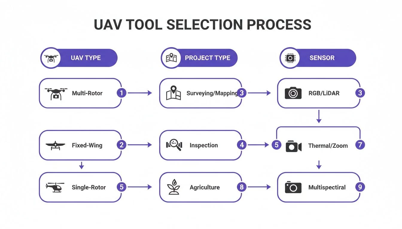
As you can see, a successful mission kicks off by picking the right tools for the job, whether you're mapping huge areas or inspecting intricate structures up close.
Setting Key Flight Parameters
Once the prep is done, it's time to dial in the technical flight parameters that directly impact your data quality. These settings are what separate a folder full of pretty pictures from a genuinely survey-grade dataset.
One of the most important settings is image overlap. This ensures your photogrammetry software has enough common points between photos to accurately stitch them all together into a seamless model.
- Frontlap: This is the overlap between one image and the next along your flight path. A setting of 75-85% is pretty standard for most topographic surveys.
- Sidelap: This is the overlap between adjacent flight lines. A setting of 60-75% is usually plenty to ensure you get full coverage without any gaps.
Your flight pattern is another key decision. A standard grid pattern is perfect for most topographic mapping jobs. But if you’re trying to capture vertical structures like building facades or complex industrial sites, a double-grid pattern (flying the same grid twice, but perpendicular to the first pass) or an orbital flight around the object will be much more effective. For a deeper dive into the different techniques, check out our guide on professional drone data collection.
Achieving Survey-Grade Accuracy
For those projects that demand the highest possible level of precision, just flying a well-planned mission isn’t going to cut it. To achieve true survey-grade accuracy, you have to tie your aerial data to known, fixed points on the ground. This is where Ground Control Points (GCPs) come into play.
Ground Control Points are physical markers placed throughout the survey area with precisely known geographic coordinates. By tagging these points in your final imagery, you're essentially correcting the entire model and anchoring your digital map to the real world with centimetre-level accuracy.
The process involves placing these visible targets across the site and then measuring their exact coordinates with a survey-grade GPS rover. As a rule of thumb, a minimum of five GCPs is recommended—one near each corner and one in the center—but more complex or hilly terrain might call for a few more. By properly integrating GCPs, you transform a visually impressive map into a reliable measurement tool that’s ready for serious engineering and design work.
Turning Raw Drone Data into Actionable Intelligence
When your aerial survey UAV lands, its job is only half-done. It doesn’t return with answers, but with a mountain of raw data—often thousands of high-res images or millions of laser points from a LiDAR sensor. Right now, that data is just a pile of unassembled puzzle pieces. The real magic, and the real value, happens in post-processing, where specialized software turns that digital raw material into something you can actually use.
This isn’t some mysterious "black box" operation. Think of it like developing film from a classic camera, but for geospatial data. You take all the raw captures, the software stitches them together using shared features, and then you "develop" them into final products that project managers and engineers rely on to make critical decisions.

This is the stage where a well-executed flight plan truly pays off. Garbage in, garbage out is the rule of thumb here. High-quality inputs lead directly to high-quality outputs, saving you hours of frustrating manual fixes and delivering results you can trust.
From Images to Digital Twins
The journey from a memory card full of data to a final report involves a few key steps, each building on the last. It all starts by importing your georeferenced images or LiDAR data into a photogrammetry or point cloud processing suite. The software then gets to work, meticulously identifying common points across hundreds or thousands of overlapping images to perfectly align them in 3D space.
Once everything is aligned, the software generates the core assets that form the foundation for every other deliverable. These aren't just pretty pictures; they're measurable, spatially accurate digital versions of your site.
The three main outputs you'll work with are:
- Orthomosaic Map: This is a single, high-resolution aerial image of your entire site, but with a crucial difference: it's distortion-free. Unlike a regular satellite photo, it’s been "orthorectified," meaning it has a uniform scale. You can take precise measurements of distance, area, and coordinates directly from it.
- 3D Point Cloud: Imagine a massive collection of individual dots, each with its own X, Y, and Z coordinate in space. That's a point cloud. It forms a dense, three-dimensional digital replica of the site, capturing the shape and texture of every feature, from buildings and stockpiles to individual trees.
- Digital Surface Model (DSM) / Digital Elevation Model (DEM): These are grid-based maps showing the terrain's elevation. A DSM captures the height of everything on the surface, including buildings and vegetation. A DEM, on the other hand, represents the bare earth, digitally stripping away all the man-made objects and trees.
Understanding the Key Deliverables
These core outputs are incredibly powerful, but they are rarely the final product. Instead, they’re the raw ingredients used to cook up the specific reports and models a client actually needs. The real power of an aerial survey UAV is unlocked when you start analysing these digital models to answer specific business questions.
An orthomosaic isn't just a map; it's a geospatially accurate tool for precise measurements. A point cloud isn't just a model; it's a site's digital twin, enabling detailed analysis from the safety of an office.
Here’s how these outputs translate into tangible value for different sectors:
| Deliverable | Description | Primary Use Cases |
|---|---|---|
| Volumetric Reports | Calculated volumes of stockpiles, pits, or earthworks derived from 3D models. | Mining inventory, construction cut/fill analysis, landfill management. |
| Contour Lines | Lines drawn on a map that connect points of equal elevation, making the site's topography easy to visualize. | Site planning, drainage analysis, civil engineering design. |
| As-Built Surveys | A detailed digital record of a project's state at a specific point in time, which can be compared against the original design plans. | Construction progress monitoring, quality assurance, payment verification. |
Ultimately, post-processing is the critical bridge that connects your fieldwork to the boardroom. It's the step that converts millions of data points into a clear report showing a project manager exactly how much material was moved last month, giving them the hard data needed to keep a complex project on schedule and on budget.
Scaling Your Drone Program with an Operations Platform
Every growing drone operation hits a wall. The spreadsheets, manual logs, and sticky notes that worked perfectly for a solo pilot suddenly become an anchor, dragging everything down. When you add a second pilot, a third drone, and a handful of new clients, the system you cobbled together doesn't just bend—it breaks. This is where growth grinds to a halt.
Moving from a one-person show to a full-fledged team brings a tidal wave of new headaches. You're suddenly trying to manage multiple pilot schedules, track maintenance across the fleet, ensure every job site is compliant, and produce professional reports for a growing list of clients. It's an administrative nightmare, and it's where mistakes happen. Think missed maintenance, compliance oversights, and hours sunk into paperwork instead of flying.
Centralizing Your Entire Operation
This is where a dedicated drone operations management platform comes in, acting as the mission control for your entire business. It pulls everything out of scattered folders and chaotic email threads and into one single source of truth. It's a fundamental shift from just doing the work to professionally managing it.
This screenshot from Dronedesk gives you a sense of what that looks like in practice—a clear dashboard showing job plans, team status, and fleet info at a glance.
What you immediately see is total visibility. No more guessing games about who's available or what drone needs servicing. It’s all right there.
From Pain Points to Professionalism
A proper platform doesn't just organize your data; it transforms your workflows. It takes those scaling pains and turns them into repeatable, professional processes that build client confidence and keep you safe.
- Automated Airspace Intelligence: Forget manual checks. The platform automatically scans for airspace restrictions and NOTAMs for every planned job, giving you a green light before you even leave the office.
- Integrated Flight Logging: Logs are captured and stored automatically. No more chasing down pilots for their flight times. You have a clean, audit-ready record for every single flight.
- Fleet and Maintenance Tracking: The system logs flight hours on every airframe and component, then sends you an alert when maintenance is due. This is how you prevent unexpected—and expensive—equipment failures.
- Client and Job Management: Everything from the initial client brief and risk assessments to the final deliverables is stored in one project folder, accessible to anyone on the team who needs it.
Make no mistake, this level of organization is becoming non-negotiable. Projections show the UAV market rocketing to USD 191.89 billion by 2035, with North America grabbing a huge 46% of that pie. That growth means more competition and clients who expect a higher standard of professionalism. As your fleet grows to meet that demand, a centralized platform is the difference between an amateur outfit and a truly scalable business. You can learn more about how Dronedesk supports scaling drone operations right here on our blog.
Still Have Questions? Let's Clear a Few Things Up
If you're thinking about adding an aerial survey UAV to your toolkit, you've probably got a few questions buzzing around. Let's tackle some of the most common ones we hear from professionals just like you.
Just How Accurate Is Drone Surveying, Really?
This is the big one, and the answer is: it depends entirely on your gear and your methods. If you just fly a high-quality drone over a site, you can expect pretty good relative accuracy, usually within a few centimetres.
But for the kind of precision needed for serious engineering or construction work, you need survey-grade absolute accuracy. This means tying your map to precise, real-world coordinates. To get there, you'll need to use either Ground Control Points (GCPs) or an RTK/PPK-enabled drone. Do it right, and you can achieve stunning accuracy of 1-3 centimetres.
What's the Best Drone for Surveying?
There’s no magic bullet here; the "best" drone is the one that's right for the job at hand.
- For tight, complex sites, like a single building or a packed construction zone, a multirotor drone (think a DJI Mavic 3 Enterprise) is your friend. Its ability to hover and maneuver in tight spaces is perfect for detailed inspections.
- For mapping huge areas—we're talking hundreds of acres—a fixed-wing UAV is the clear winner. They fly longer and cover ground much faster, making them way more efficient for large-scale projects.
And remember, the sensor is just as crucial as the drone. A standard RGB camera is your go-to for photogrammetry, but if you need to see the ground beneath thick trees, only LiDAR will do.
How Long Does an Aerial Survey Take?
An aerial survey UAV completely changes the game when it comes to time on site. A single drone can map 100-200 acres in one 30-45 minute flight. That’s a job that could easily tie up a ground-based crew for days.
The big time commitment isn't in the field—it's back at the office. While the flight itself is quick, turning thousands of images into a polished orthomosaic map or a 3D model takes time. Expect to spend several hours on post-processing, depending on how much data you collected and the horsepower of your computer.
Do I Need a Special License to Fly a Survey Drone?
Absolutely. In nearly every country, flying a drone for any commercial reason, including surveying, requires a specific license or certification. In the US, for example, you'll need a Part 107 certificate from the FAA. Before you even think about flying, make sure you know and follow the rules set by your local aviation authority.
Ready to manage your growing drone operations with a single, powerful tool? Dronedesk centralizes everything from flight planning and compliance checks to fleet management and client reporting. See how thousands of pilots are saving time and scaling their business at https://dronedesk.io.
 Drone Legal Requirements for Commercial Operations →
 Drone Near Airport Rules Explained for Safer Planning →
 International Drone Regulations Every Global Team Should Know →
 Drone Flight Risk Assessment Example for Safer Missions →
 Beyond Visual Line of Sight Explained for Operators →
 How BVLOS Drone Operations Change Commercial Workflows →
 FAA Drone Rules Every Commercial Pilot Should Know →
 FAA 107 Explained for Commercial Drone Operators →
 Canadian Drone Regulations Explained for Business Use →
 FAA Part 107 Drone License Explained for Beginners →