The Ultimate Guide to Drone Flight Planning Software - A Decision-Maker's Blueprint
Understanding the Modern Drone Planning Landscape

Flying drones has evolved far beyond simple remote control operation. Today's pilots rely on specialized drone flight planning software to manage complex missions across construction sites, farms, and film sets. This software helps both hobbyists capturing scenic shots and professionals conducting industrial operations to fly more safely and efficiently. One clear example is how pre-flight checks that used to take 30+ minutes can now be completed in just a few clicks.
The numbers tell a compelling story about this shift toward smarter drone planning. According to Valuates Reports, the drone flight planning software market is worth $219 million in 2023 and will reach $389 million by 2030. This 8.3% yearly growth shows how crucial these tools have become as more industries adopt drone technology for their operations.
Key Considerations for Choosing Flight Planning Software
Finding the right software for your drone operations means carefully weighing several key factors. Just as a photographer chooses camera gear based on their specific needs, drone operators must select planning tools that match their missions. Here's what to look for when evaluating options:
- Ease of Use: Look for software with clear menus and simple workflows that you can learn quickly
- Compatibility: Check that the software works with your drone models and other equipment you use
- Feature Set: Focus on tools you'll actually use - like automated flight paths for surveys or obstacle detection for urban flights
- Scalability: Pick software that can grow with you, whether you fly solo or manage multiple drones
- Cost: Compare pricing plans against the features you need to get the best value
Mapping Your Needs to Software Capabilities
Different drone operations require different software capabilities. A real estate photographer has very different needs than a mining surveyor. Understanding which features matter most for your work is key to picking the right tool.
| Feature | Benefit | Ideal User |
|---|---|---|
| Automated Flight Paths | Saves time and improves accuracy | Mapping, surveying, inspections |
| Terrain Following | Maintains consistent altitude above varying terrain | Aerial photography, videography |
| Obstacle Avoidance | Enhances safety and minimizes risk of collisions | Operations in complex environments |
| Real-Time Monitoring | Provides live feedback on drone status and flight progress | All users |
| Data Analysis & Reporting | Simplifies post-flight data processing and generates insightful reports | Professional users |
Take time to match these capabilities to your specific needs. This thoughtful approach helps ensure you select software that will truly improve your drone operations rather than add unnecessary complexity. The right choice will make your flights more efficient while helping you deliver better results to clients.
Critical Features That Drive Operational Excellence

Professional drone operations rely heavily on flight planning software to ensure safe and efficient missions. As drone technology advances, specialized features have emerged that give operators precise control over every aspect of their flights. These capabilities directly impact the quality of data collection, overall safety, and the bottom line for drone service providers.
AI-Powered Path Generation and Obstacle Avoidance
AI path generation takes the manual work out of flight planning by automatically creating optimized routes based on terrain, restricted zones, and mission goals. For example, when conducting a land survey, the software calculates the most efficient path while ensuring complete coverage. The system also includes dynamic obstacle detection, which goes beyond basic no-fly zones by tracking and avoiding unexpected obstacles in real-time. This is especially valuable when flying in busy areas or changing environments where traditional planning might fall short.
Intelligent Weather Integration and Real-Time Monitoring
Modern drone software pulls in live weather data to help operators make informed decisions about flight timing and conditions. This feature is particularly important for missions that depend on specific weather parameters, such as wind speed limits or clear visibility. During flights, real-time monitoring gives pilots constant updates on crucial metrics like battery levels, telemetry data, and sensor readings. This immediate feedback allows quick adjustments to keep missions on track and maintain safety standards. Learn more about these capabilities in this guide to drone software integration. For practical tips on implementing these tools, check out this resource on Efficient Drone Operations.
Data Analysis and Reporting
The final piece of the puzzle is robust data processing that turns flight data into useful information. The software automatically handles tasks like image processing, map creation, and 3D model generation. This automation is essential for applications such as building inspections, topographic surveys, and precision mapping. By handling complex calculations and data visualization, these tools free up operators to focus on mission planning and execution rather than post-processing work.
Real-World Success Stories and Implementation Insights

Let's look at how companies are putting drone flight planning software to work and getting real results. These examples show the concrete benefits and return on investment that smart implementation can deliver across different industries.
Construction: Streamlining Surveys and Site Management
Construction companies have found that drone flight planning dramatically speeds up their site surveys. What used to take days or weeks of manual work can now be completed in hours using pre-programmed flight paths and automated data collection. One construction firm reported cutting survey times by 50% after adopting this technology. Beyond just saving time and money, the detailed aerial imagery and 3D models give project managers better oversight of site progress and potential issues.
Agriculture: Optimizing Crop Management and Resource Allocation
Farmers are using drone flight planning to map out exact coverage patterns for monitoring crops and applying treatments. For example, vineyard owners can create flight plans that systematically capture data on every row of vines. This precise approach helps them spot problems early and target resources like water and fertilizer exactly where needed, reducing waste while improving crop health.
Emergency Services: Faster Response and Enhanced Situational Awareness
First responders rely on drone flight planning to act quickly in emergencies. They create ready-to-use mission templates for common scenarios like search and rescue or disaster assessment. When a wildfire breaks out, fire departments can immediately launch drones using pre-set flight paths to gather real-time information about the fire's spread and conditions on the ground. This quick access to aerial data helps teams respond more effectively and work more safely.
Speaking of industry growth, North America currently leads the global drone software market with a 36.5% share, generating USD 2.18 billion in revenue as of 2023. This strong position comes from extensive commercial and military drone use, plus many key software companies being based in the region. Learn more details in the full Market.us report on the drone software industry.
These real examples demonstrate how drone flight planning tools deliver measurable value across different fields. Companies that implement them strategically see clear improvements in their operations, safety standards, and bottom line.
Mastering Mission Planning Excellence

A well-planned drone mission is key to getting great results safely and efficiently. Taking time to plan properly helps avoid problems in the air and ensures you capture the data you need. Here's how expert drone operators approach mission planning to consistently get the job done right.
Designing Efficient Flight Paths
Smart flight planning goes beyond just plotting a basic route. Expert operators carefully consider battery life, data needs, and airspace rules when designing their flight paths. For mapping projects, they ensure photos overlap enough for accurate 3D models, while inspection flights focus on getting detailed views of specific areas. Modern planning software helps set precise waypoints, heights, and camera angles to collect all needed data while using battery power wisely.
Managing Multi-Drone Operations and Data Collection
When projects require multiple drones flying at once, coordination becomes critical. Planning software makes it possible to safely manage several drones by assigning each one specific routes and tasks. This approach works especially well for large mapping jobs or search missions where covering ground quickly matters. The software also helps gather quality data in tough conditions - features like terrain following keep drones at steady heights above uneven ground for consistent image quality.
Accounting for Critical Variables
The best drone operators leave nothing to chance. They use detailed checklists and planning tools to consider every important factor:
- Battery Management: Planning flight times with enough power for safe returns and unexpected situations
- Weather Conditions: Checking wind speeds, temperatures, and visibility before takeoff
- Legal Requirements: Getting proper permits and following airspace rules
This careful preparation prevents surprises and keeps operations safe and legal. For more insights on automated operations, check out The Complete Guide to Drone-in-a-Box Solutions.
Balancing Automation and Human Oversight
While planning software offers helpful automation, skilled human judgment remains essential. Good operators know the software enhances but doesn't replace their expertise. They stay alert during flights, ready to adjust plans if conditions change or data collection needs tweaking. Finding the right mix of automated help and hands-on control leads to consistent success across different types of missions.
Emerging Technologies and Strategic Innovations
Modern drone flight planning software keeps getting better through advances in technology. Artificial intelligence, machine learning, and advanced analytics are driving major improvements in what drones can do autonomously, opening up new possibilities across different industries.
AI-Powered Flight Optimization and Predictive Analysis
AI has become essential for smarter drone flight planning that goes beyond basic automation. Modern software analyzes weather data, terrain, and airspace rules to create optimized flight paths. The systems can now adapt routes in real-time as conditions change, making flights more efficient and safer. AI also helps predict potential issues like low battery levels or obstacles, so operators can solve problems before they affect the mission.
Machine Learning for Enhanced Situational Awareness
Flight planning software gets smarter over time by learning from past flights through machine learning. The software fine-tunes flight settings based on what worked before, leading to better predictions and operations. For example, drones become more skilled at spotting and avoiding obstacles, even in tricky environments. This improved awareness helps ensure safer flights, especially in challenging conditions. Want to learn more? Check out How to master the latest trends in the drone industry.
Advanced Analytics for Data-Driven Decision Making
Better analytics tools are changing how operators use flight data. Today's software includes powerful features that process large amounts of information to provide useful insights. This helps operators understand their flights better, spot patterns, and improve how they use their resources. For instance, analytics can show specific ways to adjust flight plans for better efficiency or data quality. Having solid data helps operators make smart choices to get the most from their drone programs.
Evaluating and Implementing New Technologies
While these new capabilities are exciting, it's important to carefully consider which ones to adopt. Think about how well they work with your current systems, how easy they are to use, and whether they're worth the cost. Start small with test projects before expanding - this helps you get the benefits while avoiding disruption. By staying informed and making thoughtful choices about new technology, drone operators can succeed as unmanned aviation continues to grow.
Strategic Implementation and Resource Optimization
Getting the most from your drone flight planning software requires careful planning and execution. Consider it like training for a marathon - you need the right equipment, preparation, and strategy to succeed. This guide will help you evaluate, implement, and optimize flight planning tools to improve your drone operations.
Assessing Your Operational Needs
Start by getting crystal clear on your requirements before looking at any software options. A wildlife photographer has very different needs than a construction site surveyor. Taking time upfront to define exactly what you need will save headaches later.
- Core Mission Requirements: List out the specific types of flights and tasks you need to accomplish
- Equipment Compatibility: Check that any solution works with your current drones and sensors
- Team Capabilities: Consider your team's technical skills and how much training they'll need
- Budget Parameters: Figure out both your upfront and ongoing budget to find sustainable options
Comparing Drone Flight Planning Solutions
With your needs defined, you can evaluate different software options systematically. Create a comparison framework focused on the features that matter most for your operations:
| Feature | Priority | Software A | Software B | Software C |
|---|---|---|---|---|
| User Interface | High | Excellent | Good | Fair |
| Mapping Quality | Critical | Excellent | Fair | Good |
| Obstacle Detection | Medium | Good | Excellent | Fair |
| System Integration | High | Fair | Good | Excellent |
| Pricing | High | $$ | $$$ | $$ |
This organized approach helps cut through marketing hype to find the best fit for your specific needs.
Implementing and Scaling for Long-Term Success
A successful rollout requires proper planning and execution. Take it step by step:
- Start Small: Begin with a pilot program to work out any issues before full deployment
- Train Thoroughly: Invest time in comprehensive team training - rushed training leads to mistakes
- Track Results: Monitor key metrics like flight efficiency and data quality to measure impact
- Support Infrastructure: Assign dedicated staff to manage implementation and ongoing support
- Develop Expertise: Help your team master advanced features to reduce reliance on outside help
Following these guidelines helps ensure your drone flight planning software delivers real operational benefits. Like maintaining any professional tool, consistent attention and refinement lead to the best results.
Dronedesk helps drone operators fly safely, work efficiently, and stay compliant. Discover how our platform can improve your drone operations.
Article created using Outrank
 What Is a BVLOS Drone and Why It Matters →
 Drone Registration Regulations Businesses Must Follow →
 Atypical Airspace Explained for UK Drone Operators →
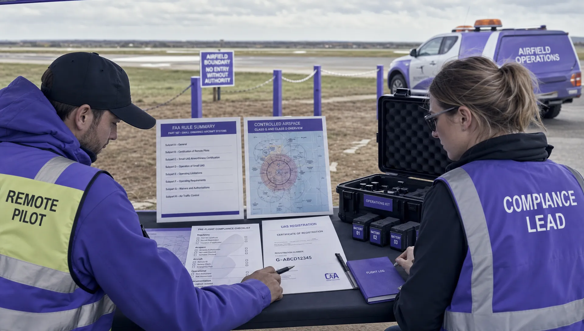 FAA Unmanned Aircraft Regulations Made Simple →
 Part 107 Test Tips to Pass With Confidence →
 How to Pass the FAA Drone Written Test First Time →
 What a BVLOS Flight Means for Risk and Compliance →
 Drone VLOS Rules Explained for Commercial Teams →
 FAA Remote ID Rule Explained for Commercial Pilots →
 Drone Legal Requirements for Commercial Operations →