Mastering UAV Data Collection for Aerial Intelligence
Imagine having the power to see your entire worksite or farm from above—not just as a pretty picture, but as a rich, measurable source of data. That's the real magic behind UAV data collection: a structured process that uses sensor-equipped drones to capture high-resolution aerial information, paving the way for precise analysis and much smarter decisions.
What Is UAV Data Collection and Why It Matters Now

It’s time to stop thinking of a UAV (unmanned aerial vehicle) as just a flying camera. Think of it as a mobile, intelligent data-gathering platform. It’s a tool that grants you access to insights that were once either impossible or far too expensive to get with traditional methods like ground crews or manned aircraft. This guide isn't just about flying drones; it's about understanding how this technology is fundamentally rewiring entire industries with unprecedented aerial intelligence.
And make no mistake, this isn't some niche tech anymore. It’s rapidly becoming a cornerstone of modern operations across a whole host of sectors. The money trail tells the story. The global UAV market, pegged at around $31.45 billion in 2025, is on track to more than double to $63.70 billion by 2032. That’s a compound annual growth rate of 10.6%, fueled by the exact kind of work we're talking about here—surveying, industrial inspections, and precision agriculture. You can dig deeper into the numbers on this impressive growth with this market analysis from Coherent Market Insights.
The Shift from Photos to Data
The heart of UAV data collection lies in a crucial shift: moving from simply taking aerial photos to creating structured, analyzable datasets. A beautiful aerial shot is nice, but a georeferenced orthomosaic map is a game-changer. One is a picture; the other is a precise, measurable digital twin of a real-world place.
A single drone flight can capture thousands of individual data points. When processed, this data reveals patterns and insights completely invisible to the naked eye, turning guesswork into data-backed strategy.
This process gives you a clear competitive edge by turning visual information into actionable intelligence. The applications are as diverse as they are powerful:
- Construction: Project managers can track earthwork volumes with stunning accuracy, monitor progress against blueprints, and boost site safety, all without ever stepping onto potentially hazardous ground.
- Agriculture: Farmers use specialized multispectral sensors to spot crop stress before it's visible, optimize irrigation down to the square foot, and apply fertilizers with surgical precision. The result? Higher yields and lower costs.
- Energy: Inspectors can safely evaluate wind turbines, vast solar farms, and miles of power lines, identifying tiny defects before they escalate into critical failures.
Why This Matters for Professionals
For today’s professionals, mastering UAV data collection is quickly moving from an "optional skill" to a "core requirement." It offers a safer, faster, and often much cheaper way to gather mission-critical information. Instead of a survey crew spending days on a large site, a drone can get the job done in a matter of hours, and with even greater detail.
This isn't just about saving time. This efficiency frees up businesses to reallocate resources, dramatically reduce operational risks, and ultimately, deliver far better results for their clients.
Choosing Your Eyes in the Sky: UAV Sensor Types
A drone’s real power isn’t in its propellers—it’s in the specialized sensors it carries. These are its sophisticated ‘eyes’ in the sky. Every sensor gives you a unique way of seeing the world, and picking the right one is probably the single most important decision you'll make for any mission. The sensor you bolt onto your drone directly defines the kind of UAV data collection you can even attempt.
It's a lot like choosing the right lens for a camera. You wouldn’t use a portrait lens to shoot a sprawling landscape, and you wouldn't use a wide-angle for a close-up. In the same way, the sensor that's perfect for mapping a construction site is completely different from one built to spot crop stress in a farmer's field.
RGB Cameras: The Digital Human Eye
The most familiar and widely used sensor is the RGB (Red, Green, Blue) camera. This is the absolute workhorse of the drone industry, capturing images just like our own eyes do. Modern, high-resolution RGB sensors are the backbone of photogrammetry—the science of taking measurements and building models from photos.
For a huge number of jobs, like creating photorealistic 3D models of buildings or generating high-resolution orthomosaic maps to track site progress, a good RGB camera is all you'll ever need. It delivers rich visual information that’s intuitive and easy for anyone to understand.
Multispectral and Hyperspectral Sensors: Seeing the Invisible
Just beyond what we can see lies a world of incredibly valuable data. This is where multispectral sensors come in. These advanced cameras are designed to capture light from very specific, narrow bands outside of human vision, especially in the near-infrared (NIR) spectrum.
So, why is that useful? It turns out that healthy plants are brilliant reflectors of NIR light. By analyzing these reflections, agronomists and environmental scientists can generate incredibly detailed "health maps" of entire fields or forests.
A multispectral sensor can spot crop stress from pests, disease, or dehydration days, sometimes weeks, before it’s visible to the naked eye. This early warning system allows for precise, targeted treatments that save money, reduce chemical use, and boost crop yields.
Hyperspectral sensors take this concept even further. Instead of just a few bands, they capture hundreds of narrow spectral bands. This gives every object a unique and detailed "spectral signature," allowing for incredibly specific analysis, like identifying different types of minerals in the ground or telling apart different species of vegetation from the air.
Thermal Sensors: Detecting Heat
Thermal sensors, often called thermal imaging cameras, don't see light at all—they see heat. These sensors build an image based on tiny differences in temperature, translating infrared radiation into a visual map of heat signatures. This ability is a game-changer for all sorts of inspection and public safety work.
You'll see thermal data collection used for:
- Building Inspections: Quickly pinpointing heat loss from bad insulation in roofs and walls.
- Solar Farm Analysis: Finding faulty or underperforming panels that show up as hot spots.
- Search and Rescue: Locating missing people by detecting their body heat, which is crucial at night or in dense woods.
- Electrical Grid Maintenance: Spotting overheating parts on power lines and in substations before they cause an outage.
LiDAR: Sensing with Light
Last but not least, we have LiDAR (Light Detection and Ranging). Unlike a camera that just passively records reflected light, LiDAR is an active sensor. It works by shooting out thousands of laser pulses every second and measuring the precise time it takes for each one to bounce back.
This process builds an incredibly dense and accurate 3D "point cloud" of the ground and everything on it. It’s less like taking a picture and more like feeling the shape of the landscape with millions of tiny, precise laser points. Because those laser pulses can often punch through tree canopies and vegetation, LiDAR is king when it comes to creating highly detailed bare-earth Digital Terrain Models (DTMs). This makes it the go-to tool for forestry, flood modeling, and complex topographic surveys.

UAV Sensor Technology Comparison
Choosing the right sensor can feel overwhelming, but breaking it down by function helps clarify which tool is right for your specific job. The table below compares the most common sensor types, what they do, and where they shine.
| Sensor Type | How It Works | Primary Data Output | Best For |
|---|---|---|---|
| RGB Camera | Captures light in the Red, Green, and Blue spectrum, just like the human eye. | Standard high-resolution photos and videos. | Creating realistic 3D models, orthomosaic maps, general visual inspections, and marketing materials. |
| Multispectral | Captures a few specific, narrow bands of light, often including near-infrared (NIR). | Vegetation indices (like NDVI), false-color imagery. | Precision agriculture (crop health), environmental monitoring, forestry management. |
| Thermal | Detects infrared radiation (heat) and creates an image based on temperature differences. | Radiometric thermal images showing heat signatures. | Building insulation inspections, solar panel analysis, search and rescue, electrical utility monitoring. |
| LiDAR | Fires rapid laser pulses and measures the return time to calculate precise distances. | Dense 3D point clouds, Digital Elevation Models (DEMs). | High-accuracy topographic mapping, forestry (canopy penetration), power line surveys, infrastructure modeling. |
Ultimately, the best sensor depends entirely on the data you need to collect. An RGB camera provides essential visual context, while LiDAR offers unparalleled structural accuracy. Thermal and multispectral sensors, on the other hand, reveal information that is completely invisible to the naked eye, opening up a whole new world of analytical possibilities.
Planning Your Mission for Flawless Data Capture
Anyone can fly a drone, but a truly successful data collection mission isn't won with fancy joystick skills. It’s a lot like building a house: the final structure is only as solid as the blueprint. The same rule applies here. A great mission is 90% planning and 10% flying, and that careful preparation is what separates amateur results from professional-grade intelligence.
This planning phase is the bedrock for all your data processing. Rushing or, worse, skipping these steps is the single most common reason for failed missions, wasted hours, and data that’s completely unusable. A solid plan means every flight is safe, efficient, and gathers exactly the information you need.
Defining Your Area of Interest
First things first: you need to digitally fence off your target area. In the industry, we call this defining your Area of Interest (AOI). Modern flight planning software lets you draw a precise polygon right over a satellite map, which tells the drone exactly where its operational boundaries are.
But this isn't just about drawing a box on a screen; it's a strategic move. Always make sure your AOI includes a small buffer around the actual site. This guarantees you get full coverage and avoids frustrating data gaps at the edges—a simple step that prevents the costly mistake of having to re-fly an entire mission because you missed a critical corner.
Flight Altitude and Image Overlap
With your AOI locked in, two crucial parameters take center stage: flight altitude and image overlap. These settings work in tandem to define the quality and ultimate usability of your data.
Flight Altitude: This directly impacts your Ground Sample Distance (GSD), which is basically the real-world size represented by a single pixel in your images. Flying lower gives you a smaller GSD (e.g., 1 cm/pixel) and incredibly high-resolution data, but it takes more flight time and creates a much larger dataset. Flying higher covers more ground faster with a larger GSD (e.g., 5 cm/pixel), but the resolution is lower. The trick is to match your altitude to the level of detail your project actually demands.
Image Overlap: During a mapping mission, a drone snaps hundreds, sometimes thousands, of photos. To stitch these together into one seamless map, they need to overlap—a lot. The gold standard is 75-80% front and side overlap. This redundancy gives photogrammetry software plenty of common points between images to build an accurate, gap-free model. For a deeper dive into crafting the perfect flight path, check out our guide on advanced UAV flight planning techniques.
Inadequate overlap is a mission-killer. It’s tempting to dial it back to save a few minutes of flight time, but this often leads to processing failures and "holes" in your final map, rendering the whole dataset worthless.
Ground Control Points and Accuracy
When you need high absolute accuracy—think construction surveys or legal boundary mapping—you have to tie your aerial data to fixed points in the real world. This is where Ground Control Points (GCPs) come in. Think of GCPs as digital anchors for your map. They are clearly marked targets placed on the ground, and their exact coordinates have been measured with survey-grade GPS equipment.
During data processing, you'll identify these markers in your drone photos and feed their known coordinates into the software. The program then uses these anchors to correct the entire dataset, shifting and stretching it to align perfectly with its true position on Earth. This is what turns a pretty picture into a survey-grade, measurable asset.
The demand for this level of precision is a key reason the industry is booming. The global UAV market, valued at over USD 36 billion in 2024, is expected to skyrocket past USD 250 billion by 2037, driven largely by sectors that depend on this kind of accuracy. You can explore more on these projections with this in-depth UAV market research.
Turning Raw Data Into Actionable Intelligence

The data you capture with a drone is really just a pile of raw ingredients. The real magic happens back at the office, during processing, where all those individual files get cooked into something truly valuable for your business. This is the workflow that turns a memory card full of images or laser scans into measurable, interactive intelligence. It all starts with getting the data off the drone.
The very first step is a simple but critical quality check. You need to review the raw data for any obvious problems—blurry images, missing files, or corrupted data. Think of it like a chef inspecting produce before starting a meal; catching a problem here saves a massive headache down the line. Once everything looks good, the data is ready for the main event.
For missions flown with standard RGB cameras, the next stage is all about photogrammetry. This is both an art and a science, stitching together hundreds or even thousands of overlapping photos into a single, cohesive digital model.
It’s a bit like assembling an incredibly complex 3D digital puzzle. Photogrammetry software finds common points across countless images to reconstruct the geometry of the site, creating a unified model that’s far more powerful than the sum of its parts.
This process is computationally heavy, but it generates several critical outputs. These are the final products that deliver the real-world value of your UAV data collection efforts.
Key Data Deliverables and Their Uses
Understanding what these processed outputs are—and what they do—is the key to using them effectively. Each one gives you a unique perspective on your project site, moving way beyond simple pictures to provide measurable, spatially accurate information.
- Orthomosaic Maps: This is a high-resolution, perfectly flat aerial map of your site. Unlike a regular aerial photo that has distortions, an orthomosaic is georeferenced, meaning every single pixel is tied to a specific geographic coordinate. It's the ultimate measurable base map.
- Digital Surface Models (DSMs): A DSM is a 3D elevation model that captures the height of everything on the ground—buildings, trees, equipment, you name it. It's a fantastic tool for visualizing the site in three dimensions and calculating heights or clearances.
- 3D Point Clouds: This is the rawest form of 3D output. It's a massive collection of millions of individual points, each with its own X, Y, and Z coordinate. A dense point cloud provides incredibly detailed structural information and is the foundation for building more polished 3D models.
From Models to Measurements
With these digital assets ready, the focus shifts from creation to analysis. This is where abstract data points become tangible business insights. For instance, on a construction site, a DSM can be used to calculate stockpile volumes with an accuracy of over 98%. A project manager can overlay the current site model onto the design plans to instantly track progress and spot any deviations.
It's the same story in agriculture. An orthomosaic map created from multispectral data gives a farmer a field-wide health report, allowing for incredibly precise fertilizer application. For infrastructure projects, a 3D point cloud of a bridge lets engineers conduct detailed virtual inspections and take measurements, all from the safety of their office.
This analytical power is fueling explosive growth in the drone industry. Drone analytics, a core part of the UAV data collection ecosystem, has become a major economic force. In 2025 alone, drone analytics solutions are projected to bring in USD 12.6 billion in global revenue, with the market expected to hit nearly USD 54 billion by 2033. This growth is a mix of cloud-based services and on-premise software. You can dive deeper into this trend with the latest drone analytics statistics from Scoop.market.us.
Ultimately, this whole workflow is designed to do one thing: convert raw aerial captures into clear, actionable intelligence. By meticulously processing raw data into accurate maps and models, professionals can measure volumes, monitor change, and conduct detailed inspections—turning abstract numbers into decisive insights that lead to better outcomes.
Navigating The Rules Of The Sky For Safe Operations
Flying a drone for any kind of data collection isn't just about getting the drone in the air; it's about doing it safely and legally. You absolutely have to get to grips with aviation regulations and safety protocols.
Every country has its own unique framework for UAVs, which means the rules you need to master will change depending on where you fly. Authorities like the FAA in the US and EASA in Europe each set their own distinct standards for licensing and operations.
Pilot Certification Requirements
If you're operating in the US, you’ll need a Part 107 license. This isn't just a piece of paper; it proves you understand crucial topics like airspace rules and how to interpret weather patterns.
Over in Europe, EASA requires either an A1/A3 or A2 certificate, which depends on how heavy your drone is and how close you plan to fly to people. Meanwhile, Canada often requires a Special Flight Operations Certificate for many commercial UAV missions.
- Always start by checking your national aviation authority’s website for the specifics on how to apply.
- You'll likely need to complete some online training modules and pass a knowledge exam.
- Don't forget to renew your certifications before they expire, or you'll be grounded.
Understanding Airspace Maps
Think of the sky as being divided into different zones. It's split into classes (A through G), and each one has its own set of rules you have to follow.
As an operator, you must be able to read and interpret sectional charts, paying close attention to restricted and prohibited areas. These no-fly zones are often around airports, national parks, and critical infrastructure for obvious reasons.
The better your situational awareness, the lower your risk of accidentally breaking a rule and facing a hefty fine.
A fundamental rule you'll almost always encounter is the requirement to maintain a visual line of sight (VLOS) with your UAV. This means you have to be able to see the drone with your own eyes—without binoculars or other aids, though corrective lenses are fine.
- Before any flight, check the latest sectional chart for active notices.
- Use an approved app to verify the real-time airspace status.
- If you're operating anywhere near controlled airspace, you’ll likely need to file a flight plan.
Respecting Privacy And Building Trust
Flying legally is one thing, but flying responsibly is another. True professionalism goes beyond just following the rules.
This means you must be diligent about not capturing images of private property or people without their explicit consent. It's an ethical practice that goes a long way toward building trust within the community and preventing complaints that could shut you down.
| Compliance Element | Benefit |
|---|---|
| Privacy Respect | Enhances community relations |
| Transparent Data Policy | Builds client confidence |
| Secure Data Storage | Protects sensitive information |
In fact, new rules are making this kind of operational transparency mandatory. Learn how Remote ID compliance can actually be a net positive for your business in our FAA Remote ID compliance guide.
Many regions now mandate that drones broadcast a Remote ID. This system is like a digital license plate, transmitting the drone's location and identification information to receivers on the ground.
- It enhances safety by alerting other aircraft to your drone's presence.
- It supports a faster emergency response if an incident occurs.
- It clearly demonstrates your compliance to any authorities who might be checking.
On top of that, securing solid liability insurance is non-negotiable. It protects both your business and your clients from the unexpected. For any flights that fall outside standard limits—like flying at night or over people—you'll need to apply for special waivers from the aviation authority.
- Pinpoint the specific regulation you need a waiver for.
- Fill out the waiver application on the authority’s official portal.
- Back up your application with supporting documents, like a detailed risk assessment.
- Submit everything and wait for approval before you even think about flying.
Taking these steps isn't just about staying on the right side of the law. It positions you as a responsible, professional, and reliable operator—the kind clients want to hire. Regulations are always evolving, so make it a habit to stay current on the latest changes and industry best practices.
Keeping meticulous records of your waivers, insurance policies, and flight logs ensures you can prove your compliance at a moment's notice. When you document all your procedures and train your team regularly, you build a powerful safety culture that clients can see and trust.
Proper documentation isn't just paperwork; it's the foundation of a safe and compliant UAV operation.
- Maintain detailed flight logs and pre-flight inspection checklists for potential audits.
- Schedule regular safety training sessions and keep records of who attended.
Staying on top of compliance isn't a chore; it’s a direct path to boosting your credibility and growing your business. The operators who adapt quickly to new rules are the ones who will succeed.
Real-World Wins with UAV Data Collection

It’s one thing to talk about the theory behind UAVs, but the real magic happens when you see UAV data collection in action. Across all kinds of industries, professionals are using this technology to solve real problems on the ground, delivering results that save money, make sites safer, and create serious efficiencies.
These aren't just minor tweaks to old workflows; they are complete game-changers. By matching the right drone and sensor to a stubborn industry problem, businesses are finding a real competitive edge. In fact, many have built entire service models around these applications—a path you can explore further by learning about starting a successful UAV business.
The transformation is especially clear in sectors that live and die by accurate spatial data. From the farm to the forest, drones are delivering insights that used to be completely out of reach.
Precision Agriculture Boosting Yields
Picture a farm where every single plant gets precisely what it needs to thrive—no more, no less. That’s what’s happening right now. A farmer sends a drone with a multispectral sensor over hundreds of acres. This sensor sees what the human eye can't, picking up on subtle signs of crop stress caused by pests or a lack of water.
This raw data gets turned into what's called a Vegetation Index (NDVI) map, which is basically a detailed health report for the entire field. That map is then plugged directly into the farm's smart tractors and sprayers.
- The Result: The machinery automatically applies fertilizer or pesticide only on the specific areas that need it.
- The Impact: This simple change slashes fertilizer costs, reduces chemical runoff, and can boost overall crop yields by 5-10%.
Construction Tracking Progress and Safety
On a massive construction project, the daily battle is keeping everything on time and on budget. A project manager uses weekly drone flights to run a full topographic survey. The high-resolution photos are then stitched together to create a stunningly detailed 3D model and an orthomosaic map of the site.
This "digital twin" is laid over the original design files, instantly showing where things are off. The same data is used to calculate the exact volume of earth that’s been moved, making sure contractors are paid fairly for their work.
By using UAV data to monitor stockpile volumes and track progress, construction firms can achieve over 98% accuracy in their measurements, eliminating costly disputes and guesswork.
This consistent oversight not only keeps the project moving but also makes the site safer by spotting potential hazards without anyone having to set foot in a dangerous area.
Environmental Science Protecting Ecosystems
For conservationists, keeping an eye on huge, remote habitats has always been a monumental task. Imagine a team trying to protect a massive forest. They can use a drone equipped with a LiDAR sensor to map the whole ecosystem.
The LiDAR pulses shoot through the leaves and branches, giving the team two crucial layers of data: a Digital Surface Model (DSM) of the very top of the tree canopy and a Digital Terrain Model (DTM) of the bare ground underneath. By subtracting one from the other, they get a perfect Canopy Height Model.
This allows them to:
- Quantify Biomass: Get an accurate estimate of how much carbon is stored in the forest.
- Monitor Habitat Change: Track deforestation or new growth over time with incredible precision.
- Analyze Wildlife Corridors: See the exact forest structures that animals depend on to move around.
In all of these scenarios, UAV data isn't just a gimmick. It’s a core tool that drives real, measurable value for the business.
Frequently Asked Questions About UAV Data Collection
As you get your hands dirty in the world of aerial intelligence, you're bound to have some practical questions. It's only natural. This section tackles some of the most common things people ask about UAV data collection, giving you clear, straightforward answers to help you move forward. We'll cover everything from accuracy to costs, filling in any gaps in your knowledge.
How Accurate Is Drone Data?
This is a great question, and the answer is: it depends entirely on the gear and methods you're using.
The standard GPS on most drones will get you accuracy within a few meters. That's perfectly fine for things like a quick visual roof inspection or a simple marketing video. But when you need survey-grade results, you have to step up your game with techniques like Real-Time Kinematic (RTK) or Post-Processed Kinematic (PPK).
These advanced methods use a ground-based reference station to correct the drone's satellite signal in real-time (or after the flight), dialing in the accuracy to just a few centimeters.
An RTK or PPK workflow is what elevates a drone from a simple camera platform to a professional surveying instrument. This is the key to creating maps and models that are not just visually appealing but also highly measurable and reliable for critical decisions.
For industries like construction, engineering, and land surveying, this isn't just a nice-to-have; it's an absolute requirement.
What Software Do I Need for UAV Data Collection?
A solid drone data workflow really boils down to two key types of software.
- Flight Planning Software: Think of this as your mission control. Before you even take off, you'll use an app like DJI Pilot 2 to map out your flight path. You can define the survey area on a map, set your flight altitude and image overlap, and tweak all the other parameters for a perfect, automated mission.
- Data Processing Software: Once the drone lands, this is where the magic happens. Photogrammetry software, such as DJI Terra or Agisoft Metashape, takes all those raw photos and stitches them together into your final products, like detailed orthomosaics and interactive 3D models.
The right software for you will ultimately come down to your specific drone, the sensor you're flying, and exactly what you need to deliver to your client.
How Much Do Drone Operations Cost?
The cost can swing wildly. You could get started with a small enterprise drone for basic mapping for around $5,000. On the other end of the spectrum, a high-end system kitted out with a LiDAR sensor and survey-grade GPS can easily top $50,000.
But don't forget, the initial price tag is just the beginning. You also need to budget for the ongoing costs of running the business. These include:
- Software subscriptions for processing and analysis platforms.
- Pilot certification fees and continuous professional development.
- Liability insurance, which is non-negotiable for any commercial work.
- Regular maintenance and the occasional repair bill.
Ready to manage your entire drone operation from a single, powerful platform? Dronedesk simplifies everything from flight planning and compliance checks to client management and fleet tracking. See how thousands of pilots are saving time and boosting efficiency by visiting https://dronedesk.io to start your free trial.
 Beyond Visual Line of Sight Explained for Operators →
 How BVLOS Drone Operations Change Commercial Workflows →
 FAA Drone Rules Every Commercial Pilot Should Know →
 FAA 107 Explained for Commercial Drone Operators →
 Canadian Drone Regulations Explained for Business Use →
 FAA Part 107 Drone License Explained for Beginners →
 How to Review a DJI Drone Flight Log Step by Step →
 Drone Registration Law Explained for Commercial Pilots →
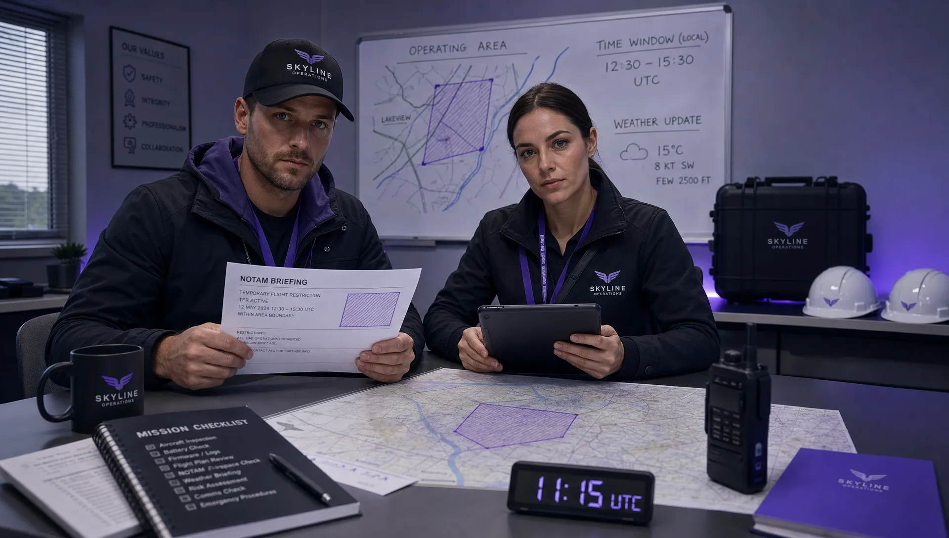 How to Check a Drone NOTAM Before Every Mission →
 BVLOS Drone Meaning and Why It Matters →