How Survey Firms Use Drone Survey Software to Scale
Scaling a drone survey business is rarely limited by the aircraft. It is usually limited by the operational system around the aircraft.
A survey firm may have skilled pilots, reliable drones and excellent mapping workflows, yet still struggle to take on more work because every job depends on manual planning, scattered spreadsheets, duplicated risk assessments, equipment uncertainty and post-flight admin. That works for a few projects a month. It starts to creak when the firm is managing multiple sites, pilots, clients and deadlines at once.
This is where drone survey software becomes a scaling tool rather than just an admin convenience. For survey companies, utilities, construction consultants and infrastructure inspection teams, the right software helps turn drone operations into a repeatable business process: plan, approve, fly, log, report and improve.
Scaling drone surveys means scaling the operation, not just the fleet
Many survey firms first adopt drones to reduce time on site, improve safety and capture richer data. A single operator can prove the value quickly. The scaling challenge begins when the firm wants to serve more clients, cover more geography or support several survey teams at the same time.
At that stage, growth depends on questions such as:
- Can every pilot follow the same pre-flight process?
- Can managers see which drones, batteries, sensors and people are available?
- Can risk assessments and checklists be standardised without becoming generic?
- Can job records be found quickly during an audit or client review?
- Can the business plan work confidently around airspace, site hazards and operational constraints?
Without a central system, each extra pilot can create extra admin. Every new client introduces more documentation. Every site variation increases the chance that something important is missed. Drone survey software helps firms scale by reducing that operational drag.

Why spreadsheets stop working for growing survey firms
Spreadsheets are useful when a firm is testing drone services or running occasional flights. They are flexible, familiar and cheap. The problem is that they do not naturally enforce process, connect live operational data or provide a reliable audit trail.
For example, a survey manager might have one spreadsheet for equipment, another for pilot availability, a folder of risk assessment templates, email chains for client details and separate logs for completed flights. Individually, each tool is understandable. Collectively, they create friction.
| Scaling issue | What happens with manual systems | What drone survey software changes |
|---|---|---|
| Flight planning | Information is gathered from multiple places each time | Planning data and job records sit in one workflow |
| Team coordination | Managers rely on messages, memory and spreadsheets | Pilot and team details are managed centrally |
| Fleet visibility | Drone status, maintenance and allocation can be unclear | Aircraft and equipment records are easier to track |
| Compliance | Risk assessments and logs may be inconsistent | Standardised processes support more consistent records |
| Reporting | Performance data is hard to extract | Operational reporting becomes easier to review |
The risk is not just inefficiency. In UK commercial drone operations, operators must understand their regulatory responsibilities and operate within the rules set by the Civil Aviation Authority. The UK CAA drone guidance makes clear that safe, legal operation depends on factors such as the aircraft, operating category, location and level of risk. As survey work becomes more complex, the operational record matters more.
Drone survey software versus drone mapping software
Survey firms often use the phrase drone survey software to describe several different tools. In practice, there are two distinct layers.
Drone mapping or photogrammetry software processes captured data. It helps create outputs such as orthomosaics, point clouds, 3D models, contours and volumetric measurements. This layer is essential for deliverables.
Drone operations management software manages the business and safety workflow around the flight. It helps with planning, team coordination, fleet records, risk assessments, checklists, flight logs and reporting.
A scalable survey operation usually needs both. Mapping software turns images into survey outputs. Operations software helps ensure the firm can plan and deliver those flights consistently across clients, sites and teams.
For a small firm, the distinction may feel academic. For a growing survey company, it becomes important. If all investment goes into data processing but the planning process remains manual, the bottleneck simply moves upstream.
How survey firms use drone survey software to scale
1. Standardising flight planning across every job
Repeatability is the foundation of scale. Survey firms need a planning process that works whether the job is a quarry stockpile survey, roof inspection, construction progress capture, utilities corridor survey or topographical mapping task.
Drone survey software helps by giving teams a consistent structure for each operation. Instead of rebuilding the plan from scratch, managers can work through a defined process that captures the right client, site, crew, equipment and operational details.
This matters because scaling is not just about doing more work. It is about doing more work without quality dropping. A consistent planning workflow reduces reliance on individual memory and makes it easier to train new team members.
2. Making risk assessments more repeatable
Survey work often involves dynamic environments: construction sites, substations, roads, rail corridors, quarries, public spaces, private land and industrial facilities. Each site brings different hazards, permissions and access constraints.
A growing firm needs a way to create risk assessments that are efficient but still specific to the operation. If every risk assessment is written manually, admin becomes a barrier. If every risk assessment is copied without thought, safety quality suffers.
Software supports scale by helping teams build repeatable risk assessment workflows while keeping each job tied to its own location, operating context and hazards. This is particularly valuable when a firm has several pilots producing documentation for different project managers or clients.
3. Keeping fleet and team data visible
As soon as a survey business operates more than a handful of drones, visibility becomes a management issue. Which aircraft is assigned to which job? Which pilot is available? Are the right team details recorded? Are fleet records up to date?
When this information lives in separate spreadsheets or individual inboxes, managers spend time chasing answers. Centralising fleet and team management helps firms allocate resources with more confidence.
This visibility also helps commercial planning. A firm can see whether it has enough capacity to accept a new project, whether it needs to subcontract, or whether it should invest in additional aircraft, sensors or training.
4. Improving client and site continuity
Survey firms often work with repeat clients: developers, local authorities, landowners, engineering consultancies, facilities teams and utility companies. The same client may have multiple sites, recurring survey intervals and changing contacts.
Drone survey software with client management helps keep the operational relationship organised. Job history, site information and operational records become easier to retrieve. That continuity is valuable when a client asks for evidence of previous flights, requests a repeat survey or needs confidence that the provider has a mature operating process.
For larger survey firms, this operational data may also need to connect with finance, ERP, CRM or reporting systems. At that point, integrating drone operations with wider business systems becomes a strategic project. Some mid-market organisations work with specialist AI automation and system integration partners to reduce disconnected processes between operations, finance and management reporting.
5. Supporting better operational reporting
Scaling without measurement is guesswork. Survey firms need to understand how work is actually flowing through the operation.
Useful metrics include planning time per job, number of flights per pilot, equipment utilisation, cancelled or postponed flights, overdue logs, maintenance issues, repeat client volume and the ratio of admin time to billable fieldwork.
Drone survey software helps by turning operational activity into data that managers can review. The goal is not reporting for its own sake. The goal is to identify bottlenecks, improve margins and protect service quality as volume increases.
What a scalable drone survey workflow looks like
A mature workflow does not need to be complicated. It needs to be consistent, visible and easy for pilots to follow.
| Workflow stage | Scaling objective | Software support to look for |
|---|---|---|
| Client and job setup | Capture the commercial and site context once | Client records and job details |
| Desktop planning | Identify airspace, nearby constraints and operational considerations | Airspace intelligence and proximity intelligence |
| Risk and method | Produce consistent safety documentation | Risk assessments and configurable checklists |
| Resource allocation | Match people and equipment to the job | Team management and fleet management |
| Field execution | Keep pilots aligned with the planned workflow | Checklists and flight logging |
| Review and improvement | Learn from completed operations | Data reporting and searchable records |
This is the kind of operating rhythm that allows a survey firm to move from ad hoc drone usage to a managed drone programme.
Where Dronedesk fits for survey firms
Dronedesk is built as an all-in-one web platform for drone operators, covering the operational administration around drone work. According to the Dronedesk features page, relevant capabilities include client management, fleet management, team management, airspace intelligence, proximity intelligence, flight planning, flight logging, data reporting, configurable checklists and risk assessments.
For survey firms, that combination is important because the scaling problem is rarely isolated to one task. Planning, compliance, people, aircraft and records all interact. If a manager improves flight planning but still tracks fleet data separately, the process remains fragmented. If risk assessments are standardised but flight logs are inconsistent, audit confidence remains weaker than it should be.
Dronedesk is not a replacement for specialist photogrammetry or CAD software. Instead, it supports the operational layer before and after data capture. A typical survey firm might use Dronedesk to manage the job, plan the operation, coordinate team and fleet information, complete checklists and retain flight records, then use its preferred mapping tools to process the captured data.
That separation of responsibilities is healthy. Survey teams can choose the best processing tools for their deliverables while keeping the operational workflow consistent across the business.
Signs your survey firm is ready for drone survey software
Not every business needs a full operational platform on day one. But there are clear signs that manual systems are becoming a constraint.
You are likely ready if pilots are spending too much time recreating documents, managers cannot easily see fleet or team availability, client records are scattered across emails and folders, or risk assessments vary significantly between operators. Another sign is that audit requests or client due diligence exercises take too long because records are difficult to compile.
Growth can make these issues visible very quickly. A process that felt manageable with one pilot can become fragile with five. A folder structure that worked for ten jobs can become confusing after one hundred. The best time to introduce software is before admin begins limiting sales capacity or operational confidence.
How to implement drone survey software without disrupting pilots
Software only helps scale if the team actually uses it. Survey firms should treat implementation as an operational change, not just a technology purchase.
Start by documenting the current workflow. Identify where job information enters the business, who approves flight plans, how risk assessments are created, where equipment records are stored and how completed flights are logged. This reveals the points where software can remove duplication.
Next, standardise the minimum viable process. Avoid trying to perfect every template before launch. Focus first on the core workflow that every pilot must follow, then improve it based on real use.
It also helps to appoint an internal owner. This person does not have to be a full-time drone operations manager, but they should be responsible for process quality, template updates, user adoption and management reporting.
Finally, review the data after the first few weeks. Look for missed steps, inconsistent records, repeated questions and bottlenecks. The value of drone survey software increases when firms use operational evidence to refine how they work.
The commercial upside of operational maturity
Clients do not only buy survey outputs. They also buy confidence. A developer, utility company or infrastructure owner wants to know that the survey provider can operate safely, reliably and professionally.
A mature software-backed workflow helps demonstrate that confidence. It shows that the firm has a consistent approach to planning, risk, people, equipment and records. That can support larger contracts, framework opportunities and repeat work where procurement teams expect more than technical skill alone.
Operational maturity also protects margins. If every job requires unnecessary manual admin, growth can increase workload without increasing profitability. When planning, logging and reporting are structured, the business has a better chance of increasing job volume without adding the same proportion of back-office effort.
FAQ
Is drone survey software the same as drone mapping software? No. Drone mapping software processes captured imagery or sensor data into outputs such as maps, models and point clouds. Drone survey software can also refer to the operational tools used to plan flights, manage pilots and aircraft, complete risk assessments, log flights and report on activity.
What should a survey firm look for in drone survey software? Look for tools that support the full operational workflow, including flight planning, team management, fleet management, risk assessments, checklists, flight logging and reporting. The best choice depends on your operating model, client requirements and regulatory environment.
Can a small survey firm benefit from drone survey software? Yes, especially if the firm expects to grow or works with clients that require strong documentation. A small team can use software to create professional habits early, reduce duplicated admin and make it easier to add pilots later.
How does drone survey software help with compliance? It helps by making planning steps, risk assessments, checklists, team details, fleet records and flight logs more consistent and easier to retrieve. It does not replace the operator's responsibility to understand and follow applicable regulations, but it can support a more disciplined compliance process.
When should a survey company move away from spreadsheets? Move when spreadsheets start slowing down job delivery, hiding key information or creating inconsistent records. Common triggers include adding more pilots, managing multiple sites, serving larger clients or preparing for more formal audits and procurement checks.
Build a survey operation that can grow
Drone survey work scales best when the operational foundation is as professional as the data deliverables. More drones and better sensors can increase capability, but repeatable planning, clear records, consistent risk management and fleet visibility are what allow a firm to grow with confidence.
If your survey team is ready to move beyond spreadsheets and disconnected admin, explore Dronedesk and see how an all-in-one drone operations platform can support safer, more scalable survey operations.
 Drone Flying Laws: A Practical Guide for Operators →
 CAA UAV Regulations Explained for UK Operators →
 UK SORA Explained for Drone Operators →
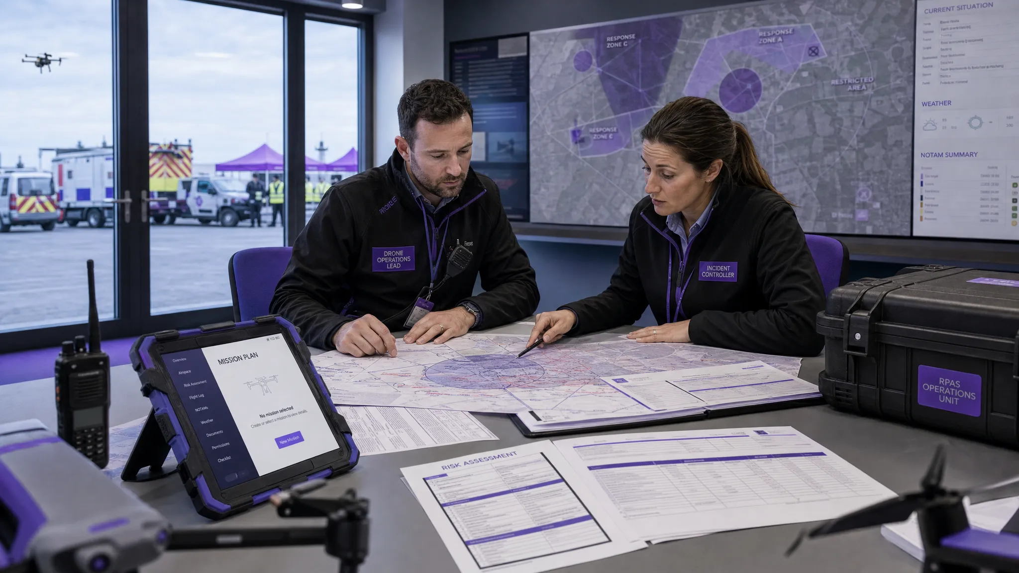 AUS Drone Laws Explained for Commercial Operators →
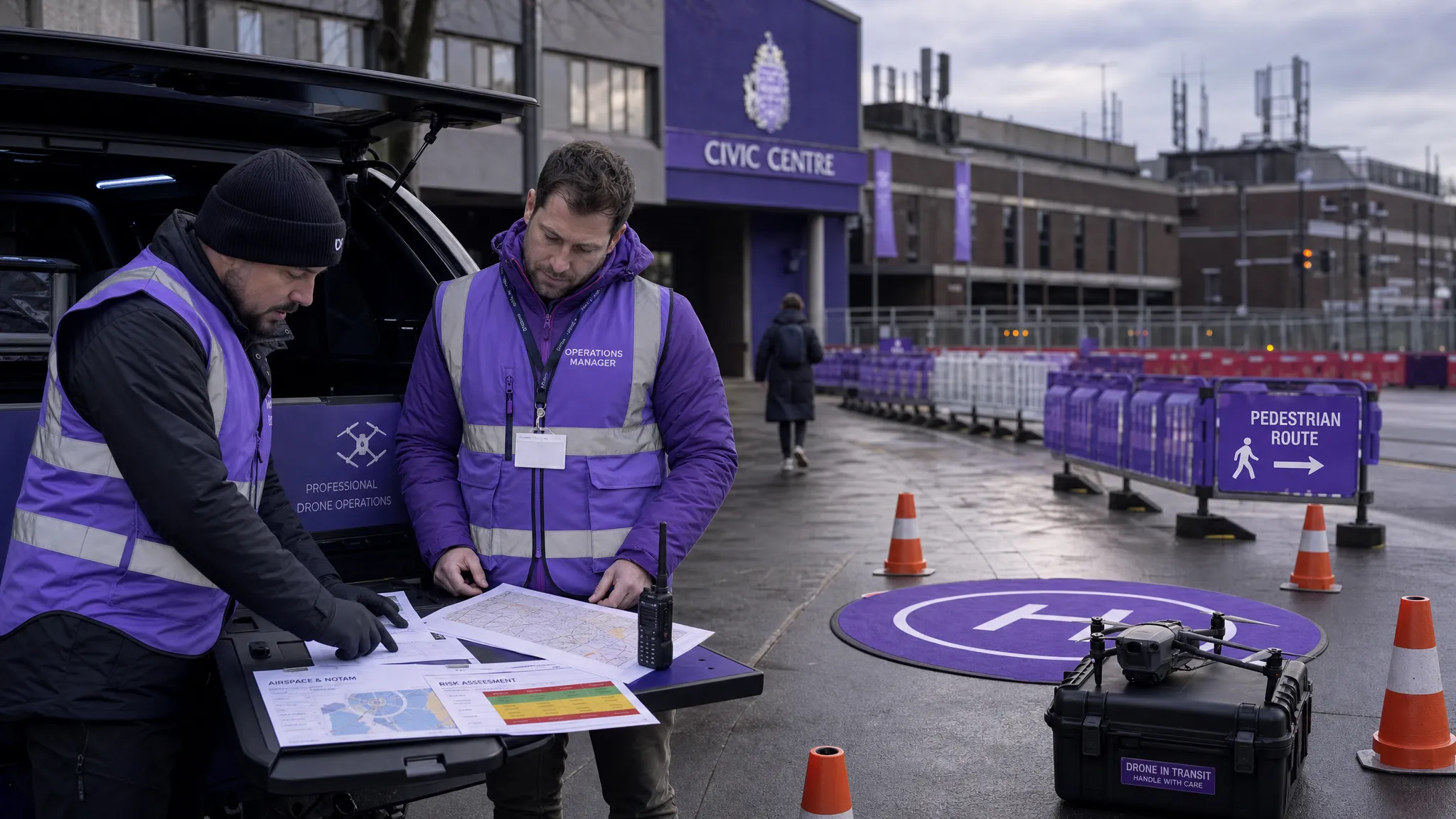 Drone Flying Rules Explained for Business Use →
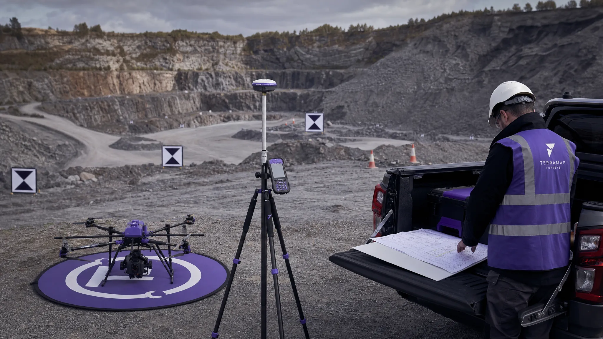 How to Choose an Aerial Survey Drone for Accurate Data →
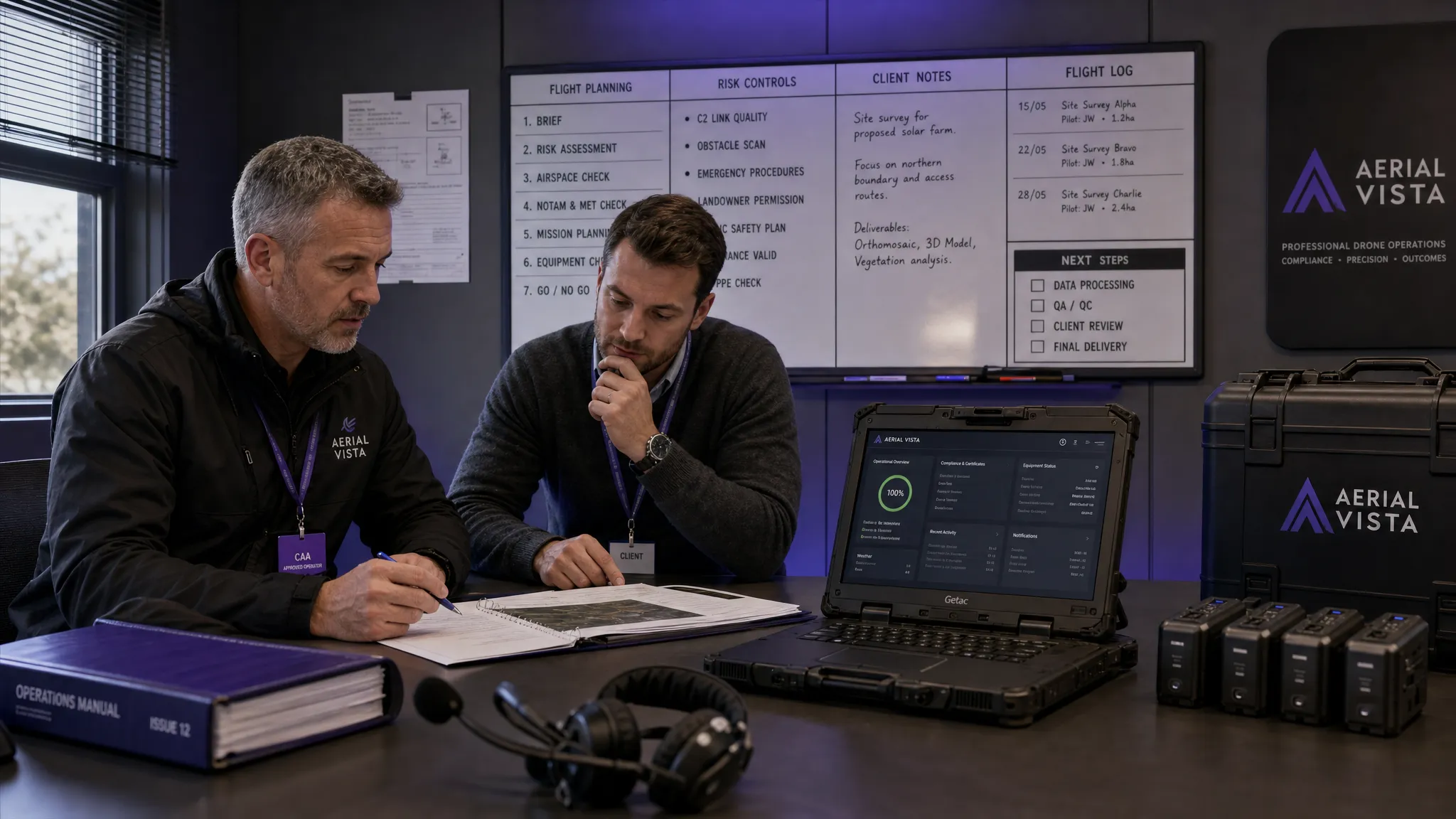 What Makes a Great Drone Operator in 2026? →
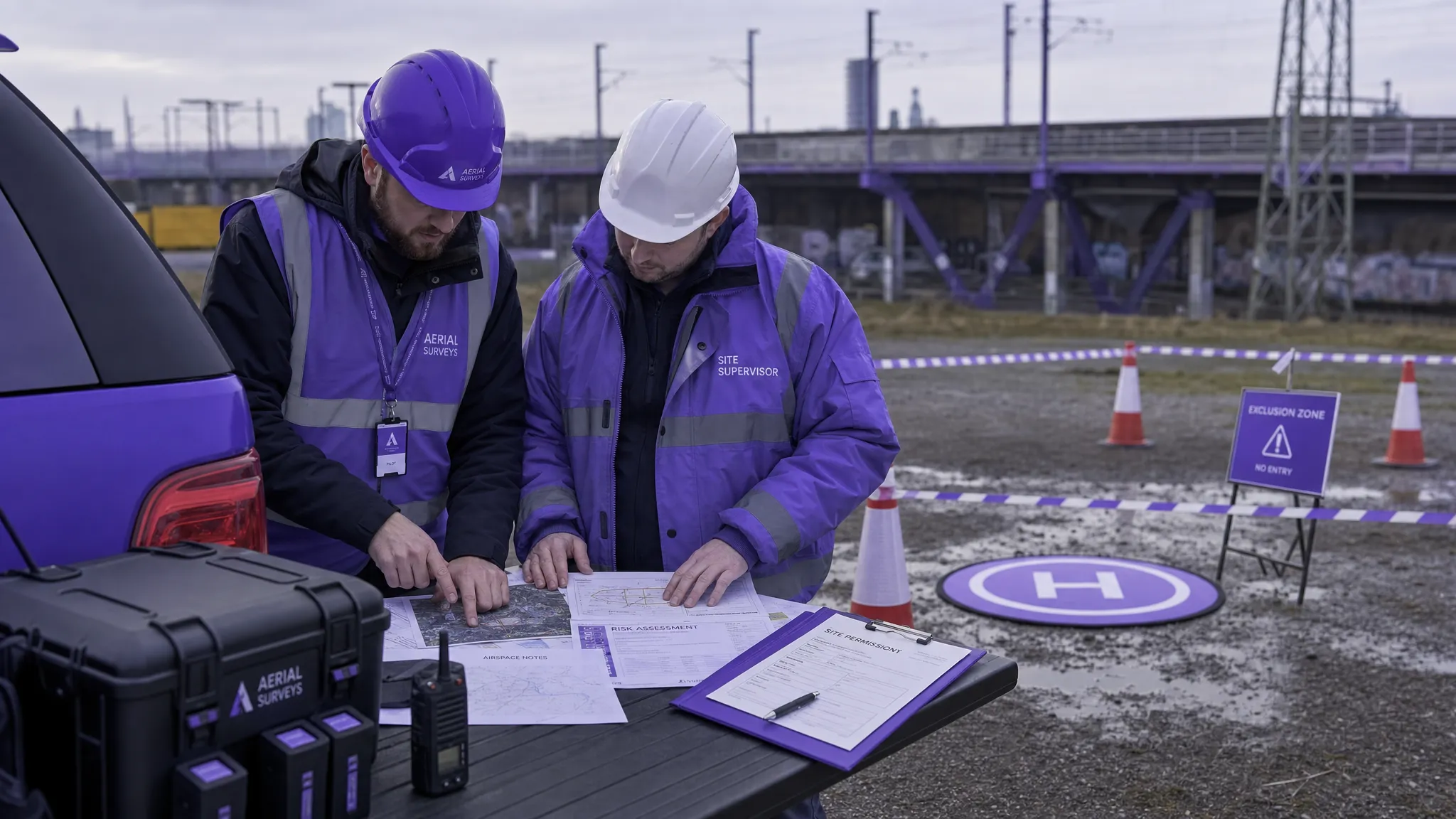 Drone Rules Every Commercial Operator Should Know →
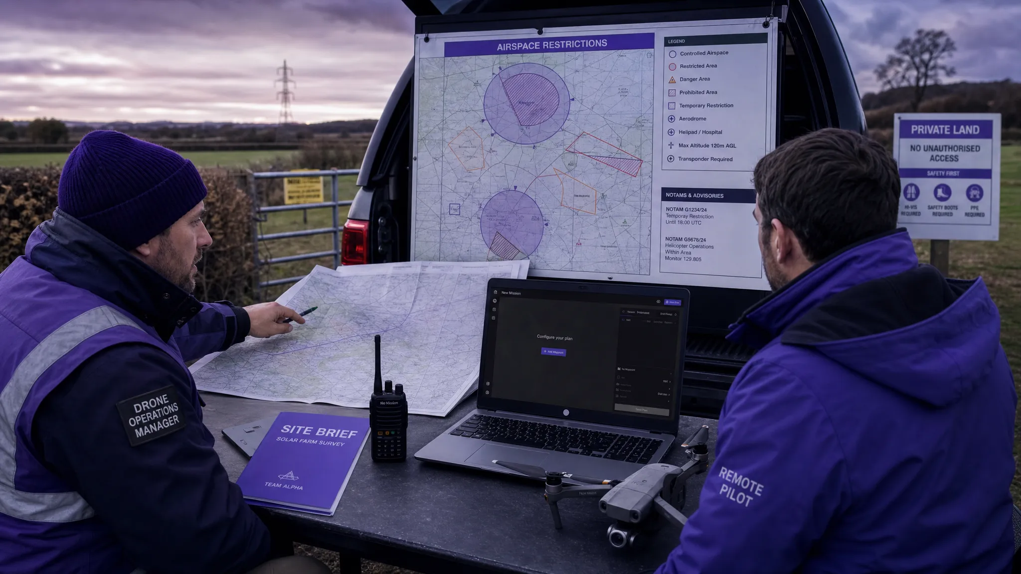 How to Use a Drone Flight Restrictions Map Safely →
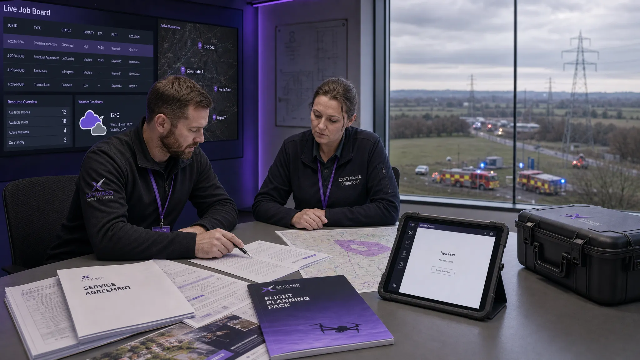 Drone as a Service: Is DaaS Right for Your Business? →