Feb 8th 2026
From Hours to Minutes: The New Dronedesk Site Plan for SORA Flight Planning
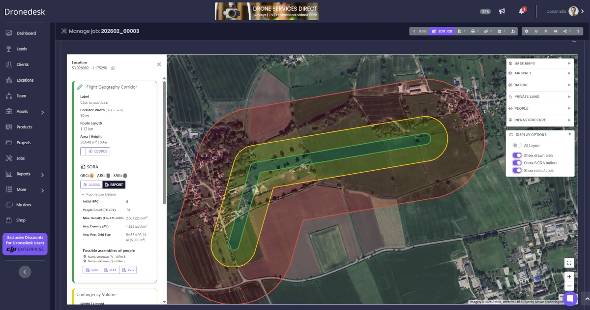
The rebuilt Dronedesk site plan turns complex SORA and BVLOS drone flight planning into a minutes-long process with integrated population data, automated risk calculations, and one-click regulatory reports.