10 Best Places to Fly Drones Near Me (2025 Guide)
The thrill of unboxing a new drone is universal, but the immediate question that follows is always the same: 'Where are the best places to fly drones near me?' Finding a location that is not only scenic and spacious but also legal and safe can be a significant challenge for new and experienced pilots alike. The right spot can be the difference between a successful mission with stunning footage and a frustrating day ending in a fine or damaged equipment.
This guide cuts through the confusion, offering a definitive roundup of 10 types of locations perfect for your next flight. We'll explore the pros and cons of each, provide actionable tips for vetting them, and show you how to streamline your entire pre-flight planning process to ensure every launch is a success. Whether you're a recreational hobbyist capturing breathtaking landscapes or a commercial operator managing complex jobs, understanding where you can legally and safely fly is the first and most critical step to mastering the skies.
This article is your practical checklist for identifying, verifying, and logging ideal drone-friendly locations. We move beyond generic advice to give you a clear framework for pre-flight diligence, from airspace intelligence checks to on-site risk assessments. You will learn not just what makes a good flying spot, but how to confirm its suitability for your specific mission. Let's get started on finding the perfect airspace for your next project.
1. National Parks and Public Lands
When searching for spectacular and wide-open places to fly drones near me, government-managed public lands offer some of the most breathtaking landscapes available. This category includes vast areas like National Parks, National Forests, and Bureau of Land Management (BLM) lands, which often feature minimal ground-level obstructions and dramatic terrain perfect for both commercial and recreational flights.

It is crucial, however, to understand that drone operations in these sensitive environments are highly regulated. Most U.S. National Parks, for example, have a blanket ban on launching, landing, or operating unmanned aircraft without a special permit. In contrast, many BLM and National Forest areas are more permissive, but specific local rules always apply. Failure to comply can result in significant fines and confiscation of your equipment.
Vetting Public Lands for Drone Flights
Before you even pack your gear, your first step is rigorous pre-flight planning. Start by identifying the specific managing agency for the land you wish to fly over. A quick search on the agency's official website will often reveal their drone policies.
Pro Tip: Never assume permission. Always call the local ranger district or field office for the most current information. Rules can change seasonally due to wildlife nesting, fire risk, or other temporary restrictions that may not be immediately obvious online.
This verification process is a critical part of your pre-flight checklist. Using a tool like Dronedesk, you can document these communications and permissions directly within your job or flight plan, creating a clear audit trail that demonstrates your due diligence. For a deeper dive into the specific rules, you can learn more about flying drones responsibly in National Parks and public areas.
While drone flight regulations can be strict in these areas, you might find more flexibility for other activities, such as exploring Canada's National Parks on electric bikes, which offers another way to appreciate the scenery. Always respect the specific rules of the location you visit.
2. Agricultural Fields and Farmland
For commercial and recreational pilots alike searching for expansive places to fly drones near me, agricultural fields and private farmland present a fantastic opportunity. These locations are characterized by vast, open skies, flat terrain, and minimal obstacles, creating an ideal environment for everything from pilot training and equipment testing to sophisticated agricultural surveying missions.
Unlike public lands, farmland is private property, meaning access is entirely at the discretion of the landowner. However, this also means you can often operate with more flexibility once permission is granted. Farmers and ranchers are increasingly aware of drone technology for precision agriculture, crop monitoring, and livestock management, making them receptive to professional operators who can offer valuable services or simply fly responsibly.
Vetting Farmland for Drone Flights
Gaining access to private farmland requires a professional approach and clear communication. Your first step is to identify the property owner and make a formal request. Never fly over private land without explicit, documented permission. This protects you, the landowner, and the industry's reputation.
Pro Tip: Offer something of value in return for access. This could be a small fee, a set of high-quality aerial photos of their property, or even a basic crop health analysis from your flight data. A professional, mutually beneficial proposal is far more likely to be accepted.
Documenting permission is a critical step in your flight planning process. Within a platform like Dronedesk, you can upload a signed permission form or save email correspondence directly to the job file. This creates a permanent record of your authorization to operate, demonstrating professionalism to clients and regulatory bodies. You can discover more about the specific applications and benefits by exploring how drones are transforming agriculture.
When flying, always respect the landowner’s property and operations. Be mindful of active farm machinery, irrigation systems, and livestock. Schedule your flights to avoid disrupting crucial farm activities and always provide the owner with your planned flight times in advance.
3. Beach and Coastal Areas
For drone pilots looking for stunning visual backdrops, beach and coastal areas are among the best places to fly drones near me. These locations offer expansive, unobstructed views where the land meets the sea, providing a dynamic environment for both photography and videography. The natural boundaries of the coastline create a relatively safe and open airspace, ideal for recreational flights and professional projects like real estate shoots or environmental monitoring.

However, flying in these environments presents unique challenges, including corrosive salt spray, strong and unpredictable winds, and local regulations designed to protect wildlife and beachgoers. Many popular beaches, such as those along the California coast or Florida's Gulf Coast, have specific ordinances that may restrict drone operations, especially during peak tourist seasons. Diligent preparation is essential to ensure a safe and legal flight.
Vetting Coastal Areas for Drone Flights
Before heading to the coast, your pre-flight checklist must account for both environmental and regulatory factors. Start by checking local municipal or county park websites for specific drone policies. Many coastal towns and cities have rules that are stricter than federal FAA guidelines, often prohibiting drone takeoffs and landings from public beaches without a permit.
Pro Tip: Salt air is highly corrosive to electronic components. After every coastal flight, wipe down your drone and its accessories with a slightly damp cloth to remove salt residue. Consider applying protective coatings to motors and electronics for added longevity.
Documenting your research is a key part of professional operations. Within Dronedesk, you can create custom checklists that include steps like checking tide charts, verifying local beach ordinances, and assessing wind conditions. This ensures you never overlook a critical detail and can prove you took all necessary precautions before your flight. Be particularly cautious with your drone’s return-to-home feature, as setting it over water could lead to a lost aircraft if an issue arises.
4. Desert and Arid Regions
For drone pilots seeking vast, unobstructed horizons, desert and arid regions are unparalleled places to fly drones near me. These landscapes, such as the Mojave Desert in California or Utah's iconic red rock country, offer exceptional visibility and dramatic scenery with minimal ground-level obstacles like trees or buildings. The wide-open terrain is perfect for practicing long-range maneuvers, capturing stunning cinematic footage, and conducting large-scale survey missions.
While these environments appear empty, they are often a patchwork of public and private land, including Bureau of Land Management (BLM) areas, state parks, and military airspace. It's essential to verify land ownership and check for any Temporary Flight Restrictions (TFRs) before launch. The harsh conditions, particularly extreme heat and fine dust, also demand special consideration for your equipment to prevent overheating and damage.
Vetting Desert and Arid Regions for Drone Flights
Successful operations in the desert begin with meticulous planning focused on both airspace and environmental challenges. Your first step is to use an aviation map or a tool like Dronedesk to identify the specific land designation and any overlapping controlled airspace. Always check local regulations, as areas like White Sands National Park have strict no-fly policies similar to other national parks.
Pro Tip: Heat is your biggest enemy. Fly during the cooler hours of the early morning or late afternoon to protect your drone's electronics and batteries. This timing also provides the best golden-hour lighting for photography and videography, reducing the harsh midday glare.
To manage the intense sunlight, using neutral density (ND) filters is non-negotiable for achieving correctly exposed, cinematic video. You should also carry more batteries than you think you’ll need, as high temperatures can cause them to drain significantly faster. Always allow your drone and batteries to cool down in the shade between flights to prolong their lifespan and ensure safe operation.
5. Lakes, Rivers, and Waterways
For drone pilots seeking expansive, obstacle-free environments, large bodies of water provide some of the best places to fly drones near me. Lakes, rivers, and coastlines offer dramatic backdrops and naturally open airspace, ideal for capturing stunning footage or conducting surveys without worrying about trees or buildings. The contrast between land and water creates visually compelling compositions for both photographers and videographers.
However, flying over water introduces unique risks, including the potential for total equipment loss in case of a malfunction. It also requires awareness of local regulations concerning wildlife, boating traffic, and public recreation areas. Areas like the Great Lakes shorelines or sections of the Colorado River can be fantastic, but they often fall under various jurisdictions that must be checked beforehand.
Vetting Waterways for Drone Flights
Your pre-flight checklist for over-water operations must be meticulous to mitigate the higher stakes. Start by using an LAANC-enabled app to check airspace restrictions, as many popular waterfronts are near controlled airspace or temporary flight restrictions (TFRs) for events. Beyond airspace, identify any local ordinances related to parks, beaches, or wildlife preserves bordering the water.
Pro Tip: Always equip your drone with a flotation device when flying over water. These inexpensive attachments can be the difference between a simple recovery and a complete loss of your aircraft and data if a battery fails or a motor cuts out.
Documenting your risk assessment is crucial for professional operations. In Dronedesk, you can create a specific risk assessment template for over-water flights, noting mitigations like flotation gear, planned return-to-home points on solid ground, and monitoring for marine traffic. This ensures a repeatable, safe process for every flight and provides a clear record of your commitment to operational safety.
6. Urban Parks and Public Gardens
For drone pilots operating in densely populated areas, finding accessible and legal places to fly drones near me can be a significant challenge. Urban parks and public gardens often provide a solution, offering legally designated spaces within city limits. These locations typically feature open green spaces, clear boundaries, and established regulations that can make them safe and predictable environments for both recreational and certain commercial drone operations.

It is essential to recognize that not all city parks permit drone flights. Many municipalities have specific ordinances governing UAS operations on public property. Larger parks like Golden Gate Park in San Francisco or Balboa Park in San Diego may have designated flying areas, while smaller neighborhood parks might have outright bans. Always verify local laws before launching to avoid fines and ensure public safety.
Vetting Urban Parks for Drone Flights
Your pre-flight diligence is key to a successful and compliant flight in an urban park. Begin by checking the official website for the city's parks and recreation department, which is the best source for specific drone policies. Many cities now have dedicated webpages outlining their rules for unmanned aircraft.
Pro Tip: Look for "Model Aircraft Fields" or designated UAS flying zones within larger parks. These areas are specifically set aside for this activity and often have the clearest guidelines, minimizing potential conflicts with other park visitors.
Documenting your research is a professional best practice. Using Dronedesk, you can attach screenshots of the park's drone policy or notes from a call with the park authority directly to your flight plan. This creates a verifiable record of your due diligence, which is invaluable for commercial operations. Always be mindful of your surroundings, fly during off-peak hours to avoid crowds, and maintain a strict visual line of sight to navigate around trees, light posts, and other common urban obstacles.
7. Mountain Peaks and Alpine Regions
For drone pilots seeking truly epic and dramatic footage, high-altitude mountain terrain offers some of the most rewarding places to fly drones near me. Alpine regions, such as the Rocky Mountains or Sierra Nevada, provide unparalleled vistas and dynamic landscapes that are perfect for stunning aerial photography and videography. The unique flying conditions, characterized by challenging weather and thin air, demand specialized knowledge but yield incredible visual results.
Operating at high elevations presents significant technical challenges. The thinner air reduces lift and causes batteries to drain faster, while unpredictable weather patterns can ground a flight in minutes. Proper planning is essential not only for a successful mission but also for the safety of your equipment and yourself, as many of these locations are remote and rugged.
Vetting Alpine Regions for Drone Flights
Before heading to the mountains, your pre-flight preparation must account for the unique environmental stressors. High altitude significantly impacts drone performance, particularly battery efficiency and motor strain. You must verify local land use rules, as many popular mountain areas fall within National Forests or other regulated jurisdictions.
Pro Tip: Always calibrate your drone's compass before every flight in mountainous terrain. Large iron deposits within the rock can cause magnetic interference, leading to erratic flight behavior or a flyaway. Early morning flights are often best to avoid the strong thermal updrafts and winds that typically develop later in the day.
This high-altitude preparation is a non-negotiable part of your workflow. Using a platform like Dronedesk, you can create custom pre-flight checklists that include high-altitude specific items like "re-calibrate compass" and "check battery temperature." This ensures you never overlook critical steps when planning for these demanding but spectacular locations.
If you are exploring these scenic areas, you might also be interested in other recreational activities, such as kayaking in national parks, which can provide a different perspective on the landscape. Always be sure to follow all local regulations for any activity you undertake.
8. Golf Courses and Sports Facilities
For pilots seeking perfectly manicured and obstacle-free environments, golf courses and sports facilities are excellent places to fly drones near me. These privately managed locations feature vast, open turf, predictable layouts, and clear sightlines, making them ideal for everything from pilot training and equipment testing to high-end real estate photography and creating promotional content for the facility itself.
Unlike public parks, access to these areas is strictly controlled, which means you cannot simply show up and fly. Securing permission is a mandatory first step. However, this controlled access can be a significant advantage, as it often means you will have the entire airspace to yourself once a flight window is approved, eliminating interference from other pilots or the general public.
Vetting Golf Courses for Drone Flights
The key to accessing these prime locations is a professional approach. You must contact the course or facility management directly to propose your flight and explain its purpose, whether for commercial work or private practice. Be prepared to provide proof of insurance and your pilot certification.
Pro Tip: Offer something of value in return for access. Suggest providing the facility with a few complimentary high-resolution aerial photos or a short promotional video clip. This gesture can often turn a "no" into an enthusiastic "yes" and open the door for future paid work.
Documenting this permission is non-negotiable. Using a platform like Dronedesk, you can upload written agreements or log communication details with management directly into your flight plan. This creates a verifiable record of your authorization, which is crucial for demonstrating compliance and professionalism, especially if you are offering drone services to golf courses as a commercial venture. Always schedule flights during off-hours, such as early mornings or days the facility is closed to the public, to ensure safety and avoid disrupting operations.
9. Industrial Parks and Warehousing Districts
For commercial operators looking for practical places to fly drones near me, industrial parks and warehousing districts present a unique and valuable opportunity. These zones are often characterized by large, open spaces, predictable structures, and controlled access, making them ideal for a range of professional applications such as site surveys, roof inspections, and inventory management. The minimal residential presence also reduces privacy concerns, a common hurdle in urban drone operations.
Operating in these environments requires a different kind of diligence compared to flying in natural landscapes. These are active worksites, often with heavy machinery, constant vehicle traffic, and specific safety protocols. Gaining permission from facility management or property owners is the mandatory first step, followed by a thorough understanding of the site's daily operations and potential hazards.
Vetting Industrial Sites for Drone Flights
Before launching, a comprehensive site survey and clear communication with on-site management are essential. Start by obtaining a site map and discussing the facility's operational schedule to identify periods of low activity, such as early mornings or weekends, which are often the safest times to fly.
Pro Tip: Always establish a clear communication plan with ground personnel. Provide them with high-visibility vests and two-way radios so you can be alerted to unexpected movements of trucks, forklifts, or personnel entering your flight zone.
Your pre-flight planning should include a detailed risk assessment that accounts for machinery, power lines, and building materials. Understanding common structures, like typical warehouse steel building characteristics, can significantly aid in planning safe flight paths and identifying potential signal interference sources. You can use a tool like Dronedesk to log these site-specific risks, attach site plans, and document your communication with facility managers, ensuring a professional and safe operation from start to finish.
10. Designated Drone Parks and Flying Fields
For pilots seeking dedicated, safe, and legal places to fly drones near me, specially designated parks and flying fields are an ideal solution. These areas, often managed by local clubs or municipalities, are specifically set aside for unmanned aircraft systems (UAS) and model aircraft operations. They provide an environment where pilots can fly with confidence, knowing they are in an approved location with established rules and a community of fellow enthusiasts.
These managed sites range from Academy of Model Aeronautics (AMA) chartered fields to city-run drone parks and even competitive racing facilities. The key advantage is that the airspace has already been vetted for safety, and ground operations are governed by clear, posted guidelines. This removes much of the guesswork associated with finding a new flying spot and fosters a culture of safety and shared knowledge among operators.
Vetting Designated Flying Fields
Joining and flying at a designated field is a straightforward process, but it still requires some due diligence to ensure a good fit and full compliance. Start by searching for local AMA clubs or using apps to locate nearby drone parks. Most clubs have a website or social media presence detailing their location, rules, and membership requirements.
Pro Tip: Before committing to a membership, visit the field during a busy time, like a weekend morning. This allows you to observe the club's culture, talk to current members, and understand the flow of operations. Ask about safety briefings, frequency management, and any specific field etiquette.
This initial research is a crucial step for a positive experience. Tools like Dronedesk can help you manage the details of different potential club memberships or log flights conducted at these specific locations, keeping your operational records organized. For a comprehensive overview of how to find these spots, you can get more information on the best places to fly your drone.
Top 10 Drone Flying Locations Comparison
| Location | 🔄 Complexity | ⚡ Resource needs | ⭐ Expected outcomes | 📊 Ideal use cases | 💡 Key tips |
|---|---|---|---|---|---|
| National Parks and Public Lands | Moderate — variable permits/restrictions | Moderate — travel, permits, spare batteries | ⭐⭐⭐ — spectacular scenic footage | Large-scale landscape photography, long-range surveys | Check park rules, fly off-peak, avoid wildlife |
| Agricultural Fields and Farmland | Low (with landowner permission) | Moderate — sensors for crop analysis, batteries | ⭐⭐ — high value for data-driven results | Precision agriculture, crop health monitoring, surveying | Obtain written permission, avoid crop damage |
| Beach and Coastal Areas | Low–Moderate — local rules, wind hazards | Moderate — corrosion protection, flotation gear | ⭐⭐ — striking seascapes; higher loss risk | Coastal photography, shoreline mapping, recreational shots | Protect against salt, avoid over-water RTH, fly mornings |
| Desert and Arid Regions | Low — generally open but remote | High — heat mitigation, dust protection, extras | ⭐⭐ — clear visibility and dramatic landscapes | Extended-range flights, geological and scenic shoots | Fly early/late, shield equipment from sand, carry spares |
| Lakes, Rivers, and Waterways | Moderate — safety & boating considerations | Moderate — flotation, waterproofing, GPS awareness | ⭐⭐ — reflective, cinematic imagery; recovery risk | Waterway surveys, wildlife/landscape photography | Use flotation, avoid over deep water, monitor boats |
| Urban Parks and Public Gardens | Moderate–High — local regulations, crowds | Low — convenient access; sometimes permits | ⭐ — good practice and short scenic shots | Skill practice, short urban shoots, demonstrations | Check park rules, respect privacy, fly off-peak |
| Mountain Peaks and Alpine Regions | High — weather, altitude and navigation issues | High — batteries, emergency gear, calibration tools | ⭐⭐⭐ — exceptional vistas but technically demanding | Dramatic aerials, alpine surveys, high-elevation shoots | Short flights, frequent compass calibration, monitor weather |
| Golf Courses and Sports Facilities | Low–Moderate — owner permission often required | Low — easy logistics if approved | ⭐ — controlled, polished imagery for marketing | Course photography, event coverage, practice | Obtain manager approval, avoid play times, stay visible |
| Industrial Parks and Warehousing Districts | Moderate — security & safety compliance | Moderate–High — certifications, insurance, comms | ⭐⭐ — practical commercial outcomes (inspections) | Facility inspections, inventory surveys, construction monitoring | Secure agreements, follow Part 107, coordinate with staff |
| Designated Drone Parks and Flying Fields | Low — managed and regulated | Low — possible membership fees, basic gear | ⭐⭐ — safe, consistent practice & community support | Training, FPV racing, club events, skill development | Join local clubs, follow posted rules, attend briefings |
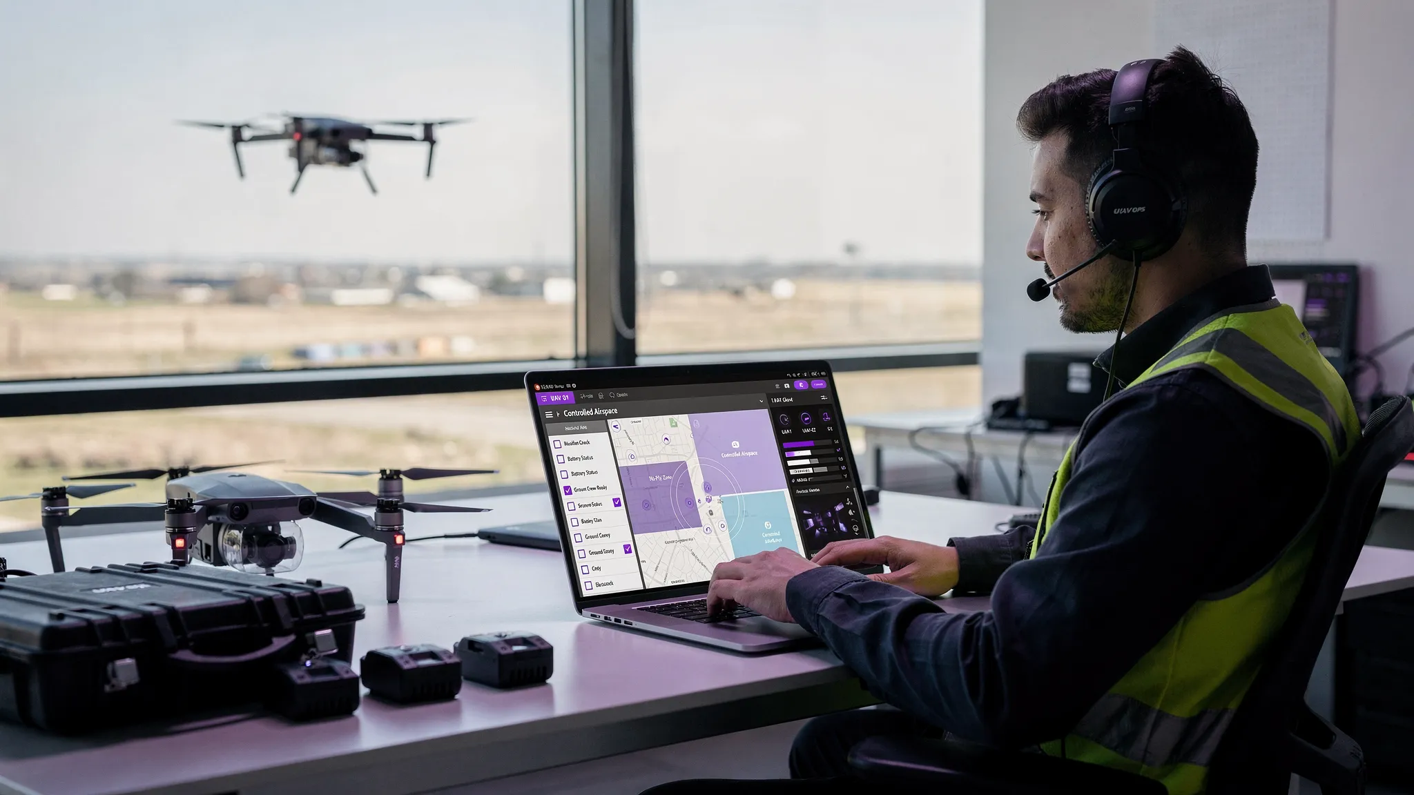
From Planning to Post-Flight: Streamlining Your Operations
Finding exceptional "places to fly drones near me" is the first step in a much larger, more intricate process. As we've explored, locations from sprawling agricultural fields and serene coastal areas to bustling industrial parks and designated flying fields each present a unique set of opportunities and challenges. The true mark of a professional operator isn't just discovering a visually stunning location; it's mastering the entire operational lifecycle that surrounds each flight.
This journey from initial concept to final deliverable requires a systematic approach. It involves meticulous pre-flight planning, comprehensive airspace intelligence, robust risk assessments, and diligent post-flight logging. The difference between a successful, compliant mission and a problematic one often lies in the efficiency and thoroughness of these background tasks.
Synthesizing Your Drone Workflow
Think of each location we discussed not as a standalone destination, but as a project with its own specific workflow. A flight over a coastal area demands a different risk assessment (tides, public access, marine life) than one in an industrial park (RF interference, moving vehicles, private property permissions). The key is to standardize your process, not your plan.
Core takeaways from our exploration include:
- Due Diligence is Non-Negotiable: Never assume a location is safe or legal to fly. Always verify airspace classifications, local ordinances, and temporary flight restrictions (TFRs) before you even pack your gear.
- Context is Everything: The "best" place to fly is entirely dependent on your mission's objective. A cinematic shot requires a different environment than a technical survey or a recreational flight.
- Safety is an Active Process: A safe flight is the result of proactive planning. This includes creating detailed risk assessments, checking weather conditions meticulously, and having contingency plans in place for potential issues.
By internalizing these principles, you shift from simply finding a spot to fly to executing a professional, repeatable, and scalable operation.
From Disparate Tools to a Centralized Hub
Many pilots, especially those starting out, fall into the trap of using a chaotic collection of separate tools. They might use one app for airspace maps, another for weather forecasts, a spreadsheet for flight logs, and a word processor for risk assessments. While this might seem manageable for a few flights, it quickly becomes inefficient and prone to error as your operations grow.
This is where the power of an integrated drone management platform becomes clear. Instead of jumping between multiple applications, a centralized system brings every critical element into a single, cohesive dashboard.
Operational Insight: Centralizing your flight operations doesn't just save time; it creates a "single source of truth." This ensures that every piece of data, from airspace checks to flight logs and risk assessments, is consistent, accessible, and audit-ready, which is crucial for commercial compliance and client confidence.
Imagine planning a survey mission at one of the industrial parks we covered. With a platform like Dronedesk, your workflow is transformed. You can instantly visualize controlled airspace, identify ground hazards, generate a site-specific risk assessment, log your flight data automatically, and even manage client details and project deliverables all in one place. This streamlined approach allows you to focus your energy on what truly matters: executing the flight safely and capturing high-quality data.
Ultimately, mastering the art of finding and flying in diverse locations is about building a professional framework. It’s about elevating your passion or business from a series of one-off flights into a smooth, compliant, and highly efficient operation. The right tools are not just a convenience; they are the foundation upon which professional drone services are built.
Ready to unify your workflow and turn every flight plan into a seamless, professional operation? Dronedesk consolidates everything you need, from airspace intelligence and risk assessments to flight logging and client management, into one powerful platform. Discover how to streamline your search for "places to fly drones near me" and manage the entire mission lifecycle by visiting Dronedesk to start your free trial today.
 UAV Software Guide for Flight Planning and Compliance →
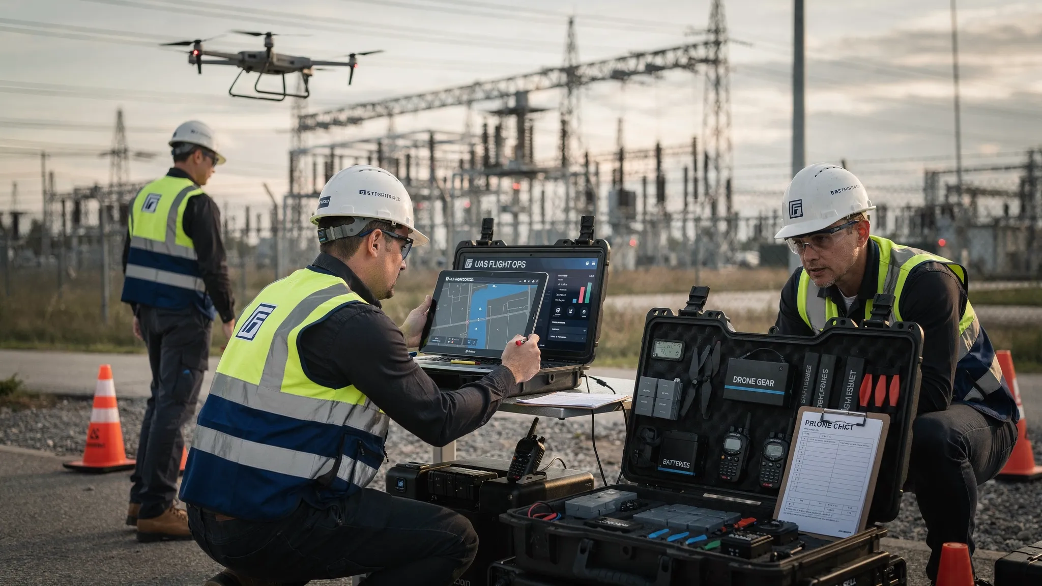 What Makes a Great Drone Platform for Commercial Teams →
 Your Guide to the Ultra Light Aircraft Licence in 2026 →
 UAVs for Sale: A Professional Buyer's Guide for 2026 →
 UAS Fleet Management Tips for Safer Multi-Pilot Operations →
 UAS Practice Exam: Your 2026 Part 107 Study Plan →
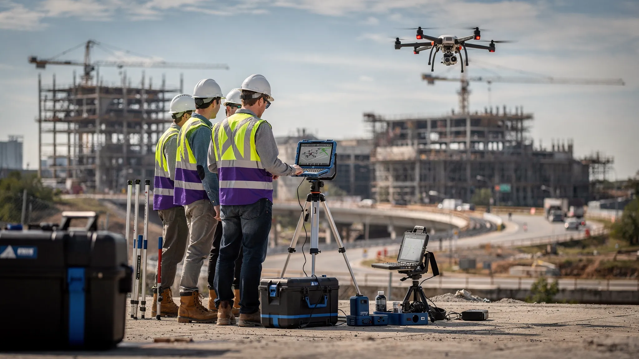 How Survey Firms Use Drone Survey Software to Scale →
 Drone Logbook vs Flight Log: What Operators Should Keep →
 Mastering Digital Aeronautical Flight Information File →
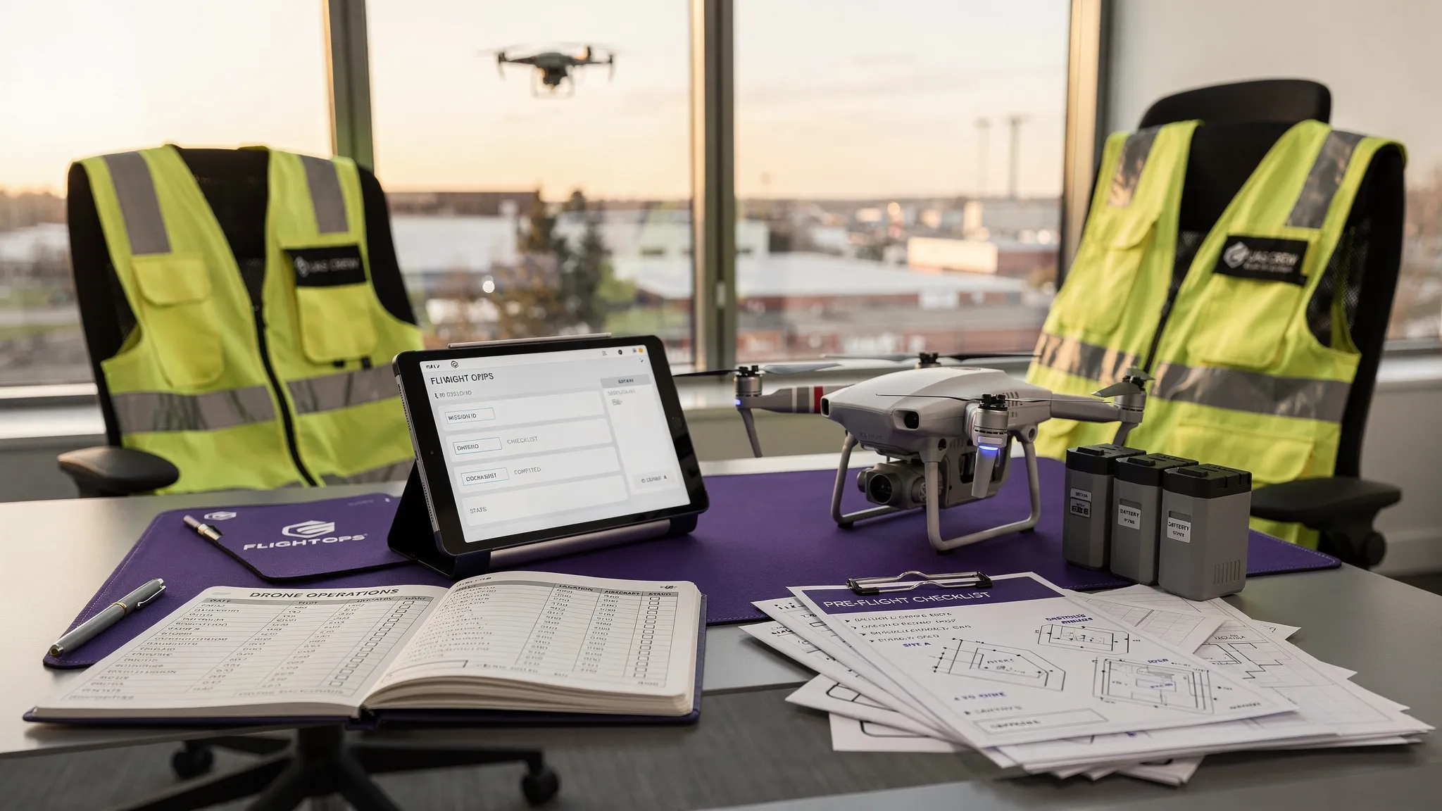 How to Set Up a Drone Pilot Logbook That Stands Up to Audits →