A Guide to Modern Drone Inspection
Can you picture it? Someone dangling from a rope hundreds of feet in the air, just to check on a wind turbine. Or a building’s entire facade wrapped in expensive scaffolding simply for a visual check. For years, that was just how asset inspection was done—a job defined by enormous risks, jaw-dropping costs, and crippling operational downtime. It was necessary, sure, but it was also fundamentally broken.
Why Asset Inspection Is Evolving
The world of asset management has always walked a tightrope, balancing necessity with risk. You can't just skip inspections on critical infrastructure like towering bridges, sprawling solar farms, or complex industrial plants. Their safety and integrity are non-negotiable. But the old way of doing things—sending people into harm's way—created a constant headache for businesses.
These manual methods weren't just dangerous; they were slow and incredibly expensive. Think about the logistics. Assembling rope access teams, renting cranes, or building out massive scaffolding structures often cost more than the actual repair work. On top of that, the data collected was often subjective, limited to what a person could see and snap with a handheld camera. This made it tough to spot trends or compare conditions over time.
The Shift to Smarter Methods
The real game-changer was the arrival of accessible, advanced technology. The obvious dangers and limitations of manual inspections created a huge demand for something safer, faster, and far more data-rich. This need kick-started a major shift in how industries manage their assets, moving away from putting people at risk and embracing remote data capture. Drone inspection was the clear answer.
An inspection is no longer just a visual check-up; it's a strategic data-gathering mission. By deploying technology, companies can transform a reactive, high-risk task into a proactive, data-driven maintenance strategy that protects both their people and their bottom line.
This evolution is happening across the board. The testing, inspection, and certification (TIC) market is currently valued at a staggering USD 399.39 billion, a figure driven by tough global safety and quality standards. This enormous market shows just how vital reliable inspection data is to every major industry.
A New Era of Safety and Efficiency
Drones, or Unmanned Aerial Vehicles (UAVs), are so much more than flying cameras. They are sophisticated platforms for remote sensing that completely rewrite the rules on the cost and safety of inspections. What used to be a multi-day shutdown with a large crew can now be done by a single certified drone pilot in just a few hours—and they’ll probably capture better data, too.
This new approach is especially powerful for proactive maintenance, like maintaining a metal roof, including inspection, where finding rust or damage early can head off major repair bills down the line. The benefits are massive and clear:
- Safety: It keeps your team safely on the ground, far from falls, confined spaces, or live electrical equipment.
- Cost-Effectiveness: It slashes the need for pricey equipment rentals and keeps asset downtime to a minimum.
- Data Quality: It captures high-resolution images and sensor data, creating a permanent digital record you can analyze for years to come.
This guide will walk you through this modern approach, covering everything from the basic concepts to advanced applications that integrate directly into your business operations.
Understanding Drone Inspection Fundamentals
So, what exactly is a drone inspection? At its core, it's about giving your team a 'flying, high-resolution eye' that can reach dangerous or expensive-to-access locations safely and easily. This process pulls people out of harm's way while capturing far better, more consistent data than traditional methods ever could.

Think of a drone inspection not just as flying a drone, but as a systematic mission for gathering critical data. Instead of a blurry photo taken from the ground or a subjective note scribbled in a logbook, you get a verifiable, crystal-clear digital record of an asset’s condition. This approach elevates inspections from a simple check-up to a strategic data-gathering operation.
Drone inspection is the use of an unmanned aircraft to capture high-quality visual and sensor data from an asset to assess its condition safely and efficiently.
This simple definition, however, underpins a powerful combination of hardware, software, and human expertise. Let’s break down the essential components that make a professional drone inspection possible.
The Core Components of an Inspection
A successful mission relies on three key elements working in perfect harmony. Each piece plays a critical role in turning a simple flight into actionable business intelligence. Miss one, and you just have a drone in the air.
-
The Unmanned Aerial Vehicle (UAV): This is the drone itself—the physical platform that does the flying. Modern commercial drones are rugged, stable, and built for reliability, capable of flying precise, pre-planned routes even in challenging weather.
-
The Payload: This is the specialised sensor or camera the drone carries. The payload is the real workhorse of the inspection. It can be anything from a standard high-resolution camera for visual checks to advanced thermal sensors for spotting heat anomalies or even LiDAR units for creating precise 3D models.
-
The Ground Control Station (GCS): This is the pilot's command centre on the ground. It typically includes the remote controller and a tablet or computer running flight software. From the GCS, the pilot monitors the drone’s status, adjusts flight paths, and controls the payload to make sure the right data is being captured.
Together, these components form the bedrock of any aerial inspection. A robust UAV gets you to the location, a high-quality payload gathers the necessary data, and a reliable GCS ensures the entire operation is executed safely and accurately.
Traditional vs Drone Inspection Methods
The advantages of this modern approach become incredibly clear when you compare it directly with older, manual methods. The differences in safety, cost, and the quality of data you get back are striking. An inspection that once required shutting down operations for days and putting people at risk can now be done in a few hours with the pilot's feet firmly on the ground.
Take a look at this direct comparison:
| Factor | Traditional Inspection | Drone Inspection |
|---|---|---|
| Safety | High-risk work at height, in confined spaces, or near active hazards. | Operator remains safely on the ground, eliminating physical risk. |
| Cost | Requires expensive scaffolding, cranes, or specialized rope access teams. | Drastically reduces equipment, access, and labour costs. |
| Downtime | Often requires asset shutdown, causing significant operational losses. | Can be completed quickly with minimal or even zero operational downtime. |
| Data Quality | Subjective, inconsistent, and limited to what is manually recorded or photographed. | High-resolution, georeferenced, and repeatable data for better analysis. |
| Speed | Slow and labour-intensive, often taking days or weeks to complete. | Up to 90% faster, covering large areas in just a fraction of the time. |
This shift isn't about replacing people; it's about equipping them with far better tools for the job. By adopting drone technology, businesses aren't just making their inspection processes safer and more efficient. They're fundamentally improving their ability to manage and maintain their most valuable assets with an unprecedented level of insight.
Exploring Different Types of Drone Inspections
Not all drone inspections are cut from the same cloth. Think of it like a doctor’s bag—you wouldn't use a stethoscope to check a broken bone. In the same way, a drone pilot chooses a specific camera or sensor—the "payload"—to diagnose a specific problem on an asset. The job dictates the tool, and the data you need determines the sensor you fly.
Let's walk through the main types of drone inspections, starting with the most common and working our way to more advanced, data-heavy methods. You’ll quickly see how a single flight can give you layers of valuable insight that go way beyond a simple snapshot. Each method opens a unique window into the health of an asset.
Visual Inspection: The Digital Naked Eye
The most common and straightforward method is visual inspection. It’s like giving your team a superpower: a high-resolution eye in the sky that can safely get within inches of hard-to-reach or dangerous areas. This type of inspection uses standard RGB (Red, Green, Blue) cameras to capture incredibly detailed photos and videos.
It’s the go-to approach when you just need to see the physical state of a surface.
- Roof Surveys: Spotting cracked tiles, water pooling, or membrane damage on vast commercial roofs without anyone taking a single step onto them.
- Facade Checks: Looking for cracks, water stains, or wear and tear on a building's exterior, a job that used to demand expensive scaffolding.
- Construction Progress: Keeping a visual record of site development and making sure construction milestones are hit on schedule.
The data is instantly understandable, making it a brilliant tool for routine maintenance, initial damage checks, and progress monitoring. It’s no surprise that this technology is a huge part of the building inspection services market, which is expected to hit USD 23.19 billion by 2032. Drones deliver the safety and efficiency to make that happen.
Thermal Inspection: Seeing in Signatures of Heat
Now we go beyond what the human eye can perceive with thermal inspection. This method uses a specialised radiometric thermal camera that doesn't see light but instead detects and measures infrared radiation—in other words, heat. What you get is a "heat map" of an asset, revealing temperature differences invisible to a normal camera.
A thermal inspection doesn't see light; it sees energy. Problems often show up as distinct hot or cold spots, flagging a potential failure, energy leak, or defect long before it becomes critical.
This makes it an absolute game-changer for all sorts of diagnostic work.
- Solar Panel Inspection: Instantly finding faulty cells or panels that are underperforming because they’re overheating—a task that would be painstakingly slow to do by hand.
- Electrical Substation Checks: Pinpointing overheating components in transformers or along power lines, helping prevent catastrophic failures.
- Building Envelope Audits: Finding exactly where heat is escaping through poor insulation in walls and roofs, which is key to improving a building's energy efficiency.
LiDAR Inspection: Mapping the World in 3D
When you need surgical precision, LiDAR inspection is the ultimate tool. LiDAR stands for Light Detection and Ranging. A LiDAR sensor fires out thousands of laser pulses every second and measures the tiny amount of time it takes for them to bounce back. By gathering millions of these return points, it builds a hyper-accurate, three-dimensional "point cloud" of an asset or an entire site. As you can imagine, this level of detail is a major reason why drone operations are transforming infrastructure inspections.
This isn't just a picture; it’s a measurable, digital replica of the real thing. LiDAR is brought in when precise dimensions and structural integrity are non-negotiable. For instance, it's used to create "digital twins" of bridges, power lines, or entire industrial plants. With these models, engineers can measure clearances, spot deformities, and run complex simulations, all from the safety of their office.
The Complete Drone Inspection Workflow
A professional drone inspection is far more than just getting a drone in the air. It’s a well-oiled operation, built on clear, repeatable steps that guarantee safety, efficiency, and high-quality results.
Think of it as a four-act play. Each act is distinct, but they all flow together to tell a complete story. Let's pull back the curtain on the entire lifecycle of a professional drone inspection, from the first spark of an idea to the final client handover.
Phase 1: Planning and Risk Assessment
Long before the propellers start whirring, the real work begins. This first phase—the planning—is the absolute foundation of a safe and successful mission. It’s where you dot the i's and cross the t's, identifying potential snags, clarifying the job's goals, and making sure everything is above board legally. If you drop the ball here, the whole project could be in jeopardy.
This stage involves a few key activities:
- Airspace Checks: Making sure the flight zone is free of no-fly zones, controlled airspace, or any temporary flight restrictions (TFRs).
- Weather Monitoring: Keeping a sharp eye on the forecast. High winds, rain, or even just poor visibility can ground a mission before it even starts.
- Risk Assessment: Methodically walking through every possible on-site hazard, from overhead power lines to people walking nearby, and figuring out how to manage each one.
- Flight Plan Creation: Designing the exact flight path—whether automated or manual—to ensure you get full, detailed coverage of the asset you're inspecting.

Laying it all out visually like this shows just how much meticulous prep work, from checklists to sorting out your team and gear, goes into a professional job.
Phase 2: On-Site Data Acquisition
With a solid plan locked in, it’s time for the action. This is the "boots on the ground" phase where the pilot actually flies the mission. The focus here isn't just taking pretty pictures; it’s about systematically capturing consistent, high-resolution data that can be properly analysed later.
Once on-site, the pilot runs through final pre-flight checks, secures a safe spot for take-off and landing, and then it’s up, up, and away. Whether flying by hand or letting an automated plan do the work, the key is maintaining the right overlap between images and holding a steady altitude and camera angle. This precision is what guarantees you won’t miss a single crucial detail.
For a great real-world example, check out our guide on drone power line inspection, which shows just how vital this step is when inspecting long, linear assets.
Phase 3: Data Processing and Analysis
Once the drone is back on the ground, the raw data—often hundreds or thousands of images and sensor readings—gets offloaded. Now the real magic begins. Specialised software takes all those individual photos and stitches them together into a single, massive, high-resolution map (an orthomosaic) or a detailed 3D model of the structure.
This is where you turn raw information into genuine business intelligence. Analysts then pore over these digital twins, meticulously tagging any anomalies they find—cracks, rust, hot spots, you name it. It's a far more thorough and objective way to inspect something than what a person can do with their own two eyes from the ground.
Phase 4: Reporting and Delivery
The final step is to take all those findings and package them up for the client. And this isn't just a data dump. A truly professional report is a clean, clear summary that tells the client everything they need to know about the health of their asset.
The best reports include annotated images showing exactly where the problems are, detailed descriptions of each defect, and practical recommendations for what to do next. This is where the true value of the inspection is delivered, giving the client clear, actionable insights to make informed decisions. It’s the perfect end to a well-executed workflow.
Core Benefits of a Drone Inspection Program
It’s easy to get caught up in the "wow" factor of a drone buzzing through the air, but the real magic happens when you look at the tangible, game-changing advantages they bring to an inspection program. Shifting from traditional, hands-on methods to an aerial approach isn't just a simple upgrade; it’s a fundamental change that directly boosts safety, slashes costs, and delivers data that’s leagues ahead of what you’re used to.

This technology allows businesses to finally break free from a reactive "fix-it-when-it-breaks" cycle and adopt a smarter, data-driven strategy. Let's dig into the five most compelling benefits.
Enhanced Safety for Your Teams
Without a doubt, the single most important benefit is enhanced safety. Think about it. Traditional inspections often put people in genuinely dangerous situations—working at dizzying heights, squeezing into confined spaces, or operating near live electrical equipment. Drones take your team out of the line of fire completely.
Instead of a person climbing a cell tower or carefully navigating a treacherous roof, a certified pilot can conduct a far more thorough inspection from the solid ground below. This simple change drastically reduces the risk of falls, injuries, and other workplace accidents. It’s about protecting your most valuable asset: your people.
Significant Cost Reduction
The financial upside is both immediate and massive. Imagine a manual bridge inspection. It could mean closing traffic lanes, hiring specialized lift equipment, and paying a large crew for several days of work. A drone can often complete that same inspection in a matter of hours with a single operator, causing minimal disruption and cutting out the need for expensive rentals.
By minimizing the need for scaffolding, cranes, and operational downtime, a drone inspection program can cut costs by as much as 70-90% compared to manual methods. This makes regular, detailed asset reviews financially viable for more businesses.
This cost-effectiveness isn't limited to just one industry. Whether you're inspecting a wind turbine, a sprawling commercial building, or a solar farm, the savings on labor, equipment, and lost productivity are simply too big to ignore.
Superior Data Quality
Drones capture information with a level of consistency and detail that a human inspector, no matter how skilled, just can't replicate. A drone can fly a pre-programmed, automated path, snapping thousands of high-resolution, georeferenced images. This guarantees that every square inch of an asset is documented in the exact same way, every single time.
This high-quality data becomes the foundation for incredibly powerful digital tools.
- Detailed Orthomosaics: Thousands of individual images are stitched together to create a single, ultra-high-resolution map of an asset.
- Accurate 3D Models: Using technologies like LiDAR and photogrammetry, you can produce precise, measurable digital twins of your structures.
- Thermal Insights: Infrared cameras can see what the naked eye can't, revealing hidden energy leaks or overheating components long before they fail.
This level of detail elevates an inspection from a simple visual check-up to a comprehensive digital analysis. You can learn more about turning this wealth of information into clear, actionable reports with the right drone inspection software.
Increased Efficiency and Speed
What used to take a team of inspectors days or even weeks can now be done in a tiny fraction of the time. A drone can survey a massive commercial roof in under an hour or inspect miles of power lines in a single day. This incredible speed means your assets are back in service faster, minimizing expensive downtime.
This newfound efficiency also makes it practical to conduct inspections more frequently, which is the key to proactive maintenance.
Proactive and Predictive Maintenance
This might be the most strategic benefit of all. By conducting regular drone inspections, you build a historical, time-stamped record of an asset's condition. By comparing data sets over time, you can actually track the rate of deterioration, spot developing issues, and predict potential failures well before they become critical emergencies.
This proactive approach transforms maintenance from a costly, reactive fire-drill into a planned, predictable, and budgeted part of your operations, ultimately extending the life of your most critical assets.
Right, let's talk about how this all works in the real world.
Theory is one thing, but seeing a clean process in action is what really counts. That four-phase inspection workflow—planning, acquisition, analysis, and reporting—has a ton of moving parts. If you're trying to juggle it all manually with spreadsheets, a mishmash of apps, and stacks of paperwork, you know how quickly things can fall apart. That's where projects stall, time gets wasted, and risks creep in.
This is exactly why a dedicated platform like Dronedesk exists. It takes a potentially chaotic process and turns it into a simple, single operation.
Let's walk through a typical job for a drone operator to see what this looks like. The day doesn't start with a frantic scramble for paperwork; it starts with one dashboard. A new request for a roof inspection lands. Instead of starting a messy new folder of random documents, the operator just logs into Dronedesk and creates a new job.
From that moment on, the platform becomes the central hub for the entire project.
From Planning to Paperless Compliance
First up, the client details and job location are punched in. Dronedesk instantly gets to work, pulling up detailed maps and crucial airspace intelligence for the site. Without having to switch to another app, the operator can see controlled airspace, ground hazards, and even live NOTAMs.
A few clicks later, a comprehensive risk assessment is generated, built from pre-saved templates that make sure nothing gets missed. This document is then automatically logged and neatly stored with the job file.
The screenshot below gives you a glimpse of the Dronedesk dashboard. Think of it as mission control for every single inspection you run.
This unified view means you have immediate access to job planning, team scheduling, and all your compliance documents, completely doing away with the need for scattered tools.
Next, the flight plan. The operator can map out the required flight path and attach it directly to the job record. Team members and specific drones from the fleet management module are assigned. Every single step, from that first client call to the final pre-flight checklist, is logged. What you get is a perfect, audit-ready paper trail for every inspection.
Dronedesk isn't just a digital filing cabinet; it’s an active management system. It guides you through the tricky compliance steps of an inspection, making sure safety and accountability are baked into your workflow right from the start.
This systematic approach means that by the time the pilot even gets to the site, all the heavy administrative lifting is already done. They can pull up all the job details, risk assessments, and flight plans right on their phone or tablet, run through their on-site checks, and get on with the actual mission.
From Data Capture to Client Delivery
Once the flight is done, the captured data is offloaded for processing. While Dronedesk doesn't process the imagery itself, it's still there to manage the final, critical stages of the project. As soon as the analysis is complete and the findings are ready, the operator can generate a professional, branded report.
This report pulls in all the job details logged earlier—client info, site location, team members, even the risk assessment—and merges them with the inspection findings. The final PDF is then shared with the client via a secure link. The job gets marked as complete, invoices are generated, and all the records are safely archived for any future needs.
This entire lifecycle, from the first phone call to the final invoice, all happens in one system. It's a perfect example of how a purpose-built platform can transform a chaotic inspection workflow into a smooth, professional, and scalable business operation, saving you hours of admin on every single job.
Frequently Asked Questions About Drone Inspection
As drones become a familiar sight in modern asset management, it's only natural for questions to pop up. Whether you're a potential client weighing the investment or a new pilot trying to get your bearings, clear answers are a must. Here, we’ll tackle some of the most common queries we hear about drone inspections.

Let's dive into the practical concerns that both clients and pilots run into, breaking down the world of aerial inspections into straightforward, no-nonsense terms.
How Much Does a Drone Inspection Cost?
There's no simple price list for a drone inspection because the cost really depends on the complexity of the job. It's like asking how much it costs to hire any skilled professional—the final quote is shaped by exactly what you need them to do.
Several key factors will influence the final price:
- Asset Complexity: A simple, flat commercial roof is a far cry from a sprawling industrial plant or a towering bridge with all its nooks and crannies. The more complex the structure, the more time and planning involved.
- Data Requirements: A basic visual check-up with high-resolution photos will naturally cost less than a mission that needs specialized gear like thermal or LiDAR sensors.
- Deliverables: What you get at the end matters, too. A simple PDF with annotated photos is a different beast entirely from a fully interactive 3D model or a detailed thermal analysis report.
What Are the Legal Requirements for Commercial Drone Flights?
Flying a drone for business isn't a free-for-all. It's a regulated activity that demands strict adherence to aviation laws to keep everyone safe. In the United States, for example, any pilot flying commercially must be certified under the FAA’s Part 107 rules.
This certification isn't just a piece of paper; it proves the pilot understands critical things like airspace classifications, flight restrictions, and what to do in an emergency. Beyond the pilot's license, every single flight needs careful planning to navigate airspace rules and local laws. Staying compliant isn’t just a good idea—it's a legal and professional duty for every commercial inspection.
How Accurate Is Drone Inspection Data?
The data you get from a drone can be incredibly accurate, but only if the mission is flown correctly with the right equipment. Getting a reliable final report depends on a few key elements working in harmony.
The accuracy isn't just about the drone's camera. It's a combination of sensor quality, precise flight parameters, and sophisticated post-processing software that transforms raw data into dependable, measurable insights.
It starts with high-quality sensors that capture crisp, clear details. Then, consistent flight paths with the right amount of image overlap ensure there are no blind spots in the data. Finally, powerful software stitches it all together, corrects for any distortions, and produces georeferenced models that are a true digital twin of the real thing. When it's all done right, the data is not only spot-on but also repeatable, giving you a reliable benchmark for future inspections.
Ready to manage every step of your inspection workflow with ease? Dronedesk gives you the tools to handle planning, compliance, and reporting in one seamless platform. See how Dronedesk can save you time and keep you compliant.
 Beyond Visual Line of Sight Explained for Operators →
 How BVLOS Drone Operations Change Commercial Workflows →
 FAA Drone Rules Every Commercial Pilot Should Know →
 FAA 107 Explained for Commercial Drone Operators →
 Canadian Drone Regulations Explained for Business Use →
 FAA Part 107 Drone License Explained for Beginners →
 How to Review a DJI Drone Flight Log Step by Step →
 Drone Registration Law Explained for Commercial Pilots →
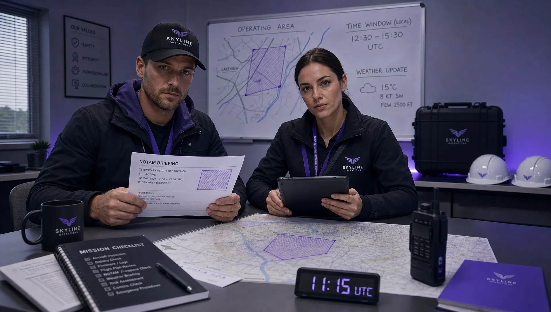 How to Check a Drone NOTAM Before Every Mission →
 BVLOS Drone Meaning and Why It Matters →