Drone Inspections: How to Plan Safer, Faster Site Visits
Drone inspections can make roof surveys, utility checks, construction progress visits and emergency assessments safer by reducing the need for people to work at height, enter hazardous areas or spend long periods near live infrastructure. But the flight itself is only one part of the job. The difference between a smooth inspection and a frustrating site visit is usually decided before the pilot arrives.
Faster site visits rarely come from rushing. They come from removing uncertainty: what needs to be inspected, what evidence the client needs, where the drone can safely fly, who must be briefed, and what will happen if conditions change. A good plan gives the remote pilot fewer decisions to make under pressure and gives the client a cleaner, more reliable result.
Why drone inspections need a site-first planning process
Drone inspections are different from general aerial photography. The objective is not simply to capture attractive imagery, it is to collect usable evidence from a specific asset or area. That could mean identifying cracked roof tiles, checking corrosion on a structure, documenting storm damage, inspecting a solar array, or assessing an inaccessible incident scene.
That evidence requirement affects almost every planning decision. A roof condition survey may need close oblique imagery and careful control of overflight near neighbouring properties. A utility corridor inspection may need a longer linear plan, battery staging, land access arrangements and a stronger communications plan. An emergency services deployment may need a fast but disciplined process that keeps airspace, people and scene control front of mind.
The Health and Safety Executive provides guidance on working at height, and one of the practical benefits of drone inspections is that they can reduce the need for ladders, scaffolding or rope access in early assessment stages. That benefit is only realised when the drone operation itself is planned with the same seriousness as any other safety-critical site activity.
Start with the inspection objective, not the flight path
A common mistake is to open a map and start drawing a flight area before the deliverable is clear. For safer and faster drone inspections, define the inspection outcome first. The route, equipment, crew, permissions and risk controls should follow from that outcome.
Before planning the flight, clarify what the client or incident commander actually needs to know. Are they looking for defects, measurements, thermal anomalies, general condition evidence, progress records, or rapid situational awareness? Do they need stills, video, a map, a 3D model, a written report, or simply a visual assessment on the day?
| Inspection objective | Planning implication | Site-time saver |
|---|---|---|
| Roof or facade condition | Plan close visual imagery, safe standoff distances and angles that avoid unnecessary overflight | Reduces repeat passes caused by missing elevations or poor image angles |
| Solar panel inspection | Plan timing, sensor choice and consistent flight lines if thermal data is required | Prevents unusable data caused by poor environmental conditions |
| Bridge or structure inspection | Identify obstructions, GPS limitations, public access points and emergency landing options | Helps brief spotters and manage ground risk before launch |
| Utility corridor inspection | Plan access points, battery changes, handover points and communications coverage | Keeps long linear operations organised and reduces downtime |
| Emergency assessment | Define the priority information needed and who will receive it | Avoids collecting excessive footage that does not support decisions |
This first step also protects the operator commercially. When the output is agreed in advance, it is easier to explain what is included, what is not included, and what conditions could require a reschedule or change in method.
Build your pre-site intelligence pack
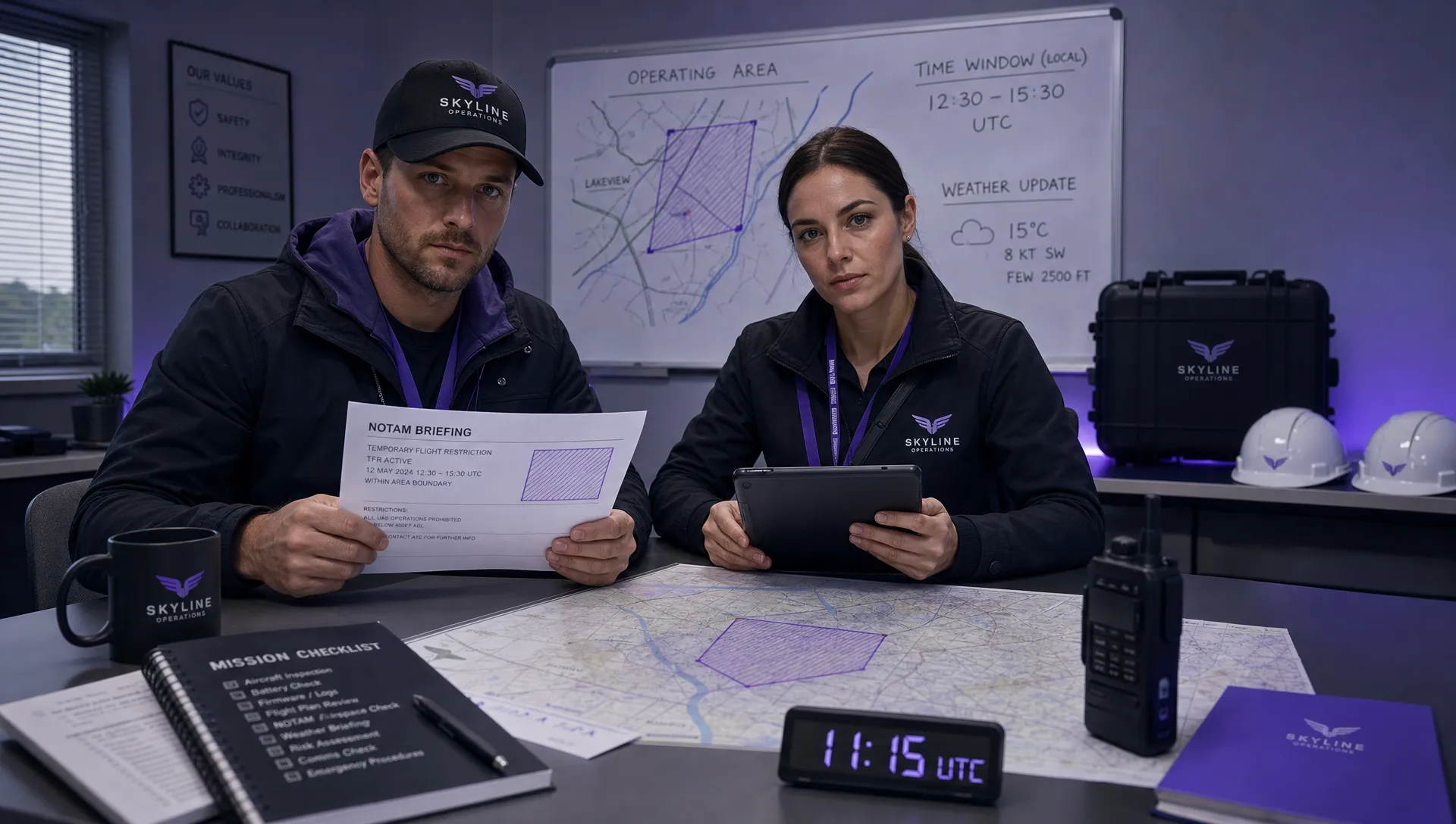
The more intelligence you gather before travelling, the less time you spend solving basic problems on site. A pre-site pack does not need to be complicated, but it should bring together the information that affects safety, compliance and data quality.
Start with the location. Review the exact asset boundary, access gates, parking, launch and recovery options, public rights of way, nearby roads, railway lines, overhead cables, trees, masts, cranes, reflective surfaces and areas where uninvolved people may appear. For built-up or industrial sites, consider how the drone will behave near walls, steelwork and other features that may affect GPS, compass performance or obstacle sensing.
Airspace should be checked early, not at the last minute. In the UK, operators should refer to current CAA requirements and guidance, including the CAA drones section and the Drone and Model Aircraft Code. Depending on the aircraft, location and operating category, you may need additional permissions, coordination or operating procedures before the job can go ahead.
Weather is not just a go or no-go decision. For inspections, it affects data quality. Wind can make close inspection less stable, rain can make surfaces reflective or unsafe, low sun can create shadows that hide defects, and heat conditions can influence thermal work. If the client needs comparable records over time, similar lighting and flight conditions may be important.
A useful pre-site pack typically covers:
- The inspection objective and required deliverables
- Site access, parking, welfare and escort arrangements
- Airspace checks, nearby aerodromes and any coordination requirements
- Ground hazards, public interface and exclusion-zone options
- Asset-specific hazards such as power, heat, chemicals, water or moving plant
- Weather thresholds and rescheduling criteria
- Emergency contacts, lost-link actions and incident procedures
This pack gives the pilot and crew a shared operating picture before the site induction begins.
Treat risk assessment as a planning tool, not paperwork
Risk assessment is often viewed as an administrative requirement, but for drone inspections it is one of the best ways to make the site visit quicker. When hazards and controls are already considered, the on-site team can focus on verifying conditions rather than building the plan from scratch.
A strong drone inspection risk assessment should connect the asset, environment, people and flight method. It should not be a generic form copied from the previous job without review. Recurring clients and repeat sites can benefit from templates, but each visit still needs a fresh check for temporary hazards such as scaffolding, events, roadworks, cranes, livestock, parked vehicles or changes in public access.
| Planning area | Safety question | Decision to make before arrival |
|---|---|---|
| Airspace | Are there restrictions, nearby aerodromes or other airspace users to consider? | Whether permissions, notifications or alternative timing are needed |
| Ground risk | Where could uninvolved people enter the operating area? | How to brief the client, position observers and manage access |
| Asset hazards | Could the asset create magnetic, electrical, thermal or physical hazards? | What standoff distance, route and contingency actions are appropriate |
| Weather | What conditions would make the inspection unsafe or unusable? | Clear go, delay and abort thresholds |
| Data protection | Could the flight capture people, private property or sensitive areas? | How to limit capture, brief stakeholders and manage data handling |
| Emergency response | What happens after lost link, low battery, flyaway or injury? | Who does what, who is contacted and where the aircraft should recover |
For survey companies and utility operators, this structured approach also helps maintain consistency across different crews. For emergency services, it supports rapid deployment without abandoning discipline. For solo operators, it reduces cognitive load when managing the client, aircraft, airspace and site safety alone.
Plan the site visit sequence
Once the inspection objective and risk controls are clear, map the visit as a sequence of actions. This is where many operators gain time on site. Instead of arriving and deciding what to do next, the crew follows a pre-agreed flow.
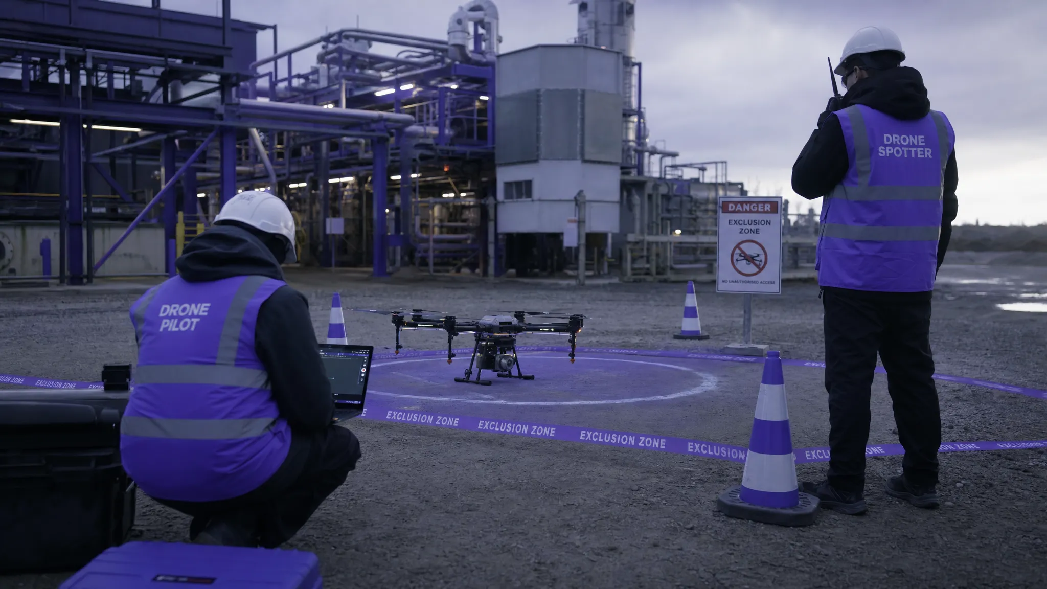
A practical sequence starts before arrival. Confirm access, names, contact numbers and any induction requirements. If a site escort is needed, make sure they understand where the drone team needs to go and how long the inspection is expected to take. If the site is operational, agree how you will coordinate with plant operators, security teams or maintenance staff.
On arrival, verify that the planned launch area is still suitable. Then complete the site briefing, confirm exclusion arrangements, check for new hazards and review the flight sequence. Keep the briefing short but specific. The team should know the objective, boundaries, emergency actions, communication signals and stop criteria.
During the inspection, work in logical sections. For example, inspect one elevation or asset zone fully before moving to the next. This reduces the chance of gaps and makes it easier to label data afterwards. If the site is complex, use a simple capture list so the pilot or observer can confirm that each required area has been covered.
After landing, do not rush away. A quick data review on site can prevent costly revisits. Check that the critical images or video clips are present, sharp and correctly exposed. Confirm any obvious limitations with the client while everyone is still available. Then complete flight logs, defect notes and post-flight checks as soon as practical.
Use checklists to make repeat inspections consistent
Checklists are not there to replace professional judgement. They are there to prevent predictable omissions, especially when a team is busy, tired or working in a high-pressure environment. For drone inspections, checklists are particularly useful because the same job often combines aviation decisions, site safety, client requirements and data management.
For most inspection work, four checklist stages are enough. A pre-mobilisation checklist confirms permissions, equipment, crew, weather and deliverables. A site-arrival checklist confirms hazards, access, briefing and launch area suitability. A pre-take-off checklist confirms aircraft status, batteries, settings, return-to-home behaviour, observers and communications. A post-flight checklist confirms data, logs, aircraft condition and client handover.
The value comes from making these checklists specific to the type of inspection. A roof inspection checklist should not be identical to a flood response checklist. A thermal solar inspection should include sensor and environmental checks that would be irrelevant to a simple progress visit.
For growing teams, standardised checklists also support training. New pilots learn the organisation's expected operating rhythm, while experienced pilots get a safety net against routine errors.
Match the capture method to the evidence required
A safe, fast site visit can still fail if the data is not fit for purpose. The capture method should be planned with the same care as the flight safety controls.
For close visual inspections, image angle, distance, overlap and lighting matter. Too far away and defects may be missed. Too close and the aircraft may introduce unnecessary risk or produce images that lack context. For mapping outputs, overlap, altitude, ground control and processing requirements need to be considered before site arrival. If the inspection will produce orthomosaics, point clouds or 3D models, it is worth reviewing how drone mapping tools fit into the workflow. Dronedesk has a separate drone mapping software guide that explains these outputs and how different software categories compare.
For thermal inspections, timing and environmental conditions are critical. Solar panel, building heat-loss and infrastructure inspections can be affected by irradiance, wind, rain, surface moisture and temperature differences. The pilot may fly perfectly, but the inspection can still disappoint if the conditions were unsuitable for the question being asked.
Data naming and storage should also be planned. Decide how assets, zones, flights and batteries will be named before the job starts. This makes post-processing, reporting and client communication much easier, especially when multiple pilots or repeat visits are involved.
Plan for people as carefully as the drone
Many inspection delays come from human coordination rather than aircraft limitations. The drone may be ready, but the site contact is unavailable, security has not been briefed, the maintenance team is working in the area, or the public cannot be kept away from the operating zone.
For commercial and utility inspections, send a short pre-visit briefing to the client. Explain what you need from them, where you plan to operate, what could stop the flight, and who has authority to pause site activity if required. For emergency services, this coordination may happen through an incident command structure, but the principle is the same: the drone team must be integrated into the wider site operation.
Good communication also helps manage expectations. Clients may not realise that a safe drone inspection depends on weather, airspace, ground control and privacy considerations. Explaining those factors early reduces pressure on the pilot to continue when conditions are not right.
Turn each inspection into a reusable operating pattern
The first visit to a site always takes the most effort. The best operators turn that effort into reusable knowledge. After the job, review what changed, what took longer than expected, what hazards were missed in desktop planning, and what data the client actually used.
For repeat inspections, update the site plan rather than starting again. Keep notes on preferred access points, launch areas, blind spots, radio issues, neighbour concerns, livestock, security procedures and seasonal hazards. If the site is inspected monthly or quarterly, this history becomes a practical safety asset.
As teams grow, the challenge becomes consistency. Different pilots should not produce completely different plans for the same type of work. This is where documented workflows, shared checklists, fleet records and standard reporting processes become important. If your organisation is scaling beyond a single pilot, Dronedesk's drone fleet management guide explores how to manage aircraft, pilots, maintenance, flight logging and compliance as operations become more complex.
How Dronedesk supports drone inspection planning
Inspection work often creates a lot of administration around a relatively short flight: client details, site information, permissions, airspace checks, risk assessments, checklists, equipment records, flight logs and reports. Managing that across spreadsheets, folders and separate apps can make repeatable planning harder than it needs to be.
According to the Dronedesk features page, Dronedesk includes client management, fleet management, team management, airspace intelligence, proximity intelligence, flight planning, flight logging, data reporting, configurable checklists and risk assessments in one web platform. For drone inspections, that means the key operational records can be managed around the job rather than scattered across disconnected tools.
This is especially useful for operators who inspect multiple sites, manage several pilots, or need consistent records for clients in regulated sectors. It helps turn planning into a repeatable workflow: capture the client requirement, assess the site, build the plan, complete the checklist, log the flight and keep the record together. If you are evaluating efficiency and user feedback, Dronedesk also publishes a customer satisfaction survey.
A practical drone inspection planning checklist
Use this as a simple planning structure before your next site visit. Adapt it to your operating manual, aircraft, permissions and sector.
| Stage | Confirm before moving on |
|---|---|
| Scope | The asset, inspection objective, deliverables and success criteria are clear |
| Regulation | The operation fits your permissions, operating category and pilot competence |
| Airspace | Current restrictions, nearby aerodromes and coordination needs are checked |
| Site access | Parking, escort, induction, launch area and emergency access are agreed |
| Ground safety | Exclusion zones, observers, public interface and stop criteria are planned |
| Aircraft and crew | Aircraft, batteries, sensors, maintenance status and crew roles are confirmed |
| Data capture | Flight method, image requirements, naming convention and storage are agreed |
| Contingency | Weather thresholds, lost-link actions, emergency contacts and abort plan are set |
| Close-out | Flight logs, data review, client notes and equipment checks are completed |
The goal is not to make planning bureaucratic. The goal is to make good decisions early, document them clearly and arrive on site ready to work.
Frequently Asked Questions
What makes drone inspections safer than traditional inspections? Drone inspections can reduce the need for people to access roofs, towers, unstable ground or hazardous areas during initial assessment. They still require careful aviation and site safety planning, including airspace checks, ground risk controls and emergency procedures.
How far in advance should I plan a drone inspection? Plan as early as possible, especially if the site is near controlled airspace, critical infrastructure, public areas or operational plant. Simple sites may only need a short lead time, while complex utility, construction or emergency response work may require more coordination.
What should be included in a drone inspection risk assessment? Include airspace, ground risk, site access, weather, asset-specific hazards, uninvolved people, data protection, crew competence, equipment suitability and contingency actions. The assessment should reflect the specific site and task, not just a generic template.
How can I make repeat drone inspections faster? Standardise the workflow. Reuse verified site information, maintain updated checklists, keep clear asset naming conventions, review previous flight notes and store flight logs and risk assessments where the team can access them.
Do drone inspections always need mapping software? No. Many inspections only need structured stills, video or thermal imagery. Mapping software becomes important when you need outputs such as orthomosaics, 3D models, point clouds or measurable site progress records.
Plan safer site visits with a repeatable workflow
Safer, faster drone inspections depend on preparation. When the objective is clear, the hazards are understood, the site team is briefed and the records are organised, the flight becomes the easiest part of the job.
If you want to manage inspection planning, risk assessments, checklists, flight logs and operational records in one place, explore Dronedesk and see how it can support more consistent drone operations from planning through to close-out.
 How to Check a Drone NOTAM Before Every Mission →
 BVLOS Drone Meaning and Why It Matters →
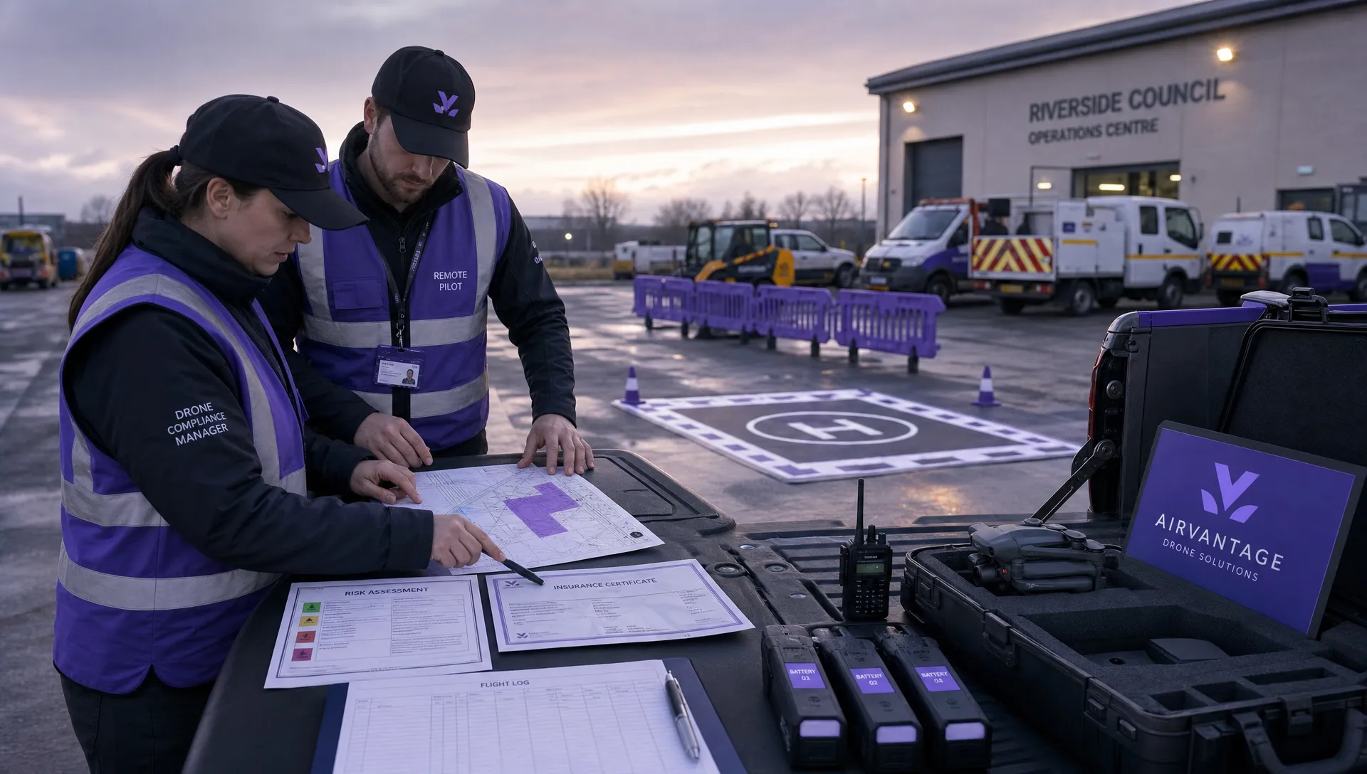 Drone Operation Regulations Explained for Businesses →
 How to Pass Your Drone Pilot License Test →
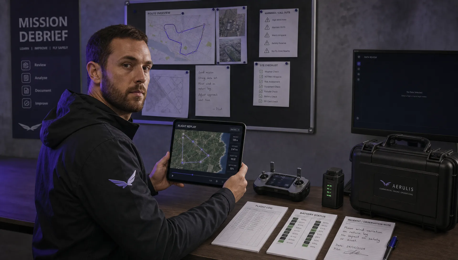 How to Review a DJI Flight Record After a Mission →
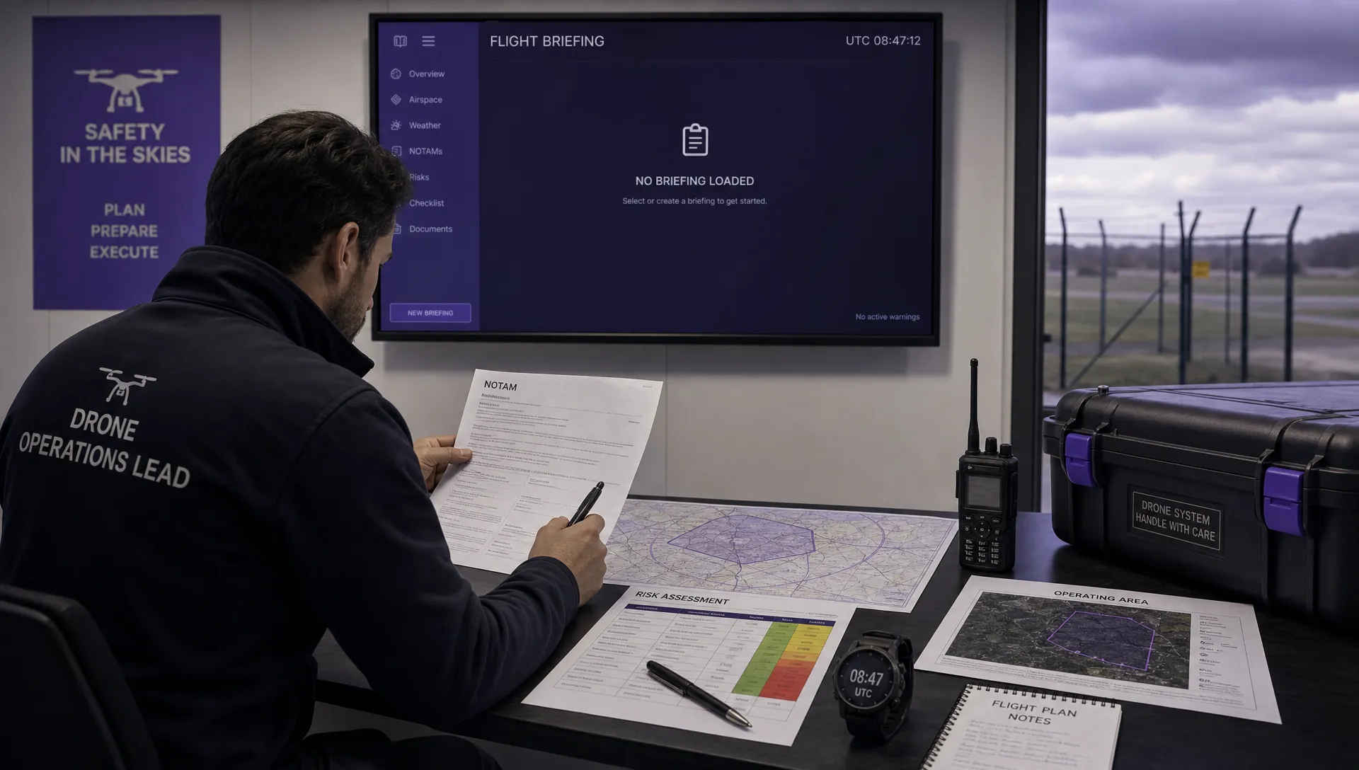 How to Check a Drone NOTAM Before You Fly →
 Part 108: What Drone Operators Should Expect →
 Beyond Visual Line of Sight BVLOS Explained →
 Drone Laws and Regulations Every Team Should Review →
 Current Drone Laws: What Changed in 2026? →