A Guide to Safely flying drone near airport - Rules, LAANC, and Safety
So, can you actually fly a drone near an airport?
The short answer is yes, but it's a qualified yes. You absolutely can, but only with explicit authorization from the Federal Aviation Administration (FAA). Flying without that green light is not just a bad idea—it's illegal, dangerous, and comes with some seriously steep penalties. The entire process demands military-grade planning and a rock-solid commitment to safety protocols. There’s no room for error when you’re sharing the sky with crewed aircraft.
Understanding the Risks of Flying Near Airports

Operating a drone around an airport is nothing like flying in an open field. This is the big leagues. It’s a high-stakes environment that requires a professional pilot’s mindset and a deep respect for the national airspace system. Think about it: the airspace around airports is some of the most congested and complex in the world. Manned aircraft are constantly taking off, landing, and maneuvering, often at very low altitudes.
An unauthorized drone in that mix is a massive threat. A collision, even with a small sub-250g drone, can lead to catastrophic engine failure, shatter a cockpit windscreen, or cripple critical flight controls. This isn't just a theoretical risk.
The Stark Reality of Near-Misses
The danger is real, and the statistics are alarming. Over the past decade, drones have been involved in a staggering 51% of reported near-misses with manned aircraft near U.S. airports. That's 122 of the 240 reported incidents, and most of them happen during takeoff and landing—precisely when planes are most vulnerable. If you want a clearer picture, read more about the surge in unauthorized flights; it’ll make you realize why compliance is non-negotiable.
Because the stakes are so high, the FAA has established incredibly strict regulations. These rules aren't there to make our lives difficult. They’re designed to protect lives—both in the air and on the ground. Understanding and respecting these regulations is the first and most critical step for any pilot even thinking about a mission near an airport.
Key Takeaway: Flying a drone near an airport puts you directly into a high-risk environment. Your role instantly shifts from being just a pilot to an active participant in aviation safety, where every single decision carries serious weight.
Why Compliance Is Your Top Priority
To operate legally in this environment, you have to engage directly with the systems built to manage it. The good news is the FAA provides tools and resources to help pilots fly safely, and their official UAS page should be your go-to source.
Bookmark it. Seriously. It’s your primary resource for rules, authorizations, and safety guidelines. From there, you can get direct access to the LAANC system, the DroneZone portal, and current flight advisories. It’s an essential tool for every professional pilot.
Ultimately, it comes down to acknowledging the seriousness of these operations and committing to a culture of safety. Every flight demands rigorous planning, flawless execution, and zero compromises on compliance. This guide is designed to walk you through that exact process, ensuring your operations are both successful and, most importantly, safe.
Your Essential Pre-Flight Planning Checklist
When you're flying a drone near an airport, your success hinges on the quality of your planning, not just your skill on the sticks. Every single safe flight starts with meticulous groundwork long before the props ever spin up. This isn't just about ticking a few boxes; it's about building a deep, comprehensive awareness of the airspace you're about to enter.
Think of it this way: an airline pilot doesn't just hop in the cockpit and hit the throttle. They spend serious time reviewing flight plans, weather reports, and the aircraft's status. As a drone pilot in controlled airspace, you need to adopt that exact same professional mindset. It’s your job to know every detail about your operational area before you even think about leaving the house.
Decoding the Airspace
First things first, you have to know exactly what kind of airspace you plan to fly in. The sky isn't one big empty space—it's sliced and diced into different classes, each with its own rulebook. Airports are typically wrapped in Class B, C, or D airspace, which are the most restrictive for obvious reasons.
Your go-to tool for this is the FAA's official B4UFLY mobile app. It's an indispensable resource that gives you real-time airspace information. Just open the app, drop a pin on your intended flight location, and it will instantly tell you if you're in controlled airspace and what kind of authorization you'll likely need.
For a more granular view, especially for complex jobs, you’ll want to get familiar with VFR Sectional Charts. These are the detailed maps that crewed aircraft pilots live by. They might look a bit intimidating at first glance, but they're packed with critical information:
- Airport Boundaries: Solid blue or magenta lines clearly show the edges of Class B, C, and D airspace.
- Altitude Ceilings: Numbers printed on the chart indicate the upper and lower limits for that specific slice of sky.
- Obstacles: The charts are peppered with symbols marking tall towers, buildings, and other potential hazards you need to be aware of.
Learning to read these charts is a skill that truly separates the hobbyists from the pros. It gives you the same bird's-eye view as the pilots you'll be sharing the sky with.
Before we move on, here's a quick cheat sheet for understanding the different types of airspace you'll most commonly encounter around airports and what you'll generally need to do to fly there.
Airspace Classes and Drone Authorization Requirements
| Airspace Class | Typical Location | Altitude Grid | Authorization Method |
|---|---|---|---|
| Class B | Surrounds the busiest major airports. | Depicted as inverted wedding cakes with multiple layers, up to 10,000 feet. | LAANC or manual authorization required. Very restrictive. |
| Class C | Surrounds airports with a control tower and radar. | Generally two layers: a 5-mile radius up to 4,000 feet AGL. | LAANC or manual authorization required. |
| Class D | Surrounds smaller airports with a control tower. | Typically a single cylinder, 4 nautical miles in radius, up to 2,500 feet. | LAANC is the most common method. |
| Class E | Controlled airspace, often starting at 700 or 1,200 feet. | Can extend down to the surface around some non-towered airports. | LAANC required if operating in surface-level Class E. |
This table is just a starting point. Always, always verify the specific requirements for your exact location using tools like B4UFLY before every single flight.
Checking for Temporary Restrictions
Okay, so you've identified your airspace class. You're not done yet. The airspace is a living, breathing thing, and conditions can change by the day or even by the hour. You absolutely must check for Temporary Flight Restrictions (TFRs) and Notices to Airmen (NOTAMs).
A TFR can pop up for all sorts of reasons—VIP movements like a presidential visit, a major sporting event, or emergencies like wildfires. Flying into an active TFR without specific permission is a massive violation. Similarly, NOTAMs contain time-sensitive info that could directly impact your flight, like unexpected crane operations near your site or runway closures that change air traffic patterns. You can find this information directly on the FAA's official TFR and NOTAM websites.
Here’s a classic mistake I’ve seen people make: assuming an approved LAANC authorization automatically clears you to fly through a TFR. It does not. If a TFR appears over your authorized flight area, you are grounded until it's lifted. Checking for TFRs and NOTAMs should be the absolute last thing you do before heading out the door.
Building Your Complete Flight Plan
Meticulous planning is about more than just checking airspace maps. It’s about creating a bulletproof plan that covers every angle of your operation. This is where a tool like Dronedesk becomes a real game-changer, helping you pull all your planning, risk assessments, and compliance paperwork into one organized hub. A solid plan means you've thought through every variable.
For a really deep dive into all the nuts and bolts, our guide on the ultimate drone pre-flight checklist gives an exhaustive breakdown of everything from checking your gear to analyzing the weather.
At a minimum, your flight plan should nail down these key elements:
| Planning Component | Description | Why It's Critical |
|---|---|---|
| Site Risk Assessment | Identify ground hazards like power lines, foot traffic, and potential emergency landing spots. | This is all about mitigating risks to people and property on the ground. |
| Weather Analysis | Check wind speed and direction (at the surface and aloft), visibility, and precipitation forecasts. | Ensures you're flying within your drone's limits and can always maintain visual line of sight. |
| Contingency Procedures | Know exactly what you’ll do in case of a lost link, flyaway, battery failure, or an unexpected aircraft encounter. | This allows you to act calmly and decisively in an emergency instead of panicking. |
| Authorization Details | Record your LAANC confirmation number, your authorized altitude, and the precise time window for your flight. | It’s your proof of compliance if you're ever questioned and keeps you operating within your approved limits. |
This level of detailed prep isn't optional when you're planning to fly a drone near an airport. It screams professionalism, guarantees you're compliant, and most importantly, it helps keep the skies safe for everyone.
Getting the Green Light to Fly
Okay, you’ve done your homework and planned the mission. Now for the most important part: getting the official all-clear to actually fly. Let's be blunt: flying a drone near an airport without explicit permission is a massive no-no. It's a serious violation, so this step is absolutely non-negotiable.
The good news is that the days of painful, long-winded paperwork are mostly behind us. Modern systems have made getting authorization surprisingly straightforward for pilots who know the ropes.
The main tool in your arsenal will be the Low Altitude Authorization and Notification Capability (LAANC) system. Think of it as an automated handshake between you, the FAA, and private app developers. It’s designed to give pilots near-instant airspace authorization in controlled airspace, and it should always be your first stop.
Using LAANC for Near-Instant Approval
Let's walk through a real-world scenario. You've landed a real estate photography gig, but the property is just a couple of miles from a Class D airport. A quick look at the FAA Facility Map (which you can use to understand the different airport altitude grids) shows your location is inside a grid with a pre-approved ceiling of 200 feet.
Instead of a drawn-out manual process, you can get clearance in minutes, right from your phone. Here’s how simple it is using a LAANC-approved app like Aloft:
- Mark Your Spot: First, you’ll open the app and pinpoint your exact operating area on the map, usually by drawing a quick polygon or dropping a pin.
- Set Your Flight Details: Next, you'll plug in your desired maximum altitude. In our example, that's 200 feet, which is at the ceiling for that grid. You'll also enter your planned flight time and duration.
- Submit Your Request: Add your pilot and drone details, then hit submit. The system instantly cross-references your request with the FAA's safety rules for that specific slice of airspace.
- Get Your Authorization: If your request is within the pre-approved limits, you'll typically get an automated authorization back via text or in the app within seconds. It comes with a unique confirmation number—make sure you keep that for your records.
For pilots who need to be agile and responsive, this system is a total game-changer. The process is clear, simple, and quick, as long as you're playing by the established rules.
This whole decision-making process can be simplified into a few core steps.

As you can see, getting authorization isn't just one action. It's the final piece of a safety puzzle that begins with truly understanding the airspace you're about to enter.
What to Do When LAANC Isn’t an Option
But LAANC doesn't cover every single situation. You'll need to go old-school and file a manual request through the FAA DroneZone portal in a few specific cases.
You’ll have to use DroneZone if:
- You need to fly higher than the LAANC grid allows. If the map says the ceiling is 200 feet but your job requires 300 feet, LAANC will deny it flat out.
- The airport isn’t LAANC-enabled. While most major airports are on the system, some smaller facilities or military-controlled airfields aren't integrated yet.
- Your flight requires a specific waiver. If you're doing something that falls outside standard Part 107 rules (like certain complex operations), you'll need a waiver alongside your airspace authorization.
Submitting through DroneZone is a much more involved process. You’ll fill out detailed forms about your flight plan, safety protocols, and how you plan to mitigate risks. Unlike the instant feedback from LAANC, these manual requests are reviewed by actual FAA personnel and can take anywhere from a few days to several weeks, or even longer, to get a response.
Expert Tip: Never, ever assume a manual request will be approved quickly. If you know a job requires a DroneZone submission, build that time into your project plan. I always recommend submitting your request a minimum of 90 days in advance to avoid a last-minute scramble that leaves you with a disappointed client.
These systems are in place for a reason. Statistics show that over 60% of reported close calls between drones and aircraft happen within 200 feet of airports. These encounters often involve smaller planes, like single-engine propeller aircraft (44.8% of incidents) and multi-engine jets (41.6%), which are constantly operating in and out of the very airports where we work. Following the rules isn't just about compliance; it's about protecting aircraft during their most vulnerable phases of flight.
Flying at Night and Other Special Cases
Want to fly near an airport after sunset? That adds another layer to your planning. While LAANC now supports night operation requests, you absolutely must hold a current Part 107 night authorization. This means you've completed the updated FAA training module covering night operations and physiology.
When you submit a LAANC request for a night flight, the process itself is the same. However, by submitting it, you are officially certifying that you'll follow all the night flying rules, which includes equipping your drone with anti-collision lights visible for at least three statute miles. A manual request for a night flight will get even closer scrutiny, so be prepared to provide a very detailed plan for how you'll maintain safety in a low-light environment.
On-Site Procedures for a Safe Flight

You’ve done the hard yards. Your LAANC authorization is in hand, and the mission plan is solid. Now comes the moment of truth: flight day. This is where the meticulous planning meets the real world, and where a professional pilot really proves their worth.
Remember, all that prep work is just a foundation. How you handle the dynamic, on-site environment when flying near an airport is what truly defines a safe operation.
The first thing you do when you arrive? It isn’t powering up the drone. It’s walking the site for one last, comprehensive risk assessment. Paper plans are great, but reality has a way of throwing curveballs.
The Final On-Site Assessment
This is your last chance to spot anything new that could put your flight in jeopardy. Your plan might have been perfect 24 hours ago, but things change. You need to physically walk the entire operational area and use your own eyes.
Here’s what you’re looking for:
- New Obstacles: Has a delivery truck parked right in your planned emergency landing zone? Did a mobile crane or some scaffolding pop up overnight? These things happen constantly and must be factored in.
- People and Traffic: Get a feel for the flow of pedestrians and vehicles. Is it much busier than you anticipated? You need to confirm your takeoff and landing zones are still clear and well away from public access.
- Sudden Weather Shifts: Check your apps for real-time weather data. Has the wind picked up? Is a surprise rain shower rolling in? The wide-open spaces around airfields can experience rapid weather changes.
This final walkthrough isn't optional. It’s a mandatory step to confirm that the conditions on the ground match the assumptions you made back at the office. No surprises.
Maintaining Unbroken Situational Awareness
Once those props are spinning, your most important job is maintaining total situational awareness. That doesn’t just mean staring at your drone; it means actively scanning the entire environment—sky and ground. Your best tool for this? Your own two eyes.
The FAA is crystal clear about keeping your drone within your Visual Line of Sight (VLOS) at all times. This rule is non-negotiable near an airport. You have to be able to see the drone with your own eyes, without needing binoculars or FPV goggles, to properly judge its position relative to everything else.
For more complex jobs, especially with tricky sightlines or in busy airspace, bringing a Visual Observer (VO) is one of the smartest decisions you can make. A VO is your dedicated second set of eyes, focused solely on scanning the sky for other aircraft and keeping eyes on the drone while you handle the controls.
A Visual Observer is your best defense against the unexpected. Their sole job is to watch the drone and the surrounding airspace, giving you the critical seconds needed to react to a low-flying helicopter or a sudden flock of birds.
Communication and Contingency Plans
Your LAANC authorization is the official green light, but your on-site communication plan is about immediate, real-time safety. Keep the phone number for the airport's Air Traffic Control (ATC) tower handy. While you won't call for a routine, approved flight, you must be ready to contact them instantly if an emergency unfolds.
And speaking of emergencies, what's your plan when things go wrong? "Hoping for the best" isn't a strategy. You need pre-planned, practiced responses for every likely failure.
Your contingency plan absolutely must cover:
- Lost Link or Flyaway: What's your immediate action? Does your drone’s pre-set return-to-home (RTH) altitude conflict with any obstacles or, crucially, the typical manned aircraft traffic pattern? Knowing the local airport pattern altitude is key to setting a safe RTH.
- Unexpected Aircraft: You see or hear an approaching aircraft. What do you do? The answer is always the same: land your drone immediately. You give way to all manned aircraft, every single time. No exceptions.
- Sudden Weather Change: If the wind kicks up or rain moves in unexpectedly, what’s your procedure for getting the aircraft down safely and quickly?
The stakes are getting higher. The FAA recently reported a staggering 411 illegal drone incursions at U.S. airports in a single quarter—that’s a 25.6% jump from the year before. One extreme case involved a single drone flying 27 times in controlled airspace, reaching almost 8,900 feet above its legal ceiling and crossing active commercial flight paths.
These aren't just numbers; they're a stark reminder of why professional, compliant pilots are so vital to keeping the skies safe for everyone.
Mastering Post-Flight Logging and Review
The job isn’t over when the props stop spinning. In fact, what you do after landing is just as critical for compliance and safety as everything that came before, especially after a flight near an airport. This is where meticulous logging and an honest debrief separate the amateurs from the pros.
For any Part 107 pilot, keeping a detailed flight log isn't just a good habit—it's a professional necessity. While the FAA doesn’t dictate a specific format, they can ask to see your records at any time. A well-kept log is your proof of compliance, your alibi, and your professional history all in one.
The Anatomy of a Professional Flight Log
Think of your logbook as the complete story of the operation. It's more than just flight times; it’s a detailed record that proves you did everything by the book, which is non-negotiable for a sensitive mission like flying near an airport.
Each flight entry needs to capture the essentials:
- Pilot and Aircraft: Who was the Remote Pilot in Command (RPIC)? Which specific drone was flown?
- Date, Time, and Duration: Log the date, start and end times, and the total flight duration.
- Location Details: Get specific. Note the address or, even better, the GPS coordinates.
- Flight Parameters: Record the maximum altitude you reached and the total distance covered.
- Authorization Proof: This is the big one for airport jobs. You absolutely must log your LAANC authorization number, the approved altitude ceiling, and the valid time window for the flight.
Punching all this in by hand is a grind and, let's be honest, it's easy to make mistakes. This is where a platform like Dronedesk really shines. It can automatically sync flight data from your drone, creating perfect, compliant logs without you having to type a single character.
Go Beyond the Logbook with a Post-Flight Debrief
A logbook keeps you legal, but a post-flight debrief makes you better. This is just a simple, structured review of the mission aimed at figuring out what you can learn for next time. It’s a habit that pays huge dividends down the road.
After a tricky flight, grab your team (or just a notepad) and ask a few key questions:
- What went right? Give credit where it's due. Did your pre-flight checks catch a potential problem? Was communication with your spotter crisp and clear?
- What didn't go to plan? Be honest. Did you hit some unexpected wind shear? Was there way more foot traffic on-site than you anticipated?
- How can we do better next time? Turn those challenges into action. Maybe you need to tweak an emergency procedure, pack different gear, or add a new step to your on-site checklist.
This process of self-assessment is what builds true expertise. Every flight, especially in challenging airspace, is a chance to sharpen your procedures, head off new risks, and become a safer, more skilled pilot.
By consistently logging your flights and conducting thoughtful debriefs, you create a powerful feedback loop. You’re not just flying; you’re learning, adapting, and building a professional reputation built on a rock-solid foundation of safety and compliance.
Common Questions About Flying Drones Near Airports
Even when you've got a solid grip on the rules, flying a drone near an airport is bound to bring up some tricky, specific questions. This is complex territory, and it’s smart to want clear answers before you power up your aircraft.
Let's dive into some of the most common things pilots ask when they're prepping for jobs in these high-stakes environments. We’ll give you direct, no-nonsense answers to help you fly with confidence and stay on the right side of the FAA.
Can Recreational Pilots Get Authorization?
Yes, absolutely. Recreational flyers can and must get authorization to fly in controlled airspace, just like Part 107 commercial pilots. The process is exactly the same: you have to use a LAANC-enabled mobile app to submit your request.
This isn't just bureaucratic red tape. It's about ensuring every single aircraft in sensitive airspace is accounted for, whether it's flown for fun or for a client. The FAA needs total visibility, and LAANC is the tool that makes it happen. As a recreational pilot, you’re held to the same high standard of responsibility when you want to operate near an airport.
What Are the Real Consequences of Flying Without Permission?
Let's be blunt: flying without authorization is a serious federal offense. This isn't a slap on the wrist. The FAA has a whole range of enforcement actions it can take, and none of them are something you want to experience.
The penalties are severe and can escalate quickly depending on how badly you mess up:
- Hefty Fines: FAA fines are no joke. They often run into thousands of dollars per violation. For a commercial operation, these fines can climb past $30,000.
- Losing Your Certificate: For Part 107 pilots, this is the big one. The FAA can suspend or permanently revoke your remote pilot certificate, effectively ending your professional drone career overnight.
- Criminal Charges: If your unauthorized flight endangers a crewed aircraft or is tied to other criminal activity, you could be facing federal criminal charges. That can mean actual prison time.
Beyond the legal and financial nightmare, flying illegally tanks public trust and gives every responsible drone pilot a bad name. It's just not worth the risk. Ever.
Is LAANC Available Everywhere and All the Time?
This is a critical point that trips up a lot of pilots. LAANC is a fantastic system, but it's not a magic wand—it isn't universal or available 24/7. Understanding its limits is crucial for proper flight planning.
First off, not every airport is LAANC-enabled. While the network covers over 800 airports across the US, plenty of smaller, non-towered, or military airfields aren't hooked in yet. You must check your LAANC provider app to confirm availability for your specific location. If an airport isn't on the system, you're looking at a manual authorization request through the FAA DroneZone, which can take weeks or even months.
Key Insight: Never just assume LAANC is an option. Make it the very first thing you verify when planning a job near an airport. Finding out your location needs a manual authorization the day before a flight is a planning failure that can easily cost you the job.
What's more, LAANC isn't always "on," even at participating airports. Some air traffic control facilities have specific hours for processing automated requests. If you try to submit a request for a late-night flight outside of these hours, it might get kicked to a manual review by ATC, which means delays or a flat-out denial.
Always check the operational hours for the specific airport you're working near. This info is usually right there in your LAANC app and is essential if you're planning any early morning or late-night missions.
Planning, logging, and making sure every flight near an airport is compliant can feel like a full-time job. Dronedesk brings everything into one place, from pre-flight risk assessments and LAANC checks to automatic flight logging and compliance reports. Stop juggling spreadsheets and start flying with confidence. Learn how Dronedesk can save you time and keep you safe.
 JARUS SORA Explained in Plain English →
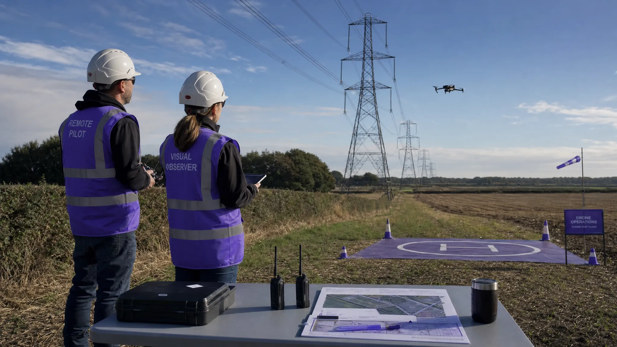 Drone Visual Line of Sight Rules Explained →
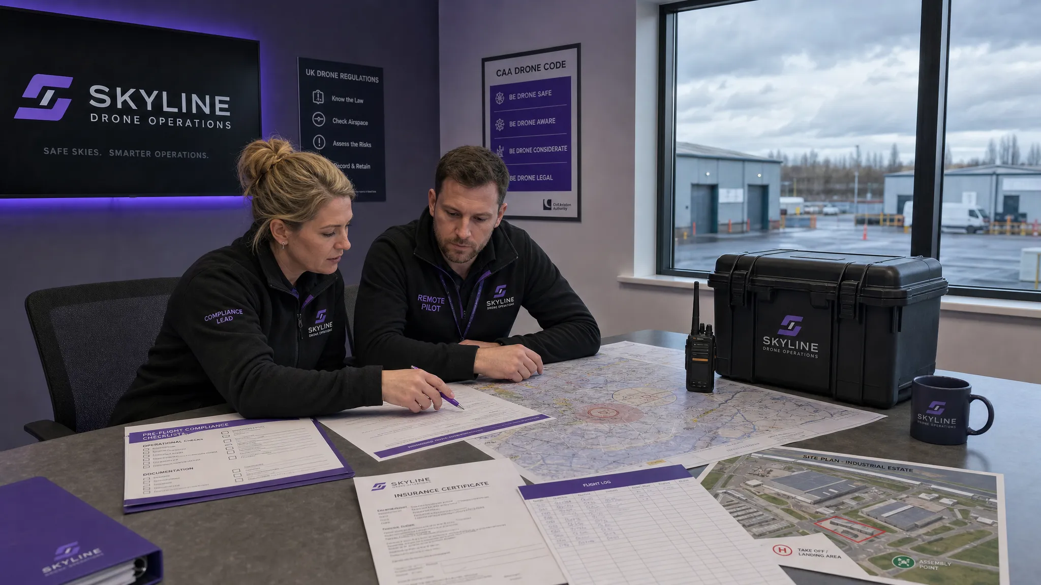 Drone Regulations Checklist for Commercial Flights →
 Drone Flying Laws: A Practical Guide for Operators →
 CAA UAV Regulations Explained for UK Operators →
 UK SORA Explained for Drone Operators →
 AUS Drone Laws Explained for Commercial Operators →
 Drone Flying Rules Explained for Business Use →
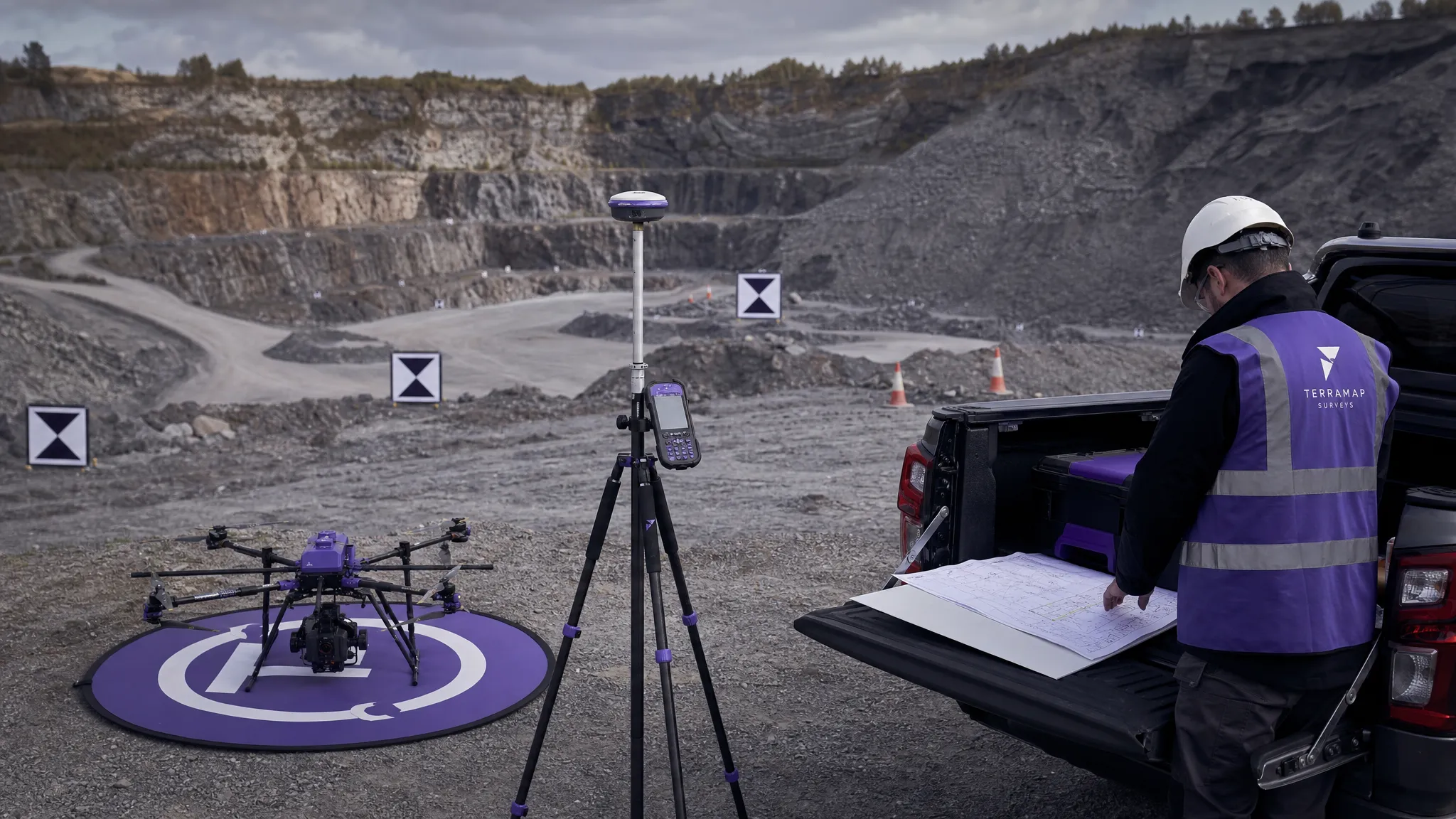 How to Choose an Aerial Survey Drone for Accurate Data →
 What Makes a Great Drone Operator in 2026? →