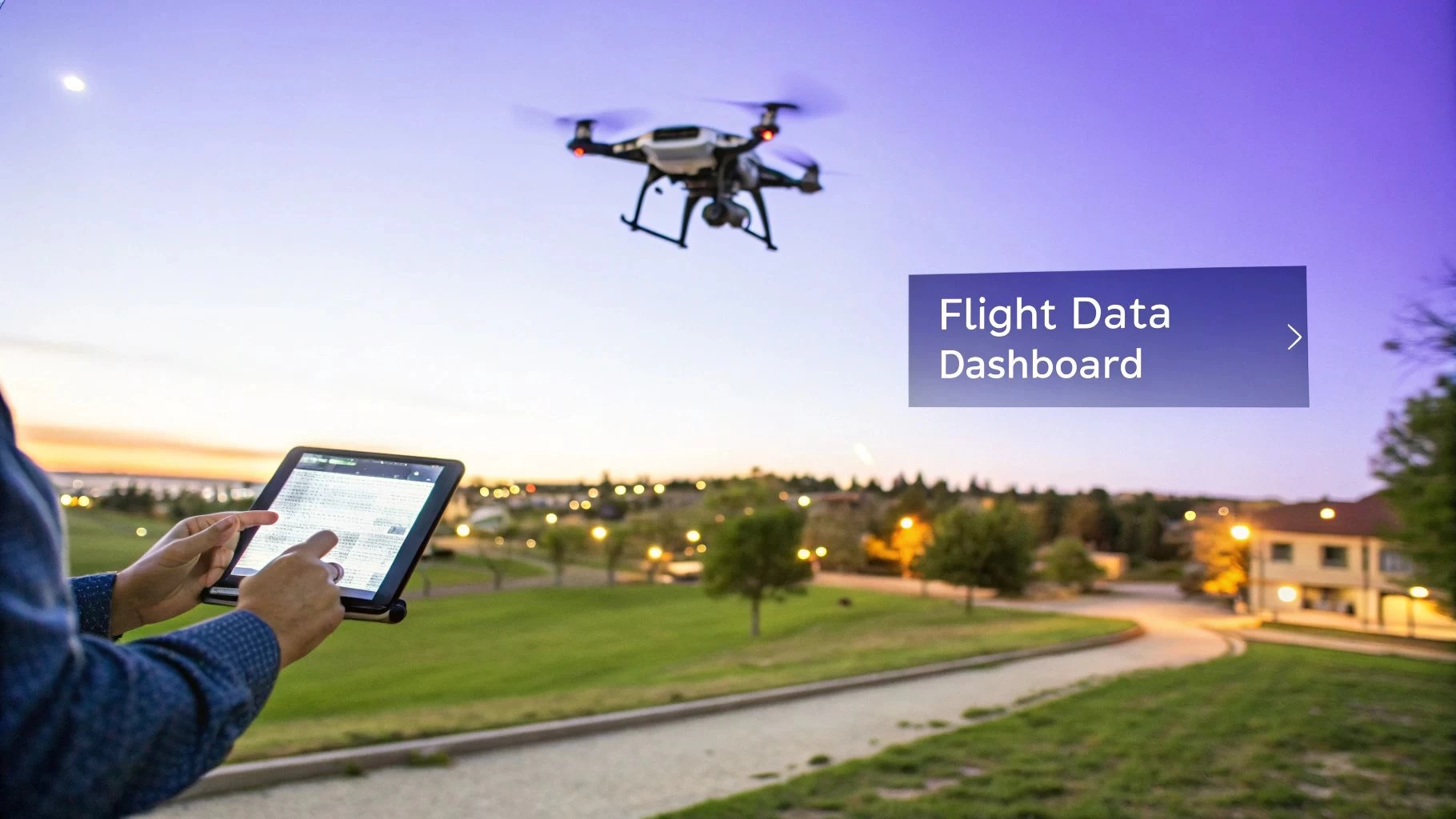
Your Guide to Flight Data Acquisition in Drone Operations
Flight data acquisition is basically the digital nervous system of your drone. It’s the process of grabbing every single piece of information your aircraft spits out during a mission—from its exact GPS coordinates and altitude to the nitty-gritty details of battery health and payload settings. This data, when captured, tells the complete story of a flight.
Why Mastering Flight Data Is a Professional Necessity
Think about the dashboard in a modern car. It gives you real-time feedback on your speed, fuel, and engine status—all critical info for driving safely and efficiently. Flight data acquisition does the exact same job for a drone, but the stakes are much higher for professional pilots. We're not just talking about technical logs here; it's about building a solid foundation of operational intelligence.
Every single flight generates a massive stream of data points. This information is the raw material for everything from proving compliance to shaping your business strategy. Without a structured way to capture and make sense of it all, you’re essentially flying blind, leaving crucial insights on the table.
Building a Foundation for Smart Operations
A disciplined approach to flight data acquisition is what really separates the pros from the hobbyists. It unlocks some key advantages that pay off immediately and just keep compounding over time, leading to smarter, more profitable missions.
Here are a few of the biggest wins:
- Enhanced Safety: Digging into your flight data can uncover recurring issues, pilot habits that need a tweak, or potential equipment failures before they turn into a real incident.
- Streamlined Compliance: Automated data collection makes creating detailed flight logs a breeze. And as you know, those logs are non-negotiable for meeting regulatory requirements from aviation authorities.
- Improved Efficiency: By tracking metrics like battery performance and flight times across dozens of missions, you can start to seriously optimise your planning and cut down on costly downtime.
- Actionable Insights: When you aggregate data from all your flights, trends start to emerge. This helps you make smarter calls on everything from fleet maintenance schedules and pilot training to how you quote your jobs.
Mastering the flow of data from your drone is the first step toward building a safer, more compliant, and ultimately more profitable drone operation. It transforms a simple flight log into a powerful business asset.
At the end of the day, getting a handle on flight data acquisition is fundamental. It empowers everyone—from solo pilots to small teams and large enterprises—to move beyond just flying and start using data to gain a real competitive edge. This guide will walk you through exactly how to capture this critical information effectively.
Understanding the Core Components Capturing Drone Data
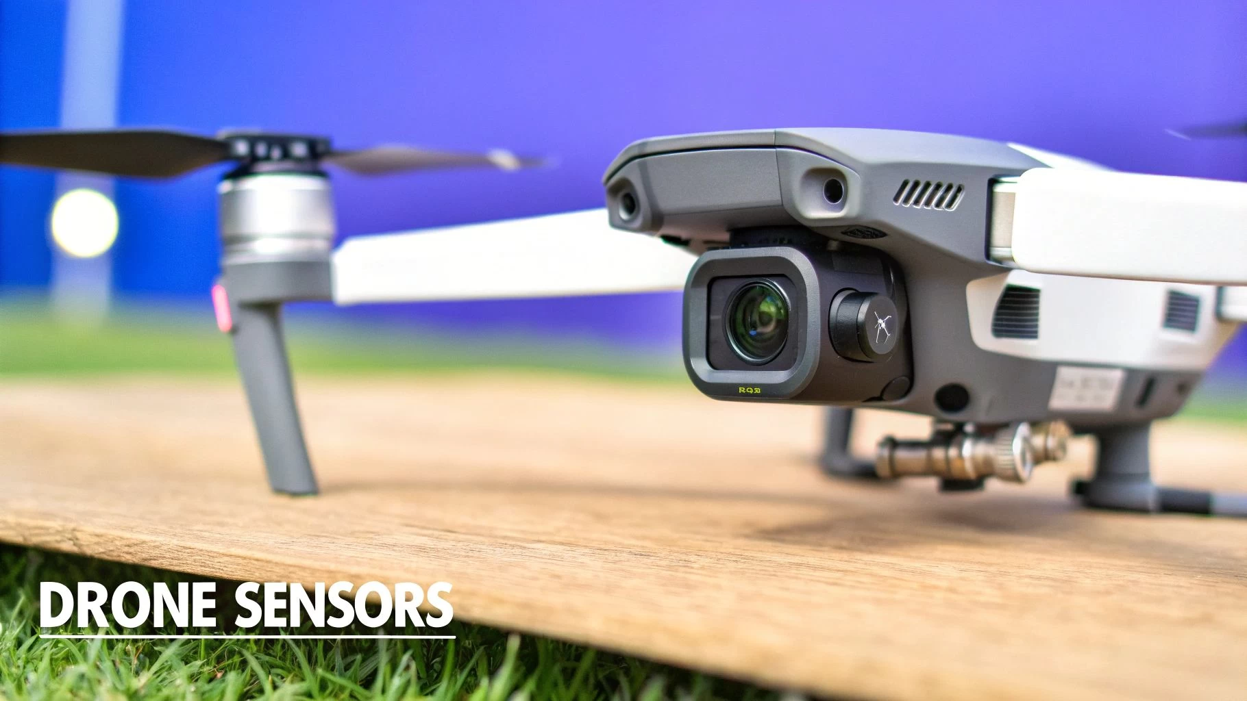
To get a real handle on flight data acquisition, we first need to look under the hood at the drone's sensory system. Think of these bits and pieces as the drone's nervous system; they're constantly pulling in information about the world around it.
These sensors and telemetry systems are the physical foundation that makes every digital flight log, compliance report, and operational insight a reality. Each one has a specific job, and when you combine their data streams, you get a complete, high-fidelity picture of the entire mission.
Let's break down the key parts that turn real-world events into digital records.
The Drone's Inner Ear and Sense of Place
At the heart of any drone's ability to fly is the Inertial Measurement Unit (IMU). This piece of kit is basically the drone's inner ear, giving it a sense of balance and orientation. The IMU uses accelerometers and gyroscopes to measure how the drone is tilting, turning, and moving through space. This constant flood of data lets the flight controller make thousands of tiny adjustments every second to keep the aircraft stable and responsive.
Working hand-in-glove with the IMU is the Global Positioning System (GPS) receiver. If the IMU is the drone's inner ear, the GPS is its map and compass. It provides the exact geographic coordinates—latitude, longitude, and altitude—which are the bedrock of any flight record. This is the data that proves precisely where your drone was at any given moment, a cornerstone for both mission planning and regulatory compliance.
A drone’s flight stability and location tracking depend entirely on the partnership between its IMU and GPS. The IMU handles the micro-movements and orientation, while the GPS provides the macro-position on a global scale.
The Eyes and Beyond: Sensory Payloads
Beyond the essential bits needed just to stay in the air, payload sensors are what give a drone its purpose. These are the tools that gather the valuable data you—or your clients—actually need.
- High-Resolution Cameras: These are the drone's eyes, capturing everything from breathtaking aerial photos to detailed inspection videos. The data here isn't just the images; it also includes crucial metadata like camera settings (ISO, shutter speed) and geotags that link each photo to a specific GPS coordinate.
- LiDAR (Light Detection and Ranging): Think of LiDAR as the drone's ability to 'see' in three dimensions using laser pulses. It measures distances with incredible accuracy, creating detailed point clouds that can be turned into precise 3D models of terrain, buildings, and infrastructure.
- Multispectral and Thermal Cameras: These advanced sensors see light beyond the visible spectrum. Multispectral sensors are a game-changer in agriculture for checking crop health, while thermal cameras detect heat signatures, making them indispensable for everything from solar panel inspections to search and rescue missions.
To help make sense of it all, here's a quick rundown of the main players.
Key Drone Sensors and Their Functions
This table breaks down the most common sensors, what they do, and the kind of data they collect. Think of it as a cheat sheet for your drone's sensory toolkit.
| Sensor Type | Primary Function | Data Captured | Analogy |
|---|---|---|---|
| IMU | Measures orientation & angular rate | Acceleration, rotation, orientation | The drone's inner ear |
| GPS | Determines global position | Latitude, longitude, altitude, time | The drone's map & compass |
| Camera | Captures visual imagery | Photos, videos, geotagged metadata | The drone's eyes |
| LiDAR | Measures distance with light | 3D point clouds, distance data | 3D vision with lasers |
| Thermal | Detects heat signatures | Temperature variations, thermal imagery | Seeing in heat |
| Multispectral | Captures specific light wavelengths | Light reflectance, vegetation indices | Seeing invisible light |
Each of these sensors contributes a unique layer to the overall mission data.
The information gathered by these payload sensors, when layered with the core flight telemetry, creates an incredibly rich and detailed dataset. Understanding how this information gets recorded is just as important as knowing how it’s captured. If you want to dive deeper, check out our guide on professional flight data recorder software.
It's this synergy between hardware components that makes modern flight data acquisition so powerful, providing the raw material for platforms like Dronedesk to generate logs, reports, and vital safety insights.
Decoding the Language of Drones and Data Formats
Once your drone's sensors have captured a mission's worth of information, that raw data needs to be organized into a coherent story. Think of data formats and protocols as the languages drones use to talk—to their own components, to ground stations, and to the software you use to manage your operations. Just like with human languages, each has its own grammar and structure. Figuring them out is the key to unlocking the real value in your flight data acquisition efforts.
This data isn't just a jumble of numbers; it's a structured narrative of the entire flight. Picking the right format is like choosing the best way to tell that story, whether it’s for a quick summary or a detailed forensic analysis. Without a common language, that critical information would stay trapped inside the drone, completely inaccessible and useless.
MAVLink The Universal Translator for Drones
Imagine a world where every phone brand used a different, incompatible charging cable. That’s pretty much the problem MAVLink (Micro Air Vehicle Link) solves for the drone world. It’s a lightweight, open-source messaging protocol that acts as a kind of universal translator, allowing different components like flight controllers, ground stations, and sensors to communicate seamlessly, no matter who made them.
MAVLink packages data into standardized messages for just about everything, from GPS position and battery status to waypoint commands. This common language is the backbone of many open-source drone platforms, creating a flexible ecosystem where a massive range of hardware and software can work together harmoniously.
The key takeaway is that MAVLink creates a common ground, ensuring that data from all sorts of sources can be understood and processed consistently.
Proprietary and Specialized Log Formats
While MAVLink is great as a universal standard, many manufacturers cook up their own proprietary formats to capture incredibly detailed, platform-specific information. These logs are often much richer and more comprehensive because they’re tailored to the unique capabilities of their own hardware.
- DJI Flight Logs: As a giant in the industry, DJI has a seriously sophisticated logging system. Their .TXT or .DAT files are packed with a wealth of information, tracking hundreds of parameters from gimbal angles and stick inputs to individual battery cell voltages. These detailed logs are invaluable for diagnostics and deep performance analysis. You can learn more about how to decipher DJI's detailed flight logs in our dedicated guide.
- Flight Recorder Formats (.blackbox, .ulog): Often called the "black box" for drones, these formats are built for high-fidelity recording, capturing sensor data at incredibly high rates. They are absolutely essential for post-crash investigations and for engineers looking to fine-tune flight performance with extreme precision.
- Comma-Separated Values (CSV): The simplest and most accessible format of them all. CSV files organize data into plain text tables that almost any program can read. While they aren't as detailed as binary logs, their universal compatibility with spreadsheet software like Excel makes them perfect for quick analysis, custom charting, and straightforward data sharing.
The growth in sophisticated data logging isn't unique to drones. The global Flight Data Acquisition Unit (FDAU) market, which hit $1.2 billion, is projected to reach $2.5 billion by 2034. This mirrors the demand in commercial aviation, where FDAUs collect over 1,000 flight parameters to ensure safety. For drone professionals, platforms like Dronedesk serve a similar function, syncing detailed logs to improve safety and compliance on a smaller but equally critical scale.
Getting a handle on these different "languages" is the final step in the capture process. It’s what ensures the story of your flight can be properly read, analyzed, and integrated into your operational workflow, transforming all those raw data points into genuine, strategic assets.
Best Practices for Reliable Flight Data Collection
Knowing what flight data is and how it’s formatted is one thing. Actually capturing clean, reliable data, mission after mission? That’s another challenge entirely.
Top-quality flight data acquisition isn't something that just happens by accident. It's the direct result of a solid, professional workflow that puts data integrity first at every single stage, from your pre-flight checks right through to how you archive everything afterwards.
Getting these best practices nailed down turns data collection from just another box-ticking exercise into a real strategic advantage. It means every log is accurate, every file is secure, and every mission adds to a trustworthy record of your operations. This is the discipline that separates the pros from those leaving compliance and safety to chance.
Pre-Flight Protocols for Data Integrity
The groundwork for great flight data is laid long before your drone even thinks about leaving the ground. A thorough pre-flight routine is your first line of defense against dodgy or incomplete data. This goes way beyond just checking your props and batteries; it’s about making sure the systems that record your mission's story are ready to go.
Your pre-flight data checklist should have a few key things on it:
- Sensor Calibration Verification: Never just assume your IMU and compass are good to go. Run through or verify the calibrations just as the manufacturer suggests, especially if the drone has been rattling around in a vehicle or stored near anything magnetic. A wonky IMU calibration can throw off all your orientation data, messing up the entire flight log.
- GPS Signal Lock Confirmation: Make sure you have a solid GPS lock with plenty of satellites before you even think about taking off. A weak signal means inaccurate position data, making your logs pretty useless for compliance or for creating accurate maps.
- Storage Media Check: Check that your SD cards or internal storage have enough room and are working properly. A full or faulty card is a ridiculously common, and totally preventable, reason for losing data. Get into the habit of formatting your cards regularly to avoid file system errors.
Ensuring Robust Data Synchronization and Storage
Once the mission is wrapped up, your focus needs to shift to looking after the data you’ve just carefully collected. How you handle syncing and storing that data is crucial, especially as your operations get bigger. A messy folder on a single laptop just won't cut it for a professional operation.
Think of data syncing like pulling together notes from several different meetings into one master document. If the timestamps are all over the place or files are named incorrectly, the whole record becomes a chaotic mess. This is a massive issue on complex jobs with multiple drones, where a perfectly synced timeline is absolutely essential for proper analysis.
The aim is to create a single source of truth for every mission. Good synchronization and secure storage aren't just about backing up files; they’re about maintaining a coherent, defensible history of your operations that can be audited and analysed with total confidence.
Choosing the Right Storage Solution
Your storage strategy needs to fit the size and complexity of your operations. What works for a solo pilot is a world away from what an enterprise with a massive fleet needs.
- For Solo Pilots: Local storage on high-quality external hard drives or a Network Attached Storage (NAS) system can work well. The trick is to have a disciplined backup routine—ideally, follow the 3-2-1 rule (three copies of your data, on two different types of media, with one copy stored offsite).
- For Teams and Enterprises: A cloud-based platform pretty much becomes a necessity. Centralised cloud storage gives the whole team secure, permission-based access, handles backups automatically, and builds a scalable archive. Platforms like Dronedesk are built for this, syncing flight logs straight to a central dashboard for instant analysis and record-keeping.
Upholding Data Security and Compliance
Finally, every professional drone pilot has a duty to protect the data they collect. Flight data can contain all sorts of sensitive information, from details of a client's project to images of private property. Securing this data is a cornerstone of professional trust and a major compliance requirement.
Put strong security measures in place to protect your data, whether it's being transferred or just sitting on a drive. Use strong, unique passwords for all your accounts and switch on two-factor authentication wherever you can. When you're moving files around, use secure methods, not unencrypted email attachments.
When it comes to compliance, keeping an organised, unchangeable record of all your flight operations is non-negotiable. This is where drone operations platforms really prove their worth. By automatically parsing and storing flight logs in a structured way, they create an audit trail that's easy to follow, proving your due diligence to regulators and clients, and cementing your reputation as a reliable, professional operator.
Turning Raw Data into Actionable Business Insights
Raw flight data, fresh off the drone, is a bit like unrefined crude oil—it’s packed with potential, but you can’t exactly put it straight into your car. The real magic happens when you process that dense stream of numbers, turning a jumble of log files into a powerful strategic asset. This is where post-mission processing and a solid drone operations platform come into play, refining that raw data into clear, actionable business intelligence.
This isn't just about saving a few minutes here and there. It completely removes the soul-crushing hours of manual data entry and all but eliminates the risk of human error. Instead of wrestling with inscrutable log files, you get straight to the insights that help you run smarter, safer, and more profitable operations.
The whole process, from pre-flight checks to post-flight analysis, is a cycle. Getting it right means every stage feeds into the next, ensuring the data you collect is reliable and ready to be put to work.
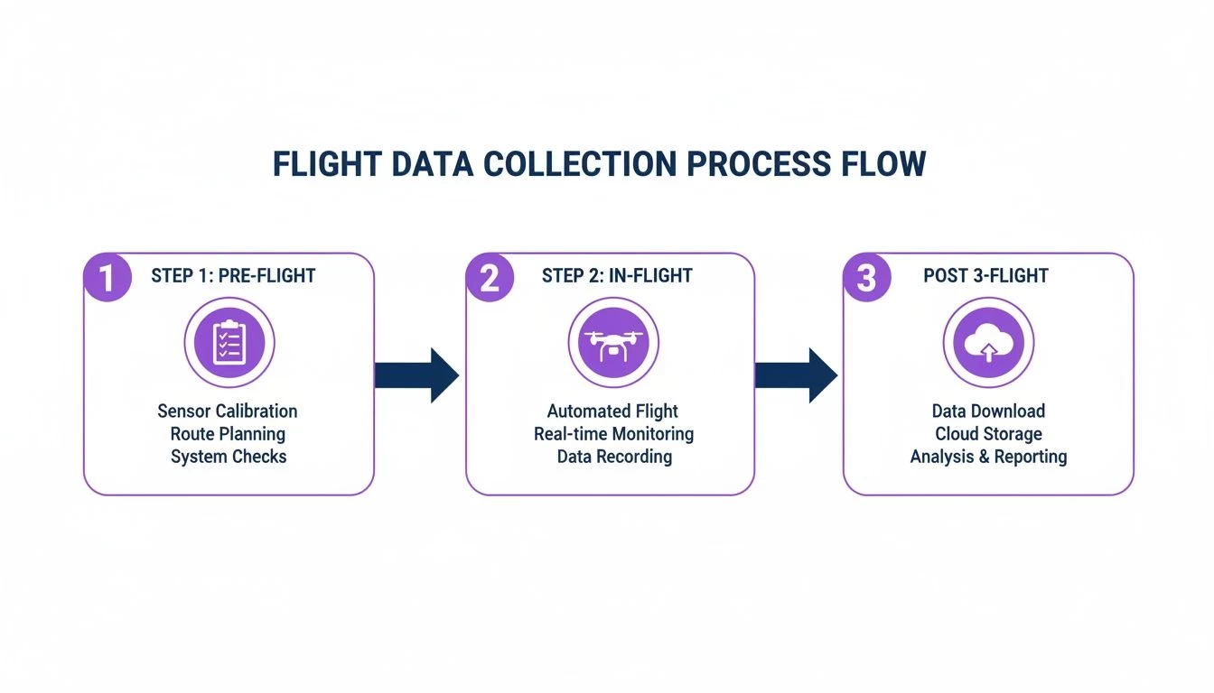
This workflow is the backbone of professional drone operations, maintaining data integrity from start to finish. It’s about building a complete, unbroken chain of operational excellence.
Automating the Administrative Burden
Imagine this: you've just wrapped up a complex mission. Instead of sitting down for an hour to manually type out flight times, locations, and battery usage, you simply upload the flight log. Instantly, a smart platform like Dronedesk parses that data and automatically populates all the records for that mission. That’s the reality of modern drone management.
This kind of automation goes way beyond simple data entry. The platform can:
- Auto-populate flight records: Instantly fill in crucial details like flight duration, maximum altitude, and distance flown. You get a perfect digital paper trail with zero manual effort.
- Track equipment usage: Log the exact flight time for specific drones, batteries, and payloads. This gives you precise data for scheduling maintenance based on actual use, not just a gut feeling.
- Generate compliance reports: With every flight accurately logged and organised, creating reports for aviation authorities or clients becomes a simple matter of a few clicks.
The aim here is to graduate from mere data collection to achieving true data intelligence. By automating the donkey work, you free up your valuable time to focus on what actually matters—analysing the results and making strategic decisions.
An automated approach to flight data acquisition and processing turns compliance from a headache into a seamless, almost invisible, background process.
Fueling Smarter Business Decisions
Once your flight data is processed and neatly organised, it transforms into a goldmine of business insights. This structured information can power detailed reports that give you a bird's-eye view of your entire operation, helping you make properly informed decisions that impact every corner of the business.
This isn’t a new concept. The broader aviation industry has relied on this for decades. The flight data monitoring (FDM) market in North America is valued at USD 1.21 billion, showing just how deeply data analysis is woven into the safety and efficiency programs of major airlines. That market is projected to hit USD 5.56 billion by 2034, all driven by the demand for real-time analytics. Drone platforms are essentially mirroring this on a more accessible scale, syncing logs to boost productivity and safety.
By pulling together data from all your missions, you can generate powerful reports for:
- Financial Oversight: Accurately track flight hours and asset usage on a per-project basis. This leads to much more precise job costing and a clearer picture of your profitability.
- Asset Management: Keep a close eye on the health and lifecycle of your fleet. You can spot underperforming batteries or identify drones that need maintenance before they fail, preventing costly downtime.
- Operational Analysis: Analyse team performance, spot patterns in how missions are flown, and pinpoint where extra training or workflow tweaks could make a big difference. If you want to get into the weeds on this, you can learn how to analyze a drone log file in our detailed guide.
Ultimately, turning raw data into insights creates a powerful feedback loop. It helps you continuously improve your operations, making your business more competitive, compliant, and profitable in the long run.
Practical Use Cases Across Drone Professions
Theory is one thing, but the real power of solid flight data acquisition shines when you apply it to the everyday grind of a professional drone pilot. The data you gather isn't just some technical log; it's a powerful tool that solves real business problems, builds trust with your clients, and lays the groundwork for serious growth.
Of course, what you need from that data depends entirely on what you do. For a freelance photographer, it might be all about proving compliance for a single job. For a huge company, it's about seeing the big picture across an entire fleet of drones.
Let's break down how this data makes a real difference for different kinds of drone pros.
For the Solo Photographer and Videographer
When you're a one-person creative show, your reputation is your currency. Clients don't just hire you for your artistic flair; they're paying for your professionalism and reliability. Flight data acts as your bulletproof evidence that you operate safely and by the book, adding a massive layer of trust and protection.
Picture this: a client gets nervous and questions whether you flew too high over their property. Instead of just giving them your word, you can pull up a detailed flight log showing the exact flight path and maximum altitude. Dispute over. That data is your professional alibi.
- Proof of Compliance: Effortlessly pull logs showing you stayed within authorised airspace and stuck to the mission plan.
- Client Reassurance: Hand over a flight summary that screams safety and precision, putting nervous clients at ease.
- Incident Investigation: If something does go wrong, you have a detailed, second-by-second record to figure out what happened, protecting you from liability.
For the Small Survey and Inspection Team
If you're part of a small crew doing detailed surveys or infrastructure inspections, accuracy is everything. The success of a 3D model or a thermal inspection lives or dies on perfectly synced data from every sensor on your drone. In this world, flight data acquisition is the superglue holding the whole project together.
Think about a LiDAR survey to create a high-res topographical map. The final model is only as good as the data that goes into it. A solid data log ensures every single laser point from the LiDAR is perfectly matched with the drone's precise GPS location and IMU orientation. Without that perfect marriage of data, your final map would be a distorted, useless mess and the entire mission would be a write-off.
For technical teams, flight data isn't just a mission record—it's a critical ingredient in the final product. The quality of your data directly defines the value of what you deliver.
For the Enterprise Operations Manager
Running a large fleet of drones and pilots brings its own unique headaches. You're juggling standardization, safety, and efficiency on a massive scale. For an enterprise manager, aggregated flight data provides that crucial bird's-eye view you need to run a safe, compliant, and cost-effective drone program. Data from hundreds of missions becomes your ultimate analytical tool.
By digging into fleet-wide data, a manager can spot a pilot who consistently pushes their batteries to the limit, flagging a need for a quick chat or some extra training. In the same way, tracking the total flight hours for each drone automates your maintenance schedule, preventing surprise equipment failures and expensive downtime. It's this proactive, data-driven approach that keeps a large-scale operation running like a well-oiled machine and proves regulatory compliance across the board.
A Few Common Questions About Flight Data
Even when you've got the basics down, a few questions always pop up when it comes to putting flight data acquisition into practice. Let's clear up some of the most common ones pilots ask.
Why Can't I Just Use My Drone App's Log?
It's a fair question. While the basic log from your drone's app is a decent starting point, think of it as a quick summary versus the full story. For professional work, it just doesn't have the depth you need for serious compliance or operational analysis.
A proper flight data acquisition workflow captures a massive range of parameters—often hundreds more than a standard app provides. More importantly, when you feed that detailed data into a management platform like Dronedesk, you create a permanent, auditable record that's always accessible. This isn't just about ticking a box; it automates your compliance reporting and delivers business insights a simple log file never could.
How Much Data Are We Actually Talking About Here?
The amount of data a mission generates can vary wildly. It really comes down to the mission type and what payload you're flying. A 20-minute mapping flight with a high-res camera might spit out several gigabytes of images, but the core telemetry log itself? That could be just a few megabytes.
The real challenge isn't the size of the data, but how you manage it. For a solo pilot, a couple of external hard drives might do the trick. But once you're running a team, a centralised cloud platform becomes non-negotiable for secure storage, easy access, and reliable long-term archiving.
Does Better Data Really Make My Operations Safer?
Absolutely. It's the difference between being proactive and reactive about safety. When you have detailed flight data, you can spot potential problems in your post-mission analysis long before they turn into critical failures in the air.
For instance, by tracking battery voltage trends across dozens of flights, you can accurately predict when a battery is starting to degrade. This lets you retire it safely before it decides to fail mid-mission. In the same way, reviewing flight paths and proximity alerts helps you spot and correct risky pilot habits, building a safety culture based on hard evidence, not just guesswork.
Ready to turn your raw flight data into your most valuable business asset? See how Dronedesk automates flight logging, streamlines compliance, and unlocks real-world insights for your entire operation. Explore Dronedesk today.
 What a BVLOS Flight Means for Risk and Compliance →
 Drone VLOS Rules Explained for Commercial Teams →
 FAA Remote ID Rule Explained for Commercial Pilots →
 Drone Legal Requirements for Commercial Operations →
 Drone Near Airport Rules Explained for Safer Planning →
 International Drone Regulations Every Global Team Should Know →
 Drone Flight Risk Assessment Example for Safer Missions →
 Beyond Visual Line of Sight Explained for Operators →
 How BVLOS Drone Operations Change Commercial Workflows →
 FAA Drone Rules Every Commercial Pilot Should Know →