Beyond Visual Line of Sight BVLOS Explained
Beyond visual line of sight, usually shortened to BVLOS, is one of the most important concepts in the future of commercial drone operations. It is also one of the most misunderstood.
For many operators, BVLOS sounds like a simple distance issue: fly the drone further than you can see it. In reality, it is a regulatory, technical and operational step change. It affects how you plan missions, manage risk, monitor airspace, maintain command and control, train remote pilots and prove that your operation can be conducted safely.
For survey companies, utility operators and emergency services, BVLOS can unlock missions that are hard, expensive or risky to complete with visual line of sight flying. But it is not something to treat as an add-on to normal drone work. It requires a different level of evidence, process and operational discipline.
What does beyond visual line of sight BVLOS mean?
Beyond visual line of sight BVLOS means the remote pilot cannot maintain direct, unaided visual contact with the unmanned aircraft well enough to monitor its flight path, avoid collisions and respond safely to hazards.
The key word is “unaided”. Corrective glasses or contact lenses are normally acceptable, but binoculars, a live video feed, telemetry or a map display do not turn a BVLOS flight into a visual line of sight flight. If the remote pilot is relying on instruments, sensors or another system instead of direct visual observation to keep the aircraft safely separated, the operation is likely to be BVLOS.
BVLOS is not defined by one fixed distance. A small aircraft may become impossible to see safely at a few hundred metres in poor light, while a larger aircraft in clear conditions may be visible further away. Weather, aircraft size, background, terrain, lighting and the pilot’s position all matter.
The practical test is simple: can the remote pilot see the drone clearly enough, throughout the flight, to understand its orientation, monitor the surrounding airspace and take timely action to avoid conflict? If not, the operation has moved beyond visual line of sight.
VLOS, EVLOS and BVLOS compared
Drone operators often hear VLOS, EVLOS and BVLOS used together, but they are not interchangeable. The distinction matters because each model carries a different risk profile and usually a different approval burden.
| Operating model | What it means | Typical use | Key limitation |
|---|---|---|---|
| VLOS | The remote pilot keeps direct unaided visual contact with the drone | Standard inspection, photography, local mapping and public safety overwatch | Range is limited by visibility, terrain and the pilot’s position |
| EVLOS | Extended visual line of sight, often using trained observers to maintain visual contact and communicate with the pilot | Corridor inspections, events, larger survey areas | Still depends on human visual observation and robust communications |
| BVLOS | The drone operates where the remote pilot cannot maintain direct unaided visual contact | Long linear inspections, remote site monitoring, drone-in-a-box operations, emergency response | Requires stronger technical, procedural and regulatory controls |
EVLOS can sometimes feel like a bridge between VLOS and BVLOS, but it is not the same as BVLOS. In EVLOS, people are still visually monitoring the aircraft or surrounding airspace as part of the safety model. In BVLOS, the operation must rely on other mitigations, such as detect-and-avoid capability, airspace controls, strategic deconfliction, operating environment restrictions and robust contingency procedures.
Why BVLOS matters for commercial drone operations
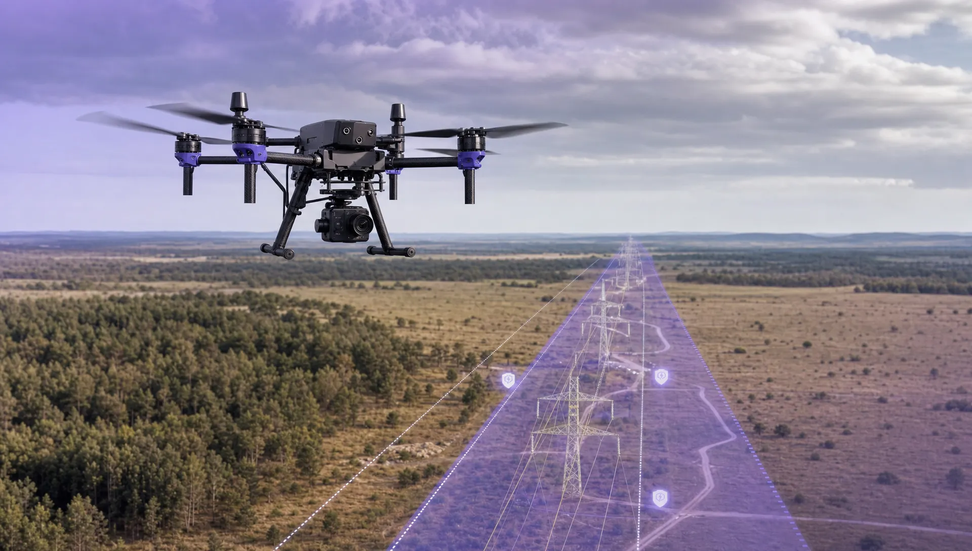
BVLOS matters because many high-value drone missions are not naturally suited to short-range VLOS flying. A visual inspection of one roof, one cell tower or one construction site may fit well within VLOS. A 40 km powerline, a pipeline corridor, a railway route, a floodplain or a remote search area usually does not.
For commercial and public sector operators, BVLOS can make drone operations more scalable by reducing the need to reposition pilots repeatedly along a route. It can also keep people away from hazards such as steep terrain, live highways, rail corridors, contaminated sites or unstable structures.
Common BVLOS use cases include:
- Utility inspections of powerlines, substations, wind farms, pipelines and water infrastructure.
- Survey and mapping of large sites, linear corridors, quarries, coastlines and agricultural areas.
- Emergency services support for search and rescue, flood assessment, wildfire monitoring, traffic incidents and hazardous material events.
- Security and remote monitoring using scheduled patrols or drone-in-a-box deployments.
- Environmental and asset monitoring across locations that are difficult, dangerous or slow to access on foot.
The strongest BVLOS business cases usually have three things in common: the mission area is large, the environment is repetitive or well understood, and the safety benefit of reducing human exposure is clear.
Why BVLOS is harder than normal drone flying
The main challenge with BVLOS is not just distance. It is the loss of the remote pilot’s direct visual role in collision avoidance and situational awareness.
During a VLOS flight, the pilot can look up, see the drone, notice a helicopter, spot unexpected people entering the area and judge whether the aircraft is drifting towards a hazard. In BVLOS, those tasks must be handled through a combination of planning, technology, procedures and operational limits.
A BVLOS operation must answer questions such as:
- How will the drone remain separated from other airspace users?
- What happens if the command and control link is degraded or lost?
- How will the operator know if people, vehicles or aircraft enter the operating area?
- What contingency actions are programmed, briefed and tested?
- What evidence shows that the aircraft, crew and procedures are reliable enough for the proposed mission?
This is why regulators treat BVLOS as an advanced operation rather than a routine extension of range.
The UK regulatory position in 2026
In the UK, BVLOS is generally outside the scope of routine Open Category drone flying. Operators normally need to work within the Specific Category and obtain an appropriate operational authorisation from the Civil Aviation Authority (CAA), unless a very specific exemption or framework applies.
The CAA’s primary reference for unmanned aircraft operations is CAP 722, which sets out regulatory guidance for UAS operations in UK airspace. Operators considering BVLOS should use current CAA material rather than relying on older blog posts, forum advice or assumptions based on another country’s rules.
In practice, a BVLOS approval is usually tied to a clearly defined concept of operations. It is not a blanket permission to fly anywhere beyond sight. The authorisation may be limited by aircraft type, geography, altitude, airspace, crew roles, procedures, communications systems, weather minima, operating volume, contingency arrangements and other mitigations.
The regulatory pathway may involve an Operational Safety Case, a Specific Operations Risk Assessment or another accepted method depending on the nature of the operation and the CAA’s current framework. Because this area continues to evolve, especially around detect-and-avoid, electronic conspicuity and lower-risk environments, operators should check the latest CAA guidance before investing heavily in equipment or writing procedures.
For teams tracking changes in regulation, technology and market adoption, Dronedesk also maintains a curated drone industry newsfeed that can help operators keep an eye on BVLOS developments.
What a BVLOS operation has to prove
A credible BVLOS proposal needs to show that the operator understands the risk and has proportionate controls in place. Regulators are not just interested in whether the drone can technically fly the route. They want to know whether the overall system is safe.
That system includes the aircraft, remote pilot, operating procedures, software, communications links, maintenance regime, emergency response plan, airspace environment and organisational oversight.
The core areas usually include:
| Area | What needs to be demonstrated | Example evidence |
|---|---|---|
| Concept of operations | What the mission is, where it happens and how it will be controlled | Route maps, operating volumes, roles, procedures and limitations |
| Air risk | How other aircraft will be avoided or deconflicted | Airspace analysis, detect-and-avoid strategy, NOTAM or airspace coordination where applicable |
| Ground risk | How people and property on the ground are protected | Population analysis, buffer zones, emergency landing areas and containment strategy |
| Command and control | How the aircraft stays connected and what happens if the link fails | Link performance data, lost-link procedures and tested failsafes |
| Crew competence | How the team is trained for normal and abnormal situations | Training records, role descriptions, simulations and emergency drills |
| Aircraft reliability | Whether the aircraft is suitable for the operation | Maintenance records, technical specifications, redundancy and flight history |
| Operational assurance | How the operator learns, audits and improves | Flight logs, occurrence reporting, checklists and review processes |
The important point is that BVLOS approval is evidence-led. A polished document is not enough if the operator cannot show that procedures are used consistently in real operations.
The technical building blocks of BVLOS
BVLOS operations vary widely, from a rural infrastructure inspection to an automated drone dock in an industrial site. However, most rely on a similar set of technical and procedural building blocks.
Command and control link reliability is fundamental. The aircraft must receive instructions and send back the information needed to monitor its status. Operators need to understand link coverage, latency, interference, redundancy and the behaviour of the drone if the connection is lost.
Detect and avoid is another major challenge. In VLOS operations, the pilot’s eyes are the primary detection system. In BVLOS, detection may involve a mix of onboard sensors, ground-based systems, electronic conspicuity, procedural segregation, airspace restrictions or operating in environments where the air risk is demonstrably low.
Geographical containment helps prevent the drone from leaving its approved operating volume. This may include geofencing, flight termination logic, buffer areas, emergency landing points and carefully designed routes.
Human oversight remains essential. BVLOS does not remove the remote pilot or operations team from responsibility. Even when flight automation is used, humans must understand the mission, monitor the system, manage abnormal situations and know when to stop.
Accurate records are also vital. Logs, checklists, maintenance records, risk assessments and incident reports help prove that the operation is being conducted as authorised and that lessons are being captured.
BVLOS and autonomous drones are not the same thing
BVLOS is often discussed alongside autonomy, but they are different concepts.
A drone can fly BVLOS while still being actively managed by a remote pilot. Equally, a drone can perform automated waypoint flying within visual line of sight. Autonomy describes how much of the flight is handled by onboard systems or software. BVLOS describes whether the remote pilot can maintain direct visual contact.
This distinction matters for safety cases. An automated BVLOS mission needs to address both the risks of operating beyond sight and the risks associated with automation, such as route programming errors, sensor failure, unexpected obstacles or degraded positioning accuracy.
For drone-in-a-box systems, the operational model may also need to address site security, remote supervision, automated pre-flight checks, weather sensing, launch and recovery area control, and how the operation is stopped if conditions move outside approved limits.
How BVLOS changes flight planning
BVLOS flight planning is more detailed than a normal VLOS job. The planning process must consider not just the route, but the safety envelope around the route and the assumptions that make the flight acceptable.
For a linear inspection, for example, the route itself may be straightforward. The harder questions are often around where the aircraft can safely go if something fails, where people may appear unexpectedly, how low-level aircraft activity will be detected, and what communications coverage exists across the full operating area.
Good BVLOS planning normally includes:
- A defined operating volume with lateral and vertical limits.
- Buffer areas and contingency volumes for abnormal situations.
- Airspace review, including nearby aerodromes, low-flying activity and temporary restrictions.
- Ground risk review, including roads, buildings, public access points and gatherings.
- Weather thresholds, including visibility, wind, precipitation and icing risk where relevant.
- Emergency landing or recovery options.
- Crew communication plans and escalation procedures.
This is where operational consistency becomes important. If every pilot plans in a different format or stores records in a different place, it becomes harder to demonstrate control. Operators moving from occasional VLOS jobs towards advanced permissions should standardise how they plan, approve, brief, fly and review missions.
For organisations managing multiple aircraft, pilots and maintenance schedules, a structured approach to drone fleet management becomes increasingly important before advanced operations such as BVLOS are introduced.
What BVLOS means for survey companies
Survey companies are often attracted to BVLOS because mapping and inspection work frequently involves large areas or long corridors. Roads, railways, pipelines, quarries, coastlines and agricultural sites can be inefficient to capture through repeated short VLOS flights.
BVLOS can support more continuous data capture, but it also raises expectations around repeatability. Survey operators need to think beyond image overlap and ground sampling distance. They must also consider airspace risk, public access, aircraft reliability, data integrity, battery strategy, handover procedures and emergency recovery.
A strong BVLOS survey operation is not just a mapping workflow with more range. It is a controlled aviation operation that happens to collect survey data.
What BVLOS means for utilities and infrastructure operators
Utility companies are among the clearest beneficiaries of BVLOS because their assets often stretch across remote, hazardous or difficult terrain. Powerlines, pipelines, water networks, rail corridors and wind farms all create inspection challenges that drones can help solve.
The operational case is often strongest when BVLOS reduces the need for people to access dangerous areas, climb structures, walk long corridors or work near live assets. However, utilities also tend to operate in complex environments, including roads, settlements, controlled airspace, private land and critical infrastructure sites.
That means stakeholder coordination is a major part of BVLOS readiness. Landowners, asset managers, air navigation stakeholders, local authorities, emergency contacts and internal safety teams may all need to be considered before routine BVLOS operations can scale.
What BVLOS means for emergency services
Emergency services have a different BVLOS profile because incidents are dynamic. A search area, wildfire, flood zone or major traffic incident may change quickly, and the value of aerial information can be time-critical.
BVLOS could help emergency teams extend situational awareness without sending responders into unsafe areas. It may also support remote overwatch, missing person searches, flood mapping and hazardous scene assessment.
The challenge is that emergency operations cannot rely on perfect conditions. Procedures need to be simple enough to apply under pressure, while still meeting authorisation requirements. Crew roles, command structure, communications with incident commanders and handover between teams all need to be clear.
The importance of structured drone programme management is reflected in Dronedesk’s law enforcement drone operations case study, which shows how a public sector team approached pilots, assets, maintenance and regulatory oversight in an in-house drone programme.
Preparing your organisation for BVLOS
Not every operator is ready for BVLOS, even if they have experienced pilots and capable aircraft. Readiness is usually organisational before it is technical.
Before pursuing BVLOS, ask:
- Do we have consistent flight planning, risk assessment and approval processes?
- Are pilot qualifications, currency and role responsibilities clearly recorded?
- Can we prove aircraft maintenance, defects, batteries and equipment status?
- Do our checklists match the way we actually operate?
- Are abnormal and emergency procedures trained, not just written?
- Can we retrieve flight logs and safety records quickly if audited?
- Do we have a clear safety culture for reporting issues and stopping unsafe flights?
If the answer to several of these questions is no, the best first step may be to strengthen standard operations before attempting BVLOS. Regulators are more likely to trust an operator that can show disciplined, repeatable VLOS operations than one that jumps straight to advanced concepts without strong records.
How Dronedesk can support BVLOS readiness
Dronedesk is not a BVLOS approval service, and it does not replace the need for regulatory authorisation, specialist safety work or competent aviation judgement. However, it can support the operational foundations that advanced drone programmes need.
For teams preparing for more complex missions, Dronedesk’s drone operations management features bring key administration into one platform, including client management, fleet management, team management, airspace intelligence, proximity intelligence, flight planning, flight logging, data reporting, configurable checklists and risk assessments.
Those capabilities are relevant because BVLOS depends heavily on evidence and consistency. Operators need to show what was planned, who was involved, which aircraft was used, what checks were completed, what risks were assessed and what happened during and after the flight.
For survey companies, utilities and emergency services, that operational record can become as important as the aircraft itself. BVLOS is not just about flying further. It is about being able to demonstrate control across the whole operation.
Frequently Asked Questions
What does BVLOS stand for? BVLOS stands for beyond visual line of sight. It describes a drone operation where the remote pilot cannot maintain direct, unaided visual contact with the aircraft throughout the flight.
Is BVLOS legal in the UK? BVLOS can be legal in the UK, but it normally requires the appropriate CAA authorisation in the Specific Category or another valid regulatory framework. Operators should check current CAA guidance before planning BVLOS work.
Can I use a live camera feed to make a flight VLOS? No. A camera feed can support situational awareness, but it does not usually count as unaided visual contact with the drone. If the pilot cannot directly see the aircraft well enough to avoid hazards, the flight is likely to be BVLOS.
Is EVLOS the same as BVLOS? No. EVLOS extends visual line of sight using trained observers or defined procedures, while BVLOS involves operating where the remote pilot cannot maintain direct unaided visual contact. The safety case and approval requirements can be different.
What types of drones can fly BVLOS? BVLOS suitability depends on the aircraft, operating environment, safety systems, command and control link, procedures and regulatory approval. There is no universal rule that a particular drone is automatically suitable for BVLOS in all contexts.
Do I need detect-and-avoid for BVLOS? Some form of collision risk mitigation is required, but the exact approach depends on the operation. It may involve technology, airspace procedures, operating restrictions, electronic conspicuity, observers, strategic deconfliction or a combination of measures.
Build the foundations before flying beyond sight
BVLOS is one of the biggest opportunities in professional drone operations, but it rewards preparation. The operators most likely to succeed are those that can combine a strong safety case with disciplined day-to-day management of people, aircraft, planning, risk and records.
If your organisation is preparing for more advanced drone operations, Dronedesk can help you centralise the operational admin that supports safer, more consistent flying. Explore Dronedesk to see how it supports flight planning, risk assessments, checklists, fleet management, team management and flight logging in one platform.
 Drone Legal Requirements for Commercial Operations →
 Drone Near Airport Rules Explained for Safer Planning →
 International Drone Regulations Every Global Team Should Know →
 Drone Flight Risk Assessment Example for Safer Missions →
 Beyond Visual Line of Sight Explained for Operators →
 How BVLOS Drone Operations Change Commercial Workflows →
 FAA Drone Rules Every Commercial Pilot Should Know →
 FAA 107 Explained for Commercial Drone Operators →
 Canadian Drone Regulations Explained for Business Use →
 FAA Part 107 Drone License Explained for Beginners →