A Pilot's Guide to Class E Airspace Rules
Class E airspace rules lay out how pilots operate within this massive slice of controlled airspace, which is primarily designed to protect aircraft flying under Instrument Flight Rules (IFR). Unlike its more restrictive cousins, Class E often doesn't have a control tower, but it still comes with specific requirements for weather visibility and equipment.
For drone pilots, the most important thing to know is where this airspace actually begins—at the surface, 700 feet, or 1,200 feet—because that simple fact determines whether or not you need flight authorization.
Decoding the Sky's Connective Tissue
Think of the national airspace system like a network of roads. Class B and C are the bustling city centers with stoplights and strict traffic control. Class G is like a quiet country lane with almost no rules.
Class E? That’s the sprawling highway system connecting everything. It's technically controlled airspace, but it often feels a lot more flexible than the others.
This "everywhere" airspace exists to give aircraft a safe, managed environment, especially for those flying under IFR who are relying on air traffic control for guidance. It makes sure that even when a plane is cruising between major airports or approaching a smaller airfield without a tower, it’s still separated from other traffic. This is exactly why you'll find Class E starting at all sorts of different altitudes.
Why Class E Airspace Is So Common
The whole point of Class E is to create a safe corridor for aircraft as they move through different phases of flight. It’s a real workhorse, serving a few key functions:
- Protecting Instrument Approaches: Around many airports, you'll see Class E extend down to 700 feet above the ground. This shields aircraft as they descend through clouds using their instruments.
- Defining Federal Airways: It forms the "highways in the sky" that IFR traffic follows between cities, creating predictable routes that are easier for air traffic controllers to manage.
- Filling in the Gaps: In vast rural areas, Class E usually kicks in at 1,200 feet, making sure that once an aircraft climbs up to a cruising altitude, it enters a controlled, protected environment.
This FAA sectional chart excerpt is a great example of how Class E is shown on a map. That faded magenta line is your clue, indicating where the floor of the airspace begins.

As the chart shows, this airspace often wraps around airports to protect those instrument procedures—a critical concept for any pilot to get their head around.
To give you a quick cheat sheet, here are the main things to remember about Class E.
Key Characteristics of Class E Airspace
| Characteristic | Description |
|---|---|
| Primary Purpose | To protect aircraft operating under Instrument Flight Rules (IFR). |
| Control Status | It's controlled airspace, even without a control tower. |
| Common Altitudes | Typically begins at 700 ft or 1,200 ft AGL, but can extend to the surface. |
| Upper Limit | Extends up to, but not including, 18,000 ft MSL. |
| Drone Pilot Concern | Authorization is required if flying in Class E that goes down to the surface. |
This table should help you keep the most important details straight as you plan your flights.
For drone operators, this isn't just trivia—understanding these boundaries is non-negotiable. Even though your typical 400-foot flight ceiling keeps you in the clear (Class G) most of the time, you absolutely have to know when Class E extends all the way to the surface. Flying there requires specific flight authorization.
If you want to dive even deeper, our complete guide on what is Class E airspace offers a ton of additional insights and examples. Getting this foundational concept right is the first step toward navigating the skies safely and making sure every flight is by the book.
Identifying Where Class E Airspace Begins
Knowing exactly where uncontrolled Class G airspace ends and controlled Class E begins is one of the most fundamental skills for any pilot. This isn't just about reading a map; it's about seeing the invisible architecture of the sky.
Think of Class E as a ceiling hanging over the ground. Your job is to figure out just how high that ceiling is wherever you plan to fly.
This "floor" of Class E airspace isn't set at one standard altitude across the board. It shifts depending on the needs of the local airspace, mostly to protect aircraft as they approach and depart from airports. The two most common starting altitudes you'll run into are 700 feet and 1,200 feet Above Ground Level (AGL).
Reading the Aeronautical Chart
Your go-to tool for spotting these boundaries is a VFR sectional chart. These maps use specific visual cues to show you where the floor of Class E airspace changes. Learning to spot these is completely non-negotiable for safe, compliant flights.
The key is to look for the soft, colored borders or lines that outline different areas:
- Faded Magenta Line: When you see a thick, faded magenta border, it's a clear signal that Class E airspace starts at 700 feet AGL. This lower floor is typically found around airports that have published instrument approach procedures. It gives IFR traffic a protected environment much sooner as they descend.
- Faded Blue Line: In areas marked with a faded blue border, the floor of Class E kicks in higher up, at 1,200 feet AGL. You'll often see this in more remote areas, far from the hustle of busy airfields. And if you don't see any colored lines at all? The default is that Class E begins at 1,200 feet AGL.
The chart below gives you a great visual on why knowing your position and the airspace rules is so critical.

It really drives home the point that a pilot's awareness is central to navigating these invisible boundaries safely.
When Class E Starts at the Surface
There’s one more critical scenario to watch for, and it’s a big one for drone pilots. Sometimes, Class E airspace extends all the way down to the ground. When this happens, it creates a zone with zero Class G airspace whatsoever.
On a sectional chart, a dashed magenta line enclosing an airport indicates that Class E airspace begins at the surface. Flying a drone in this area, at any altitude, requires specific authorization from the FAA, typically through the LAANC system.
This setup is used for airports that have weather observers and approved instrument procedures but don't have an operating control tower. It ensures every single aircraft operation, from takeoff to landing, happens inside a controlled environment.
For a drone pilot, misidentifying a surface-level Class E area is one of the easiest ways to end up with an airspace violation. It makes chart interpretation an absolutely essential pre-flight task.
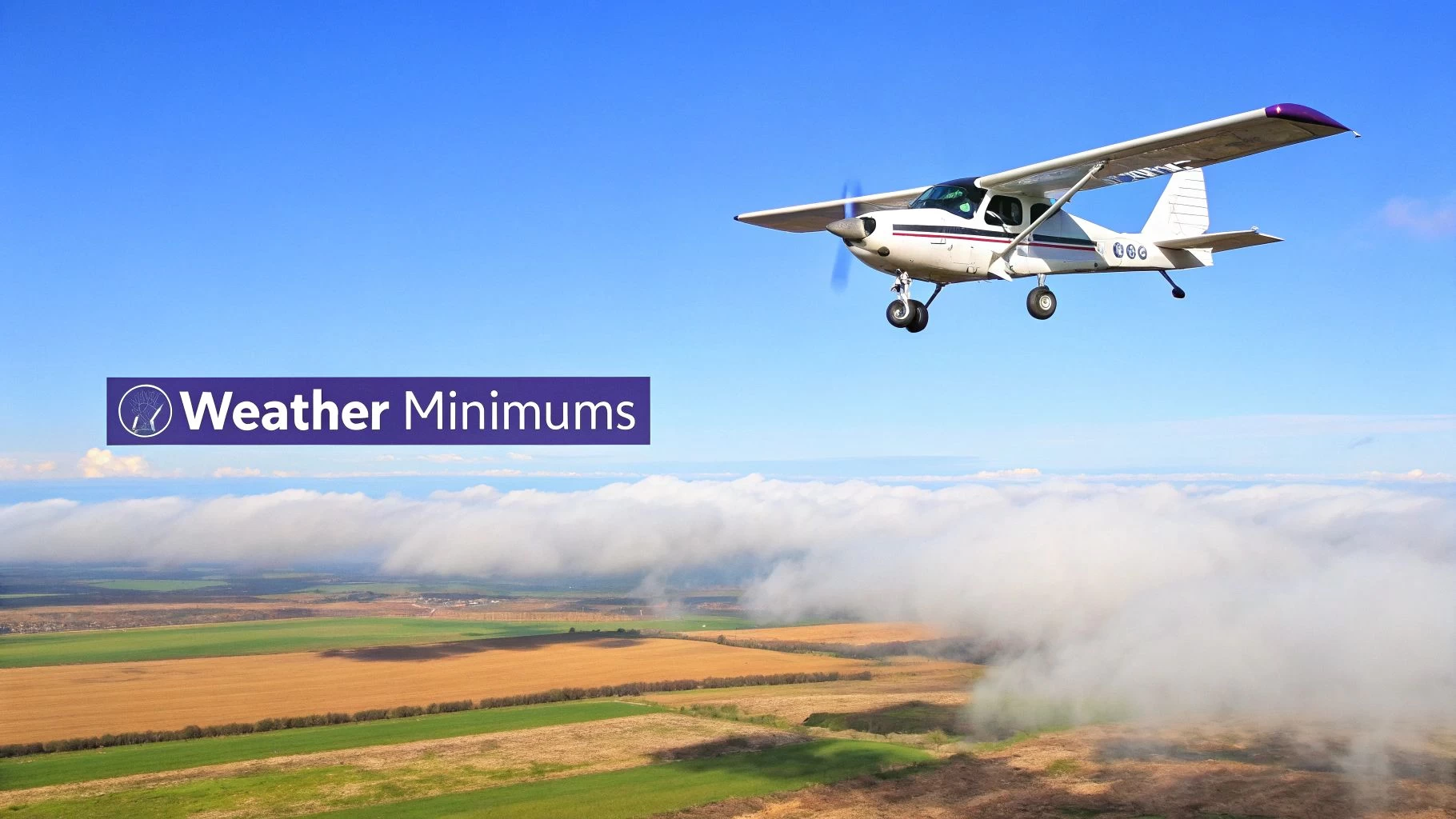
Mastering VFR Weather and Visibility Rules
Flying under Visual Flight Rules, or VFR, is exactly what it says on the tin—you fly by looking out the window. For that to work, the weather needs to be good enough to see other aircraft and obstacles with plenty of time to spare. Class E airspace has specific standards for this, called weather minimums, that every pilot needs to know to keep things safe up there.
These aren't just random numbers the FAA pulled out of a hat. They're carefully designed to create a safety bubble around your aircraft. Think of it as a guaranteed reaction time, but measured in distance. When you have three miles of visibility, you're in a much better position to spot another plane, figure out where it's headed, and stay well clear.
That’s why getting the "why" behind these rules is just as important as memorizing the numbers.
Below 10,000 Feet MSL: The 3-152 Rule
For nearly all drone operations and most general aviation flights, the key weather minimums are for flights below 10,000 feet Mean Sea Level (MSL). The rule of thumb here is easy to remember: "3-152."
It's a simple mnemonic that breaks down what you need for visibility and cloud clearance:
- 3 Statute Miles of flight visibility.
- 1,000 feet above any clouds.
- 500 feet below any clouds.
- 2,000 feet horizontally from any clouds.
Picture a cloud as a solid object you can't see through. These distances give you enough room to maneuver if another aircraft suddenly pops out of a cloud bank. Sticking to these minimums is a non-negotiable part of your pre-flight checks, and a big piece of that is knowing exactly how to read weather reports to make a smart go/no-go call.
Above 10,000 Feet MSL: The 5-111 Rule
Things change once you get up to or above 10,000 feet MSL. Aircraft are moving a lot faster, covering ground in the blink of an eye. To account for this extra speed, the Class E rules for visibility and cloud clearance get a bit tighter.
The bigger distances required at higher altitudes are all about speed. You need more space to provide the same reaction time when two aircraft might be closing in on each other at over 500 knots.
Up here, the rule becomes "5-111":
- 5 Statute Miles of flight visibility.
- 1,000 feet above any clouds.
- 1,000 feet below any clouds.
- 1 Statute Mile horizontally from any clouds.
This bigger safety bubble is tailored for the higher speeds of jets and turboprops, giving them the time they need to see and avoid each other. While drone pilots won't be flying this high, understanding the logic shows how airspace rules are built to handle different risks.
To make it even clearer, here's a quick comparison of the VFR minimums at different altitudes within Class E airspace.
Class E VFR Weather Minimums
| Altitude | Flight Visibility | Distance from Clouds |
|---|---|---|
| Below 10,000 ft MSL | 3 statute miles | 500 ft below, 1,000 ft above, 2,000 ft horizontal |
| At or above 10,000 ft MSL | 5 statute miles | 1,000 ft below, 1,000 ft above, 1 statute mile horizontal |
By getting these VFR minimums down pat, you can confidently check the weather and know that every flight you make is both legal and, more importantly, safe.
Communication and Equipment You Actually Need
So, what’s the deal with talking to ATC in Class E? This is probably one of the top questions I hear from new pilots, and the short answer is… it depends. Usually, you don’t need to, but there’s more to it than that.
Let’s break down what you actually need to have and who you need to talk to (if anyone) to fly safely and legally in Class E airspace.
Think of most Class E airspace as a quiet country road compared to the bustling multi-lane highways of Class B or C. For pilots flying under Visual Flight Rules (VFR), there's no requirement to be in constant contact with Air Traffic Control. You just need to follow the rules of the road.
The main job of Class E is to protect aircraft flying under Instrument Flight Rules (IFR), which are already talking to ATC. As a VFR pilot, your primary responsibility is situational awareness—plain and simple, you need to "see and avoid."
When Do You Need to Get on the Radio?
While most VFR flying in Class E is a pretty quiet affair, there are times when you absolutely have to be on the radio. If you're operating under an IFR flight plan, you’ll be under positive ATC control for your entire flight, so communication is mandatory.
Even when it’s not required, it’s always a smart move to monitor the local frequencies, especially near airports with published instrument procedures. Even without a control tower, listening in gives you a massive heads-up about other aircraft in the area. Best practice is to make voluntary position reports; it just makes the sky safer for everyone.
At its core, Class E is controlled airspace designed to keep IFR traffic safe. If you're flying VFR, you're a guest in their system. You don't always need to talk, but you always, always need to be listening and looking.
Mandatory Gear: ADS-B Out
While you might not always need a two-way radio for VFR flights, other equipment is non-negotiable. The big one here is ADS-B Out (Automatic Dependent Surveillance-Broadcast). This tech is a game-changer; it broadcasts your aircraft's position, altitude, and speed to other aircraft and ATC.
The rule is pretty clear: ADS-B Out is required in Class E airspace at and above 10,000 feet MSL, but not in the airspace at and below 2,500 feet AGL. You’ll also need it within the 30-nautical-mile Mode C veil that surrounds Class B airports. Having the right gear ensures you’re visible to everyone else, a cornerstone of modern aviation safety. Tracking this kind of data is also a vital part of any professional operation's flight data monitoring program.
This isn't just a U.S. thing, either. Globally, ADS-B is becoming the standard for managing IFR traffic safely in Class E. More and more countries are mandating it to improve tracking and integrate satellite surveillance. You can get a good overview of these global ADS-B mandates on universalweather.com.
Essential Rules for Drone Pilots
For us drone pilots, Class E airspace isn't about memorizing complex weather minimums like a traditional pilot would. It really boils down to one simple question: do I need authorization to fly here? The answer hinges entirely on where the floor of that Class E airspace begins, a detail that has a massive impact on your day-to-day operations.
Most of the time, you'll be flying well within uncontrolled Class G airspace. Under Part 107 rules, you're generally capped at 400 feet Above Ground Level (AGL). Since Class E often starts way up at 700 feet or 1,200 feet AGL, you have a nice, comfortable buffer. In these common situations, you don't need any special airspace authorization because you never actually poke into controlled airspace.
Navigating Surface Level Class E
Things get a whole lot different when Class E stretches all the way down to the ground. You'll spot these areas on an aeronautical chart as a dashed magenta line circling an airport. Flying a drone inside this boundary—at any altitude—means you're in controlled airspace from the second you lift off.
This is where the FAA’s LAANC (Low Altitude Authorization and Notification Capability) system becomes your best friend. LAANC is a brilliant automated system that gives drone pilots near-instant permission to fly in controlled airspace around many airports.
Before your props even think about spinning up in a surface-level Class E zone, you must request and get approval through a LAANC-enabled app.
Here's a simple way to think about it: if there's no cushion of Class G airspace underneath you, you need permission. That 400-foot AGL ceiling you normally fly under doesn't grant you a free pass if controlled airspace starts right at the surface.
Using LAANC for Flight Authorization
Getting a thumbs-up through LAANC is a refreshingly straightforward process. It's designed to be quick, connecting you directly with Air Traffic Control data to green-light flights up to pre-approved safe altitudes.
Here's the basic play-by-play:
- Pick a LAANC Provider: Fire up an FAA-approved app like Aloft, AutoPylot, or DroneUp.
- Map Out Your Flight: In the app, draw a box or polygon on the map showing exactly where you plan to fly.
- Check the UAS Facility Maps: The app will instantly show you the maximum altitude you can get approved for in that specific grid, all based on the UAS Facility Map for that airport.
- Send Your Request: Plug in your flight details—when you'll fly, for how long, and the max altitude you need.
- Get Your Authorization: For most requests that are under the grid's altitude ceiling, you'll get an approval sent back to your device almost instantly.
This system is a game-changer, giving drone pilots safe and legal access to more airspace than ever before. For any professional operator, mastering the class e airspace rules for surface-level zones and getting slick with the LAANC process isn't just a good idea—it's an absolute must.
The Final Frontier: High-Altitude Airspace
When we talk about class e airspace rules, most pilots immediately think of the familiar altitudes below 18,000 feet. But there's another, much wilder side to Class E that starts where most conventional aircraft can't even dream of flying. This is the upper atmosphere, kicking in above 60,000 feet MSL, and it's rapidly becoming the next great frontier in aviation.
This isn't just empty space; it's becoming a critical operational zone for some seriously futuristic tech. We're talking about high-altitude, long-endurance drones, sophisticated surveillance platforms, and even commercial space vehicles plunging back to Earth. These machines are pushing the limits of what's possible, and that means we need a whole new rulebook.
Let's face it, traditional air traffic control, with its radar towers and direct voice comms, just isn't built for these extreme altitudes. It would be impractical and wildly expensive. The sheer vastness of this space and the unique flight paths of these vehicles demand a much more dynamic, automated way to manage traffic.
Planning for the Upper Echelon
To get ahead of this, the FAA is building a brand-new system from the ground up. This unique environment, known as Upper Class E airspace (everything above 60,000 feet MSL), is getting its own traffic management system called ETM. Working alongside NASA, the FAA is developing the Upper Class E Traffic Management (ETM) system to handle the expected surge in high-altitude flights that conventional ATC just can't support.
This is a huge deal for safely integrating these advanced vehicles into our national airspace. You can dive deeper into the FAA's vision for shaping the future of high-altitude flight.
This isn't just tweaking the old rules; it's a complete rethink of how we manage air traffic. The ETM system will be a cooperative, data-driven network where the operators themselves—not air traffic controllers—are the ones primarily responsible for coordination and staying out of each other's way.
This move mirrors a bigger trend in aviation: letting technology enable more decentralized and efficient management of the skies. As these new types of vehicles become more common, the class e airspace rules for the upper atmosphere will keep evolving, opening up a new era of flight that was once reserved for military and space programs. It’s a perfect example of how airspace regulations have to stay nimble to keep up with innovation.
Class E Airspace: Your Questions Answered
Even when you think you've got a handle on the rules, Class E airspace can throw some curveballs. It's one of those topics where the theory makes sense, but the real-world application can leave pilots scratching their heads. Let's tackle some of the most common questions we hear from drone operators.
Do I Always Need to Talk to Air Traffic Control in Class E?
For drone pilots, the short answer is almost always no. It's a common misconception.
Class E is primarily "controlled" airspace for the benefit of aircraft flying under Instrument Flight Rules (IFR). Think of commercial airliners and other high-altitude traffic already in constant communication with ATC. For them, Class E provides a safety bubble.
Since you're flying under Visual Flight Rules (VFR), you're not part of that system and don't need to be on the radio. The only time you'll "communicate" is when you're in Class E that goes down to the ground. In that case, you'll need an electronic LAANC authorization, which is a data exchange, not a voice call.
How Can I Spot Where Class E Begins on a Sectional Chart?
This is a critical skill, and luckily, it's all about recognizing a few key visual cues on your VFR sectional chart. These colored lines are your cheat sheet for staying compliant.
- A faded blue line means Class E starts way up at 1,200 feet AGL. You've got plenty of room below.
- A faded magenta line tells you the floor of Class E drops to 700 feet AGL.
- A dashed magenta line circling an airport is the big one to watch. This means Class E airspace begins right at the surface.
Getting these visual markers right isn't just for passing your Part 107 test. It’s the fundamental skill that keeps you out of trouble on every single flight. Misreading these lines is probably one of the easiest ways for a drone pilot to accidentally bust controlled airspace.
Can I Even Fly My Drone in Class E?
Absolutely! But how you fly depends entirely on where that airspace floor is.
If you're in an area where Class E begins at 700 or 1,200 feet AGL, you're golden. You can fly your drone up to the standard 400-foot AGL ceiling without needing any specific authorization because you're technically operating in the uncontrolled Class G airspace underneath it.
But if you see that dashed magenta line, it's a different ball game. Since Class E extends all the way to the ground, you must get authorization before your props ever start spinning. For almost everyone, this means firing up a certified app and getting a near-instant approval through the FAA's LAANC system.
Planning flights in complex airspace shouldn't be a headache. With Dronedesk, you get advanced airspace intelligence and streamlined flight planning tools that take the guesswork out of compliance. Ensure every mission is safe and legal by visiting https://dronedesk.io to see how our platform can support your operations.
 International Drone Regulations Every Global Team Should Know →
 Drone Flight Risk Assessment Example for Safer Missions →
 Beyond Visual Line of Sight Explained for Operators →
 How BVLOS Drone Operations Change Commercial Workflows →
 FAA Drone Rules Every Commercial Pilot Should Know →
 FAA 107 Explained for Commercial Drone Operators →
 Canadian Drone Regulations Explained for Business Use →
 FAA Part 107 Drone License Explained for Beginners →
 How to Review a DJI Drone Flight Log Step by Step →
 Drone Registration Law Explained for Commercial Pilots →