Class E Airspace Requirements A Pilot's Guide
When you're a drone pilot, the Class E airspace requirements boil down to a few key things: getting airspace authorization for every flight, staying on top of weather minimums, and making sure your drone has Remote ID. Since this is the most common type of controlled airspace out there, getting these things right is just part of the daily routine for any serious operator.
Understanding Class E: The Sky's Open Highway
Think of the sky as a huge, invisible road system. The superhighways way up high are Class A, while the hectic, multi-lane interchanges around major airports are Class B and C. Class E, on the other hand, is the massive network of main roads and country lanes that connects everything in between.
For drone pilots, Class E is the airspace you'll spend most of your time in. Knowing its rules isn't just a good idea—it's essential for flying safely and staying on the right side of the law.
The FAA officially labels Class E as controlled airspace. All that really means is that Air Traffic Control (ATC) services are on standby. For us drone pilots, that tag is our cue that we need to get permission and follow a specific set of rules before we fly, even if we never talk to a controller directly. It's all about keeping the skies safe and orderly for everyone, from tiny drones to passenger jets. For a deeper dive into all the different classifications, check out our complete guide on the types of FAA airspace.
Where Does Class E Begin and End?
Pinpointing the "floor" of Class E airspace can be one of the most confusing parts for new pilots. It doesn't have the hard, clearly defined boundaries you see in other airspace classes; instead, its starting altitude changes depending on where you are.
Typically, Class E begins at either 700 feet or 1,200 feet above ground level (AGL) and stretches all the way up to, but not including, 18,000 feet mean sea level (MSL). This huge slice of the sky is designed to accommodate all kinds of aircraft flying under both Instrument Flight Rules (IFR) and Visual Flight Rules (VFR), essentially filling in the gaps where other controlled airspace isn't needed.
Here's a quick rundown of where you can expect Class E to start:
- 700 Feet AGL: You'll often find this around airports that have an approved instrument approach. On a sectional chart, this is marked by a fuzzy-edged magenta circle or shape.
- 1,200 Feet AGL: This is the default floor for Class E just about everywhere else in the country. If there's no other designation, you can usually assume this is where it starts.
- The Surface: In certain areas, Class E goes all the way down to the ground. These zones are circled with a dashed magenta line on charts. If you're flying here, you always need authorization, no matter how low you are.
A classic rookie mistake is thinking you're in the clear if Class E starts at 700 feet and you plan to fly at 200 feet. If you are physically inside the lateral boundary of a surface-level Class E zone, you need authorization. Period.
To help you remember the essentials, here is a quick overview of what defines Class E airspace.
Class E Airspace Key Characteristics at a Glance
| Attribute | Description |
|---|---|
| Airspace Type | Controlled |
| Typical Floor Altitude | Starts at 700 ft AGL, 1,200 ft AGL, or the surface. |
| Ceiling Altitude | Extends up to but not including 18,000 ft MSL. |
| Drone Authorization | Required via LAANC when flying within the defined boundaries. |
| Chart Depiction | Magenta vignette (700 ft floor), dashed magenta line (surface floor). |
| Primary Purpose | To protect aircraft operating under Instrument Flight Rules (IFR). |
This table serves as a handy cheat sheet, but the real test is applying this knowledge in the field by reading your VFR sectional charts correctly before every flight.
Why Is It Considered "Controlled"?
So, if you're flying in a field with no control tower in sight, why is it still "controlled" airspace? It's all about protecting aircraft flying under IFR.
Pilots flying on instruments rely on ATC to keep them safely separated from other air traffic, especially when visibility is poor. As drone pilots, our main job is to see and avoid these other aircraft. The FAA’s Class E airspace requirements, like needing authorization and maintaining weather minimums, are in place to make sure we're predictable and safe participants in this shared airspace.
Think of it like getting a permit to do roadwork on a busy street. The permit isn't there to tell you how to pave the road; it's there to make sure you don't disrupt the normal flow of traffic and cause an accident. It's the same principle in the sky.
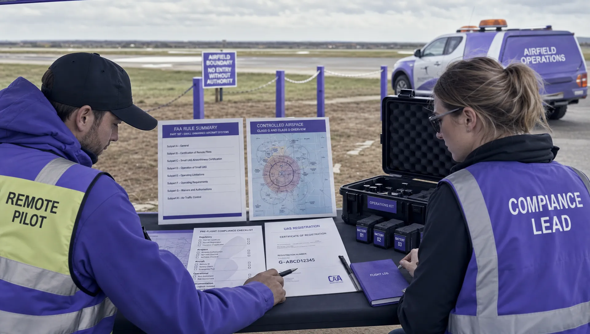
Your Compliance Checklist for Class E Operations

Flying safely in Class E airspace is about more than just knowing where the lines are on a map. It demands a disciplined, step-by-step approach before you even think about spinning up the props. Treat it like a pilot’s pre-flight inspection, but for your paperwork and permissions.
Following a consistent checklist is what separates the pros from the amateurs. It’s not just about dodging FAA fines; it’s about building a culture of safety that protects your gear, your reputation, and the crewed aircraft sharing the skies with you. Every item on this list is a crucial link in the chain.
Foundational Pilot and Drone Requirements
Before you can even request airspace authorization, you have to get your own house in order. These are the absolute, non-negotiable basics for any legal commercial drone flight.
First and foremost is your Remote Pilot Certificate. Is it current? Is it on your person or easily accessible during the flight? If you're coming up on your 24-month renewal, make sure you’ve completed the recurrent online training to stay legal.
Next up, your drone itself needs to be registered with the FAA. This applies to any aircraft weighing 0.55 pounds (250 grams) or more. That registration number has to be marked on the outside of the drone where it can be easily seen. It's a simple step, but one that’s surprisingly easy to forget.
Obtaining Mandatory Airspace Authorization
This is the big one. For any flight in controlled Class E airspace that goes down to the surface, you cannot launch without getting the green light from the FAA. Luckily, this process is much easier than it used to be.
Let's be crystal clear: if your flight is happening inside the boundaries of controlled airspace—including Class E that starts at the ground—you must have authorization before you take off. Flying at 50 feet doesn't get you a pass.
Your go-to tool for this is the Low Altitude Authorization and Notification Capability (LAANC) system. LAANC is a fantastic system that gives you near-instant, automated approval for flights up to the pre-approved altitude ceilings shown on UAS Facility Maps. You can access it through dozens of FAA-approved apps, many of which are built right into flight planning software like Dronedesk. Submitting a LAANC request should become second nature in your pre-flight routine.
Adhering to Standard Operational Limits
Getting LAANC approval doesn’t mean the rulebook goes out the window. You still have to operate within the standard flight rules laid out in Part 107. These regulations exist for a reason—to keep drones safely away from other aircraft and people on the ground.
These are the core rules that form the bedrock of safe flying in any shared airspace:
- Maintain Visual Line-of-Sight (VLOS): You or a designated spotter has to be able to see the drone with your own eyes at all times. No, the camera feed on your controller doesn't count.
- Maximum Altitude of 400 Feet AGL: You're capped at 400 feet above ground level. The only exception is if you're inspecting a tall structure, in which case you can fly up to 400 feet above the top of it, as long as you stay within a 400-foot radius.
- Restrictions on Flying Over People: Part 107 is very strict about this. Unless your drone meets the specific safety requirements for one of the four operational categories, flying over people is a no-go.
- Daylight Operations Only (Without a Waiver): Your standard Part 107 certificate only allows you to fly from 30 minutes before sunrise to 30 minutes after sunset. To fly during twilight, you need anti-collision lights that are visible for at least three statute miles.
By methodically running through this checklist—certificate, registration, authorization, and operational rules—you ensure every flight is buttoned-up, professional, and safe. This is the discipline that defines a true aviation professional.
How to Get Airspace Authorization with LAANC
Not too long ago, getting the green light to fly your drone in Class E airspace was a real headache. You’d submit a request and wait… and wait. Sometimes for weeks, sometimes for months. Thankfully, those days are long gone. The process is now almost instantaneous, all thanks to the Low Altitude Authorization and Notification Capability (LAANC) system.
Think of LAANC as a direct, digital line to air traffic control. It’s an automated system that takes your flight plan and, in a matter of seconds, checks it against pre-approved safety limits for that specific patch of sky. For commercial drone pilots, this system has been a total game-changer, transforming a major administrative bottleneck into a quick pre-flight task.
At its core, LAANC runs on what the FAA calls UAS Facility Maps (UASFM). These maps overlay a grid on the airspace around airports, showing the maximum altitudes where drone flights are already pre-approved. When you send a request, the system simply checks if your flight altitude is within that pre-approved ceiling. If it is, you get your authorization right away.
Step-by-Step Guide to Submitting a LAANC Request
Getting a LAANC authorization is surprisingly simple and should be a standard part of your pre-flight checklist. You'll do this through an FAA-approved LAANC Service Supplier, which are typically flight planning apps you might already be using, like Aloft or B4UFLY.
The image below gives a good overview of the communication loop that’s required when flying in controlled airspace. It really highlights the pilot's responsibility to coordinate with Air Traffic Control.
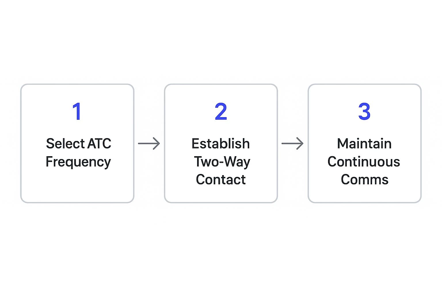
LAANC basically automates this entire process for drone pilots, as long as you stay below the approved altitude ceilings. Here's how you can do it yourself:
-
Pinpoint Your Flight Area: First, open your LAANC-enabled app and use its map tool to draw a precise boundary around where you plan to fly. Be as accurate as you can—no need to request a huge area if you're only working in a small corner of it.
-
Plug in Your Flight Details: The app will ask for the basics. You’ll need to enter the date, start time, and duration of your flight (which can be up to 12 hours). Most importantly, you'll specify the maximum altitude you intend to fly at, in feet Above Ground Level (AGL).
-
Check the Altitude Limit: Your app will show the UASFM grid for your selected area, clearly displaying the maximum allowable altitude. As long as your requested height is at or below that number (for example, you ask to fly at 150 feet in a 200-foot zone), you're set for an instant auto-approval. To get more comfortable with these charts, check out our guide on how to read a drone FAA map.
-
Submit and Get Your Authorization: Give your details one last look and hit submit. Almost immediately, you should receive a confirmation text or email. This message will contain an authorization number, which you need to have on hand in case you're ever asked for it by the FAA or law enforcement.
Key Reminder: Getting LAANC authorization doesn't give you a free pass on other regulations. All the other Part 107 rules still apply. You must maintain a visual line of sight, avoid flying over people, and follow every other operational rule to the letter.
When LAANC Isn't an Option
LAANC is fantastic, but it's built for standard, by-the-book flights. If your mission is a bit more complex or pushes the boundaries of the pre-approved limits, you’ll need to go a different route.
You’ll have to file a manual authorization request directly through the FAA DroneZone portal for any operation that involves:
- Flying Above the UASFM Ceiling: If you need to fly to 300 feet but the grid for your area is capped at 200 feet, LAANC will deny your request instantly.
- Operations in "Zero Grid" Zones: Some areas, usually right next to airport runways, are marked with a "0" on the facility maps. This means no automated approvals are given out, period.
- Flying at Night: While LAANC can handle some nighttime requests, many situations still require a specific night operations waiver and may trigger a manual review.
Be prepared: these manual applications require a thorough safety case explaining why you need the exception and how you'll manage the risk. The FAA can take up to 90 days to review and approve them. This means you absolutely must plan well in advance for any non-standard flight in Class E airspace.
Mastering Weather Minimums for Safe Flights
 Getting your airspace authorization is a huge step, but it’s really only half the battle. Mother Nature always gets the final say, and in Class E airspace, her rules are baked right into federal regulations. The FAA’s weather minimums aren't just helpful suggestions for getting better aerial shots; they are non-negotiable requirements designed to keep everyone safe up there.
These rules, officially known as Visual Flight Rules (VFR), exist for one simple reason: to make sure you can see and avoid other aircraft. Think of it like driving on the highway. You wouldn’t merge into traffic during a thick fog where you can’t even see the car ten feet ahead. The same logic applies in the sky, where the stakes are even higher.
Meeting these minimums is a fundamental responsibility for any Part 107 pilot. That final "go/no-go" call you make based on the weather is one of the most important decisions of any mission.
Decoding Visibility and Cloud Clearance
The FAA sets two specific weather requirements for drone operations in Class E airspace. They might sound a bit technical at first glance, but they’re actually quite straightforward once you translate them into real-world terms.
First, you need at least three statute miles of visibility. This is simply the horizontal distance you can see clearly. Before you take off, look for a landmark you know is roughly three miles away—maybe a water tower, a specific building, or a distant hill. If you can't see it, your visibility is below the legal minimum, and the flight is a no-go.
Second, you have to keep your drone a specific distance away from clouds. This creates a protective bubble around your drone, ensuring you don’t suddenly emerge from a cloud and surprise a manned aircraft—or vice versa. An easy way to remember the required cloud clearance is with the simple phrase "5-1-2."
The "5-1-2" Rule for Cloud Clearance:
- 500 feet below clouds
- 1,000 feet above clouds
- 2,000 feet horizontal from clouds
The "1,000 feet above" rule rarely comes into play for drone pilots, since we’re almost always flying below 400 feet AGL anyway. The two numbers you’ll really need to burn into your memory are staying 500 feet below the cloud base and 2,000 feet away from them horizontally.
Applying Weather Minimums in the Real World
So, how does this all come together before a flight? It always starts with checking a reliable aviation weather source. Knowing how to properly interpret these reports is a skill every pilot needs. For a deeper dive, check out our guide on how to read weather reports for drone flights.
Let’s walk through a quick, practical example. Imagine the forecast shows a solid cloud ceiling at 800 feet AGL and reports visibility at four miles.
- Visibility Check: Four miles is better than the required three miles. You're good to go.
- Cloud Clearance Check: To stay 500 feet below that 800-foot ceiling, your absolute maximum altitude for the flight is now 300 feet AGL. Even though Part 107 says you can fly up to 400 feet, today’s weather has just lowered your operational ceiling.
This is a perfect example of how the day's weather directly impacts your flight limits. Ultimately, mastering these weather requirements is about more than just checking a box. It’s about exercising sound judgment as the pilot-in-command and always putting safety first.
What Gear Do You Actually Need to Fly in Class E?
Flying safely and legally in Class E airspace isn't just about knowing the rules; it's about having the right gear on your drone. The FAA has put specific hardware requirements in place to make sure every unmanned aircraft is visible and identifiable, which is absolutely critical for keeping our skies safe.
Think of it like this: a car needs license plates and headlights to be on the road, right? Well, drones need their own versions of that tech to share the sky with planes and helicopters. These aren't just fancy add-ons—they're fundamental pieces of your flight kit, especially as more and more aircraft take to the skies.
Remote ID: Your Drone's Digital License Plate
The biggest equipment rule you need to know about is Remote ID. Essentially, it's a digital license plate for your drone. This system broadcasts key information in real-time, allowing the FAA, law enforcement, and even other pilots to see who and what is flying nearby.
So what's it broadcasting? Your drone's serial number, its current position and altitude, and the location of your controller. This transparency helps everyone distinguish responsible pilots from those flying recklessly. It's truly the foundation of the FAA's entire plan for integrating drones safely into the national airspace.
You’ve got two main ways to get compliant:
- Standard Remote ID Drone: Most drones you can buy new today have this tech built right in. It's the easiest option because you're good to go straight out of the box.
- Broadcast Module: Got an older drone? No problem. You can attach a small, separate device called a broadcast module. It clips onto your drone and handles all the broadcasting, instantly making your older gear compliant.
The bottom line is simple: No Remote ID, no flying in controlled airspace like Class E. The only exception is if you're flying within a specific FAA-Recognized Identification Area (FRIA).
Anti-Collision Lights: Making Sure You're Seen
Another critical piece of equipment becomes mandatory if you plan to fly when the sun is low. For any flights during civil twilight—that’s the 30-minute window right before sunrise and right after sunset—your drone must have anti-collision lights.
We're not talking about a tiny LED, either. The FAA is clear that these lights must be visible from at least three statute miles away. The reason is obvious: to make your drone stand out to pilots of manned aircraft who are trying to spot a small drone against a darkening sky. A bright, flashing strobe can easily be the one thing that prevents a dangerous close call.
Part of a Bigger Picture: The Push for Airspace Awareness
These drone equipment rules aren't happening in a vacuum. They’re part of a global trend toward using technology to keep tabs on everything in the air. Manned aviation is seeing the same thing with the expansion of ADS-B (Automatic Dependent Surveillance–Broadcast) mandates.
By 2025, both Mexico and Canada will require ADS-B in certain airspace to better manage air traffic. Looking ahead, NavCanada plans to require it in all Class C, D, and E airspace by 2028. This clearly shows where things are headed—all aircraft, big and small, will need to be electronically visible. You can read more about these global ADS-B mandates on universalweather.com.
Ultimately, equipping your drone for Class E isn't just about checking a box on a form. It's about being a professional, responsible pilot. By making sure your drone is both electronically identifiable and physically visible, you’re doing your part to keep the skies safe and organized for everyone.
Common Questions About Flying in Class E
Let's face it, navigating the rules of Class E airspace can feel like a puzzle. Even when you've got the basics down, specific situations can pop up that leave you scratching your head. This is where we'll tackle those common, practical questions head-on.
My goal here is to give you direct, clear answers to the things drone pilots ask most often. We'll clear up the confusion so you can feel confident you're making the right call out in the field. Think of this as your go-to guide for the tricky details of flying in Class E.
Can Recreational Pilots Fly in Class E Airspace?
Absolutely. Recreational flyers are welcome in Class E airspace, but you have to play by the same core rules as the commercial Part 107 pilots. When it comes to safety and awareness in the sky, the FAA doesn't draw a line between hobby and work.
This means you must get airspace authorization before flying in any controlled airspace that starts at the ground, and that includes surface-level Class E. Your best friend for this is the LAANC system, which you can access through a number of FAA-approved apps.
On top of that, recreational pilots have a few specific hoops to jump through:
- Pass The Recreational UAS Safety Test (TRUST): This is a free, straightforward online test. You need to complete it and have proof of completion with you whenever you fly.
- Follow Safety Guidelines: The big ones are keeping the drone within your visual line of sight, staying below 400 feet, and always giving way to manned aircraft.
- Register Your Drone: If your drone tips the scales at 0.55 pounds (250 grams) or more, it needs to be registered with the FAA.
The bottom line is that the core safety principles apply to everyone. Whether you're flying for fun or for a client, getting permission to enter controlled airspace is a must.
What Happens if I Fly Without Authorization?
I'll be blunt: flying a drone in Class E airspace without FAA authorization is a terrible idea. It’s a serious violation, and the FAA comes down hard on unauthorized flights in controlled airspace. The consequences can hit your wallet and your ability to fly in the future.
The penalties aren't just a slap on the wrist. Fines for commercial operators can soar past $30,000 for a single violation, depending on how serious the situation was.
Beyond the hefty fines, the FAA has other tools it can use. They might issue a warning or require you to go through remedial training. For Part 107 pilots, the stakes are even higher—we're talking about the suspension or even total revocation of your Remote Pilot Certificate. Losing that certificate grounds you from all professional drone work, period.
My LAANC Request Was Denied. What Now?
Getting a LAANC denial is frustrating, but don't panic. It doesn’t automatically mean your flight is a no-go. It usually just means your request is a bit more complex than the automated system can handle. The most common triggers are asking to fly higher than the pre-approved ceiling shown on the UAS Facility Map or operating near a sensitive spot that needs a human review.
Your next move is to file a manual airspace authorization request through the official FAA DroneZone portal. Be warned, this process is a lot more involved than a quick LAANC submission.
Here's what you're in for with a manual request:
- It demands a detailed safety case. You'll need to clearly explain why you need to fly there and spell out every step you'll take to keep the operation safe.
- It takes a lot longer. LAANC gives you an answer in seconds. A manual review by the FAA can take up to 90 days. This means planning way ahead is absolutely essential for these kinds of missions.
So if LAANC says no, don't just give up or—even worse—fly anyway. Shift gears, head over to the DroneZone portal, and be ready to submit a thorough, well-justified request well before your flight date.
Do I Need LAANC if Class E Starts at 700 Feet?
This is easily one of the most common mix-ups for new pilots, and the answer is a firm yes, you still need authorization. The key isn't the altitude where the Class E "shelf" begins. What matters is whether you are standing inside the lateral boundaries of a Class E zone that extends all the way to the surface.
Picture it like a tiered wedding cake. An airport often has a circle of Class E airspace on the map—say, a 5-mile radius—that goes right down to the ground. Outside of that, there might be a bigger ring where Class E only starts at 700 feet AGL.
If your flight is anywhere inside that inner circle, you are in surface-level Class E, and you need authorization no matter how low you fly. Flying at 50 feet still requires a LAANC approval because you're within a zone that is controlled from the ground up. Before every single flight, you have to check your charts and a LAANC app to know the exact rules for your precise location.
Planning complex flights and keeping up with compliance can be a massive headache, but Dronedesk makes it simple. Our all-in-one platform helps you manage everything from pre-flight checklists and airspace analysis to flight logging and client reporting, so you can be sure every operation is safe and by the book. Stop juggling a dozen different apps and spreadsheets—see how Dronedesk can streamline your entire workflow at https://dronedesk.io.
 FAA Unmanned Aircraft Regulations Made Simple →
 Part 107 Test Tips to Pass With Confidence →
 How to Pass the FAA Drone Written Test First Time →
 What a BVLOS Flight Means for Risk and Compliance →
 Drone VLOS Rules Explained for Commercial Teams →
 FAA Remote ID Rule Explained for Commercial Pilots →
 Drone Legal Requirements for Commercial Operations →
 Drone Near Airport Rules Explained for Safer Planning →
 International Drone Regulations Every Global Team Should Know →
 Drone Flight Risk Assessment Example for Safer Missions →