Top 7 Drone Tracking Apps of 2025 for Ultimate Flight Control
Taking Off with the Best Drone Tracking Apps
Managing your drone operations effectively requires the right tools. This listicle presents seven leading drone tracking apps for 2025, helping you choose the best fit for your needs. Discover which app best suits your workflow, whether you're a solo operator or managing a large team. These drone tracking app solutions address crucial needs like pre-flight planning, airspace awareness, and flight logging. We'll cover AirMap, DJI Fly, FlightRadar24, DroneDeploy, UAV Forecast, Litchi, and Kittyhawk, highlighting their strengths and weaknesses.
1. AirMap: Your Comprehensive Airspace Management Solution
AirMap stands out as a leading drone tracking app, offering a robust airspace intelligence platform catering to a wide range of users, from solo drone operators to large enterprise drone operations. Whether you're a professional photographer capturing stunning aerial footage, a surveyor mapping out a construction site, or a drone service provider managing a fleet of UAVs, AirMap provides the tools and information necessary for safe and compliant drone operations. This comprehensive platform goes beyond simple drone tracking, offering real-time airspace insights, automated flight authorizations, and sophisticated planning tools, making it a vital resource for anyone serious about drone flight.
One of the key reasons AirMap deserves its place on this list is its comprehensive airspace data. It pulls information from official sources, including the Federal Aviation Administration (FAA) in the United States and equivalent aviation authorities in other countries, providing accurate and up-to-date information on airspace restrictions, temporary flight restrictions (TFRs), and Notices to Airmen (NOTAMs). This real-time data feed is crucial for ensuring your drone operations comply with all regulations and avoid potential hazards. Imagine planning a drone flight for a critical infrastructure inspection only to find out at the last minute that the airspace is temporarily restricted. AirMap helps you avoid such scenarios by providing proactive alerts and ensuring you're always aware of the airspace conditions before taking off.
For those operating in controlled airspace near airports, AirMap simplifies the process of obtaining Low Altitude Authorization and Notification Capability (LAANC) authorization. The app automates the LAANC request process, submitting your flight plans directly to the FAA and providing near-instantaneous approvals in most cases. This streamlined authorization process is a significant time-saver, particularly for commercial operators who frequently fly in controlled airspace. Compared to manually requesting authorization, which can take days or even weeks, AirMap's automated system dramatically reduces the administrative burden and allows you to focus on your mission.
AirMap also shines in its flight planning and logging capabilities. The app allows you to create detailed flight plans, taking into account airspace restrictions, terrain data, and weather conditions. You can pre-program waypoints, set altitudes, and define geofences, ensuring your drone follows a precise flight path. Post-flight, AirMap automatically logs your flight data, creating a valuable record for compliance and analysis. This feature is particularly useful for commercial operators who need to maintain detailed flight logs for insurance purposes or regulatory audits.
Beyond its core features, AirMap integrates seamlessly with a wide range of drone platforms, including major manufacturers like DJI. This integration allows for direct control of your drone through the app, streamlining your workflow and eliminating the need to switch between multiple applications. Features like real-time drone tracking and telemetry data further enhance situational awareness and contribute to safer flight operations.
While AirMap offers a free version with basic features, some of the more advanced functionalities, like advanced flight planning and LAANC authorization, require a paid subscription. The pricing structure varies depending on the level of access and features required. Technical requirements are minimal, with the app available for both iOS and Android devices. While the interface is generally intuitive, some beginner users might find the wealth of information and features slightly overwhelming initially. Another limitation is the limited offline functionality, requiring a stable internet connection for most features. Despite these minor drawbacks, AirMap remains a powerful and valuable tool for anyone involved in drone operations. Its comprehensive airspace data, streamlined LAANC authorization, and robust flight planning capabilities make it a top choice for drone tracking and airspace management. For more information and to download the app, visit https://www.airmap.com.
2. DJI Fly
DJI Fly is the official drone tracking app for DJI's consumer drone lineup, encompassing popular models like the Mavic Mini, Air series, and Mini series. Serving as a centralized hub, it seamlessly integrates flight control, camera operation, and, importantly, real-time drone tracking. This makes it a powerful tool for various applications, from casual aerial photography to professional drone operations, catering to everyone from solo flyers to enterprise teams. As a drone tracking app, DJI Fly provides crucial real-time flight data, GPS positional information, and visualizes the drone's flight path, ensuring operators maintain situational awareness and facilitate safe drone operations. This tracking functionality is especially valuable for beyond visual line of sight (BVLOS) operations (where permitted), allowing pilots to confidently monitor their drone's location and trajectory.
![]()
DJI Fly’s intuitive interface simplifies complex drone operations. Its user-friendly design caters to users of all experience levels, making it easy for beginners to grasp the fundamentals of drone flight and for experienced pilots to access advanced features. The app’s real-time flight telemetry provides vital information such as altitude, speed, battery life, and signal strength, all displayed clearly on the screen. GPS tracking allows operators to pinpoint their drone's location on a map, making it easier to plan flights, avoid obstacles, and retrieve the drone after landing. Furthermore, the integrated camera control and gimbal adjustment features enable users to capture stunning aerial photos and videos with precise framing and smooth cinematic movements. You can adjust camera settings like ISO, shutter speed, and aperture directly within the app, giving you complete creative control over your aerial imagery.
For more advanced users, DJI Fly offers a suite of intelligent flight modes. Features like ActiveTrack allow the drone to autonomously follow a designated subject, while QuickShots provide pre-programmed flight paths for capturing dynamic cinematic shots with minimal effort. These automated features are particularly useful for solo operators who need to focus on capturing the perfect shot without manually controlling the drone's every movement. DJI Fly also diligently logs flight records, allowing pilots to review flight data, analyze performance, and even replay flights for post-flight analysis. This is an invaluable feature for professional drone operators, surveyors, and inspectors who need to document their flights for regulatory compliance or client reporting.
While DJI Fly seamlessly integrates with DJI drones, its biggest limitation is its exclusive compatibility with the DJI ecosystem. It doesn't support drones from other manufacturers, which might be a drawback for users who operate a mixed fleet. Additionally, certain features, like accessing airspace information and firmware updates, require an internet connection. While DJI Fly provides basic geofencing and no-fly zone warnings, its airspace information is less detailed than dedicated airspace awareness apps. Learn more about DJI Fly to understand its capabilities in-depth.
The app is free to download and use with compatible DJI drones. There are no subscription fees or in-app purchases required for core functionality. In terms of technical requirements, DJI Fly is compatible with most modern iOS and Android devices. Check the DJI website for a complete list of compatible devices before downloading. Setting up DJI Fly is straightforward. After downloading the app, simply connect your DJI drone to your mobile device via Wi-Fi, and the app will automatically recognize and connect to the drone. You'll be guided through a brief setup process, and then you're ready to fly. DJI Fly is regularly updated with new features, performance improvements, and bug fixes, ensuring you have access to the latest technology and a smooth user experience. For operators seeking a user-friendly, feature-rich, and reliable drone tracking app specifically for their DJI drones, DJI Fly is an excellent choice.
3. FlightRadar24
FlightRadar24 is a widely recognized name in real-time flight tracking, primarily known for monitoring commercial aircraft. However, its capabilities extend beyond just passenger planes, offering valuable airspace awareness tools that are increasingly relevant for drone operators. While not a dedicated drone tracking app in the strictest sense, FlightRadar24 provides crucial insights into the airspace, helping drone pilots understand air traffic patterns and potential hazards. This makes it a valuable tool for maintaining situational awareness and promoting safe drone operations, especially in complex or congested airspace. Learn more about FlightRadar24 to delve deeper into its applications in aviation management. It earns its place on this list due to its comprehensive airspace overview, making it a useful supplementary tool for drone pilots.
![]()
The core functionality of FlightRadar24 revolves around live tracking of aircraft worldwide, primarily using Automatic Dependent Surveillance-Broadcast (ADS-B) technology. This technology, also used by some drones, allows the platform to pinpoint the location, altitude, speed, and heading of aircraft in real-time. For drone operators, this offers a powerful means of understanding the airspace environment, identifying potential conflicts with manned aircraft, and planning flights accordingly. Imagine a scenario where a surveyor needs to deploy a drone for a rooftop inspection near a small airport. FlightRadar24 can provide a live view of air traffic in the area, allowing the surveyor to schedule the drone operation during periods of minimal aircraft activity, significantly reducing the risk of a collision.
While FlightRadar24 excels in providing broad airspace awareness, it's important to understand its limitations regarding drone-specific features. The platform's primary focus remains on manned aviation, and its drone tracking capabilities are not as comprehensive as dedicated drone tracking apps. For instance, it does not offer direct drone flight planning tools, nor does it provide features like geofencing or remote identification of individual drones. This makes it more of a supplementary tool for drone pilots, offering crucial context and situational awareness, rather than a primary flight management system.
FlightRadar24 is available on multiple platforms, including web browsers, iOS, and Android devices. Basic access to real-time flight tracking is free, but a subscription unlocks premium features like detailed historical flight data, advanced filtering options, and a 3D view with augmented reality capabilities. The cost of the premium subscription varies depending on the chosen plan. While the free version provides adequate airspace awareness for many drone operators, the premium features can be beneficial for professionals who require more in-depth analysis and historical data.
For solo drone operators and small teams, the free version of FlightRadar24 can provide valuable situational awareness, particularly when operating near airports or in congested airspace. Larger drone operations or enterprise-level users may find the premium features, such as historical flight data and advanced filtering, more beneficial for long-term planning and analysis. Professional photographers and videographers can use the app to ensure clear skies and avoid unexpected aircraft intrusions during shoots. Similarly, surveyors and utility inspectors can leverage the platform to enhance safety and plan drone deployments effectively.
In summary, while FlightRadar24 is not specifically designed as a "drone tracking app," its comprehensive air traffic monitoring capabilities make it a valuable tool for drone pilots seeking to enhance their situational awareness. By providing real-time insights into the airspace, it empowers drone operators to make informed decisions, mitigate risks, and integrate drone operations safely within the broader aviation landscape. While it lacks specific drone management tools, its focus on overall airspace monitoring makes it a worthy addition to any drone pilot's toolkit, particularly when used in conjunction with other drone-specific applications. You can explore their website at https://www.flightradar24.com for more information.
4. DroneDeploy
DroneDeploy stands out as a leading cloud-based drone mapping and analytics platform, making it a powerful drone tracking app for professionals. While offering comprehensive flight tracking and fleet management, its true strength lies in transforming aerial data into actionable insights. This makes it a valuable tool for various industries, from construction and agriculture to surveying and inspections. DroneDeploy is designed for commercial and enterprise users who need to plan, execute, and analyze drone missions efficiently and effectively. This isn't just about knowing where your drone is; it's about leveraging the data it collects to improve workflows and make informed decisions.
![]()
One of the key advantages of DroneDeploy is its sophisticated mission planning capabilities. Users can pre-program flight paths with waypoint navigation, ensuring precise and consistent data acquisition. This feature is particularly beneficial for large-scale mapping projects or complex inspection workflows. Real-time flight tracking and monitoring provide operators with constant awareness of the drone's location and status, enhancing safety and operational efficiency. For organizations operating multiple drones, the fleet management tools streamline operations by allowing centralized control and coordination.
DroneDeploy’s power truly shines in its automated data processing and analytics. Once a flight is completed, the platform automatically processes the collected imagery and generates a variety of outputs, including orthomosaics, 3D models, and contour maps. These outputs can be used for various purposes, such as volumetric measurements for construction projects, crop health analysis in agriculture, or infrastructure inspections for utilities. The platform also offers powerful analytics tools that allow users to extract valuable insights from the data, identifying potential issues, and making data-driven decisions. For example, a construction manager can use DroneDeploy to track progress on a site, identify potential delays, and optimize resource allocation. Similarly, a surveyor can generate highly accurate maps and measurements, reducing the need for time-consuming ground surveys.
While DroneDeploy excels in its professional features, it’s important to consider its pricing and technical requirements. The platform operates on a subscription basis, and while several tiers are available, the more advanced features come at a premium cost, potentially prohibitive for casual drone users. Additionally, while DroneDeploy supports a wide range of drone models, ensuring compatibility with your specific hardware is crucial. The platform also has a steeper learning curve than more basic drone tracking apps. New users will need to invest time in learning the software's functionalities and best practices. There are extensive training resources and customer support available, but mastering the platform requires commitment.
Compared to simpler drone tracking apps that primarily focus on real-time location tracking, DroneDeploy offers a much more comprehensive solution. While apps like AirMap provide valuable airspace information and basic flight logging, they lack the advanced mapping, data processing, and analytics capabilities of DroneDeploy. For users requiring these professional-grade tools, the investment in DroneDeploy is justified. However, for recreational flyers or those with basic tracking needs, simpler and less expensive alternatives may be more suitable.
For users looking to implement DroneDeploy, a few tips can help ensure a smooth onboarding process. Firstly, thoroughly review the supported drone models and ensure compatibility with your existing hardware. Secondly, take advantage of the available training resources and tutorials to familiarize yourself with the platform’s functionalities. Starting with a smaller project can help you gain practical experience and build confidence before tackling larger and more complex missions. Lastly, clearly define your project goals and data requirements upfront to ensure that you are using the right tools and workflows within DroneDeploy. The platform's robust feature set can be overwhelming initially, so a focused approach will help maximize efficiency and ROI. You can find more information and sign up for a free trial on their website: https://www.dronedeploy.com.
5. UAV Forecast
UAV Forecast isn't a drone tracking app in the traditional sense of following a drone's real-time location. Instead, it focuses on providing the critical environmental context you need for safe and successful drone operations. Think of it as a pre-flight checklist focused entirely on weather and related conditions. This makes it an invaluable tool for any drone pilot, from hobbyists capturing aerial footage to professionals conducting critical infrastructure inspections. UAV Forecast empowers pilots to make informed decisions about when and where to fly, minimizing risks and maximizing the chances of a productive flight. It’s a proactive approach to drone safety, offering peace of mind before you even take off.
![]()
For solo drone operators, small to medium-sized drone teams, and even large enterprise drone operations managers, understanding hyperlocal weather conditions is paramount. UAV Forecast delivers precisely that. Whether you're a professional photographer seeking the perfect golden hour lighting or a surveyor mapping a construction site, the app provides location-based weather data, including wind speed, direction, and gusts, which are critical factors affecting drone stability. Utility inspectors can leverage the app to ascertain safe conditions for inspecting power lines or cell towers, minimizing weather-related risks. Even drone service providers can benefit by using UAV Forecast to ensure client projects are scheduled and executed under optimal conditions, demonstrating professionalism and a commitment to safety.
The core strength of UAV Forecast lies in its drone-specific weather information. It goes beyond standard weather apps by providing data relevant to drone flight. This includes GPS satellite visibility and accuracy predictions. Knowing how many satellites are visible and their signal strength can significantly impact your drone's positioning accuracy, especially for autonomous flights or those relying on precise GPS data. The app also alerts you to solar activity and geomagnetic storms, which can interfere with GPS signals and potentially disrupt drone operations. These features are crucial for ensuring reliable and safe flights, particularly for long-range or beyond visual line of sight (BVLOS) operations.
UAV Forecast simplifies complex meteorological data into easy-to-understand flight condition recommendations. The app uses a straightforward "good/caution/no-fly" system, allowing pilots to quickly assess the suitability of weather conditions for their planned flight. This feature is especially valuable for less experienced pilots who may not be as proficient at interpreting raw weather data. Learn more about UAV Forecast and how it integrates into pre-flight planning.
While UAV Forecast offers a free basic version, unlocking the full suite of features requires a subscription. The premium features typically provide more detailed forecasts, extended range predictions, and potentially additional data layers. Pricing details are available on the UAV Forecast website (https://www.uavforecast.com). The app is available on both iOS and Android platforms, ensuring accessibility for a wide range of users.
Although primarily focused on weather and environmental data, UAV Forecast doesn't offer features for actual flight tracking or logging. It also doesn't include information on airspace regulations or restrictions. For these needs, you would have to utilize supplemental apps or resources. Therefore, while UAV Forecast provides a critical piece of the pre-flight planning puzzle, it's important to remember it’s not a comprehensive drone management tool. It's designed to be used in conjunction with other tools and resources to ensure safe and compliant drone operations. However, its specialized focus on drone-specific weather data makes it a valuable addition to any drone pilot's toolkit, deserving its place on this list of essential drone-related apps.
6. Litchi
Litchi is a powerful third-party drone tracking app designed specifically for DJI drones, offering a significant upgrade in autonomous flight control and tracking capabilities compared to the standard DJI apps. It caters to professionals seeking advanced features like sophisticated waypoint missions, diverse follow-me modes, and comprehensive flight telemetry data. Its popularity stems from its ability to unlock the full potential of DJI drones for complex flight operations, pushing boundaries beyond the limitations of manufacturer-provided software. Whether you're a seasoned drone pilot or looking to elevate your aerial skills, Litchi offers a robust platform for precise and creative drone control.
![]()
For solo drone operators, Litchi simplifies complex tasks like creating cinematic footage with its smooth follow-me modes and precisely planned waypoint missions. Small to medium-sized drone teams can leverage Litchi's features to ensure consistent flight paths and data acquisition for projects ranging from aerial photography to infrastructure inspection. Enterprise drone operations managers benefit from the advanced telemetry data and mission planning capabilities, crucial for efficient and safe operations in demanding environments. Professional photographers and videographers can unlock creative potential with Litchi's diverse flight modes and VR compatibility, capturing stunning perspectives with ease. Finally, surveyors and utility inspectors can utilize Litchi's precise waypoint missions to automate data collection, improving accuracy and efficiency in their workflows.
One of Litchi's standout features is its advanced waypoint mission planning. This allows users to pre-program detailed flight paths with precise control over altitude, speed, camera angle, and actions at each waypoint. This functionality is invaluable for applications like mapping, 3D modeling, and infrastructure inspection, where consistent and repeatable flight paths are critical. Litchi also boasts multiple autonomous flight modes, including various follow-me options, orbit mode, point of interest mode, and focus mode. These modes empower users to capture dynamic and engaging footage without manually piloting the drone, freeing them to focus on camera operation and creative framing. Real-time telemetry and GPS tracking within the app provide crucial flight data, ensuring safe and informed decision-making during flight operations.
The advantage of Litchi over standard DJI apps lies in its expanded feature set and control over drone functionality. While DJI apps provide basic flight control and some autonomous features, Litchi unlocks a higher level of precision and control. Compared to other third-party drone tracking apps, Litchi stands out with its strong community and mission sharing capabilities. This allows users to learn from others, download pre-built missions, and share their own flight plans, fostering a collaborative environment for drone enthusiasts and professionals. Furthermore, Litchi operates on a one-time purchase model, eliminating recurring subscription fees often associated with other drone software solutions.
Litchi is compatible with a wide range of DJI drones, from the Mavic series to the Phantom and Inspire platforms. However, this specialization in DJI drones also represents a limitation, as it lacks compatibility with drones from other manufacturers. New users should be aware of the steeper learning curve compared to more basic drone apps, requiring time and practice to master its advanced features. While Litchi offers extensive capabilities, it's important to note that it doesn't receive official support from DJI. Additionally, Litchi requires separate purchases for each platform (iOS, Android, etc.), which can be a minor inconvenience for users operating across multiple devices.
Setting up Litchi is relatively straightforward. After purchasing and installing the app, users connect it to their DJI drone via Wi-Fi. The app then guides users through the process of calibrating the drone and setting up their desired flight modes and parameters. Numerous online tutorials and resources are available to help new users familiarize themselves with the app’s functionalities and best practices.
Currently, Litchi is priced at $24.99 on both the Apple App Store and the Google Play Store. While specific technical requirements vary depending on the DJI drone model being used, a compatible mobile device with sufficient processing power and storage is necessary.
For those seeking advanced drone tracking capabilities and autonomous flight control beyond the standard DJI app functionality, Litchi is a powerful tool well worth considering. Its comprehensive features, one-time purchase model, and strong community support make it a compelling option for professionals seeking to maximize the potential of their DJI drones. You can find more information and download the app at https://flylitchi.com.
7. Kittyhawk (Now Aloft)
Kittyhawk, now integrated into the Aloft platform, earns its spot on this list due to its history as a leading drone operations platform, specifically designed for commercial and enterprise users. While it initially carved its niche with comprehensive flight planning, real-time drone tracking, and robust fleet management capabilities, the transition to Aloft has brought both enhanced features and a few considerations for existing users. For those seeking a drone tracking app capable of handling complex operations and integrating seamlessly into existing business workflows, exploring Aloft (formerly Kittyhawk) is worthwhile. Think of it as a powerful tool designed to streamline operations, manage risk, and ensure compliance in even the most demanding commercial drone environments.
![]()
One of the key strengths of Kittyhawk, carried over into Aloft, is its focus on airspace analysis and automated LAANC (Low Altitude Authorization and Notification Capability) authorizations. This is critical for commercial operators who frequently need to fly in controlled airspace. The streamlined regulatory approval process through Aloft significantly reduces the administrative burden and allows for faster turnaround times on flight permissions. Imagine needing to fly a drone for a roof inspection in a suburban area – Aloft simplifies the process of obtaining the necessary airspace authorizations, allowing you to focus on the task at hand. This is a significant advantage over manually submitting LAANC requests through other platforms, which can be time-consuming and cumbersome.
Beyond individual flight planning, Aloft excels at fleet management. Drone teams can track pilot certifications, aircraft maintenance schedules, and flight logs, all within a centralized platform. This is particularly valuable for organizations operating multiple drones and pilots, ensuring that everything is documented and compliant with regulations. Consider a drone service provider managing a team of pilots across different locations – Aloft provides a centralized dashboard to monitor all operations, track pilot currency, and ensure adherence to company policies. This comprehensive overview significantly reduces administrative overhead and enhances operational efficiency.
For those migrating from Kittyhawk, the transition to Aloft requires some adjustment. While Aloft retains the core functionalities of Kittyhawk, the interface and some workflows have been updated. Existing Kittyhawk users should consult Aloft's migration resources to understand the changes and ensure a smooth transition. This might involve familiarizing themselves with new menu structures, updated features, and potentially retraining team members.
While pricing for Aloft is not publicly available and requires contacting their sales team, it's generally geared towards commercial operations and enterprise clients. Individual hobbyists or recreational drone users might find the cost prohibitive and the feature set overly complex for their needs. Simpler drone tracking apps with basic flight logging and airspace awareness might be more suitable for casual users. However, for serious commercial operators, the robust compliance tools, streamlined regulatory processes, and comprehensive fleet management capabilities offered by Aloft justify the investment.
Implementing Aloft into an existing workflow usually involves onboarding team members, configuring the platform to align with specific operational requirements, and integrating with existing business systems. Aloft offers support and documentation to facilitate this process. For larger organizations, dedicated account managers can assist with tailoring the platform to their specific needs.
In comparison to other drone tracking apps, Aloft stands out with its enterprise-grade features and regulatory compliance focus. While apps like AirMap offer similar airspace intelligence and LAANC functionality, Aloft's emphasis on fleet management, detailed compliance reporting, and integration with enterprise workflows makes it a more compelling solution for larger organizations. For smaller teams or individual pilots, simpler, more cost-effective options might be sufficient. However, if your operations require robust compliance features, sophisticated flight planning tools, and the ability to manage a fleet of drones and pilots, Aloft (formerly Kittyhawk) offers a comprehensive platform to elevate your drone program.
Drone Tracking Apps Feature Comparison
| Platform | Core Features & Capabilities | User Experience & Quality | Value & Pricing | Target Audience | Unique Selling Points |
|---|---|---|---|---|---|
| AirMap | Real-time airspace maps, automated LAANC, flight planning | ★★★★, professional-grade, complex for beginners | 💰 Paid tiers for advanced features | 👥 Commercial & pro pilots | ✨ Streamlined LAANC, wide compatibility |
| DJI Fly | Flight telemetry, camera control, intelligent flight modes | ★★★★★, user-friendly, DJI optimized | 💰 Free, DJI drone exclusive | 👥 Consumer DJI users | ✨ Seamless DJI integration |
| FlightRadar24 | Global flight tracking, airspace awareness, 3D & AR views | ★★★★, multi-platform, data-rich | 💰 Subscription for premium data | 👥 Aviation enthusiasts & drone pilots | ✨ Extensive manned aircraft data |
| DroneDeploy | Mission planning, fleet management, data analytics | ★★★★, commercial-grade, steep learning | 💰 Expensive, subscription based | 👥 Commercial & enterprise users | ✨ Cloud-based mapping & analytics |
| UAV Forecast | Drone-specific weather, GPS satellite, solar activity | ★★★★, simple interface | 💰 Free basic, paid premium | 👥 Recreational & professional pilots | ✨ Detailed flight condition alerts |
| Litchi | Advanced waypoint missions, autonomous modes, VR flight | ★★★★, advanced, higher learning curve | 💰 One-time purchase | 👥 Professional DJI pilots | ✨ Advanced autonomous features |
| Kittyhawk | Flight planning, LAANC, fleet & compliance management | ★★★★, enterprise-focused, complex UX | 💰 Higher cost, enterprise pricing | 👥 Commercial & enterprise ops | ✨ Robust compliance & integrations |
Choosing Your Perfect Drone Tracking Companion
Finding the right drone tracking app can significantly impact your drone operations, whether you're a solo enthusiast or managing a large fleet. From pre-flight planning with apps like UAV Forecast and AirMap, to in-flight control and autonomous missions with DJI Fly and Litchi, to post-flight analysis with DroneDeploy, the tools we've explored offer a diverse range of capabilities. Remember to prioritize features that align with your specific needs. Are you focused on airspace awareness, flight logging, or streamlined team management? Identifying your key requirements will guide you toward the ideal drone tracking app.
Several factors beyond core features should also influence your decision. Consider ease of use, platform compatibility (iOS, Android), subscription costs, and the level of customer support offered. For those managing larger teams or complex projects, features like real-time drone tracking, geofencing, and maintenance logging become increasingly crucial. If you're also an investor keeping track of your drone-related stocks and assets, an advanced portfolio tracker can be an invaluable tool to monitor your portfolio's performance.
Ultimately, the best drone tracking app is the one that empowers you to fly safely, efficiently, and with confidence. From recreational pilots to enterprise-level operations, leveraging the power of these digital tools can elevate your drone program to new heights.
For professional drone operations management, including comprehensive flight logging, maintenance tracking, and team collaboration, take a look at Dronedesk. This powerful platform simplifies complex workflows and helps you maintain regulatory compliance. Explore the advanced features and capabilities of Dronedesk today.
 Beyond Visual Line of Sight Explained for Operators →
 How BVLOS Drone Operations Change Commercial Workflows →
 FAA Drone Rules Every Commercial Pilot Should Know →
 FAA 107 Explained for Commercial Drone Operators →
 Canadian Drone Regulations Explained for Business Use →
 FAA Part 107 Drone License Explained for Beginners →
 How to Review a DJI Drone Flight Log Step by Step →
 Drone Registration Law Explained for Commercial Pilots →
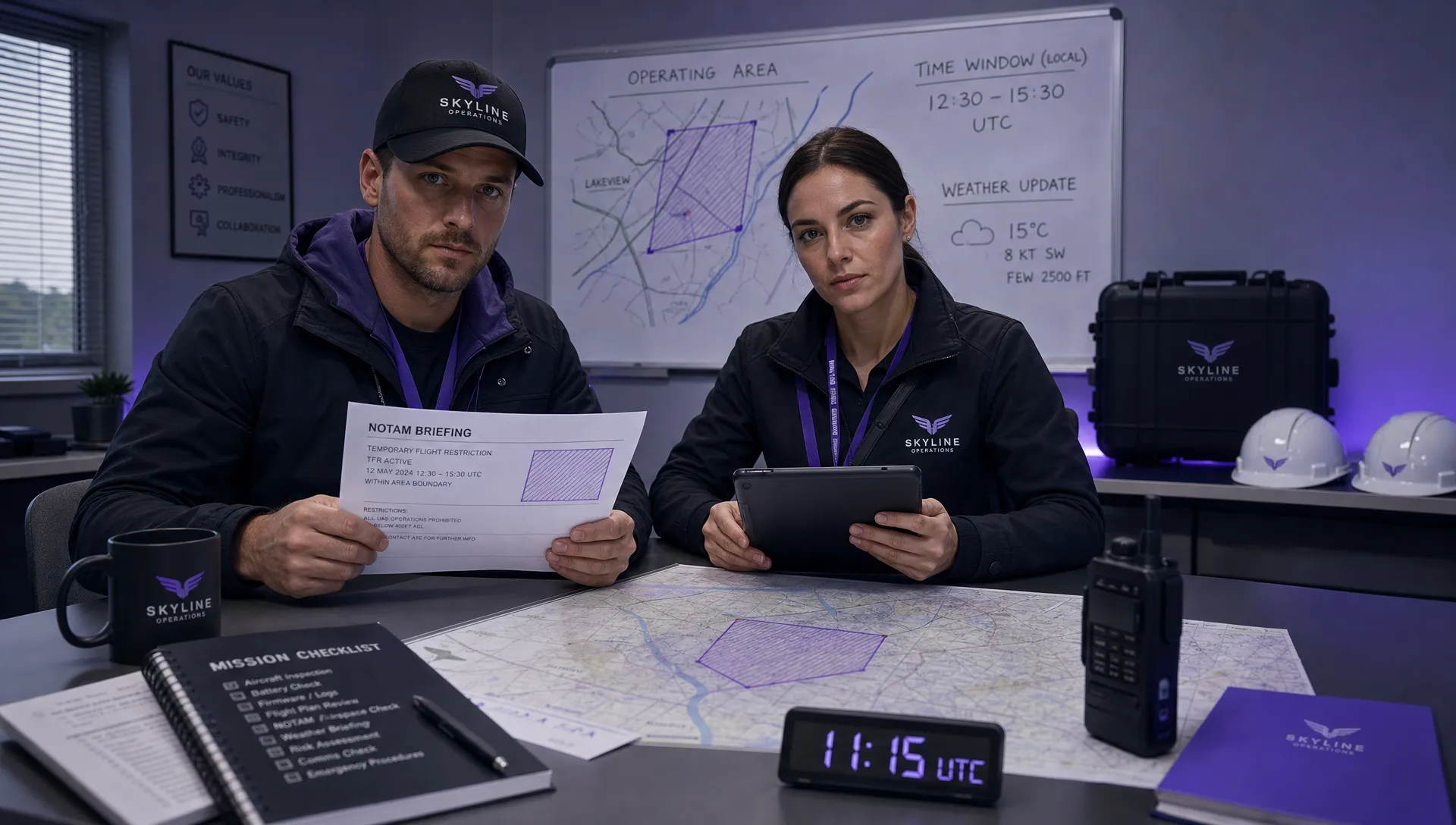 How to Check a Drone NOTAM Before Every Mission →
 BVLOS Drone Meaning and Why It Matters →