A Guide to Drone Restricted Airspace
Think of drone restricted airspace as invisible fences in the sky. These digital boundaries mark off areas where you simply can't fly a drone, or where your flight is heavily limited. They’re put in place to keep sensitive locations like airports, military bases, and critical infrastructure safe from accidents or potential threats.
Why We Have Invisible Fences in Our Skies
Imagine a motorway with no lanes, no speed limits, and no warning signs for dangerous junctions. It would be absolute chaos. Our skies work on a similar principle, and drone restricted airspace is the traffic management system that keeps everything in order for unmanned aircraft. These aren't just rules for the sake of rules; they are a cornerstone of national security and public safety.
These invisible lines on a map are there to stop very real, very serious things from happening. Without them, the chances of a drone hitting a passenger plane on final approach would be terrifyingly high. A rogue drone could also threaten critical infrastructure like power plants, government buildings, or even a packed stadium during a big game.
Protecting People and Places
The whole point of defining and enforcing restricted airspace is to tackle specific, real-world risks. Once you get the "why" behind the rules, it's easier to appreciate your part in keeping our shared airspace safe.
- Aviation Safety: The number one priority is keeping drones and crewed aircraft separate. A collision, even with a small drone, could be catastrophic for a plane or helicopter. That's why the airspace around airports is some of the most tightly controlled.
- National Security: High-security sites like military bases, government buildings, and nuclear facilities are strict no-fly zones. This is to prevent spying, surveillance, or even potential acts of terrorism.
- Public Safety and Privacy: You'll often find restrictions over big public events, schools, or prisons. This is all about keeping people on the ground safe and protecting the privacy of individuals in sensitive areas.
Ultimately, a safe flight is the pilot's responsibility. Regulators like the FAA and CAA create the rulebook, but it's the operator on the ground who has to read the maps, understand the restrictions, and make the call to fly or not.
The Pilot’s Critical Role
Every drone pilot, from a hobbyist getting sunset shots to a professional on a complex inspection job, is a vital part of this safety net. Respecting restricted airspace isn't just about dodging massive fines; it's about acting like a responsible member of the aviation world.
For example, a real estate photographer must check that a beautiful property isn't sitting directly under the flight path of a local airport before they even think about launching. In the same way, a crew surveying storm damage has to be aware of any Temporary Flight Restrictions (TFRs) put in place, which clear the air for emergency helicopters and other response aircraft.
Ignoring these digital fences puts the whole system at risk. One careless flight could shut down an airport, spark a major security alert, or worse, endanger lives. That’s why a thorough pre-flight check, including a detailed look at airspace maps, isn't just a good idea—it’s non-negotiable for every single flight. When you take this responsibility seriously, you're helping to keep the skies safe and open for everyone.
Decoding The Different Types of Airspace Restrictions
It’s easy to think of “no-fly zones” as simple on-or-off areas, but the reality is much more nuanced. I like to think of the sky like a city’s road network. Some areas are like multi-lane motorways with strict rules, while others are more like quiet residential streets with different guidelines. For any drone pilot, getting a handle on these different types of drone restricted airspace is the first step to planning a safe, legal flight every single time.
The most common restrictions you'll run into are around airports. This airspace is carefully categorized into different classes based on the amount and type of air traffic. The structure is often described as an "upside-down wedding cake"—a series of protected layers that get wider as they go higher, extending up and out from the airport.
If you want to really dive deep into the nuts and bolts, we have a detailed guide on the https://blog.dronedesk.io/types-of-airspace/ for drone pilots.
Controlled Airspace Around Airports
The skies near busy airports are, without a doubt, the most tightly controlled. Your flight plan absolutely has to account for these zones to avoid any chance of conflict with manned aircraft. It's our biggest responsibility as pilots.
- Class B Airspace: This is the big one. It blankets the nation’s busiest airports, like LAX or JFK. As the most restrictive airspace, flying a drone here demands explicit authorization from Air Traffic Control (ATC). You'll typically get this through the LAANC (Low Altitude Authorization and Notification Capability) system.
- Class C and D Airspace: These zones surround airports that see regular commercial traffic but aren't quite as congested as Class B hubs. You'll still need LAANC authorization to fly here, but for many spots, the process is automated and you can get instant approval up to a pre-set altitude.
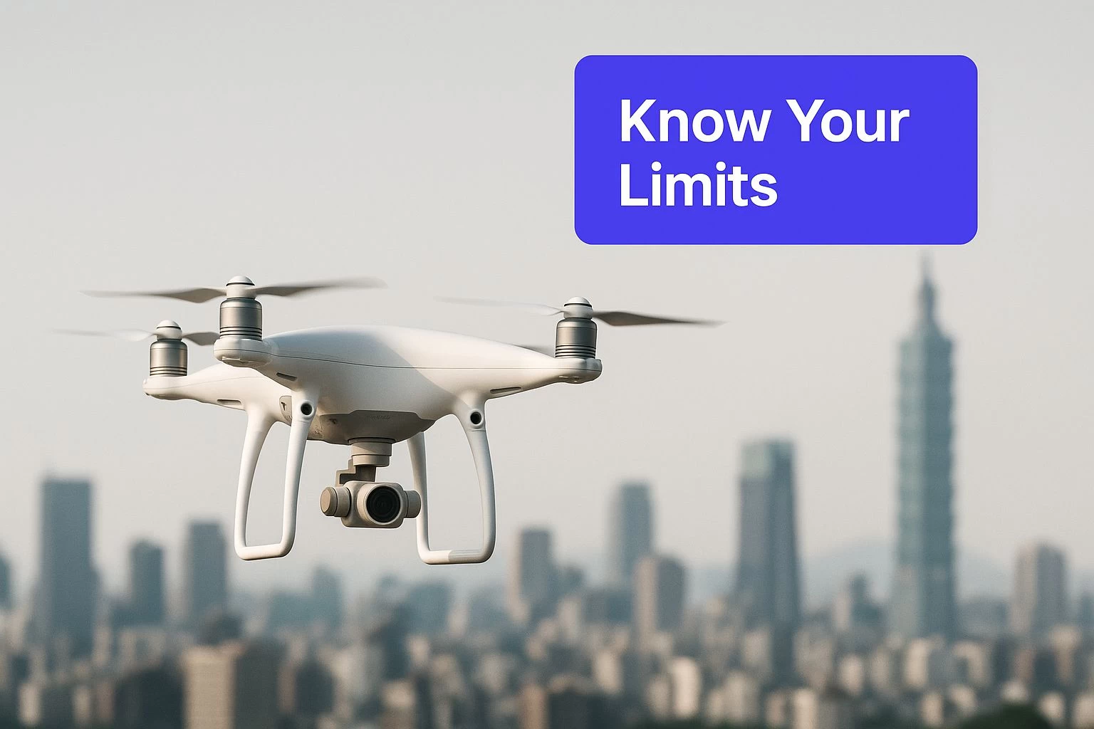
This image really drives home the point that it's on you, the pilot, to know the rules before you launch.
The buck stops with the pilot in command. You are always the final authority and carry the full weight of responsibility for making sure your flight is compliant, no matter what an app might tell you.
Temporary and Special Use Airspace
Beyond airports, other restrictions can pop up anywhere, sometimes with very little warning. This is precisely why checking your maps right before you fly isn't just a good idea—it's essential.
A Temporary Flight Restriction (TFR) is a classic example. These are short-term no-fly zones put in place for specific events or situations, such as:
- Major sporting events like the Super Bowl
- Accident sites or natural disasters, to give emergency responders clear airspace
- VIP movements, like when the President is visiting an area
You'll also come across Military Operations Areas (MOAs) on your maps. While they aren't always strictly off-limits, these are zones where military aircraft are practicing low-altitude, high-speed maneuvers. Flying a drone here without extreme caution and situational awareness is playing with fire.
This approach to managing airspace isn't just a U.S. thing; it's a global standard. Nearly every country prohibits or heavily restricts drone flights in sensitive areas, with airports universally at the top of the list. Most aviation authorities, from the FAA here to EASA in Europe, cap standard drone flights at around 400 feet (120 meters) above the ground to maintain a safe buffer from crewed aircraft.
Permanent No-Go Zones
Finally, there are some places that are always off-limits. No exceptions. These are usually designated for national security reasons and are clearly marked as Prohibited Areas on aviation charts. Flying a drone over locations like Washington D.C., active military bases, or nuclear power plants is completely illegal and comes with severe consequences.
Looking ahead, new concepts like Urban Air Mobility (UAM) initiatives are pushing regulators to create new, more dynamic types of restricted airspace, especially over dense city centers. As our skies get busier, a deep understanding of this complex map of restrictions will only become more critical for every single drone operator.
Global Rules And The Steep Cost Of Violations

Flying a drone isn’t just a local hobby; it’s an activity that plugs you into a global web of regulations. While the specific rules can feel a bit different from one country to the next, the big ideas are the same everywhere: safety, security, and accountability. Getting your head around this bigger picture is a must for any pilot, whether you're flying in your own back garden or on the other side of the world.
Big players like the Federal Aviation Administration (FAA) in the US and the European Union Aviation Safety Agency (EASA) in Europe really set the tone for how airspace is managed. Both have built solid systems to keep the skies safe, but they’ve come at it from slightly different angles, reflecting the unique legal and geographical areas they cover.
The FAA and EASA: A Tale of Two Systems
You can think of the FAA and EASA like two expert chefs given the same ingredients—drones, airspace, and safety—but asked to cook up their own signature dish. The FAA’s recipe has traditionally focused on pilot accountability, trusting authorized operators to fly in certain controlled airspaces once they get the green light. It’s a system built on a foundation of trust and personal responsibility.
EASA, on the other hand, went with a category-based system (Open, Specific, and Certified) that sorts flights by their level of risk. This approach creates a standardized set of rules across all its member countries, which makes it much simpler for pilots to know what’s expected of them, no matter where they are in the Union.
Even with their differences, both systems are chasing the same goal: keeping drones out of drone restricted airspace without permission. This common ground shows a worldwide agreement that safety has to come first.
The ultimate responsibility for a compliant flight always lies with the Remote Pilot in Command. Regulatory bodies provide the framework, but the pilot on the ground is the one who must make the final, safe decision.
This idea of pilot responsibility is only getting more important. The technology is shifting to put more control, and therefore more accountability, right in the operator's hands. It's a clear signal that every pilot needs to be on their A-game.
The High Price Of Getting It Wrong
Ignoring these rules isn't like copping a parking ticket. The penalties for flying into drone restricted airspace are seriously stiff, and they’re designed that way to discourage reckless flying. These aren't just empty threats; aviation authorities are dead serious about enforcement.
They impose strict no-fly zones, especially around airports and other sensitive sites, to protect national security. Fly where you shouldn't in the United States, for example, and you could be looking at civil fines up to $27,500. If your flying is deemed reckless, that can jump to an eye-watering $75,000. Other countries are just as tough; the UAE can hit you with fines up to Dh100,000 and even jail time. A report by AZoRobotics on the global landscape of drone regulations lays out more of these international penalties.
These massive fines send a crystal-clear message: flying a drone is a serious business with real-world consequences.
Why Compliance Is Non-Negotiable
A single rogue flight can cause a massive headache, leading to airport shutdowns, triggering security alerts, and damaging public trust in drone technology as a whole. This is exactly why having the right tools and knowledge is so vital.
New tech like Remote ID is making it easier than ever for authorities to see who is flying what, where, and when. This means the days of "flying under the radar" are pretty much over. To get a better handle on what's coming, check out our deep dive on the FAA Remote ID requirements.
At the end of the day, careful planning and a healthy respect for the rules are what make or break a mission. The cost of a mistake—to your wallet, your legal record, and your reputation—is just too high to take a chance.
Essential Tools for Identifying Restricted Airspace
Knowing the rules of the sky is one thing, but seeing them mapped out in front of you is another entirely. Thankfully, you don't need a degree in cartography to fly safely these days. A whole suite of powerful digital tools can turn complex regulations into simple, visual guides, making it easier than ever to plan compliant flights and avoid accidentally wandering into drone restricted airspace.
Think of these tools as your digital co-pilot. They live right on your phone or tablet and give you an up-to-the-minute picture of the airspace you intend to fly in. It's just like using a weather app to check for rain, but instead, you're checking for no-fly zones.
The Must-Have Airspace Apps
For every pilot, from the weekend hobbyist to the seasoned commercial pro, having a reliable airspace awareness app is simply non-negotiable. These apps pull data directly from official sources like the FAA, giving you the most current information on no-fly zones, airport boundaries, and those critical temporary restrictions that can pop up at a moment's notice.
Two of the most popular and trusted options in the U.S. are:
- B4UFLY: Developed in partnership with the FAA, B4UFLY is the go-to source for official airspace information. It gives you a clear, interactive map with straightforward "Good to Go" or "Warning" indicators, which is perfect for a quick, at-a-glance check of your flight area.
- Aloft (formerly Kittyhawk/AirMap): A long-standing leader in the industry, Aloft goes a bit deeper. It provides detailed airspace maps and weather data, and it's also a primary portal for requesting LAANC authorizations to fly in controlled airspace near airports. Its beefier feature set makes it a firm favourite among commercial operators.
These apps aren't just for planning from your desk. It's a rock-solid best practice to check them again right on-site before takeoff. TFRs can be issued with very little notice, and this one simple step can save you from a world of trouble. If you want to dive deeper, you can explore more options in our guide to the best restricted airspace maps.
It's a common mistake to think these apps grant you permission to fly. They don't. They are purely informational tools. The ultimate legal responsibility for a safe and compliant flight always rests with you, the Remote Pilot in Command.
Understanding Manufacturer Geofencing
Beyond the apps on your phone, your drone itself likely has its own built-in safety net. Major manufacturers like DJI include geofencing systems that use GPS to prevent the drone from flying into known restricted areas. In the past, these systems often created a hard "wall," literally stopping the drone from entering a no-fly zone.
This screenshot from the FAA shows the clear, user-friendly interface of the B4UFLY app, indicating advisories for a specific location.

The map instantly alerts the pilot to potential airspace issues, turning abstract rules into an easy-to-understand geographical guide before they even think about launching.
But things are changing. In early 2025, DJI updated its GEO system in the U.S. to better align with FAA principles. Instead of a hard block, the system now gives you an "Enhanced Warning" as you approach restricted airspace. This shift puts the final decision—and the full responsibility—back where it belongs: with the pilot.
This update drives home a critical point: geofencing is a helpful guide, not a substitute for proper flight planning. It’s a great backup, but it won't protect you from every hazard, especially a pop-up TFR that hasn’t been pushed to the drone's database yet.
A Layered Approach to Safety
No single tool is a magic bullet for compliance. The safest and most professional pilots I know all use a layered approach, pulling together multiple resources to build a complete picture of their operating environment.
A solid pre-flight workflow should look something like this:
- Initial Scouting: Start with a tool like Google Earth or a dedicated flight planner. Get a feel for the terrain, buildings, and potential ground hazards before you even think about the sky.
- Airspace Analysis: Check at least two reliable airspace apps, like B4UFLY and Aloft. Cross-referencing them ensures you don’t miss anything important, like TFRs or specific airport advisories.
- On-Site Verification: Right before you spin up the props, open your airspace app one last time. This is your final check for any last-minute changes.
- Acknowledge Geofencing: Pay attention to any warnings from your drone’s built-in system, but never, ever rely on it as your only source of truth.
By weaving these tools together, you create a robust safety net. It dramatically cuts the risk of an accidental flight into drone restricted airspace, helping ensure every flight you take is not just successful, but perfectly legal and sound.
Your Pre-Flight Checklist for Compliant Operations
Great pilots don't guess; they plan. A solid, repeatable pre-flight routine is the absolute bedrock of any safe and compliant drone operation. It’s how you take the complex puzzle of regulations and drone restricted airspace and turn it into a simple, manageable workflow. This isn’t just about ticking boxes. It’s about building a system that cuts down risk and makes sure every flight is by the book.
Following a structured checklist turns what could be a stressful job into a calm, controlled procedure. You know nothing has been missed, from the first look at the site to getting your final flight authorization. It gives you the peace of mind that comes from proper due diligence, protecting you, your clients, and the public.
Step 1: Groundwork and Digital Scouting
Before you even think about grabbing your gear, your mission starts at your desk. The very first step is to do a thorough digital site survey. Fire up tools like Google Maps or Google Earth to get a good lay of the land.
This is your chance to spot potential ground-level hazards that could mess with your flight:
- Obstacles: Keep an eye out for tall trees, power lines, cell towers, and buildings.
- Public Access: Make a note of any footpaths, roads, or public areas nearby.
- Takeoff and Landing Zones: Scout for safe, clear, and level spots to launch and recover your drone.
Doing this initial recon gives you a crucial mental map of the area. You'll be able to anticipate challenges long before you arrive, which is the foundation for your entire flight plan.
Step 2: Airspace Analysis and Authorization
Once you've got the ground hazards mapped out, it's time to look up. This is the single most critical step for staying clear of drone restricted airspace. Using a mix of official airspace apps and flight management software isn't just a good idea—it's essential for getting the full picture.
Relying on just one source of information is a recipe for disaster. Best practice is to cross-reference at least two official data sources, like B4UFLY and a LAANC provider. This ensures you have the most accurate, up-to-the-minute airspace intelligence.
This is where a dedicated drone operations platform really proves its worth. A flight management system like Dronedesk, for example, pulls airspace data directly into your planning workflow.
Here’s a look at the Dronedesk dashboard, which centralizes flight planning, risk assessments, and compliance checks all in one place.
Having an integrated view like this lets a pilot manage every part of a mission—from client details to airspace analysis—without juggling multiple apps and windows. It seriously reduces the chance of overlooking a critical detail.
Your airspace check needs to cover:
- Controlled Airspace: Figure out if your location is in Class B, C, D, or E airspace. If it is, you'll need authorization.
- LAANC Requests: For flights in controlled airspace near many airports, use a LAANC-enabled app or platform to request automated, near-instant authorization. Just remember to plan ahead, as some requests aren't immediate.
- TFRs and NOTAMs: Always check for Temporary Flight Restrictions and Notices to Airmen. These can pop up with very little warning for things like special events, emergencies, or VIP movements.
Step 3: Documentation and Risk Assessment
A professional operation is a documented one. Before any flight, you need to complete and record a risk assessment. This is where you formally identify the potential hazards you found during your scouting and analysis, and then write down the specific steps you'll take to manage them.
For example, if you spotted a public footpath near your flight zone, your mitigation plan might be to use a visual observer to manage pedestrian traffic. You might also schedule the flight for a time of day when you know footfall will be low.
Flight management platforms like Dronedesk can automate a huge chunk of this paperwork. They have templates for risk assessments, store all your flight logs, and maintain compliance records, creating a detailed audit trail for every single job. This documentation isn't just about ticking a compliance box; it's your proof of professionalism and your best defence if there's ever an incident or an inquiry.
By making this three-step process a habit, you build a reliable system that ensures every flight is safe, compliant, and professional.
Let's be honest: the skies are getting more crowded, and not everyone is playing by the rules. The problem of drones flying where they shouldn’t is a huge headache, affecting everything from airport safety to national security. To be a responsible pilot, it helps to understand why this is happening and the critical role you play in being part of the solution.
This isn't just a feeling; the numbers back it up. Drones have become incredibly cheap, powerful, and easy to fly, putting some serious tech into the hands of millions. The trouble is, the public's understanding of complex airspace rules hasn't kept pace with this boom, leading to a massive spike in both accidental and, sometimes, deliberate screw-ups.
A Growing National Concern
What used to be a few isolated mistakes has ballooned into a consistent threat. In the U.S. alone, incidents of drones flying into drone restricted airspace—think airports, military bases, and major events—shot up by nearly 26% in recent years. That’s a sharp increase, and it points to a serious gap in our defences, especially as drone tech gets better while the tools to stop them lag behind. As you can read in the full report on this concerning trend, it’s a clear warning that every single flight counts.
The problem gets worse when you consider just how hard it is for authorities to spot and stop a small, fast-moving drone. When a commercial pilot spots a drone near their plane, it can cause massive delays and security alerts. But finding the person on the ground who's flying it? That's often like finding a needle in a haystack.
Your commitment to safe, educated flying is the single most important defense against the misuse of drone technology. Every compliant flight reinforces the value of drones and helps keep the skies safe for everyone.
The Pilot’s Role in a Crowded Sky
As drone technology moves forward, so does your responsibility as a pilot. For instance, some manufacturers are changing how their geofencing works. Instead of a hard "wall" that physically stops a drone from entering a restricted zone, they’re moving to an "Enhanced Warning" system. This puts the final call—and all the legal liability—right on your shoulders.
This shift really drives home a core principle of aviation: the pilot in command is always the final authority. It’s your job to know the rules, check your maps, and make the safe call. Every. Single. Time.
This is why your pre-flight routine matters so much. When you run through your checks and plan your mission properly, you're not just ticking boxes. You're actively taking part in keeping our national airspace safe and secure. Your professionalism is the direct answer to the careless flying that makes headlines and gives the whole industry a bad name. Your actions protect the future of drone operations for all of us.
Frequently Asked Questions
The world of airspace rules can feel a bit tangled sometimes. Having straight answers to the most common questions is the best way to keep your flights safe and on the right side of the law. This quick guide should help you tackle those tricky situations and lock in the key principles every pilot needs to live by.
What Should I Do If I Accidentally Fly into Restricted Airspace
If you suddenly realize you’ve drifted into a restricted zone, your one and only priority is to land your drone immediately and safely. Don't try to fly through it or find a "quick way out." Just get it on the ground.
Once your drone is down, it's time to document everything. Make a note of the exact time, your location, and the flight path you took. Depending on where you were—near an airport or inside a pop-up TFR, for instance—you might need to report the mistake to the FAA. It's always, always better to report it yourself than for them to find out another way.
Can I Get Permission to Fly in a Restricted Zone
Yes, you often can, but how you get it really depends on the type of airspace. For the controlled airspace around many airports (that's your Class B, C, or D stuff), you can usually request automated permission through the LAANC system. It's a slick process that's often near-instant for flights under the approved altitude ceiling.
For other types of no-fly zones, like military operations areas or special temporary restrictions, the process is a lot more hands-on. You'll typically need to apply for a specific waiver directly from whatever agency is in charge. This is usually a route for professional operators who have a very clear, documented reason for needing access.
How Reliable Are Drone Airspace Apps
Apps like B4UFLY and Aloft are incredibly reliable, pulling their data straight from official FAA sources. That said, no piece of technology is 100% perfect, 100% of the time.
A true professional workflow means checking at least two different sources before you even think about taking off. You also have to be religious about keeping your apps updated, since Temporary Flight Restrictions (TFRs) can pop up with very little notice. These apps are fantastic tools, but remember, the ultimate legal responsibility for a safe and compliant flight always rests with the pilot in command.
Streamline your entire flight planning process and ensure every mission is compliant with Dronedesk. From airspace analysis and risk assessments to client management and flight logging, our platform brings everything into one place. See how much time you can save at https://dronedesk.io.
 Drone Legal Requirements for Commercial Operations →
 Drone Near Airport Rules Explained for Safer Planning →
 International Drone Regulations Every Global Team Should Know →
 Drone Flight Risk Assessment Example for Safer Missions →
 Beyond Visual Line of Sight Explained for Operators →
 How BVLOS Drone Operations Change Commercial Workflows →
 FAA Drone Rules Every Commercial Pilot Should Know →
 FAA 107 Explained for Commercial Drone Operators →
 Canadian Drone Regulations Explained for Business Use →
 FAA Part 107 Drone License Explained for Beginners →