Drone Flight Plan - Expert Tips for Aerial Success
Crafting Your First Drone Flight Plan: Beyond the Basics

Creating a solid drone flight plan is much more than simply marking points on a map. It's the foundation of safe and effective drone operations. A good plan involves careful consideration of several elements, like altitude, speed, environmental conditions, and regulations. This pre-flight process separates professional drone work from amateur endeavors.
Understanding the Core Components
Think of a well-structured drone flight plan as a roadmap for your drone. It guides the aircraft along a specific route, ensuring efficient data gathering and a safe return. This plan should detail the intended flight path using waypoints, and the desired altitude at each waypoint.
It should also specify speed parameters to keep the drone operating within safe and efficient limits. These parameters depend on the mission's goal and the drone's capabilities. For instance, a drone collecting high-resolution images of a construction site needs a slower speed and lower altitude than one surveying a large agricultural field.
Crucially, a robust plan includes contingency plans. These address unexpected issues like strong winds or battery problems, essential for safe drone operations.
Incorporating Environmental Factors
Environmental factors play a big role in drone flight plans. Wind speed and direction, temperature, and visibility are key considerations. Strong winds can impact drone stability and battery life, possibly pushing the aircraft off course. This makes adapting the flight plan to the wind essential.
Temperature extremes can also influence battery performance, requiring close attention during flight. Learn more about drone flight planning best practices: How to master drone flight planning.
Advanced Planning Considerations
Drone technology continues to advance, making mission planning more complex. Multi-sensor systems now allow drones to handle intricate missions. A typical flight plan now involves precise specifications like the drone platform, sensors used, trajectory points, speed, and start time. Integrating data from multiple sensors enhances data accuracy and efficiency, proving especially useful in fields like remote sensing and telecommunications.
Going beyond the basics, experienced drone operators employ advanced techniques to maximize their missions. This can include terrain following to maintain a steady altitude over changing landscapes, important for consistent data acquisition. You can delve into drone technology development: https://apps.dtic.mil/sti/tr/pdf/ADA346266.pdf.
Including obstacle avoidance in the flight plan minimizes risks by enabling the drone to safely navigate around structures or natural barriers. These advanced features lead to safer, more efficient missions and improved data quality. Precise planning empowers drone operators to execute complex maneuvers, capturing data with greater accuracy and detail.
Flight Planning Tools: What the Professionals Actually Use

Now that we understand the basics of drone flight planning, let's explore the software that can make the process smoother and more effective. The sheer number of flight planning tools available can be a bit daunting. This section will help you navigate the options and discover the preferred tools of seasoned commercial drone operators.
Choosing The Right Software For Your Needs
Picking the right flight planning tool is a big decision for any drone pilot. The software you choose has a direct impact on your efficiency and safety. Some tools specialize in automated flight paths for mapping, while others prioritize real-time obstacle avoidance for challenging environments. Consider your specific needs carefully.
Think about terrain awareness. This feature helps drones maintain a safe altitude above varied landscapes. Obstacle detection is also vital for safe flight, especially in busy urban areas. And don't forget automated path generation, which simplifies planning and lets you focus on other important tasks.
Free Vs. Premium: Finding The Right Balance
Many free flight planning tools offer excellent features, making them a good starting point for new pilots. These typically offer basic waypoint navigation, altitude adjustments, and some airspace awareness. But for professional work, premium software often offers significant advantages.
Premium tools usually include advanced features like sophisticated mapping integrations, terrain following, and advanced obstacle avoidance. For example, integration with software like Dronedesk can streamline your entire drone operation. This includes improved workflows and better data analysis.
Key Features To Look For
Whether you opt for a free or premium tool, several key features are essential for safe and efficient drone operations. Keep these in mind as you evaluate different options:
-
User-Friendly Interface: The software should be intuitive and easy to use, enabling you to create and adjust flight plans quickly.
-
Airspace Awareness: Up-to-date airspace maps and real-time alerts about flight restrictions are essential for staying compliant.
-
Terrain Following: This feature helps maintain a consistent altitude above the ground, which is particularly important for aerial photography and videography.
-
Obstacle Avoidance: Look for software that allows you to pre-program obstacle avoidance or react to unexpected obstacles in real-time.
-
Mission Types: Support for a variety of mission types—like mapping, waypoint navigation, and inspections—makes the software more versatile.
-
Compatibility: Double-check that the software is compatible with your drone model to ensure smooth integration and control.
To help illustrate the differences between popular flight planning software options, let's take a look at the following comparison table:
Drone Flight Planning Software Comparison: A comprehensive comparison of popular drone flight planning software options.
| Software Name | Price Range | Key Features | Best For | Supported Drones |
|---|---|---|---|---|
| Dronedesk | Free - £299/month | Flight planning, risk assessments, logs, maintenance tracking, CRAM | Commercial drone operators, enterprise | DJI, Parrot, Autel, and more |
| Pix4Dcapture | Free - $149/month | Flight planning for mapping and 3D modeling | Mapping, surveying, inspection | DJI, Parrot, Autel, and more |
| DroneDeploy | Free trial - $99/month | Automated flight planning, live mapping, data analysis | Agriculture, construction, inspection | DJI, Parrot, and more |
| Litchi | $24.99 one-time purchase | Waypoint missions, follow me, panoramic photos | Enthusiasts, aerial photographers | DJI drones |
| GS Pro (DJI) | Free | Flight planning, waypoint missions, virtual joystick | DJI drone users | DJI drones only |
This table highlights key differences in pricing, features, and target users, allowing you to quickly compare popular choices. While Dronedesk caters to commercial operators with comprehensive operational management, Pix4Dcapture focuses on mapping and modeling. DroneDeploy offers automated flight planning and live mapping capabilities, whereas Litchi and GS Pro are geared more towards individual drone pilots.
By considering these features, and using the comparison table as a guide, you can select the right flight planning software for your needs. The investment in the right planning tool will result in safer, more efficient, and ultimately, more successful drone missions.
Advanced Drone Flight Plan Techniques Worth Mastering

Moving beyond the basics of waypoints, altitude, and speed opens up a world of possibilities for drone pilots. Advanced flight plan techniques offer greater operational efficiency and enhanced safety. These are the strategies seasoned professionals use to execute complex missions and consistently achieve optimal results.
Optimizing Battery Life For Extended Missions
Battery life is a critical factor in drone operations. Maximizing your flight time requires careful planning and in-flight adjustments. One key technique is minimizing ascent and descent. These vertical movements consume a significant amount of power.
Plan your waypoints to leverage natural elevation changes and group tasks at similar altitudes. Another strategy is optimizing flight speed. While flying at higher speeds might seem quicker, it often drains the battery faster. A moderate and consistent speed typically results in more efficient power use.
Finally, in colder climates, pre-heating your batteries is crucial. This ensures optimal performance and reduces power drain during the initial ascent.
Managing Complex Multi-Waypoint Sequences
As missions become more complex, efficiently managing multiple waypoints is key. Visualizing the flight path in 3D within your flight planning software, such as Dronedesk, can help identify potential conflicts or inefficiencies before they happen.
Organizing waypoints into logical groups or segments simplifies the plan and makes it easier to manage during flight. This modular approach also makes it easier to adapt if conditions change mid-flight. Before taking off, simulating the flight plan is crucial for verifying waypoint accuracy, timing, and estimated battery consumption.
Adapting To Challenging Environments
Operating in challenging environments requires specialized techniques. In confined spaces, slow, controlled movements and precise waypoint placement are paramount. Using obstacle avoidance features and switching to manual flight mode for fine adjustments are vital for safe navigation.
In mountainous regions, maintaining a consistent altitude above ground level is essential. This is where terrain following capabilities, powered by technologies like LiDAR, within your flight planning software become critical. This integration has drastically improved aerial survey accuracy. Advanced flight planners allow you to define precise paths and manage speed and altitude for optimal data quality, especially in complex terrain. Explore this topic further: Learn more about LiDAR integration with Drone Flight Plans.
Contingency Planning For Unexpected Events
Even the most meticulous plans can be disrupted by unexpected events. A robust drone flight plan always includes contingencies. Pre-determined emergency landing zones along the flight path are essential. These zones should be clear, accessible, and safe for landing in case of a sudden problem.
Establishing communication protocols with ground personnel ensures you can relay information about any unexpected events and coordinate responses effectively. Carrying essential spare parts, such as extra batteries and propellers, can prevent a minor issue from becoming a major setback. Mastering these advanced techniques elevates drone operations to a higher level of safety, efficiency, and data quality.
Leveraging Flight Logs to Transform Your Operations

Your drone's flight logs are much more than just a historical record. They hold a treasure trove of data that can significantly improve your operations. These logs contain essential information that can boost safety, efficiency, and the overall effectiveness of your future drone missions. Smart drone programs understand this and actively utilize flight logs to gain an advantage.
Unlocking the Power of Data: Key Metrics to Track
Flight logs capture a wealth of information, but focusing on the key metrics is crucial for efficient analysis. Battery performance is paramount. Logs record voltage drops, discharge rates, and temperature fluctuations, offering insights into battery health and identifying potential problems.
Motor performance data helps identify potential mechanical issues early. This includes RPM variations, temperature spikes, and current draw. Addressing these issues proactively through maintenance can prevent costly failures down the line.
GPS data is also incredibly valuable. GPS coordinates and altitude readings allow you to reconstruct flight paths and identify deviations from the planned route. This information is invaluable for analyzing pilot technique and optimizing routes for future missions. For more detailed information, explore this topic further.
From Raw Data to Actionable Insights
Turning the raw data from flight logs into actionable insights requires the right tools. Platforms like Dronedesk offer automated uploading and analysis of flight logs, simplifying the process. This allows you to easily identify patterns and trends that might be missed with manual review. Learn more about mastering drone flight logs.
For instance, if you notice consistent battery drain during specific maneuvers, it might indicate a need for additional pilot training or adjustments to your flight plan. Similarly, repeated deviations from the planned flight path could point to unforeseen obstacles or GPS signal issues.
Implementing a Continuous Improvement Cycle
The most successful drone programs utilize flight log analysis to establish a continuous improvement cycle. Regularly reviewing logs, identifying areas for improvement, and making adjustments to your procedures based on data is essential.
This cyclical process ensures that valuable lessons are applied to future missions, leading to improved safety and greater operational efficiency. Sharing these insights within your team fosters a culture of learning and continuous improvement. By understanding and using the information within your flight logs, you can shift from reactive to proactive drone operations, constantly optimizing your procedures and achieving better results.
Navigating Regulatory Hurdles in Drone Flight Planning
Planning a drone flight involves more than just plotting points on a map and deciding how high to fly. Ensuring your flight plan adheres to all regulations is a key part of professional drone operations. While this can feel overwhelming, a systematic approach makes integrating compliance into your workflow quite manageable.
Understanding the Regulatory Landscape
Drone regulations differ significantly based on location. Your first step is understanding the specific rules where you'll be flying. These rules often cover things like maximum altitude, no-fly zones, and required certifications. For example, operating near airports usually requires special permissions and strict adherence to guidelines. You might find this helpful: Drone Regulations 101: What Every Drone Operator Needs to Know.
Regulations can also change between jurisdictions. If you operate across borders, understanding the specific rules of each region is essential. Keeping up with regulatory changes is also important. The drone industry is constantly evolving, and rules can update frequently.
Integrating Compliance into Your Workflow
Successfully navigating regulations means incorporating compliance into your planning process from the beginning. This means considering regulatory limitations right as you design your flight plan. Using tools that provide real-time airspace information and warnings can help you avoid restricted areas and maintain compliance.
It's also important to establish clear communication with the relevant authorities. A good relationship with local aviation regulators can simplify the approval process for more complicated operations. Proactive communication helps prevent delays and ensures your flights meet all requirements.
Accurate and detailed record-keeping is also vital for demonstrating compliance. Maintaining thorough flight logs, including dates, times, locations, and drone information, is essential. Platforms like DroneLogbook simplify the management of flight logs and compliance reports. It allows users to generate reports for agencies like the FAA, CAA, and EASA. By integrating over 80 types of telemetry data, DroneLogbook provides valuable insights into drone operations for better mission planning and personnel management.
Developing Compliance Checklists
Creating specific checklists is a practical way to ensure regulatory compliance. These checklists should outline requirements based on your operating environment and the types of missions you fly. For instance, a checklist for operations near airports could include verifying airspace restrictions, obtaining necessary permissions, and confirming no conflicts with manned aircraft.
Reviewing and updating these checklists regularly is vital to keep up with changing regulations. A drone operations management platform, such as Dronedesk, can automate many checklist items, integrating them directly into your workflow. This reduces the chance of oversight and ensures consistent compliance. Being proactive not only keeps you compliant but also cultivates a culture of safety and professionalism in your drone program.
Industry-Specific Drone Flight Plan Strategies That Work
Different industries use drones for vastly different purposes, each requiring a unique approach to flight planning. Whether it's construction monitoring, agricultural surveys, search and rescue, or cinematic productions, the key to a successful drone mission lies in creating a flight plan tailored to the specific needs of the industry.
Construction Monitoring: Tracking Progress and Ensuring Safety
In the construction industry, drones provide an efficient way to monitor progress, inspect sites, and ensure worker safety. A typical drone flight plan in this sector focuses on capturing high-resolution images and videos of the site at regular intervals. These images can then be used to create 3D models of the project, track progress against timelines, and identify potential safety hazards.
Critical planning factors include the frequency of flights, required image resolution, and the timing of data capture to minimize shadows and optimize lighting. A key challenge involves coordinating drone flights with ongoing construction activities to ensure the safety of both drone operators and construction workers.
Agricultural Surveys: Optimizing Crop Management
The agricultural sector uses drones for a variety of tasks including crop health assessment, precision spraying, and livestock monitoring. A drone flight plan for agricultural surveys generally involves flying a grid pattern over the field at a specific altitude to capture multispectral images. These images allow farmers to identify areas of stress, optimize irrigation schedules, and tailor fertilizer application to specific needs.
Key considerations include flight altitude for optimal sensor coverage, required overlap between images, and weather conditions, as wind and cloud cover can significantly impact data quality. Efficient battery management and flight planning are also crucial for covering large agricultural areas.
Search and Rescue: Locating People and Assessing Damage
In search and rescue operations, drones offer a rapid and effective means of locating missing persons, assessing damage in disaster-stricken areas, and providing real-time situational awareness to emergency responders. Flight plans in this context prioritize speed and flexibility. Pre-programmed waypoints may be used to cover a search area, but operators must also be able to adapt the flight plan in real time based on incoming information.
Key considerations include obstacle avoidance in complex environments, reliable real-time video transmission, and the ability to quickly deploy the drone in time-sensitive situations.
Cinematic Productions: Capturing Stunning Aerial Footage
Drones have become an essential tool in the filmmaking industry, providing stunning aerial perspectives and dynamic camera movements previously impossible to achieve. Cinematic drone flight plans focus on creative camera movements, smooth transitions, and precise choreography to capture the desired shots.
Key factors include flight path design, optimal camera angle, and integration with other filming equipment. Challenges include maintaining a safe distance from actors and crew while capturing dynamic footage. The flight plan must also consider airspace restrictions and obtain any necessary permits for filming.
Incorporating Best Practices: A Flexible Framework
Regardless of the industry, several core principles contribute to successful drone flight planning. First, thorough pre-flight checks are essential to ensure the drone is in optimal condition and all systems are functioning correctly. Next, meticulous airspace analysis is necessary to verify the flight area is clear of hazards and complies with all relevant regulations. Finally, clear communication between the drone operator and any relevant stakeholders—such as construction site managers, agricultural workers, or film crew—ensures everyone is aware of the flight plan and any potential risks.
The following table summarizes key flight planning considerations across various industries:
Industry-Specific Flight Planning Considerations: Key considerations and planning elements for common drone applications across industries
| Industry | Primary Mission Types | Critical Planning Factors | Common Challenges | Recommended Approaches |
|---|---|---|---|---|
| Construction | Progress monitoring, site surveys, safety inspections | Flight frequency, image resolution, data capture timing | Coordinating flights with construction activity | Establish clear communication protocols with site management, conduct thorough pre-flight risk assessments |
| Agriculture | Crop health assessment, precision spraying, livestock monitoring | Flight altitude, image overlap, weather conditions | Covering large areas efficiently, managing battery life | Optimize flight paths for efficient coverage, utilize multispectral imagery for detailed analysis |
| Search and Rescue | Locating missing persons, damage assessment, situational awareness | Obstacle avoidance, real-time video transmission, rapid deployment | Navigating complex environments, adapting to changing conditions | Pre-program waypoints with flexibility for real-time adjustments, ensure reliable communication systems |
| Cinematic Productions | Capturing aerial footage, dynamic camera movements | Flight path design, camera angle, integration with other equipment | Maintaining safe distances from personnel, airspace restrictions | Carefully plan flight paths and camera movements, obtain necessary permits and approvals |
This table provides a glimpse into the diverse challenges and considerations involved in drone flight planning across different sectors. Each industry presents its unique set of requirements, highlighting the importance of a flexible and adaptable approach.
By adopting a flexible framework that incorporates industry best practices, drone operators can effectively tailor their flight plans to the unique demands of any project, maximizing the safety and efficiency of their operations while achieving the desired outcomes.
The Future of Drone Flight Planning: What's Actually Coming
The drone industry is constantly evolving, and flight planning technology is changing right alongside it. But beyond the current hype, what advancements will truly reshape how we plan drone operations? By analyzing trends and speaking with industry experts, we can separate truly impactful technologies from the noise.
Autonomous Planning Systems: Taking the Pilot Out of the Equation?
One of the most significant advancements is the development of more sophisticated autonomous planning systems. These systems move beyond basic waypoint navigation, using real-time data analysis and artificial intelligence to dynamically adjust flight plans in mid-air. Imagine a drone independently rerouting around unexpected obstacles or adjusting to sudden weather changes. This level of autonomy could significantly improve the efficiency and safety of drone operations, especially in challenging or unpredictable environments.
The Rise of Artificial Intelligence: Smarter, More Adaptive Flights
Artificial intelligence is already influencing countless industries, and drone flight planning is no different. AI algorithms can process massive amounts of data—including weather patterns, terrain information, and airspace restrictions—to create highly efficient and safe flight plans. AI also plays a key role in predictive maintenance, analyzing flight logs and sensor data to identify potential mechanical problems before they become serious. A standard drone flight plan incorporates elements like the drone platform, sensors, trajectory, speed, and start time. Furthermore, the increasing use of multi-sensor data collection is improving accuracy and efficiency, which benefits fields like remote sensing and telecommunications. You can learn more about drone technology development: Explore this topic further.
Unmanned Traffic Management (UTM): The Next Frontier in Airspace Management
As drone use increases, the need for a robust Unmanned Traffic Management (UTM) system becomes more critical. UTM systems are designed to manage drone traffic flow, similar to how air traffic control systems manage traditional aircraft. These systems provide real-time airspace awareness, allowing drones to safely share the skies with other aircraft and avoid collisions. This will be essential for enabling more complex drone operations, such as beyond visual line of sight (BVLOS) flights and large-scale drone deliveries.
Preparing for the Future: Balancing Innovation and Reliability
While these emerging technologies hold immense potential, drone operators need a balanced approach. It’s crucial to differentiate between ready-to-use technologies and those still needing further development. Investing in proven technologies while monitoring emerging trends is key for long-term success. This means carefully evaluating new software and hardware, conducting thorough testing and simulations, and prioritizing reliability and safety above all else.
Leading drone operators are preparing for the future by adopting flexible planning strategies that can adapt to technological advancements and regulatory changes. They understand that staying ahead requires continuous learning, adaptation, and a willingness to embrace new technologies that offer tangible benefits. They are also actively working with regulators and industry stakeholders to help shape the future of drone operations. Ready to enhance your drone operations? Dronedesk is a comprehensive drone operations management platform built for professionals. Streamline your workflows, improve safety, and ensure compliance with Dronedesk’s robust features. Learn More
 Beyond Visual Line of Sight Explained for Operators →
 How BVLOS Drone Operations Change Commercial Workflows →
 FAA Drone Rules Every Commercial Pilot Should Know →
 FAA 107 Explained for Commercial Drone Operators →
 Canadian Drone Regulations Explained for Business Use →
 FAA Part 107 Drone License Explained for Beginners →
 How to Review a DJI Drone Flight Log Step by Step →
 Drone Registration Law Explained for Commercial Pilots →
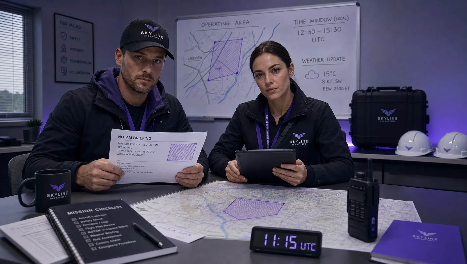 How to Check a Drone NOTAM Before Every Mission →
 BVLOS Drone Meaning and Why It Matters →