Your Guide to Flying in Class G Airspace
Think of the sky as a massive, invisible highway system.The air around major airports is like a tightly managed multi-lane motorway, full of rules, signs, and traffic controllers. Class G airspace, on the other hand, is like all the local country roads that connect everything else. It’s uncontrolled, which means Air Traffic Control (ATC) isn't actively directing or separating aircraft flying within it.
What Is Class G Airspace, Really?

At its heart, Class G is the default airspace. It's the foundational layer that fills in all the gaps where other, more restrictive airspace classes (like B, C, D, or E) aren't needed. This uncontrolled status gives pilots—especially drone operators—a huge amount of freedom, but it comes with a serious dose of responsibility.
The golden rule here is the "see and avoid" principle. Since there’s no controller telling you where to go, it's completely up to each pilot to stay alert, scan the skies constantly, and keep a safe distance from everything else. This concept is the absolute bedrock of flying under Visual Flight Rules (VFR) in this environment.
The True Scale of Uncontrolled Airspace
So, just how much of the sky is Class G? You'd probably be surprised. It makes up the vast majority of low-altitude airspace in the United States. In fact, an estimated 96% of the low-altitude environment is designated as Class G.
This immense coverage makes it the go-to airspace for countless activities, from agricultural spraying to real estate drone photography. But it also presents a real safety challenge, as many aircraft flying here aren't required to have modern position-reporting equipment like ADS-B. This creates what's known as an "electronic conspicuity gap," a topic Commercial UAV News explains in more detail.
Ultimately, this freedom means you, the Remote Pilot in Command, are the sole authority for your drone's safety and separation from other air traffic. You won't get traffic alerts or instructions from a controller. You are your own traffic cop, and that demands constant situational awareness.
Key Characteristics of Class G
To fly safely and legally, you have to know what defines Class G airspace. While there are several different types of airspace an operator must know, Class G has its own unique set of rules.
The most important thing to remember is this: in Class G, freedom and responsibility are two sides of the same coin. With no ATC services, the burden of safety falls squarely on the pilot's shoulders through the "see and avoid" mandate.
Let's break down the essential features of Class G into a quick-reference table. This is the stuff you absolutely need to have locked in before you fly.
Class G Airspace At a Glance
This table provides a snapshot of the fundamental characteristics of Class G airspace, giving you a clear, at-a-glance summary.
| Characteristic | Description |
|---|---|
| Control Status | Uncontrolled. ATC does not provide air traffic control services, separation, or flight following for VFR aircraft. |
| Pilot Responsibility | The pilot in command is solely responsible for seeing and avoiding other aircraft, terrain, and obstacles. |
| Communication | No ATC communication is required, though using a CTAF at non-towered airports is a standard and vital safety procedure. |
| Equipment | For VFR flight, no specific equipment (like a transponder with Mode C or ADS-B Out) is generally required, though it is highly recommended. |
Getting a firm grip on these basics is your first and most important step toward mastering operations in this widespread and accessible airspace.
How Do I Know Where Class G Airspace Is?
Unlike the neat circles and boxes you see for other airspace types on a map, Class G doesn't get its own shiny outline. Instead, it’s defined by what it’s not. Think of it as the foundational layer of air filling all the gaps left behind by more restrictive, controlled airspace like Class B, C, D, and E.
To fly safely and legally, you have to know exactly where this uncontrolled airspace ends and controlled airspace begins. This isn't just theory; it's a practical skill you build by learning to read aviation maps, specifically VFR Sectional Charts. These charts are your roadmap to the sky, and they hold all the clues you need.
The most common way Class G is defined is by the floor of the Class E airspace sitting above it. Picture Class E as a ceiling hovering over Class G. Your job is to figure out just how high that ceiling is wherever you plan to fly.
Decoding the Colors on a Sectional Chart
On a sectional chart, the boundaries are marked by colored vignettes—think of them as soft, shaded lines. They aren't just for decoration; they're direct visual instructions telling you where the floor of Class E airspace starts. And that, in turn, tells you where Class G stops.
There are two main colors you absolutely need to recognize:
- Magenta Vignette: A faded, fuzzy magenta line tells you the floor of the overlying Class E airspace kicks in at 700 feet Above Ground Level (AGL). When you're inside this shaded area, Class G only goes from the surface up to 699 feet AGL.
- Blue Vignette: A faded blue line means the Class E floor starts much higher, at 1,200 feet AGL. In these spots, Class G extends from the surface all the way up to 1,199 feet AGL.
What if you don't see any colored vignette at all? Then the default rule applies: Class G runs from the surface up to 1,200 feet AGL, where Class E begins. You'll find this most often in remote, rural areas far from airports.
Vertical and Lateral Boundaries in the Real World
Let's ground this with a real-world example for a drone pilot. Imagine you're planning a flight for an agricultural survey. You pull up your sectional chart or a flight planning app like the one in Dronedesk.
You notice your target field is partially covered by a magenta vignette. This is a massive clue.
For the part of the field inside the magenta shading, you know Class G airspace ends at 699 feet AGL. If your drone creeps up to 700 feet, you've just busted into controlled Class E airspace without authorization—a big no-no.
But for the portion of the field outside that magenta shading, the rules are different. Here, Class G extends all the way up to 1,199 feet AGL. This is precisely why getting good at reading charts is a non-negotiable skill for staying compliant.
Special Cases You'll Find Around Airports
Airports are hotspots for shifting airspace boundaries. While Class G might be the default elsewhere, the presence of an airport almost always changes the game to protect planes coming and going.
That 700-foot AGL floor (the magenta vignette) often exists specifically to create a safer, controlled environment for aircraft on an instrument approach to a runway. Here’s a quick-glance guide to what to look for on your chart:
| Chart Symbol | Airspace Implication | Your Action |
|---|---|---|
| Dashed Magenta Line | Class E to the Surface | In this area, there is no Class G airspace. It's controlled from the ground up. You'll need LAANC authorization to fly here. |
| Dashed Blue Line | Class D Airspace | This area is controlled from the surface up to a specific altitude. Class G simply doesn't exist here. You must have LAANC authorization. |
| Solid Magenta Line | Class C Airspace | A multi-layered, controlled area. You won't find any Class G within its surface boundaries. |
| Solid Blue Line | Class B Airspace | The most restrictive airspace around major airports. There is no Class G within its surface boundaries. |
Learning these visual cues is the key to true situational awareness. By just looking at a chart, you can instantly tell if you’re in the clear within Class G airspace or if you’re about to wander into an area with much stricter rules. It's this skill that empowers you to operate with both freedom and responsibility, making sure every flight is a safe and legal one.
VFR Weather Minimums for Safe Flight
When you're flying in the wide-open, uncontrolled freedom of Class G airspace, clear weather isn't just a bonus—it's your single most important safety tool. With no Air Traffic Control to keep aircraft separated, your ability to "see and avoid" other traffic is all that stands between a safe flight and a potential disaster. These rules aren't just bureaucratic red tape; they're based on the hard physics of flight and the limits of human reaction time.
The specific requirements, what we call Visual Flight Rules (VFR) weather minimums, are not one-size-fits-all. They shift based on your altitude and whether you're flying during the day or at night. Getting these down isn't about memorizing numbers for a test; it's about truly understanding the "why" behind them so you can make smart, instinctive decisions every time you fly.
Why Do Weather Minimums Matter So Much?
Think of visibility requirements as your built-in safety cushion. That 3 statute miles of flight visibility isn't just an arbitrary number pulled out of a hat. It gives you, the pilot in command, just enough time to spot another aircraft, figure out where it's headed, and make a move to avoid a conflict. When visibility starts to drop, so does your reaction time, shrinking your margin for error to almost nothing.
The rules for staying clear of clouds are just as vital. Clouds are, for all practical purposes, solid objects; you have no idea what's hiding inside them or just on the other side. An aircraft can pop out of a cloud bank with absolutely zero warning. Keeping a mandated distance—like staying 500 feet below a cloud layer or 2,000 feet horizontally away from one—ensures you have the space to react if another aircraft suddenly appears.
The infographic below does a great job of showing how airspace is layered, which is directly tied to the weather minimums you need to follow at different altitudes.

This visual helps illustrate a key point: as you climb higher in Class G, the rules often get stricter to account for faster aircraft and different types of operations.
The Dangers of Pushing Your Luck
It’s always tempting to launch when the weather is "just okay." But let me be blunt: pushing VFR minimums in Class G airspace is one of the riskiest gambles a pilot can make. A sudden fog bank or a drop in visibility can lead to spatial disorientation, a terrifying and often fatal situation, especially for pilots who aren't instrument-rated.
Let's paint a picture. Imagine you decide to fly with just one mile of visibility when the rules call for three. An aircraft flying at 120 knots covers two miles every single minute. If you and that aircraft are flying toward each other, your combined closure rate means you have less than 30 seconds from the moment you might spot each other to the moment of impact. That's not enough time.
Pushing weather minimums in uncontrolled airspace is a terrible trade-off. You're swapping a massive amount of safety for a tiny bit of convenience. The whole "see and avoid" principle completely falls apart when you can no longer see.
Mastering these weather concepts is non-negotiable for any pilot. If you're looking to build this kind of deep, practical knowledge, structured drone flight training is invaluable. Good training ensures you don't just know the rules, but you respect the very real consequences of breaking them.
Comparing Day and Night Minimums
You'll notice that the required minimums often get stricter at night or at higher altitudes, and for good reason. Flying at night naturally makes it harder to see unlit obstacles and to judge distances, so you need more visibility to maintain the same level of safety you have during the day. Similarly, once you get above 10,000 feet MSL, you’re sharing the sky with much faster aircraft. The visibility requirement jumps to 5 statute miles to give everyone more time to see and be seen.
To make this crystal clear, here’s a breakdown of the specific requirements. This isn't just data to be memorized; think of it as your go/no-go checklist before every single flight in Class G airspace.
Class G VFR Weather Minimums Day and Night
| Altitude | Flight Visibility | Distance from Clouds |
|---|---|---|
| 1,200 feet AGL or less (Day) | 1 statute mile | Clear of clouds |
| 1,200 feet AGL or less (Night) | 3 statute miles | 500' below, 1,000' above, 2,000' horizontal |
| Above 1,200' AGL but below 10,000' MSL (Day) | 1 statute mile | 500' below, 1,000' above, 2,000' horizontal |
| Above 1,200' AGL but below 10,000' MSL (Night) | 3 statute miles | 500' below, 1,000' above, 2,000' horizontal |
| Above 10,000' MSL | 5 statute miles | 1,000' below, 1,000' above, 1 statute mile horizontal |
By sticking to these standards, you're doing more than just following a rule—you're being an active participant in the collaborative safety culture that makes our airspace work. You are upholding your end of the "see and avoid" bargain that keeps everyone flying in uncontrolled airspace safe.
What Gear Do You Really Need?
So, when you're flying in Class G airspace, what equipment is actually required? The legal answer is surprisingly simple: for most flights under Visual Flight Rules (VFR), there are no specific mandates. You’re not legally obligated to have a transponder or even ADS-B Out.
But this is where we have to draw a hard line between what's legal and what's safe. Flying with the bare minimum is like driving on a foggy country road at night without your headlights. Sure, you might be allowed to do it in some remote places, but it's a huge, unnecessary risk to yourself and everyone else out there.
Closing the Electronic Visibility Gap
The lack of required equipment creates a dangerous problem we call the "electronic conspicuity gap." In plain English, it means aircraft can be operating right next to each other while being completely electronically invisible. This is precisely why voluntarily adopting modern safety tech is no longer just a good idea—it's essential.
Using technology like ADS-B is a game-changer for your situational awareness. It’s a two-way street:
- ADS-B Out: This broadcasts your aircraft's position, altitude, and speed to other aircraft and air traffic control. You show up as a clear blip on their screens.
- ADS-B In: This lets you receive those same signals from other equipped aircraft, painting a live traffic picture on your own screen or electronic flight bag (EFB).
Equipping your operation with ADS-B is the single best thing you can do to see and be seen. It effectively slams the door on that dangerous electronic gap and completely transforms how you perceive the airspace around you.
The Lifeline at Non-Towered Airports
While you don’t have to chat with ATC in most of Class G, communication becomes absolutely critical when you're near a non-towered airport. Here, you'll use the airport's designated Common Traffic Advisory Frequency (CTAF), sometimes called a UNICOM frequency. Think of it as a shared party line just for pilots.
This frequency is for self-announcements. You get on the radio and state your position and what you plan to do, so every other pilot in the vicinity can build a mental map of the traffic. This system of clear, polite communication is the standard procedure that prevents takeoffs, landings, and pattern work from descending into chaos.
The skies are getting busier. Commercial airliners are projected to jump from about 29,000 aircraft in 2025 to 38,300 by 2035—that's a 32% increase. At the same time, massive advancements in drone technology are forcing regulators to rethink how uncontrolled airspace is managed. In 2025, for instance, there are active efforts to raise the typical 400-foot AGL ceiling in some Class G zones to 700 or even 1,200 feet AGL to better support diverse drone missions. You can dig into the FAA's full projections to get a sense of these future aerospace trends.
Safety Tip: Always keep your radio calls clear, concise, and standard. Announcing your aircraft type, position relative to the airport, altitude, and intentions helps other pilots build a mental picture of the traffic pattern without a controller guiding them.
How to Make a Great Self-Announcement
Making a solid radio call is a real skill. It's not about having a long conversation; it’s about broadcasting vital information as efficiently as possible. Whether you're a drone operator on the ground near an airport or a manned pilot in the air, your calls should follow a predictable, professional pattern.
Here’s what standard calls on a CTAF sound like:
- Taking Off: "Podunk Traffic, Drone N123AB, taking off runway two-seven, remaining in the pattern, Podunk."
- Entering the Pattern: "Podunk Traffic, Cessna Skyhawk 456CD, ten miles south, two thousand five hundred, inbound for landing, Podunk."
- Pattern Work: "Podunk Traffic, Drone N123AB, on the downwind leg for runway two-seven, touch-and-go, Podunk."
These short, standardized announcements are the backbone of safety at thousands of airports that operate within Class G airspace. They ensure that even without a control tower watching over things, order and safety win the day.
Drone Operations in Class G Airspace

If you're flying a drone, there's a very good chance you're spending most of your time in Class G airspace. This is our home turf. It’s where we get to capture those incredible shots over rolling hills or conduct detailed inspections in rural areas. While its "uncontrolled" status gives us a ton of freedom, it’s not a free-for-all; every flight is still governed by the FAA's Part 107 rules.
Getting a handle on these rules isn't just about acing a test. It’s about building the habits of a safe, professional, and compliant pilot every single time you fly.
The Foundational Rules for Drones in Class G
Before you even pop in a battery, you need to have the core Part 107 rules etched into your brain. These aren't suggestions—they're the absolute bedrock of commercial drone operations in Class G airspace, designed to keep you and other aircraft safely separated.
Here are the non-negotiables you must live by:
- Altitude Limit: Fly at or below 400 feet Above Ground Level (AGL). The only exception is if you're flying within a 400-foot radius of a structure, in which case you can fly up to 400 feet above its uppermost point. This keeps us clear of most manned air traffic.
- Visual Line-of-Sight (VLOS): You have to be able to see your drone with your own eyes, unassisted, at all times. No excuses. This is your primary tool for avoiding collisions and reacting to hazards.
- Flying Over People: You can't fly over anyone who isn't directly involved in your operation. There are new rules for flying over people, but they require a specific category of drone and strict adherence to FAA guidelines.
- Daylight Operations: Flights are generally limited to daylight hours. You can fly during civil twilight (the 30 minutes before sunrise and 30 minutes after sunset), but only if your drone is equipped with proper anti-collision lighting.
These rules create a predictable safety bubble for drone pilots. But that’s only one part of the equation. The other is remembering you're not alone out there.
Beyond the Rules: Sharing the Sky
That 400-foot ceiling feels pretty spacious, but it's a huge mistake to assume you have Class G all to yourself. This airspace is a workplace for all sorts of low-flying manned aircraft, and not seeing them coming is one of the biggest gambles a drone pilot can take.
The most critical skill for a drone pilot in Class G is not just flying the drone, but constantly scanning the sky. Your eyes and ears are your best safety equipment.
Think about who else is down there with you. Crop dusters fly incredibly low and can pop up over a treeline without warning. Helicopters are out there doing everything from power line inspections to medical transports and law enforcement patrols. None of them are looking for a drone.
This is where your responsibility as a pilot goes way beyond just memorizing regulations. It’s about active, vigilant sky-scanning.
Developing Practical Situational Awareness
Becoming a genuinely safe pilot means looking for trouble before it finds you. It's a mindset that marries your knowledge of the rules with what you're seeing and hearing on the ground.
Actionable Scanning Tips:
- Look and Listen: Before you even launch, take a solid minute to scan the horizon and just listen. You’ll often hear an approaching aircraft long before you see it.
- Anticipate Flight Paths: Take a look around. Are you near a hospital with a helipad? Flying over active farmland? Use these environmental clues to predict where other aircraft might be operating.
- Know Your Escape Route: Always have a pre-planned exit strategy to get your drone out of harm’s way fast. This usually means descending straight down or flying directly back to your position.
Mastering these practices is what separates the pros from the amateurs. For professional pilots, strong drones regulatory compliance and market readiness isn't just about dodging fines; it’s about building a reputation for being safe and dependable. When you treat every flight with this level of care, you earn your place as a respected user of the sky.
Got Questions About Class G? We've Got Answers
Let's be honest, navigating the rules of the sky can feel like learning a new language. Even when you think you have a handle on things, practical questions always pop up. When it comes to Class G airspace, its "uncontrolled" nature is exactly what causes the most confusion for new and seasoned pilots alike.
This is where we clear things up. We're tackling the most common questions we hear, connecting the textbook theory to the real world so you can fly with more confidence.
Do I Really Need to Talk to ATC in Class G Airspace?
The short answer is a simple no. Since Class G is uncontrolled, Air Traffic Control (ATC) isn't providing separation services, so there's no requirement to be in contact with them. No one is directing your flight path.
But—and this is a big but—that doesn't mean you should fly in radio silence. If you're anywhere near a non-towered airport, you absolutely should be using the designated Common Traffic Advisory Frequency (CTAF). Think of it as a party line for pilots. Everyone announces their position and what they plan to do next. It's a cooperative system that keeps everyone safe.
Even when you're far away from an airport, just listening in on relevant frequencies can give you a massive boost in situational awareness. It’s always better to know who else might be out there with you.
Can I Fly IFR in Class G?
Yes, you technically can fly under Instrument Flight Rules (IFR) in Class G, but it's not very common and follows some very specific rules. To even start an IFR flight that will eventually pop into controlled airspace, you first have to get a clearance from ATC.
Here's the critical part: while you're on that IFR flight plan, ATC is responsible for keeping you separated from other IFR traffic only.
This means that when your IFR flight path dips into a slice of Class G airspace, ATC can’t see or separate you from VFR aircraft. The responsibility to "see and avoid" any VFR traffic falls squarely back on you, the pilot.
This shared, and frankly, riskier, responsibility is why most IFR routes are intentionally designed to stay within controlled airspace (like Class E) as much as possible, where pilots get the full benefit of radar services and guaranteed traffic separation.
What's the Difference Between a 700 AGL and 1200 AGL Floor?
This question gets right to the heart of reading a sectional chart. The "floor" everyone talks about isn't the floor of Class G—it's the floor of the Class E airspace that sits right on top of it. Knowing the height of this Class E floor tells you exactly where the Class G ceiling is.
Here’s how to spot it on a chart:
- 700 Feet AGL Floor (Magenta Shading): See a fuzzy, faded magenta area? That tells you the overlying Class E airspace starts at 700 feet Above Ground Level (AGL). Inside that shaded zone, Class G only goes from the surface up to 699 feet AGL. You’ll often find this around airports with instrument approaches to give descending aircraft a controlled environment sooner.
- 1,200 Feet AGL Floor (Blue Shading): A faded blue shaded area means the Class E floor starts higher up, at 1,200 feet AGL. This is the more typical setup. Inside the blue, Class G extends from the surface all the way up to 1,199 feet AGL.
And if you're in an area with no colored shading at all? The default rule applies: the Class E floor is at 1,200 feet AGL. Getting comfortable with these chart symbols is the only way to know for sure which airspace you're in at a given altitude.
How Fast Can I Fly in Class G?
Speed limits in the sky exist for the same reasons as on the road: to give everyone enough time to see and react. In Class G, the speed limits are all about altitude.
Below 10,000 feet Mean Sea Level (MSL), the universal speed limit for all aircraft is 250 knots. This is a standard rule that applies across most lower-altitude airspace.
Once you climb above 10,000 feet MSL in Class G, however, that 250-knot limit disappears. Aircraft can go faster, which is a big reason why the weather visibility requirements also jump up significantly at those altitudes. For us drone operators, this is mostly an academic point, since we're already limited to 100 mph (which is 87 knots) and can't go above 400 feet AGL anyway.
Is All Airspace Above 14,500 Feet Class A?
Not quite. It’s a common point of confusion, but there’s a layer in between. While it's true that Class A airspace starts way up at 18,000 feet MSL across the U.S., the airspace from 14,500 feet MSL up to 17,999 feet MSL is actually designated as Class E airspace.
Think of it this way: Class G is strictly a low-altitude airspace. Its absolute upper limit is 14,500 feet MSL. You will never find Class G above that altitude. The moment you climb past 14,500 feet MSL, you are in Class E, which continues all the way up until you hit the floor of Class A.
This structure ensures that as aircraft climb higher and fly faster, they are brought into a controlled environment where ATC can provide full services and keep everyone safely separated.
Trying to manage all these details—airspace, weather, rules—can feel like a full-time job. Dronedesk cuts through the complexity by building advanced airspace intelligence right into your flight planning. You can see boundaries, check for advisories, and log every mission detail in one place, making sure every flight is safe, compliant, and efficient. See how much time you could save by visiting us at https://dronedesk.io.
 What Is a BVLOS Drone and Why It Matters →
 Drone Registration Regulations Businesses Must Follow →
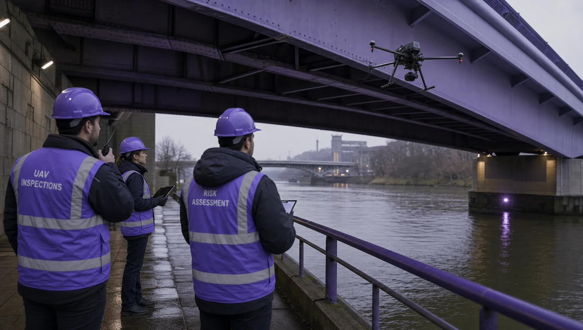 Atypical Airspace Explained for UK Drone Operators →
 FAA Unmanned Aircraft Regulations Made Simple →
 Part 107 Test Tips to Pass With Confidence →
 How to Pass the FAA Drone Written Test First Time →
 What a BVLOS Flight Means for Risk and Compliance →
 Drone VLOS Rules Explained for Commercial Teams →
 FAA Remote ID Rule Explained for Commercial Pilots →
 Drone Legal Requirements for Commercial Operations →