Top Apps for Drone Pilots in 2025 | Flight & Airspace Tools
Taking Off with the Best Drone Apps
Whether you're a seasoned pro or just starting out, the right apps are essential for successful drone operations. This listicle presents eight of the best apps for drone pilots in 2025, covering flight planning, airspace awareness, data capture, and post-processing. Streamline your workflow and improve safety with these powerful tools. From pre-flight checks with apps like B4UFLY and AirMap to automated flight and data capture with DroneDeploy and Pix4Dcapture, we've got you covered. Discover the top apps for drone pilots to optimize your flights and unlock new possibilities.
1. Dronedesk
For drone pilots seeking a comprehensive solution to manage their entire operation, Dronedesk emerges as a leading contender among apps for drone pilots. This powerful platform caters to everyone from solo operators capturing breathtaking aerial footage to large enterprises coordinating complex drone missions. Dronedesk consolidates essential functions like client management, fleet tracking, team coordination, and airspace monitoring into a single, streamlined interface. It’s designed to drastically reduce administrative overhead, ensuring regulatory compliance and boosting overall operational safety, allowing pilots to focus on what they do best: flying.

Consider a scenario where a drone service provider is tasked with inspecting a wind turbine farm. Using Dronedesk, they can easily import the client's requirements, assign pilots and drones to the project, plan flight paths while considering airspace restrictions and potential hazards, and generate pre-flight checklists. Post-flight, data from DJI drones syncs directly with Dronedesk, simplifying logbook entries and generating detailed reports for the client. This eliminates manual data entry, reducing errors and freeing up valuable time.
Another key strength of Dronedesk lies in its comprehensive airspace and proximity intelligence. Before each flight, pilots can access real-time airspace information, including temporary flight restrictions (TFRs), no-fly zones, and potential hazards like power lines or wildlife. This feature is critical for maintaining safe operations and avoiding costly penalties for airspace infringements. Dronedesk's advanced mapping tools allow for precise flight planning, enabling pilots to design optimal routes, set waypoints, and simulate flights before taking off. This meticulous planning is invaluable for complex missions, like infrastructure inspections or large-scale aerial surveys.
For teams transitioning from manual or spreadsheet-based systems, Dronedesk offers a significant upgrade. While there might be an initial onboarding period to familiarize the team with the platform's features, the long-term benefits in terms of efficiency and data management far outweigh the initial learning curve. Implementation tips include dedicating time for team training, utilizing the available support resources, and customizing the platform to align with specific workflow requirements. Dronedesk's customer support is highly regarded, offering assistance to users throughout the implementation process and beyond.
Dronedesk's scalable pricing plans cater to a wide range of users. From solo operators to large enterprises, there's a plan designed to fit specific needs and budgets. While some advanced features and enterprise options are available only on higher-tier or custom plans, the core functionalities provided in the basic plans offer significant value for most drone pilots. This flexibility in pricing ensures that even smaller operations can benefit from the powerful features of Dronedesk.
Compared to other drone management apps for drone pilots, Dronedesk stands out with its all-encompassing approach. While some apps focus solely on flight logging or airspace awareness, Dronedesk combines these elements with client and team management, offering a true end-to-end solution. This integrated approach eliminates the need for multiple apps, streamlining workflows and simplifying data management. The robust reporting features are another advantage, providing valuable insights into finances, asset maintenance, and flight logs. This data can be used to optimize operations, identify areas for improvement, and demonstrate ROI to clients.
In conclusion, Dronedesk deserves its place on this list of apps for drone pilots due to its comprehensive feature set, user-friendly interface, and commitment to safety and compliance. Its ability to streamline operations, enhance situational awareness, and provide valuable insights makes it an indispensable tool for drone professionals of all levels. Whether you’re a solo operator or managing a large fleet, Dronedesk empowers you to plan, execute, and document your drone missions with greater efficiency and confidence. You can explore their offerings and request a demo on their website at https://dronedesk.io.
2. DJI Fly
DJI Fly is the official companion app for a wide range of DJI consumer drones, making it a central hub for piloting, capturing, and sharing aerial content. This app caters to both beginners taking their first flight and experienced pilots looking for intuitive control and intelligent flight modes. If you’re flying a DJI drone from the Mini series, Air series, or even FPV drones, DJI Fly is likely the app you’ll be using. Its streamlined interface, combined with powerful features, makes it a strong contender among the best apps for drone pilots. Specifically, its ease of use, combined with powerful automated features, makes it a perfect entry point for new pilots while providing enough advanced functionality to remain useful as skills develop.

One of DJI Fly's most significant advantages is its seamless integration with DJI drone hardware. This tight integration allows for real-time HD video transmission with minimal latency, giving pilots a clear view from the drone's perspective. The app provides comprehensive control over the camera settings, allowing adjustments to ISO, shutter speed, aperture (where applicable), and white balance, empowering users to capture professional-quality footage. Furthermore, the intuitive on-screen controls make maneuvering the drone simple, even for novice pilots.
Beyond basic flight controls, DJI Fly offers a suite of intelligent flight modes that simplify complex aerial maneuvers. QuickShots, for instance, allows pilots to execute pre-programmed cinematic movements with just a few taps, capturing stunning footage effortlessly. ActiveTrack enables the drone to automatically follow a selected subject, keeping it in frame even during dynamic movements. These intelligent features open up creative possibilities for solo drone operators, photographers, and videographers, enabling them to capture professional-looking shots without extensive piloting experience.
DJI Fly also shines in its post-production capabilities. A built-in video and photo editor allows for quick edits and adjustments directly within the app. Users can trim footage, add music from a built-in library, apply filters, and utilize pre-designed templates to create polished videos ready for sharing. This streamlines the workflow for content creators, especially those working in fast-paced environments like news gathering or event coverage. For enterprise drone operations, such as surveyors and utility inspectors, the ability to quickly edit and annotate footage on-site can significantly improve efficiency.
While DJI Fly is free to download and use, some features, like accessing specific maps and geospatial information, might require a stable internet connection. This is an important consideration for drone service providers operating in remote areas with limited connectivity. The app is also limited to DJI consumer drone models, so those using drones from other manufacturers will need to explore alternative applications. While the app provides a good level of camera control, more advanced manual controls, favored by some professional photographers and videographers, are somewhat limited.
Key Features and Benefits for Different Users:
- Solo Drone Operators: Easy-to-use interface, intelligent flight modes for cinematic shots.
- Small to Medium Drone Teams: Streamlined workflow for capturing and editing content.
- Enterprise Drone Operations Managers: Efficient on-site data capture and processing.
- Professional Photographers and Videographers: High-quality video transmission and basic camera control.
- Surveyors and Utility Inspectors: Real-time data visualization and efficient post-flight processing.
- Drone Service Providers: Quick deployment and ease of use for various client projects.
Setup and Implementation:
Setting up DJI Fly is straightforward. Simply download the app from the Apple App Store or Google Play Store and follow the on-screen instructions to connect to your compatible DJI drone. Ensure your drone's firmware is up to date for optimal performance and access to the latest features. The app provides tutorials and guides to help new users familiarize themselves with the interface and flight controls.
Comparison with Similar Tools:
Compared to other third-party apps for drone pilots, DJI Fly stands out due to its seamless integration with DJI hardware and its comprehensive feature set. While some third-party apps offer more advanced manual camera controls or specialized features for specific industries, DJI Fly provides a well-rounded solution for most consumer drone users.
Website: https://www.dji.com/mobile/dji-fly
DJI Fly is a powerful and versatile app that deserves a place in any drone pilot's toolkit. Its user-friendly design, coupled with advanced features and intelligent flight modes, makes it an excellent choice for both beginners and experienced users. While some limitations exist, the app's strengths in ease of use, integrated features, and smooth hardware integration make it a valuable asset for a wide range of applications.
3. Litchi
Litchi is a powerful, third-party flight control app specifically designed for DJI drones, offering a comprehensive suite of autonomous flight planning features that go beyond the capabilities of the standard DJI apps. It caters to a wide range of users, from hobbyist drone pilots looking to expand their creative horizons to professional aerial photographers and videographers demanding precise control and complex flight maneuvers. If you're seeking one of the best apps for drone pilots looking for sophisticated autonomous control, Litchi deserves serious consideration.

One of Litchi's standout features is its advanced waypoint mission planning. Unlike basic waypoint systems, Litchi allows you to meticulously plan flights using GPS coordinates, specifying altitude, speed, camera angle, and actions at each waypoint. This granular control is essential for professional applications like surveying, infrastructure inspection, and precision agriculture. For instance, surveyors can pre-program a drone to fly a grid pattern over a designated area, capturing overlapping images for accurate 3D mapping. Similarly, utility inspectors can plan automated flights around power lines or cell towers, capturing high-resolution images for damage assessment without manually piloting the drone in potentially dangerous proximity.
For creative professionals, Litchi offers a wealth of tools for capturing stunning aerial footage. Panorama mode automates the process of taking 360-degree panoramic photos, stitching them together seamlessly for breathtaking views. The orbit mode enables you to effortlessly circle a point of interest, maintaining a consistent camera focus while capturing dynamic footage. The follow-me mode intelligently tracks a moving subject, keeping it centered in the frame, freeing you to focus on camera settings and framing. These features are invaluable for filmmakers, real estate photographers, and anyone seeking to capture professional-quality aerial videos.
Beyond its robust autonomous features, Litchi also boasts VR headset support, transforming your drone flight into an immersive first-person view (FPV) experience. By connecting compatible VR goggles, you can experience the thrill of flying as if you were in the drone's cockpit, enhancing the overall flying experience and opening up new creative possibilities.
Litchi also shines in its offline capabilities. Once you've planned your mission, you can download it to your drone and fly completely offline, eliminating reliance on a stable internet connection, which is crucial in remote areas or environments with poor cellular coverage. The Mission Hub, a built-in feature, allows users to share and download flight plans, fostering a community of drone pilots and providing inspiration and ready-made missions for various scenarios.
While Litchi provides powerful features for drone pilots, it's important to acknowledge its learning curve. Beginners may find the extensive customization options initially daunting. The app requires a one-time purchase of approximately $25-30, unlike some free alternatives. Customer support is also generally considered less responsive than that provided by official DJI apps. Finally, it's important to be aware of potential compatibility issues with newer drone firmware, making it advisable to check for compatibility with your specific drone model before purchasing.
Despite these minor drawbacks, Litchi remains a highly valuable tool for drone pilots seeking advanced autonomous control. Its robust feature set, offline functionality, and active community make it a worthwhile investment for anyone looking to elevate their drone operations. You can download Litchi and learn more about its features on their website: https://flylitchi.com. If you're among the apps for drone pilots that prioritize precision and creative control, Litchi is certainly worth exploring.
4. B4UFLY
Navigating the complex world of airspace regulations is paramount for any drone pilot, whether a hobbyist or a professional. B4UFLY, the official mobile app from the Federal Aviation Administration (FAA), stands as a critical tool for ensuring safe and legal drone operations within the United States. This free app empowers drone pilots – from solo operators to enterprise teams – with the information they need to determine permissible flight locations, understand airspace restrictions, and ultimately, fly responsibly. B4UFLY deserves a place on every US-based drone pilot's device as the primary resource for pre-flight airspace checks and staying informed about FAA regulations.

B4UFLY's core functionality revolves around providing real-time, location-based airspace information. Using GPS integration, the app displays an interactive map highlighting airspace restrictions, warnings, and advisories. This is crucial for avoiding no-fly zones, such as those surrounding airports, heliports, and other sensitive areas like national parks or military installations. Before each flight, pilots can quickly check their intended flight location on the map to ensure compliance with FAA regulations. This feature is invaluable for professionals like surveyors, utility inspectors, and drone service providers who frequently operate in diverse and potentially restricted environments.
The app also offers proximity warnings for airports and heliports, notifying pilots when they are nearing restricted airspace. This feature provides an additional layer of safety, preventing accidental incursions into controlled airspace. Furthermore, B4UFLY provides direct links to request airspace authorizations (LAANC) for operations in controlled airspace, streamlining the process for commercial drone operations. For those unfamiliar with FAA drone regulations, the app offers integrated educational content, keeping users updated on the latest rules and best practices. This educational component is particularly useful for recreational fliers and those new to drone operations.
B4UFLY offers several advantages as the official FAA app. Firstly, it guarantees regulatory compliance, offering peace of mind for drone pilots concerned about inadvertently breaking the law. Secondly, it's completely free to use, eliminating any subscription fees or hidden costs. The app’s simple and intuitive interface prioritizes safety and legality, making it easy for users of all technical levels to access critical airspace information. Regular updates ensure that the app reflects the latest airspace changes and regulatory updates, maintaining its relevance and reliability.
While B4UFLY offers significant benefits for US-based drone pilots, some limitations exist. The app is specifically designed for US airspace and does not provide information for international flights. Compared to some commercial alternatives, B4UFLY's functionality is relatively basic. It doesn't offer advanced features like flight planning, mission creation, or autonomous flight capabilities. These features are often essential for professional drone operations involving complex flight paths or data acquisition. Furthermore, some users have reported occasional GPS accuracy issues in remote areas, highlighting the importance of verifying location information through multiple sources when operating in challenging environments.
For implementation, simply download B4UFLY from the Apple App Store or Google Play Store and grant the necessary location permissions. Before each flight, open the app and check the interactive map for any airspace restrictions or warnings at your intended flight location. Familiarize yourself with the app’s features and educational resources to maximize your understanding of FAA regulations. While B4UFLY is a powerful tool, it is recommended to use it in conjunction with other pre-flight planning resources, especially for complex or commercial operations.
For drone pilots operating within the United States, B4UFLY is an indispensable tool for ensuring safe and legal flights. It provides a readily accessible, location-based resource for understanding airspace restrictions, staying informed about FAA regulations, and ultimately, fostering responsible drone operations. While it lacks some of the advanced features found in commercial flight planning apps, its focus on regulatory compliance and free access makes it a must-have for any drone pilot operating under US jurisdiction. You can download B4UFLY from the official FAA website: https://www.faa.gov/uas/recreational_fliers/where_can_i_fly/b4ufly
5. DroneDeploy
DroneDeploy is a powerful cloud-based drone mapping and analytics platform that caters primarily to commercial and enterprise drone operations. It's a comprehensive solution, moving beyond basic flight control to offer automated flight planning, real-time map generation, and advanced analytics tools. This makes it a valuable asset for professionals in various industries, from construction and agriculture to surveying and inspections. If you’re looking for an app that can transform your drone from a flying camera into a sophisticated data acquisition tool, DroneDeploy deserves a serious look. Its focus on streamlining workflows and providing actionable insights justifies its place on this list of essential apps for drone pilots.

One of DroneDeploy’s standout features is its automated flight planning capability specifically designed for mapping and surveying missions. You define the area of interest, and the app automatically generates an optimized flight path, taking into account factors like overlap and ground sampling distance (GSD). This automation significantly reduces pilot workload and ensures consistent data capture for accurate results. As the drone flies, DroneDeploy provides real-time map generation and progress tracking, giving you immediate feedback on the mission's status.
Beyond flight planning, DroneDeploy shines in its data processing and analysis capabilities. The captured imagery is automatically uploaded to the cloud, where it is processed into orthomosaic maps, 3D models, and other geospatial data products. The platform offers a suite of analytics tools, allowing users to perform volume measurements, track changes over time, and generate detailed reports. For example, in construction, DroneDeploy can be used to monitor progress, calculate material volumes, and identify potential safety hazards. In agriculture, it can help assess crop health, optimize irrigation, and estimate yields. Surveyors and utility inspectors can leverage DroneDeploy to create accurate maps and models of infrastructure, identifying defects and potential issues.
While DroneDeploy offers robust functionality, it's important to be aware of its limitations. The platform operates on a subscription-based pricing model, starting at $99/month, which can be a significant investment for individual drone pilots or small businesses. Its feature set is primarily geared towards commercial applications, potentially making it overkill for hobbyists or those focused solely on aerial photography and videography. A reliable internet connection is essential for full functionality, as both flight planning and data processing rely on cloud connectivity. Lastly, mastering the advanced analytics features may require some time and effort due to the learning curve involved.
DroneDeploy offers integrations with various business software and CAD programs, enabling seamless data transfer and collaboration within existing workflows. This interoperability is crucial for enterprise users who need to integrate drone data into their broader business processes. Furthermore, DroneDeploy provides API access, allowing developers to build custom integrations and extend the platform’s functionality.
For solo drone operators and small to medium drone teams, DroneDeploy can streamline operations and unlock new business opportunities. The platform’s automated flight planning and data processing features free up valuable time, allowing pilots to focus on higher-value tasks like analysis and client communication. Enterprise drone operations managers benefit from the platform's scalability and robust data management capabilities, facilitating efficient collaboration and reporting across large teams and projects.
When comparing DroneDeploy to other drone mapping software like Pix4Dmapper or Maps Made Easy, several factors come into play. While all three offer similar core functionalities, DroneDeploy distinguishes itself with its focus on enterprise features, extensive integrations, and user-friendly interface. Pix4Dmapper is known for its advanced processing algorithms and offline capabilities, while Maps Made Easy offers a competitive pricing structure for smaller operations. The optimal choice depends on specific project requirements, budget constraints, and technical expertise.
Implementing DroneDeploy involves creating an account, selecting a subscription plan, and downloading the mobile app for flight control. Familiarize yourself with the platform's features through the available tutorials and documentation. Plan your first mapping mission carefully, ensuring you have a stable internet connection and sufficient battery life for your drone. After the flight, explore the various data processing and analysis tools to gain insights from your captured imagery. Gradually explore the advanced features and integrations as you become more comfortable with the platform.
6. Pix4Dcapture
Pix4Dcapture is a powerful, free flight planning app specifically designed for drone pilots engaged in mapping, surveying, and inspection projects. It seamlessly integrates with Pix4D's suite of photogrammetry software, streamlining the entire process from flight planning to data processing and analysis. This app stands out for its automation capabilities, allowing users to easily create optimized flight paths that ensure the necessary image overlap for accurate 3D reconstructions. For those looking to leverage the power of photogrammetry, Pix4Dcapture offers a user-friendly entry point into this advanced field. It simplifies the complexities of data acquisition, allowing pilots to focus on capturing high-quality aerial imagery for their specific needs, making it an invaluable tool for a wide range of applications.

Pix4Dcapture's key strength lies in its pre-programmed flight patterns optimized for various mission types. Whether you're mapping a large terrain, surveying a construction site, or inspecting a cell tower, the app provides ready-to-use templates that guarantee efficient data collection. These templates automatically calculate the required image overlap and ground sampling distance (GSD) based on your selected altitude and camera parameters, removing the guesswork from flight planning and ensuring high-quality results. This automated approach is particularly beneficial for users new to photogrammetry, allowing them to achieve professional-grade data acquisition without extensive technical expertise.
One of the standout features is the real-time mission monitoring. As the drone flies its pre-determined path, the app displays progress indicators, battery life, and other vital information, allowing pilots to keep track of the mission and make adjustments if necessary. This real-time feedback enhances situational awareness and helps ensure a successful data collection flight. The tight integration with Pix4D's processing software is another major advantage, allowing for seamless transfer and processing of the captured imagery. This streamlines the workflow and significantly reduces the time required to generate accurate maps, models, and other deliverables.
Pix4Dcapture supports a wide array of drone platforms and cameras, extending its usability across different brands and models. This cross-platform compatibility makes it a versatile tool for drone pilots regardless of their preferred hardware setup. From DJI and Parrot to Autel and more, Pix4Dcapture empowers users to leverage their existing equipment for photogrammetry applications. However, while the app is free to use for flight planning, processing the captured data requires a subscription to Pix4D's software suite. The cost of the software subscription should be factored into the overall budget when considering Pix4Dcapture for your drone operations.
While Pix4Dcapture excels in its specialized area of photogrammetry, it's important to note some limitations. Compared to more general-purpose drone flight apps, Pix4Dcapture offers a more focused set of flight modes, primarily catering to mapping and inspection missions. It may not be the ideal choice for pilots who require a wider range of flight control options or cinematic camera movements. The interface, designed primarily for technical users, might also present a slight learning curve for beginners. Achieving the best results with Pix4Dcapture often requires a basic understanding of photogrammetry principles, such as image overlap, ground control points (GCPs), and processing techniques. You can learn more about Pix4Dcapture and other drone mapping software options in this helpful article: Learn more about Pix4Dcapture
For optimal implementation, spend some time familiarizing yourself with the app's interface and settings before your first flight. Practice setting up different flight plans and adjusting parameters like altitude, overlap, and flight speed. Consider using ground control points (GCPs) to enhance the accuracy of your maps and models, especially for demanding surveying applications. Pix4Dcapture proves particularly valuable for drone pilots engaged in professional mapping, surveying, and inspection projects where precision and data quality are paramount. Its free availability, coupled with its integration into the powerful Pix4D ecosystem, makes it an attractive option for both individuals and teams seeking to leverage the benefits of photogrammetry. While the software subscription for data processing does add a cost component, the overall value proposition remains compelling, offering a streamlined workflow and professional-grade results for a variety of drone mapping applications. Consider your specific needs and budget when evaluating Pix4Dcapture as a potential addition to your drone toolkit.
Top 6 Drone Pilot Apps Comparison
| Platform | Core Features/Capabilities | User Experience & Quality ★ | Value & Pricing 💰 | Target Audience 👥 | Unique Selling Points ✨ |
|---|---|---|---|---|---|
| 🏆 Dronedesk | Client, fleet & team management, airspace intelligence, DJI syncing | ★★★★★ Trusted by 2,400+ pilots, robust reporting | Scalable plans, money-back guarantee | Solo pilots to large enterprises | All-in-one platform, reduces planning time 50% |
| DJI Fly | Flight control, camera settings, automated flight modes | ★★★★ User-friendly, seamless DJI integration | Free | DJI consumer drone users, beginners | Intuitive interface, real-time telemetry |
| Litchi | Advanced waypoint missions, orbit/follow-me modes, VR support | ★★★★ Professional-grade, customizable | One-time ~$25-30 | Professional pilots & enthusiasts | Offline missions, strong community sharing |
| B4UFLY | FAA airspace map, location-based restrictions, educational content | ★★★ Simple, official FAA app | Free | US-based recreational pilots | Official FAA compliance app |
| DroneDeploy | Automated mapping, 3D modeling, analytics | ★★★★ Professional-grade, cloud-based | Subscription from $99/month | Commercial, enterprise industries | End-to-end mapping & analytics workflow |
| Pix4Dcapture | Pre-defined mapping flight patterns, image overlap | ★★★★ Professional photogrammetry | Free app (processing software paid) | Mapping & surveying professionals | Seamless Pix4D integration, multiple drone support |
Choosing the Right App for Your Drone Missions
From pre-flight planning and airspace awareness to automated flights and post-processing data analysis, the right apps for drone pilots can significantly enhance safety and efficiency. We've covered a range of powerful tools in this list, from comprehensive flight management platforms like Dronedesk and DJI Fly to specialized apps like Litchi for autonomous missions, AirMap and B4UFLY for airspace intelligence, and DroneDeploy, Hover, and Pix4Dcapture for image processing and data analysis. Each app brings unique strengths to the table, catering to various needs within the drone ecosystem.
The most important takeaways when selecting apps for drone pilots are to consider your specific requirements and flying style. Do you primarily focus on aerial photography, videography, inspections, surveys, or something else entirely? Are you a solo operator, part of a small team, or managing a larger enterprise drone operation? Your answers will guide you towards the best tools for the job. Consider factors such as budget, the technical complexity of the software, integration with your existing drone hardware, and the types of missions you typically fly. While this list focuses on drone-specific applications, many pilots find value in using broader aviation tools. For instance, resources like the other helpful aviation apps from AviatorTips.com can provide valuable insights into wider airspace management and flight planning.
Remember, responsible and informed drone operation benefits everyone in the drone community. By leveraging the power of these applications, you can improve your workflow, enhance data acquisition, and ensure safer skies.
Ready to streamline your drone operations and maximize your efficiency? Dronedesk is a comprehensive platform designed for managing flight logs, maintenance records, and other critical aspects of your drone business. Explore Dronedesk today and discover how it can elevate your drone program to new heights.
 Canadian Drone Regulations Explained for Business Use →
 FAA Part 107 Drone License Explained for Beginners →
 How to Review a DJI Drone Flight Log Step by Step →
 Drone Registration Law Explained for Commercial Pilots →
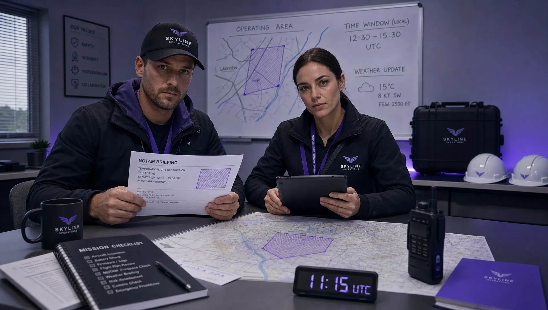 How to Check a Drone NOTAM Before Every Mission →
 BVLOS Drone Meaning and Why It Matters →
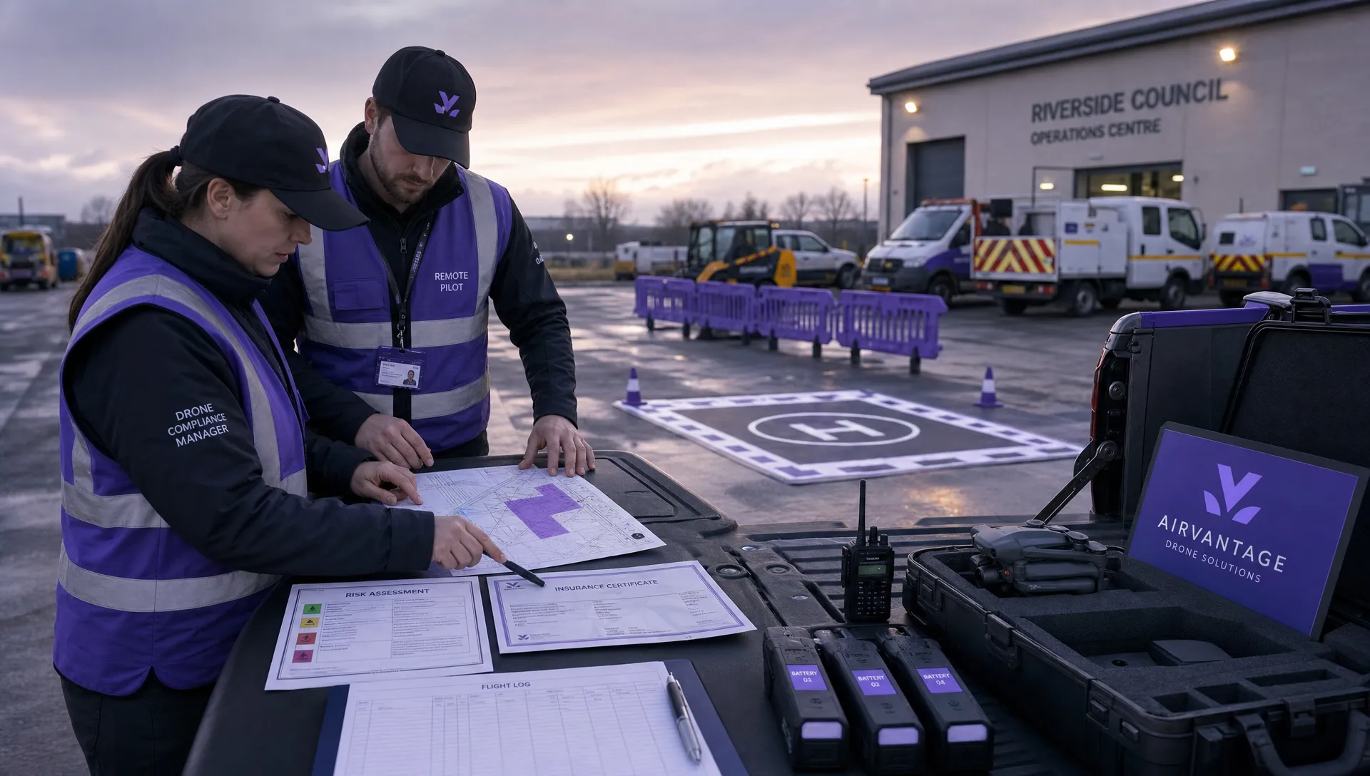 Drone Operation Regulations Explained for Businesses →
 How to Pass Your Drone Pilot License Test →
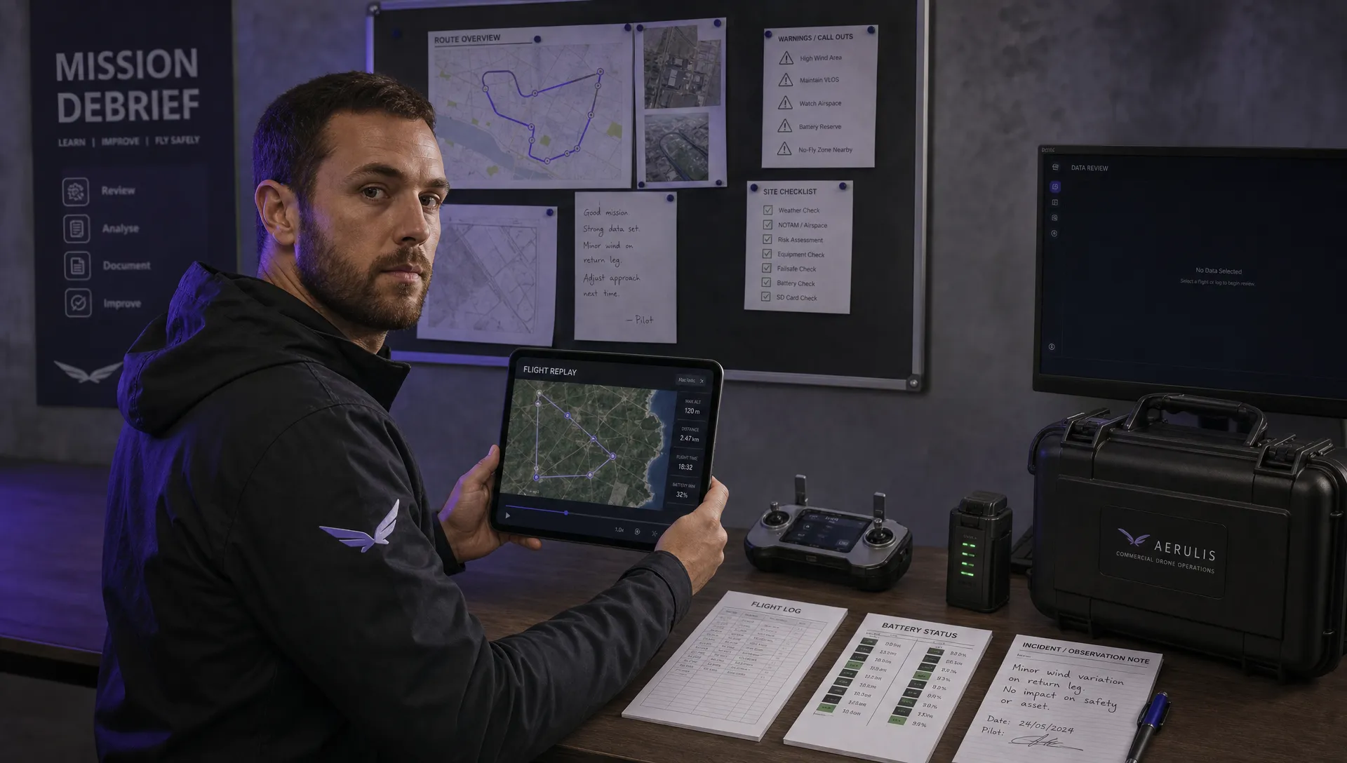 How to Review a DJI Flight Record After a Mission →
 How to Check a Drone NOTAM Before You Fly →